DocumentsAppendixJul 20, 2026Pages 52–89
Environmental Protection & Hazard Area Development Permit Area Guidelines
Schedule B sets out development permit process requirements and guidelines for environmental protection and hazardous areas. It addresses exemptions, sensitive ecosystems, riparian areas, vegetation and restoration, impact avoidance, and hazardous-area development.
Key facts
- Schedule B
- June 2026
- Part 1: Environmental Protection
- Part 2: Hazardous Area
Environmental Protection & Hazard Area Development Permit Area Guidelines
June 2026
Schedule B
Table of Contents
- DPA Process — 1
- Introduction — 5
- Part 1. Environmental Protection Development Permit Area Guidelines — 9
- General Exemptions — 10
- General Guidelines — 13
- Guidelines for Vegetation and Restoration — 18
- Guidelines to Avoid Impacts — 20
- Part 2. Hazardous Area Development Permit Area Guidelines — 25
- General Exemptions — 26
- General Guidelines — 29
DPA Process
This section outlines how the Environmental Protection and Hazardous Area Development Permit Area (DPA) Guidelines are applied as part of the DPA process, and identifies submission requirements.
1. Procedure
1.1 Where land has been designated in the Official Community Plan as a “Development Permit Area”, the landowner must obtain a Development Permit, authorized for issuance by a resolution of Council, before developing the land.
1.2 A Development Permit may not vary use, density or floodplain provisions. Where an area is designated as a Development Permit area, the following apply unless the owner first obtains a Development Permit:
a. The land within the area shall not be subdivided;
b. Construction of, or addition to, a building or structure shall not be commenced;
c. Land must not be altered (including site clearing, tree/vegetation removal, blasting, and/or landscaping) when it is within an area designated for:
i. Protection of the natural environment, its ecosystems and biological diversity; or
ii. Protection of development from hazardous conditions;
d. Land, or a building or structure, on a Provincial or municipal heritage site shall not be altered; and
e. Land, or a building or structure on that land, must not be altered when it is within an area designated for:
i. Revitalization of an area in which a commercial use is permitted; or
ii. Establishment of objectives to promote: energy conservation, water conservation, or reduction of greenhouse gas emissions.
1.3 A Development Permit must not vary the application of a zoning bylaw in relation to residential rental tenure.
1.4 A Development Permit issued must be in accordance with the stated guidelines. However, all guidelines may not be applicable in every permit. In situations where a guideline is not appropriate to the particular circumstances, Council may deem the guideline not applicable. Council may also issue a Development Permit which varies or supplements a regulation of the Zoning Bylaw.
1.5 The Director of Community Planning and Development may consider issuing variances to the minimum setbacks required by the Zoning Bylaw where the variance is being sought to preserve or reduce impact to an Environmentally Valuable Feature or Streamside Protection and Enhancement Area.
2. DPA Application Submission Requirements
2.1 Applicants are required to provide a checklist or statement of intent to indicate how their proposal complies with these guidelines. Where some element of the design does not comply, a justification stating the divergence and reason shall be made. Council may diverge from these guidelines where a compelling rationale that preserves the qualitative intent of the guidelines is supplied.
2.2 Pursuant to the City of Langford Development Approval Information Bylaw, every application for a Development Permit should be accompanied by plans dimensioned in metric units, indicating the following, as applicable, as well as the information noted in the Guidelines:
a. Location of all buildings and structures;
b. Siting of parking areas, driveways, and loading bays;
c. Extent and nature of landscaping, including details of trees to be removed, retained or proposed to be planted in accordance with the City of Langford Landscape Policy;
d. Professional reports/studies prepared by the appropriate qualified professional;
e. Lot grading plan; and
f. Preliminary engineered frontage drawings.
2.3 The City may require security in accordance with Section 502 of the Local Government Act to ensure the installation and maintenance of landscaping or environmental restoration/compensation is in compliance with these guidelines.
2.4 Evaluation of an application—including all technical review and referral stages—will only commence once full payment of applicable fees, as prescribed by Development Procedures Bylaw No. 209, is received by the City. Review will remain pending until such payment is satisfied.
Introduction
This Section explains how the Environmental Protection and Hazardous Area Guidelines are intended to be used in concert with other municipal land use planning documents, including: the Official Community Plan (vision and policy); the Zoning Bylaw (development regulation); and other DPA requirements (guidelines).
The following pages outline how the Guidelines are structured, how different sections relate to one another, and how applicants, staff, and decision-makers should navigate the document.
About Langford
Langford is a rapidly growing and evolving city, shaped by its natural setting, emerging urban centres, and strong connections to the surrounding region. As one of the fastest-growing communities in British Columbia, Langford is experiencing significant change in the scale, form, and diversity of new development.
These Environmental Protection and Hazardous Area Guidelines are intended to support that growth by providing clear direction on how sensitive ecosystems, riparian areas, and the urban forest can be integrated into development, such that the natural features so important to biodiversity, sustainability, and the health and well-being of residents continue to be an important aspect of Langford’s identity into the future.
The Hazardous Area Guidelines set out direction to ensure that new development is protected from natural hazards.
Relationship to Other Regulations
Development in Langford is guided by a series of municipal documents that work together to shape growth and change. Understanding how these documents relate to one another will help applicants navigate the approvals process more clearly and efficiently.
The Official Community Plan (OCP) is Langford’s primary visioning document. It sets out the long-term vision for the city and establishes policies related to land use, growth, housing, transportation, sustainability, and community character. All development in Langford is expected to align with the direction and intent of the OCP.
The Zoning Bylaw translates this vision into regulations that determine what can be built on a specific site. Zoning identifies permitted uses, density, height, setbacks, and other quantitative standards. Applicants should first confirm that a proposed development complies with the applicable zoning or determine whether a rezoning is required.
The Form and Character Design Guidelines build on both the OCP and zoning by providing direction on how development should be designed. The guidelines address site planning, building design, landscape treatment, and other considerations that influence how development fits within its context and contributes to the public realm. While zoning establishes the parameters of development, the guidelines shape its quality, character, and relationship to surrounding areas.
The Environmental Protection and Hazardous Area Guidelines also build on both the OCP and zoning by providing direction on how development should be designed and laid out to integrate natural features into the site and to avoid or mitigate potential impacts from natural hazards. The guidelines address site planning and layout, measures to prevent encroachment or adverse impacts during construction, and considerations to ensure the long-term protection and function of retained natural features.
Together, these documents are intended to support a coordinated and predictable approvals process, helping applicants design proposals that align with Langford’s vision with flexibility in how that vision is achieved.
How To Use This Document
Applicants should review each section early in the design process and consider how the Environmental Protection and Hazardous Area Guidelines (“Guidelines”) apply to their specific site and proposal. Guidelines apply under a series of Development Permit Areas (DPA). DPA applications should clearly demonstrate how proposals respond to the guidelines.
This document is intended to be used as a helpful and practical guide to inform the design of development proposals.
The Guidelines are organized into the following two parts, which contain associated exemptions and guidelines:
- Part 1: Environmental Protection
- Part 2: Hazardous Area
Throughout the document, visual examples and citations to additional sources are provided to help explain the intent of the guidelines and show how they may be applied in different development contexts. Illustrations and images are intended to support understanding and interpretation and do not prescribe design outcomes or replace regulatory requirements.
Part 1. Environmental Protection Development Permit Area Guidelines
The following exemptions and guidelines apply to those lands identified on Map 10: Riparian Zones and Map 11: Sensitive Ecosystems of the Official Community Plan.
General Exemptions
1.1 Sensitive Ecosystems and Riparian Areas
1.1.1 Despite the designation of an area as a Development Permit Area (DPA), the Local Government Act provides that conditions may be specified under which a Development Permit (DP) is not required. In the case of lands within the Riparian and Sensitive Ecosystem DPAs, the following exemptions apply:
a. Actions to prevent, control, or reduce hazards, such as flooding or erosion, that represent immediate threats to life, public, or private property are temporarily exempt from the requirement to obtain a DP. The City of Langford, may, at its discretion, require a retroactive DP. Planned works designed to mitigate future emergencies or hazards are not exempt.
b. Public utilities and operational works, including construction, repair, or maintenance of public works undertaken by the City or its authorized agents and contractors, provided that these works follow best management practices and meet or exceed the intent of the DPA.
c. Road and utility works within highways (as defined by Streets and Traffic Bylaw No. 2233) that are authorized by the Director of Engineering and Public Works, provided that within the Riparian DPA an environmental protection plan, approved in writing by the Director of Community Planning and Development, is prepared and monitored by a Qualified Environmental Professional (QEP), and that any necessary Provincial or Federal approvals are obtained.
d. Habitat improvement activities and trail and park projects undertaken by the City of Langford, provided they meet or exceed the intent of the DPA.
e. Ecological restoration, including planting native vegetation and/or removing non-native or invasive vegetation using small hand tools. A plan which considers proper disposal methods, planting, safety, and erosion and sediment control may be required to the satisfaction of the City.
f. Native plant salvaging may occur prior to the issuance of a DP, provided that:
i. A complete DP Application has been submitted to the satisfaction of the Director of Community Planning and Development;
ii. Salvaging of plants occurs only within those lands proposed to be altered by the DP Application;
iii. The plants are retained and transplanted as part of the landscape plan within the subject property or are transplanted to another suitable location at the discretion and approval of the Director of Community Planning and Development in writing; and
iv. The Director of Community Planning and Development authorizes the native plant salvaging in writing.
g. Subdivision of lands where:
i. There will be no alteration of the land associated with, or directly resulting from, the plan of subdivision.
ii. Subdivisions that are lot line adjustments, subdivisions for park purposes, or for lot consolidation.
h. The removal and replacement of hazardous trees in accordance with the Tree Protection Bylaw.
i. The reconstruction or repair of a permanent structure in accordance with Section 532 of the Local Government Act and Section 3(3) of the Riparian Areas Protection Regulation, if the structure remains on its existing footprint.
j. Minor repair or alteration of existing structures within their existing footprint, where vegetation removal or disturbance is not required, including interior renovations or replacement of a roof or exterior siding.
k. Maintenance of existing gardens and landscaping, such as mowing, planting vegetation, and minor soil disturbances, not altering the general contours of the land.
l. Activities permitted by existing agreements with senior government agencies or covenant terms.
m. Existing land uses and buildings, provided that the area occupied by the land use is not increased or the area occupied by the building is not expanded.
n. Development for agricultural use and normal farm practices (as defined in Section 1 of the Farm Practices (Right to Farm) Act) provided that:
i. The lot is zoned for agriculture and/or is within the Agricultural Land Reserve; and
ii. Agricultural buildings are set back from streams in accordance with the Guide for Bylaw Development in Farming Areas (Ministry of Agriculture, Food and Fisheries (2020), or subsequent versions of the guide.
While the Riparian DPA does not apply to farming activities as defined in the Farm Practices Protection Act, it does apply to residential, commercial and industrial development in the Agricultural Land Reserve and on lands that are used, designated, or zoned for agricultural.
1.2 Sensitive Ecosystems
1.2.1 In addition to Section 1.1, the following exemptions apply on lands within the Sensitive Ecosystem DPA:
a. Development on lots that have an area of less than 300 m² where a registered professional biologist provides a letter to the satisfaction of the City that certifies that no rare plants, sensitive ecosystems, or significant habitat features are located within the area proposed to be altered and that the proposed alteration would not affect any such features, as determined through a detailed field assessment in the appropriate season(s).
b. Accessory buildings not exceeding a gross floor area of 10 m² and minor additions to buildings or structures, provided that all of the following are met:
i. There is no increase in any bylaw non-conformities;
ii. All zoning requirements are satisfied;
iii. There is no further encroachment in the designated DPA OR that no trees or vegetation will be removed or impacted; and
iv. Site coverage is not increased by more than 5% of the existing coverage.
1.3 Riparian Areas
1.3.1 In addition to Section 1.1, the following exemptions apply on lands within the Riparian DPA:
a. Where a registered professional biologist (R.P.Bio) provides a letter to the satisfaction of the City that certifies that the entire area proposed to be altered is located outside of the Riparian Assessment Area (RAA). The RAA is measured as either:
i. 30 m from the high-water mark of any watercourse; or
ii. For streams in ravines less than 60 m wide, the RAA extends 30 m beyond the top of the ravine bank; or
iii. For ravines greater than 60 m wide, the RAA extends 10 m from the top of the bank.
General Guidelines
1.4 Sensitive Ecosystems and Riparian Areas
1.4.1 Land and existing trees and vegetation may not be disturbed except as allowed in a DP or DP exemption issued by the City of Langford.
1.4.2 A site plan developed by a BC Land Surveyor or QEP must be provided as part of a DP Application, which:
a. Locates the proposed development relative to the DPA boundaries and property lines;
b. Locates the Environmentally Valuable Features and/or the applicable Streamside Protection Enhancement Area (SPEA) identified by a QEP;
c. Delineates the top of bank or high-water mark, as applicable;
d. Locates the setback identified by the QEP to separate the proposed development from the Environmentally Valuable Feature and/or SPEA; and
e. Identifies where soil or vegetation will be disturbed for the construction of buildings, yards, driveways, patios and walkways.
1.4.3 A site grading plan prepared by a professional engineer must be provided as part of a DP Application and approved by the Director of Engineering and Public Works, unless the Director determines that it is not required.
1.4.4 A report prepared by an ISA certified Arborist must be provided as part of a DP Application. This report, at a minimum, must outline critical root zones and protection measures for trees along the edge of the Environmentally Valuable Feature or SPEA.
1.5 Sensitive Ecosystems
1.5.1 An Environmental Impact Study (EIS) must be provided as part of a DP Application. The field assessments to inform the EIS must be conducted in the appropriate season(s) by an R.P.Bio and consider the following Environmentally Sensitive Features, including those species that may not have been present during the field assessment but are known to inhabit such habitats and ecosystems:
a. Sensitive ecosystems;
b. Rock outcroppings;
c. Wildlife species;
d. Wildlife habitat and corridors;
e. Rare, endangered or regionally significant species or ecosystems;
f. Watercourses, wetlands, and their riparian areas;
g. Forested areas; and
h. Any additional high-value habitat, such as nests, dens, and wildlife trees.
1.5.2 The EIS must also include recommendations for:
a. The location of development, servicing, and any recommended building setbacks or buffers to avoid or minimize impact to identified Environmentally Valuable Features.
b. The designation of non-disturbance areas in which no development may occur and which may not be impacted by development. When identifying these non-disturbance areas, the QEP must consider all guidelines and:
i. Prioritize the protection of contiguous natural areas, including on adjacent sites;
ii. Identify and protect wildlife corridors, or provide opportunities to strengthen connectivity with any adjacent natural areas;
iii. Prioritize the protection of natural areas adjacent to watercourses and other protected Environmentally Valuable Features, to create refuge habitat;
iv. Minimize impacts to mature trees; and
v. Follow the provincial environmental mitigation hierarchy of avoid, minimize, restore on-site, and offset. The QEP must demonstrate that all reasonable measures have been exhausted at each step before proceeding to the next, in order to minimize impact.
c. Protection, mitigation, and enhancement strategies, such as:
i. Tree Protection and Replacement Plan prepared by an ISA Certified Arborist;
ii. Restoration Plan;
iii. Permanent fencing;
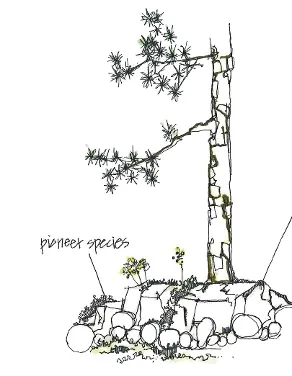
iv. Removal of invasive species and restoration; and
v. Construction and Environmental Management Plan outlining procedures to prevent or mitigate adverse environmental impacts during construction.
1.5.3 The EIS should be completed prior to site planning and the development of a site grading plan to ensure Environmentally Valuable Features are identified, mapped, and appropriately prioritized for protection throughout the development process.
1.5.4 The City may request peer review of the EIS at the applicant’s expense.
1.6 Riparian Areas
1.6.1 All watercourses that meet the definition of watercourse under the Riparian Areas Protection Regulation (RAPR) are included in this DPA, including unmapped watercourses.
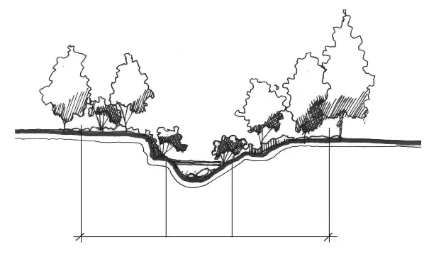
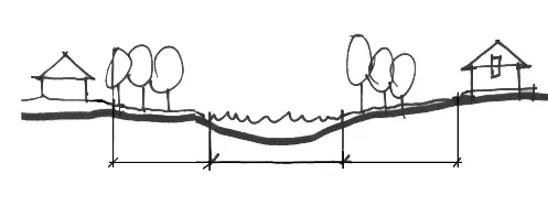
1.6.2 The DPA is measured as 45m from the high-water mark of a watercourse. Disturbance within this area is prohibited unless authorized by a DP or DP exemption.
1.6.3 Unless otherwise permitted in a DP issued by the City, the minimum development setbacks within the Riparian DPA will be:
a. 10 m from top of ravine bank for ravines greater than 60 m in width;
b. 30 m from top of ravine bank for ravines less than 60 m in width; or
c. 30 m from the high-water mark for all other watercourses.
1.6.4 An Assessment Report pursuant to the RAPR (or subsequent regulations) must be developed by a QEP and provided as part of a DP Application. The QEP must certify that they are qualified to carry out and comply with the Assessment Methods outlined in the Regulation. The Report must identify the width of the SPEA to be protected and describe the measures needed to protect the integrity of the SPEA. The QEP must include:
a. The QEP’s opinion that the development will not result in any harmful alteration, disruption or destruction of natural features or functions which support fish life processes.
i. If the QEP is of the opinion that the development will result in harmful alteration, disruption, or destruction of the natural features or functions which support fish life processes, Authorization must be obtained in accordance with the Fisheries Act in order for the development to proceed.
b. The QEP’s opinion that the SPEA identified in the Assessment Report will be protected from the effects of the development by measures identified in the report, with the result that the development will not result in any harmful alteration, disruption or destruction of any natural features or functions that support fish life processes.
i. These measures typically fall under the following categories and may require input from additional QEPs: danger trees, windthrow, slope stability, protection of trees, encroachment, sediment and erosion control, stormwater management, and floodplain concerns.
c. A copy of the Assessment Report submitted to, and accepted by, the Province of British Columbia through the Riparian Areas Regulation Notification System.
1.6.5 Any measures recommended or required by the Assessment Report to preserve, protect, restore or enhance the SPEA may be included in the DP as conditions.
1.6.6 Any development occurring within the Riparian DPA is encouraged to exceed the minimum standards of the RAPR.
1.6.7 The City may request peer review of the Assessment Report at the applicant’s expense.
1.7 Sensitive Ecosystems and Riparian Areas
1.7.1 Within a non-disturbance area designated by a DP to protect an Environmentally Valuable Feature or SPEA, the construction of buildings and structures, alteration of land, and trimming or removal of trees and vegetation is not permitted, except as outlined in the Exemptions.
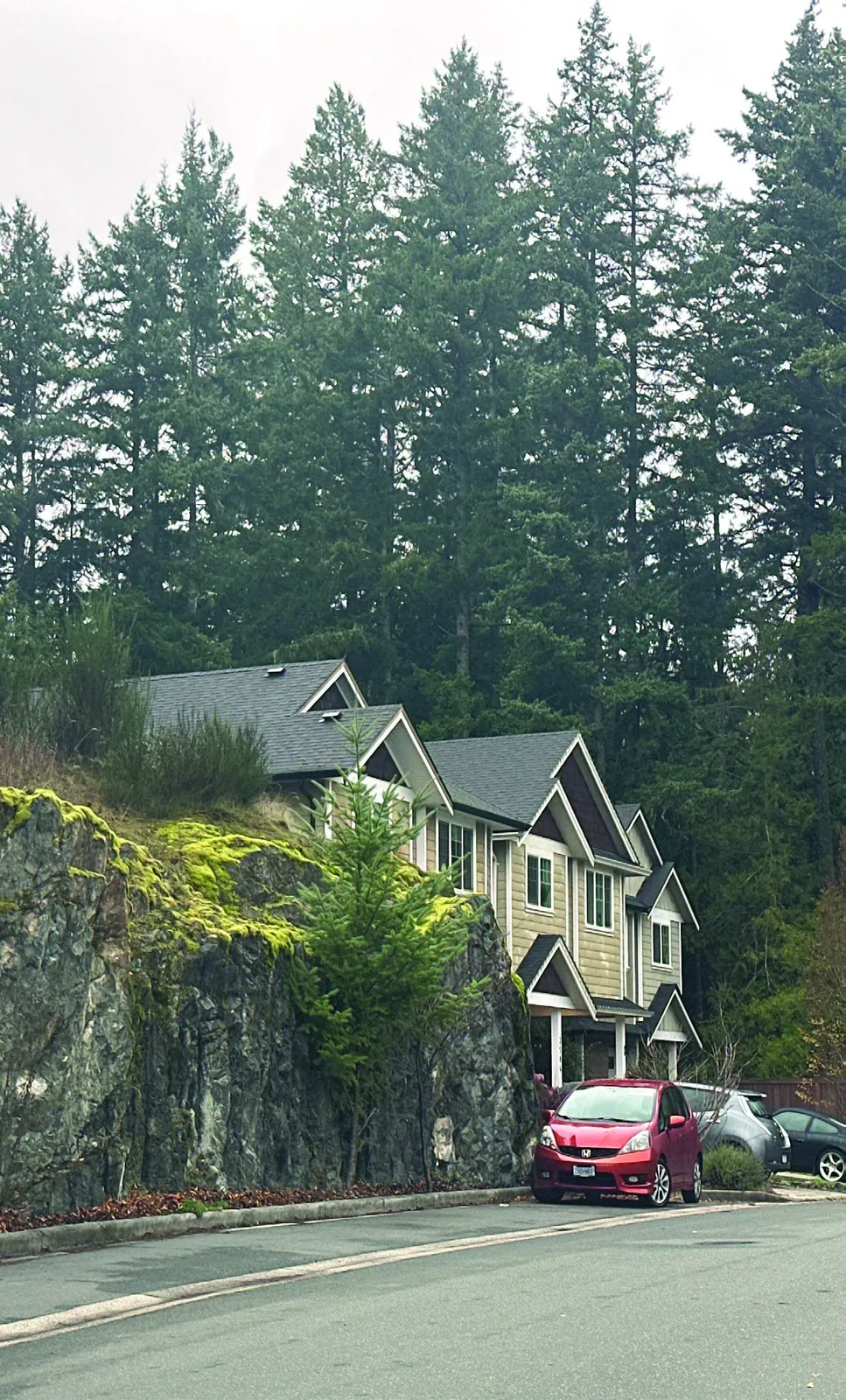
1.7.2 Retain and protect established trees and understory vegetation outside of the Environmentally Valuable Feature or SPEA, where possible, to create continuous natural areas.
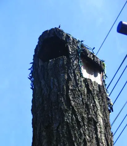
1.7.3 Retain and protect dead-standing wildlife trees that do not pose a risk to people or property.
1.7.4 Retain natural corridors connecting Environmentally Valuable Features within and adjoining the development site. Corridors should be as wide as possible and kept free of development where feasible to maximize wildlife use. Corridor size should be determined by a QEP, and may be tailored to suit the landscape context.
1.7.5 Conduct a stand stability assessment to protect retained forest areas for developments which result in the creation of a new forest edge. A QEP must complete this assessment.
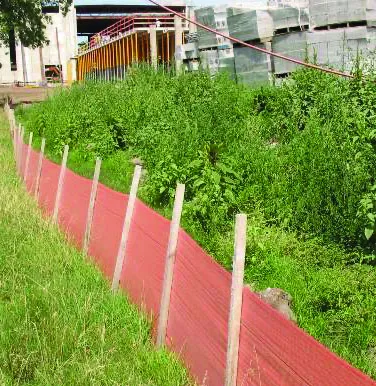
1.7.6 Enhancement, restoration, or compensation works for sites which have been degraded through historical disturbance, invasive species presence, or other factors may be required. This plan must be developed by a QEP and include monitoring and maintenance for a minimum of 5 years.
1.7.7 The preservation of wildflower communities and groups of vegetation, along with their associated under-storey (rather than individual species), is strongly encouraged outside of the Environmentally Valuable Feature or SPEA.
1.7.8 The preservation of wetlands, vernal pools and other seasonal watercourses is required unless their removal is authorized under the Water Sustainability Act.
1.7.9 Include a landscaping program that supports the City’s Urban Forest Management Plan and Official Community Plan canopy targets through the retention of a minimum 20% canopy cover or a combination of retention and replanting of trees on-site and in adjoining on-street boulevards that, at maturity, will achieve a 30% canopy cover of the site.
The City acknowledges that, in addition to being supported by the retention and replanting of trees on-site and in adjoining boulevards, the City’s Urban Forest Management Plan and Official Community Plan canopy targets are supported by the provision of park and other public open space as a condition of development approvals, including rezoning and subdivision.
Where an applicant for a DP to alter lands within a multi-phase development has provided forested lands to the City as a condition of approval of a previous phase of development, the provision of those lands will be considered by the City when assessing the applicant’s landscape program and will result in an appropriate reduction to the minimum canopy cover otherwise required.
1.7.10 The City may require security in accordance with Section 502 of the Local Government Act to ensure the installation and maintenance of landscaping or environmental restoration/compensation is in compliance with these guidelines.
1.8 Sensitive Ecosystems and Riparian Areas
1.8.1 Prior to any development activity, the applicant will:
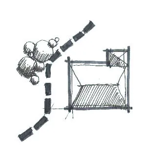
a. Delineate non-disturbance areas for Environmentally Valuable Features, SPEAs, and other trees or natural areas to be retained with temporary high visibility fencing. This fencing should:
i. Be placed at the drip line of any trees to be retained;
ii. Be a minimum height of 1.2m;
iii. Supported by poles placed at 2.5 m intervals;
iv. Remain in place throughout clearing, site preparation, construction and any other form of disturbance;
v. Allow appropriate opportunities for wildlife movement along the corridor; and
vi. Be routinely inspected and repaired when necessary.
1.8.2 The DP may require the Environmentally Valuable Features and SPEAs to be permanently delineated with a split-rail fence, or other type of fence recommended by the QEP and approved by the Director of Community Planning and Development.
1.8.3 Where development requires new roads, all road design should seek to minimize impacts to Environmentally Valuable Features and SPEAs. Measures to minimize impacts include:
a. Minimize road, utility, and other crossings of watercourses and riparian ecosystems. Where crossings are necessary, design them to be narrow and perpendicular to riparian areas;
b. Implement design standards for safe wildlife crossings where new roads are required through an Environmentally Valuable Feature or SPEA. Considerations may include culverts under roadways, bump outs, speed control measures, educational signage, fencing, and naturalization of medians;
c. Minimize impervious surfaces and promote natural filtration. Incorporate absorbent landscaping and encourage the permeability of landscaped areas adjacent to Environmentally Valuable Features or SPEAs by protecting and re-using native topsoil, preventing compaction during construction, and aerating or loosening compacted soils;
d. Improve or maintain fish habitat and access; and
e. Use clear-span bridges or open-bottomed stream crossings whenever feasible. Incorporate fish baffles or other best management practices to support fish passage in enclosed crossings.
[Images 17–21: Road and crossing design examples illustrating ways to reduce impacts to riparian ecosystems and wildlife.]
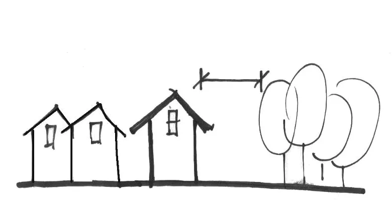
1.8.4 All new buildings, projecting features, and impervious surfaces are recommended to be setback a minimum of 3 m from the SPEA or Environmentally Valuable Feature to protect their integrity and establish a transition zone. A smaller buffer and/or setback can be proposed provided that a QEP submits a letter certifying there will be no impacts to these non-disturbance areas or the critical root zone of retained trees. Tree retention or planting, stormwater management, nature-scaping, and trails in these areas are encouraged. Yard space is also an acceptable use for this space, provided it remains free of buildings and structures. A landscape plan may be required at the discretion of the City.
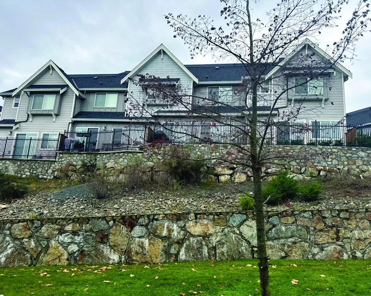
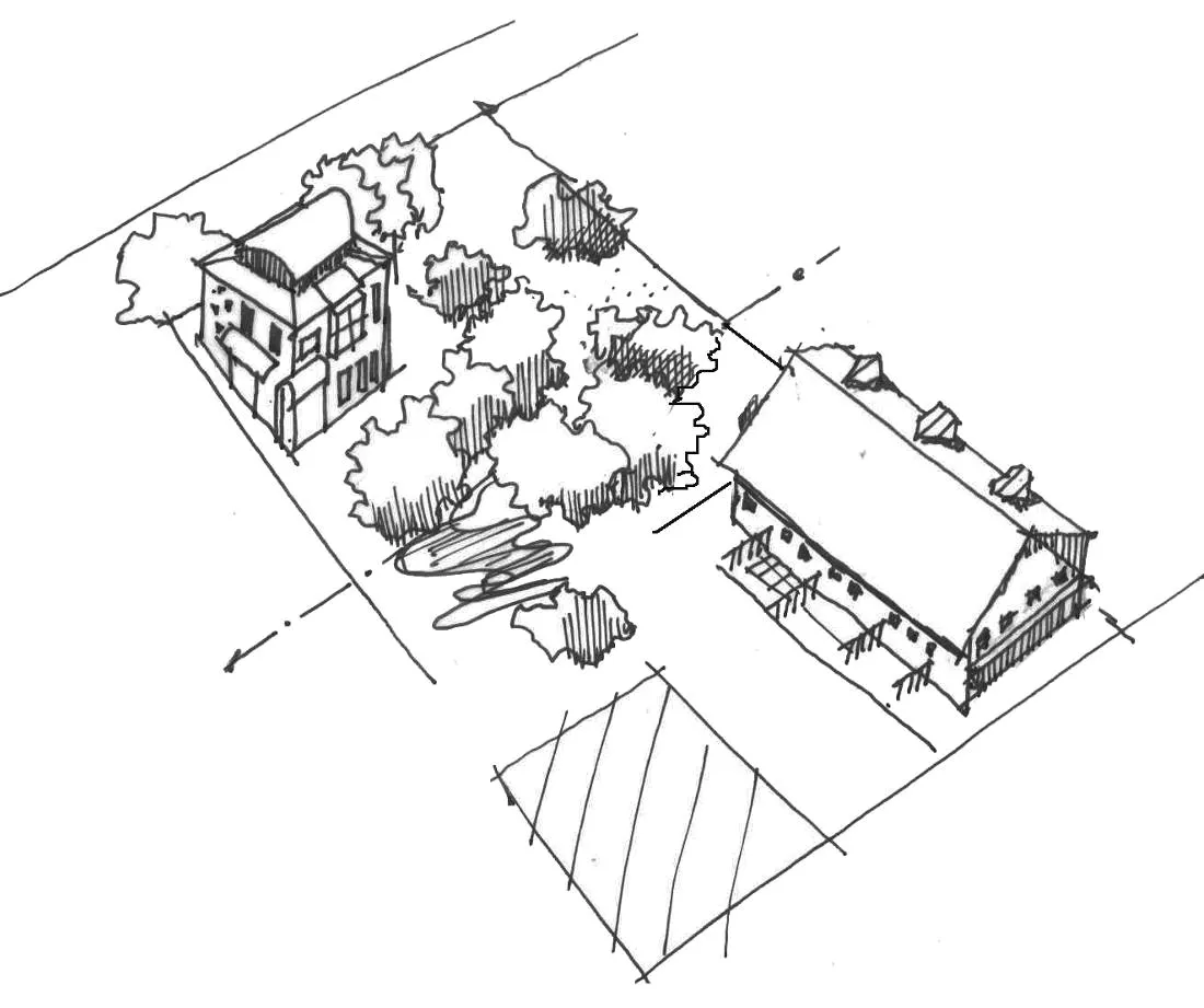
1.8.5 Despite the maximum building envelope defined by the Zoning Bylaw, the DP may designate acceptable building footprint locations within the building envelope and/or limit the extent of clearing to the area strictly necessary to achieve the proposed use in order to protect identified Environmentally Valuable Features or SPEAs.
1.8.6 Clustering development and use of strata lot averaging, where permitted by the Zoning Bylaw, is encouraged where this can be demonstrated to protect Environmentally Valuable Features.
1.8.7 Home sites shall be landscaped to preserve the integrity of protected areas by minimizing the invasion of domestic plantings, and selecting the location and composition of planting areas in accordance with the recommendations of a QEP. The planting or retention of pollinator-friendly species is highly encouraged.
1.8.8 Development must not impact any species at risk or critical habitat identified by the BC Conservation Data Centre or the QEP.
1.8.9 Bird nests are protected in accordance with the BC Wildlife Act, and Migratory Birds Convention Act. The nests of raptors such as bald eagle, peregrine falcon, osprey, and various owls are protected year-round. If any raptors nests or otherwise protected nests are identified, they must be protected following the provincial “Guidelines for Raptor Conservation during Urban and Rural Land Development in British Columbia (2013)” or future versions if one is released. Active nests of all other birds cannot be removed or disturbed during the nesting season, March 1 to August 31, or otherwise recommended by a QEP. If tree or vegetation removal occurs within the nesting season, a bird nesting survey must be completed prior to any activity which may disturb nesting birds.
1.8.10 Protection of nesting and denning sites from development encroachment and development activities is encouraged where other regulations do not protect these features. Where nests and/or denning sites are located on a property, construction should be timed such that it does not interfere with active nesting/denning seasons.
1.8.11 Site clearing should be undertaken immediately prior to construction in order to minimize the amount of time that disturbed soils are exposed to weathering. If this is not possible, exposed soils should be re-vegetated, covered or otherwise protected from run-off erosion.
1.8.12 The DP may require development activities to be timed to occur outside of fish spawning periods, if recommended by the QEP. Any works proposed below the top of bank are required to submit a notification or approval under the Water Sustainability Act.
1.8.13 A site shall be developed in such a way that the existing drainage system and the quality and quantity of storm water run-off are maintained by:
a. No increase in the volume of storm water discharge from the site;
b. No increase in the sediment loadings of storm water discharge from the site; and
c. Prevention of potential spills of hazardous materials, oils and other contaminants into the storm water discharge from the site.
1.8.14 Ensure maintenance vehicles are able to access stormwater infrastructure such as ditches, culverts, and creeks while maintaining the integrity of the SPEA.
1.8.15 Pollutants shall be prevented from entering lakes and watercourses through control of surrounding drainage.
1.8.16 Development must be in accordance with the protection, mitigation, and enhancement strategies recommended in the EIS or Riparian Assessment Report.
1.8.17 Sediment containment and erosion control measures will be installed under the direct supervision of a QEP prior to land preparation and development.
1.8.18 An environmental monitoring program prepared by a QEP may form part of the DP to ensure protection of retained Environmentally Valuable Features and SPEAs, as well as compliance with other applicable conditions of the permit.
1.8.19 All developments are encouraged to incorporate the recommendations and guidelines contained in the Ministry of Environment’s Develop with Care document.
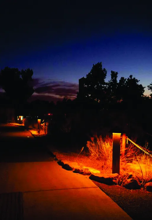
1.8.20 Apply Dark Sky lighting principles and targeted illumination in order to reduce spill lighting into retained Environmentally Valuable Features and SPEAs.
1.8.21 Building design should consider treating glass and transparent surfaces to reduce the potential for bird collisions or implementing measures to reduce bird collisions.
1.8.22 A natural state covenant in favour of the City must be registered to protect retained Environmentally Valuable Features and SPEAs.
1.8.23 Dedication of waterbodies, Environmentally Valuable Features, or the SPEA may be required as a condition of DP approval on a site-by-site basis, at the discretion of the City.
Part 2. Hazardous Area Development Permit Area Guidelines
The following exemptions and guidelines apply to those lands identified on Map 13: 200-Year Floodplain, Map 14: Steep Slopes, Map 15: Drainage Concerns, and Map 16: Interface Fire Hazard Areas in Official Community Plan Bylaw No. 2200.
General Exemptions
2.1 Steep Slopes, 200-Year Floodplain, Drainage Concerns, Interface Fire Hazard Areas
2.1.1 Despite the designation of an area as a Development Permit Area (DPA), the Local Government Act provides that conditions may be specified under which a Development Permit (DP) is not required.
a. Actions to prevent, control, or reduce hazards, such as flooding or erosion, that represent immediate threats to life, public, or private property are temporarily exempt from the requirement to obtain a DP. The City of Langford, may, at its discretion, require a retroactive DP. Planned works designed to mitigate future emergencies or hazards are not exempt.
b. Public utilities and operational works, including construction, repair, or maintenance of public works undertaken by the City or its authorized agents and contractors, provided that these works follow best management practices and meet or exceed the intent of the DPA.
c. Road and utility works within highways (as defined by Streets and Traffic Bylaw No. 2233) that are authorized by the Director of Engineering and Public Works.
d. Habitat improvement activities and trail and park projects undertaken by the City of Langford, provided they meet or exceed the intent of the DPA.
e. Ecological Restoration, including:
i. Planting native vegetation and/or removing non-native or invasive vegetation using small hand tools. A plan which considers proper disposal methods, planting, safety, and erosion and sediment control may be required to the satisfaction of the City.
f. Native plant salvaging may occur prior to the issuance of a DP, provided that:
i. A complete DP Application has been submitted to the satisfaction of the Director of Community Planning and Development;
ii. Salvaging of plants occurs only within those lands proposed to be altered by the DP Application;
iii. The plants are retained and transplanted as part of the landscape plan within the subject property or are transplanted to another suitable location at the discretion and approval of the Director of Community Planning and Development in writing; and
iv. The Director of Community Planning and Development authorizes the native plant salvaging in writing.
g. Subdivision of lands where:
i. There will be no alteration of the land associated with, or directly resulting from, the plan of subdivision; or
ii. Subdivisions that are lot line adjustments, subdivisions for park purposes, or for lot consolidation.
h. The removal of trees in accordance with the Tree Protection Bylaw.
i. The reconstruction or repair of a permanent structure in accordance with Section 532 of the Local Government Act, if the structure remains on its existing footprint.
j. Minor repair or alteration of existing structures within their existing footprint, where vegetation removal or disturbance is not required, including interior renovations or replacement of a roof or exterior siding.
k. Maintenance of existing gardens and landscaping, such as mowing, planting vegetation, and minor soil disturbances, not altering the general contours of the land.
l. Activities permitted by existing agreements with senior government agencies or covenant terms.
m. Existing land uses and buildings, provided that the area occupied by the land use is not increased or the area occupied by the building is not expanded.
n. Development for agricultural use and normal farm practices (as defined in Section 1 of the Farm Practices (Right to Farm) Act) provided that:
i. The lot is zoned for agriculture and/or is within the Agricultural Land Reserve; and
ii. Agricultural buildings are set back from streams in accordance with the Guide for Bylaw Development in Farming Areas (Ministry of Agriculture, Food and Fisheries (2020), or subsequent versions of the guide.
o. Accessory buildings not exceeding a gross floor area of 10 m² and minor additions to buildings or structures, provided that all of the following are met:
i. There is no increase in any bylaw non-conformities;
ii. All zoning requirements are satisfied;
iii. There is no further encroachment in the designated DPA OR that no trees or vegetation will be removed or impacted; and
iv. Site coverage is not increased by more than 5% of the existing coverage.
p. Where the work in question is geotech (P.Eng.) certified as part of the Building Permit or Subdivision process.
q. Where a qualified professional provides a letter that certifies that the designated Hazardous condition does not apply.
2.2 200-Year Floodplain
2.2.1 In addition to Section 2.1, the following exemptions apply on lands within the 200-Year Floodplain DPA:
a. Where a building is legally non-conforming in the designated floodplain, it may have a one-time only expansion/addition at the original floor elevation up to, but not exceeding, 25% of the non-conforming habitable area on the main floor of the building existing at the time of enactment of flood proofing requirements, provided that:
i. There is no increase in non-conformity in respect to setback requirements;
ii. No fill is brought onto the site;
iii. The addition satisfies the floodplain elevation; and
iv. The foundation allows flood waters to pass through.
b. Where a building is legally non-conforming in the designated floodplain, it may have an expansion/addition in excess of 25% provided that:
i. The existing building and the addition are raised and placed on a new foundation which satisfies the required floodplain elevation and allows flood waters to pass through;
ii. Any expansion or addition complies with all other zoning and building bylaw regulations;
iii. There is no increase in non-conformity in respect to zoning requirements; and
iv. No fill is brought onto the site.
2.3 Interface Fire Hazard
2.3.1 In addition to Section 2.1, the following exemptions apply on lands within the Interface Fire Hazard DPA:
a. For minor additions (less than 46.45 m²) to an existing house;
b. For the removal of trees or vegetation, if no other Environmental Protection or Hazardous Area Development Permit Areas apply;
c. For lands identified as “Moderate” or “Low” on Map 16 of OCP Bylaw No. 2200;
d. If a Section 219 Covenant relating to interface fire hazard requirements and mitigation measures is already registered to title for the parcel(s) in question, to the satisfaction of the Director of Community Planning and Development.
General Guidelines
2.5 Steep Slopes, 200-Year Floodplain, and Drainage Concerns
2.5.1 Land and existing trees and vegetation may not be disturbed except as allowed in a DP or DP exemption issued by the City of Langford.
2.5.2 A report certified by a Professional Engineer (P.Eng) may be required to assist in identifying:
a. Hazardous conditions;
b. Potential risk to new and existing residents; and
c. Potential risk with respect to climate change adaptation.
2.5.3 If the report identifies areas on the site that should be protected from development, development should be set back from the non-disturbance area and the report should make recommendations for appropriate setbacks.
2.5.4 A site plan developed by a BC Land Surveyor or P.Eng may be required, which:
a. Locates the proposed development relative to the DPA boundaries and property lines;
b. Locates the identified hazard areas;
c. Identifies the applicable buffer or setback recommended by the P.Eng to separate the proposed development from identified hazard areas; and
d. Identifies where soil or vegetation will be disturbed for yards, driveways, patios, walkways, or stored due to construction activities, relative to the DPA boundaries.
2.5.5 The City may request peer review of a report from a P.Eng at the applicant’s expense.
2.5.6 Site clearing should be undertaken immediately prior to construction in order to minimize the amount of time that disturbed soils are exposed to weathering. If this is not possible, exposed soils should be re-vegetated, covered or otherwise protected from run-off erosion.
2.5.7 Sediment containment and erosion control measures will be installed under the direct supervision of a qualified professional prior to land preparation and development.
2.5.8 A site shall be developed in such a way that the existing drainage system and the quality and quantity of storm water run-off are maintained by:
a. No increase in the volume of storm water discharge from the site;
b. No increase in the sediment loadings of storm water discharge from the site; and
c. Prevention of potential spills of hazardous materials, oils and other contaminants into the storm water discharge from the site.
2.5.9 Protection, mitigation, and enhancement strategies may be required at the City’s discretion, such as:
a. Tree Protection and Replacement Plan prepared by an ISA Certified Arborist;
b. Restoration Plan;
c. Permanent fencing;
d. Removal of invasive species and restoration; and
e. Construction and Environmental Management Plan outlining procedures to prevent or mitigate adverse environmental impacts during construction.

2.6 Steep Slopes
2.6.1 Sediment containment and erosion control measures will be installed under the direct supervision of a qualified professional prior to land preparation and development.
2.6.2 When land is altered, due regard shall be given to maintaining the normal drainage system and regulating storm water run-off.
2.6.3 Exposed soil on steep slopes subject to erosion shall be re-vegetated, covered or otherwise protected from run-off erosion.
2.6.4 Rock slopes adjacent to building lots must be certified as safe for the intended use by a P.Eng (Geotechnical) prior to the issuance of a Building Permit.
2.6.5 Development will not be permitted on hillsides of 30% or greater slope with poor soil stability or susceptibility to erosion unless a P.Eng has been engaged to resolve the hazard.
2.7 200-Year Floodplain and Drainage Concern
2.7.1 The applicant will ensure that the proposed development:
a. Does not negatively impact the floodplain; and
b. Is flood-proofed in accordance with City of Langford standards.
2.7.2 Minimum habitable elevation levels will be the 1 in 200 year flood levels as defined by the Langford Storm Water Master Plan (prepared by Reid Crowther and Associates, or as amended by the City of Langford) plus 0.3 m (1 ft) for surge and 0.3 m (1 ft) freeboard along the main stem of creeks and tributaries and lakes/wetlands.
2.8 Interface Fire Hazard
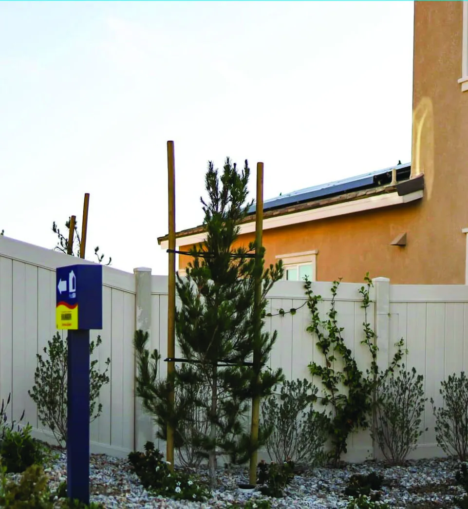
2.8.1 Plans may be required, which:
a. Identifies the extent and nature of existing and proposed landscaping, including details of trees and ground cover; and
b. Identifies the exterior materials of existing and proposed buildings (siding and roofs).
2.8.2 One or more report(s) prepared by a professional (Registered Professional Biologist, a Professional Engineer, or a Registered Professional Forester) that is qualified to assess interface fire hazard may be required. The report(s) shall provide recommendations for minimizing interface fire hazard risk to the development, as well as, where possible, recommendations to preserve sensitive ecosystems that may occur in close proximity to development.
2.8.3 The interface fire hazard report may include recommendations for relaxations to restrictions on exterior building materials and sprinklers if the resulting development changes the actual level of risk from extreme or high to moderate or low.
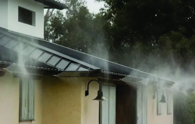
2.8.4 For developments that only have one access route, exterior sprinkler systems on dwellings for protection against exposure fires are encouraged.
2.8.5 For developments that have insufficient water service, as determined by the Fire Chief and Chief Building Inspector, exterior fire sprinklers may be required.
2.8.6 Clustering development and use of strata lot averaging where permitted by the City of Langford Zoning Bylaw is encouraged where this can be demonstrated to protect sensitive ecosystems or reduce the risk of fire spread.
2.8.7 The construction of a trail system around the development to accommodate fire vehicle access for fighting wildfire in interface areas may be required.
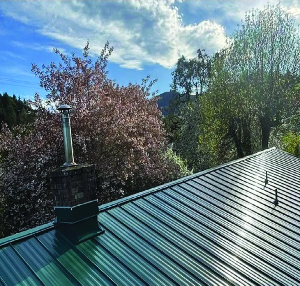
2.8.8 All buildings within 30m of a high or extreme wildfire risk as identified by the report(s) must include fire resistant construction materials for exterior siding and roofing.
2.8.9 In designing new subdivisions and neighbourhoods, applicants shall consider incorporating fire breaks adjacent to residential areas, which may be in the form of cleared parkland, roads, or trails.
2.8.10 Because of the potential for interface wildfires to interfere with hydro service to developments, and thus interfere with residential sprinkler systems, all hydro servicing in new developments within high and extreme interface fire hazard areas is encouraged to be underground and is required for developments of four (4) or more lots of urban density (i.e., lots less than 1,000 m²).
2.8.11 A plan for the expedient removal of all land clearing debris (wood and vegetation) resulting from development must be submitted and complied with prior to the registration of any new subdivision plan. The approving officer may consider accepting security for the removal of the material within three (3) months of plan approval provided that the materials do not remain on site during high fire risk seasons.
2.8.12 The Director of Community Planning and Development may require the applicant to provide a landscape plan and memo prepared in consultation with both a Registered Professional Biologist and a Registered Professional Forester. The memo will provide recommendations for ensuring minimal fuel loading within landscaped areas, ongoing protection from interface fire hazard, and the type and density of fire resistive plantings that may be incorporated within landscaped areas to help mitigate the interface fire hazard.
2.8.13 New developments should provide adequate fuel removal and reduction zones prior to any subdivision or building permit approval.
2.8.14 New developments should provide fuel removal and fuel reduction zones as necessary for adjacent existing developments where there is not sufficient room available on the adjacent property to establish full fuel removal and reduction areas.
Fuel Removal and Reduction Zones
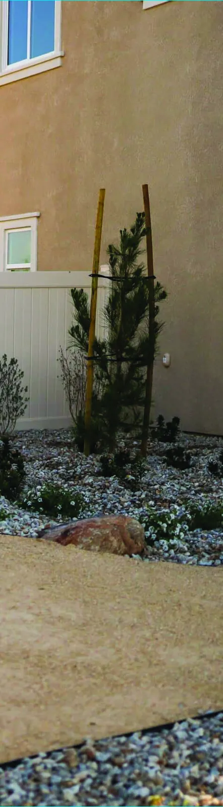
2.8.15 Fuel Removal Zone One: A distance of at least 10m and, depending on the surrounding environment, possibly up to 20m from the proposed building and projections. This distance depends upon and increases with the degree of aspect of slope and the surrounding fire risk. Within Fuel Removal Zone One:
a. All trees, underbrush, dead limbs and debris piles which pose a fire risk are to be removed;
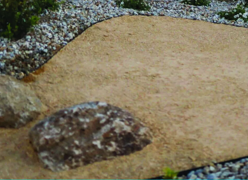
b. Landscaping should consist of low combustible vegetation only—plant deciduous trees to provide shade to cool the area around the dwelling and to enhance wildlife habitat;
c. Underground automatic irrigation system to be installed and maintained;
d. Bark mulch, wooden fencing or coniferous plant species are prohibited; and
e. No outdoor storage of building material, landscape debris or combustible materials is permitted.
2.8.16 Fuel Reduced Zone Two: A distance of 20 m to 30 m from the proposed building and projections. Within Fuel Removal Zone Two:
a. Low tree density to be provided and maintained by removing smaller trees and ensuring that the crowns of trees are separated by a minimum distance of 3 to 6 m;
b. Mature trees to be maintained, but limbs to a height of 10 m (30 ft) are to be removed;
c. High combustible bush and undergrowth to be removed;
d. Only deciduous trees to be planted and maintained and should have a minimum separation distance of 3 to 6 m between crowns; and
e. Deciduous trees to be planted and maintained to provide shade and enhance wildlife habitat.
2.8.17 In order to ensure the ongoing restriction on wood fuel adjacent to residences, the Director of Community Planning and Development may require the applicant to post a security in accordance with Section 479 of the Local Government Act. In lieu of the bond, the Director of Community Planning and Development may accept a Section 219 covenant requiring property owners to ensure the fuel restriction zone around houses and buildings is maintained and that if they are not maintained, they may be required to pay a rent charge of $1 000 per year.
2.8.18 A Section 219 covenant that prohibits any outdoor burning may be required.
Document Images
(12)