DocumentsStaff ReportJun 16, 2025Pages 121–305
FireSmart Community Funding and Supports
Report on FireSmart community funding opportunities and supports, describing available grants, recommended actions and proposed next steps to increase wildfire resiliency.
Key facts
- Agenda item 8.4 (starts page 121)
- Discusses FireSmart funding streams and potential city actions to improve community wildfire resiliency
- Includes recommended programs, partnerships and timelines for implementation
FireSmart Community Funding and Supports
Page 121
t 250.478.7882 e administration@langford.ca 2nd Floor, 877 Goldstream Avenue Langford, BC V9B 2X8
Staff Report to Council
DATE: Monday, June 16, 2025 DEPARTMENT: Fire Rescue SUBJECT: FireSmart Community Funding & Supports
EXECUTIVE SUMMARY: Using the FireSmart Community Funding and Supports (FCFS) grant available through UBCM, the Community Wildfire Protection Plan (CWPP) developed in 2020 has been updated to a Community Wildfire Resiliency Plan (CWRP). The CWRP is the next generation of plans that will serve as the primary wildfire risk reduction mechanism for Langford which incorporates FireSmart disciplines into the new plan. A CWRP is one of the requirements to be eligible for future FCFS funding for wildfire mitigation.
BACKGROUND:
The FireSmart Community Funding and Supports is intended to reduce the risk of wildfires and mitigate their impacts on BC Communities. Funding is provided by the Province of BC and is administered by Union of BC Municipalities (UBCM). The UBCM FireSmart funding stream provides funding to local governments and First Nations to increase community resiliency by under-taking community based FireSmart planning and activities that reduce the community's risk from wildfires.
FireSmart is a nationally recognized program to support local governments and First Nations on strategies to reduce the threat of wildfires. The FireSmart program is backed by a vast amount of field, laboratory, and wildfire modelling research and FireSmart principals have been shown to be effective in reducing the risk to life and property in the most extreme wildfire conditions.
The Hazard, Risk, and Vulnerability Analysis (HRVA) conducted by Behr Integrated Solutions Inc. in 2020 for the City of Langford identifies wildfires as a significant risk for our community. The City of Langford's Community Wildfire Protection Plan (CWPP), completed by Diamond Head Consulting in 2020 and the Provincial Wildland Urban Interface Risk Classification for Langford, both place Langford in the highest risk category, and both support the significance of developing wildland urban interface fire mitigation strategies using FireSmart principles.
In 2023, the City of Langford utilized UBCM funding to hire a FireSmart Coordinator to continue developing the FireSmart Program with a strong focus on community engagement and public education. Efforts encompassed a comprehensive approach to wildfire mitigation, incorporating education, community engagement, development considerations, interagency cooperation, emergency planning, Page 121 of 341
Page 122
FireSmart Community Funding & Supports 20250616 Report to Council Page 2 of 3
training, and specific projects targeting critical infrastructure and residential areas. This enhanced wildfire resilience and fostered a safer environment for at risk neighborhoods.
COMMENTARY:
Staff applied for and received approval from UBCM to use the FCFS funding to update the City’s of Community Wildfire Protection Plan (CWPP) to a Community Wildfire Resiliency Plan (CWRP), aligning with the required five-year update cycle.
CWRP’s are the next generation of CWPP’s and serve as the primary wildfire risk reduction planning mechanism for British Columbia communities. It is a science-based approach towards wildfire risk reduction that reflects local priorities and Provincial goals for prevention and mitigation.
To better ensure that plans consistently take a comprehensive approach to wildfire risk reduction and resiliency measures, the BC Wildfire Service partnered with FireSmart BC to develop a new framework for community wildfire resiliency planning. The new plan incorporates the successful components of the CWPP while integrating new elements that more comprehensively align with the seven FireSmart disciplines. Also in 2024, to be eligible for additional funding, communities were required to have a CWRP in place, have a local FireSmart Coordinator and host in a Community FireSmart Resiliency Committee. By updating the City’s CWPP to a CWRP, Langford will continue to meet the criteria for additional funding opportunities.
By approving the completed CWRP, Council can direct staff to prioritize and implement its recommendations to reduce the wildfire risk in Langford. Overall, the City’s local FireSmart program aims to heighten community awareness and resilience against the threat of wildfires through ongoing wildfire mitigation education to residents. The CWRP has 33 recommendations which will provide the framework for future mitigation work to reduce the threat of wildfires in the community.
FINANCIAL IMPLICATIONS:
The UBCM FireSmart Community Funding & Supports grant funding will cover wages as well as fund activities and initiatives to implement the recommendations of the CWRP. No additional funding will be required from the City of Langford at this time.
LEGAL IMPLICATIONS:
None.
OPTIONS:
Option 1 Page 122 of 341
Page 123
FireSmart Community Funding & Supports 20250616 Report to Council Page 3 of 3
THAT Council approve the updated Community Wildfire Resiliency Plan and direct staff to prioritize the implementation of the recommendations within the plan.
OR Option 2 THAT Council take no action with respect to the Community Wildfire Resiliency Plan at this time.
SUBMITTED BY: Chris Aubrey, Fire Chief Concurrence: Melisa Miles, Manager of Legislative Services Concurrence: Donna Petrie, Senior Manager of Communications & Economic Development Concurrence: Matthew Baldwin, RPP, MCIP, Director of Development Services Concurrence: Leah Stohmann, RPP, MCIP, Director of Community Planning and Climate Change Concurrence: Katelyn Balzer, P.Eng., Director of Engineering and Public Works Concurrence: Michael Dillabaugh, CPA, CA, Director of Finance Concurrence: Braden Hutchins, Deputy Chief Administrative Officer Concurrence: Darren Kiedyk, Chief Administrative Officer Page 123 of 341
Page 124
Page 124 of 341
Page 125
City of Langford Community Wildfire Resiliency Plan December 2024
Submitted to: Tianna Dupuis FireSmart Coordinator Langford Fire Rescue
Phone: 250-478-9555 Website: https://langford.ca/ Submitted by: Diamond Head Consulting Ltd. 3559 Commercial St Vancouver, BC
Phone: 604-733-4886 Website: www.diamondheadconsulting.com
Page 125 of 341
Page 126
Community Wildfire Resiliency Plan | City of Langford | December 2024 iii Professional Seal and Signatures
Registered Professional Forester Registered Professional Forester Matthew Shields 5137 Michael Coulthard 3772 Date signed Date signed 19 December 2024 19 December 2024 I certify that the work described herein fulfills the standards expected of a registrant of the Association of British Columbia Forest Professionals and that I did personally supervise the work.
I certify that I have reviewed this document, and while I did not personally supervise the work described, I have determined that this work has been completed to the standards expected of a registrant of the Association of British Columbia Forest Professionals.
Page 126 of 341
Page 127
Community Wildfire Resiliency Plan | City of Langford | December 2024 iv Table of Contents LIST OF FIGURES ..................................................................................................................... VI LIST OF TABLES ...................................................................................................................... VII LAND ACKNOWLEDGEMENT .................................................................................................. VIII ACKNOWLEDGEMENTS .......................................................................................................... VIII FREQUENTLY USED ACRONYMS ............................................................................................... IX EXECUTIVE SUMMARY .............................................................................................................. X INTRODUCTION ........................................................................................................................ 1 Overview ................................................................................................................................ 1 How to use this CWRP ............................................................................................................. 2 Plan Goals .............................................................................................................................. 4 Plan Objectives ....................................................................................................................... 5 Plan Development Summary .................................................................................................... 5 RELATIONSHIP TO OTHER PLANS ............................................................................................ 6 Linkages to Existing Community Wildfire Plans .......................................................................... 6 Linkages to Other Plans ........................................................................................................... 7 COMMUNITY DESCRIPTION .................................................................................................... 11 Area of Interest .................................................................................................................... 11 Wildland-Urban Interface ....................................................................................................... 11 COMMUNITY INFORMATION .................................................................................................. 14 Demographics and Housing ................................................................................................... 14 Fire and Emergency Response ............................................................................................... 15 VALUES AT RISK ...................................................................................................................... 17 Human Life and Safety .......................................................................................................... 17 Environment and Protected Areas .......................................................................................... 20 Critical Infrastructure ............................................................................................................ 28 WILDFIRE RISK ASSESSMENT ................................................................................................ 36 Wildfire Environment ............................................................................................................. 36 Provincial Strategic Threat Analysis ........................................................................................ 54 Local Wildfire Risk Assessment............................................................................................... 57 Hazard, Risk, and Vulnerability Analysis .................................................................................. 60 INTRODUCTION TO FIRESMART ............................................................................................. 61 FireSmart – Key Concepts ...................................................................................................... 62 Key Aspects of FireSmart for Local Government ...................................................................... 65 Langford’s FireSmart Program ................................................................................................ 65 EDUCATION ............................................................................................................................. 66 Factors for Success ............................................................................................................... 66 Initiatives to Consider............................................................................................................ 69 LEGISLATION AND PLANNING ................................................................................................ 75 Federal Acts and the Community Wildfire Resiliency Plan ......................................................... 75 Provincial Acts and the Community Wildfire Resiliency Plan ...................................................... 75 Page 127 of 341
Page 128
Community Wildfire Resiliency Plan | City of Langford | December 2024 v Langford’s Role ..................................................................................................................... 75 Factors for Success ............................................................................................................... 76 Initiatives to Consider............................................................................................................ 76 DEVELOPMENT CONSIDERATIONS ......................................................................................... 79 Langford’s Role ..................................................................................................................... 79 Initiatives to Consider............................................................................................................ 83 INTERAGENCY COOPERATION ................................................................................................ 85 Factors for Success ............................................................................................................... 85 Initiatives to Consider............................................................................................................ 86 FIRESMART TRAINING AND CROSS-TRAINING ..................................................................... 87 Factors for Success ............................................................................................................... 87 Initiatives to Consider............................................................................................................ 89 EMERGENCY PLANNING .......................................................................................................... 90 Factors for Success ............................................................................................................... 90 Initiatives to Consider............................................................................................................ 92 VEGETATION MANAGEMENT ................................................................................................... 96 Managing Vegetation through FireSmart ................................................................................. 96 Fuel Management for Forest Landscapes ................................................................................ 99 FIRESMART ROADMAP .......................................................................................................... 106 ACTION PLAN & IMPLEMENTATION ..................................................................................... 107 APPENDICES ......................................................................................................................... 115 Appendix A: Glossary of Terms ............................................................................................ 115 Appendix B: Local Wildfire Threat and Risk Process ............................................................... 117 Appendix C: Engagement .................................................................................................... 127 Appendix D: Community Survey Response Report ................................................................. 128 Appendix E: CRI Mandatory Maps ........................................................................................ 167
Page 128 of 341
Page 129
Community Wildfire Resiliency Plan | City of Langford | December 2024 vi List of Figures Figure 1. Area of interest (AOI) for the Plan. .......................................................................13 Figure 2. Visual comparison of "interface" (left, Westhills) and "intermix" (right, Ravens View) conditions.........................................................................................................................13 Figure 3. Structure density within the project area. ..............................................................18 Figure 4. Protected areas and known locations of protected species or habitat within the AOI. 25 Figure 5. Facilities considered critical infrastructure by the CWRP. .........................................30 Figure 6. Fuel types from the Provincial Strategic Threat Analysis in Langford. .......................42 Figure 7. 30-year modelled climate averages for Langford (Meteoblue)..................................43 Figure 8. Windspeeds by month experienced for Langford ....................................................44 Figure 9. Wind rose diagram for Langford ...........................................................................45 Figure 10. Potential impacts of climate change on wildfire behaviour. ....................................49 Figure 11. Location of historic fires from BCWS data. ...........................................................53 Figure 12. Area burned by decade, 1920-2024. ...................................................................54 Figure 13. PSTA Wildfire Threat Ratings in Langford ............................................................56 Figure 14. Wildfire risk resulting from the local risk assessment. ...........................................59 Figure 15. Pathways to home ignition in the WUI. ................................................................62 Figure 16. The FireSmart zone system. ...............................................................................64 Figure 17. Survey respondents described their vision for a FireSmart community (6/90). .........66 Figure 18. Priority sub-areas for FireSmart planning and neighbourhood initiatives. ................74 Figure 19. Comparison of surface and crown fire behaviour. ............................................... 101 Figure 20. Potential Fuel Management Areas in Langford. ................................................... 103 Figure 21. Characteristics of the five common conifer fuel types. ......................................... 118 Figure 22. Weighted averages are used to determine wildfire risk. ...................................... 126
Page 129 of 341
Page 130
Community Wildfire Resiliency Plan | City of Langford | December 2024 vii List of Tables Table 1. Goals of the CWRP ................................................................................................ 4 Table 2. Linkages to existing community wildfire plans. ......................................................... 6 Table 3. Relationship of Community Wildfire Resiliency Plan to local government plans. ........... 8 Table 4. Community Information for Langford. ....................................................................15 Table 5. Major resources for fire response within Langford. ..................................................16 Table 6. Species and ecological communities with designated provincial conservation status. ..22 Table 7. SARA-listed species with confirmed observations or identified critical habitat within Langford. .........................................................................................................................24 Table 8. Critical infrastructure and buildings identified by Langford’s emergency program. ......32 Table 9. Summary of fuel types within Langford. .................................................................41 Table 10. Average weather (2011-2021), from 14G ..............................................................46 Table 11. Climate data for BEC subzones in Langford. ..........................................................48 Table 12. Fire starts by decade (1950-2020). ......................................................................52 Table 13. PSTA Wildfire Threat Ratings with interpretation of fire behavior potential. ..............55 Table 14. Summary of wildfire risk classes. .........................................................................58 Table 15. Summary of wildfire risk from the local threat assessment. ....................................58 Table 16. Potential key messages for a wildfire communications strategy ...............................68 Table 17. Priority sub-areas for FireSmart planning and neighbourhood initiatives. .................71 Table 18. Guide to Wildfire Response Condition Level. .........................................................92 Table 19. Firefighting equipment to improve suppression capability in natural areas. ..............93 Table 20. Potential City-owned properties for FireSmart greenspace management. .................98 Table 21. Areas with the highest potential for fuel management in Langford. ....................... 104 Table 22. Action Plan....................................................................................................... 108 Table 23. Sample tracking and reporting tool. ................................................................... 114 Table 24 Slope percentage and fire behaviour implications. ................................................ 124 Table 25 Slope position of value and fire behaviour implications. ......................................... 124 Table 26 Proximity to the Interface. .................................................................................. 125
Page 130 of 341
Page 131
Community Wildfire Resiliency Plan | City of Langford | December 2024 viii Land Acknowledgement The City of Langford acknowledges and honours the traditional territories of the Coast Salish, specifically Xwsepsum (Esquimalt), Lekwungen (Songhees), Sc’ianew (Beecher Bay), and the WSÁNEĆ Peoples represented by the Tsartlip, Pauquachin, Tsawout, Tseycum, and Malahat Nations. We thank them for sharing this beautiful land. The City of Langford acknowledges and honours the importance of listening, understanding, and engaging meaningfully and intentionally with local First Nations. The City is committed to building strong relationships with the local Nations and is committed to ensuring this work is a priority and approached in a good way. While there is much work to do, and will be an ongoing evolving process, the City is going to start by understanding the priorities of all local First Nations on a one-on-one basis. This document will be updated to honour what we learn and will keep the City accountable to our commitments. This approach to building relationships with local First Nations will be applied to all City projects and initiatives with the commitment of being accountable partners, and strong allies to the Indigenous community.
Acknowledgements We thank all those who have contributed to this Community Wildfire Resiliency Plan by providing guidance, direction, and feedback to the project team.
This project has been led by Langford Fire Rescue, supported by Diamond Head Consulting. Tianna Dupuis, FireSmart Coordinator, was the liaison between the City of Langford and the consulting team.
Langford Fire Rescue • Tianna Dupuis, FireSmart Coordinator • Simon Chadwick, Assistant Chief
Diamond Head Consulting Ltd • Matthew Shields, RPF • Michael Coulthard, RPBio, RPF • Riley Spear, FIT
Geographica Group • Nick Zukanovic, GISP
Finally, we also thank the Community Resiliency Investment Program (CRI) and the Union of British Columbia Municipalities (UBCM), whose support was critical to the funding and completion of this project. Page 131 of 341
Page 132
Community Wildfire Resiliency Plan | City of Langford | December 2024 ix Frequently Used Acronyms AOI Area of Interest BC British Columbia BCWS British Columbia Wildfire Service BP Building Permit CFBPS Canadian Fire Behavior Prediction System CFFDRS Canadian Forest Fire Danger Rating System CRD Capital Regional District CRI Community Resiliency Investment CWPP Community Wildfire Protection Plan CWRP Community Wildfire Resiliency Plan DAI Development Approval Information DP Development Permit DPA Development Permit Area EMBC Emergency Management British Columbia EMP Emergency Management Plan FCFS FireSmart Community Funding and Supports FRPA Forest and Range Practices Act GIS Geographic Information Systems HRVA Hazard, Risk, and Vulnerability Analysis LFR Local FireSmart Representative LRMP Land and Resource Management Plan MOE Ministry of Environment MOF Ministry of Forests OCP Official Community Plan PSTA Provincial Strategic Threat Assessment SWPI Strategic Wildfire Prevention Initiative UBCM Union of British Columbia Municipalities WRR Wildfire Risk Reduction WUI Wildland-Urban Interface
Page 132 of 341
Page 133
Community Wildfire Resiliency Plan | City of Langford | December 2024 x Executive Summary The City of Langford has prepared this Community Wildfire Resiliency Plan (CWRP) to update its previously completed Community Wildfire Protection Plan. This Plan examines wildfire risk in the wildland-urban interface (WUI) of Langford and makes 33 recommendations to help build the community’s FireSmart program and improve its wildfire preparedness and resiliency. Consultants conducted assessments on public land in the WUI to examine the characteristics of the forest fuel environment. These assessments and data from the Provincial Strategic Threat Analysis (PSTA) were used to map the wildfire risk in relation to known values throughout the WUI, such as the location of homes, critical infrastructure, and environmental values. The analysis shows that although most of the public land base is characterized by a moderate wildfire risk; there are significant areas of high risk within Langford. Natural forests in Langford are expected to readily support surface fire during the fire season and may support more severe fire behaviour during periods of extreme fire danger. Uncontrolled surface fires may be less severe than all possible wildfire behaviour, but they remain a public safety risk and significant environmental hazard in an urban setting. Climate change is expected to cause hotter temperatures and drier summers in Langford, weather patterns that are consistent with increasing fire danger. Wildfire risk on private land cannot be modelled under the grant funding terms for this project, but actions to protect private property adjacent to public lands are an important consideration of this CWRP. Proactive measures can be taken to reduce wildfire risk through education to increase public awareness, improve FireSmart programming for residents and municipal operations, emergency planning and interagency cooperation, and fuel management on public lands. The City of Langford has a robust FireSmart program that the CWRP supports and recommends building upon. Recommendations in the Action Plan are framed with suggested priorities and implementation timeframes. Many of the actions recommend preserving Langford’s eligibility for funding within the Community Resiliency Investment Program (CRI) that funded the creation of the CWRP update. The City should work to update this Plan every five years to account for changing conditions in its forests and to address new needs in the community. The Action Plan identifies the following sixteen (16) actions as high priorities for implementation during the first five-year planning cycle:
Page 133 of 341
Page 134
Community Wildfire Resiliency Plan | City of Langford | December 2024 xi Action Plan # Action Summary 1 Conduct a formal review of the CWRP contents every 5 years. Review the Action Plan every year. (p.76) 2 Maintain a FireSmart and Wildfire Resiliency position within the Langford Fire Rescue. (p.65) 3 Participate in regular meetings of the Community FireSmart & Resiliency Committee (p.86) 4 Publish the CWRP and highlights on Langford’s website (p.69) 5 Examine education/information needs for FireSmart projects as the program is expanded (p.69) 8 Develop FireSmart strategies in priority neighbourhoods (see Table 17, p.70) 9 Develop programs that help residents eliminate green waste and yard debris (p.78) 13 Update the development referral process to ensure fire and emergency personnel are included (p.83) 15 Incorporate recognition of and addressing wildfire hazard into the Official Community Plan (p.83) 16 Update and modernize Langford’s Interface Fire Hazard DPA (p.83) 21 Support firefighters to access additional training on future CRI funding applications. (p.89) 23 Establish a guide for emergency preparedness levels during wildfire season (p.93) 24 Conduct FireSmart Assessments of existing critical infrastructure and community assets. (p.92) 26 Incorporate info from the CWRP into the next Emergency Evacuation Plan update (p.95) 31 Consider advancing one or more FireSmart activities in suggested green spaces (p.97) 32 Explore cooperating with BC Parks and/or CRD to suggest FMP development in high priority areas. (p.102)
Page 134 of 341
Page 135
Community Wildfire Resiliency Plan | City of Langford | December 2024 1 Introduction Overview This Community Wildfire Resiliency Plan (CWRP) examines wildfire risk in the City of Langford and makes management recommendations. Funding for this Plan was provided through the Community Resiliency Investment Program (CRI). To be resilient means one can recover from a challenge or life-changing event. Wildfire has the potential to impact Langford, but the City can prepare for this challenge. Emergency preparedness, wildfire response, vegetation management, community planning, and personal readiness are all important elements of building the City’s resiliency to wildfire. This CWRP assesses risk within the public lands of the wildland-urban interface (WUI), the area where natural vegetation and urban development meet. Wildfire can travel from wildland vegetation into neighbourhoods and homes. This transfer is likeliest to occur where neighbourhoods are directly adjacent to large areas of natural vegetation, though ember spotting can affect areas far from the wildfire. There is also a risk of fire moving the opposite direction, from structure fires in the WUI into adjacent natural areas. The causes of most fires in Langford are human origin. To create the CWRP, registered forest professionals visited public lands in the WUI to collect information for mapping wildfire risk. Although wildfire risk is not assessed for private land, the recommendations of the CWRP can be used as a resource for all Langford residents. Recommendations follow the seven disciplines of FireSmart, the national program for community wildfire preparedness.
The Community Resiliency Investment Program is a program funded by the government of British Columbia to reduce the risk of wildfires and mitigate their impacts on BC communities. Wildland-urban interface is the area where human development meets or is located within forest, and consequently, where development faces greater risk of wildfire. Page 135 of 341
Page 136
Community Wildfire Resiliency Plan | City of Langford | December 2024 2 How to use this CWRP The first three sections of the CWRP following this introduction consider Langford’s context and present the findings of the wildfire risk assessment. The community’s planning context and background for the creation of the CWRP is presented in Relationship to Other Plans (p.6). A description of the community, including more detail on how the WUI is defined as well as a brief discussion of socioeconomic and environmental features within the Plan area is contained in Community Description (p.11). The results of wildfire threat assessments and local wildfire risk mapping are presented in Wildfire Risk Assessment (p.36). This section also contains information on the historic fire regime and climate change factors that may influence wildfire risk in the future. The next section is an Introduction to FireSmart (p.61) which provides an overview of FireSmart programming and concepts. After the Introduction to FireSmart, seven sections identify community resources and needs in each of the seven FireSmart Disciplines: • Education (p.66). This section examines how Langford can improve or enhance outreach with residents and neighbourhoods to increase awareness of wildfire risk and build support for wildfire management. • Legislation and Planning (p.75). This section explores the relationship between legislation and planning policy and their relationship to wildfire management and discusses how these tools could be amended or expanded to support community wildfire prevention and preparedness. • Development Considerations (p.78). This section examines how municipal bylaws regulate development and explores opportunities to influence development outcomes by integrating FireSmart principles into site design and development standards. • Interagency Cooperation (p.85). This section provides recommendations supporting engagement with stakeholders and partner institutions. • Cross-Training (p.87) This section explores opportunities building wildfire training for emergency response personnel and neighbourhood FireSmart representatives. • Emergency Planning (p.90). This section considers how emergency planning processes and procedures can incorporate wildfire risk and build wildfire preparedness. • Vegetation Management (p.95). This section discusses the costs and benefits of fuel management through small-scale FireSmart projects in green spaces and larger-scale fuel management in areas of natural vegetation.
Page 136 of 341
Page 137
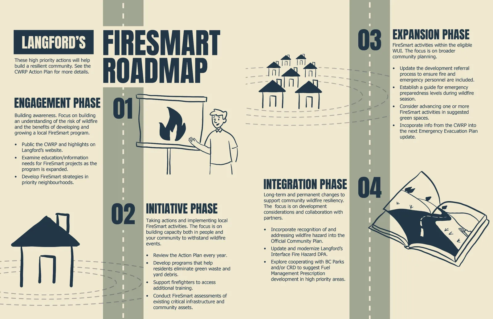
Community Wildfire Resiliency Plan | City of Langford | December 2024 3 These sections are followed by the FireSmart Roadmap and Action Plan & Implementation (p.106), which review actions discussed in the preceding sections and identify levels of priority toward full implementation. The Action Plan can stand alone with the Executive Summary as a guide to improving wildfire resiliency in Langford. 33 recommendations to improve wildfire resiliency in the community are provided, organized by the appropriate FireSmart discipline and suggested priority. The FireSmart Roadmap functions as a quick visual summary of key CWRP implementation priorities. Appendices (p.115) to the Plan provide additional details and definitions for the wildfire threat assessment and risk process, a glossary of terms, a description of the community engagement process undertaken, and CRI-required map submissions.
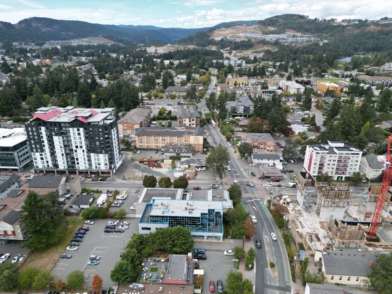
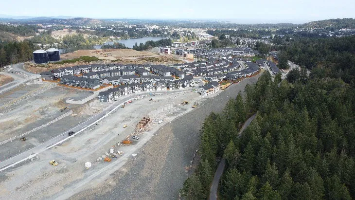
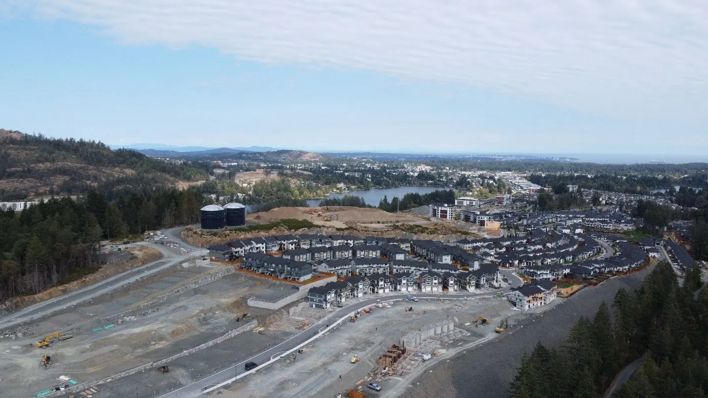
Photo 1. Aerial view of the City of Langford.
Page 137 of 341
Page 138
Community Wildfire Resiliency Plan | City of Langford | December 2024 4 Plan Goals Wildfires are a significant hazard. Although there have been no major wildfires within the City’s boundary in recent years, the natural landscapes surrounding Langford can support wildfire and have for several millennia. The goals of this CWRP have been crafted in response to this reality, setting an agenda that influences each following section in the Plan. Table 1. Goals of the CWRP Goals Public Health and Safety Public safety is enhanced through wildfire prevention, preparation and response. Protection of infrastructure Community infrastructure is protected from wildfire, such that infrastructure critical to emergency response can be relied upon during a major disaster. Interagency Co- operation and Policy Wildfire management occurs in cooperation with all relevant agencies and, where appropriate, with local partners like neighbouring municipalities, fire departments, and First Nations. Public Awareness, Education and Advocacy Effective education, advocacy, and communication increase public understanding, support, and awareness of wildfire risk management. Sustainable Planning Careful consideration for wildfire risk and mitigation process through community planning, development, and growth management. Environmental Protection and Enhancement Ecosystems that support biodiversity and environmentally sensitive features are protected from wildfire impacts and the impacts of wildfire management activities. Adaptive Management The effectiveness of wildfire management initiatives is monitored and continuously improved through review of actions and decision-making processes. Financial Responsibility Wildfire resiliency initiatives are considered through a financial lens, making the best use of available grants and funding from other levels of government.
Page 138 of 341
Page 139
Community Wildfire Resiliency Plan | City of Langford | December 2024 5 Plan Objectives The following objectives provide context on how the CWRP will achieve its goals: • Provide an updated understanding of wildfire risk within the WUI based on the provincial data available and site assessments by qualified professionals. • Identify areas of higher relative risk where Langford should focus actions to reduce wildfire risk and/or protect homes and infrastructure. • Examine opportunities to adjust Langford bylaws, policies, or programs to support improved wildfire preparedness and prevention. • Help build capacity for fire suppression and response by identifying ways supports for Langford Fire Rescue. • Consider where partnerships with residents, communities, organizations, or other governments may be needed to improve wildfire preparedness and/or address wildfire hazards. Plan Development Summary This CWRP was funded by the 2023 Union of British Columbia Municipalities Community Resiliency Investment Program Grant. The CWRP program is the new generation of the province’s local wildfire planning program, which was initiated in 2004 as the Strategic Wildfire Prevention Initiative. This new CWRP will replace the current Community Wildfire Protection Plan completed in 2020. Langford awarded a contract to develop the Plan to Diamond Head Consulting, Ltd. in Spring 2024. Field assessments took place in the summer of 2024. Planning was supported by a public engagement process, described in Appendix C: Engagement. A draft Plan was submitted for review by City staff in December 2024. The final draft of the Plan was submitted before Council in the spring of 2025.
Page 139 of 341
Page 140
Community Wildfire Resiliency Plan | City of Langford | December 2024 6 Relationship to Other Plans The Community Wildfire Resiliency Plan (CWRP) is a strategic document that informs the City of Langford’s priorities for wildfire response and preparedness where they intersect with emergency services, operations, and community planning. The City’s plans for government operations, emergency management and evacuation, corporate strategies, climate action, parks and urban forestry are all relevant to the CWRP. The plans of other governments, such as provincial or Indigenous resource management plans, may also influence the CWRP. Linkages to Existing Community Wildfire Plans Langford’s previous Community Wildfire Protection Plan (CWPP) was prepared in 2020. This Plan has guided the City’s robust FireSmart program but was recommended for update every five years. Changes to the provincial template for community wildfire plans have also occurred, reducing the portion of the WUI where Langford can lead fire prevention initiatives and shifting from an emphasis on identifying opportunities for fuel management towards balanced focus on all seven FireSmart disciplines. The City is bordered on the west by the Capital Regional District (CRD) Juan de Fuca Electoral Area, which completed its own CWRP in 2023. To the south, the District of Metchosin completed its CWRP in 2022. To the north, the District of Highlands prepared a Community Wildfire Protection Plan in 2009. To the east, View Royal is in the process of developing a CWRP. The City of Langford’s new CWRP supports ongoing coordination between the fire departments of both the surrounding unincorporated areas and the incorporated municipalities in the Westshore area. Table 2. Linkages to existing community wildfire plans. Plan Description Relationship to CWRP Community Wildfire Protection Plan – City of Langford (2020) This is the current Community Wildfire Protection Plan in place for the City of Langford, funded by the previous CRI program. This Plan assessed several areas of the City as having a high to extreme interface hazard rating. Procedures for wildfire threat assessment have since been adjusted, meaning the risk results differ from the current CWRP. The Action Plan outlines 27 recommendations to manage wildfire hazards, separated into three sub-areas: Education, Vegetation Management, and Infrastructure. This document provides context for this CWRP and informs recommendations. It guides the City’s current FireSmart program, through which the City conducts home assessments in the WUI, offers chipping days for yard waste, and engages different audiences with educational materials. Many initiatives recommended by the CWPP should be continued under the new plan. Page 140 of 341
Page 141
Community Wildfire Resiliency Plan | City of Langford | December 2024 7 Plan Description Relationship to CWRP Community Wildfire Resiliency Plan – Capital Regional District Juan de Fuca Electoral Area (2023) This CWRP applies to the areas of the CRD surrounding the City of Langford. It follows the current provincial methods for determining local wildfire risk and generally identifies wildfire risk in the Juan de Fuca Electoral Area as moderate. 35 recommendations are included in the CWRP Action Plan to build community resilience to wildfire. This document provides context on the wildfire behaviour potential and risk in the areas surrounding the City to the west, including the protected CRD watershed, where moderate to high risk was found in the vicinity of Goldstream. Information on local suppression resources in the Electoral Area is relevant to this CWRP. Community Wildfire Resiliency Plan – District of Metchosin (2022) This CWRP applies to the municipality to the south- southwest of the City of Langford. This CWRP follows the current methods for determining local wildfire risk and generally identifies wildfire risk in the District of Metchosin as moderate. 28 recommendations are included in the CWRP Action Plan to build community resilience to wildfire. This document provides context on the wildfire behaviour potential and risk in the adjacent municipality to the south of the City. Information on local suppression resources in the District is relevant to this CWRP. Community Wildfire Protection Plan – District of Highlands This CWPP was completed in 2009 and risk information contained in it is likely to be outdated. The plan contains 35 recommendations among the themes of communication and education, structure protection, emergency response, training, and vegetation management. This document provides context on the FireSmart program in the neighbouring District of Highlands. Information may be outdated due to the 2009 publication date.
Linkages to Other Plans The City of Langford has several plans in place that influence wildfire preparedness and response. The Official Community Plan sets out policy which steers the City’s approach to managing wildfire, growth, and building urban resilience. The OCP sets higher-level direction that further implemented through regulatory tools like the City’s Zoning and Subdivision and Development Servicing Bylaws. As of December 2024, Langford’s Official Community Plan is under review. Upon completion of the OCP review in 2025, the City will have renewed its approach to growth management and may have new policies to support community wildfire resilience and preparedness. Policy in the current OCP broadly acknowledges the risk posed by wildfire, as well as the intersection of fire with interface land uses and climate change. The City’s Emergency Evacuation Plan specifies how the municipality will respond in the event of an emergency such as a wildfire. Under new provincial legislation, the Emergency and Disaster Management Act, the City’s Emergency Plan may need to be amended to address Page 141 of 341
Page 142
Community Wildfire Resiliency Plan | City of Langford | December 2024 8 preparedness, prevention, and recovery in greater detail. Table 3 provides a summary of other City of Langford plans reviewed and their relevance to this CWRP. Table 3. Relationship of Community Wildfire Resiliency Plan to local government plans. Plan Description Relationship to CWRP City of Langford Official Community Plan, Bylaw No. 1200, 2024 This Plan was prepared by the City of Langford in 2008 and develops a vision for land use within the community. This plan was last amended in 2024 and is currently being reviewed. Under the Local Government Act, Official Community Plans must address how a local government area’s land is to be allocated for land use. These documents can also set local government policy for a variety of social and economic issues. Bylaws adopted by the local government must be consistent with the adopted Official Community Plan. The Plan addresses planning and land use in Langford, containing policies regarding growth and development that influence wildfire risk.
The OCP designates all lands shown as high and extreme interface fire hazard in Map 19 as a Development Permit Area (DPA). This is done for the protection of development from wildfire hazards, pursuant to Section 488(1)(b) of the Local Government Act (Bylaw No. 1828), for the purpose of ensuring that development within high and extreme wildfire hazard risk areas occurs in a way that minimizes the risk to persons and property associated with these hazards.
An Interface Fire Hazard Planning Model: A Case Study of the District of Langford (2002) This model was produced for Langford to address the Wildland- Urban Interface fire hazards and identify available resources to reduce wildfire hazards. This model was developed for one of the first interface fire projects undertaken by a municipality in BC. Its results include the mapping of high- and extreme-risk interface areas, which were subsequently used to guide the discussion of wildfire hazards in the Official Community Plan, and to develop Development Permit Areas Guidelines that minimize wildfire risk to persons and property. The model methods are no longer consistent with current provincial standards. Page 142 of 341
Page 143
Community Wildfire Resiliency Plan | City of Langford | December 2024 9 Plan Description Relationship to CWRP City of Langford Emergency Evacuation Plan (2020) The Langford Emergency Evacuation Plan considers the organization and hierarchy within the City during an emergency event as well as the setup of Emergency Operation Centres and Reception Centres. This Plan also includes individual evacuation plans for possible emergencies at different scales and intensities. The Emergency Evacuation Plan identifies the processes and procedures the City will follow to evacuate residents during emergencies at different scales and intensities. This plan identifies wildfire as a hazard and identifies vulnerable populations and critical infrastructure in the event of an emergency.
The Province is in the process of transitioning to the new Emergency and Disaster Management Act, though the previous Emergency Program Act and regulations remain in force as of December 2024. Regulations bringing the new Act into force for local government-related provisions are expected in 2025 and will require a review of Langford’s emergency plans.
The CWRP can inform updates to emergency planning, helping the City make resource allocation and response decisions and incorporate prevention and preparedness into emergency plans if necessary. City of Langford Strategic Plan 2023- 2027 The City’s Strategic Plan sets out the shared strategic vision of Council for the next four years. The Strategic Plan identifies seven Priority Areas for the Council’s efforts: Sustainable Development, Climate Change and Environmental Stewardship, Economic Development, Transportation, Good Governance, and Quality of Life Wildfire resiliency is connected to each focus area of the Strategic Plan. The CWRP is Langford’s strategy for preventing harm to life, property, and the environment from wildfire, objectives which underpin strategic goals for community development and wellbeing. City of Langford Urban Forest Management Plan (2024) The City’s Urban Forest Management Plan is a long-term guide to securing the urban forest and related ecosystem services like shade, urban cooling and stormwater runoff. Its Action Plan directs the City towards a canopy cover target of 40-45% by 2050. Education around FireSmart landscaping can help decrease the impression that fire safety and urban greening are necessarily in conflict. Design solutions for a healthy urban forest can also support reduced wildfire behavior. The CWRP positions FireSmart as an important factor in landscape design within higher risk areas in Langford. This should influence tree and plant selection in high risk areas, as well as planting design.
Page 143 of 341
Page 144
Community Wildfire Resiliency Plan | City of Langford | December 2024 10 In November of 2024, Council approved the Community’s first Urban Forest Management Plan (UFMP). This plan details strategic guidance to achieve urban forest management goals within the City, and includes actions for new resources and program areas, reimagined development processes and standards, and enhanced tree protection outcomes, amongst other matters. At the same meeting, Council adopted Bylaw 2206, (A Bylaw to Protect, Regulate, and Prohibit the Cutting Down, Removal, and Damaging of Trees in the City of Langford). This CWRP makes recommendations that involve vegetation management, potentially including tree removal. Tree cutting or removal on public property by City employees or their agents acting on City business is not subject to Bylaw 2206. Balancing tree protection and wildfire risk mitigation should occur at the scale of individual sites using the FireSmart framework. Langford’s urban forest management also considers the implications of species selection and planting site design for wildfire risk. In addition to Local Government Act and Community Charter, which sets out municipal powers both through land use planning and through numerous other areas of municipal governance, orders and notices established through the Land Act, Forest and Range Practices Act, Oil and Gas Activities Act, Environment and Land Use Act, and Wildlife Act can also influence the priorities and recommendations of the CWRP due to constraints they may place on the crown land base. The British Columbia Wildfire Service may also create landscape-level plans for fuel management in provincial landscape units. These plans identify areas of high wildfire risk within an identified area and prioritize these areas for fuel management to reduce wildfire risk. Fuel management operations were ongoing during the preparation of this CWRP. See the Vegetation Management section (p. 95) for discussion of this project and how it relates to further vegetation management in Langford.
Page 144 of 341
Page 145
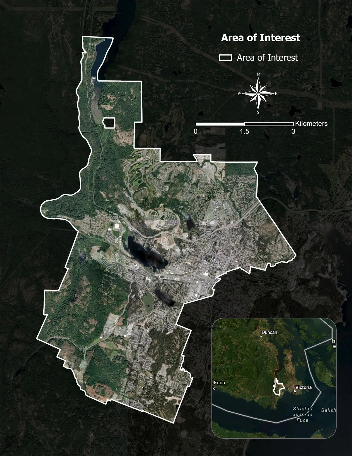
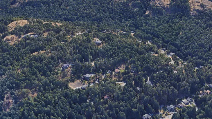
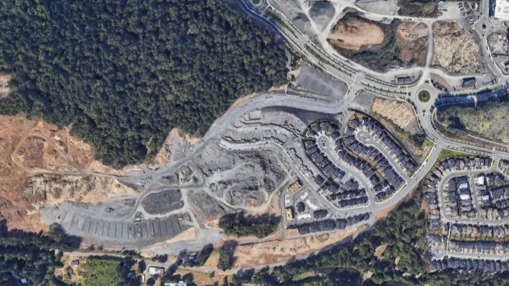
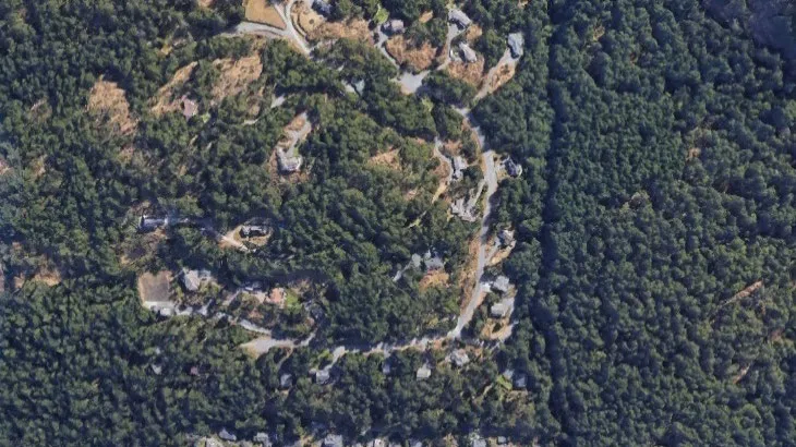
Community Wildfire Resiliency Plan | City of Langford | December 2024 11 Community Description Area of Interest The Area of Interest (AOI) defines the community boundaries for the Community Wildfire Resiliency Plan (CWRP). The AOI for this CWRP is the municipal boundaries of the City of Langford (Figure 1). Langford is located on southern Vancouver Island, just west of the capital city of Victoria. Langford is one of Canada’s fastest-growing cities, with a population of over 46,000 residents (2021 Census). The City has a mix of neighbourhood styles and ages, including its City core with single- and multi-family housing and local businesses, its expanding suburban neighbourhoods of single-family homes and large-format commercial and light industrial land uses, rural acreages, and extensive natural areas. The urban area is the westernmost extent of greater Victoria and interfaces with the forest landscape of southern Vancouver Island. Small forest patches are also scattered throughout the City’s urban neighbourhoods. The City of Langford is 4,315.6 hectares (43.2 km2) in area. Langford is situated between the unincorporated communities of the Juan de Fuca Electoral Area to the west, the District of Highlands to the north, the Town of View Royal and City of Colwood to the east, and District of Metchosin to the south. Goldstream Provincial Park, Mount Wells Regional Park, and the Capital Regional District watershed contain extensive forested public land within the City’s western boundary. Wildland-Urban Interface Within the Area of Interest, the CWRP focuses particularly on a zone called the wildland-urban interface (WUI). The WUI is the area where combustible forest fuels are found adjacent to buildings and infrastructure. The BC Wildfire Service defines the WUI as the area within one kilometre of a density of six buildings (or “structures”) per square kilometre. It typically borders the most populated areas of a community, where most buildings and people would be at risk if a wildfire were to occur. Almost the entirety of the City’s municipal boundary is within the provincially designated WUI. Patterns of development within the WUI vary. The WUI can be conceptualized as having two broad types that influence wildfire preparedness and response. The first type is called “interface” and refers to patterns of development where the boundary between forests and developed uses is discernable at the neighbourhood or community scale. Interface conditions suggest a distinct boundary between homes and forests and are often created where development patterns consist of subdivision and land clearing or where forests are separated from communities by agricultural use. The second type of WUI is called “intermix,” which refers to landscapes where the boundary between forests and urbanized areas is indistinct and may only be apparent at the scale of an individual property. In intermix landscapes, homes and infrastructure are located at lower densities, within the forest, and generally without a distinct interface boundary. This kind of development is common in rural areas. The WUI areas of Langford consist of both interface and intermix conditions, reflecting the diversity of development in the community. Figure 2 (below) shows examples of these two WUI conditions. Page 145 of 341
Page 146
Community Wildfire Resiliency Plan | City of Langford | December 2024 12
Page 146 of 341
Page 147
Community Wildfire Resiliency Plan | City of Langford | December 2024 13 Figure 1. Area of interest (AOI) for the Plan.
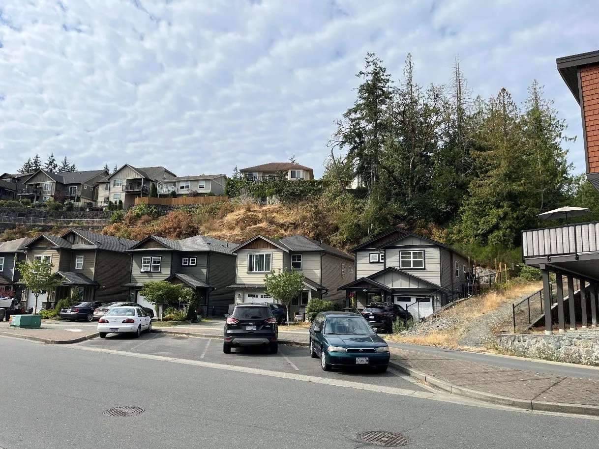
Interface conditions are where the boundary of urbanized and forested areas is visible at the scale of whole neighbourhoods. Intermix conditions are where the boundary of urbanized and forested areas is less defined and visible at the scale of single houses or groups of houses.
Figure 2. Visual comparison of "interface" (left, Westhills) and "intermix" (right, Ravens View) conditions.
The WUI type influences how wildfires put homes at risk. Homes in the intermix are surrounded by forest vegetation and may be at risk of ignition through direct contact with flame, radiant heat from nearby fire, and wind-borne embers or firebrands. Homes in the interface next to the forest boundary may also face these three ignition sources, though homes toward the interior of an interface neighbourhood or subdivision are more at risk of wind-borne embers alighting on building surfaces or landscaping. In both cases, managing the landscape around buildings and employing fire-resistant construction helps build the resilience of property to a wildfire event. Since a significant number of wildfires are of human origin, managing WUI fuels can also help contain human-origin fires before they spread into surrounding forests. Most development in Langford’s WUI is characteristic of interface conditions, with land clearing occurring as part of the subdivision and development process, resulting in neighbourhoods with discrete boundaries with forest vegetation. A few select areas are more typical of intermix conditions, including development on Finlayson Arm Road, Ravens View Drive and Walfred Road. Page 147 of 341
Page 148
Community Wildfire Resiliency Plan | City of Langford | December 2024 14 Community Information Demographics and Housing Patterns of development, housing design and construction practices directly influence wildfire risk. As Langford’s population increases, greater pressure will be placed on emergency services. Careful consideration for wildfire risk through planning and design processes can enhance Langford’s wildfire resilience, such as by implementing FireSmart development practices. The population of Langford was 46,5841 in 2021. The number of private dwellings was 19,968, with 19,050 of these reported as being regularly occupied, meaning most homes (95%) are occupied by permanent residents. The City’s population increased by 31.8% from 2016 to 2021—the greatest proportional increase in population observed among BC municipalities over that period. The City of Langford completed its most recent Housing Needs Assessment in 2020. This report reviewed data from the 2016 census and other available market information to assess the suitability of the City’s housing stock relative to levels of demand for rentals and home ownership2. Langford has a low vacancy rate of 1.5%, which is consistent with vacancy rates observed throughout the CRD. This report also notes that Langford has a limited supply of both rental housing and affordable housing, particularly for couples with children, individuals living alone, and most single-parent households. As of the 2021 Census, the median age is 7 years younger than that of the CRD, and 4 years younger than the provincial average. Homeowners (70% of the population) greatly outnumber renters or other tenancy forms. The average household income is $106,500, similar to the provincial average of $108,600. Demographics also influence risk and appropriate emergency planning and response. Older residents, lower-income households, and households where English is a second language may need different supports to connect with City resources, implement FireSmart techniques for building and landscaping, or receive direction from emergency responders during a wildfire. This report compares key demographic attributes of Langford with the CRD and British Columbia.
1 Statistics Canada. 2023. (table). Census Profile. 2021 Census of Population. Statistics Canada Catalogue no. 98- 316-X2021001. Ottawa. Released November 15, 2023. https://www12.statcan.gc.ca/census- recensement/2021/dp-pd/prof/index.cfm?Lang=E (accessed September 11, 2024). 2 City of Langford. 2020. Langford Housing Needs Assessment. Page 148 of 341
Page 149
Community Wildfire Resiliency Plan | City of Langford | December 2024 15 Table 4. Community Information for Langford. Community Information Langford Capital Regional District (CRD) Province of British Columbia Total Population 46,584 415,451 5,000,879 Land area (km2) 41.43 2,338.22 920,686.00 Population density (persons/km2) 1124.4 177.1 5.4 Number of private dwellings 19,968 198,435 2,211,694 Number of dwellings occupied by usual residents 19,050 185,206 2,041,834 Average household income ($) $106,500 $106,900 $108,600 Average household size (persons) 2.4 2.2 2.4 Households by tenure – owner 12,335 (65%) 116,530 (63%) 1,363,190 (60%) Households by tenure – renter 6,715 (35%) 68,425 (37%) 669,450 (30%) Prevalence of low- income, after-tax (LICO-AT) (%) 6.8 9.1 5.8 Labour force participation rate (%) 72.4 63.1 63.3 Unemployment rate (%) 6.2 6.8 8.4 Median age (years) 38.4 45.2 42.8 Language spoken most often at home: non- official languages 2,820 (6.1%) 24,920 (6.1%) 847,550 (17.1%) Data Sources:
Statistics Canada. 2023. (table). Census Profile. 2021 Census of Population. Statistics Canada Catalogue no. 98-316-X2021001. Ottawa. Released November 15, 2023. https://www12.statcan.gc.ca/census- recensement/2021/dp-pd/prof/index.cfm?Lang=E (accessed September 11, 2024).
Fire and Emergency Response Fire response is provided by Langford Fire Rescue. This composite Fire Department is comprised of 35 full-time and 17 paid-on-call firefighters. The Department also responds outside of its service area when required, guided by mutual and automatic aid agreements with neighbouring fire departments. Automatic Aid agreements are in place with the Town of View Royal and the City of Colwood. This means that responders from Langford will automatically deploy to an incident that falls inside a partner’s service area and vice versa. Langford Fire Rescue also maintains mutual aid agreements with both View Royal and Colwood as well as the District of Metchosin, District of Highlands, Malahat Fire Department, District of Sooke, City of Esquimalt, and City of Victoria. This establishes that the departments will share resources and equipment where possible to improve response capacity throughout their respective service areas. Page 149 of 341
Page 150
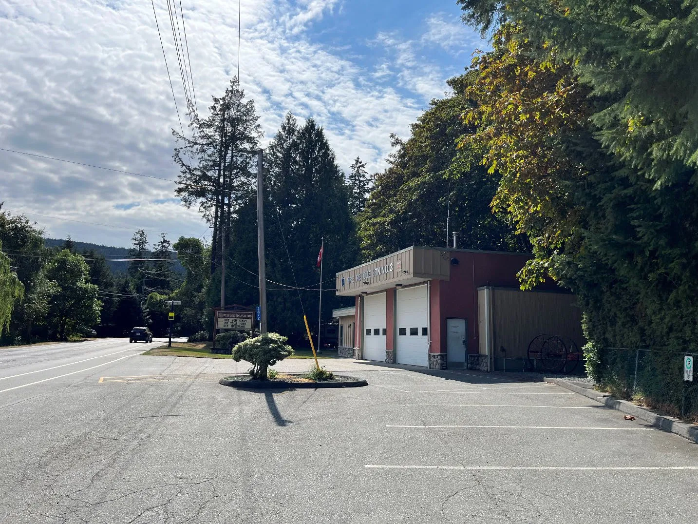
Community Wildfire Resiliency Plan | City of Langford | December 2024 16 The BC Wildfire Service will not automatically deploy to ignitions in the forest within a local department’s service area but may respond if aid is requested. Provincial resources could be deployed to Langford from the South Island Fire Centre located in Cobble Hill, approximately 40 km north of Langford. Langford Fire Rescue operates from three Fire Halls. Fire Hall #1 is located on Peatt Road at Veterans Memorial Parkway, Fire Hall #2 is located on Happy Valley Road near Glen Lake, and Fire Hall #3 is located on Sooke Lake Road in Goldstream. Between the three fire halls, Langford Fire Rescue’s major equipment includes three fire engines, a ladder truck, a rescue truck, a brush truck, and three utility vehicles. In addition, Fire Hall #2 maintains an ATV for remote access, and Fire Hall #3 maintains a prevention trailer and ESS trailer. The Department maintains a schedule of anticipated replacement for each vehicle and equipment combination, which allows multiyear planning of response capacity. Langford Fire Rescue trains all members to the National Fire Protection Association (NFPA) 1001—Full-Service standard. Most members have received WSPP-WFF 1 training relevant to wildfire suppression. Several department members have been deployed to support structural protection efforts with the BCWS during busy fire seasons or have experience as wildland firefighters. Table 5. Major resources for fire response within Langford. Organization Full-time Staff, Level of Certification Part-time Staff, Level of Certification Major Resources for Fire Response Langford Fire Rescue · 35 career firefighters.
· All firefighters trained to NFPA 1001 level 2 or NFPA 1021 level 2 or higher.
· All with WSPP-WFF 1 or equivalent wildland firefighting training · 17 paid on-call firefighters.
· All firefighters trained to NFPA 1001 level 2 or NFPA 1021 level 2 or higher.
· Most with WSPP-WFF 1 or equivalent wildland firefighting training · Fire Hall #1: 3 engines, 1 rescue engine, 1 ladder truck, 2 utility vehicles, 1 boat and boat trailer, 1 tech trailer, 4 personnel vehicles
· Fire Hall #2: 1 engine, 1 brush truck, 1 ATV and ATV trailer
· Fire Hall #3: 1 utility vehicle, 1 prevention trailer, 1 ESS trailer
Page 150 of 341
Page 151
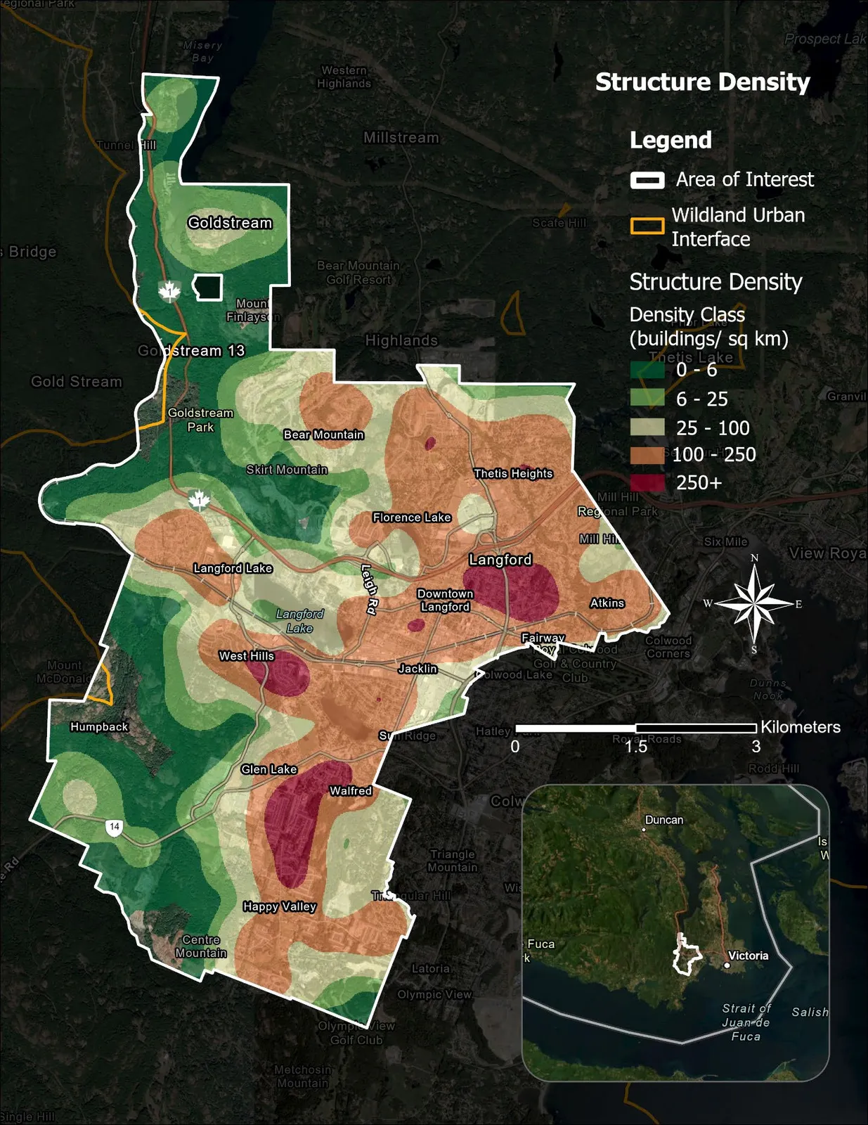
Community Wildfire Resiliency Plan | City of Langford | December 2024 17 Values at Risk Human Life and Safety Wildfire planning in British Columbia uses the density of “structures,” typically buildings with civic addresses, as a proxy for population density and thus risk to human life. Areas with an average density of more than six structures per square km are recognized as the Wildland Urban Interface. The density of structures varies across Langford’s interface and intermix areas (Figure 3). There are also several large areas of forest within the City’s boundaries, including Goldstream Provincial Park, Mount Wells Regional Park, a portion of Mill Hill Regional Park, and Thetis Lake Regional Park, and several smaller municipal parks. While the density of development and structures varies, almost every structure in the City is within 1,000 metres of forested land. Development conditions and structure density affect all aspects of fire management response and can strongly influence fire behaviour. The connection between how communities are built and fire risk is discussed in greater detail in Introduction to FireSmart (p. 75) and Development Considerations (p. 78).
Page 151 of 341
Page 152
Community Wildfire Resiliency Plan | City of Langford | December 2024 18
Figure 3. Structure density within the project area. The WUI represents a buffer of one km around areas of 6 structures per km2 or higher. Page 152 of 341
Page 153
Community Wildfire Resiliency Plan | City of Langford | December 2024 19 Human Health In addition to the direct risks to life and safety, large uncontrolled wildfires can cause other negative human health impacts over a wider area. Residents of Langford are familiar with the negative impact of poor air quality from wildfire smoke, which has affected BC’s South Coast during several recent fire seasons. Heavy smoke disproportionately affects vulnerable populations of the elderly, people with pre-existing medical conditions such as asthma, as well as people with low incomes3. Smoke can also worsen the outcome of respiratory diseases. The long-term effects of wildfire on physical and mental health extend beyond just immediate response. People who have been evacuated, lost property, been injured, or who have seen loved ones struggle with health issues during an emergency can suffer from ongoing trauma that impacts their daily routine and makes ordinary tasks and experiences difficult. Mental health issues such as depression and anxiety can linger in a community that has experienced wildfire long after the event itself4. In the community survey conducted to support the CWRP, 64% of respondents had been directly impacted by at least one effect of wildfire, with smoke/poor air quality and mental anxiety being the most commonly reported impacts.
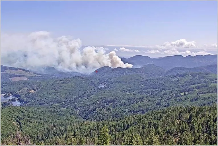
Photo 2. Smoke from the Old Man Lake wildfire affected Greater Victoria in 2024 (BC Wildfire Service).
3 BC Centre for Disease Control. 2021 (October). “Wildfire Smoke” [webpage]. http://www.bccdc.ca/health- info/prevention-public-health/wildfire-smoke. Accessed October 21, 2021. 4 Belleville, G., M.-C. Ouellet, & C.M. Morin. 2019. Post-traumatic stress among evacuees from the 2016 Fort McMurray Wildfires: Exploration of psychological and sleep symptoms three months after the evacuation. International Journal of Environmental Research and Public Health. 2019(16):1604 (14pp). Page 153 of 341
Page 154
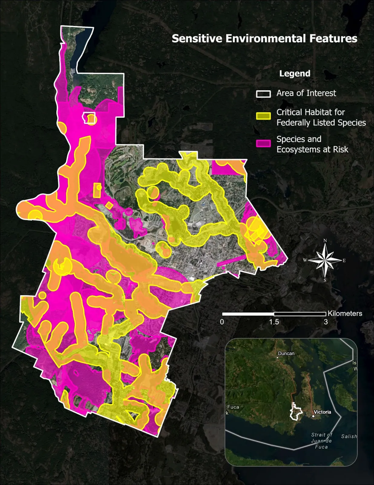
Community Wildfire Resiliency Plan | City of Langford | December 2024 20 Environment and Protected Areas Langford contains extensive areas of natural vegetation on public and private property. Green spaces in the City provide important habitats for native wildlife, produce ecosystem services, and often have high recreational value and visitation. Parks About 5% of Langford’s land base is comprised of municipal parks. The total area of City parks is 200 ha, though most are only a few hectares in size. City parks often contain small areas of native forest, but also include community and neighbourhood parks that are fully landscaped. City parks are a small portion of the City’s overall parkland (almost 1,000 ha in total), which includes extensive areas managed by the CRD in Mount Wells, Sooke Hills Wilderness, Mill Hill, and Thetis Lake Regional Parks as well as Goldstream Provincial Park. These regional and provincial parks are predominantly maintained as natural ecosystems, though all feature recreational walking and biking trails, picnic areas, and other park facilities. Parklands play important roles in protecting critical habitat for salmon-spawning and federally listed species, as well as at-risk species and ecological communities. Wildfire in Langford’s forested parks could result in the loss of recreation and social values and require costly clean-up and restoration. The City can lead vegetation management to reduce wildfire risk in municipal parks but must partner with the CRD or BC Parks to advance any fuel management in their park properties. Opportunities for fuel management in parks are discussed in the Vegetation Management section of this report (p. 95).
Page 154 of 341
Page 155
Community Wildfire Resiliency Plan | City of Langford | December 2024 21
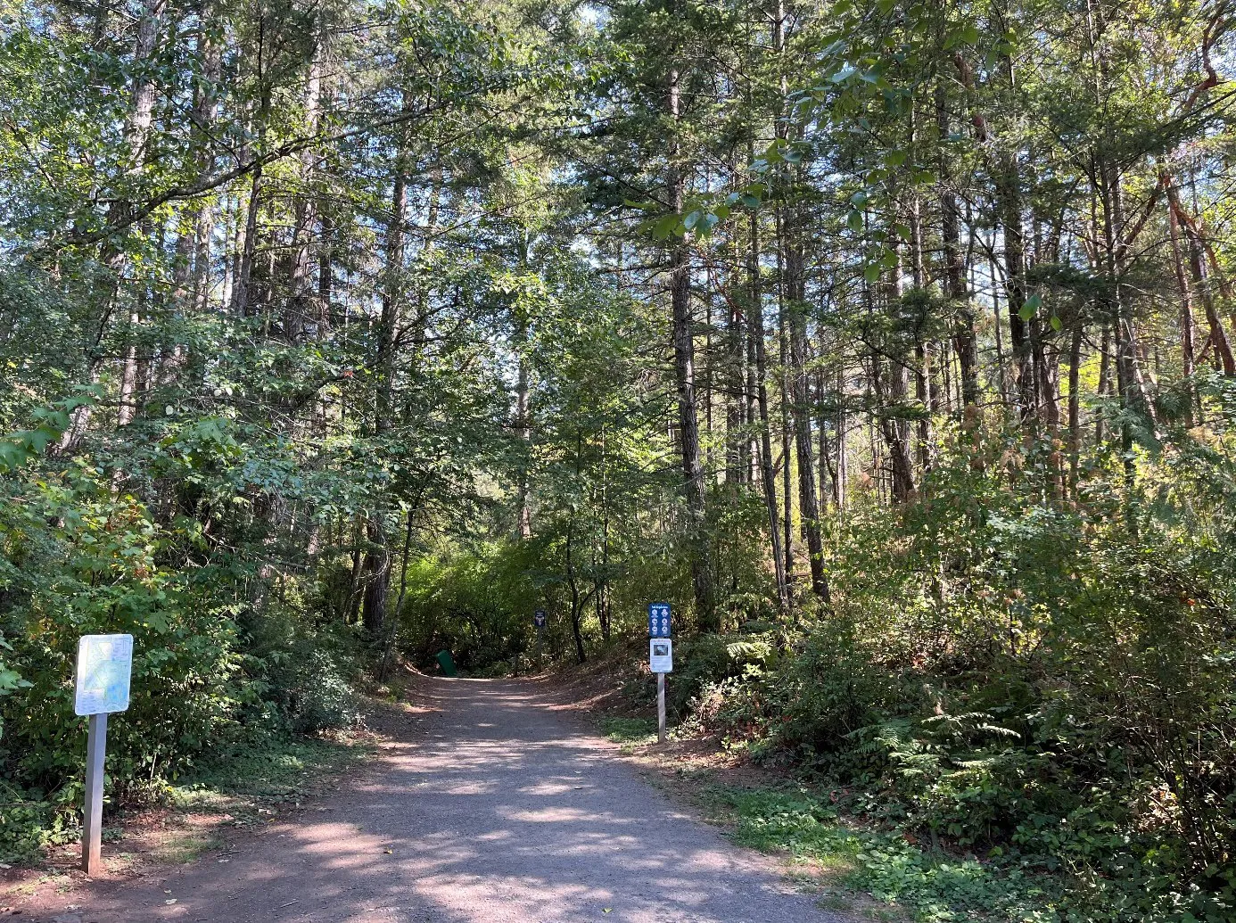
Photo 3. Trail entrance in Thetis Lake Regional Park in Langford.
Page 155 of 341
Page 156
Community Wildfire Resiliency Plan | City of Langford | December 2024 22 Wildlife, Species at Risk, and Protected Ecosystems Wildfires can have severe impacts on sensitive wildlife, plants, and ecosystems. The BC Conservation Data Centre (CDC) records BC’s most vulnerable vertebrate animals and vascular plants, each of which is assigned to a provincial red or blue list according to their provincial conservation status rank. Species or populations at high risk of extinction are placed on the red list and are candidates for formal endangered species status. Blue-listed species are considered vulnerable to human activity and natural events. Table 6 provides a summary of these species and ecological communities found within the City according to current provincial data. Figure 4 depicts publicly available locations of these species and ecological communities. Some of the locations of red-listed species are masked to deter vandalism. Table 6. Species and ecological communities with designated provincial conservation status. Occurrence ID Name Type Conservation Status 134361, 134362 arbutus / hairy manzanita Ecological Community Red 6868, 1556 Douglas-fir - arbutus Ecological Community Red 11604 Douglas-fir / Alaska oniongrass Ecological Community Red 55775, 55771, 55776, 55773 Douglas-fir / dull Oregon-grape Ecological Community Red 134937, 1612, 134940, 134938 Garry oak / California brome Ecological Community Red 8488 Garry oak / oceanspray Ecological Community Red 109170 grand fir / dull Oregon-grape Ecological Community Red 139126 Lyngby's sedge herbaceous vegetation Ecological Community Red 79990 red alder / salmonberry / common horsetail Ecological Community Blue 138193 three-way sedge Ecological Community Red 80022 western redcedar / common snowberry Ecological Community Red 125762 western redcedar / salmonberry Ecological Community Red 58881 Blue-grey Taildropper Invertebrate Animal Blue 1654 Common Ringlet, insulana subspecies Invertebrate Animal Red 25865 Dun Skipper Invertebrate Animal Blue 135099 Island Tiger Moth Invertebrate Animal Red 4514, 8490 Propertius Duskywing Invertebrate Animal Red 60091 Western Branded Skipper, oregonia subspecies Invertebrate Animal Red 104405 Western Bumble Bee Invertebrate Animal Yellow 29427 banded cord-moss Nonvascular Plant Yellow Page 156 of 341
Page 157
Community Wildfire Resiliency Plan | City of Langford | December 2024 23 Occurrence ID Name Type Conservation Status 129457 rigid apple moss Nonvascular Plant Red 37091 twisted oak moss Nonvascular Plant Unknown 68588, 79436, 68376 common bluecup Vascular Plant Blue 6996, 25659 deltoid balsamroot Vascular Plant Red 112091, 68286, 95592 fern-leaved desert-parsley Vascular Plant Red 6952 Howell's violet Vascular Plant Red 2306, 6948 Lobb's water-buttercup Vascular Plant Red 14013 near navarretia Vascular Plant Blue 94659 poverty clover Vascular Plant Blue 126513, 24413 prairie lupine Vascular Plant Red 10162 purple sanicle Vascular Plant Red 6914 slender popcornflower Vascular Plant Red 14643, 79317, 68605, 91571 slimleaf onion Vascular Plant Blue 24268, 73995, 1740 Vancouver Island beggarticks Vascular Plant Blue 22787 white meconella Vascular Plant Red 27702, 36205, 8502 white-top aster Vascular Plant Blue 45042 wine-cup clarkia Vascular Plant Red 30064 Common Sharp-tailed Snake Vertebrate Animal Red 55880, 103368, 55882 Northern Red-legged Frog Vertebrate Animal Blue 41842 Painted Turtle - Pacific Coast Population Vertebrate Animal Red 103419 Wandering Salamander Vertebrate Animal Blue 16680 Western Screech-Owl, kennicottii subspecies Vertebrate Animal Blue
In addition to Provincial conservation status, there are 8 vertebrate, invertebrate and plant species with federal protections under Canada’s Species at Risk Act (SARA) that are known or believed to inhabit the project area (Table 7). Additionally, the Coastal Douglas-fir forests found in Langford provide suitable habitat for several species with other federally established protections. Pileated woodpecker nests, raptor nests, and other bird nests may be found in the City, which are protected by the Migratory Birds Convention Act during all or part of the year. Wildfire impacts can also affect riparian, estuarine, and potentially marine environments inhabited by protected species of fish and other aquatic animals.
Page 157 of 341
Page 158
Community Wildfire Resiliency Plan | City of Langford | December 2024 24 Table 7. SARA-listed species with confirmed observations or identified critical habitat within Langford.5 Name Category Typical habitat Deltoid Balsamroot Plant Garry oak/Douglas-fir woodland Sharp-tailed Snake Vertebrate Garry oak/Douglas-fir woodland Marbled Murrelet Vertebrate Old forest Batwing Vinyl Lichen Plant South-facing rock outcrops Blue-grey Taildropper Invertebrate Old forest (mixed) White Meconella Plant Open rocky/grassy sites Purple Sanicle Plant Meadows and open woodlands Western Painted Turtle (Pacific Coast population) Vertebrate Shallow freshwater and slow- moving streams
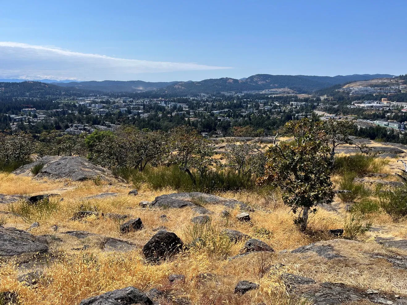
Photo 4. Red-list ecological community Garry oak / California brome.
5 B.C. Conservation Data Centre: CDC iMap [web application]. 2023. Victoria, British Columbia, Canada. Available: http://maps.gov.bc.ca/ess/sv/cdc/ (Accessed Sept 13, 2024) Page 158 of 341
Page 159
Community Wildfire Resiliency Plan | City of Langford | December 2024 25
Figure 4. Protected areas and known locations of protected species or habitat within the AOI. Page 159 of 341
Page 160
Community Wildfire Resiliency Plan | City of Langford | December 2024 26 Community Watersheds A majority of Langford’s drinking water is accessed via the CRD’s water supply system (Sooke Lake watershed) as described in Water Supply and Waste (p. 31). While there are no community watersheds within the AOI, the Waugh Creek and Goldstream Community Watersheds (within the CRD watershed area) are near Landford’s western boundary. These watersheds provide a steady supply of drinking water to urban areas throughout the Capital Regional District. Forest cover in the watersheds is a critical part of regulating the region’s water supply and water quality. Severe fires can have impacts on cover and soil health that increase sedimentation and erosion issues6. If severe fire were to occur in the watersheds threats to drinking water quality or supply may occur7. Taking action to reduce ignition hazards and wildfire risk inside the City’s western boundary may indirectly protect watershed function.
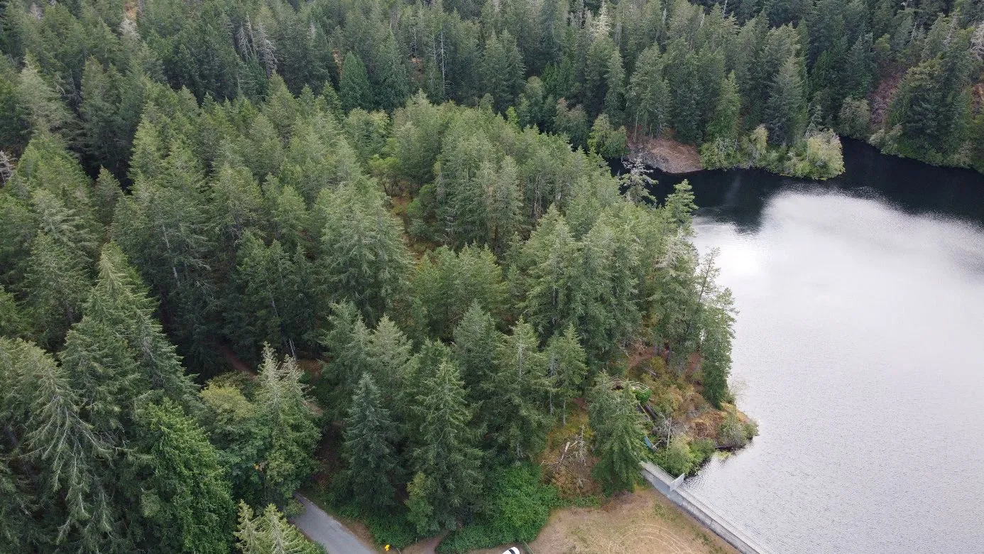
Photo 5. The Humpback Reservoir was once part of Greater Victoria’s regional water supply system.
6 R.A. Shakesby and S.H. Doerr (2006), Wildfire as a hydrological and geomorphological agent, Earth Science Review, 74, 269-307. 7 H.G. Smith, G.J. Sheridan, P.N. Lane, P. Nyman, and S. Haydon (2011), Wildfire effects on water quality in forest catchments: A review with implications for water supply, Journal of Hydrology, 396, 170-192. Page 160 of 341
Page 161
Community Wildfire Resiliency Plan | City of Langford | December 2024 27 Cultural and Archaeological Values Langford sits within the traditional territory of several Indigenous Nations, including the Xwsepsum (Esquimalt), lək̓ ʷəŋən (Songhees), Sc'ianew (Beecher Bay), and the W̱ SÁNEĆ Peoples represented by the Tsartlip, Pauquachin, Tsawout, Tseycum, and Malahat Nations. Indigenous Peoples have lived in this landscape since time immemorial. Actions to advance wildfire management in Indigenous traditional territory must involve local Nations to ensure land management incorporates Indigenous values and stewardship priorities. The City of Langford has engaged with First Nations governments to understand potential impacts and alignments of CWRP development on their interests. Engagement is ongoing as several Nations expressed interest in continuing to inform the City’s wildfire prevention and preparedness efforts. Some cultural sites are protected directly by the Province through the Heritage Conservation Act. This Act allows the Archaeology Branch of the Ministry of Forests and Ministry of Lands, Waters, and Resource Stewardship to maintain a confidential spatial database of archaeological and historical sites related to Indigenous culture and history. A qualified archaeologist must be involved in any forestry activities undertaken within 50 m of historical and/or archaeological sites to comply with the Act. Several sites protected by the Act are known in Langford, though their locations cannot be published as part of the CWRP. Wildfires can cause the loss of cultural values by causing damage to historic and archaeological sites. While physical damage to cultural sites as the result of wildfire management is unacceptable, activities like fuel modification can help preserve cultural values by reducing the likelihood of high-intensity and damaging wildfires. Wildfire management activities like the clean-up of fine fuels can be planned to align with or even enhance cultural values and practices when undertaken with Indigenous knowledge, input and/or direct participation. Hazardous Values Certain urban land uses or activities are associated with higher risk during a wildfire event. Activities that involve flammable materials or their storage, high-temperature machinery, or chemicals hazardous to human health if improperly handled are just some examples of such a use. Langford’s diverse land uses include industrial and commercial properties where hazards may include stores of fuel, oxidizing substances, fertilizers, or other combustibles that are particular risks during a wildfire. Industrial areas in the City include businesses that involve sources of heat, like metal fabrication and automotive servicing, that are ignition risks. These particular hazards are addressed through the BC Fire Code. Refueling stations and parked cars are additional hazards commonly found in Langford’s WUI. Langford is the gateway to the Capital Regional District for FortisBC’s network of buried natural gas lines. The FortisBC main supply line enters Langford from the CRD watershed lands and follows the E&N Railway right-of-way and Langford Parkway to an important receiving facility and operations centre near Jacklin Road. From here, natural gas lines distribute fuel to facilities throughout Greater Victoria. Subsurface gas lines are typically buried deeper than 12 inches Page 161 of 341
Page 162
Community Wildfire Resiliency Plan | City of Langford | December 2024 28 (30.5 cm) and are well insulated from subsurface heating8, making ignition during a wildfire improbable. However, preventive fuel management or suppression activities can involve heavy machinery like excavators, making confirming the location of natural gas lines important for worker safety. Electrical infrastructure, particularly overhead distribution lines, are a widespread hazard. Trees and vegetation often interfere with overhead electrical lines, which can spark to vegetation within the limits of approach and cause ignitions. BC Hydro actively maintains its distribution network to remove vegetation from the limits of approach. Downed powerlines during high wind events during the fire season in California have been widely publicized factors in the ignition of major interface fires in that state. Power lines are a potential source of ignition when poorly maintained and are also a serious hazard for suppression and prevention crews conducting work around the interface. Other Resource Values Langford serves as a hub for outdoor recreation in the region, featuring an extensive network of popular hiking and biking trails. Bear Mountain Resort, which hosts a golf course within the interface, is also the proud home of the Canadian National Mountain Bike Team. The resort offers facilities, including a terrain park and a variety of forested trails. Additionally, City- maintained trails create connectivity between Langford Lake and the regional parks of Mount Wells and Mount MacDonald, which are known for their rock-climbing opportunities, featuring several well-established but unsanctioned routes. Within the city limits, forested areas are predominantly privately owned or managed by the city and the CRD for park purposes. In the AOI, forests are primarily located on private lands in residential subdivisions or in designated protected areas, such as regional watersheds and parks, where timber harvesting is restricted. There is a small area of private managed forest land in the southwestern edge of the City where timber harvesting may occur. Critical Infrastructure Critical infrastructure includes the municipal assets crucial to the health and safety of the community, often enabling basic functions to occur. Critical infrastructure also includes public assets identified in a Hazard, Risk and Vulnerability Assessment undertaken by a local government. In developing the CWRP, the City of Langford identified a list of facilities that are critical infrastructure for its emergency planning. Additional sites and facilities have been included in consideration of field review by the consulting team and with input from City staff.
8 D.J. Eldridge, J. Ding and S.K. Travers, (2023), Wildfire effects on soil and soil processes, in Australia’s Megafires: Biodiversity Impacts and Lessons from 2019-2020, eds. L. Rumpff, S.M. Legge, S. van Leeuwen, B.A. Wintle, and J.C.Z. Wolnarski. CSIRO Publishing, pp. 49-58. Page 162 of 341
Page 163
Community Wildfire Resiliency Plan | City of Langford | December 2024 29 Electrical Power Electrical power is provided to most of Langford by an electrical grid of above and below- ground transmission lines, with over 54 kilometres of above-ground lines fastened to wooden poles. Wooden poles are vulnerable to fire, and in many locations, these lines are within a few metres of forests. The main substation for the Westshore municipalities is located in the commercial area on Jacklin Road near Langford Parkway. The major transmission line entering this substation from the west is one of several transmission lines bringing power to the Greater Victoria area. The substation compound is remote from the forest interface, being over one kilometre from any significant forested area. Natural Gas As described under Hazardous Values (p.27), FortisBC has a receiving station and support office located in Langford that connects Greater Victoria to its provincial network of natural gas lines. Located on Langford Parkway near Jacklin Road, these facilities are over one kilometre from any significant forested area.
Photo 6. Aerial perspective on the BC Hydro substation on Jacklin Road. Page 163 of 341
Page 164
Community Wildfire Resiliency Plan | City of Langford | December 2024 30 Figure 5. Facilities considered critical infrastructure by the CWRP. Page 164 of 341
Page 165
Community Wildfire Resiliency Plan | City of Langford | December 2024 31 Communications Infrastructure In most of Langford, primary connections to telephone and internet service are provided by the same overhead connections used for electrical power. Cellular telephone service and text-based messaging services are frequently residents’ primary means of communication. Cell service is provided by the major Canadian telecommunications companies to most parts of Langford, although the mountainous topography in the north and west of the City can cause small areas of no service. Because of the hilly topography, dozens of cell towers are installed throughout the community. Major tower sites include Mount MacDonald, Walfred Reservoir (Happy Hill), and central Langford. Radio communication is an important part of emergency response in Langford. Langford Fire Rescue is one of many regional users of the CREST system, an interlinked P25 digital radio network co-owned by several regional response agencies. Fire/Rescue Stations #1 and #2 incorporate 10 m radio towers for maintaining longwave communications. In the event of a power failure, on-site generators will allow communications between the stations and crews to continue via radio. A smaller radio mast is also installed on Fire/Rescue Station #3.
Community buildings and facilities Many institutions and public buildings are crucial for maintaining the function of government and community services. Community buildings include Langford City Hall, RCMP West Shore Detachment, schools and school board offices, the Langford Fire, BC Vancouver Island Emergency Dispatch Centre, BC Hydro Substation, health and senior care facilities, and CRD water system facilities. Newer facilities typically display FireSmart construction materials or landscaping, while review of older facilities showed several have combustible building trims, facing, or inappropriate landscaping. Common issues include lack of vegetation maintenance or allowing coniferous vegetation to grow within the recommended fuel free zone of 1.5 m surrounding structures and facilities. Table 8 lists the critical infrastructure identified by Langford Fire Rescue for the CWRP.
Page 165 of 341
Page 166
Community Wildfire Resiliency Plan | City of Langford | December 2024 32 Table 8. Critical infrastructure and buildings identified by Langford’s emergency program. Name Type Address Latitude Longitud e BC Vancouver Island Emergency Dispatch Centre Ambulance Service 2764 Leigh Rd, Victoria, BC V9B 4G1 48.4515 646°N 123.5181 786°W CRD Communications Infrastructure Communications Victoria, BC V9B 4P9 48.4419 492°N 123.5689 672°W BC Hydro Substation Electrical Infrastructure Langford, BC V9B 4V5 48.4417 304°N 123.5099 266°W Langford File Hall #2 Fire Department 3205 Happy Valley Rd, Langford, BC V9C 2V9 48.4327 306°N 123.5248 227°W Langford File Hall #1 Fire Department 2625 Peatt Rd, Victoria, BC V9B 3T9 48.4545 120°N 123.4969 554°W Langford File Hall #3 Fire Department 2872 Sooke Lake Rd, Victoria, BC V9B 4R3 48.4597 678°N 123.5513 176°W Fortis BC Gas Infrastructure 1027 Langford Pkwy, Victoria, BC V9B 2N7 48.4429 070°N 123.5169 295°W Langford City Hall Municipal Building 877 Goldstream Ave #125, Victoria, BC V9B 2X8 48.4497 890°N 123.5046 274°W RCMP - Langford Detachment Police Department 698 Atkins Ave, Victoria, BC V9B 3A4 48.4479 695°N 123.4948 346°W Lakewood Elementary School 2363 Setchfield Ave, Victoria, BC V9B 5W1 48.4657 153°N 123.5066 964°W Spencer Middle School School 1026 Goldstream Ave, Victoria, BC V9B 2Y5 48.4503 911°N 123.5146 419°W Belmont Secondary School School 3041 Langford Lake Rd, Victoria, BC V9B 0L9 48.4426 960°N 123.5298 469°W Millstream Elementary School 626 Hoylake Ave, Victoria, BC V9B 3P7 48.4659 560°N 123.4962 761°W Crystal View Elementary School 2662 Silverstone Way, Victoria, BC V9B 6A6 48.4529 936°N 123.4775 109°W Savory Elementary School 2721 Grainger Rd, Victoria, BC V9B 3K6 48.4488 470°N 123.4855 986°W Ruth King Elementary School 2764 Jacklin Rd, Victoria, BC V9B 3X6 48.4515 990°N 123.5054 110°W Lighthouse Christian Academy School 1289 Parkdale Dr, Victoria, BC V9B 4G9 48.4381 285°N 123.5330 734°W Willway Elementary School 2939 Mt Wells Dr, Victoria, BC V9B 4T4 48.4571 434°N 123.5489 899°W Sooke SD 62 School Board 3143 Jacklin Rd, Victoria, BC V9B 5R1 48.4364 692°N 123.5131 729°W Sooke SD 62 International Office School Board 814 Goldstream Ave, Victoria, BC V9B 2X8 48.4497 508°N 123.5016 392°W Supply Disinfection Facility Water Infrastructure Niagara Main Road, Langford 48.4595 278°N 123.5650 123°W Supply Disinfection Facility Water Infrastructure Niagara Main Road, Langford 48.4609 660°N 123.5723 938°W Supply Disinfection Facility Water Infrastructure Niagara Main Rd, Langford, BC V0R 2L0 48.4609 660°N 123.5711 473°W Fortis BC Sub-station Electrical Infrastructure Victoria, BC V9B 3Y5 48.4433 920°N 123.5148 254°W Page 166 of 341
Page 167
Community Wildfire Resiliency Plan | City of Langford | December 2024 33 Name Type Address Latitude Longitud e Hydro / Fortis main lines Electrical Infrastructure Victoria, BC V9B 3Y6 48.4436 103°N 123.5153 904°W Langford Legion Emergency Reception Centre 761 Station Ave, Victoria, BC V9B 2S1 48.4460 988°N 123.5000 035°W Alexander Mackie Senior Center Health Care 753 Station Ave, Victoria, BC V9B 0Z5 48.4456 908°N 123.4988 734°W Prince Edward Lodge Senior Center Health Care 741 Station Ave, Victoria, BC V9B 2S1 48.4463 740°N 123.4981 045°W Priory Long Term Care Health Care Victoria, BC V9B 2W4 48.4458 213°N 123.4878 978°W St. Anthony's Urgent Care Center Health Care 582 Goldstream Ave, Victoria, BC V9B 2W7 48.4467 749°N 123.4870 109°W Jesken Aerie Assisted Living Health Care 582 Goldstream Ave, Victoria, BC V9B 2W7 48.4491 731°N 123.5018 560°W Cherish Senior Care Health Care 2234 Sooke Rd, Victoria, BC V9B 1X1 48.4401 003°N 123.5123 774°W New Langford city park location Public Space Langford, BC V9B 0L9 48.4471 034°N 123.5487 630°W Pexsisen Elementary School School 3100 Constellation Ave, Victoria, BC V9B 0L9 48.4474 801°N 123.5421 631°W Center Mountain Lellum Middle School School 3090 Constellation Ave, Langford, BC V9B 0V2 48.4487 705°N 123.5423 633°W Happy Valley Elementary School School 3291 Happy Valley Rd, Victoria, BC V9C 2W3 48.4283 395°N 123.5292 414°W South Latoria Elementary School School 833-801 Latoria Rd, Victoria, BC V9C 3A7 48.4141 751°N 123.5205 725°W Water Tower Water Infrastructure 640 Kestrel Ridge, Victoria, BC V9B 6C3 48.4712 347°N 123.4953 069°W Water Reservoir Water Infrastructure Victoria, BC V9B 6T2 48.4738 197°N 123.5241 360°W Water Reservoir Water Infrastructure Langford, BC V9B 6X4 48.4644 329°N 123.5321 451°W Water Tower Water Infrastructure Langford, BC V9B 6X4 48.4615 208°N 123.5277 677°W Water Tower Water Infrastructure Langford, BC V9B 0L9 48.4496 334°N 123.5478 575°W Irwin Park Dam Water Infrastructure Irwin Rd, Victoria, BC V9B 5Y6 48.4430 119°N 123.5415 150°W Humpback Reservoir Dam Water Infrastructure Langford, BC V0R 2L0 48.4480 583°N 123.5550 690°W Lookout Lake Dam Water Infrastructure Victoria, BC V9C 3P7 48.4178 757°N 123.5135 413°W
Page 167 of 341
Page 168
Community Wildfire Resiliency Plan | City of Langford | December 2024 34
Photo 7. Langford Fire/Rescue Station #3 Page 168 of 341
Page 169
Community Wildfire Resiliency Plan | City of Langford | December 2024 35 Water Supply & Waste Treatment The City of Langford's water and sewer system relies on water supply from the CRD Watersheds. The AOI is home to the primary treatment facilities for the CRD system at Japan Gulch. CRD buildings at this site house disinfection facilities and watershed administration. To protect the regional water supply from wildfires, the CRD employs full-time personnel for wildfire protection and emergency response within its watershed. Buildings at Japan Gulch are designed with fire-resistant materials and are located in a fuel-free compound to mitigate the threat of wildfires. Additionally, backup generators are in place to supply power during outages. The proactive measures taken by the CRD have reduced the likelihood of the facilities being involved in a wildfire. Within Langford, boosting stations and water storage facilities maintain pressure in the distribution system. These facilities are typically designed to be FireSmart, with metal or concrete construction and gravel perimeters. The City’s sanitary sewer services are provided by a network of underground sewer mains supported by pump stations. Waste is transported via this network to the CRD’s wastewater treatment plant for the area, the McLoughlin Point Wastewater Treatment Plant. This facility is located in Esquimalt and receives wastewater from the core area municipalities. The Hartfield Landfill in Saanich receives residual solids from the wastewater treatment plant.
Photo 8. Hilltop water storage in the Westhills neighbourhood helps maintain pressure in the water supply system. Page 169 of 341
Page 170
Community Wildfire Resiliency Plan | City of Langford | December 2024 36 Wildfire Risk Assessment Crucial to building community resiliency to wildfires is developing an understanding of where wildfire risk is the highest so that investment to reduce wildfire risk is effective, sensible, and balanced with other community values and interests. In the CWRP, the terms wildfire threat and wildfire risk refer to different components of Langford’s vulnerability to wildfire. Wildfire threat refers to the potential behaviour in natural areas and reflects factors like fuel loading, type, and distribution, slope and aspect, and weather conditions. Wildfire threat has no relationship to how close a forest is to populated areas or other values. Wildfire risk considers both the potential fire behaviour as well as the proximity of values that could be impacted. Wildfire Environment This section describes the factors contributing to the wildfire threat in Langford. These include topography, forest fuels (vegetation, debris, and organic soil), and weather. Topography Topography influences wildfire behaviour in several ways. Wildfire spreads faster in the uphill direction. Hot air from a fire rises uphill, preheating the forests above it and drying fuels ahead of the fire’s arrival. On steep slopes, heat directed uphill also accelerates combustion. For these reasons, areas with steep slopes are expected to have a higher wildfire threat. Aspect also plays a role in wildfire behaviour. In the northern hemisphere, south-facing slopes receive more direct solar radiation. This results in an increase in temperature and a decrease in relative humidity, which affects vegetative cover, fuel loading, and fire behavior. Langford’s terrain is gently rolling or flat surrounding the City centre and Langford Lake, but hilly elsewhere. Elevation ranges from approximately 20 m above sea level at the boundary with View Royal to over 300 m on Bear Mountain, Mount Wells, Mount Finlayson, and Mount MacDonald. Due to poor access and steep terrain, several areas in the City could support volatile wildfire behaviour and pose a suppression challenge.
Wildfire threat is a ranking of potential fire behavior based on fuel conditions, weather conditions, slope, aspect, and other biophysical factors. Wildfire risk is a measure of the probability of a wildfire occurring combined with the consequences or impacts it would cause. Page 170 of 341
Page 171
Community Wildfire Resiliency Plan | City of Langford | December 2024 37 Fuels (vegetation) Forest fuels consist of dead and living vegetation and forest floor organic material. Fuel conditions vary with tree species, live and dead proportions, and density of understory shrubs and plants. Fuels dominated by coniferous trees and shrubs are typically more flammable than deciduous forests due to their relatively low moisture content and flammable resins. Some plants produce volatile chemicals that readily burn, such as oils produced by scotch broom. Grasses burn quickly due to the large ratio of surface area to volume in their leaves, and often dieback during dry seasons in a process called curing. Deciduous broadleaved fuels are more resistant to ignition due to their high moisture content. Forest fuels belong to one of four layers. The first is ground fuel which is the organic matter in the soil (soil carbon). Next are surface fuels, which include all the dead branches, leaf litter, and low plants on or just above the surface of the ground. Above this, ladder fuels are the large shrubs, low branches, and small trees that extend between the surface fuels and the main forest canopy. Lastly, crown fuels are the foliage, branches, and other vegetation lodged within the forest canopy.
Photo 9. Forest fuel layers.
Page 171 of 341
Page 172
Community Wildfire Resiliency Plan | City of Langford | December 2024 38 The combination of fuel characteristics from each of these layers influences how wildfire will behave. The response of fire suppression varies with the intensity of a wildfire. For example, BC Wildfire Service ground crews will not be dispatched in front of a fire burning with an intensity of more than 2,000 kilowatts per metre (kw/m). This is a measure of energy being put out by the head of an advancing fire. In forested environments, fires with high intensities can climb into tree crowns via ladder fuels. If conditions are right, ignition in the tree canopy will become an active crown fire where the fire is spreading along the ground and through the crown simultaneously. These fires consume whole forests, from the soil to the tops of the trees, sending embers far ahead on the wind to light new fires, and are too dangerous for ground crews to fight directly.
Photo 10. Example of an active crown fire. (Kenai Peninsula, Alaska) Crown fire is a wildfire that involves fuels in the tree canopy. It can be “active”, meaning fire is advancing through tree crowns directly, or “passive”, meaning surface fire intensity is great enough to cause the torching of single trees or small tree patches but not the general advancement of the fire front through the crown. Page 172 of 341
Page 173
Community Wildfire Resiliency Plan | City of Langford | December 2024 39 Crown fires become more likely where hazardous coniferous fuels have low vertical and horizontal separation. Some combinations of species, sites, and climates naturally produce ecosystems that have less separation between the fuel layers. The fuel characteristics of forests also change drastically over time as the ecosystem develops. In Canada, a standardized system of assigning 16 simplified fuel types to forests is used to help model wildfire threat and risk. These are the fuel types of the Canadian Fire Behavior Prediction System. Although the fuel types were developed for nation-wide applications, practice in British Columbia and applied research by the Canadian Forest Service and BC Wildfire Service has resulted in several standard rules for assigning forest fuel types. In Langford, most forests are represented by the C-5 fuel type. This represents a mature coniferous forest with a relatively high vertical separation of fuels, where a high-intensity surface fire would be required to create an active crown fire. As a result, C-5 forests on flat ground are typically rated to have a low or moderate wildfire threat. However, C-5 forests on steep terrain can produce more volatile fire behaviour, increasing the threat from moderate to high. While C-5 forests can support crown fire, it takes a very large amount of energy to cause the fire to jump from the surface fuels to the crown fuels because of the generally large gap between lower fuels and tree crowns. The circumstances that support crown fire activity in C-5 forests remain infrequent in Coastal BC, although climate change is creating conditions that are consistent with more extreme fire danger. Other common fuel types in this area are D-1/2 (deciduous), M-1/2 (mixed wood) and O-1a/b (grasses and herbaceous vegetation). Forest stands with a high proportion (>75%) of deciduous trees, such as those in D-1/2 stand, have a lower wildfire threat. Stands that consist of a mix of deciduous and coniferous trees are classified as M-1/2 stands. Their wildfire threat varies with the proportion of conifers found in them. Fire behaviour in grass fuel types O-1a/b can be highly variable depending on season and the presence or absence of irrigation. Most of the O-1a/b fuels in Langford are lawns, golf courses, or agricultural fields, which have a low wildfire threat because of regular maintenance or irrigation.
Vertical and horizontal separation refer to fuel distribution within a forest and are used to help classify forests into standardized fuel types. Page 173 of 341
Page 174
Community Wildfire Resiliency Plan | City of Langford | December 2024 40 Table 9 provides a summary of fuel types by total area. Fuel type mapping prepared by the Provincial Strategic Threat Analysis is completed at the landscape scale and may not be accurate on a particular property. Suburban areas where buildings are mixed with vegetation and lawns may be typed as D-1/2, O-1a/b, or non-fuel. Fuel type review during CWRP production focuses on forested areas on public property, as fuel typing on private property is excluded from the risk analysis. No fuel type changes have been made to the provincial dataset for Langford’s CWRP update (Figure 6).
Page 174 of 341
Page 175
Community Wildfire Resiliency Plan | City of Langford | December 2024 41 Table 9. Summary of fuel types within Langford. Fuel Type Name Area (ha) General description Generalized fire behaviour potential C-5 1882.6 Mature, low to moderate density stands of native conifers, generally over 40 years in age and over 15 m in height. Low to moderate D-1/2 416.1 Deciduous stands with less than 25% coniferous composition. Low M-1/2 194.0 Mixed wood stands have between 25 and 75% coniferous and deciduous composition. Low to moderate N 239.0 Non-fuel areas – pavement, rock, extensive sand. Negligible O-1a/b 1423.9 Grass fuel types. also used to represent agricultural fields and large lawns. Low W 159.5 Bodies of water, including freshwater and the ocean. None
Page 175 of 341
Page 176
Community Wildfire Resiliency Plan | City of Langford | December 2024 42
Figure 6. Fuel types in Langford from the Provincial Strategic Threat Analysis. Page 176 of 341
Page 177
Community Wildfire Resiliency Plan | City of Langford | December 2024 43 Weather Weather in Langford is moderated by the Pacific Ocean. Sea breezes cool the air during the summer and increase local humidity. Average daily highs for Langford have ranged between 6°C (December) and 22°C (August). Most precipitation arrives in fall, winter, and spring, with sharply reduced precipitation in June, July, and August. Snow is rare and may fall only four or five times per year. Due to subdued elevation and mild climate, forest ecosystems in Langford do not typically receive water from snowmelt during the fire season. Annual temperature ranges and precipitation are summarized in Figure 7.
Figure 7. 30-year modelled climate averages for Langford (Meteoblue).
Winter is the windiest time of year. The North Pacific storm track sends high winds and moisture to this area from the south. These events are often experienced as strong onshore from the southwest or northwest. While fire risk is very low during the wet winter months, these wind events are notable because they contribute to surface fuel loading by bringing small branches and needles to the forest floor. These fine fuels then dry out to become ground fuel for the next fire season.
Page 177 of 341
Page 178
Community Wildfire Resiliency Plan | City of Langford | December 2024 44 Winds are usually subdued in the summer months and through the peak fire season, with the onset of character summer high-pressure systems and clear skies. Average high temperatures are exceeded when high pressure over the BC interior forces warm, dry air down to the coast. These events lower the relative humidity, raise temperatures, and increase the potential for ignitions. During severe fire seasons, this weather pattern can also bring smoke to the area from wildfires burning in other areas of the Pacific Northwest. Further south in Washington and Oregon, strong east-to-west summer airflows have been linked historically to catastrophic fire seasons, with hundreds of thousands of hectares burned9. Figure 8 and Figure 9 provide graphical representations of historically modelled winds and windspeeds in Langford.
Figure 8. Windspeeds by month experienced for Langford (Meteoblue).
9 Abatzoglou, J.T., D.E. Rupp, L.W. O’Neill, & M. Sadegh. (2021). Compound extremes drive the western Oregon wildfires of September 2020. Geophysical Research Letters 48(8): Page 178 of 341
Page 179
Community Wildfire Resiliency Plan | City of Langford | December 2024 45
Figure 9. Wind rose diagram for Langford (Meteoblue). The diagram shows cumulative hours (the wind rose radius) at an average windspeed from each cardinal direction during the average year (1990-2020).
Fire Weather Rating Fire Weather Rating uses weather measurements to assess likely fire behaviour for a defined forecast period. The BC Wildfire Service monitors weather throughout the Province. Fire weather is an essential component in most fire prediction models and is used to help determine a community’s landscape-level wildfire threat. In Canada, temperature, relative humidity, wind, and 24-hour precipitation are tracked daily and recombined to calculate several index components of fire weather. While these variables are tracked throughout the year, during most of the rainy season, weather measurements fail to meet thresholds for the publication of calculated fire weather indices. The Canadian Forest Fire Danger Rating System carries rules about when in the year fire weather ratings need to be updated daily so the public and emergency responders can plan activities to mitigate fire risk. This is an estimate of the fire season, which is the period in the year during which wildfire activity is reasonably foreseeable. Historically, wildfire season begins on May 1 and lasts until September 30, although the fire season has and will continue to lengthen due to climate change. Page 179 of 341
Page 180
Community Wildfire Resiliency Plan | City of Langford | December 2024 46 Table 10 shows weather averages during the fire season for the nearest BC Wildfire Service weather station, located in the CRD watershed (CRD-14G). The data shown covers the period between 2011 and 2021, inclusive, which is the extent of historical data available. The statistics show the fire season is characterized by an extended period in July and August of warm weather with little rainfall. The maximum temperature in June 2021 of 40.4°C was recorded during the record-breaking heat wave of that year. It is the highest temperature recorded at this weather station. Table 10. Average weather (2011-2021), from 14G
Weather Attribute May Jun Jul Aug Sep 2011-2021 Maximum Daily High (°C) 27.5 40.4 33.8 34.3 31.6 Daily Average High (°C) 16.4 19.1 22.9 23.5 19.1 Monthly Average Rainfall (mm) 44.6 29.6 11.4 19.5 88.2
Climate Change and Wildfire Behavior Climate change is causing changes to temperatures and precipitation patterns that impact forest health and wildfire risk. In 2017, the CRD prepared climate projections for the capital region based on the RCP 8.5 “Business as Usual” emissions scenario. Their report found that the region can expect the number of days with a high temperature of at least 25°C to triple from 12 to 36 days per year by the 2050s, with only modest increases in annual precipitation. Increased precipitation is expected to arrive as part of stronger storms, primarily in fall, while summer will actually see precipitation decrease by 20%. These changes suggest that Langford will experience warmer winters and summers, longer growing seasons, and longer dry periods during the hottest part of the year10 Predictions for warmer, drier summers are ingredients for a longer wildfire season. Patterns observed in other parts of BC and North America suggest that hotter, drier conditions might be expected to result in an overall increase in wildfire frequency11,12. Warmer temperatures in spring and fall will extend the duration of the fire season, extending periods of high wildfire risk13.
10 Capital Regional District. (2017, April). Climate Projections for the Capital Region. 66 p. 11Kirchmeier-Young, M.C., N.P. Gillett, F.W. Zwiers, A.J. Cannon, & F. Anslow. (2019). Attribution of the influence of human-induced climate change on an extreme fire season. Earth’s Future, 7: 2-10. 12 Taylor, S., Régnière, J., St-Amant, R., Spears, J., & Thandi, G. (2010). High resolution simulations of fire weather indices and wildfire risk in British Columbia with climate scenarios. Victoria: Canadian Forest Service. 13 Abatzoglou, J., & Williams, A. (2016). Impact of anthropogenic climate change on wildfire across western US forests. Proc Natl Acad Sci USA 113(42):11770–11775. Page 180 of 341
Page 181
Community Wildfire Resiliency Plan | City of Langford | December 2024 47 Climate change affects the characteristics of forest fuels as well as fire weather ratings. Climate change can influence the outbreaks of insects and tree diseases14. More frequent and prolonged droughts reduce tree health and vigour, increasing their susceptibility to pathogens and pests15. Declining forest health influences tree mortality and increases fuel loading. Forest health- damaging agents can be biotic, like mountain pine beetle, or abiotic, like an unusual windstorm or frost. For example, in Langford, stress can be observed in western redcedar and western hemlock has been observed, most likely due to extended growing season drought. This has increased fuel loads in some forests, in particular, the fine fuel load of small branches and dropped foliage that contributes to increased surface fire intensity. Longer growing seasons resulting from climate change may also increase fuel production by allowing more photosynthesis. Despite uncertainty about the pace and trajectory of emissions and therefore of climate change, BC’s fire season has lengthened in recent years. It is reasonable to anticipate that climate change impacts on forest health and weather patterns will result in an increase in wildfire frequency and intensity within Langford and the surrounding area.
14 Woods, A. J., Heppner, D., Kope, H. H., Burleigh, J., & Maclauchlan, L. (2010). Forest health and climate change: A British Columbia perspective. The Forestry Chronicle, 86(4), 412-422. 15 Sturrock, R., Frankel, S., Brown, A., Hennon, P., Kliejunas, J., Lewis, K., Woods, A. (2011). Climate change and forest diseases. Plant Pathology, 60(1), 133-149. Biogeoclimatic ecosystem classification (BEC) is the province-wide system used to relate climate, physical geography, and plant communities. Fire regime is the pattern of returning fire in a landscape, dependent on climate, ecological, and anthropological factors. Page 181 of 341
Page 182
Community Wildfire Resiliency Plan | City of Langford | December 2024 48 Fire History Climate and Ecosystems Langford’s climate is characterized by cool, wet winters and warm summers with long dry periods. The climate helps shape the Biogeoclimatic Ecosystem Classification (BEC) and fire regime. The BEC system is used in British Columbia to describe ecosystems by vegetation, soil, and climate. The entire Province is divided into regional or landscape-scale classifications called “zones,” which each present a dominant vegetation community as the result of interactions between soils, climate, and ecology. Langford is primarily within the Coastal Douglas-fir (CDF) BEC zone, while far western parts of the community are within the Coastal Western Hemlock (CWH) BEC zone. The CDF BEC zone occurs close to the coastline of eastern Vancouver Island and is the driest, mildest area of British Columbia’s temperate coastal rainforest. The CDF is characterized by warm, dry summers with an extended fire season. The entirety of the CDF consists of one “subzone”, the “moist maritime”. The CWH has many subzones which reflect its wider extent throughout coastal British Columbia. The portion within Langford is part of the CWHxm subzone, or “very dry maritime”. This part of the CWH borders the CDF to the west on southern Vancouver Island and represents areas with slightly higher precipitation totals and reduced growing season moisture deficits. Table 11 summarizes climate averages for the BEC subzones found in Langford.
Table 11. Climate data for BEC subzones in Langford. Biogeoclimatic Subzone Avg. Annual Precipitation (mm) Avg. Summer Precipitation (mm) Avg. Annual Temperature (°C) Summer Heat to Moisture Index* CDFmm 1038 198 9.8 89 CWHxm (xm1) 1487 285 9.3 62
- Summer heat to moisture index is the mean warmest month temperature divided by the mean summer precipitation, multiplied by one thousand.
Since climate is changing, BEC zones are being rearranged on BC’s landscape. Researchers at Centre for Forest Conservation Genetics (UBC) have projected that by the 2050s under a “business as usual” emissions scenario Langford’s climate will be unlike any current climate in BC16. This brings into question to what extent current BEC designations will be useful for understanding forested environments.
16 Wang, T., A. Hamann, D. Spittlehouse, and C. Carroll. (2016) Locally Downscaled and Spatially Customizable Climate Data for Historical and Future Periods for North America, PLoS ONE 11(6): e0156720. Page 182 of 341
Page 183
Community Wildfire Resiliency Plan | City of Langford | December 2024 49
Figure 10. Potential effects of climate change on wildfire behaviour.
Page 183 of 341
Page 184
Community Wildfire Resiliency Plan | City of Langford | December 2024 50 Disturbance Regime All ecosystems are influenced by periodic disturbances that vary in size, severity, and frequency. Examples of common disturbances include wildfire, windthrow, ice and freeze damage, water, landslides, insect, and disease outbreaks as well as human-caused events such as logging. Historically, agents of disturbance were viewed as unhealthy and a threat to the integrity of the forest as a timber resource. Today, foresters and ecologists alike recognize the role of periodic disturbance in maintaining healthy and diverse forests and ecosystems. All BEC subzones have been separated into Natural Disturbance Types (NDT) according to the Forest Practices Code Biodiversity Guidebook. These Natural Disturbance Types are classified into five categories based on the size and frequency of natural disturbances that occur in those ecosystems: • NDT 1 Ecosystems with rare stand-initiating events • NDT 2 Ecosystems with infrequent stand-initiating events • NDT 3 Ecosystems with frequent stand-initiating events • NDT 4 Ecosystems with frequent stand-maintaining fires • NDT 5 Alpine Tundra and Sub-alpine Parkland ecosystems The CDFmm and CWHxm subzones are considered to belong to NDT 2 – ecosystems with infrequent stand-initiating events. The most common stand-initiating event in natural unmanaged forests in this region is wildfire. “Stand-initiating” refers to the act of destruction that removes the existing forest and frees up space and resources for a new forest to grow in its place. Species like Douglas-fir, Garry oak, and arbutus are relatively shade-intolerant, meaning they cannot grow competitively under the shade of other trees. For these species to become widespread and to replace themselves over many generations has required periodic fire. Pre-colonization fire return intervals in CWH and CDF forests were estimated to be 200 years on average by the Biodiversity Guidebook. Fires would have been of moderate size (20 to 1000 ha) with unburned areas resulting from local geography and chance. Forests would mainly have taken the appearance of widespread even-aged stands with a mosaic of younger or older forest patches and scattered veteran, fire-scarred trees17. Site-specific studies have shown through charcoal analysis that the fire interval was more frequent than 200 years in some coastal Douglas-fir forests18,19.
17 Province of British Columbia. (1995). Biodiversity Guidebook. Forest Practices Code of British Columbia, p. 22. 18 Murphy, S.F., M.G. Pellatt, & K.E. Kohfeld. (2019). A 5,000-year fire history in the Strait of Georgia lowlands, British Columbia, Canada. Frontiers in Ecology and Evolution 7(90). 19 Lucas, J.D. & T. Lacourse. (2013). Holocene vegetation history and fire regimes of Pseudotsuga menziesii forests in the Gulf Islands National Park Reserve, southwestern British Columbia, Canada. Quaternary Research 79(2013): 366-376. Fire return interval is the time between fires in a defined area, typically measured at the landscape scale. Page 184 of 341
Page 185
Community Wildfire Resiliency Plan | City of Langford | December 2024 51 Cultural influences on the fire return interval Indigenous cultural practices, including the use of fire, have long influenced the forest landscape of coastal British Columbia. Evidence from charcoal and pollen records from the CDF zone show repeated low severity fires which caused meadows to persist despite a cooling climate more favourable to closed-canopy forest20. Indigenous oral histories and contemporary European accounts report the use of fire. Cultural burns were small fires set in the spring and fall to reduce the build-up of debris in forests, preserve productive meadows, and to enhance valuable food crops and game forage, among other purposes. Fires managed by Indigenous Peoples sometimes caused alarm for settlers, although settlers themselves used fire to clear land for farming21. Cultural burning was restricted by the colonial government’s Bush Fire Act of 1874. 20th century forest management promoted widespread fire suppression to protect timber resources and forest communities. The effectiveness of this approach is being questioned as awareness of historical fire ecology grows and climate change promotes longer fire seasons.
Photo 11. Mount Wells Regional Park. A mixed-severity fire regime was an important driver of forest ecology in Langford prior to settlement and urbanization.
20 Brown, K.J., N.J.R. Hebda, G. Shoups, N. Conder, K.A.P. Smith, J.A. Trofymow. (2019). Long-term climate, vegetation and fire regime change in a managed municipal water supply area, British Columbia, Canada. The Holocene 29(():1411-1424. 21 Parminter, J. (2023). First Nations’ Cultural Burning in British Columbia. Journal of Ecosystems and Management 23(1):1–7. Page 185 of 341
Page 186
Community Wildfire Resiliency Plan | City of Langford | December 2024 52 Recorded fires in the AOI Many forests found today around the south coast of British Columbia would have regenerated following fire disturbance. These fires originated from many sources of ignition from land clearing, lumbering, railways, camping, and mining activities22. The BC Wildfire Service provides information on historic fires throughout British Columbia. This data includes records of “fire starts” which were attended by the provincial agency since 1950 and mapped large fires since the 1920s. Since 1950, there have been 400 fire starts recorded by the Wildfire Service in Langford. 30 recorded “starts” have occurred since the year 2000. Of all starts since 1950, just 7 of 400 were caused by lightning and 342 were of human origin. No cause was determined for the remaining 51 fire starts in the dataset. Table 12 summarizes the number of fire starts in the BCWS dataset by decade. Table 12. Fire starts recorded by the BCWS in Langford by decade (1950-2020). Decade Total by decade 1950s 83 1960s 148 1970s 73 1980s 36 1990s 29 2000s 18 2010s 9 2020s 4 Total 400
The BCWS data does not record information for wildfires the provincial agency does not respond to. There are many small fire starts that are extinguished by local fire departments that are not recorded in the BCWS data. As the authority having jurisdiction for fire response within the city limits, Langford Fire Rescue has responded to many fire starts in the interface in the last ten years. These include small fires in vegetation near trails, illegal campfires, and car and home fires spreading to vegetation like hedges. These fires can pose a high risk despite their small size because of their proximity to homes or other infrastructure.
22Parminter, J.V. (1978). An Historical Review of Forest Fire Management in British Columbia. [Thesis]. Vancouver: University of British Columbia. Page 186 of 341
Page 187
Community Wildfire Resiliency Plan | City of Langford | December 2024 53
Figure 11. Locations of historic wildfires from BCWS data. Page 187 of 341
Page 188
Community Wildfire Resiliency Plan | City of Langford | December 2024 54 The Wildfire Service also maintains long-term datasets encompassing large fires. Between 1920 and 2024, 41 wildfires occurred or crossed into Langford. 32 of these fires occurred before 1950, when Langford’s landscape was still substantially rural or forested. Only two wildfires have occurred since 1974, in 2010 south of Mount Wells and the 2020 fire in Mill Hill Regional Park. Both of these more recent fires are substantially smaller than earlier fires. Urbanization in Langford has reduced the area of natural vegetation where wildfire can initiate and increased fire suppression capacity. Both factors explain the reduction in the size, frequency, and extent of wildfires within the city.
Figure 12. The area burned by decade, 1920-2024.
Provincial Strategic Threat Analysis The Provincial Strategic Threat Analysis (PSTA) is a wildfire threat mapping exercise conducted at a provincial scale. It is intended to be used as a starting point for assessments of local wildfire risk, which can then be refined through a Community Wildfire Resiliency Plan. This Community Wildfire Resiliency Plan updates the components of the Provincial Strategic Threat Analysis by integrating local weather and making field corrections to fuel typing for public land in the Area of Interest. The Provincial Strategic Threat Analysis encompasses several spatial layers, including wildfire threat and fuel typing. The analysis includes information and maps that describe fuel types, historical fire density, the potential for embers to land (spotting impact), head fire intensity, and a final calculated wildfire threat score. Scores are then used to assign locations within the Province into one of ten Fire Threat Classes. Threat Class 7 is a threshold used to describe where the most volatile wildfire behaviour is expected. Areas of the Province that fall into these higher classes are most in need of wildfire planning and mitigation. Areas rated as Class 7 or higher are where fire intensity, frequency and spotting can potentially cause catastrophic losses 236.7 925.1 657.6 323.1 127.4 42 0 0 0 0.5 2 0 100 200 300 400 500 600 700 800 900 1000 1920s 1930s 1940s 1950s 1960s 1970s 1980s 1990s 2000s 2010s 2020s Area Burned (ha) Page 188 of 341
Page 189
Community Wildfire Resiliency Plan | City of Langford | December 2024 55 in any given wildfire season wherever ratings overlap with values at risk. Class 6 areas are also considered prone to dangerous crown fires at lower frequencies. Within Langford, approximately 67% of the land base is on private land and has not been rated. An additional 4% is water and has no associated wildfire threat. The public land base is approximately 1,260 ha, or one-third of the AOI. Within the public land base, over 1,000 ha have high wildfire threat ratings of 7 or 8. No areas on public land have a low PSTA rating (1- 3). This means that the public land base in Langford can be expected to support wildfire during typical fire season weather, with potential for fires of high severity. Within Langford, the area subject to the greatest potential wildfire behavior are forests within Goldstream Provincial Park, where steep terrain contributes to an extreme threat level. Table 13. PSTA Wildfire Threat Ratings with interpretation of fire behavior potential. PSTA Threat Rating (class) Area (ha)* % of land area Fire Behaviour Potential Extreme (9-10) 32.8 1.0% Crown fire under regular fire season weather conditions. Rapid rates of spread, high intensities, and fuels in most strata consumed. High (7-8) 1011.9 23.3% Vigorous fire with crown fire likely under elevated temperatures and wind during fire season. High rates of spread, high intensities, and some crown fuels consumed. Moderate (4-6) 217.1 5.0% Vigorous surface fire, and crown fire possible under the windiest and driest wildfire season weather conditions. Moderate rates of spread and intensities, crown fuel consumption possible. Low (1-3) 0 0% Surface fire during typical fire season weather conditions. Low rates of spread and intensity, crown fuel consumption unlikely. No Data (Private Land) 2805.9 65.0% No data No Data (Private Managed Forest Land) 85.9 2.0% No data Water 162.1 3.7% Wildfire not possible *Minor differences in area totals between PSTA data and other tables result from different data resolutions.
Page 189 of 341
Page 190
Community Wildfire Resiliency Plan | City of Langford | December 2024 56
Figure 13. PSTA Wildfire Threat Ratings in Langford Page 190 of 341
Page 191
Community Wildfire Resiliency Plan | City of Langford | December 2024 57 Local Wildfire Risk Assessment Ground field checks of PSTA data were completed in February of 2024. The determination of Local Wildfire Risk follows the 2023 CWRP guide which uses fuel type information, weather, topography, and a proximity analysis based on the known location of homes and critical infrastructure in the WUI. Field visits confirm both fuel type and PSTA wildfire threat. If fuel types and/or wildfire threat is inaccurate, they must be corrected in the Provincial dataset. No corrections to fuel typing information were needed for the AOI. Site visits are focused on parcels owned, leased, or otherwise maintained by the City of Langford within the WUI. In addition to verifying wildfire threat and fuels data, sites are also assessed for their potential for vegetation management to reduce wildfire risk. Field assessments focus on areas of higher PSTA threat and proximity to homes, businesses, and critical infrastructure. The local wildfire risk assessment combines the updated wildfire threat assessment with the values at risk within the community. A series of buffers are created around values at distances of 0-100m, 100-500m, 500-2,000m, and >2,000m. These buffers are then intersected with the wildfire threat assessment to calculate wildfire risk. This risk assessment represents the level of threat posed by wildfire in forests to values identified by the CWRP. Risk ratings are described in Table 14. The results of the wildfire risk analysis are provided in Table 15. Appendix B: Local Wildfire Threat and Risk Process provides a detailed summary of the technical process for determining this local wildfire risk score. The factors driving wildfire risk vary which can result in unexpected findings. For example, forests with extreme wildfire threat can have only a moderate wildfire risk when widely separated from the nearest values. The level of risk depends on the proximity of values to forests capable of sustaining severe wildfire behaviour. Page 191 of 341
Page 192
Community Wildfire Resiliency Plan | City of Langford | December 2024 58 Table 14. Summary of wildfire risk classes. Wildfire Risk Description Typical factors Extreme Areas of high or extreme wildfire threat close to values • Dense conifer fuels (C2, C3) or slash (logging or windthrown debris) • Upwind of community • Steep slopes • Within 100m of values High Areas of high to extreme wildfire threat somewhat near values • Conifer fuels, sometimes dense, slash (logging or windthrown debris) • Typically upwind of community • Varying slopes • 0-500m from values Moderate Area of moderate to extreme wildfire threat somewhat separated from values • Grass, mixed, or conifer fuels • Upwind or perpendicular to wind • Flat to moderate slopes • 100-500m from values Low Areas of low to moderate wildfire threat separated from values • Mixed or deciduous fuels • Downwind from community • Flat slopes •
500m from values No Data (Private Land) Not assessed • Not assessed Water or non-fuel Water or non- combustible surfaces (pavement) • Not capable of supporting wildfire
Table 15. Summary of wildfire risk from the local threat assessment. Wildfire Risk Area (ha) % of land area Extreme 0 0 High 212.9 5% Moderate 948.9 22% Low 1.0 <1% No Data (Private Land) 2885.5 67% No Data (Private Managed Forest Land) 83.5 2% Water 173.8 4% Page 192 of 341
Page 193
Community Wildfire Resiliency Plan | City of Langford | December 2024 59
Figure 14. Wildfire risk resulting from the local risk assessment. Page 193 of 341
Page 194
Community Wildfire Resiliency Plan | City of Langford | December 2024 60 Moderate wildfire risk is most typical of Langford’s public land base; however, there are significant areas of high risk. Several neighbourhoods are characterized by interface conditions where homes abut forests with a high risk rating. High risk means that wildfire, including the potential for more volatile fire behavior involving tree crowns, is somewhat likely during typical fire season weather conditions. High risk areas in Langford are generally associated with coniferous forest on steep slopes adjacent to neighbourhoods, circumstances that are widespread on the western side of Bear Mountain, northern side of the Goldstream community, and occur in scattered locations elsewhere such as Mount Wells, Mill Hill, and Thetis Lake Regional Parks. Where forests having moderate wildfire risk abut values, it is implied that they are less likely to support high-intensity fires than those in areas of high risk. Across Langford, climate change may increase the likelihood of volatile fire behaviour by raising fire weather indices above historical averages and increasing fuel loading because of declining forest health. High-risk areas are driven by multiple factors, including forest fuel loading, terrain and topographic exposure, and proximity to a high density of homes. In areas characterized by high wildfire risk, forests may support crown fire during hot and dry conditions, although passive crown fire is more likely than active crown fire. Qualitative Factors Affect Relative Risk Qualitative factors relevant to fire suppression affect the relative risk experienced by neighbourhoods. Factors can include the provision of adequate hydrants, distance from a fire hall, provision of secondary access/egress routes, and neighbourhood awareness and preparedness initiatives not reflected by the local wildfire risk assessment. Areas with a single point of access are at an inherently higher risk during a wildfire because secondary routes can safeguard emergency access during rapidly changing events. Urban and suburban neighbourhoods have nearby access to hydrants connected to the Langford water system which is the most reliable source of water in Langford. However, small rural roads and subdivisions sometimes lack hydrant service. During a wildfire, these areas will rely on water from Langford Fire Rescue tanker trucks and mutual and automatic aid resources.
Hazard, Risk, and Vulnerability Analysis Local governments in British Columbia undertake a Hazard, Risk, and Vulnerability Analysis as part of their emergency programs. This process results in a report that rates different kinds of disasters and emergencies by their likelihood and consequence and deals with concepts similar to wildfire threat (the potential for a disaster to occur) and wildfire risk (the consequences of that potential disaster). Langford, in partnership with Behr Integrated Solutions Inc., prepared a Hazard Risk and Vulnerability Analysis in 2020. The accompanying report found that wildfire was one of the primary natural hazards of concern. Two categories of wildfire were assessed: wildfire prompting evacuation and wildfire reducing level of service in the City. Wildfire prompting Page 194 of 341
Page 195
Community Wildfire Resiliency Plan | City of Langford | December 2024 61 evacuation was found to be an event of low likelihood but high consequence, while wildfire reducing level of service in the City was found to be an event of high likelihood and low consequence. The CWRP should be interpreted as aligned with these results. The local risk assessment suggests that fires of low severity could occur in any fire season. Fires of lower severity are easier to suppress and more likely to lead to reduction in level of service for City services than to evacuation. High severity fires are possible but the highest severity of fire (supporting active crown fire) is somewhat unlikely. Crown fire behavior is difficult to suppress and more likely to lead to evacuation. Decisions about evacuation alerts and orders are made by emergency responders on the basis of actual risks to life and property during a wildfire, not the prevention-oriented risk assessments contained in this CWRP or the City’s Hazard, Risk, and Vulnerability Analysis. Introduction to FireSmart FireSmart is a nationwide program for wildfire preparedness and prevention. Each province has established a committee to prepare FireSmart guidance for landowners, residents, developers, local government, and emergency responders to help them understand wildfire risk and preparedness concerns, and to support the implementation of actions that manage wildfire risk. FireSmart is a system of knowledge that is used throughout Canada’s wildland-urban interface (WUI). Training is available for individuals to become ambassadors for wildfire preparedness in their communities. FireSmart is organized into seven “disciplines” or topic areas which address different aspects of wildfire preparedness: • Education (p.66) • Legislation and Planning (p.75) • Development Considerations (p.78) • Interagency Cooperation (p.85) • Cross-Training (p.87) • Emergency Planning (p.90) • Vegetation Management (p.95) The following seven major sections of the Community Wildfire Resiliency Plan (CWRP) discuss each of these disciplines in turn and consider recommendations the City may pursue to improve wildfire preparedness. See the Action Plan (p.106) for a summary of recommendations and suggested priorities. The CWRP uses FireSmart terminology to discuss risks and recommendations in the community. For readers unfamiliar with FireSmart, this section provides an overview of FireSmart concepts and ideas. These concepts are referenced frequently throughout the following sections and FireSmart programming in general. Additional information on the FireSmart program and concepts can be found at firesmartbc.ca.
Page 195 of 341
Page 196
Community Wildfire Resiliency Plan | City of Langford | December 2024 62 FireSmart – Key Concepts FireSmart programming and materials make recommendations for building and vegetation based on wildfire science. The focus of this program is on homes, but recommendations are generally applicable to any building in the wildland-urban interface (WUI). During a wildfire, homes are ignited by: • Sparks or embers landing and accumulating on vulnerable surfaces such as roofs, verandas, eaves, and openings. Embers can also land on or in nearby flammable materials such as bushes, trees or woodpiles causing a fire that then subjects the home to either radiant heat or direct flame. • Radiant heat from flames up to 30 m away from a structure that melts or ignites siding or breaks windows. • Direct flame from nearby forest vegetation.
Figure 15. Pathways to home ignition in the WUI.
Page 196 of 341
Page 197
Community Wildfire Resiliency Plan | City of Langford | December 2024 63 FireSmart assessments divide the area around a home into three “zones”, which radiate out from the structure and reflect the different ignition pathways. The Immediate Zone is the area immediately adjacent to a structure, out to 1.5 m. A non- combustible surface should extend around the entire structure and any attachments, such as decks. Creating a non-combustible surface can be as easy as clearing vegetation and combustible material down to mineral soil. The Intermediate Zone is the area within 1.5 and 10 m of the home or building. In this area life and property are at higher risk from radiant heat. It has been shown through analysis of recent large-scale wildfires that the most important factors in protecting structures are the exterior construction materials and immediate landscaping next to homes23. FireSmart guidance emphasizes the use of non-combustible or fire-resistant building materials for decks and outbuildings along with landscaping plans that reduce the potential for direct exposure of the home to radiant heat or flame in this area. Cleaning up debris, garbage, or storage from around the home is also of primary importance in this area. The Extended Zone includes the area from 10 m to 30 m from a structure. Wildfires in forests within this zone can subject a building to radiant heat and may produce an ember shower onto the building. Forest fuels are generally treated aggressively in this area to prevent a crown fire from establishing and reduce the intensity of radiant heat and ember production. Treatments may include removal of ground fuel, thinning of trees, and lift pruning of retained trees. The fire resistance of homes in the interface can be improved by achieving FireSmart standards for building materials, ignition sources and combustible fuels within each of these zones. If a wildfire does threaten the area, suppression capability is improved with good access to the interface area, defensible spaces around values, and a good water supply.
23 Westhaver, A. 2017. Why some homes survived: Learning from the Fort McMurray wildland/urban interface fire disaster. Institute for Catastrophic Loss Reduction (ICLR) research paper series – number 56. (March 2017). Page 197 of 341
Page 198
Community Wildfire Resiliency Plan | City of Langford | December 2024 64
Figure 16. The FireSmart zones of ignition.
Page 198 of 341
Page 199
Community Wildfire Resiliency Plan | City of Langford | December 2024 65 Key Aspects of FireSmart for Local Government The involvement of local governments is critical to building wildfire resiliency. The Province supports local governments in preparing CWRPs and conducting FireSmart initiatives via the Community Resiliency Investment (CRI) Program. The Community Resiliency Investment Program is administered by the Union of British Columbia Municipalities (UBCM). This UBCM Program allows local governments to access additional funding for wildfire risk management. Actions eligible for funding are aligned with the seven disciplines of FireSmart, with additional support funding for administering and facilitating these actions via CWRPs, staff positions, and committees. UBCM Program requirements change each year. Requirements and guidelines for funding for the current year and recent past program years can be found on the UBCM website. Currently, the three following elements of a FireSmart program are required components of local FireSmart programming. Ensuring Langford continues to meet these requirements is essential to preserving eligibility for funding opportunities.
- Have a current CWRP that is acceptable to the BCWS Wildfire Prevention Officer. The CWRP lays the groundwork for wildfire resilience in the form of recommendations and an action plan for implementation. Langford’s updated CWRP will meet this requirement.
- Participate in a Community FireSmart and Resiliency Committee. This Committee provides a forum for regional collaboration and strategic planning, including identifying recommendations from the CWRP for implementation. Langford participates in a regional FireSmart Committee.
- Retain a FireSmart position. The FireSmart position can be adapted to the community’s circumstances but should generally incorporate roles described for FireSmart programming by FireSmart BC. Langford Fire Rescue employs a FireSmart Coordinator to run the community’s FireSmart program. These three initiatives are critical for maintaining CRI program eligibility and are the strategic basis for Langford’s programming in each of the seven FireSmart disciplines.
Langford’s FireSmart Program Langford Fire Rescue has a robust and growing FireSmart program. Led by the FireSmart Coordinator under the direction of the Fire Chief, the program includes outreach at several community events and in schools each year, a busy home assessment program, home sprinkler sales, and an online information centre for FireSmart references, building, and landscaping info, as well as responding to incidental requests for information from the public. The FireSmart Coordinator also participates in the regional Community FireSmart Resiliency Committee established among the Westshore municipalities and the Capital Regional District and liaises with other agencies. Last year, the program completed over 25 home assessments and connected with hundreds of residents at in-person events. CWRP recommendations build on this strong basis.
Page 199 of 341
Page 200
Community Wildfire Resiliency Plan | City of Langford | December 2024 66 Education Education is the first of the seven FireSmart disciplines. It focuses on enhancing awareness of wildfire risk and prevention. This awareness encourages individuals to act on private property while also building public support for initiatives led by governments. An education component is currently mandatory for applications to Community Resiliency Investment Program grants for wildfire preparedness. Recommendations attached to the Education discipline are meant to promote a sense of understanding, empowerment, and, eventually, shared responsibility. Initiatives in this discipline aim to develop citizens, emergency responders, and government officials who can explain and act on wildfire risks in their communities. Because most of the land base in Langford is privately owned, education is also the primary tool available to the City for influencing wildfire risk. Factors for Success The vision of a FireSmart community Public engagement can be one of the most challenging aspects of community wildfire planning. Through its programs, Langford Fire Rescue should present a vision of a future FireSmart community. The community survey supporting the CWRP development asked respondents to comment on their vision for Langford’s future as a FireSmart community. Themes highlighted by respondents include communication between the City, emergency responders, and residents; vegetation management to reduce fuel loading in interface areas; encouraging FireSmart landscaping and building materials; reducing the size and area of the wildland-urban interface through urban planning; and updating evacuation and recovery plans. What does wildfire resiliency mean to you? “Accepting that wildfires will happen, trying to minimize impacts through reducing interface risks and allowing for quick and effective recovery.” “Better communication and community involvement for preparedness.” “Creating safe zones between forested/natural areas and the communities adjacent to them.” “Public safety and environmental protection should go hand in hand, with efforts to safeguard people balanced by measures to preserve nature and wildlife habitats.” “Keeping debris and leaf litter cleaned up. Removing dead trees (not the entire forest) and having all firefighters trained in forest fire fighting.” “Green forested areas and landscapes, low volumes of dead fall in forested areas that are close to developed areas, space between homes, and yards free of clutter and garbage.” Figure 17. Six survey respondents described their vision for a FireSmart community. Page 200 of 341
Page 201
Community Wildfire Resiliency Plan | City of Langford | December 2024 67 Audience for communications The effectiveness of education initiatives depends on appropriate targeting of different audiences. Appropriate audiences can include: • Community sub-areas. This plan describes two types of WUI condition, interface and intermix, that describe the density and arrangement of forest vegetation near homes. Mount Wells/Ravensview Drive and Braemar Heights/Walfred Road are the most prominent examples of intermix conditions in Langford. Other areas are more typical of interface conditions. Homes in intermix areas are more vulnerable to all three ignition pathways, while risk to homes in interface areas are generally less vulnerable to direct flame or radiant heat than ember spotting. Table 17 describes potential community sub- areas for strategic FireSmart communications.
• Age and household size. Families with children and people living on fixed incomes may face cost pressures that keep them from engaging in emergency preparedness or FireSmart initiatives. Others may not have the time to participate in community activities. Older individuals may have difficulty with the manual labour involved in creating a FireSmart property. Some individuals may speak English as a second language, making visual and graphic communications or translation services valuable components of education on FireSmart issues.
• Langford staff and Council. Promoting FireSmart awareness among staff and elected representatives is an important part of improving policy and achieving alignment on strategic objectives. Langford Fire Rescue can lead internal training and information sharing to ensure core personnel are familiar with the City’s FireSmart program.
• Development sector. The CWRP makes several recommendations which if implemented would affect the City’s communications with builders and the rules and procedures builders follow. The development sector includes developers, designers, landscape architects, arborists, and other building trade professionals who plan development to meet the City’s guidelines and bylaw requirements. Among other initiatives, it may be beneficial to conduct outreach with the sector regarding proposed changes to the Fire Interface Hazard Development Permit Area (map and guidelines). For more information, see Development Considerations, p.79.
• Other jurisdictions and agencies. Liaising with other actors in the community helps develop a shared understanding of wildfire risk and FireSmart. Key organizations to communicate with which have land management obligations or conduct regular vegetation management in the AOI include the Capital Regional District (Regional Parks and Watershed Protection), BC Parks (Goldstream Provincial Park), and BC Hydro.
Page 201 of 341
Page 202
Community Wildfire Resiliency Plan | City of Langford | December 2024 68 Information placement FireSmart information is the subject of active and passive communication strategies. Determining the appropriate location and timing of each includes considering when target audiences are available. For example, it may be difficult to engage external agencies in December, when many organizations have reduced staffing and are focused on completing other work before end-of-year. For outreach with the general public, providing FireSmart outreach at significant local community events like farmers’ markets, fairs, or other celebrations can be a successful approach for passive communications. Passive communication strategies also involve placing signage or notices in public locations, like parks, where ignition is a concern. Digital and physical resources are desirable to respond to the needs for different audiences. While most people are comfortable reviewing information on a computer or mobile phone, relying solely on digital communications may not be appropriate for young children or older adults. Digital information should be posted on the Langford Fire Rescue’s website and social media channels, though the City may want to make clear that printed materials are available on request or at a certain location, such as City Hall or the public library. Strategic communications Successful public engagement requires consistent and clear messaging. To guide FireSmart education Langford Fire Rescue should create a brief communications strategy that elaborates key messages, audiences, and expected outcomes that can be used to evaluate and adjust the education component of its FireSmart initiatives. The communications strategy can be an internal document that is maintained by the FireSmart Coordinator in consultation with Langford Fire Rescue and other City staff. Table 16. Potential key messages for a wildfire communications strategy Potential Key Messages for Public Communications • Wildfire is an annual risk in Langford’s forested areas. • Extended hot and dry conditions combined with high winds create the potential for difficult to control wildfire behavior. • Climate change projections for the region are consistent with longer fire seasons. • Private landholders have a role to play in protecting life and property by adopting FireSmart practices for building and landscape maintenance, and by having a household or business emergency plan. • Langford can help reduce wildfire risk by strategically managing forest fuels on its parkland and continuing its FireSmart program.
Page 202 of 341
Page 203
Community Wildfire Resiliency Plan | City of Langford | December 2024 69 Initiatives to Consider Creating opportunities for passive outreach In developing initiatives within the education discipline, Langford should leverage its existing resources and programs. Passive outreach means presenting and providing information about wildfire risk in a variety of formats that residents can use in a self-directed fashion. Langford can use digital and physical communication mediums to support community liaisons. Digital resources may be preferred and seen by more people. At a minimum, the CWRP should be made public on the City of Langford website. Physical copies of the CWRP may be required as some people prefer to review physical documents. Langford should consider printing the plans on request for people with low digital literacy or other accessibility limitations. A printed reference copy should be made available at the City Hall and/or the library. Langford Fire Rescue can liaise with the Greater Victoria Public Library system to promote the FireSmart BC Library program, which includes activity kits and resources for young children and families. The CWRP promotes the use of FireSmart landscaping on private and public property. FireSmart BC’s Plant Program is a consumer-oriented information system of plant tags and in-store advertising that helps homeowners, business owners, and general contractors select low- flammability vegetation for their landscaping projects. Gardenworks Colwood is the nearest participating garden centre. Langford Fire Rescue can conduct outreach with one or more local home and garden centres to explore expanding the program to commercial locations within the AOI. Parklands in Langford are primary sites for passive education through signage. The largest public parks in Langford are managed by BC Parks and the CRD, making partnership with these agencies useful for installing signage about ignition risk, fire danger, or unsafe uses during fire season. The City should also increase signage in its own park system, concentrating on parks in western Langford that are natural in character. Expanding access to FireSmart information and services Langford’s FireSmart program distributes educational resources regularly throughout the year at community events, through the development review process, and during home assessments. The ability to conduct outreach is limited by staff capacity and budgets for printing and distribution as well as participation and staff time at community events, which often occur outside of regular hours. Growing the FireSmart program with new initiatives should be complemented with additional resourcing for promoting and explaining FireSmart programming. Applications to CRI’s FireSmart Community Funding and Supports stream requires education initiatives be part of planned programming and should consider scope for additional printed/digital material distribution, staff time, and in-person engagement needs as they arise.
Page 203 of 341
Page 204
Community Wildfire Resiliency Plan | City of Langford | December 2024 70 Hosting special FireSmart events to support program extension A variety of special events can support program extension. Wildfire community preparedness days and FireSmart days invite members of the public to learn about wildfire emergency preparedness at home and work or conduct light work around a community park or facility while receiving information about FireSmart. Activities can include extension services like advising on building material or landscaping selection, learning about Langford’s FireSmart programming, removing debris from the vicinity of buildings or pathways, pruning vegetation, removing invasive species, and raking leaves or needles. The events can include an educational component, such as a presentation about FireSmart landscaping. This type of event is usually advertised widely and supports general information sharing with the entire community. Special events can also be used to act as gateways to other planned programming. Neighbourhood Champion workshops work to advance FireSmart Neighbourhood Recognition in interested communities by training community volunteers and advocates to engage further with their communities. Events relevant to Langford may also include field trips or site visits to areas where vegetation management is planned or to view the implementation of FireSmart building and landscaping principles. Identifying potential neighbourhoods for FireSmart planning FireSmart planning and outreach to communities should reflect neighbourhoods of similar levels of risk and access. The CWRP identifies that most neighbourhoods are exposed to moderate risk, while several neighbourhoods abut areas of high risk. Neighbourhoods that may make suitable sub-areas based on shared access, identity, and geographic profile are listed in Table 17. Page 204 of 341
Page 205
Community Wildfire Resiliency Plan | City of Langford | December 2024 71 Table 17. Priority sub-areas for FireSmart planning and neighbourhood initiatives. Area Name Wildfire Risk Rating Area Description Recommended FireSmart Activities Bear Mountain Interface H-M Interface area of suburban properties in the northwest portion of the City of Langford. This area comprises properties along Bear Mountain Parkway and small subdivisions on the west and north side of Bear Mountain Parkway. The Bear Mountain Golf Club is also included in this area. There are approx. 80 properties interfacing directly with Goldstream Provincial Park, sitting upslope of coniferous forests. Scotch broom infestation is common in this area. FireSmart initiatives are a priority for this area. Initiatives should include communications and engagement goals for FireSmart assessments of private property, community parklands, and critical infrastructure. This area is adjacent to areas identified as having potential for fuel management by the CWRP. Additional FireSmart management could target scotch broom removal and other fuel hazards, which may require the cooperation of Bear Mountain Resort. Finlayson Arm Intermix H-M Interface areas with a low density of large, rural properties in the northern portion of the City of Langford. This area comprises the homes along Finlayson Arm Rd, Falcon Heights Rd, and Emerald Road. Access to this area relies on long and winding roads/driveways surrounded by heavy forest cover. This area is relatively far from suppression resources and lacks fire hydrants. Approx. 40 properties. FireSmart initiatives are a priority for this area. Initiatives should include communications and engagement goals for FireSmart assessments of private property. Given the lack of public property in this area, the focus of initiatives should be on education and outreach with homeowners to encourage adherence to FireSmart landscaping and building practices. Organizing a regular Chipping Day where a green waste disposal bin is provided for homeowners in this area could help promote annual property maintenance. Goldstream Meadows Interface H-M Interface between established residential subdivision and Goldstream Provincial Park. Residential community centered on Humpback Road north of the E&N Railway corridor. This community is potentially vulnerable to ember spotting from three sides, though only forests to the north in Goldstream Provincial Park are within the AOI and have been risk assessed by this project. The High/Moderate risk rating is consistent with 2023 results for nearby WUI area within the CRD watershed. Approx. 100 properties, including several mobile home parks. FireSmart initiatives are a priority for this area. Initiatives should include communications and engagement goals for FireSmart assessments of private property. Most of the risk to this community is the result of ember spotting potential from forests outside the AOI. The focus of the strategy should be education and outreach with homeowners to encourage adherence to FireSmart landscaping and building practices. Organizing a regular Chipping Day where a green waste disposal bin is provided for homeowners in this area could help promote annual property maintenance. Page 205 of 341
Page 206
Community Wildfire Resiliency Plan | City of Langford | December 2024 72 Area Name Wildfire Risk Rating Area Description Recommended FireSmart Activities Ravensview Intermix M-H Intermix subdivision located on the north side of Mount Wells, somewhat isolated from other parts of the City. This area comprises the properties along Ravens View Dr, Creekside Trail, and Lakewood Pl. Access to this area relies on long and winding roads/driveways. The area lacks fire hydrants. Approx. 50 properties. The area is a secondary priority for FireSmart initiatives. The focus of initiatives should be education and outreach with homeowners to encourage adherence to FireSmart landscaping and building practices. Organizing a regular Chipping Day where a green waste disposal bin is provided for homeowners in this area could help promote annual property maintenance. Centre Mountain Interface M-H Interface area of a mix of suburban homes and high-density, small subdivisions. This area is comprised of the homes along Linda Loma Drive, Summer Breeze Lane, Lavender Field Green, Guenter Place, and Palm Terrace. The risk rating reflects results from Loma Linda Park. Approx. 40 properties directly interface Loma Linda Park or surrounding privately-owned forest. Some of the immediate interface hazard may be reduced in future years through urban development on Centre Mountain. The area is a secondary priority for FireSmart initiatives. The focus of initiatives should be education and outreach with homeowners to encourage adherence to FireSmart landscaping and building practices. Organizing a regular Chipping Day where a green waste disposal bin is provided for homeowners in this area could help promote annual property maintenance. Lack of established access to Loma Linda Park makes it a poor candidate for hosting a community clean-up project in green spaces. Mill Hill Interface M-H Interface between mix of new and established residential subdivisions on the north side of Mill Hill, partly adjacent to the area which burned in the regional park in 2020. Approx. 60 properties, including a mobile home park. The area is a secondary priority for FireSmart initiatives. Initiatives should include promoting home assessments and general education and outreach. The CWRP identifies adjacent portions of Mill Hill Regional Park as an area to explore fuel management, including the potential for prescribed burning for cultural/ecosystem restoration purposes. If a fuel management prescription is developed within this area, engagement with homeowners to explain the treatment plan and purpose could be part of FireSmart programming.
Page 206 of 341
Page 207
Community Wildfire Resiliency Plan | City of Langford | December 2024 73 Area Name Wildfire Risk Rating Area Description Recommended FireSmart Activities Thetis Heights Interface M-H Interface area between established neighbourhood and Thetis Lake Regional Park, centered on Gourman Place and Bellamy Road. Trail use downslope of property in the adjacent regional park is potentially an ignition risk. The area is a secondary priority for FireSmart initiatives. Initiatives should include promoting home assessments and general education and outreach. The CWRP identifies adjacent portions of Thetis Lake Regional Park as an area to explore fuel management, potentially involving some tree removal. If a fuel management prescription is developed within this area, engagement with homeowners to explain the treatment plan and purpose could be part of FireSmart programming. Westhills Interface M-H Interface area of relatively high density in the western portion of the City of Langford. Relatively recent land clearing has resulted in a well-defined boundary with the forest. Westhills is one of the fastest-growing communities in Langford and large areas remain to be constructed. The area is located centrally to suppression resources. There are over 100 properties within this community. Ember spotting is the most relevant ignition pathway to this area. The area is a secondary priority for FireSmart initiatives. Initiatives should include promoting home assessments and general education and outreach. There are also opportunities in this area for hosting community clean-up of vegetation management for green spaces in City-managed parks such as Irwin Park. The CWRP identifies Irwin Park in this neighbourhood as an area to explore fuel management, likely a demonstration project. If a fuel management prescription is developed within this area, engagement with homeowners to explain the treatment plan and purpose could be part of FireSmart programming. Walfred Road Intermix M Intermix properties in the eastern portion of the City of Langford. This area comprises the properties along Walfred Rd, Worrall Dr, and Mountain Top Rd. Access to this area relies on long and winding roads/driveways. Approx. 60 properties. The area is a secondary priority for FireSmart initiatives. Initiatives should focus on education and outreach with homeowners to encourage adherence to FireSmart landscaping and building practices. Organizing a regular Chipping Day where a green waste disposal bin is provided for homeowners in this area could help promote annual property maintenance. Other areas M Other neighbourhoods within the City of Langford FireSmart initiatives could be developed based on local interest. Page 207 of 341
Page 208
Community Wildfire Resiliency Plan | City of Langford | December 2024 74
Figure 18. Priority sub-areas for FireSmart planning and neighbourhood-level initiatives. Page 208 of 341
Page 209
Community Wildfire Resiliency Plan | City of Langford | December 2024 75 Legislation and Planning Federal Acts and the Community Wildfire Resiliency Plan The Government of Canada makes laws concerning matters of national interest. Natural resources, land management, and emergency response are generally under provincial authority, which means relatively few federal acts and policies are directly relevant to the recommendations of this Community Wildfire Resiliency Plan (CWRP). The Government of Canada is not a significant landowner within Langford, and there is no federally owned forest land within Langford. The Federal legislation with the greatest implications on wildfire management are the acts that protect animals, plants, and ecosystems, including the Fisheries Act, Migratory Birds Convention Act and Species at Risk Act. These acts confer protection by prohibiting damage and assessing penalties. Activities which remove vegetation, such as fuel management, may trigger reviews under an Act if a protected species or habitat is compromised. Any fuel management prescription must consider whether federally protected species or habitats will be impacted and how these impacts can be avoided. These Acts also affect how local governments apply bylaws and Development Permit requirements.
Provincial Acts and the Community Wildfire Resiliency Plan The Province of British Columbia has core authority over lands, natural resources, and municipalities, making it the source of local government jurisdiction and a primary influence on forest and land management, including wildfire. Provincial legislation that affects the other FireSmart disciplines includes the Building Act and Building Code, Emergency and Disaster Management Act, Environmental Management Act, Forest and Range Practices Act, Local Government Act, BC Fire Code and Wildfire Act. Regulations under each of these enactments, such as the Open Burning Smoke Control Regulation, provide legal guidance and objectives for aspects of community development, land management, wildfire prevention, and emergency response.
Langford’s Role Langford’s bylaws regarding burning, tree protection, and other issues, as well as corporate policies that guide capital projects and procurement can influence risk mitigation. The City regulates its bylaws through education, outreach, and enforcement, while policies are advanced internally or enforced through contracts on City projects. The City regulates ignition hazards through the Burning and Fire Regulation Bylaw (No. 1532, 2014). This bylaw sets out when the Fire Chief will approve permits for backyard burning in the City, acknowledging that backyard burning is used on rural properties for debris management in some cases. Page 209 of 341
Page 210
Community Wildfire Resiliency Plan | City of Langford | December 2024 76 Council recently adopted a new Tree Protection Bylaw (No. 2206, 2024) following the development of the City’s Urban Forest Management Plan. This Bylaw is intended to promote and recognize the value of trees throughout the City while placing reasonable restrictions on tree removal. Tree cutting to mitigate a fire hazard within the Interface Fire Hazard Areas DPA is an acceptable reason for issuing a permit under this bylaw. Most trees smaller than 20 cm in diameter at breast height do not require a permit to be removed. These smaller trees are often the primary concerns for fire transfer within the Immediate and Intermediate Zones of FireSmart. The new Tree Protection Bylaw is an example of appropriate balance between protecting trees and supporting wildfire hazard mitigation.
Factors for Success Recognizing Langford’s jurisdiction and capacity Another factor in the success of a policy initiative is recognizing Langford’s capacity to implement it. Policy changes within the scope of the City’s authority include adjusting policies for community planning and development review, managing the use of municipal-owned parkland, and developing the capacity for bylaw or policy enforcement. Considering the need for enforcement or other resourcing While most residents knowingly follow rules and regulations, many may not be aware of the scope, application, or applicability of new or existing policy and regulatory measures. New bylaws or policies commonly bring with them differing or enhanced administration processes or powers, which can require enhanced or altered capacities or resources to support implementation. Understanding the trade-offs being made in the adoption of new policy and regulation, in terms of their effect and their associated administration burden, can inform decision- and policy-makers as they work through the architecture of new policy or bylaws. Policies that require additional investments in training or equipment should be carefully considered to ensure they fit within the community’s broader vision, goals, and resources.
Initiatives to Consider Conduct a review of the CWRP every 5 years. Review the Action Plan every year. Langford can ensure it remains eligible for the CRI program by adopting a regular review and update process for this CWRP. Changes in the conditions in the forest, community, and/or climate will each reduce the relevance of this document over time. Regular assessment of wildfire risk in the community should be an essential part of community resiliency in the interface. A more frequent review of the Action Plan would keep the CWRP top of mind for the City’s emergency personnel, and can help monitor progress toward the community’s resiliency goals. Also, recognizing which actions have been deferred and which have been advanced can help pinpoint how the CWRP can be adjusted at its next update to better align with community needs. Page 210 of 341
Page 211
Community Wildfire Resiliency Plan | City of Langford | December 2024 77 Regularly assess wildfire hazard on Langford-owned properties Langford can adopt internal policies to assure reasonable levels of service are respected concerning wildfire risk on municipal property. The assessment tools for vacant land and facilities vary. For forested land and parks, the appropriate assessment tool is the most recent provincial standards for Wildfire Threat Assessment. These assessments constitute the practice of professional forestry and should be completed by a registered forest professional with the appropriate expertise. For facilities and infrastructure, the appropriate standard is generally the FireSmart Critical Infrastructure Assessment, which provides a hazard score to reflect the vulnerability (risk) of the capital asset in the context of the surrounding fuel environment (within 100 m). Critical infrastructure and permanent structures in forested parks should receive this assessment. While there is no legal requirement that FireSmart assessments be completed by accredited professionals, a Local FireSmart Representative or Wildfire Mitigation Specialist is recommended for these assessments. An appropriate level of service for both kinds of assessment is once every five years. New assessments more frequent than every five years are suggested if significant changes in forest health or the environment cause excess fuel loading. Langford occasionally acquires new parkland for its portfolio of local parks. Where forested, these parcels must be assessed for wildfire hazards.
Photo 12. Irwin Park, Westhills neighbourhood
Page 211 of 341
Page 212
Community Wildfire Resiliency Plan | City of Langford | December 2024 78 Create a FireSmart building policy to incorporate FireSmart design principles in Langford facilities As part of a FireSmart program for its properties and critical infrastructure, Langford should incorporate FireSmart principles into City projects, where appropriate. Completed facilities are opportunities to educate members of the public about FireSmart building and landscaping materials and techniques. FireSmart design principles are sometimes seen as in conflict with any wood construction, which is a popular material in BC communities. FireSmart design focuses on reducing the use of small-piece wood components in finishing applications, such as shakes, shingles, and facing boards. Large-diameter wood elements such as heavy timbers or modern innovations like glued laminated timber (glulam) may potentially be used with minor impacts on hazard scoring. The use of unrated wood products or construction assemblies in the interface should be avoided, as designs that feature unrated wood products present clear pathways for fire to travel between homes and forests or vice versa. Recommendations for FireSmart building materials and construction can be found at the Government of BC Website https://www2.gov.bc.ca/assets/gov/public-safety-and-emergency-services/wildfire- status/prevention/prevention-home-community/bcws_homeowner_firesmart_manual.pdf
Develop programs to help residents eliminate green waste and yard debris Frequently residents see a barrier to FireSmart in the difficulty and expense of removing yard debris (fuel) from their properties. The CWRP recommends developing a chipping days program in identified neighbourhoods as part of promoting residential FireSmart activities. To address the needs of residents who miss scheduled dates, the City could try working with the CRD to investigate the potential to reduce tipping fees for green waste or other home fuel hazards at the Hartland landfill. Reducing or eliminating tipping fees for residential green waste from interface hazard areas is a proposal in the 2023 Juan de Fuca Electoral Area CWRP.
Page 212 of 341
Page 213
Community Wildfire Resiliency Plan | City of Langford | December 2024 79 Development Considerations Langford’s Role The City of Langford is responsible for its Official Community Plan (OCP, Bylaw No. 1200), Zoning Bylaw (No. 300), Development and Servicing Bylaw (No. 1000) and Development Permit Design Guidelines (i.e., appendices of the Zoning Bylaw). Staff review applications for proposed land use and development within the community against these guidelines and regulations. Community planning tools are important for building fire resilience because they can be used to influence the layout, design, and construction of new development and subdivisions. This section discusses the community planning tools available to Langford and how they could be used to improve wildfire resiliency. Actions discussed in this section a range of policies, bylaws, and other regulatory tools, as well as procedural recommendations to bolster the consideration for wildfire risk management through design and construction process. Langford’s OCP is currently under review. The City provides limited recognition of wildfire as a natural and present hazard in its existing OCP, although there is support for this CWRP and emergency preparedness in general, as well as mapping of interface hazard areas as those relate to the City’s development permit guidelines. The ongoing (as of December 2024) OCP review presents an excellent opportunity elevate the profile wildfire hazard within a critical community document, and also provides opportunities to shape new policy to support change in the handling of design and construction processes. Land use, subdivision, and construction have large impacts on the future fire safety of communities. In recent decades, attention has been placed on the design of development, buildings, and landscaping as they influence the risk of wildfire in the wildland-urban interface (WUI). The National Fire Protection Association (NFPA), a US-based international organization, has developed codes and standards for the recommended design of subdivisions and buildings in the WUI, including NFPA 1141 and NFPA 1144. NFPA 1141 addresses the design of subdivisions and fire protection infrastructure at the neighbourhood scale, while NFPA 1144 considers the appropriate materials and requirements for building and landscaping on individual properties. These standards are updated periodically and reissued in new editions. Several municipalities in British Columbia have used these standards to help bring FireSmart into planning review and enforce compliance. The Province may develop regulations within the BC Building Code that address wildfire hazards in the WUI in the future. FireSmart principles in the Immediate Zone (0-1.5 m) and Intermediate Zone (1.5-10m) are often the focus of regulations in municipalities which consider wildfire hazards in their subdivision (or relevant zoning and development) bylaws. This is because, in many municipalities, development in the interface is characterized by small-lot residential development in which the future management of off-site areas is impractical because of different ownership. Guidelines for subdivision in the interface often support the creation of a “fuel-free zone”, within which vegetation and landscaping are to have low flammability ratings and non-combustible building materials are preferred.
Page 213 of 341
Page 214
Community Wildfire Resiliency Plan | City of Langford | December 2024 80 Subdivision and development control can support FireSmart practices by ensuring: • developments have a buffer of 10 m between homes and coniferous vegetation, • subdivisions meet good emergency design standards (e.g., turnarounds, cisterns, or local hydrant networks where warranted), and • subdivisions either provide or plan for secondary access to neighbourhoods, where subdivision size warrants. In more rural areas with larger lot sizes, where portions of the Extended Zone (10-30 m) are also located on-site, conforming to FireSmart guidance for landscaping and development in the Extended Zone can support a more resilient site to wildfire risk. NFPA 1141 contains industry- accepted guidance on the design of subdivisions in the wildland-urban interface. Zoning Zoning provisions set out permitted land use and building envelopes within Langford. These two land use considerations in particular influence community fire resilience by setting rules for how land is used, as well as the relationship of the land to neighbouring use. For example, buildings often require minimum setbacks from property lines that differ by zone. Minimum setbacks are therefore a key driver in the distance provided both between buildings and from forest vegetation. Additional design performance measures are prescribed through Langford’s Development Permit Design Guidelines. FireSmart and zoning performance are not created equal. An unfortunate reality is that in many modern single-family subdivisions, homeowners rarely have full control over the Intermediate Zone (1.5-10m) because minimum setbacks in urban residential zoning tend to be considerably less than the Intermediate Zone prescribed by FireSmart. The consequence of this is that the Intermediate Zone applicable to one home commonly extends into land owned by one or more neighbouring homes. Neighbouring homeowners are not obligated to modify their property in considering the compliance of neighbouring homes with FireSmart standards given the use or configuration of their lot. Issues created by small zoning setbacks in urban areas can be partially mitigated through Langford’s Development Permit Area and guidelines for wildfire risk. In this area, construction must receive a DP demonstrating the application of FireSmart building materials and landscaping, focused on the Immediate and Intermediate Zones. DP guidelines for the Interface Fire Hazard DPA are under review. Updated guidelines should consider setting a clear standard for no combustibles in landscaping within 1.5 m of homes, which would likely mean unrated wood fencing, conifer hedging, and other flammable landscaping could no longer be used in the side setbacks of many new developments. The Zoning Bylaw contains Landscaping and Screening requirements for certain land uses that are potentially in conflict with FireSmart principles, especially where land uses are within the Interface Fire Hazard Development Permit Area. The CWRP recommends reconsidering Zoning Bylaw language around fencing, decorative planting, and landscape and screening areas so that FireSmart landscaping materials are clearly required in the Interface Fire Hazard DPA.
Page 214 of 341
Page 215
Community Wildfire Resiliency Plan | City of Langford | December 2024 81 Subdivision and Development Servicing Langford’s Subdivision and Development Servicing Bylaw (No. 1000) governs standards for new subdivisions, including road design and construction, storm water management, sewage collection and disposal, water supply, irrigation, parks and trails construction, boulevard landscaping, and so forth. Where Langford’s Zoning Bylaw provides direction for the size, shape and orientation of private land and private development, Bylaw No. 1000 provides direction for the public amenities and services (including the right-of-way) that must be created to support the creation of new private lots. Because of this, Bylaw No. 1000 is an important tool in ensuring new neighbourhoods or developments are laid out to be FireSmart. Changes to Bylaw No. 1000 to support FireSmart through subdivision design could include revisiting policies for hydrant provision, secondary access and turnarounds, and land dedication for parks. During CWRP field work it was observed that many small parks and green space in Langford secured through land dedication lack effective access for firefighting or general park maintenance. While securing green space for the future is an important part of development, ensuring City lands will have regular and consistent access points suitable for vehicles and equipment is an important consideration during subdivision approval. City lands without effective vehicle access include Loma Linda Park, Parkdale Hill, and several green space reserves in the Triangle Hill and Bear Mountain areas.
Photo 13. Residential development in southeast Langford.
Page 215 of 341
Page 216
Community Wildfire Resiliency Plan | City of Langford | December 2024 82 Development Permit Areas The establishment of a DPA enables local government to designate DP areas through the OCP or Zoning Bylaw, and can be used enforce special standards related to design and construction, including Building Permit applications; however the purposes of the DPA must be justified. Many local governments in British Columbia have used these provisions to establish “Wildfire Hazard” DPAs which rely on the accepted purpose of protecting development from hazardous conditions” stated in the Act. Langford currently has an Interface Fire Hazard DPA. The City’s Interface Fire Hazard DPA has not been updated in more than a decade. Following from the CWRP project, the DPA will be updated with new guidelines and mapping to feed into the anticipated OCP updates in 2025. A DPA has two core components: a spatial component, identifying the properties to which the DPA applies, and guidelines which describe the requirements that must be met during development within the DPA. Local governments can also require wildfire hazard assessments on private land as a required submission for a DP to establish site-specific risk. This introduces an opportunity for a professional reliance model in managing wildfire hazard at the scale of individual development, whereby local government can rely on the recommendations of a suitable qualified professional to demonstrate DPA guidelines have been satisfied through the development of a specific property. Many communities with modern wildfire hazard DPAs differentiate their mapping by areas of moderate, high, and extreme risk and provide guidance tailored to risk level. This sometimes requires assumptions about the wildfire risk on private property, which is not modelled by the CWRP. Another approach to mapping a wildfire hazard DPA is to identify all properties within a buffer distance of the forest interface. Buffer distances of at least 100 m are recommended to help address the risk of ember-spotting from a nearby wildfire into a neighbourhood. Guidelines for development in the DPA must be adopted as a schedule to the OCP or Zoning Bylaw. Local government can set basic requirements about wildfire risk respecting the character of the development, including landscaping, as well as the siting, form, exterior design and finish of buildings and other structures. Guidelines are often based on NFPA 1144, with elements of NFPA 1141 and FireSmart adapted as needed to address outstanding issues with subdivision design and vegetation management. If desired, local governments may require a professional wildfire risk assessment that provides site context and advice on appropriate standards for design and construction, which may vary the guidelines. Codified guidelines are less flexible to site circumstances but provide greater certainty to applicants within the DPA and may be administered without requiring a professional report. Risk assessment reports can help to establish wildfire threat on private land and may improve the public acceptance of any change to development control by allowing for more consideration of individual circumstances.
Page 216 of 341
Page 217
Community Wildfire Resiliency Plan | City of Langford | December 2024 83 Initiatives to Consider Elevate the profile of wildfire management and resilience through OCP policy Using Langford’s OCP review process to elevate the profile of wildfire threat and resilience ensures a critical community document is broadly aligned with the objectives of this CWRP, and that enclosed policy direction supports an approach to wildfire risk management that extends well beyond development regulation. Community planning, corporate asset management, parks management, and fire/emergency response policies in the OCP should reflect the wildfire is a recurrent natural hazard in the community and that fire prevention and preparedness are key to sustaining Langford’s quality of life. Provide FireSmart information as standard issue within all development permit and building permit application packages Langford can ensure homeowners in the interface have the information they need to develop a fire-resilient design for their properties. The permit application process is an excellent opportunity for Langford to disseminate FireSmart information and importantly, it occurs early in the design process. To maximize the effect of this information, Langford could prepare a handout explaining the WUI and the importance of considering fire risk, with links to this report, the FireSmart homeowner’s guide, and the contact information for the Langford Fire Rescue or a future Local FireSmart Representative. Langford Fire Rescue should work with the City’s planning staff to provide all materials needed for this initiative and could also provide basic internal training to planners and front-counter staff to promote FireSmart as an “all department” initiative. Ensure a FireSmart perspective is applied to development and building referrals and review Langford reviews building, zoning, and OCP amendment applications internally to determine the suitability of new development in different parts of the municipality. Internal policies for referral should be amended to ensure Langford Fire Rescue is on the referral team. Increasing communications between fire professionals and the planning department will build awareness of wildfire-resilient design. Update Langford’s Interface Fire Hazard DPA toward modernized mapping and guidance Langford currently has an Interface Fire Hazard DPA. The City’s Interface Fire Hazard DPA has not been updated in more than a decade, and as such there is an opportunity to update both the mapping and modernize associated development guidelines in consideration of the current guidance provided by FireSmart. The community survey supporting this plan suggests that there is a level of acceptance for the City to pursue regulations on new development to ensure they are FireSmart. Of 129 respondents, 79% expressed support for the statement “Adjust community planning and development bylaws to require new buildings in high-risk areas use FireSmart construction and landscaping”.
Page 217 of 341
Page 218
Community Wildfire Resiliency Plan | City of Langford | December 2024 84 Review the Zoning Bylaw for landscape and screening to clarify requirements in the Interface Fire Hazard Development Permit Area Landscape and screening requirements in the Zoning Bylaw are not aligned with FireSmart landscaping principles in the Interface Fire Hazard Development Permit Area. To improve clarity and reduce non-compliant landscaping under DP, the City should review the Zoning Bylaw following anticipated DP guideline updates to ensure the Zoning Bylaw supports landscape compliance in the DP area for issues like fencing and landscaping within the Immediate Zone (1.5 m of structures). Due to limited setbacks, provisions like the minimum width of interior side lot line landscape screens and provision of decorative fencing are likely to conflict with objectives for creating a non-combustible perimeter within the Immediate Zone. Review subdivision requirements in concert with land dedication policies Currently some small green spaces and reserves on City-owned land have poor access which is a barrier to maintenance or fire suppression. Securing green space as the City grows is essential, as is ensuring new green spaces have several points of access with at least one suited to light offroad vehicles. This requires examining subdivision and land dedication policies, and potentially neighbourhood planning processes, to avoid situations where the City has accepted ownership of parcels of land that lack efficient and effective access for fire suppression or fuel management. Limited access can make accessing these green spaces for vegetation management and fire suppression challenging and expensive.
Photo 14. Subdivision sometimes results in difficult to access forested areas. Page 218 of 341
Page 219
Community Wildfire Resiliency Plan | City of Langford | December 2024 85 Interagency Cooperation Actors contributing to fire response in the AOI include the range of the Langford Fire Rescue, other City departments, representatives of the BC Wildfire Service, First Nations, nearby local governments, and major private landowners. Local emergency responders in the Westshore region participate in an existing Community FireSmart Resiliency Committee and cooperate on other initiatives like the CREST communication system. Factors for Success Identifying Actors and Roles Emergency response responsibilities are divided in the province. The following agencies and groups have important roles in preparing and responding to wildfire in Langford: • Langford Fire Rescue – Directs emergency and evacuation planning in the City, and suppresses fire within service area boundaries. Manages and communicates local burn bans. Conducts local FireSmart program. • City of Langford – Declares local states of emergency. Supports local park management and sets policies for parkland acquisition. Regulates development and exercises municipal powers related to land use, trees, and development (incl. landscaping). • Nearby fire departments – Have mutual or automatic aid agreements with Langford Fire Rescue guiding assistance to each other during incidents. • Capital Regional District – The Regional District coordinates key services like sewerage and water delivery for Langford residents and maintains a FireSmart Coordinator on staff. Manages fire suppression in the protected watershed which forms Langford’s western boundary. • BC Wildfire Service – Before a wildfire, supports wildfire risk reduction through projects on provincial crown land and joint training; collaborates with local fire departments and local governments on FireSmart projects. During a wildfire, supports suppression response inside fire service area boundaries when called on. Acts as primary fire suppression response outside of local fire department service areas. • First Nations – Langford is within the traditional territory of the Xwsepsum (Esquimalt), Lekwungen (Songhees), Sc'ianew (Beecher Bay), and the W̱ SÁNEĆ Peoples represented by the Tsartlip, Pauquachin, Tsawout, Tseycum, and Malahat Nations. These Nations can advise emergency responders on social, economic, and cultural values threatened by fire prevention or suppression activities. • Emergency Management BC – Before, during, and after a wildfire supports local government response. • Ministry of Forests – Provides review and issues tenures to fuel management projects located on crown land. • BC Hydro – Responsible for maintaining safe limits between vegetation and its electrical network.
Page 219 of 341
Page 220
Community Wildfire Resiliency Plan | City of Langford | December 2024 86 Regular Communications: the Community FireSmart Resiliency Committee Core organizations and emergency responders in the Westshore municipalities meet regularly through the Community FireSmart and Resiliency Committee. Langford Fire Rescue’s participation in this initiative offers opportunities to learn and engage with the FireSmart programs in neighbouring communities, collaborate on regional initiatives, and secure CRI program eligibility. Setting Expectations for Interagency Cooperation With so many actors involved in emergency response, it is important to set goals, scope, and limitations on any regular communications. This is largely the goal of any regular committee or working group established to bring representatives of the different emergency responders and land managers together. A committee charter can be used to establish the rules and organization of a working group’s activities and acts as a contract between partners to build trust and promote coordination of emergency planning functions.
Initiatives to Consider Maintain Participation in a Wildfire Resiliency Committee Participating in such a committee is a required pre-condition of CRI FCFS applications for allocation-based funding. Langford Fire Rescue should review guidance for operating a CFRC and ensure the Wildfire Resiliency Committee’s mandate covers the following suggested functions: • Review and/or create CRI funding applications. • Suggest initiatives for inclusion in the funding applications. • Provide monitoring of CWRP implementation. • Support Community FireSmart Days and advocate for FireSmart planning in priority neighbourhoods. • Research alternate funding sources for priority projects not supported by CRI. • Advocate for FireSmart and proposed activities among Committee members’ communities and organizations. • Advocate and educate within the community at large, leading FireSmart communications on behalf of multiple partners. • Liaise with the BC FireSmart Committee to provide learning and feedback on program design and availability. Additional guidance and suggested roles for a CFRC can be found on the FireSmart BC website.
Page 220 of 341
Page 221
Community Wildfire Resiliency Plan | City of Langford | December 2024 87 Provide cultural sensitivity training to better partner with Indigenous Peoples Ensuring that all communities receive an equitable standard of service and care during a wildfire is an important public duty. As a discipline involving land management, wildfire prevention can affect Indigenous cultural values. Langford contains several known sites of archaeological value and many more of continuing cultural significance. Additionally, the City’s boundary completely surrounds Goldstream IR 13, an uninhabited reserve jointly held by the W̱ SÁNEĆ Nations. Ensuring emergency responders are trained to provide culturally sensitive assistance to Indigenous residents during a wildfire and to have positive, proactive relationships with representatives of Indigenous nations is an important aspect of reconciliation. CRI supports providing cultural safety and humility training to emergency management personnel involved in both wildfire prevention and suppression. Langford should seek to ensure emergency responders have this cultural training. Coordinate a tabletop scenario exercise with suppression partners Langford Fire Rescue can facilitate a joint training exercise with other local departments, representatives of the BCWS, and other emergency personnel. This exercise would gather participants and present a wildfire scenario, which then allows all participants to confirm their roles and follow through a chain of action during the hypothetical wildfire event. The scenario should include details about the wildfire’s location, time, and context. Such an exercise can also be a time to discuss seasonal wildfire readiness with fire departments with which Langford has enacted aid agreements. FireSmart Training and Cross-Training FireSmart Training and Cross-Training are intended to develop the level of ability and knowledge of emergency managers and first responders to respond to wildfire and conduct prevention activities. Cross-training means bringing the knowledge of one role together with the knowledge of another and is a major component of facilitating FireSmart programming and interagency cooperation. While the Community Resiliency Investment (CRI) program recognizes the value of a range of training for emergency responders, it focuses its investment on a set of selected courses focused on fire suppression training and FireSmart implementation. Factors for Success Identify Needs Because of the dedication of community members, Langford has an excellent base of knowledge and training in wildfire preparedness and response. The Langford Fire Rescue has a robust training program to meet provincial requirements for registered departments and encourages members to develop knowledge of interface fire suppression and management by supporting members to access additional certifications. Members of the department have a variety of experiences working with or for the BC Wildfire Service and some have served as contract structural protection crews on interface wildfires elsewhere in the province. Maintaining this training and experience-building program can help secure resilience in Langford.
Page 221 of 341
Page 222
Community Wildfire Resiliency Plan | City of Langford | December 2024 88 Identify Funding Eligibility Local fire departments can refer to this document and the annual updated CRI program information to understand which courses or opportunities are covered by grant funding. Currently, direct funding opportunities for training within the CRI program are limited to certain courses and professional roles for enrolment. For example, only volunteers with Fire Departments registered with the Office of the Fire Commissioner can access the suite of courses related to fire suppression. The following courses can be funded from the CRI program for members of the Langford Fire Rescue: • SPP-WFF1 Wildland Firefighter Level 1 – This course, designed by the Office of the Fire Commissioner, provides training to structural firefighters in the specifics of wildland firefighting and enables structural firefighters to participate in the province’s Structural Protection Program, or field deployments during the fire season. This course replaces S- 100 and S-185 for structural firefighters participating in wildland deployments with the BC Wildfire Service. • S-100 Basic Fire Suppression and Safety – This course, designed by the BC Wildfire Service, is the minimum basic standard for any person to participate as a wildland firefighter in British Columbia. • S-185 Fire Entrapment Avoidance and Safety – This course, designed by the BC Wildfire Service, provides basic knowledge of entrapment avoidance and survival techniques during a wildfire. • S-231 Engine Boss – This course, designed by the BC Wildfire Service, trains firefighters with wildland experience to lead an engine and crew during an interface event and allows contract firefighters to act in higher capacities while on deployment. • WSPP-115 and WSPP-FF1 – These courses provide training and instruction for structure protection unit crews working with the BC Wildfire Service on deployment. • Task force leader (structure protection only) – This course supports personnel on deployment with BCWS to monitor and assess specialty resources that can be brought together to accomplish a suppression task. • Structure Protection Group Supervisor (structure protection only) – This course supports personnel on deployment with BCWS to implement their assigned portion of the Incident Action Plan and be responsible for all operations conducted within the division/group. • Wildfire Mitigation Specialist training – The Home Partners Program workshop is required training for certification of Wildfire Mitigation Specialists, the credential required for FireSmart assessors participating in the Home Partners Program.
Page 222 of 341
Page 223
Community Wildfire Resiliency Plan | City of Langford | December 2024 89 Initiatives to Consider Support members of the Langford Fire Rescue and the City’s emergency response to access additional training on a continuing basis As recruitment occurs, ensure all members receive basic wildland fire suppression training (SPP- WFF1 or equivalent) and support members to access additional training for structure protection deployments as interest arises. This would ensure all members have the same knowledge of wildland suppression and enable all members to participate in structural protection deployments with the BC Wildfire Service if desired. Engine Boss training supports higher roles for contract members in the province’s Structural Protection Program, valuable interface firefighting experience that can be brought back to Langford. While ICS 100 certification is standard for Langford and City emergency staff, staff responsible for the Emergency Operations Centre may benefit from receiving higher levels of ICS training. Although it is not currently funded by CRI, consider supporting additional staff involved in EOC management to achieve ICS 200 certification. Consider developing a Home Partners Program approach to FireSmart assessment The Home Partners Program (HPP) is another means to provide homeowners with personalized property assessments. While Local FireSmart Representatives are trained to develop neighbourhood recognition, the Home Partners Program is focused on delivering targeted assessments to individual properties within an area, regardless of neighbourhood FireSmart activity. Assessment and completion of recommendations by the homeowner is recognized by some insurance providers who provide discounted rates to homeowners who have obtained a FireSmart certification through the program. The program depends on FireSmart certified “Wildfire Mitigation Specialists” who have received additional training to conduct a more detailed FireSmart hazard assessment. Specialists conduct home assessments in the program, providing a personalized report to property owners that contains specific discussion about the features of their home, and how the fuel environment on their property is likely to behave during a wildfire event. No members of Langford Fire Rescue are currently certified Wildfire Mitigation Specialists. Training for the Wildfire Mitigation Specialist role can be funded through the CRI program. Langford can grow its program by helping Langford Fire Rescue members access training to meet future demand, with at least two certified members being desirable for ensuring program continuity. Langford can also dedicate public outreach and advertising for the HPP service through its online channels and in-person engagements.
Page 223 of 341
Page 224
Community Wildfire Resiliency Plan | City of Langford | December 2024 90 Ensure at least 2 certified Wildfire Mitigation Specialists are within the Langford Fire Rescue on a continuing basis. Ensuring the department is staffed by a certified Wildfire Mitigation Specialist will facilitate the delivery of a future Home Partners Program. One way to ensure continuity in this credential is to aim to have two or more members certified at any time. If staff are added to the department to develop FireSmart programming, this credential should be considered an asset. Emergency Planning This FireSmart discipline addresses Langford’s preparedness and examines connections between the Community Wildfire Resiliency Plan (CWRP) and the City’s emergency planning mandate. The primary purpose of this section is to consider how the threat of wildfire can be incorporated into emergency planning conducted by the City and appropriate levels of readiness during the fire season. This discipline also includes related interagency actions such as coordinating joint training and scenario exercises. Wildfires are complex and dynamic events that have the potential to combine multiple emergencies within communities. Wildfires rapidly change behaviour depending on winds, weather, the fuel environment, and topography. Respecting the dynamism of wildfire is the first step to making a successful plan. Langford prepares an emergency plan; declares states of local emergency; issues evacuation alerts, orders and rescinds; and coordinates an Emergency Operations Centre during periods of need. Emergency planning undertaken by Langford focuses on rapid situation assessment and an all-hazards approach, rather than prescriptive plans that may quickly be overcome by situational uncertainty. During a wildfire emergency, multiple routes and resources may quickly become unpassable or unsafe or need to be reserved for emergency responders. Factors for Success Wildfire Preparedness Condition Level Adopting a guide to emergency preparedness levels about wildfire danger can help prioritize limited departmental resources during fire season (
Page 224 of 341
Page 225
Community Wildfire Resiliency Plan | City of Langford | December 2024 91 Table 18). This guide will associate Langford’s staffing and activities with the levels of fire danger, with more action to prepare for wildfire being appropriate whenever fire danger rises above low. Fire danger is monitored daily during the fire season by the Langford Fire Rescue and can be viewed publicly on the website of the BC Wildfire Service. Langford can work towards implementing a level of service based on the example below, adapted from the BC Wildfire Service’s guidance.
Page 225 of 341
Page 226
Community Wildfire Resiliency Plan | City of Langford | December 2024 92 Table 18. Guide to Wildfire Response Condition Level. Preparedness Level/ Fire Danger Rating Possible Action Guidelines I Low • Staff monitor fire danger rating weekly II Moderate • Staff monitor fire danger rating daily III High • Staff on normal shifts • Notify the proposed Community FireSmart and Resiliency Committee of the preparedness level. • Publish the fire danger rating on the Langford website and publicize it on social media. IV Extreme • Weekly communications with EOC staff over internal preparedness; review EOC activation plans. • Promote wildfire awareness and reporting mechanisms on social media channels. • Publish the fire danger rating on the Langford website and publicize it on social media. V Ongoing fire(s) • Issue area closures in affected local parks and publicize with media releases, Langford website, social media and Westshore Alert. • Mobilize EOC if evacuation is needed, or if fire requires additional support from Emergency Management BC. • Issue Evacuation Alerts and Orders based on fire behaviour prediction as appropriate in consultation with BC Wildfire Service and publicize with a media release and Langford website. • Assist evacuated residents with support access and emergency lodging. • Daily communications with BC Wildfire Service and response partners. • Daily public updates via social media.
Initiatives to Consider Conduct FireSmart assessments for critical infrastructure and community assets Langford can complete FireSmart Home Ignition Zone or Critical Infrastructure assessments as appropriate for critical infrastructure and community assets. This is supported by the Community Resiliency Investment program to allow local governments to develop a FireSmart program for their capital asset and emergency infrastructure portfolio. With assessments in place, Langford could apply for implementation funding to complete re-landscaping or even exterior renovations of its facilities and infrastructure. Observations of critical infrastructure during CWRP preparation revealed a high standard of adherence to FireSmart building materials and landscaping for fire and emergency and utility infrastructure, and varying standards of adherence for community assets not managed by the City. Formalizing FireSmart assessments for critical infrastructure and community assets will create a list of projects for landscaping and building maintenance that can be scheduled annually. Acquire additional equipment to support effective fire response. As part of preparing this CWRP, Langford Fire Rescue compiled a list of equipment for acquisition to support suppression response in natural areas. The equipment overlaps with the Page 226 of 341
Page 227
Community Wildfire Resiliency Plan | City of Langford | December 2024 93 Structure Protection List provided through the FCFS program to guide equipment purchases, although not all entries can be funded at this time ( Table 19). Table 19. Firefighting equipment to improve suppression capability in natural areas. Langford Equipment List FCFS Structure Protection List eligible 1600 feet 1.5 forestry line Yes (Phase 1) 400 feet econo line Yes (Phase 1) 6 water thiefs Yes (Phase 1) 6 econo nozzles Partial (Phase 1, limit 5) 3 Hanson nozzles No 2 back packs No 8 hose clamps No Fuel lines for Mark 3 pump Yes (Phase 1, max 4 single & 4 dual) 4 gated wyes (scotty) Partial (Phase 4, limit 1) 4 hand pump back packs Partial (Phase 3, limit 1) 1 Mark 3 pump Yes (Phase 1)
Establish a guide for Wildfire Emergency preparedness levels during wildfire season Langford can help allocate the limited resources of the Emergency Program during fire season by developing and following a guide to Wildfire Response Condition Levels (
Page 227 of 341
Page 228
Community Wildfire Resiliency Plan | City of Langford | December 2024 94 Table 18, above), tied to fire danger reporting updated daily by the province. The table presented previously in this section can be used as a sample of the content and actions to be considered by Langford Fire Rescue in defining its level of service for different fire danger ratings. Actions should be refined in consultation with emergency response partners. Identify “Clean Air Refuges” for use by vulnerable populations during periods of heavy smoke While the focus of the CWRP is on preparing for a wildfire within the municipal boundaries, wildfire smoke impacts have affected the community during past fire seasons. Langford can seek to identify potential local partners, such as commercial centres or community buildings with suitable HVAC systems, where residents can access filtered air during high smoke periods. The steps of identifying community partners for such a program and alerting them to expected smoke conditions could be incorporated into the wildfire emergency preparedness condition guide, along with guidelines for monitoring expected smoke weather. Page 228 of 341
Page 229
Community Wildfire Resiliency Plan | City of Langford | December 2024 95 Conduct pre-incident planning as part of the Fire Department’s wildfire preparedness The pre-incident plan is a body of knowledge for wildfire response prepared by emergency responders led by Langford Fire Rescue. All partners in fire suppression and emergency response should know where key fire suppression resources are located in the community, including water sources and resources, vehicles, future structure protection equipment, and even stores of hand equipment. The following issues should be addressed by a pre-incident plan: Command • First responder • Incident command and delegation • Management constraints • Area closure procedures • Interagency agreements
Logistics • Alert/Order publication and notification • Location of utilities and de-energization • Communications protocols • Roads, trails, and access • Emergency Operation Centre location Operations • Air and water access • Control line locations • Natural barriers • Safety zone options • Staging area locations • GPS locations for key points Planning • Topographic maps • Vegetation and fuel maps • Community base map • Hazardous values • Archaeological/cultural values • Protected or rare environmental features • Land ownership • Access control
Preparing a pre-incident plan is an opportunity to simulate a wildfire response effort. Developing the plan can be part of joint training exercises coordinated between Langford, Parksville, BC Wildfire Service, the CRD, and adjacent local fire departments.
Update the City’s Emergency Evacuation Plan to reflect new provincial legislation and information from the CWRP The City’s Emergency Evacuation Plan was last updated in 2020. While provisions for responding to wildfire are still relevant to EOC setup and operation, updates should incorporate additional preparedness information and contextual information on wildfire risk provided by the CWRP. Additional regulations associated with the Emergency and Disaster Management Act are anticipated in early 2025 which may be relevant to this undertaking.
Page 229 of 341
Page 230
Community Wildfire Resiliency Plan | City of Langford | December 2024 96 Vegetation Management In the context of wildfire, manipulating the fuel environment is often an effective way to reduce wildfire threat or risk. This is what vegetation management achieves, from the small-scale of FireSmart on individual properties to larger-scale fuel management in forests. This discipline addresses opportunities to mitigate wildfire risk by altering both natural forest vegetation and the cultivated landscaping around the homes and critical infrastructure. Considerations for this section are divided into two categories corresponding to the common forms of implementation: FireSmart landscaping focused closely on homes, infrastructure, and small green spaces; and broader fuel management in forest areas. This division reflects the difference in goals and methods between the two scales. As of 2024, CRI now supports funding for FireSmart (small-scale) treatments of culturally significant sites such as identified First Nations sites and community green spaces, which can include municipal parks, linear corridors, and other natural lands not otherwise suited for the development of landscape-scale fuel management. These areas are in addition to projects focused on community assets, critical infrastructure, and residential areas.
Managing Vegetation through FireSmart FireSmart vegetation management is intended to reduce the risk of ignition to a specific building, infrastructure, or cultural value/natural area when threatened by fire. Accordingly, FireSmart vegetation management focuses heavily on achieving guidelines in the Immediate Zone (0-1.5m), the Intermediate Zone (1.5-10 m), and the Extended Zone (10-30 m) around a home or piece of infrastructure. In natural areas, projects often focus management activities on the areas of higher ignition risk, such as near trails, parking/staging areas, and user facilities. Vegetation management for FireSmart is often guided by an assessment report prepared by a Local FireSmart Representative, though some homeowners may wish to undertake FireSmart treatments on their own. The expertise of a Registered Professional Forester is recommended for projects where management includes areas of native forest vegetation, such as in municipal parks and green spaces. Supports are available through the Community Resiliency Investment (CRI) program for FireSmart activities on private land in residential areas, for publicly owned critical infrastructure, for “community assets” that are designated as critical infrastructure for wildfire response, culturally significant sites, and community green spaces.
Page 230 of 341
Page 231
Community Wildfire Resiliency Plan | City of Langford | December 2024 97 Implementing FireSmart assessment recommendations for Langford’s Critical Infrastructure and Community Assets Local governments can apply for funding to implement the recommendations from a FireSmart assessment for designated critical infrastructure up to a maximum of $58,000 per eligible structure. This is available only for structures critical to wildfire response (such as a reception centre, water infrastructure, communications towers, and electrical infrastructure) having a completed FireSmart assessment scorecard at the time of application. Reassessment with the appropriate scorecard following the mitigation works is required to access funding supports for these projects. Conducting a FireSmart assessment program for Langford’s identified critical infrastructure and community assets must occur prior to accessing implementation funding. Field observations of critical infrastructure and community assets suggested that adherence to FireSmart building and landscaping principles is high for most critical infrastructure and community assets, with the most common deficiencies being encroaching vegetation from adjoining property. Supporting FireSmart activities on residential property Langford Fire Rescue already offers free home assessments for residential property owners. The FireSmart program for residential areas can be extended by offering rebates of up to 50% of the total cost of eligible activities identified by a FireSmart assessment to a maximum of $5,000 per property. This can be a strong incentive for homeowners who are concerned about FireSmarting their properties to decide to proceed with renovation or landscaping projects. Additionally, some homeowners having a completed FireSmart assessment are eligible to receive extra support for completion of their assessment’s recommendations. Seniors, elders, people with mobility limitations, and other vulnerable populations who cannot undertake mitigation activities can receive free labour for implementing FireSmart recommendations, which is then reimbursable for the City through FCFS. Providing labour for FireSmart projects could result in an increased demand on staff time and resources in the City, and it may make more sense for some projects to involve Parks/operations employees instead of firefighting personnel. The City should consider carefully whether the development of such a supports program is likely to result in the need for additional capacity on staff, or whether it can be supported through a supplier agreement with local landscaping firms. Exploring FireSmart projects for green spaces FireSmart projects for green spaces involve smaller areas and reduced scope of activities compared with fuel management in forest landscapes (discussed below). However, FireSmart activities like removing small, fine debris accumulations trailside in parks, on park perimeters with private property, or adjacent to critical infrastructure, can have benefits for fire suppression and fire intensity. Under the CRI program, FireSmart activities for green spaces are only eligible for support where fuel management prescription development has been ruled out as inappropriate. Langford has several City-owned parks and natural areas which may be suitable for hosting FireSmart demonstration projects.
Page 231 of 341
Page 232
Community Wildfire Resiliency Plan | City of Langford | December 2024 98 Table 20. Potential City-owned properties for FireSmart greenspace management. City of Langford Park Potential activities Langford Gravity Zone and Nature Trails Removing scotch broom from roadside and trailside. Millstream Creek Park Clearing or dispersing accumulations of fine fuels trailside. Discouraging informal trails by placing coarse woody debris across openings. Nicklaus Park Clearing or dispersing accumulations of fine fuels trailside. Setchfield Park Clearing or dispersing accumulations of fine fuels trailside. South Point Park Removing scotch broom from roadside and forest edges. Westhills Park Removing scotch broom from roadside and forest edges. Willing Park Removing scotch broom from trailsides.
Photo 15. Scotch broom is an aggressive invasive plant that burns readily.
Page 232 of 341
Page 233
Community Wildfire Resiliency Plan | City of Langford | December 2024 99 Fuel Management for Forest Landscapes Fuel management is about strategically altering the characteristics of a forest to transition it towards lower wildfire threat and thereby reducing the general risk to the community. This facilitates easier wildfire response, and a reduction in the resources required by response agencies to action a wildfire. Sometimes, fuel management is used to produce future fire suppression opportunities such as anchor points or safety zones, locations to initiate defensive back-burns or improved access to remote areas of a community. Directions for how much vegetation to remove and retain, as well as how to protect other values in the forest landscape, are contained in a fuel management prescription prepared by a Registered Professional Forester and reviewed by the BC Wildfire Service. The intent of fuel management is generally to support healthy forest development while reducing wildfire risk. Fuel management is only supported through CRI on public land. Fuel management must be on local government-managed land, such as regional or community parks, to be eligible for CRI funding. Crown land is eligible for CRI funding only if it forms a continuous treatment area with local government-managed land. Fuel management is completed through three phases:
- Identify areas for fuel treatment within a Community Wildfire Resiliency Plan (CWRP) or other high-level strategic plan.
- Develop a detailed Fuel Management Prescription which identifies objectives and strategies to reduce wildfire risk.
- Operational implementation of the Fuel Management Prescription. This CWRP is the first step in identifying and prioritizing candidate areas for fuel management prescription development. Fuel management is a process of starting wide and narrowing down potential treatment areas as constraints are identified and areas are ground-truthed. The areas mapped in Figure 20 (p.103) can be used to support discussions around pursuing a fuel management program. It should be noted that the process from initial identification of a treatment area to implementation on the ground typically takes several years. Methods for Identifying Potential Fuel Treatment Areas Areas on public lands that were identified as having potentially high wildfire risk within 100m of densely populated areas or critical infrastructure were visited in the field. Fuel plots were established in representative areas of the forest stands to determine wildfire threat. Assessments of the fuel condition were completed following the provincial assessment system using the 2020 Wildfire Threat Assessment Guide. This is the provincial standard for field assessments of fuel hazards in the WUI and is used to plan fuel hazard mitigation works. Fuel types are scored under this system which is used to help prioritise the areas for fuel hazard mitigation funding under the CRI Program. The fuel component of wildfire threat is driven by the density and continuity of fuel on the forest floor, in the canopy, and the ladder fuels that connect the two. The highest threat fuel types are composed of dense coniferous trees with high vertical and horizontal continuity and high fuel loading on the forest floor. Page 233 of 341
Page 234
Community Wildfire Resiliency Plan | City of Langford | December 2024 100
Photo 16. Example of a forest before fuel management.
Photo 17. In the same area as the previous photo, following fuel treatment.
Page 234 of 341
Page 235
Community Wildfire Resiliency Plan | City of Langford | December 2024 101 Fuel treatments at the interface modify forest composition, lowering wildfire threat. This involves reducing the overall fuel load and disrupting both vertical and horizontal continuity to create gaps between fuel layers. The overall objective of the fuel treatment prescriptions is to change the fire behaviour potential of forests from a crown fire to a surface fire under the most dangerous weather conditions. Successful fuel management allows suppression resources to be able to act on the wildfire and defend the adjacent values. The detailed strategies for reducing fire behaviour potential are detailed in a fuel management prescription, which is developed by a Registered Professional Forester with wildfire management experience. Potential strategies include tree thinning, spacing, pruning, surface debris removal, or creating fuel gaps. Treatment areas should be adjacent to the values at risk, with a target of at least 100m wide and located up against man-made and natural fuel breaks when possible.
Surface fire is where only fuels in contact with the ground are involved in a wildfire. Crown fire is where tree crowns, including foliage and branches, are involved in a wildfire. Crown fire can be passive, meaning only single tree crowns or groups of trees are involved, or active, meaning fire is readily spreading between tree crowns.
Figure 19. Comparison of surface and crown fire behaviour.
Page 235 of 341
Page 236
Community Wildfire Resiliency Plan | City of Langford | December 2024 102 Potential Treatment Areas The opportunities for forest fuel management on public land in Langford are limited. This is because of several factors, including: • The fragmented state of public land in the municipality. • High environmental values of remaining forest cover • Terrain constraints, such as the presence of riparian areas, wet soils or steep slopes. • Poor accessibility While all forms of public land ownership within the WUI are potential fuel treatment areas in this CWRP, Langford only has the authority to advance treatments that occur on its own property. Fuel management on other forms of public land ownership must be advanced through a partnership with the agency having authority and the BC Wildfire Service. Five potential areas for fuel management are identified. Two of these areas are entirely owned by the City, two are owned by the CRD, and one is owned by the province. The largest area for investigation is within the boundaries of Goldstream Provincial Park. The Goldstream potential treatment area is contiguous and borders the Bear Mountain Community to the west. This treatment area has the potential to act as a fuel break between the community and the continuous forest cover within the Park but includes steeply sloping terrain and rocky areas that could complicate prescription development and implementation. A second treatment area has been identified on CRD land within Thetis Lake Regional Park, where fuel management may help protect the community of Thetis Heights and a City-owned water tower, as well as create an additional fuel break between houses and the regional park. Treatment in these parks would require coordination with the province and with the CRD, respectively. Three additional treatment areas of lesser priority have been identified. One is along the western slope of Mill Hill Regional Park, and the remaining two potential treatment areas are located within the municipal-owned Irwin Park and Chan Hillside Park. Fuel management in these parks would reduce the risk of an interface fire in the vicinity of Westhills and Glen Lake. Page 236 of 341
Page 237
Community Wildfire Resiliency Plan | City of Langford | December 2024 103
Figure 20. Potential Fuel Management Areas in Langford. Page 237 of 341
Page 238
Community Wildfire Resiliency Plan | City of Langford | December 2024 104 Table 21. Areas with the highest potential for fuel management in Langford. The table continues next page. Short Name Long Name Jurisdiction Wildfire Risk Rating Total Area (ha) Priority Treatment Rationale / Constraints GSPP Goldstream Provincial Park BC Parks Moderate/High 56 1st Priority Rationale: Mature coniferous forest of Douglas-fir over western redcedar and bigleaf maple, some arbutus. Moderate density overstorey and understorey with above average dead and down material in the surface layer, some related to forest health issues from drought (primarily affecting western red cedar). Scotch broom is present in forest edges and openings and could act as an accelerant. Thin from below to reduce ladder fuel continuity and reduce surface fuel loading. Reduces potential fire behaviour upwind of homes to the east, flanking fires to the south, while also creating a fuel break between the Provincial Park and the Bear Mountain Community.
Constraints: Contains habitat for several blue, red and yellow-listed species. Will require coordination with BC Parks. Access challenges include limited access via easements and reserved rights of way between private property, as well as steep slopes and areas of blocky terrain with thin soils. Riparian value is present. Depending on the treatment approach, an archaeological survey may be required. New entry and staging may be required from Bear Mountain Golf Club depending on extent of treatment. Will require permission from the golf club. TLRP Thetis Lake Regional Park CRD Moderate/High 13 1st Priority Rationale: Semi-mature coniferous stand dominated by Douglas-fir, approximately 20% arbutus. Thin from below to remove suppressed and regenerating conifers and lift prune canopies to reduce ladder fuel continuity. perform surface fuel mitigation to reduce surface fire intensity. An interface fire in this area puts the community of Thetis Heights and a municipal water tower at risk.
Constraints: Recreational trails in area. Contains habitat for red-listed species slender popcorn flower and critical habitat for the federally listed species western painted turtle. Located within Thetis Lake Regional Park and will require coordination with the CRD to conduct treatment. Limited access due to private property. Large staging area adjacent to the potential treatment area to the southwest but will require the permission of the private landowner for use. Page 238 of 341
Page 239
Community Wildfire Resiliency Plan | City of Langford | December 2024 105 Short Name Long Name Jurisdiction Wildfire Risk Rating Total Area (ha) Priority Treatment Rationale / Constraints MHRP Mill Hill Regional Park Regional Moderate/High 14 2nd Priority Rationale: Mixed fuel types with O-1a/b, C-5, and D-1 (Garry oak) present. Includes portion of area burned in 2020 by wildfire. Contains red- listed ecological community (Garry Oak-California Brome) which may benefit from fire management. Included in CWRP as a potential prescribed burn candidate to reduce surface fuel volume (cured grasses) and promote fire-dependent meadow plants.
Constraints: Rocky terrain with thin soils in places. Access constrained by private property and may require easement depending on treatment plan. Conflict with recreational trails. Public sensitivity is potentially high due to the previous 2020 wildfire. Sensitive/protected ecosystems. IRP Irwin Park Municipal Moderate/High 6 2nd Priority Rationale: Mature mixed wood stand with approximately 70% conifer coverage, patchy accumulations of dead and down material, and some concentration of ladder fuels (understorey density). Treatment would reduce potential fire behaviour downslope of homes on Irwin Road and Commander Court.
Constraints: Includes mountain bike park and popular recreational trails. Some blocky terrain. Sensitive/protected ecosystems. CHP Chan Hillside Park Municipal Moderate/High 2 2nd Priority Rationale: Immature Douglas-fir and arbutus forest with high stand density and crown closure. Elevated surface fuel loading in 10 and 100 hour fuels. Located above suburban residential subdivision centered on Ronald Road. Treatment to reduce crown fire potential/ember production.
Constraints: Poor access to area via a recreational footpath and blocky terrain. Manual treatment likely required, though total area under consideration is small. Sensitive/protected ecosystems.
Page 239 of 341
Page 240
Community Wildfire Resiliency Plan | City of Langford | December 2024 106 FireSmart Roadmap
Page 240 of 341
Page 241
Community Wildfire Resiliency Plan | City of Langford | December 2024 107 Action Plan & Implementation This section takes discussion from the preceding sections on FireSmart Disciplines and summarizes recommendations for the City of Langford and Langford Fire Rescue to consider pursuing. Successful implementation of the Community Wildfire Resiliency Plan (CWRP) requires a strategy for implementation, tracking mechanisms for success, and a schedule for revisiting issues left unresolved. The Action Plan follows the SMART criteria for outlining potential initiatives: • Specific: target exactly what is to be achieved • Measurable: quantify or suggest an indicator of progress • Assignable – specify who will be responsible for implementation • Realistic: state what results can reasonably be achieved • Time Bound: state expected time for completion. Note that some recommendations must be implemented annually or biannually. For example, an annual social media campaign to raise awareness. Plan monitoring and updates While priorities and timelines are suggested below, Langford may, with feedback from the community, decide some initiatives are of greater importance than others. The risk environment will continue to change beyond the completion of the Plan and require adjusting expectations and resource allocation for building wildfire resiliency programming. This is a natural part of the implementation process of any plan. For these reasons, the CWRP and this Action Plan should be revisited from time to time to ensure they are meeting the needs of the community. A formal review after five years is recommended, with at least annual reviews of the Action Plan. Tracking and Reporting There are funding sources available to help implement many of these recommendations, subject to a competitive application program open to all local governments. UBCM manages the Community Resilience Investment (CRI) Program which offers up to 100% funding for a range of wildfire mitigation initiatives. Many of the recommendations made in this report are eligible for CRI funding. Estimated costs for implementing these recommendations are in addition to existing operating budgets. The Action Plan can be recreated and modified to add columns for noting whether items are in progress or have been completed, as well as capture specific measurable outcomes that can help justify the Region’s wildfire resiliency initiative. Following the Action Plan, Table 23 provides a sample tracking and reporting tool. Page 241 of 341
Page 242
Community Wildfire Resiliency Plan | City of Langford | December 2024 108 Table 22. Action Plan. Recommendation/Action Lead(s) Priority Cost (Est.) Resources Required Metric for Success Notes Renew ing the Plan and Building Resiliency Objective: View the Community Wildfire Resiliency Plan as a Living Document and incorporate wildfire resiliency into strategic decisions
Conduct a formal review of the CWRP contents every 5 years. Review the Action Plan every year. (p.76) Langford Fire Rescue High $35,000 per update Continuing program capacity for wildfire preparedness within the Langford Fire Rescue Maintain annual tracking and monitoring information on initiatives in the Action Plan. CRI funding eligible (CWRP updates). Having an acceptable CWRP or CWPP is a funding requirement.
Maintain a FireSmart and Wildfire Resiliency position within the Langford Fire Rescue. (p.65) Langford Fire Rescue High Salary 1 FTE Capacity for cyclical grant application to maintain position and activities; pay sufficient for employee retention Maintain FireSmart and Wildfire Resiliency position within the Department each year. CRI funding eligible. Having a FireSmart role in the community is a funding requirement.
Participate in regular meetings of the Community FireSmart & Resiliency Committee (p.86) Langford Fire Rescue High Up to $6,000 per year or $12,000 per year if acting as the lead agency Executive capacity and ability to coordinate within Langford Fire Rescue Review the mandate of the existing Wildfire Resiliency Committee and ensure suggested CFRC activities are reflected. CRI funding eligible. Active participation in a CFRC is a funding requirement. Education Objective: Promote FireSmart as a strategy for w ildfire preparedness and continue Langford Fire Rescue’s high level of engagement w ith the community
Publish the CWRP and highlights on Langford’s website (p.69) Corporate Services/ Communications High Staff time IT support Successful publication within two months following endorsement.
Examine education/information needs for FireSmart projects as the program is expanded (p.69) Langford Fire Rescue High Staff time Support an FS Coordinator position with Langford Fire Rescue. Offer an annual opportunity for residents to have their property assessed. Information materials are CRI funding eligible. New applications must include an education component.
Liaise with the Greater Victoria public library to access the FireSmart BC Library program (p.69) Langford Fire Rescue Medium $600 per branch FS Coordinator time Material “check-outs” at local library. CRI funding eligible Page 242 of 341
Page 243
Community Wildfire Resiliency Plan | City of Langford | December 2024 109 Recommendation/Action Lead(s) Priority Cost (Est.) Resources Required Metric for Success Notes 7. Host a special event to promote FireSmart landscaping in the Interface Fire Hazard DP Area (p.70) Langford Fire Rescue Medium Up to $6,000 FS Coordinator time Complete 1 event in 2025. CRI funding eligible 8. Develop FireSmart strategies in priority neighbourhoods (see Table 17, p.70) Langford Fire Rescue High Up to $1,200 per neighbourhood Capacity within the FS Coordinator schedule to support additional neighbourhood engagement. Number of households represented, participating. CRI funding eligible Legislation and Planning Objective: Ensure Langford’s by-law s and policies support w ildfire resiliency 9. Develop programs that help residents eliminate green waste and yard debris (p.78) Langford Fire Rescue High Costs to be reviewed Coordination between departments Baseline studies Operational capacity and training Green waste by weight associated with a completed FireSmart assessment. Fees deferred.
CRI funding eligible 10. Incorporate FireSmart design guidance in Langford facilities. (p.78) Corporate Administration/ Planning/ Operations Medium Staff time Coordination between departments New capital projects reflect recognition of FireSmart building design and principles. Review and revision may be CRI funding eligible depending on scope. 11. Conduct wildfire hazard assessments in City- owned natural areas every 5 years and in new greenspace dedications. (p.77) Langford Fire Rescue / Planning Medium Staff time Qualified individual or contractor Standard for wildfire hazard assessment of parklands and land dedications is established. CRI funding eligible Development Considerations Objective: Consider FireSmart design principles in planning and development bylaw s. 12. Provide FireSmart information (bulletins, brochures, web resources) with development application materials (p.83) Planning Medium Staff time Coordination between departments. FireSmart information is provided with all development permit application templates. CRI funding eligible, to a pre-determined maximum; web resources free Page 243 of 341
Page 244
Community Wildfire Resiliency Plan | City of Langford | December 2024 110 Recommendation/Action Lead(s) Priority Cost (Est.) Resources Required Metric for Success Notes 13. Update the development referral process to ensure fire and emergency personnel are included (p.83) Planning/ Langford Fire Rescue High Staff time Coordination between departments.
Capacity in departments. Host an interdepartmental workshop to go over FireSmart principles and design elements respecting land subdivision, including fuel setbacks and potential vegetation management. Develop a working protocol for FS Coordinator involvement in development review. Protocol: potentially CRI funding eligible depending on scope. 14. Review the Zoning Bylaw landscape and screening requirements to reduce potential conflicts in Interface Fire Hazard DP areas. (p.84) Planning Medium Staff time Capacity in the planning department Establish FireSmart principles in landscaping throughout the City of Langford. CRI funding eligible, subject to scope limitations. 15. Incorporate recognition of and addressing wildfire hazard into the Official Community Plan (p.83)
Planning High Staff time
Acknowledgement of wildfire hazard and resiliency issues in new corporate documents.
- Update and modernize Langford’s Interface Fire Hazard DPA (p.83) Planning High $10,000- 15,000 Contractor Map community- supported zones for wildfire interface hazard. Incorporate updates into the OCP. CRI funding eligible, subject to scope limitations.
Page 244 of 341
Page 245
Community Wildfire Resiliency Plan | City of Langford | December 2024 111 Recommendation/Action Lead(s) Priority Cost (Est.) Resources Required Metric for Success Notes 17. Review subdivision and land dedication policies to ensure new City- owned parkland and greenspace can be accessed for fire suppression and vegetation management. (p.84) Planning/ Langford Fire Rescue Medium Staff time Coordination between departments. Revise land dedication and subdivision policies to reduce the number of green spaces that lack effective access. Protocol: potentially CRI funding eligible depending on scope. Interagency Cooperation Objective: Ensuring w ildfire response is effective 18. Continue cultural training for emergency staff to support awareness and positive partnerships with Indigenous people and communities (p.87) Langford Fire Rescue
Medium Staff time & facilitation fee
1 on-duty or on-call EOC staffer with cultural sensitivity training during an emergency. CRI funding eligible 19. Coordinate a tabletop scenario exercise with suppression partners (p.87) Langford Fire Rescue Medium Staff time Participation from neighbouring departments and agencies. Complete 1 tabletop exercise per year in advance of fire season. CRI funding eligible Cross Training Objective: Ensuring emergency responders have a variety of training and experience 20. Support Langford Fire Rescue members in becoming Wildfire Mitigation Specialists. (p.90) Emergency Planning Medium Staff time (training)
At least 2 persons in Langford Fire Rescue have active WMS certification. CRI funding eligible. Support this training for the new FireSmart and Wildfire Resiliency position 21. Support firefighters to access additional training on future CRI funding applications. (p.89) Langford Fire Rescue High Incidental Identify training needs for recruits, transfers Full participation in training by members who want it. CRI funding eligible Page 245 of 341
Page 246
Community Wildfire Resiliency Plan | City of Langford | December 2024 112 Recommendation/Action Lead(s) Priority Cost (Est.) Resources Required Metric for Success Notes 22. Consider developing a Home Partners Program approach to FireSmart assessment (p.89) Langford Fire Rescue Medium Staff-time (training) Identify training needs on a cyclical basis. At least 2 persons in Langford Fire Rescue have active WMS certification. CRI funding eligible. Emergency Planning Objective: Enhance emergency response capacity 23. Establish a guide for emergency preparedness levels during wildfire season (p.93) Langford Fire Rescue High Staff time
Adopt as policy a Guide to Wildfire Preparedness Condition Levels. See Emergency Planning, p. 93 24. Conduct FireSmart Assessments of existing critical infrastructure and community assets. (p.92) Langford Fire Rescue High $25,000- $30,000 Coordination between departments Completed FireSmart Assessment Score Cards for Langford- owned critical infrastructure. CRI funding eligible. 25. Consider acquiring equipment to support more effective fire response in interface areas (p.92) Langford Fire Rescue Medium Staff time Training for firefighters in deployment and use.
Some equipment is eligible for funding under the Structure Protection provisions of CRI. 26. Incorporate info from the CWRP into the next Emergency Evacuation Plan update (p.95) Langford Fire Rescue High Staff time Updates will be informed by regulations expected later this year under the new Emergency and Disaster Management Act As per requirements in forthcoming provincial regulations.
- Identify “Clean Air Refuges” for use by the public during smoke events (p.94) Langford Fire Rescue/ Facilities Low Staff time Partnership with community businesses and facilities. Identification of suitable buildings. Identify locations that the public can visit for clean air during periods of heavy smoke. Budget Dependent
- Conduct pre-incident planning as part of preparedness (p.95) Langford Fire Rescue Low Staff time May be achieved through updates to City’s Emergency Plan Conduct a pre- incident plan.
Page 246 of 341
Page 247
Community Wildfire Resiliency Plan | City of Langford | December 2024 113 Recommendation/Action Lead(s) Priority Cost (Est.) Resources Required Metric for Success Notes Vegetation Management Objective: Modify fuel environments to reduce risk around infrastructure and communities 29. Work to implement FireSmart Assessment recommendations for critical infrastructure and community assets (p.97) Langford Fire Rescue Medium TBD based on assessment outcomes. Contractor Coordinator time Completed FireSmart activities and updated scorecards. CRI funding eligible, when initial FireSmart assessment has been completed. 30. Consider developing wraparound supports for FireSmart activities on residential property, such as a rebate or contributed labour programs (p.97) Langford Fire Rescue Medium TBD based on assessment outcomes Contractor Coordinator time
CRI funding eligible – vulnerable populations 31. Consider advancing one or more FireSmart activities in suggested green spaces (p.97) Langford Fire Rescue Parks
High Up to $27,000 per eligible location. Contractor Coordinator time Parks Host one project in a suggested park in 2025. CRI funding eligible, with a fuel management checklist 32. Explore cooperating with BC Parks and/or CRD to suggest FMP development in high priority areas. (p.102) Langford Fire Rescue High Up to $500/ha for fuel management prescription Coordination with agencies having jurisdiction. Maintain options to pursue fuel treatment in identified areas. CRI funding eligible 33. Consider FMP development in second priority areas on City owned property (p.102) Langford Fire Rescue Parks Medium Up to $500/ha for fuel management prescription
Maintain options to pursue fuel treatment in identified areas. CRI funding eligible Page 247 of 341
Page 248
Community Wildfire Resiliency Plan | City of Langford | December 2024 114 Table 23. Sample tracking and reporting tool. Recommendation/Action Lead Date Completed Cost Successes, challenges, and lessons learned Follow up – provide description Action Who leads this implementation? When was the implementation completed? Or is this an annual project? What was the cost? Include labour hours here Was the metric for success achieved? If not, why? Was the metric unrealistic? What unexpected challenges were encountered? How does implementation or failure to implement impact other actions? Did implementation of this action lead to new required actions?
Page 248 of 341
Page 249
Community Wildfire Resiliency Plan | City of Langford | December 2024 115 Appendices Appendix A: Glossary of Terms Term Definition Area of Interest (AOI) The geographic study area for a Community Wildfire Protection Plan, within which the extent of the boundaries of the WUI are determined. Community Wildfire Resiliency Plan A Plan adopted by a local government or First Nation to identify wildfire threat and risk throughout the study area, examine policy and planning responses, and assess emergency response capacity while providing action item recommendations for building community resilience. The Plan is supported by the Province through the Community Resiliency Investment Program. Critical Infrastructure Assets, structures, or features that underpin the health and safety of the community and allow governance to take place Crown fuels Forest fuels occurring above the level of the ground, on tree stems or in tree canopies, including live and dead branches attached to trees, bark, and foliage. Fire Return Interval The time between fires in a defined area, typically measured at the landscape scale. FireSmart A term that describes living with the risk of wildfire while reducing the adverse effects of wildfire. Also refers to a program of disciplines for mitigating the risks of wildfire Fuels Those elements of a forest that can burn, including organic material on the forest floor; logs; dead branches and needles; shrubs and herbs; and the bark, wood, and foliage of live trees. Fuel management Coordinated action to reduce wildfire risk by modifying the structure and density of forest fuels. Fuel management prescription A document that identifies fuel management strategies to reduce wildfire risk in a defined area, while also ensuring other values are protected. Fuel treatment The implementation of a fuel management prescription, which may involve the physical modification of fuels by heavy machinery or ground workers. Interface A pattern of urban development where contiguous development directly abuts native vegetation. Intermix A pattern of urban development where buildings are closely placed within and among trees. Page 249 of 341
Page 250
Community Wildfire Resiliency Plan | City of Langford | December 2024 116 Landscape Unit Plan A plan prepared by the Province that provides objectives for resource management within a defined area, including policies related to forest biodiversity and wildlife habitat. Official Community Plan A local government plan for an electoral area or municipality, mandated by provincial legislation, which shows how land use will be planned and how the local government will meet other provincial policy objectives. Official Community Plans may also include additional policies based on local needs and interests. Suppression Actions taken in response to fire to control the spread of the fire or to reduce it in area or severity. Surface fuels Forest fuels found on top of the organic layer of the soil and below the crowns of trees, typically including understory vegetation, dead branches, needles, and logs. Wildfire A form of natural landscape disturbance involving the combustion of vegetation. Wildfire risk The probability of a wildfire occurring, combined with the consequences or impacts it would cause. Wildfire season The period of the year during which wildfires generally take place due to weather and fuel conditions. In BC, this is typically April – September. Wildfire threat A classification of potential fire behaviour based on fuel conditions, weather conditions, slope, aspect, and other biophysical factors. Wildland-Urban Interface (WUI) The geographic area where homes and buildings meet continuous areas of natural vegetation.
Page 250 of 341
Page 251
Community Wildfire Resiliency Plan | City of Langford | December 2024 117 Appendix B: Local Wildfire Threat and Risk Process This section provides a summary of the local wildfire threat and risk assessment, including field- reviewed fuel characteristics, local fire spread patterns, topographical considerations, and proximity of fuel to the community. This appendix describes the methodology used to determine wildfire risk. The findings of this analysis have been integrated into the main body of the report in the Wildfire Risk Assessment section. The local Wildfire Risk Assessment process involves:
- Verification of local fuel types to develop a fuel type map
- Assessment of fire spread patterns
- Consideration of topography
- Stratification of the WUI based on relative wildfire threat
- Classification of wildfire risk areas
Fuel Type Attribute Assessment Fuel typing falls into sixteen national benchmark fuel types that are used by the Canadian Fire Behaviour Prediction System24. This system divides fuels into five major groups and 16 more specific fuel types. These groups are used to describe fuels according to stand structure, species composition, surface and ladder fuels, and the organic (duff) layer. The current Canadian Forest Fire Behavior Prediction (FBP) System does not include coastal forests in their fuel type descriptions25, therefore the fuel type that most closely represents forest stand structure was identified. Different fuel types are associated with different levels of wildfire threat (wildfire behaviour potential). Therefore, accurate fuel typing is a critical input to wildfire behaviour and threat assessment mapping. Conifer fuel types typically have the highest wildfire behaviour potential and are the most likely to support continuous crown fire and spotting potential. Different conifer fuel types have different crown fire and spot fire potential.
24 Natural Resources Canada. (April 2021) FBP Fuel Type Descriptions. https://cwfis.cfs.nrcan.gc.ca/background/fueltypes/ 25 Perrakis, Daniel D.B., Eade, George. (2018). British Columbia Wildfire Fuel Typing and Fuel Type Layer Description. Victoria, B.C. Canadian Forest Service, Pacific Forestry Centre. Page 251 of 341
Page 252
Community Wildfire Resiliency Plan | City of Langford | December 2024 118 C-5 - Conifer Fuel Types There are 7 possible conifer-dominated fuel types (Figure 21), only 5 of which are typically encountered in British Columbia. Only C-5 is commonly found on public land in the AOI. Although both C-3 and C-5 can be used to characterize second-growth conifer stands in BC, C-3 includes a higher-density stand with lower crown heights, while C-5 is lower in density and has higher crown heights.
Figure 21. Characteristics of the five common conifer fuel types. C-5 is prevalent within the AOI.
Page 252 of 341
Page 253
Community Wildfire Resiliency Plan | City of Langford | December 2024 119
Photo 18. Example of a stand classified as C-5 fuel type.
Page 253 of 341
Page 254
Community Wildfire Resiliency Plan | City of Langford | December 2024 120 Fuel type M-1/2 – Mixed stands This fuel type is found throughout the study area, often around riparian areas. They are characterized by stands comprised of a mix of coniferous and deciduous species. The conifer component in these stands is mostly a mix of Douglas-fir, western red cedar, and western hemlock. The deciduous component varies and includes bigleaf maple and red alder. Fire behaviour potential in these stands increases with and is highly dependent on, the number of coniferous trees present.
Photo 19. Example of a stand classified as M-2 fuel type.
Page 254 of 341
Page 255
Community Wildfire Resiliency Plan | City of Langford | December 2024 121 Fuel type D-1/2 - Deciduous This fuel type consists of stands that are generally moderately stocked and dominated by deciduous trees. Within the AOI, there is little area classified as this fuel type. These stands occur primarily in areas that have historically been disturbed. They can include a small amount of conifer trees, usually in patches or as single trees. Dead and down round wood fuels are a minor component of this fuel complex. During the summer months, the principal fire-carrying surface fuel consists chiefly of deciduous leaf litter and cured herbaceous material. Areas dominated by shrubs are also included in this type. These are dense plant communities with few trees and a variety of shrub species. These deciduous stands and shrub communities will all have a relatively low fire behaviour potential.
Photo 20. Example of a stand classified as D-1/2 fuel type (outside Langford).
Page 255 of 341
Page 256
Community Wildfire Resiliency Plan | City of Langford | December 2024 122 Fuel type O1 a/b– Grass This fuel type consists of grass cover with minimal tree cover. This fuel type is applied to unmaintained, native grasses, rather than large, maintained lawns or irrigated crops which are much less flammable. Grass fuels are dominated by fine fuels and are very responsive to moisture inputs or deficits. As such, wildfire behaviour varies widely based on recent weather conditions. Under dry and windy conditions, grass fuels can support extreme rates of spread and fire intensity. However, small amounts of moisture can drastically limit wildfire spread or behaviour. Therefore, the wildfire behaviour potential in these areas is dependent on the degree of curing, which is typically quite high during the wildfire season.
Photo 21. O-1a/b fuels may present as managed or unmanaged grass.
Page 256 of 341
Page 257
Community Wildfire Resiliency Plan | City of Langford | December 2024 123 Fuel types were provided in the Provincial Strategic Threat Analysis (PSTA) dataset. The PSTA fuels layer is conducted at a landscape level and typically appears coarse when viewed at a small scale. The PSTA fuels data is derived from existing provincial data and algorithmic interpretation of orthophotos. When examined at a local scale for a CWPP, errors are evident. These are often due to recent disturbances, such as logging or land clearing for development. Another source of error is very fine differences in fuel types that are difficult to capture in a large-scale analysis, such as selection cut harvesting, or tree mortality from disturbance. An updated fuel types layer is required to provide an accurate fire behaviour and wildfire threat map. The following process was used to update the fuel type layer, which has been developed in consultation with the BCWS fuels specialist (Dana Hicks, pers communication):
- DHC reviewed the fuel type layer with the latest ortho imagery. Identified obvious errors at this scale. This included areas identified as forest but have recently been cleared.
- Areas were identified for ground truthing. This focuses on areas adjacent values and communities as priorities.
- Fieldwork was conducted to ground-truth the fuel layers. Polygons adjacent to values were visited by a professional forester acting within their scope of practice and the accuracy of the fuel layer was confirmed. No fuel type changes have been proposed for this project.
Page 257 of 341
Page 258
Community Wildfire Resiliency Plan | City of Langford | December 2024 124 Fire Spread Patterns Initial Spread Index (ISI) is a rating of the expected rate of spread of a fire. ISI is derived by combining wind speed with the Fine Fuel Moisture Index (FFMC), which measures the moisture content of the most easily ignited fuels. High winds, FFMC, and ISI will result in an increased rate of spread and wildfire intensity and are therefore reviewed together. Data for FFMC and ISI is recorded at local BCWS weather stations. In addition, local weather stations record wind speed and direction. This data is then assessed under typical wildfire conditions to determine rates of spread potential, potential wildfire intensity, and spread direction.
Topography Steep slopes significantly increase wildfire spread through increasing radiant and convective heat. Aspect on steep slopes will also affect wildfire spread, as south-facing slopes will be much warmer and drier than other aspects. Areas with steep, vegetated slopes below them are at higher risk than flat areas with similar fuel loading.
Table 24 Slope percentage and fire behaviour implications. Slope Percent Class Fire Behaviour Implications <20% Very little flame and fuel interaction caused by slope, normal rate of spread. 21-30% Flame tilt begins to preheat fuel, increasing rate of spread. 31-45% Flame tilt preheats fuel and begins to bathe flames into fuel, high rate of spread. 46-60% Flame tilt preheats fuel and bathes flames into fuel, very high rate of spread.
60% Flame tilt preheats fuel and bathes flames into fuel well upslope, extreme rate of spread.
Table 25 Slope position of value and fire behaviour implications. Slope Position of Value Fire Behaviour Implications Bottom of Slope/ Valley Bottom Impacted by normal rates of spread. Mid Slope - Bench Impacted by increased rates of spread. Position on a bench may reduce the preheating near the value. (Value is offset from the slope). Mid slope – continuous Impacted by fast rates of spread. No break in terrain features affected by preheating and flames bathing into the fuel ahead of the fire. Upper 1/3 of slope Impacted by extreme rates of spread. At risk of large continuous fire run, preheating and flames bathing into the fuel.
Page 258 of 341
Page 259
Community Wildfire Resiliency Plan | City of Langford | December 2024 125 Local Wildfire Threat Classification Integrating fuels, fire spread patterns, and topography provides an assessment of local wildfire threat or the wildfire behaviour potential under severe wildfire conditions. Severe wildfire conditions are defined as the 90th percentile weather conditions over the last 10 years. These are the times when wildfire is most likely, and suppression conditions are most challenging. This analysis highlights the locations most likely to support high or extreme wildfire behaviour that may be beyond the suppression capability of BCWS or local fire departments.
Proximity of Fuel to the Community Fuel closest to the community usually represents the highest hazard. To capture the importance of fuel proximity, the wildland-urban interface (WUI) is weighted more heavily from the value or structure outwards. Fuels adjacent to the values and/or structures at risk receive the highest rating followed by progressively lower ratings moving out. The local wildfire threat assessment process subdivides the WUI into 3 areas (Table 26):
- Areas within 100 m of the WUI (WUI 100)
- Areas from 101 to 500 m from the WUI (the WUI 500)
- Areas 501 to 2000 m from the WUI (the WUI 2000). Table 26 Proximity to the Interface. Proximity to the Interface Descriptor* Explanation WUI 100 (0-100 m) This Zone is always located adjacent to the value at risk. Treatment would modify the wildfire behaviour near or adjacent to the value. Treatment effectiveness would be increased when the value is FireSmart. WUI 500 (101-500m) Treatment would affect wildfire behaviour approaching a value, as well as the wildfire’s ability to impact the value with short- to medium-range spotting; should also provide suppression opportunities near a value. WUI 2000 (501-2000 m) Treatment would be effective in limiting long-range spotting but short- range spotting may fall short of the value and cause a new ignition that could affect a value.
2 000 m This should form part of a landscape assessment and is generally not part of the zoning process. Treatment is relatively ineffective for threat mitigation to a value unless used to form a part of a larger fuel break / treatment.
- Distances are based on spotting distances of high and moderate fuel type spotting potential and threshold to break crown fire potential (100m). These distances can be varied with appropriate rationale, to address areas with low or extreme fuel hazards. WUI threat classes of High or Extreme are depicted in Figure 14. These are identified through a combination of both wildfire behaviour and proximity to communities or values. High WUI Threat Class areas are those with High or Extreme wildfire behaviour and are within 500 m of a Page 259 of 341
Page 260
Community Wildfire Resiliency Plan | City of Langford | December 2024 126 value or community. Extreme WUI Threat Class areas are those with High or Extreme wildfire behaviour and are directly adjacent to a value or community. Local Wildfire Risk Classification Wildfire risk at a local level is determined by combining fuel, fire spread patterns, and topography with proximity zones. This estimates the likelihood of extreme wildfire occurring near communities. The BCWS has provided a systematic process to model wildfire risk in a community which involves using weighted averages to provide a numerical wildfire risk score (Figure 22). This score is then ranked as Low, Moderate, High, and Extreme, which is then mapped for easy visual reference. Areas of high and extreme risk are typically directly adjacent to communities, and downwind of dense conifer forests. The areas of highest risk are prioritized for field assessment to ground truth and determine management options.
Figure 22. Weighted averages are used to determine wildfire risk.
Local Wildfire Risk Score Local Wildfire Threat Score (30%) Proximity (Zones) (30%) Wildfire Spread Patterns (ISI Rose) (30%) Topography (10%) Slope Position (5%) Slope (5%) Page 260 of 341
Page 261
Community Wildfire Resiliency Plan | City of Langford | December 2024 127 Appendix C: Engagement A key component of building community resilience to wildfire is establishing effective relationships within the community. This includes internal Langford staff in other departments, external stakeholders, other governments and First Nations governments, and the general public. Local First Nations The City of Langford acknowledges and honours the importance of listening, understanding, and engaging meaningfully and intentionally with local First Nations. The City is committed to building strong relationships with the local Nations and is committed to ensuring this work is a priority and approached in a good way. While there is much work to do, and will be an ongoing evolving process, the City is going to start by understanding the priorities of all local First Nations on a one-on-one basis. This approach to building relationships with local First Nations will be applied to all City projects and initiatives with the commitment of being accountable partners, and strong allies to the Indigenous community. City of Langford residents The CWRP development process invited the general public to participate via:
In-person open house for the Fire Department (October 6, 2024), where participants could speak with the FireSmart Coordinator and view project poster boards.
A community survey (online) receiving responses from 12 September 2024 to 18 November 2024. 126 people completed the survey.
Page 261 of 341
Page 262
Community Wildfire Resiliency Plan | City of Langford | December 2024 128 Appendix D: Community Survey Response Report Page 262 of 341
Page 263
Survey SURVEY RESPONSE REPORT 19 May 2023 - 18 November 2024 PROJECT NAME: Community Wildfire Resiliency Plan Page 263 of 341
Page 264
SURVEY QUESTIONS Survey : Survey Report for 19 May 2023 to 18 November 2024 Page 1 of 38 Page 264 of 341
Page 265
Q1 Have you completed any of the following FireSmart activities in the past 5 years? https://firesmartbc.ca/ (Check all that a... Participated in a community wildfire preparedness and cleanup event Completed a FireSmart home assessment for my property Changed landscaping around my property to reduce fire risk Changed building materials on the outside of my home to reduce fire risk Read about FireSmart in a brochure or online Other (please specify) Question options 25 50 75 15 19 40 9 67 12 Optional question (92 response(s), 34 skipped) Question type: Checkbox Question Survey : Survey Report for 19 May 2023 to 18 November 2024 Page 2 of 38 Page 265 of 341
Page 266
Screen Name Redacted 10/04/2024 04:31 PM Doing what we can to mitigate the potential impacts of wildfire (house and nature) Screen Name Redacted 10/04/2024 04:32 PM Fire departments informing property owners about risk, providing recommendations for mitigation. Screen Name Redacted 10/04/2024 04:32 PM Ensuring understory is free of flammable debris and poor health trees are removed from public areas. Screen Name Redacted 10/04/2024 04:33 PM Reduced interface fire risk Screen Name Redacted 10/04/2024 04:40 PM Looking at ways to reduce the on-site risk of fire approaching my home and home safety procedures that I could invoke. Screen Name Redacted 10/04/2024 05:07 PM The community working together to ensure that anything we can do to stop the fuel being available that would increase the spread of a wildfire if it were to start. Screen Name Redacted 10/04/2024 05:23 PM Accepting that wildfires will happen, trying to minimize impacts through reducing interface risks and allowing for quick and effective recovery Screen Name Redacted 10/04/2024 05:34 PM It looks like being prepared so that damage from fire is minimal and also that the community is responsive when property damage from fires happens. Screen Name Redacted 10/04/2024 05:36 PM Since there are no trees, it already seems pretty resilient Screen Name Redacted 10/04/2024 05:38 PM Homes and neighbourhoods follow FireSmart principles, parks are managed to reduce fuels using appropriate measures such as thinning or prescribed fire. Q2 What does wildfire resiliency mean to you? What would a wildfire-resilient Langford look like? Survey : Survey Report for 19 May 2023 to 18 November 2024 Page 3 of 38 Page 266 of 341
Page 267
Screen Name Redacted 10/04/2024 05:40 PM Pretty sure council has already decided so it doesn’t matter what the public thinks Screen Name Redacted 10/04/2024 05:44 PM To have a municipality that promotes fire reducing ideas. Langford should along with the province clean the forest floors like in the 50- 60's. Screen Name Redacted 10/04/2024 05:59 PM Trimmed dry grass Screen Name Redacted 10/04/2024 06:12 PM
- Homes, condos, etc built with fire resistant materials. 2. COL handing out pamphlets on how to be firesmart around the home. 3. All houses, condos, apartments, etc equipped with the latest building code fire suppression systems. 4. Firebreaks. Screen Name Redacted 10/04/2024 06:16 PM voluntary Fire Smart guideline compliance Screen Name Redacted 10/04/2024 06:32 PM Knowing that a loss to the community would not be a catastrophic loss, that we have plans with the appropriate buffers around the city and within it. Up to date evacuation plans. Better communication and community involvement for preparedness. Screen Name Redacted 10/04/2024 06:41 PM Less sprawl into the WUI. Prescribed burns and or fuel breaks in the nearby forest. And a contingency plan for the worst case scenario when those fail, like Jasper. Screen Name Redacted 10/04/2024 07:29 PM
- Creating safe zones between forested/natural areas and the communities adjacent to them. 2. Creating bylaws to restrict new plantings of high risk plants 3. Put rules in place re: building materials
- Hold information sessions on dealing with wild fir Screen Name Redacted 10/04/2024 07:46 PM No change to what we currently do. I’m not in favour of cutting down trees unless deemed a falling Harvard and or dead. Screen Name Redacted 10/04/2024 08:51 PM Enforcing fire safe building regulations, maintaining and planting drought resistant plants/trees, community events/talks. Screen Name Redacted Education, respect for society and nature. Shame litterers, seems to Survey : Survey Report for 19 May 2023 to 18 November 2024 Page 4 of 38 Page 267 of 341
Page 268
10/04/2024 09:16 PM me most fires on the Island are human caused. Screen Name Redacted 10/04/2024 09:16 PM It means stop clear cutting areas adjacent to forest, stop approving blanket resining permits, and actually save some green space around the municipality instead of clear cutting it. Centre mountain is a good example of bad fire mgmt Screen Name Redacted 10/04/2024 09:50 PM taking action around your home to make sure noting is combustible Screen Name Redacted 10/04/2024 10:03 PM I love trees and nature however unmaintained trees overhanging other properties is a concern of mine. My yard is buffeted by 4 very large trees that worry me during wind. rain and fire seasons. Screen Name Redacted 10/04/2024 10:52 PM Using materials on homes that stop fires. Also using landscaping that limit fires. Also the urban forest should be looked at by fire management not just retaining tree canopy. Screen Name Redacted 10/04/2024 11:28 PM Appropriate management of forest and trees and anything that could be a fire hazard Screen Name Redacted 10/05/2024 04:41 AM Planting native plants and trees to better resist spreading fire and encourage development that maintains current tree canopy (especially Douglas Fir) and enhances planting of native or fire resistant species that help with climate change. Screen Name Redacted 10/05/2024 05:46 AM Ability to put out a wildfire. Educating residents at the urban interface. No demolished wood houses sitting around next door for months while the developer thumbs his nose at you. Screen Name Redacted 10/05/2024 07:32 AM Not sure but happy the city is planning for this Screen Name Redacted 10/05/2024 09:19 AM Clean up of undergrowth in easements, property spaces. Excessive number of vehicles in yards and driveways Screen Name Redacted 10/05/2024 11:26 AM frestart educated and aware, grateful Langford is doing all they can firestart wise /other, feeling less stressed during fire season/year Survey : Survey Report for 19 May 2023 to 18 November 2024 Page 5 of 38 Page 268 of 341
Page 269
Screen Name Redacted 10/05/2024 11:26 AM One that allows property owners to manage and remove trees from their private property and not have government involved. My tree if I want to remove it I will. Screen Name Redacted 10/05/2024 12:49 PM Houses built further apart, metal/concrete/ignition resistant structures Screen Name Redacted 10/05/2024 01:15 PM Proper forest management to decrease the amount of deadfall and combustable material Screen Name Redacted 10/05/2024 01:19 PM Public safety and environmental protection should go hand in hand, with efforts to safeguard people balanced by measures to preserve nature and wildlife habitats. Screen Name Redacted 10/05/2024 01:41 PM prevention and protection... ensuring that potential dangers are targetted, such as accumulated understory and combustible materials. And tools to combat fires suitable to the area, such as site- based water storage reserves. Screen Name Redacted 10/05/2024 01:51 PM Average residents having Firestmart literacy beyond just keeners who pay attention to emergency preparedness. Firestmart would be part of our culture. Screen Name Redacted 10/05/2024 06:03 PM Dangerous and trees too close to a home, should be determined by the fire department. Screen Name Redacted 10/05/2024 06:44 PM Keeping debris and leaf litter cleaned up. Removing dead trees (not the entire forest) and having all firefighters trained in forest fire fighting. Screen Name Redacted 10/05/2024 07:37 PM a) having insurance b) fire hydrants near the forest Screen Name Redacted 10/05/2024 09:07 PM Strategic building materials, spacing, and creation of fire barriers with as little ecological detriment as possible Screen Name Redacted 10/06/2024 09:47 AM Keep more wooded areas. We need trees to fight the cause of global warming but firesmart these areas. Survey : Survey Report for 19 May 2023 to 18 November 2024 Page 6 of 38 Page 269 of 341
Page 270
Screen Name Redacted 10/06/2024 10:12 AM Reducing the risk of wildland fire destroying or damaging dwellings. Screen Name Redacted 10/06/2024 10:46 AM A plan with areas of priority and risk and a piece on what citizens can do Screen Name Redacted 10/06/2024 11:51 AM natural buffers to control the spread, the availability of low flammable materials especially in rural areas, cleanup of empty lots covered with dry dead trees and weeds by property owners Screen Name Redacted 10/06/2024 01:24 PM I am not sure but I do believe there must be a balance that protects forested areas as well as defining best practices. Screen Name Redacted 10/06/2024 06:59 PM Better development practices to provide spacing near green zones and community readiness for such events (knowing what to do, how to help, where to go, etc) Screen Name Redacted 10/06/2024 07:33 PM Informed community members and leaders, appropriate native vegetation and landscaping, Indigenous-led cultural burns Screen Name Redacted 10/07/2024 08:10 AM Houses are being built too close to one another, and native forests are being removed across many areas. This practice not only disrupts local ecosystems, but it also increases the risk of wildfires. Screen Name Redacted 10/07/2024 10:22 AM educated the public about possible threats due to fire Screen Name Redacted 10/07/2024 10:34 AM Using common sense Screen Name Redacted 10/07/2024 01:42 PM Climate change is the root of severe fire seasons. Be proactive - STOP clearcutting. Langford needs a plan to reduce greenhouse gases, Plant more trees for natural cooling, work with professionals, Bring community together for discussion/education.. Screen Name Redacted 10/07/2024 04:07 PM Removing flammable items near structures. Maintaining easy fire equipment access to all structures. Survey : Survey Report for 19 May 2023 to 18 November 2024 Page 7 of 38 Page 270 of 341
Page 271
Screen Name Redacted 10/07/2024 05:27 PM Balancing natural resources and practices to create fire resiliency. Screen Name Redacted 10/07/2024 05:46 PM Firestations per capita Screen Name Redacted 10/08/2024 09:48 AM Buildings must be resistant to fire. Community members who are displaced by fire must have a safe and convenient place to go to within Langford itself. Screen Name Redacted 10/08/2024 09:51 AM Keeping your property as duel free as possible Screen Name Redacted 10/08/2024 07:25 PM It means reducing obvious risks of fire, such as garbage collected or dead trees being removed from forests. A capable and resourceful fire Department. Enforced fire codes for all structures. Stop FEAR MONGERING about climate change! Screen Name Redacted 10/08/2024 07:57 PM Manager development, education and maintenance of neighborhoods and communities of people that prevent fires from taking hold or spreading faster than they can be put out Screen Name Redacted 10/09/2024 10:13 AM unsure at the moment Screen Name Redacted 10/09/2024 01:08 PM We live adjacent to a covenanted area and I’m really not sure what if anything should or could be done there. Obviously I don’t want to store firewood next to our house. Otherwise I’m up for suggestions Screen Name Redacted 10/09/2024 10:46 PM A balanced approach that takes wildlife habitat and ecological protection into consideration, while allowing for prescribed burns and debris cleanup as necessary to reduce the risk of uncontrollable wildfires. Learn from the wisdom of Indigenous elders. Screen Name Redacted 10/10/2024 07:31 AM I’m really not sure Screen Name Redacted 10/10/2024 10:03 AM How well the community can prevent and deal with wildfires. A Wildfire resilient Langford would implement mitigation strategies like forest management (cleaning/controlled burns), adequate fire station staff, fire-resistant building material, etc. Survey : Survey Report for 19 May 2023 to 18 November 2024 Page 8 of 38 Page 271 of 341
Page 272
Screen Name Redacted 10/10/2024 09:33 PM More standoff with treelike, not having wood piles right up on buildings, community members keeping their space tidy and maintained, metal roofing mandatory for all new builds, and subsidies to those replacing asphalt roofs. Screen Name Redacted 10/11/2024 01:51 PM It would prevent an interface fire from destroying neighbourhoods like what was seen in Japser, AB. Screen Name Redacted 10/11/2024 04:24 PM Fire response teams prepared to respond. Properties abutting forests prepared by clearing debris and having water stored to wet down yard/buildings. Screen Name Redacted 10/12/2024 05:05 PM clean up the fuel on the ground, cut the long grass in ditches Screen Name Redacted 10/13/2024 01:33 PM debris-free community, maintaining healthy green spaces, community safety plan for wildfires Screen Name Redacted 10/15/2024 02:24 PM I live in Kettle Creek along the old E&N line. There is quite a bit of brush between the homes & the rail line. In the past when I contacted the city & railroad about the fire hazard I was basically told "not our problem." Screen Name Redacted 10/16/2024 08:10 PM making my home and garden less flammable, there should be better fire breaks between forested areas around Langford homes/commercial areas, developers should plant areas after clearing to prevent edge trees from dying Screen Name Redacted 10/16/2024 11:55 PM There are not many wildfires and when they do happen, they are controlled rapidly. They do not damage homes or other buildings and there is no loss of life. Everyone (citizens and city officials) knows exactly what to do and what their role is. Screen Name Redacted 10/17/2024 11:11 AM It means not having any combustible materials such as cedar hedges, wooden fences or trash piled up near your house that is not being disposed of. Screen Name Redacted I am not sure what a wildfire resilient Langford would look like and I Survey : Survey Report for 19 May 2023 to 18 November 2024 Page 9 of 38 Page 272 of 341
Page 273
10/17/2024 03:40 PM am unconvinced that any strategies you intend to enact will prevent wildfires since most fires are caused my careless humans and lightning strikes, both of which are hard to control. Screen Name Redacted 10/18/2024 09:53 AM Ability of communities (Langford) to survive a wildfire without total distruction of peoples homes and livelyhood. Screen Name Redacted 10/18/2024 04:03 PM Being prepared when. Wildfire comes, be ready to easily exit the area safely if it occurs and hopes that we can rebuild quickly if it were to happen. Screen Name Redacted 10/19/2024 02:25 PM Taking steps to protect our personal property by applying FireSmart principles wherever possible. A wildfire resilient Langford would have many neighbourhoods (especially those adjacent to forested areas) introduced to/engaged with the FireSmart program. Screen Name Redacted 10/19/2024 04:25 PM Increase in public communications materials/emergency preparedness (paying for PSA ads on social media), developing new properties with wild fires in mind, consider controlled burn (e.g., pile burning) in highly forested areas like Goldstream Screen Name Redacted 10/20/2024 04:51 PM Scotch broom removed from all areas of Langford and other inflammable invasives. Regular clean-ups of garbage illegally deposited. Environmentally respectful clean-up of forest debris. Summertime watering of trees and shrubs on City property. Screen Name Redacted 10/21/2024 04:34 PM A sustainable community focused on climate change adaptation. Screen Name Redacted 10/22/2024 06:09 AM Not sure Screen Name Redacted 10/22/2024 06:21 PM Green forested areas and landscapes, low volumes of dead fall in forested areas that are close to developed areas, space between homes and yards free of clutter and garbage. Screen Name Redacted 10/22/2024 06:57 PM More separation between buildings, especially multi-family. Impossible to have a proper protection zones when there is little setback from neighbours. Survey : Survey Report for 19 May 2023 to 18 November 2024 Page 10 of 38 Page 273 of 341
Page 274
Screen Name Redacted 10/22/2024 07:16 PM Proactive action to mitigate and/or manage wildfire risk profile Screen Name Redacted 10/25/2024 03:10 PM Maintaining healthy ecosystems around our community to support stronger vegetation. Building homes and buildings with more resilient materials. Screen Name Redacted 10/25/2024 04:48 PM Separation between risk areas and developed areas. Fire resistant building materials, information campaigns for residents adjacent to forest/brush Screen Name Redacted 10/26/2024 06:46 PM Still have lots of healthy trees everywhere but people would take care of the dead fuel on the ground; homes in high risk areas should have sprinklers Screen Name Redacted 11/01/2024 06:41 PM more firesmart surveys to educate residents to keep a clear boundary of vegetation away from homes and Langford helping residents with costs of tree removal and a municaple / Screen Name Redacted 11/01/2024 08:02 PM Having developpers plant trees in new neighbourhoods that conform to the FireSmart preferred tree list and using construction materials that would be more fire deterrent (ex: wooden fences). Screen Name Redacted 11/01/2024 09:26 PM Reduce risk of fast forest fire spreading in urban areas. Langford should not be like Ft McMurray or Banf and see its building burned down if we implement a good plan for wildfire resiliency. Optional question (90 response(s), 36 skipped) Question type: Single Line Question Survey : Survey Report for 19 May 2023 to 18 November 2024 Page 11 of 38 Page 274 of 341
Page 275
Q3 Please rank the following wildfire risk factors you’ve observed in Langford from most concerning (1) to least concerning (6) OPTIONS AVG. RANK Climate change/more hot and dry weather 2.82 Ignition sources (e.g. cars parked on grass, cigarettes, equipment, campfires) 2.88 Dead trees/vegetation 3.02 Highly flammable landscaping/landscaping too close to homes 3.47 Limited access to water for fire suppression 4.15 Combustible roofing and exterior building materials 4.22 Optional question (123 response(s), 3 skipped) Question type: Ranking Question Survey : Survey Report for 19 May 2023 to 18 November 2024 Page 12 of 38 Page 275 of 341
Page 276
Q4 Rate your support for the following actions the City of Langford could take to reduce wildfire risk in the community. I am opposed to this I neither support nor oppose this I support this Question options 100 25 50 75 125 150 Remove material, such as dead trees and wood ... Promote wildfire awareness in parks and other... Host more community events for residents to l... Provide more support to residents who want to... Require new buildings in high-risk areas to u... Include FireSmart information with all develo... Offer incentives, such as rebates, to homeown... Purchase specialty equipment for the Langford... Work with the CRD, local First Nations, and t... 90 109 87 90 101 100 89 92 112 25 12 33 29 18 22 26 24 7 10 5 5 6 5 4 11 9 6 Optional question (126 response(s), 0 skipped) Question type: Likert Question Survey : Survey Report for 19 May 2023 to 18 November 2024 Page 13 of 38 Page 276 of 341
Page 277
Q4 Rate your support for the following actions the City of Langford could take to reduce wildfire risk in the community. Remove material, such as dead trees and wood on the forest floor, that could fuel fires in forested parks and City-owned property. Survey : Survey Report for 19 May 2023 to 18 November 2024 Page 14 of 38 Page 277 of 341
Page 278
I support this : 90 I neither support nor oppose this : 25 I am opposed to this : 10 10 20 30 40 50 60 70 80 90 100 Survey : Survey Report for 19 May 2023 to 18 November 2024 Page 15 of 38 Page 278 of 341
Page 279
I support this : 109 I neither support nor oppose this : 12 I am opposed to this : 5 10 20 30 40 50 60 70 80 90 100 110 120 Promote wildfire awareness in parks and other public places with posters, educational signs, and other outreach methods. Survey : Survey Report for 19 May 2023 to 18 November 2024 Page 16 of 38 Page 279 of 341
Page 280
I support this : 87 I neither support nor oppose this : 33 I am opposed to this : 5 10 20 30 40 50 60 70 80 90 100 Host more community events for residents to learn about wildfire risk and FireSmart programs. Survey : Survey Report for 19 May 2023 to 18 November 2024 Page 17 of 38 Page 280 of 341
Page 281
I support this : 90 I neither support nor oppose this : 29 I am opposed to this : 6 10 20 30 40 50 60 70 80 90 100 Provide more support to residents who want to achieve FireSmart Neighbourhood Recognition. Survey : Survey Report for 19 May 2023 to 18 November 2024 Page 18 of 38 Page 281 of 341
Page 282
I support this : 101 I neither support nor oppose this : 18 I am opposed to this : 5 10 20 30 40 50 60 70 80 90 100 110 Require new buildings in high-risk areas to use FireSmart construction and landscaping practices. Survey : Survey Report for 19 May 2023 to 18 November 2024 Page 19 of 38 Page 282 of 341
Page 283
I support this : 100 I neither support nor oppose this : 22 I am opposed to this : 4 10 20 30 40 50 60 70 80 90 100 110 Include FireSmart information with all development application packages. Survey : Survey Report for 19 May 2023 to 18 November 2024 Page 20 of 38 Page 283 of 341
Page 284
I support this : 89 I neither support nor oppose this : 26 I am opposed to this : 11 10 20 30 40 50 60 70 80 90 100 Offer incentives, such as rebates, to homeowners who protect their homes from fires by following FireSmart practices. Survey : Survey Report for 19 May 2023 to 18 November 2024 Page 21 of 38 Page 284 of 341
Page 285
I support this : 92 I neither support nor oppose this : 24 I am opposed to this : 9 10 20 30 40 50 60 70 80 90 100 Purchase specialty equipment for the Langford Fire Department specifically for fighting wildfires. Survey : Survey Report for 19 May 2023 to 18 November 2024 Page 22 of 38 Page 285 of 341
Page 286
Q5 Do you have any other suggestions for how the City could reduce wildfire risk? I support this : 112 I neither support nor oppose this : 7 I am opposed to this : 6 10 20 30 40 50 60 70 80 90 100 110 120 Work with the CRD, local First Nations, and the Provincial Government to prepare for wildfires across the region. Survey : Survey Report for 19 May 2023 to 18 November 2024 Page 23 of 38 Page 286 of 341
Page 287
Screen Name Redacted 10/04/2024 04:31 PM There needs to be a strategy to manage scotch broom- it’s out of control and very flammable Screen Name Redacted 10/04/2024 04:33 PM Free branch drop-off program to encourage people to clean up their spaces Screen Name Redacted 10/04/2024 05:07 PM Nothing specific, truly appreciate all the work that are for department does in conjunction with the municipality to keep fire safety awareness top of mind Screen Name Redacted 10/04/2024 05:34 PM Create fire safety programs, similar to the block watch program, where individual streets can work toward receiving a special designation because homeowners on their street participate in fire safety education and damage prevention tasks for their street Screen Name Redacted 10/04/2024 05:38 PM Prescribed fire is a key tool for reducing wildfire risk. I’d like to see the city evaluate its land for areas where prescribed fire could be an appropriate option, such as in the more rural areas or larger parks. Screen Name Redacted 10/04/2024 05:40 PM Nope looks like you’ve got your plan already just don’t tell me my taxes are going up because “ the public chose these plans” such a farce Screen Name Redacted 10/04/2024 05:44 PM Move traffic around the area faster so not having hot cars sit on top off flammable materials Screen Name Redacted 10/04/2024 06:12 PM The biggest concern I have is the lack of transportation corridors throughout all municipalities in the event of a catastrophic wildfire on the Malahat. I feel an emergency transportation plan must be discussed with all municipalities and implemented. Screen Name Redacted 10/04/2024 06:16 PM Have a city site where residents can bring dead branches, etc.. When the property on Irwin Road is developed, incorporate emergency access and fire hydrants for the adjacent Raven Wood Estates, where there are NO fire hydrants and ONLY one escape route o Screen Name Redacted 10/04/2024 06:41 PM One concern I have with the current and proposed policy regarding firesmart standards for new developments near woodland: I am Survey : Survey Report for 19 May 2023 to 18 November 2024 Page 24 of 38 Page 287 of 341
Page 288
worried it envourages developers to chop down the whole forest rather than uphold the higher building standards Screen Name Redacted 10/04/2024 07:29 PM New developments tend to be quite crowded together as developers aim to achieve higher density (and higher profits). There needs to be fire breaks of some kind between groups of houses, especially those that abut natural, forested areas. Screen Name Redacted 10/04/2024 07:46 PM Focus on reducing municipal costs. Limit any expenditure to removal of dead wood from municipal owned lands. Do not add any new requirements to home owners or developers. . Screen Name Redacted 10/04/2024 08:21 PM
- Encourage homeowners of large treed properties too replicate what the City plans to do to mitigate the spread of fire. Cancel open burning and provide large lot owners with drop off area to dispose of debris. Campfire permits abused for open burning Screen Name Redacted 10/04/2024 09:16 PM Follow and teach leave no trace principles. More recepticles to dispose of garbage/recycling/compost. Create a city owned public works yard, public owned garbage/recycling/compost/yard waste collection. Annual collection day for old furniture. Screen Name Redacted 10/04/2024 09:16 PM Prioritize watershed management, not watershed destruction. Fully protect fire resistant trees like Garry oaks and arbutus. Stop the clear cuts and replacement with plastic homes and non-native plants and hedges that will burn Screen Name Redacted 10/04/2024 09:50 PM Need to work with GFL to have a Langford resident yearly dumping garden waste program so neighbors to pile it up in their yards which could cause a fire. Screen Name Redacted 10/04/2024 10:03 PM Is there a phone number to contact the city if we have concerns about dry vegetation/tees if so is it easily found? Screen Name Redacted 10/04/2024 10:19 PM Re start the railway so we can get to areas in Langford to fight fire Screen Name Redacted 10/04/2024 10:52 PM Just have events for the public and youth to educate people on being fire smart. A lot of it is common sense. Survey : Survey Report for 19 May 2023 to 18 November 2024 Page 25 of 38 Page 288 of 341
Page 289
Screen Name Redacted 10/05/2024 05:46 AM Excessive woody debris should be removed from parks, but this material is part of a healthy ecosystem. Screen Name Redacted 10/05/2024 08:29 AM In years past, govt. employed summer students to work with forestry trained employees to clear dead fall, dead or broken tree limbs. Great place to start is around Langford lake. Screen Name Redacted 10/05/2024 09:19 AM Assist small bareland stratas in clearing debris with city teams or free disposal of debris on set days. Screen Name Redacted 10/05/2024 11:00 AM The Fire Department seems to have decided that Firesmart will do everything that is necessary. For large treed areas such as the Ridley property and Walfred Rd. Firesmart is not effective. What is the plan to prevent fires in this area? Screen Name Redacted 10/05/2024 11:26 AM above suggestions is a good start, and province wise Screen Name Redacted 10/05/2024 01:41 PM support property owners in fire-fighting reserve storage, especially for rural sites, with rebates and tax incentetives on purchases ; use rainwater for storage rather than pulling from the aquifers Screen Name Redacted 10/05/2024 01:51 PM Have some city buildings firesmart features and treatments highlighted so passersby can see an example of what it can look like in person. Screen Name Redacted 10/05/2024 06:03 PM The fire department not hiring an arborist to determine which trees should be removerd. Screen Name Redacted 10/05/2024 06:44 PM No Screen Name Redacted 10/05/2024 07:37 PM a) help sponser broom removal b) encourage more trees in order to moderate high temperatures Screen Name Redacted 10/06/2024 10:12 AM Transition to planting more deciduous trees and fewer conifers Survey : Survey Report for 19 May 2023 to 18 November 2024 Page 26 of 38 Page 289 of 341
Page 290
Screen Name Redacted 10/06/2024 11:51 AM hold property owners accountable for vacant holding properties upkeep Screen Name Redacted 10/06/2024 01:24 PM Langford & the Fire Department has subsidized forest clean-up efforts by placing bins in our neighbourhood, the residents have done the work. It has been a huge success. Maybe other areas could benefit from this program? Screen Name Redacted 10/06/2024 07:33 PM Partner with First Nations re traditional/cultural burns Screen Name Redacted 10/07/2024 08:10 AM It is important to revisit and carefully review the approval process for new developments. Many of these projects are being approved with housing that is too densely packed, leading to an increased removal of local native forests. Screen Name Redacted 10/07/2024 01:42 PM Harsh penalty for tossing cigarettes. Mandatory tree planting at every development site for natural (free) cooling. Stop clearing forest grounds - decomposition supports healthy forests. Screen Name Redacted 10/07/2024 05:46 PM Please stop spending our growing taxes. Screen Name Redacted 10/08/2024 09:51 AM Have a drop off area for unwanted or fallen debris so residents don’t have to wait for a designated day. Screen Name Redacted 10/08/2024 07:25 PM Getting the feedback is important and appreciated. However, when you do this all I can envision is ridiculous increased taxes AGAIN. Please DO NOT make Langford unaffordable! Screen Name Redacted 10/09/2024 10:13 AM . Screen Name Redacted 10/09/2024 01:08 PM I would like some information on what we should be doing as homeowners Screen Name Redacted 10/09/2024 10:46 PM Remove invasive scottish broom, which is highly flammable. Survey : Survey Report for 19 May 2023 to 18 November 2024 Page 27 of 38 Page 290 of 341
Page 291
Screen Name Redacted 10/10/2024 07:31 AM Put up barriers to people who park along rural wooded area in an effort to stopfrom stopping on sides of the road for a cigerette , for instance place boulders along Awsworth Rd to prevent this where fires have occurred . Screen Name Redacted 10/10/2024 10:03 AM While I support all of the ideas above (to various degrees), most important is consulting experts in fire mitigation and fire safety for what is the most impactful method to invest resources into. Screen Name Redacted 10/10/2024 11:46 AM A method of reporting if you feel that someone is being unsafe and there is a chance of a fire occurring. If this is something that already exists then educating the public on it Screen Name Redacted 10/10/2024 05:37 PM Work with First Nations to resume cultural burning practices. I am wary of removing too many dead trees and wood, as decomposition around things like treefalls are part of healthy forest ecosystems Screen Name Redacted 10/10/2024 09:33 PM Make all new build strata have a monitory to smoking bylaw Screen Name Redacted 10/11/2024 01:51 PM Increase the number of Fire Marshals that visit high risk areas such as interface zones, boondocking sites, campgrounds and back country recreational areas. The fines for such infractions are woefully inadequate, but that is a Provincial issue. Screen Name Redacted 10/12/2024 05:05 PM burn days for acreages... once this was banned... acreage owners stopped cleaning up their acreages... tonnes of fuel load on the ground Screen Name Redacted 10/15/2024 02:24 PM Put more effort into forest mgt by clearing out dead material from treed areas. Screen Name Redacted 10/16/2024 08:10 PM Cool the city with more canopy, green spaces, water features. create buffer zones/fire breaks between cleared land and forested spaces Screen Name Redacted 10/17/2024 11:11 AM Ban smoking on all public trails and public parks. Screen Name Redacted
- continue open burn periods for large properties, be sure the tree Survey : Survey Report for 19 May 2023 to 18 November 2024 Page 28 of 38 Page 291 of 341
Page 292
10/18/2024 09:53 AM removal bylaws do not prevent people from FireSmarting their homes, work with BC Hydro, etc make sure their contractors trimming trees around powerlines remove all debris createdremov Screen Name Redacted 10/19/2024 02:25 PM Would like to see a school program started at the Elementary level. Excellent resources are already available through FireSmart BC. Screen Name Redacted 10/20/2024 04:51 PM Offer workshops for FireSmart programs, do public outreach in different neighbourhoods, hire summer interns to communicate with residents at parks and community events Screen Name Redacted 10/21/2024 04:34 PM Protect old forest and big trees Screen Name Redacted 10/21/2024 04:52 PM Dead trees/wood in forested areas provide decomposing material for native ecosystems, and many flora, fauna, and fungi may be negatively impacted. If this action goes forward, I suggest very careful consideration of what and where material is removed :) Screen Name Redacted 10/22/2024 06:21 PM Nothing beyond what is being proposed or already in place. Screen Name Redacted 10/22/2024 06:57 PM More support for strata corporations to implement FireSmart; challenge to coordinate among multiple owners especially with limited funds. Screen Name Redacted 10/25/2024 04:48 PM No Screen Name Redacted 10/26/2024 06:46 PM Require sprinklers in all new buildings in high risk areas Screen Name Redacted 10/31/2024 08:10 AM we have a lot of forest coming from water shed Goldstream Park it would be an area that we need to possible be prepared with barriers or? to stop the spread? you cant clean dead wood and forest floors in most of theses areas but the boundaries are a start Screen Name Redacted 11/01/2024 06:41 PM help residents with costs for removal of trees too close to homes and have a registered biologist assisting on contract for firesmart Survey : Survey Report for 19 May 2023 to 18 November 2024 Page 29 of 38 Page 292 of 341
Page 293
Screen Name Redacted 11/01/2024 09:26 PM Look at what trees are being planted in new development areas and recommend only firesmart tree species. Change building codes not to have wood fences attached to houses (ours has one). Optional question (63 response(s), 63 skipped) Question type: Single Line Question Survey : Survey Report for 19 May 2023 to 18 November 2024 Page 30 of 38 Page 293 of 341
Page 294
Q6 Do you (select all that apply): Other (please specify) None of the above Access shopping, recreation, or other activity in Langford Go to a post secondary school in Langford Go to grade school in Langford (elementary or high school) Work in Langford Live in Langford Question options 10 20 30 40 50 60 70 80 90 100 110 120 130 123 41 4 1 80 1 1 Optional question (125 response(s), 1 skipped) Question type: Checkbox Question Survey : Survey Report for 19 May 2023 to 18 November 2024 Page 31 of 38 Page 294 of 341
Page 295
Q7 What neighbourhood do you live in? 8 (6.5%) 10 (8.1%) 10 (8.1%) 12 (9.8%) 7 (5.7%) 21 (17.1%) 28 (22.8%) 12 (9.8%) 15 (12.2%) Langford Lake and Glen Lake Westhills South Langford City Centre Goldstream Meadows Mill Hill Thetis & Millstream North Langford Bear Mountain Question options Optional question (123 response(s), 3 skipped) Question type: Dropdown Question Survey : Survey Report for 19 May 2023 to 18 November 2024 Page 32 of 38 Page 295 of 341
Page 296
Q8 Please indicate your age group: 2 (1.6%) 1 (0.8%) 15 (11.9%) 22 (17.5%) 22 (17.5%) 33 (26.2%) 25 (19.8%) 6 (4.8%) Prefer not to answer 65 and older 55 to 64 years 45 to 54 years 35 to 44 years 25 to 34 years 18 to 24 years Under 18 years Question options Optional question (126 response(s), 0 skipped) Question type: Radio Button Question Survey : Survey Report for 19 May 2023 to 18 November 2024 Page 33 of 38 Page 296 of 341
Page 297
Q9 What type of housing structure do you live in? 82 (65.1%) 20 (15.9%) 14 (11.1%) 3 (2.4%) 3 (2.4%) 4 (3.2%) 0 (0.0%) Laneway home Other (please specify) Prefer not to answer Suite in a house Apartment/Condo Townhouse/Row house Single detached house or duplex Question options Optional question (126 response(s), 0 skipped) Question type: Radio Button Question Survey : Survey Report for 19 May 2023 to 18 November 2024 Page 34 of 38 Page 297 of 341
Page 298
Q10 Do you own or rent your home? 106 (84.8%) 12 (9.6%) 6 (4.8%) 1 (0.8%) 0 (0.0%) I don’t live in Langford Other (please specify) Prefer not to answer Rent Own Question options Optional question (125 response(s), 1 skipped) Question type: Radio Button Question Survey : Survey Report for 19 May 2023 to 18 November 2024 Page 35 of 38 Page 298 of 341
Page 299
Q11 What is your total household income before-tax? 2 (1.6%) 3 (2.4%) 12 (9.5%) 12 (9.5%) 28 (22.2%) 31 (24.6%) 38 (30.2%) Prefer not to answer $150,000 or over $100,000 to $149,000 $75,000 to $99,999 $50,000 to $74,999 $25,000 to $49,999 Under $25,000 Question options Optional question (126 response(s), 0 skipped) Question type: Radio Button Question Survey : Survey Report for 19 May 2023 to 18 November 2024 Page 36 of 38 Page 299 of 341
Page 300
Q12 Do you consider yourself any of the following (select any that apply)? Refugee Any other identity that is important to you Prefer not to answer New to Langford (moved to Langford in the last 5 years) New to Canada (moved to Canada in the past 5 years) I am a caregiver for an aging parent or family member I am a caregiver for children (parent, grand parent, foster parent, etc.) Person with a disability Indigenous (First Nation, Métis, Inuit) Visible Minority 2SLGBTQIA+ Gender non-binary Woman Man Question options 5 10 15 20 25 30 35 40 45 50 55 60 65 58 55 4 9 8 3 8 18 4 3 20 13 1 Optional question (126 response(s), 0 skipped) Question type: Checkbox Question Survey : Survey Report for 19 May 2023 to 18 November 2024 Page 37 of 38 Page 300 of 341
Page 301
Q13 How did you find out about this public engagement process? 18 (14.3%) 21 (16.7%) 5 (4.0%) 6 (4.8%) 56 (44.4%) 7 (5.6%) 13 (10.3%) Other (please specify) Digital media Let’s Chat Langford Newsletter Event Local newspaper Social media City of Langford’s website Question options Optional question (126 response(s), 0 skipped) Question type: Radio Button Question Survey : Survey Report for 19 May 2023 to 18 November 2024 Page 38 of 38 Page 301 of 341
Page 302
Community Wildfire Resiliency Plan | City of Langford | December 2024 167 Appendix E: CRI Mandatory Maps
Page 302 of 341
Page 303
CHP TLRP MHRP IRP GSPP City of Langford CWRP Map 1: Area of Interest CRI #: LGPS-10612 City of Langford 0 0.5 1 1.5 2 Kilometers Feb 19, 2025 F Area of Interest Unclassified Private Municipal Mixed Ownership Federal Provincial CRD Ownership Critical Habitat for Federally Listed Species Species and Ecosystems with Provincial Conservation Status Potential Treatment Areas Wildfire Hazard Development Permit Area Woodlots & Community Forests TFLs Previous Completed Treatments Police Department Municipal Building Gas Infrastructure Fire Department Communications Water Infrastructure Education Public Space Health Care Emergency Reception Centre Electrical Infrastructure Values at Risk Page 303 of 341
Page 304
City of Langford CWRP Map 2: Local Fire Risk CRI #: LGPS-10612 City of Langford 0 0.5 1 1.5 2 Kilometers Feb 19, 2025 F Wildfire Risk AREAHA HIGH 213.1 MODERATE 949.6 LOW 1.0 PRIVATE MANAGED LAND 83.6 PRIVATE LAND 2887.7 WATER 173.9 GRAND TOTAL 4308.9 No Data (Private Managed Forest Land) No Data (Private Land) Water Low Moderate High Wildfire Risk Weighting Area of Interest CWRP WUI Eligible Buffer 1km Page 304 of 341
Page 305
CHP TLRP MHRP IRP GSPP City of Langford CWRP Map 3: Proposed Fuel Treatment Units CRI #: LGPS-10612 City of Langford 0100200300400 Meters F PROPOSED_TREATMENT_ID AREAHA CHP 1.7 TLRP 13.3 MHRP 13.8 IRP 5.9 GSPP 55.3 Feb 19, 2025 Unclassified Private Municipal Mixed Ownership Federal Provincial CRD Ownership Potential Treatment Areas Woodlots & Community Forests TFLs Previous Completed Treatments Area of Interest Page 305 of 341