DocumentsAppendixOct 23, 2023Pages 59–77
Appendix - Arborist Report (957 Walfred) - SouthShore Forest Consultants
Arborist assessment and Tree Protection Plan for 957 Walfred Road identifying 34 trees assessed and recommending protection measures; nine trees on-site proposed for removal (7 over 30cm DBH), with procedures for protection fencing, root protection, and supervision during excavation/blasting.
Key facts
- Arborist report date: original April 29, 2022 with revisions (Revision #3 Aug 12, 2023)
- Trees identified for removal (9) including Douglas-fir and Western cedar; seven >30 cm DBH
- Blasting is required on-site; recommendations for low-charge, low-nitrogen blasting to reduce root impacts
- Tree protection fencing, project arborist supervision, and signage required
- Includes Tree Inventory Appendix and site photos
Arborist Report – 957 Walfred Road – White Wolf Homes – City of Langford
Prepared by SouthShore Forest Consultants
April 29, 2022 - Revision #3 Aug 12, 2023
SouthShore Forest Consultants (Contact & Business Information)
- PO Box 2203, Sidney BC V8L-3S8
- Phone: (250) 893-9056
- Email: butcherlodi@aol.com
- GST # 777095324 RC001
- Work Safe BC # 968408
- Insurance/ Seafirst Brentwood (CFC Underwriting – 5 Million Dollar Liability - Policy PSG03515712)
- Incorporation # BC1069996 Ltd.
RE: Arborist Assessment & Tree Protection Plan (TPP)
Background / Scope of Work
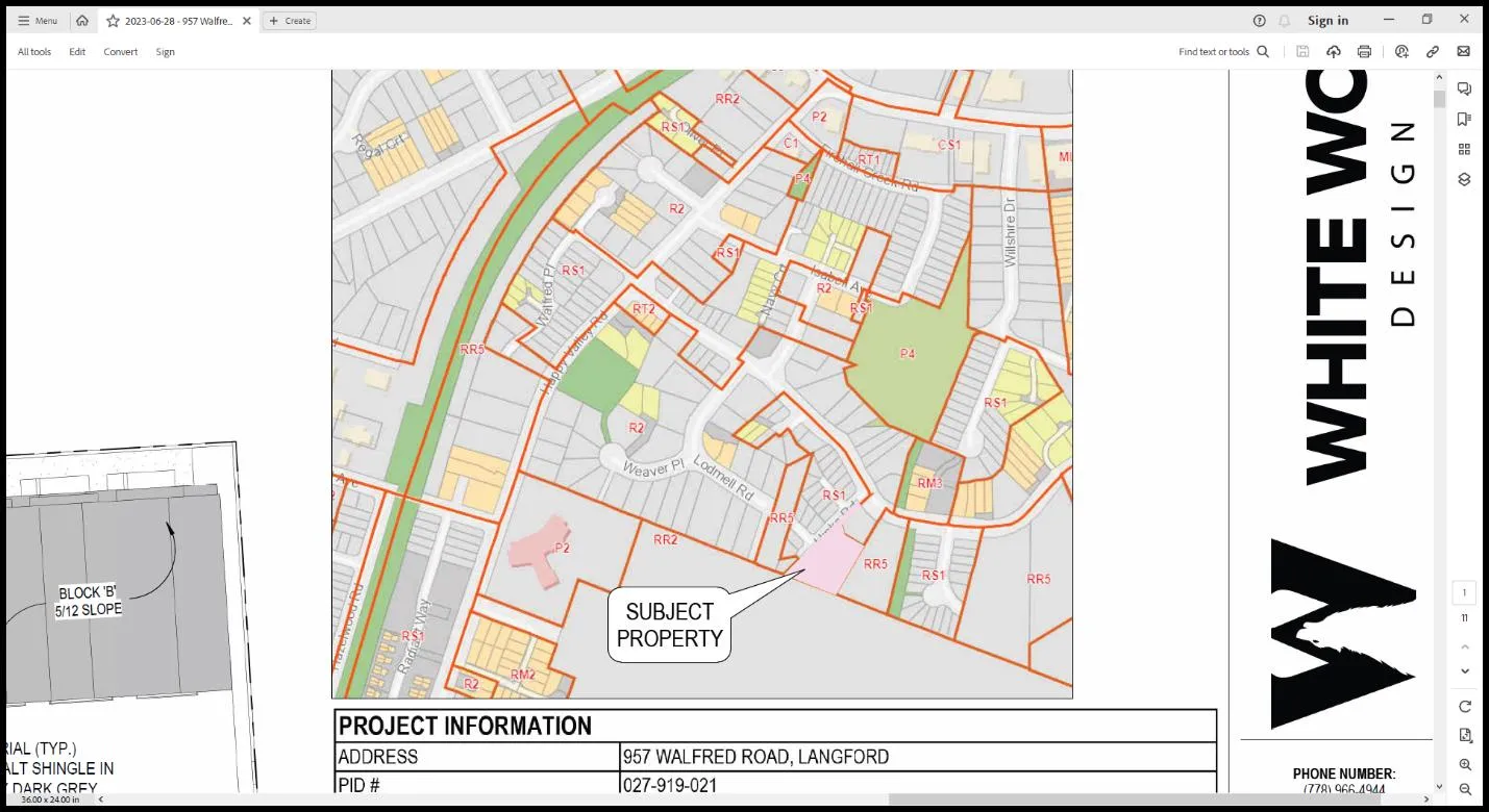
SouthShore Forest Consultants was contacted by White Wolf Homes (Kyle Velikovsky – Project Manager) a residential building contractor in regards to a project located at 957 Walfred Road in the City of Langford. The client has proposed to develop a parcel of land by creating 17-unit residential housing project. Within the proposal the client will be required to provide a section of land for a road dedication.
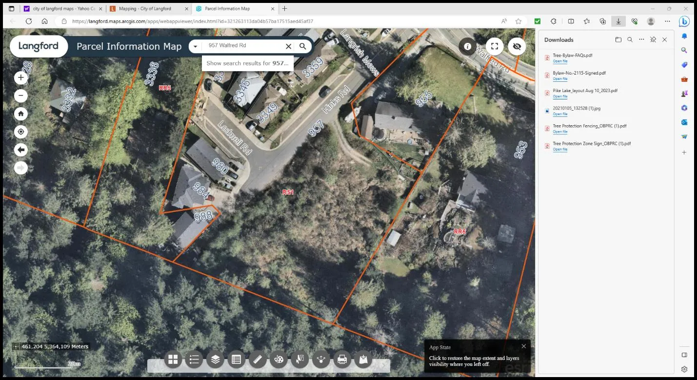
Slightly elevated and positioned with a N/W facing aspect most of the land has been cleared and therefore has a limited tree population within it. Impacts to trees positioned along the edge site will be limited. The existing proposal will require the removal of nine (9) trees. Seven (7) of the trees were assessed to be over 30cm in diameter.
The client has requested that SouthShore Forest Consultants provide a Basic Visual Tree Assessment (VTA) and Tree Preservation Plan (TPP) for the site located at 957 Walfred Road in the City of Langford.
SouthShore Forest Consultants agreed to complete the field assessment and provide the findings in an Arborist Report form, which included a Tree inventory and TPP.
Methodology
- On April 15, 2022 the property was entered and assessed by SouthShore Forest Consultants. Michael Butcher, a Consulting Arborist provided the inspection and visual tree assessment for the site. The weather that day was mild and clear. A slight wind was detected and the temperature averaged 12 +/- degrees Celsius. Dry weather conditions prevailed that afternoon.
- The property was assessed from grade. No form of diagnostic tools or invasive techniques were used during the assessment. A “Basic Visual Tree Assessment” (BVTA) was performed while on site. All tree measurements were made with the use of a standard metal forestry tape and Clinometer (height measurements). Measurements and observations were recorded with the intent to provide a static representation of the area. A “Tree Inventory” is provided separate to the report and will be referred to as Appendix “A”. Photographs of the site were taken during the assessment and these are included as Appendix “B” of this report.
- During the assessment we observed, assessed and inventoried a total of thirty-four (34) trees positioned in and around the site. In this case most of the trees were observed to be positioned well outside the area of impact. Trees were previously tagged prior to our site assessment. Tree tag numbers range from the high #300 to the mid #400. Tag numbers are somewhat ordinal and follow a general pattern throughout the site.
Observations / Discussion
During our site assessment we observed large parcel of land positioned in a section of Langford which has several development projects (residential single-family housing) occurring throughout it. Most of the site was observed to have been recently cleared resulting in the generation of young pioneer type tree species. Each of the younger trees were observed to be less than 30cm in diameter (non significant size and species). The outside perimeter of the site was observed to have established residential housing and forested areas. The forested area was observed to be established with native tree populations such as; Douglas-fir (Psuedotsuga menziesii), Western cedar (Thuja plicata), Pacific madrone (Arbutus menziesii) and Pacific dogwood (Cornus nuttallii).
The site was observed to be elevated above the road with a N/W facing aspect. Approximately 80% of the site was observed to have been recently cleared (trees removed). The perimeter of the site (South end) was observed to have a forest edge. It is in this area of the site where the greatest tree concentration occurs. During the assessment it was evident that most of the trees were positioned on private property – off site. In this case our observations indicate that the client will be responsible for the protection and preservation of all private and property line trees.
Our observations indicate that approximately nine (9) trees will be significantly impacted by the proposed development. Our observations indicate that tree root damage could occur due to excavation, grading and rock blasting operations. It is imperative that the client work to provide protect and/or utilize methodology to reduce impacts within tree Protected Root Zones (PRZ).
The client has indicated their desire to retain and protect all trees positioned off-site on private property.
Appendix A - Tree Inventory
Appendix A - Tree Inventory / Hazard Ratings Summary
Location: Whie Wolf Homes Tree Inventory
Tree Inventory Date: Apr. 22 2022
Conditions: 10 degrees +/-, wind 1-3 kilometers. Overcast and dry - Proposed subdivision
Tree Inventory Table
| TAG # | Spec. | DBH (cm) | Ht (m) | PRZ (m) | Cond. G,F,P | Impact L,M,H | Retain | Remove | Comments/Recommendations |
|---|---|---|---|---|---|---|---|---|---|
| 447 | D Fir | 57 | 26 | 9 | F/F | L/M | X | 2.5 M outside property line | |
| 448 | D Fir | 36 | 24 | 7 | F/F | L/M | X | 3.5M outside property line | |
| 446 | Dwood | 15 | 5 | 3 | F/P | L/M | X | 2.5 M outside impact area | |
| 445 | D Fir | 65 | 27 | 12 | F/F | L | X | 5+ M outside impact area | |
| 444 | D Fir | 14 | 6 | 3 | F/P | L | X | 4.5 M outside impact area - suppressed tree | |
| 443 | D Fir | 35 | 24 | 7 | F/F | L | X | 3.5-4.5 M outside impact area | |
| 442 | D Fir | 47 | 23 | 8 | F/P | M | X | 2x stem- phellinus pathogen present | |
| 441 | D Fir | 37 | 26 | 7 | F/F | L/M | X | 2.5 M from impact zone | |
| 440 | D Fir | 24 | 13 | 4 | F/F | L/M | X | 2.5 M outside impact zone | |
| 439 | D Fir | 79 | 32 | 13 | F/F | L/M | X | 3.5 M - 4 M outside impact zone | |
| 438 | D Fir | 28 | 14 | 5 | F/F | L | X | 4.5 M outside impact zone | |
| 437 | D Fir | 38 | 18 | 5 | F/F | L | X | 5+ M outside impact zone | |
| 436 | D Fir | 29 | 4 | Dead | L | X | Dead standing tree | ||
| 435 | D Fir | 45 | 27 | 8 | F/F | L | X | Well outside impact zone | |
| 434 | Arbutus | 26 | 11 | 5 | F/P | L | X | Well outside impact zone | |
| 433 | D Fir | 56 | 17 | 10 | F/F | M/H | X | Property line tree- remove to grade (excavation and blasting impacts) | |
| 373 | W Cedar | 37 | 23 | 6 | F/F | H | X | Remove to grade significant impact - proposed changes to grade & landscaping | |
| 374 | W Cedar | 100+ | 36 | 18 | F/F | L/M | X | Retain and protect | |
| 430 | W Cedar | 96 | 35 | 17 | F/F | L/M | X | 7 M outside impact zone | |
| 429 | W Cedar | 24 | 16 | 4 | F/F | L | X | 6 M+ outside impact zone | |
| 428 | W Cedar | 83 | 34 | 16 | F/F | L | X | 8 M outside impact zone | |
| 427 | D Fir | 30 | 15 | 5 | F/F | L/M | X | 2.5 M from impact zone | |
| 424 | D Fir | 46 | 27 | 8 | F/F | L | X | 7+ M outside impact zone | |
| 423 | D Fir | 41 | 16 | 8 | F/F | L | X | 7+ M outside impact zone | |
| 422 | D Fir | 34 | 24 | 6 | F/F | L | X | 7-8 M outside impact zone | |
| 421 | D Fir | 25 | 23 | 5 | F/F | L | X | 7+ M outside impact zone | |
| 420 | D Fir | 60 | 31 | 11 | F/F | L | X | 7+ M outside impact zone | |
| 419 | D Fir | 60 | 31 | 11 | F/F | L | X | 5+ M outside impact zone | |
| 417 | W Cedar | 49 | 23 | 9 | F/F | H | X | Remove | Footprint tree- remove to grade |
| 416 | D Fir | 18 | 8 | 3 | P/P | H | X | Remove | Direct impact - lot #3 |
| 415 | W Cedar | 29 | 14 | 5 | F/F | H | X | Remove | Remove to grade significant impact - proposed changes to grade & landscaping |
| 414 | W Cedar | 31 | 14 | 5 | F/F | H | X | Remove | Remove to grade significant impact - proposed changes to grade & landscaping |
| 413 | W Cedar | 17 | 8 | 3 | F/F | M/H | X | 2.0 M outside impact area - great buffer tree | |
| 412 | D Fir | 55 | 31 | 11 | F/F | L/M | X | 4.0 M outside impact zone | |
| 411 | D Fir | 57 | 32 | 11 | F/F | L/M | X | 4.5 M outside impact zone | |
| 410 | D Fir | 24 | 17 | 4 | F/F | L | X | 6+ M outside impact zone | |
| 409 | D Fir | 40 | 26 | 8 | F/F | L | X | 5-6 M outside impact zone | |
| 408 | D Fir | 34 | 16 | 5 | F/F | L | X | 4 M outside impact zone | |
| 407 | D Fir | 43 | 28 | 8 | F/F | L | X | 5+ M outside impact zone | |
| 406 | D Fir | 50 | 29 | 10 | F/F | L/M | X | 2.5-3 M outside impact zone | |
| 380 | W Cedar | 47 | 21 | 10 | F/F | M/H | X | Remove to grade significant impact - proposed changes to grade & landscaping | |
| 329 | Willow | 38 | 9 | 3 | F/F | M/H | X | Remove to grade significant impact - proposed changes to grade & landscaping | |
| 378 | D Fir | 67 | 31 | 12 | F/P | M/H | X | Remove | Phellinus present - advise removal - high impact - P/L tree - shared ownership |
Notes below the table:
- Trees - #433 & #378 are property line trees which are shared ownership with 919 Mountain Top Road.
- DBH - Diameter Breast Height – Calculated at 1.41 m above grade on tree stem
- PRZ – Protected Root Zone, (calculated at a ratio of 1:12) 50cm DBH = 6m PRZ
- CRZ – Critical Root Zone, (calculated at a ratio of 1:6) 60cm DBH = 3m CRZ
50cm DBH = 3m CRZ - Condition – P= Poor, F=Fair, G=Good
- Footprint = Excavation edge along the outside of building envelope on grade. Over excavation is expected and can be up to a 1.5m distance from the outside of the proposed footprint edge.
- Impact Zone = Constructive area, estimated at 0-1.5m outside the proposed building footprint.
- Impact Levels – L (Low), M (Moderate), H (High)
- Bylaw Protected – Trees identified which meet the City of Langford Bylaw Protection criteria.
Figures and Images
Tree Dynamics
Observed Potential Tree Impacts
- Seven (7) trees of significant size and species are positioned within the proposed building envelope and-or will be subjected to root damaging activities under the current proposal.
- Nine (9) trees have been identified for removal; #329, #373, #378, #380, #414, #415, #433, #416 & #417
- Potential impacts from the site clearing phase of the project could require tree removal. Two (2) trees #433 & #378 are property line trees and have shared ownership. These two trees cannot be removed unless a letter of consent is provided from the adjoining owner.
- Potential impacts will come in two forms; (1) Excavation within tree root zones and blasting requirements. Blasting activities have been confirmed to be required within this site. We highly recommend the use of low nitrogen blasting material. Furthermore, we recommend that low charge loading at shallower depths be utilized to reduce heat and explosive concussions. Blasting impacts will negatively affect tree roots and soil micro activity.
- Perimeter trees are for the most part are positioned outside the immediate impact zone for the site. The Project Arborist will be responsible for assessing excavation and/or blasting cuts along the edge of the site. In this case we expect low to minor root disturbances.
- Root skirting may be required – Project Arborist to assess after excavation in completed.
Tree Protection Plan (TPP) – Site Specific
- Provide Tree Protection Fencing as per Project Arborist Recommendations.
- Utilize the City of Langford Tree Protection Fencing guidelines and ensure that the fence is posted with visible signage indicating “Tree Protection Zone” – “Do not Enter”.
- Provide Project Arborist to assess and supervise any excavation requirements which could impact trees identified for retention and/or protection.
- Project arborist to assess the movement and positioning of TPF if temporary movement is required. City of Langford staff to be notified when TPF is moved or repositioned.
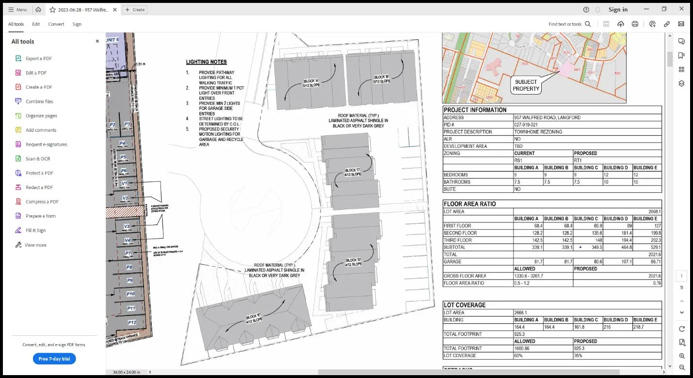
- Staging Area has been identified in Figure #2 – Developer to ensure that all materials are staged and stored in Staging Area.
- Edge Protection – Root Skirting/Curtains may be required to protected the exposed edge of cuts required toward the south and east side of the lots. In this case the Project Arborist will assess and make further recommendations.
Tree Protection Plan – General Notes
i. Provide a detailed sign specifying that tree protection measures are in place and will be followed during the project. Fines will be posted for malicious acts and can be placed on individuals who disregard the tree protection plan and its guidelines. Signs will be placed at each entrance of the project detailing what is expected when working in potentially high impact tree protection zones.
ii. Provide tree protection fencing for all trees identified with protection requirement in this report. This fencing shall be four (4ft) feet in height and made of orange plastic. If required, header and footer boards will be used to secure the protective fencing. Use the City of Langford tree protection specifications.
iii. Tree protection and root protection signs will be placed on the fencing. No entry will be allowed, unless specified by the project arborist and in their presents while on site.
iv. Restrict vehicle traffic to designated access routes and travel lanes to avoid soil compaction and vegetation disturbances.
v. Make all necessary precautions to prevent the storage of material, equipment, stockpiling of aggregate or excavated soils within tree protection areas. No dumping of fuels, oils or washing of concrete fluids will be allowed in tree protection zones.
vi. Provide an onsite arborist when a risk of root damage, root cutting or limb removal is required within the tree protection zone.
vii. Avoid alterations to existing hydrological patterns to minimize vegetation impacts to the site.
viii. The use of a project arborist is required to provide layout of tree protection zones. The project arborist(s) will provide pre-construction information to all parties involved with the project. The arborist must be notified 72hrs prior to construction activities in sensitive areas. The project arborist should be used to provide root and branch pruning when diameters are greater than 6cm.
ix. At no time will tree protection zones be removed from the project unless approved by the project arborist.
Each tree protection zone must be absent & clear of all construction materials and/or equipment. At no time can the fence be taken down unless the Project Arborist is contacted and approval is given. The Project Arborist must assess and assist fence removal and combined impacts which are require for construction completion. Michael Butcher 250.893.9056 – 72 hours notice required.
Landing / Storage Area
- Materials storage will be confined to the proposed road dedication and driveway dedications.
Compaction Reduction
- Project Arborist to make recommendations once the TPF has been installed. In this case compaction reduction may not be required.
Root Assessment and Observation
- Provide Project Arborist for excavation observation and assessment when working with in the Protected Root Zones of any protected tree. This will be required during the excavation and blasting activities.
Tree Pruning – Elevation
- Ensure that any pruning required for working distances to provide a 4-6m clearance over the development zone. This will reduce the probability of branch tear or pulling from the egress of construction equipment. Provide pruning to ANSI A300 Tree Care Industry Standards. Have a Certified Arborist perform tree pruning activities.
Although the site has been assessed, trees in the landscape are dynamic and changes could occur. This report is a static representation of the site during our assessment.
Michael Butcher
SouthShore Forest Consultants
BSc Forestry
ISA-ON-0583A
CTRA# 1401
ATTACHMENTS
- Appendix A – Tree Inventory
- Appendix B – Site Photos
Arborist Disclosure Statement
Arborist are tree specialists who use their education, training and experience to examine trees, recommend measures to enhance the beauty and health of trees, and attempt to reduce the risks.
Arborist cannot detect every condition that could possibly lead to structural failure of a tree.
Trees are living organisms that fail in ways we do not fully understand. Conditions are often hidden within trees and below the ground.
Arborist cannot guarantee that the tree will be healthy and safe under all circumstances, or for a specific period of time. Trees are dynamic specimens, not static. Changes in conditions including the environment are unknown.
Remedial treatments cannot be guaranteed.
Trees can be managed, but they cannot be controlled. The only way to eliminate all risk is to eliminate all trees.
Tree Assessment Condition Rating
Good - A tree specimen which is exempt defects, branch dieback, moderate insect and fungal identification. This tree has evenly distributed branching, trunk development and flare. The root zone is undisturbed, leaf, bud and flower production and elongation are normal for its distribution.
Fair - A tree specimen which has minor defects, branch dieback, previous limb failure, identification of cavities and insect, or fungal identification. This tree has multiple (2-3) primary stem attachments; previous utility pruning, callus growth and poor wound wood development. Minor root girdling, soil heave and identifiable mechanical damage to the root flare or root zone.
Poor - A tree specimen where 30-40% of the canopy is identifiably dead, large dead primary branching, limited leaf production, bud development and stem elongation. Limb loss or failure, and heavy storm damage leading to uneven weight distribution. Large pockets of decay, multiple cavities, heavy insect and fungal infection. Root crown damage or mechanical severing of roots. Root plate shifting, heavy lean and movement of soil.
Dead - Tree has been observed to be dead with no leaf, foliar and bud development. No stump sprouts and root suckers are present.
Excavation Process and Recommendation for Tree Root Zones
- Provide and schedule Project Arborist to assess site prior to construction.
- Inventory and identify trees and hazards which could complicate excavation process.
- Utilize hand tools and cutting equipment when large tree roots are anticipated.
- Provide small rubberized track excavation equipment which will reduce soil compaction.
- Excavator operator must be well informed about dig site and goal to complete project.
- Use shallow excavation sweeps across the site to establish a depth which roots can be easily identified. (3cm to 5cm in depth of soil for each sweep across the soil face)
- Roots greater than 6cm in diameter should be preserved and inspected by the Project Arborist. The project arborist will determine if roots should be pruned or cut.
- All roots greater than 6cm in diameter should be identified and documented for project records.
- Photos are highly recommended for documentation purposes.
Assessment of the site may expose further tree issues or conditions. If this occurs the project arborist will contact City Staff for further recommendations.
Appendix B – Site Photos
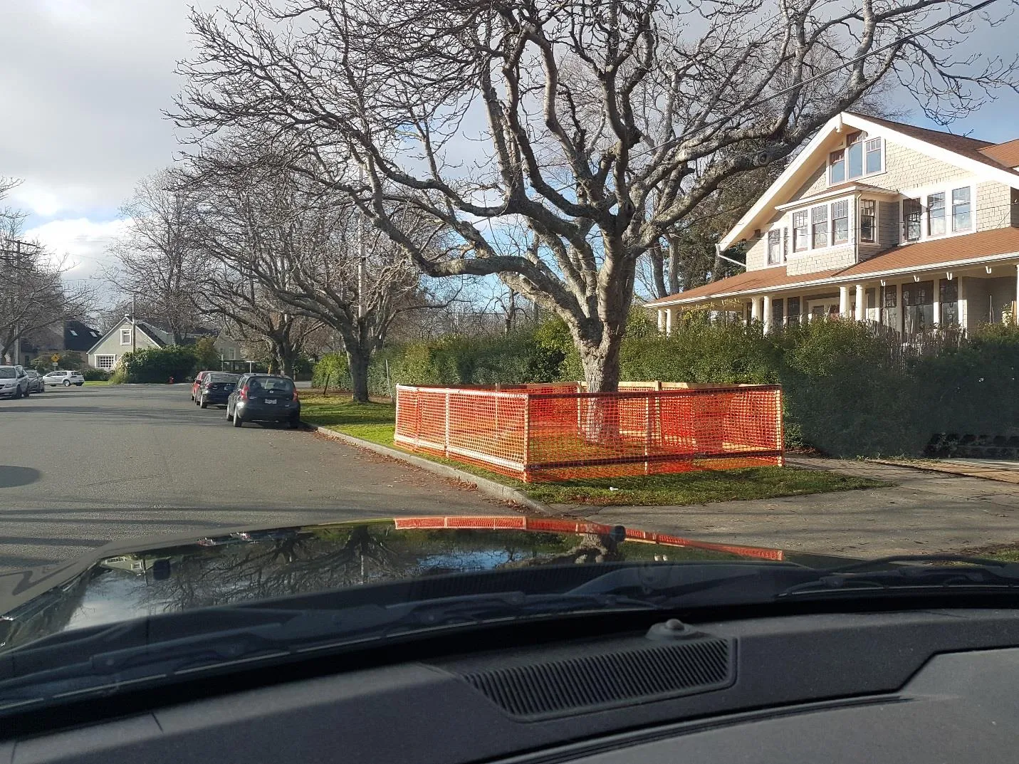
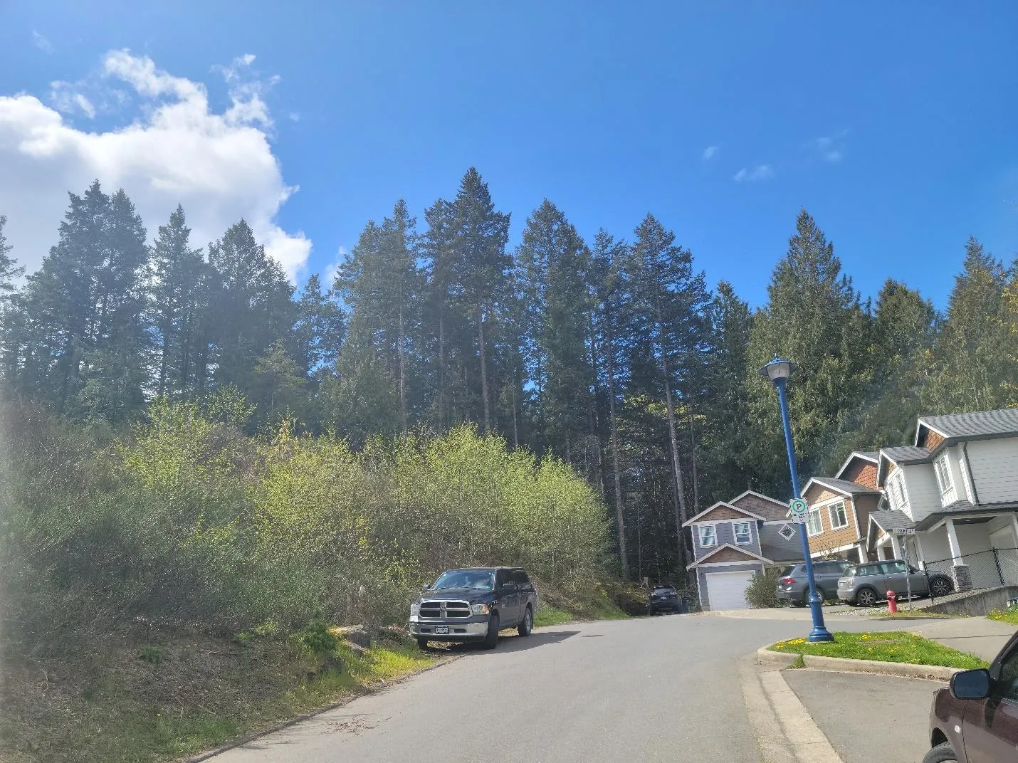
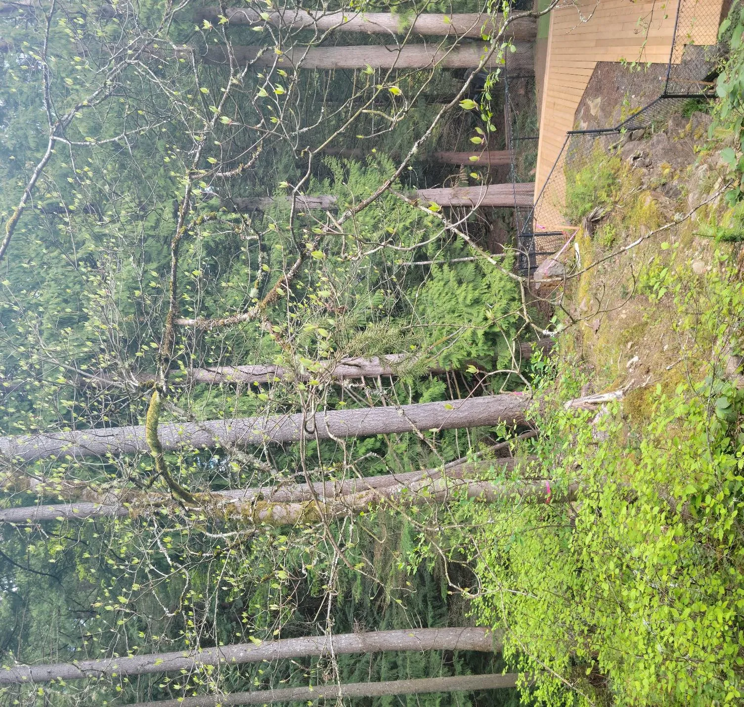
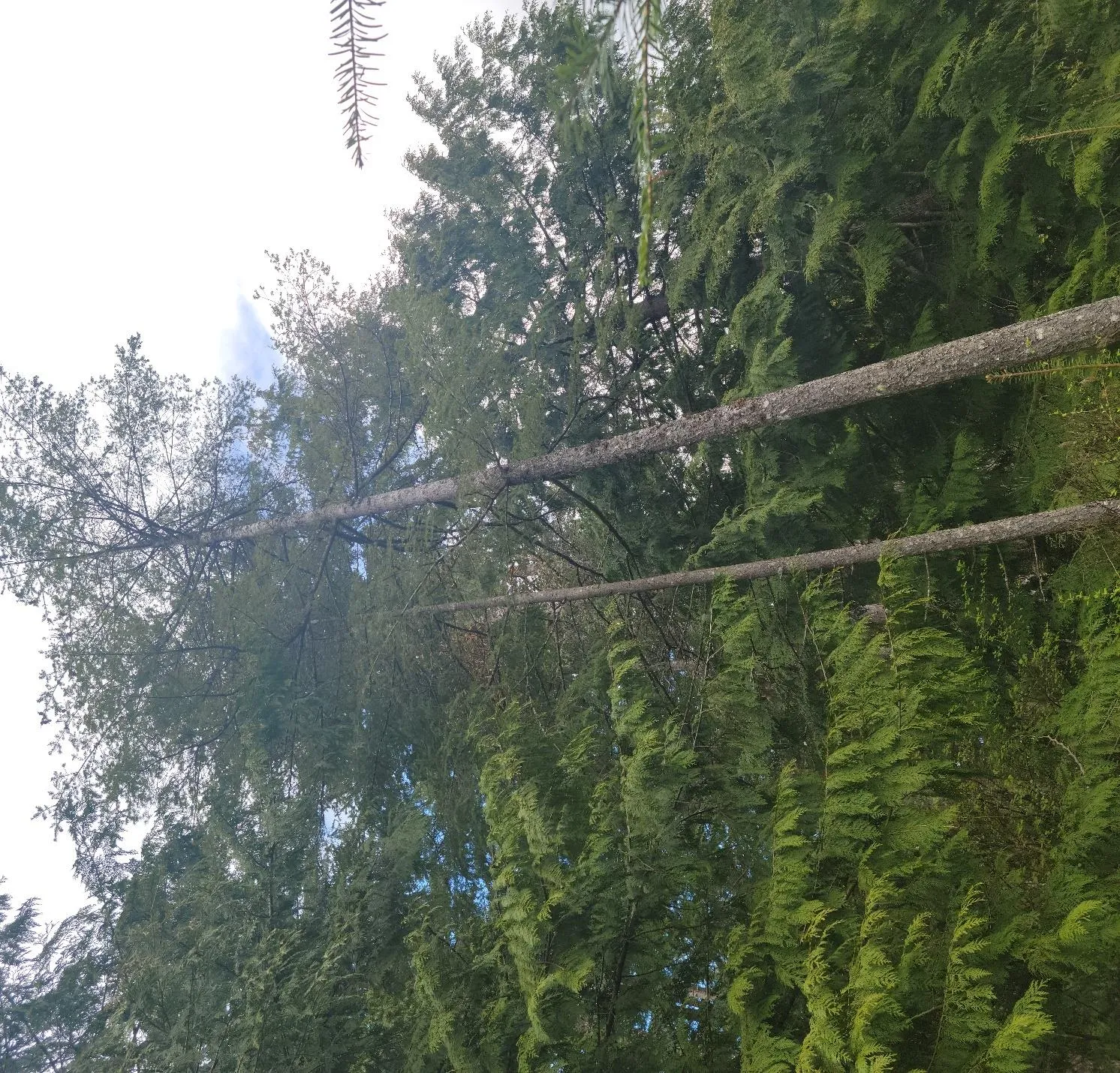
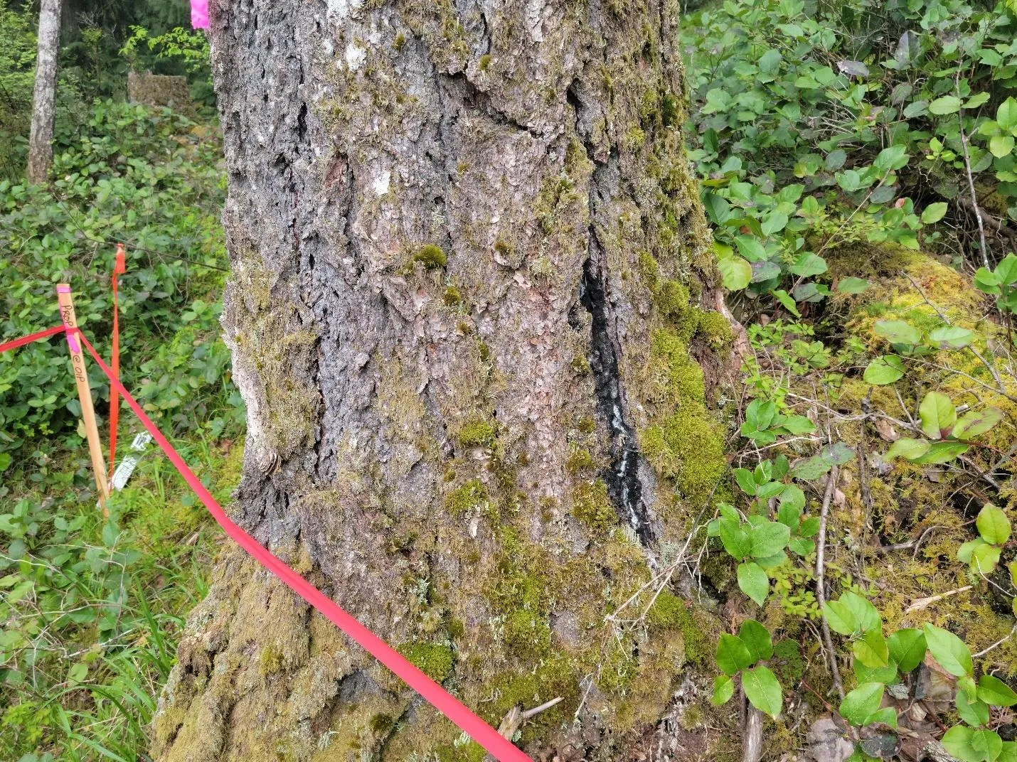
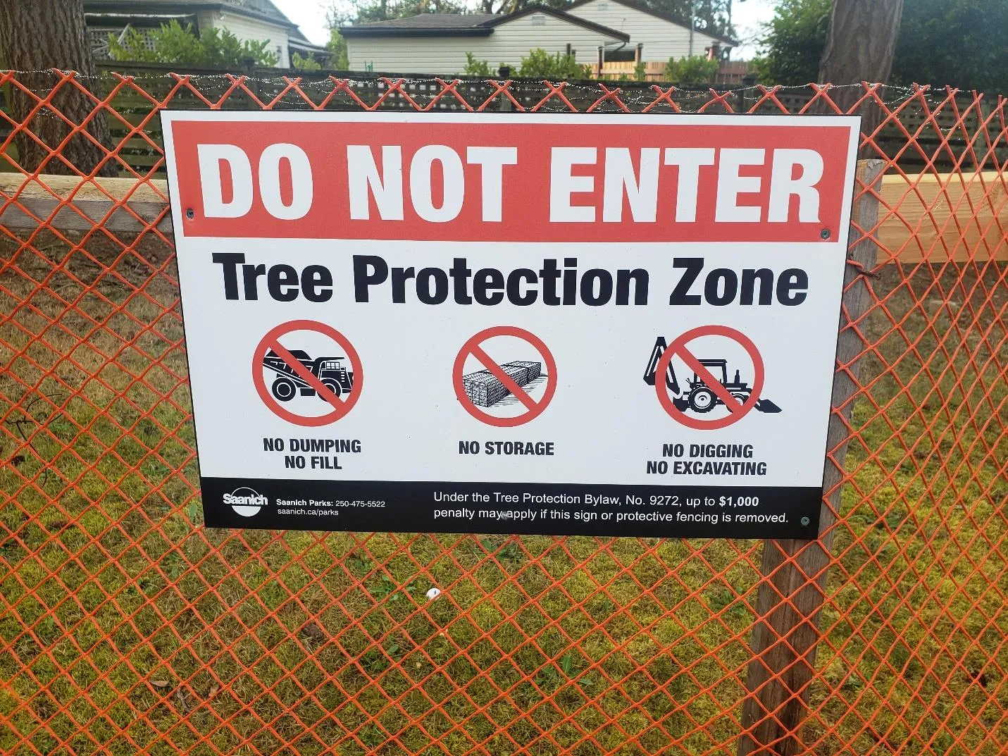
Figure #3 – Proposed Site Layout – Revised July 26, 2023
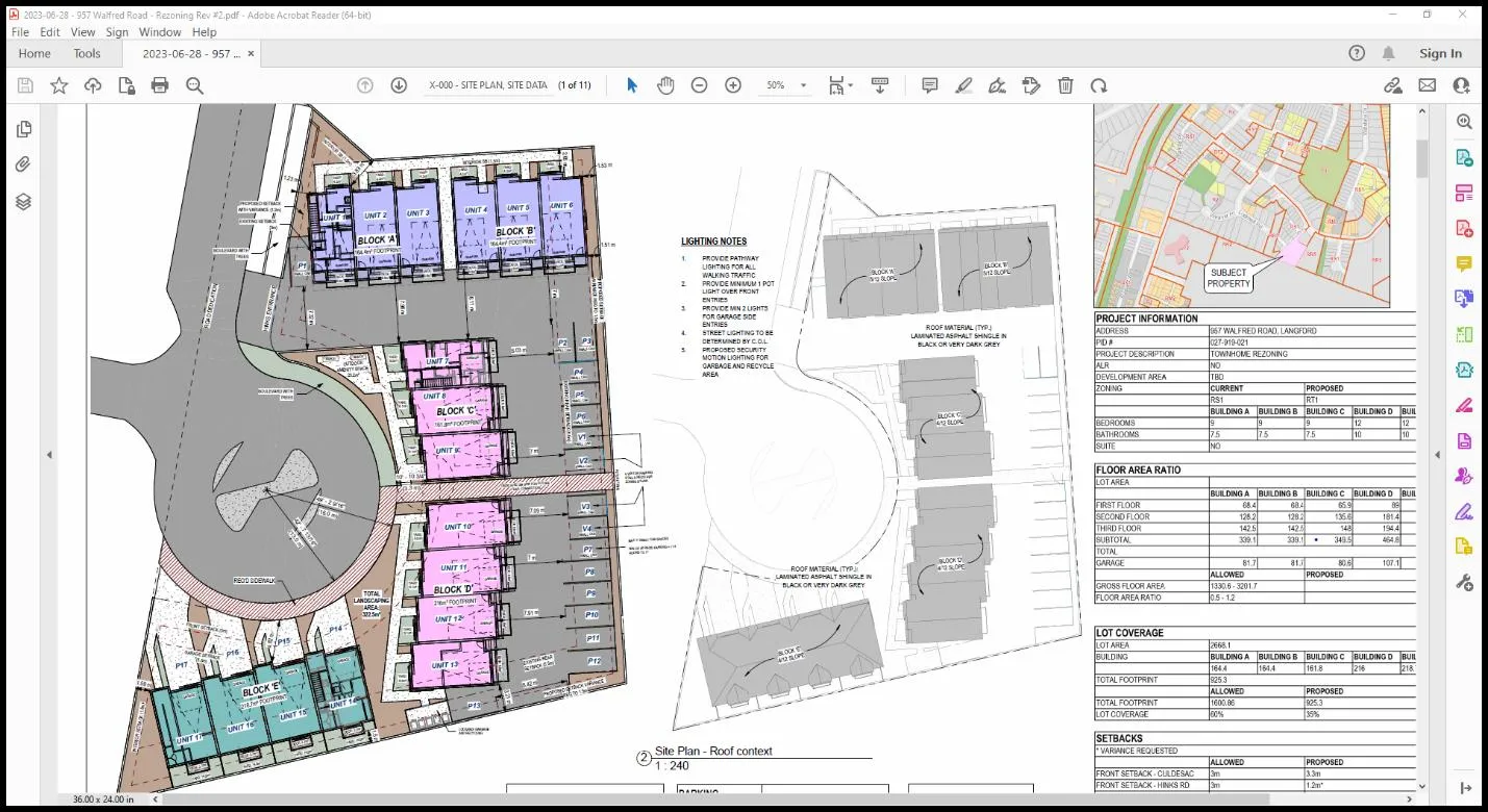
The existing site layout will require the removal of all trees positioned within the site. The excavation and grade requirements of the proposed development cannot support trees positioned within and along the site’s property lines. In this case the client is requesting the removal of seven (7) trees greater that 30cm in diameter.