DocumentsStaff ReportNov 22, 2022Pages 68–293
Staff Report / Submission: B.C. Electoral Boundaries Commission Preliminary Report
Material relating to the B.C. Electoral Boundaries Commission Preliminary Report including the Commission's preliminary recommendations, maps, analysis and the City's response/consultation materials (long attachment set).
Key facts
- Starts at page 68 as agenda item 7.5 and includes extensive background and attachments through page 293
- Contains preliminary report content from the B.C. Electoral Boundaries Commission and local analysis
- Likely includes maps, proposed boundary changes, timelines for public consultation and staff recommendations for submissions
Staff Report / Submission: B.C. Electoral Boundaries Commission Preliminary Report
Page 68
Page 1 of 2
t 250.478.7882 e administration@langford.ca 2nd Floor, 877 Goldstream Avenue Langford, BC V9B 2X8
Staff Report to Special Council
DATE: Monday, November 21, 2022 DEPARTMENT: Administration SUBJECT: BC Electoral Boundaries Commission – Preliminary Report
BACKGROUND: In BC, the Electoral Boundaries Commission Act requires that an electoral boundaries commission be appointed after every second provincial general election to propose changes to provincial electoral boundaries as BC population continues to change. There have been 10 electoral boundaries commissions in BC’s history since the first commission was appointed in 1965. The most recent BC Electoral Boundaries Commission (the Commission) was appointed on October 21, 2021.
Since then, the Commission held public meetings and accepted public submissions by mail, email, and over the phone, with over 1,000 submissions received from across BC to date. The initial public consultation phase ended on May 31, 2022. A preliminary report was submitted to the Speaker of the Legislative Assembly and made public on October 3, 2022.
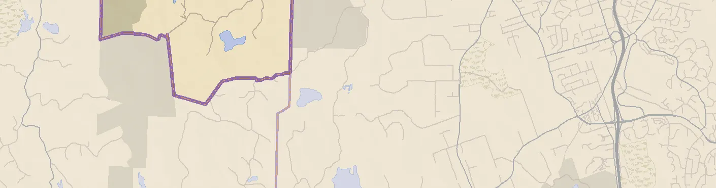
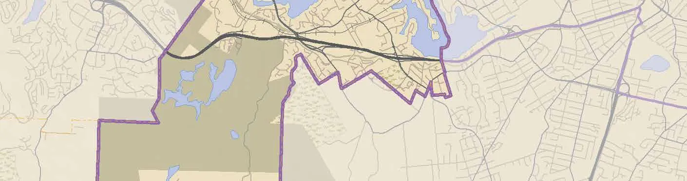
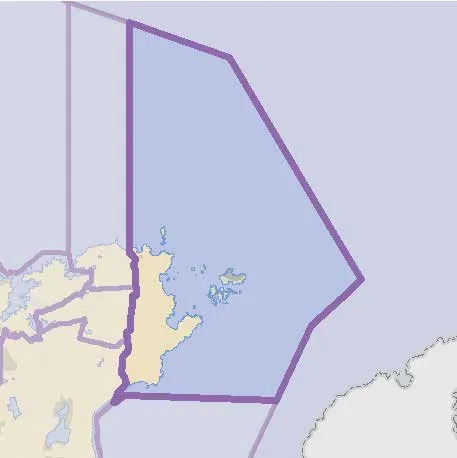
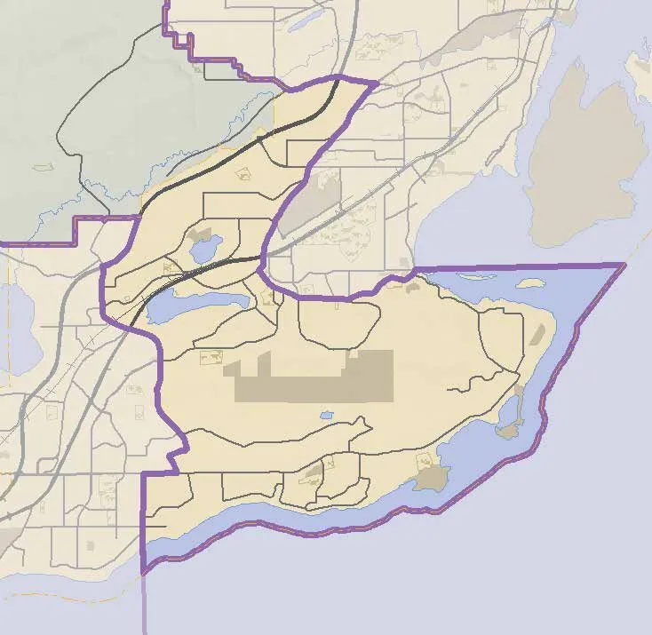
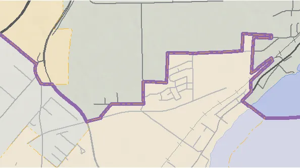
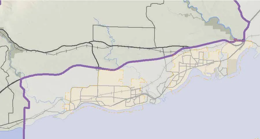
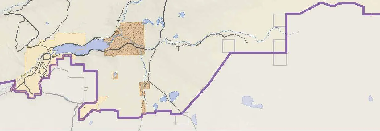
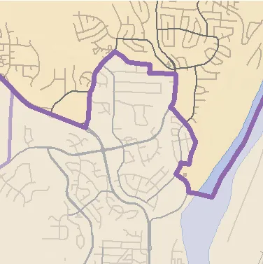
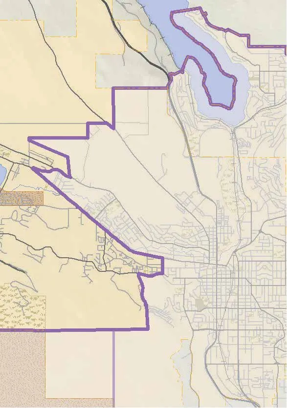
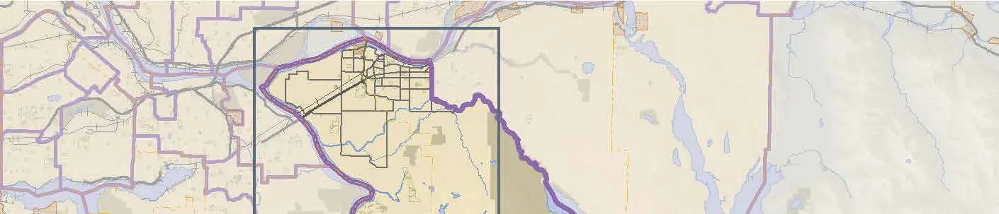
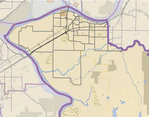
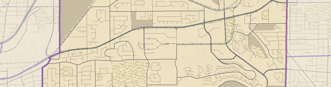
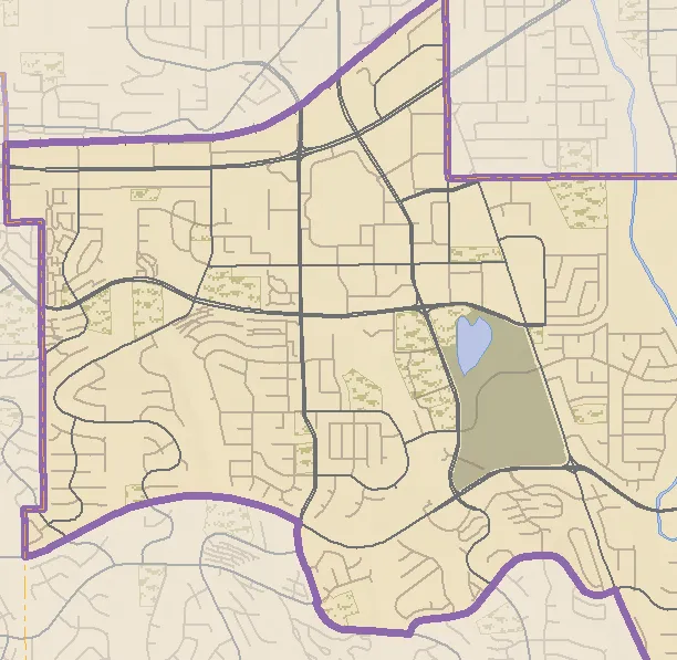
The Commission is proposing six additional electoral districts for the next provincial election, from the current 87 electoral districts to a proposed 93 electoral districts. A proposal that may be of note to Langford includes the creation of the Langford Highlands electoral district as a new electoral district. Further information, including the map of the new electoral district, the context, and the rationale for the new electoral district is found in the attached preliminary report.
The Commission continues to accept public input through their website (bcebc.ca), by email (info@bcebc.ca), by phone, and by mail until 11:59pm on November 22, 2022, following which, the Commission will hold hearings for Members of Legislative Assembly and prepare a final report and recommendations for submission to the Legislative Assembly on April 3, 2023. COMMENTARY: The BC Electoral Boundaries Commission provided the City of Langford with a copy of the preliminary report for information and asked for any input that the City of Langford may have. The Commission’s proposal pertains to future provincial elections and does not have a direct impact on municipal business. Page 68 of 308
Page 69
BC Electoral Boundaries Commission – Preliminary Report 20221121 Special Council Report Page 2 of 2
FINANCIAL IMPLICATIONS: None. LEGAL IMPLICATIONS: None. OPTIONS: Option 1 THAT Council receive this report for information.
OR Option 2 THAT staff be directed to provide the following input to the BC Electoral Boundaries Commission:
SUBMITTED BY: Marie Watmough, Deputy Director of Corporate Services Concurrence: Donna Petrie, Senior Manager of Business Development and Events Concurrence: Matthew Baldwin, MCIP, RPP, Director of Planning and Subdivision Concurrence: Michelle Mahovlich, P.Eng, P.Geo, Director of Engineering and Public Works Concurrence: Michael Dillabaugh, CPA, CA, Director of Finance Concurrence: Braden Hutchins, Director of Corporate Services Concurrence: Darren Kiedyk, Chief Administrative Officer
Attachment: BC Electoral Boundaries Commission – Preliminary Report, dated October 3, 2022 Page 69 of 308
Page 70
Preliminary Report October 3, 2022 Page 70 of 308
Page 71
Page 71 of 308
Page 72
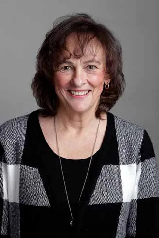
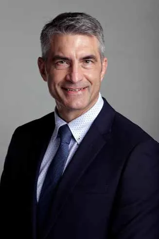
October 3, 2022 Honourable Raj Chouhan Speaker of the Legislative Assembly Province of British Columbia Parliament Buildings Victoria, British Columbia V8V 1X4 Dear Mr. Speaker: We are pleased to submit our Preliminary Report in accordance with section 10(1) of the Electoral Boundaries Commission Act. Yours sincerely, The Honourable Justice Nitya Iyer Commission Chair Linda Tynan Commissioner Anton Boegman Commissioner Chief Electoral Officer of British Columbia BC ELECTORAL BOUNDARIES COMMISSION | 100-1112 FORT STREET, VICTORIA, B.C. V9A 5K7 | BCEBC.CA Page 72 of 308
Page 73
4 | PRELIMINARY REPORT 2022 01— Contents 01— Page 73 of 308
Page 74
PRELIMINARY REPORT 2022 | 5
- Table of Contents 5
List of Maps 7
List of Tables 12 2. Executive Summary 14 3. Background 20
The Commission 22
Evolution of B.C.'s Electoral Boundaries 24 4. Context 26
Key Terms 28
Our Guiding Principles 35
Our Process to Date 39 5. Recommendations 42
Vancouver Island 47
The North 69
Prince George and the Cariboo 81
The Kootenays 91 Table of Contents Page 74 of 308
Page 75
6 | PRELIMINARY REPORT 2022
The Interior 101
Fraser Valley-Langley-Maple Ridge 119
Burnaby-New Westminster-Tri-Cities 135
Surrey 151
Richmond-Delta 167
Vancouver 179
North Shore-Sea to Sky-Sunshine Coast 197 6. Next Steps 206 7. Appendices 210
Appendix A: Population Estimates, Proposed 93 Electoral Districts 211
Appendix B: Population Estimates, Current 87 Electoral Districts 215
Appendix C: Executive Summary, Datasets 219
Appendix D: Schedule, Preliminary Public Meetings (March - May 2022) 221
Appendix E: Schedule, Public Hearings (October - November 2022) 223 Table of Contents Page 75 of 308
Page 76
PRELIMINARY REPORT 2022 | 7 Vancouver Island 53
Esquimalt-Colwood 54
Juan de Fuca-Malahat 55
Langford-Highlands 56
Oak Bay-Gordon Head 57
Saanich North and the Islands 58
Saanich South 59
Victoria-Beacon Hill 60
Victoria-Swan Lake 61
Nanaimo-Gabriola Island 62
Nanaimo-Ladysmith 63
Nanaimo-Oceanside 64
Courtenay-Comox 65
Cowichan Valley 66
Mid Island-Pacific Rim 67
North Island 68 The North 74
Bulkley Valley-Stikine 75
Nechako Lakes 76
North Coast 77
Peace River North 78
Peace River South 79
Skeena 80 List of Maps Page 76 of 308
Page 77
8 | PRELIMINARY REPORT 2022 Prince George and the Cariboo 85
Cariboo-North Thompson 86
Prince George-Cariboo 87
Prince George-Mackenzie 88
Prince George-Valemount 89 The Kootenays 95
Columbia River-Revelstoke 96
Kootenay Central 97
Kootenay East 98
Kootenay West 99 The Interior 107
Kelowna Centre 108
Kelowna-Lake Country 109
Kamloops- Mission 110
West Kelowna-Peachland 111
Boundary-Similkameen 112
Fraser-Nicola 113
Kamloops Centre 114
Kamloops-North Shuswap 115
Penticton-Summerland 116
Salmon Arm-Shuswap 117
Vernon-Monashee 118 List of Maps Page 77 of 308
Page 78
PRELIMINARY REPORT 2022 | 9 Fraser Valley-Langley-Maple Ridge 124
Abbotsford-Mission 125
Abbotsford South 126
Abbotsford West 127
Chilliwack-Cultus Lake 128
Chilliwack North 129
Langley-Aldergrove 130
Langley-Murrayville 131
Langley-Willoughby 132
Maple Ridge East 133
Maple Ridge-Pitt Meadows 134 Burnaby-New Westminster-Tri-Cities 140
Burnaby Centre 141
Burnaby East 142
Burnaby-New Westminster 143
Burnaby North 144
Burnaby South 145
Coquitlam-Burke Mountain 146
Coquitlam-Mundy Park 147
New Westminster-Maillardville 148
Port Coquitlam 149
Port Moody-Westwood Plateau 150 Page 78 of 308
Page 79
10 | PRELIMINARY REPORT 2022 Surrey 156
Surrey Central 157
Surrey City Centre 158
Surrey East 159
Surrey-Fleetwood 160
Surrey-Guildford 161
Surrey-Newton 162
Surrey North 163
Surrey-Panorama 164
Surrey South 165
Surrey-White Rock 166 Richmond-Delta 171
Delta North 172
Delta South 173
Richmond-Bridgeport 174
Richmond Centre 175
Richmond-Queensborough 176
Richmond-Steveston 177 List of Maps Page 79 of 308
Page 80
PRELIMINARY REPORT 2022 | 11 Vancouver 184
Vancouver-Fraserview 185
Vancouver-Hastings 186
Vancouver-Kensington 187
Vancouver-Langara 188
Vancouver-Little Mountain
189
Vancouver-Point Grey 190
Vancouver-Quilchena 191
Vancouver-South Granville 192
Vancouver-Strathcona 193
Vancouver-Trout Lake 194
Vancouver-West End 195
Vancouver-Yaletown 196 North Shore-Sea to Sky-Sunshine Coast 200
North Vancouver-Lonsdale 201
North Vancouver-Seymour 202
Powell River-Sunshine Coast 203
West Vancouver-Capilano 204
West Vancouver-Sea to Sky 205 Page 80 of 308
Page 81
12 | PRELIMINARY REPORT 2022 Table 1: Vancouver Island Electoral Districts 47 Table 2: Vancouver Island Population, Deviation and Area 49 Table 3: The North Electoral Districts 69 Table 4: The North Population, Deviation and Area 71 Table 5: Prince George and the Cariboo Electoral Districts 81 Table 6: Prince George and the Cariboo Population, Deviation and Area 83 Table 7: The Kootenays Electoral Districts 91 Table 8: The Kootenays Population, Deviation and Area 93 Table 9: The Interior Electoral Districts 101 Table 10: The Interior Population, Deviation and Area 103 Table 11: Fraser Valley-Langley-Maple Ridge Electoral Districts 119 Table 12: Fraser Valley-Langley-Maple Ridge Population, Deviation and Area 121 Table 13: Burnaby-New Westminster-Tri-Cities Electoral Districts 135 Table 14: Burnaby-New Westminster-Tri-Cities Population, Deviation and Area 137 Table 15: Surrey Electoral Districts 151 Table 16: Surrey Population, Deviation and Area 153 Table 17: Richmond-Delta Electoral Districts 167 Table 18: Richmond-Delta Population, Deviation and Area 169 Table 19: Vancouver Electoral Districts 179 Table 20: Vancouver Population, Deviation and Area 181 Table 21: North Shore-Sea to Sky-Sunshine Coast Electoral Districts 197 Table 22: North Shore-Sea to Sky-Sunshine Coast Population, Deviation and Area 199 List of Tables Page 81 of 308
Page 82
PRELIMINARY REPORT 2022 | 13 Page 82 of 308
Page 83
14 | PRELIMINARY REPORT 2022 Executive Summary 02 — Page 83 of 308
Page 84
PRELIMINARY REPORT 2022 | 15 THE BC ELECTORAL BOUNDARIES COMMISSION IS APPOINTED TO REVIEW PROVINCIAL ELECTORAL DISTRICT BOUNDARIES. This system of “representation by population” is based on the idea that one person’s vote should carry the same weight as another person’s vote, regardless of where they live in the province. In order for that to happen, the population of each riding must be roughly the same. The principle of representation by population in British Columbia is intertwined with the equally important principle of “effective representation.” Effective representation recognizes that elected representatives not only sit in the legislature and vote; they also play a vital role in helping their constituents deal with government bodies. The courts have called this the ombudsperson role. Effective representation is based on the idea that everyone should have equivalent access to their elected representative, especially in the ombudsperson role, regardless of their riding’s geographic size, population density or infrastructure. Since the population of British Columbia is not static, it is necessary to periodically review the number and boundaries of B.C.’s electoral districts to continue to ensure that B.C. residents have effective representation by population. The Electoral Boundaries Commission Act (the Act) requires that British Columbia is a representative democracy. The province is divided into 87 electoral districts, or ridings. The people living in each riding vote for the person they want to represent their interests in the legislature. Page 84 of 308
Page 85
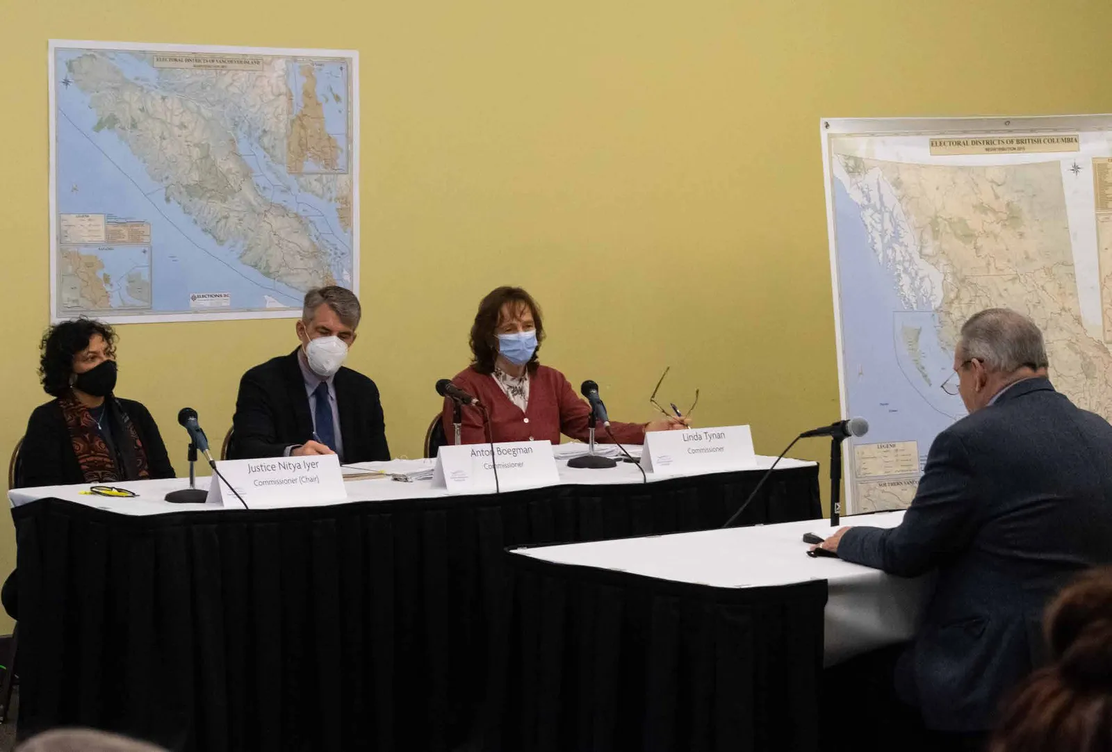
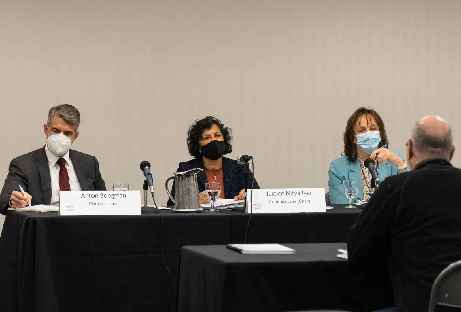
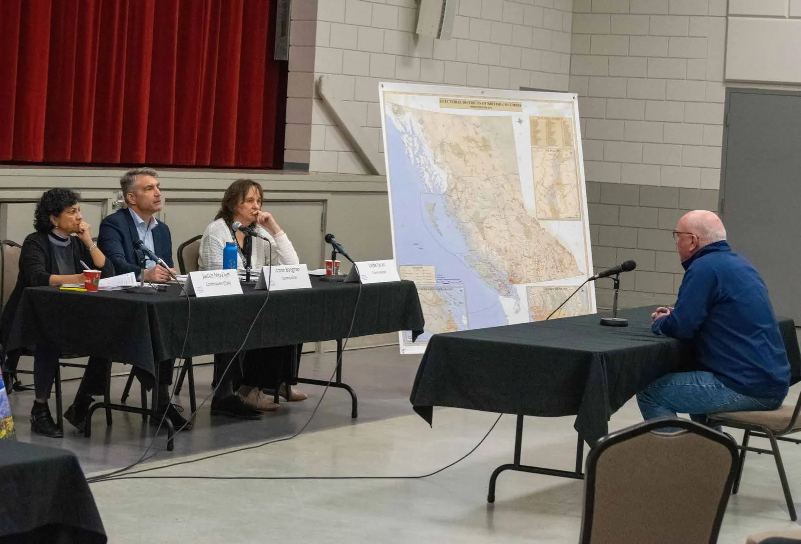
16 | PRELIMINARY REPORT 2022 IMAGE 1: PUBLIC MEETING IN NANAIMO, B.C. CREDIT: BC ELEC- TORAL BOUNDARIES COMMIS- SION. MARCH 22, 2022. The Act expressly references the principles of representation by population and effective representation. It gives meaning to them by setting out the process our Commission must follow and the factors it must consider. We must make proposals for changes to electoral boundaries, and we may propose up to six new electoral districts, potentially increasing the size of the Legislative Assembly from 87 to 93 Members. We may hold initial public meetings, or hearings, an electoral boundaries commission be appointed after every second provincial general election to propose changes to the area, boundaries and names of electoral districts in the province. Our Commission was appointed on October 21, 2021. We are: Justice Nitya Iyer, Justice of the Supreme Court of British Columbia (Chair) Linda Tynan, Local Government Advisor Anton Boegman, Chief Electoral Officer of British Columbia. You can read more about our backgrounds and the history of electoral boundaries commissions in B.C. in Chapter 3 of this report. Page 85 of 308
Page 86
PRELIMINARY REPORT 2022 | 17 and we must table our preliminary report of proposed changes in the legislature within one year of our appointment. After that, we must hold public hearings to receive public input on our proposals. Having considered that input, we must give current Members of the Legislative Assembly (MLAs) an opportunity to make submissions to us. Our final report, containing any amendments we propose in light of the input we receive, must be tabled within six months of the date of our first report. It is up to the legislature to decide whether to accept all, some or none of our recommendations. Section 9 of the Act sets out the principles that we must apply. We must determine the average number of people in each electoral district, called the “electoral quotient,” by dividing the population of the province by the number of electoral districts we propose. The Act requires us to propose electoral district boundaries based on geographic considerations (including accessibility, size and physical configuration of parts of British Columbia), demographic considerations (including communities of interest, sparsity, density and rate of population growth), and means of communication and transportation. The Act says that, in most circumstances, we should propose electoral districts that have populations within +/-25% of the electoral quotient. We call this the “usual deviation range.” The Act also recognizes that it may not always be possible to propose ridings within this usual deviation range that ensure effective representation for their residents. It permits us to make proposals for electoral districts whose populations fall outside of the usual deviation range if that is “necessary to provide for effective representation.” In making that determination, we must look for special geographic considerations, including a manageable geographic size or special demographic considerations, including communities of interest. After we were appointed, we decided that we wanted to hear from the public before forming any opinions of our own about what our proposals should be. We wanted to be as accessible as possible by travelling in person to communities, holding virtual meetings and inviting submissions through our website, email and mail. During our initial consultation process, we held 50 public meetings in 43 communities and received over 1,000 individual submissions. We also gathered information about population, population growth, geogra- phy, transportation routes and internet connectivity from a number of sources. We educated ourselves about the history of electoral boundary-drawing in B.C. and Canada, reading articles and court cases on the constitutional right to vote, and speaking with academic experts and members of prior electoral boundaries commissions. Drawing on this, our public consultation and our reading of the Act, we developed principles to guide our deliberations. You can read more about the meaning of the terms used in the Act, our guiding principles and the process leading up to our proposals in Chapter 4 of this report. Chapter 5 contains our proposals and our reasons for them, as well as maps of the boundaries of each proposed electoral district and area maps showing the relationships between neighbouring electoral districts. For convenience, we have divided the province into 11 Page 86 of 308
Page 87
18 | PRELIMINARY REPORT 2022 geographical areas: Vancouver Island, the North, Prince George and the Cariboo, the Kootenays, the Interior, Fraser Valley- Langley-Maple Ridge, Burnaby-New Westminster-Tri-Cities, Surrey, Richmond- Delta, Vancouver and North Shore-Sea to Sky-Sunshine Coast. They are listed in the order we followed for our deliberations. We propose six new electoral districts. Four are situated in the Lower Mainland where the populations of many electoral districts are currently more than 25% over the electoral quotient, and are projected to continue to grow faster than the populations of ridings in the rest of the province. These new electoral districts will be located in Burnaby, Langley, Surrey and Vancouver. On Vancouver Island, we propose an additional riding in the Langford area to ensure that the electoral districts in this fast-growing area remain within the usual deviation range. We propose a new electoral district in the Interior area, which will better balance populations in the fast- growing communities of West Kelowna, Kelowna, Lake Country and Vernon. As we propose six new electoral districts and are using 2021 population statistics, the electoral quotient is 53,773 and the usual deviation range is between 40,330 and 67,216 people in each riding. We are proposing no changes to the names or boundaries of 16 electoral districts. That leaves 71 ridings whose boundaries we propose to adjust. Many of these changes are attributable to the six new electoral districts. This is because creating a new district necessarily requires boundary adjustments to other ridings in the area. Other proposed changes reflect our efforts to bring the population of as many electoral districts as possible within the usual deviation range of +/-25% of the electoral quotient. For example, in the Kootenays, two of the four current electoral districts, Columbia River- Revelstoke and Nelson-Creston, fall below the usual deviation range. Our proposed electoral boundary adjustments bring the population of both districts within the usual deviation range. At present, 17 electoral districts fall outside the usual deviation range: six are higher than the maximum and 11 are below the minimum. Our proposed changes bring all except five ridings within the range. The five ridings whose populations remain below the usual minimum are North Coast, Skeena, Bulkley Valley-Stikine, Nechako Lakes and Peace River South.1 The population of the sixth northern riding, Peace River North, is just within the usual deviation range. Although we examined options for adjusting electoral boundaries in this area, including consolidating the current six ridings into five, we are convinced that any such changes would deprive residents of these districts of effective representation. The very large geographic size of many of these ridings and their challenging terrain and weather, along with limited transportation options and poor internet connectivity, persuades us that it is truly necessary that they retain their current boundaries. That means that the weight of a vote in the province’s least populated riding will no longer be four times more than the weight of a vote in the province’s most densely populated riding. The difference will be about three to one. In our view, this is the necessary consequence of balancing the principles of representation by population Page 87 of 308
Page 88
PRELIMINARY REPORT 2022 | 19 with effective representation over a maximum of 93 ridings, as the Act requires. We also propose boundary adjustments to reduce population disparities between neighbouring ridings, creating room for the population growth that is anticipated before the next electoral boundaries commission review. Our data allows us to predict the speed of projected growth in particular areas. However, we cannot say with confidence whether growth will occur in one riding or its neighbours. By creating as much room for growth in as many ridings as possible, our proposals reduce the likelihood that riding populations will grow or shrink outside the usual deviation range in the next eight years. Our proposed changes mean that some riding names are no longer accurate or may be confusing. In such cases, we propose name changes. We have used the electoral district names that we are proposing in the riding descriptions in Chapter 5. In addition to the details of our proposals that are set out in Chapter 5, you can find an interactive map with current and proposed electoral districts on our website (bcebc.ca). With the publication of this report, we look forward to hearing the opinions of British Columbians about our proposals. There are a number of ways to share your thoughts with us. We will be conducting in-person and virtual hearings from mid- October to early November. You can also complete the survey on our website or contact us by email, phone or post. You can find more information about these options in Chapter 6 of this report. The deadline for all submissions is Novem- ber 22, 2022. After that, we will prepare our final report and recommendations. It must be submitted to the legislature on April 3, 2023. Notes 1. THROUGHOUT THIS REPORT, WE REFER TO SPECIFIC ELECTORAL DISTRICTS BY THE NAMES WE ARE PROPOSING FOR THEM. Page 88 of 308
Page 89
20 | PRELIMINARY REPORT 2022 Background 03 — Page 89 of 308
Page 90
PRELIMINARY REPORT 2022 | 21 The Commission and the Evolution of B.C.'s Electoral Boundaries THE CURRENT BC ELECTORAL BOUNDARIES COMMISSION WAS APPOINTED ON OCTOBER 21, 2021. In this chapter we provide brief summaries of the three Commissioners’ backgrounds and introduce our hardworking staff. We also review the history and geography of electoral boundaries in our province. Over the years, different legislatures have provided electoral boundaries commissions with different mandates. We keep that history in mind when interpreting our mandate, which is discussed in Chapter 4. Page 90 of 308
Page 91
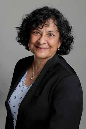
22 | PRELIMINARY REPORT 2022 The Commission Justice Nitya Iyer was appointed to the Supreme Court of British Columbia in June 2017. She started her legal career as a professor at the University of British Columbia’s faculty of law in 1990. In 1997, she was appointed to the British Columbia Human Rights Tribunal. After her term there, she went on to private practice. Justice Iyer obtained bachelor of arts and law degrees from the University of Toronto. She has a master’s degree in law from Harvard University. She was a member of the Ontario, British Colum- bia and Yukon Bars. She was awarded a Queen’s Diamond Jubilee medal in rec- ognition of her volunteer work and was named Queen’s Counsel in 2016. Justice Nitya Iyer COMMISSION CHAIR & JUSTICE OF THE SUPREME COURT OF BRITISH COLUMBIA Linda Tynan has an extensive background in local government management. She served as chief administrative officer for the District of Summerland and the Village of Nakusp and was the chief financial officer for the City of Nelson. She also held a senior management role with the Regional District of Central Kootenay. Tynan is a former president of the Gov- ernment Finance Officers Association of BC and CivicInfo BC and is a member of the Local Government Management As- sociation and the Canadian Association of Municipal Administrators. She holds a Bachelor of Business Administration from Simon Fraser University and is a Chartered Professional Accountant. Linda Tynan COMMISSIONER & LOCAL GOVERNMENT ADVISOR Page 91 of 308
Page 92
PRELIMINARY REPORT 2022 | 23 Anton Boegman was appointed as the Chief Electoral Officer of British Columbia on June 1, 2018. A planning expert and acknowledged as innovative and passionate about elections, Boegman’s focus has been improving accessibility to voting and enhancing electoral services. Anton played a senior leadership role in the past five provincial general elections, four referenda and 11 provincial by-elections. Prior to joining Elections BC, Boegman served seven years as an officer with the Royal Canadian Navy. He was also part of the initial start-up administration at Royal Roads University and worked as a technology project manager and privately as a management consultant. He graduated from the Royal Military College of Canada in 1988 with a bachelor of arts and obtained a Master of Business Administration from Athabasca University in 2001. He is also a certified project management professional. Anton Boegman COMMISSIONER & CHIEF ELECTORAL OFFICER OF BRITISH COLUMBIA Commission Staff The Commission is supported by a team of five staff, including: • Chad Stewart, Executive Director, Commission Operations • Kristopher Radford, Research and Policy Analyst • Kevin Pangman, Geography Lead • Emily Goodman, Geography Analyst • Wesley MacInnis, Communications Advisor We would like to thank Elections BC, which provided technical and administrative support to the Commission. Page 92 of 308
Page 93
24 | PRELIMINARY REPORT 2022 sq. km. Five are smaller than 10 sq. km. Forty-five ridings have more than 60,000 residents, and 10 have fewer than 40,000. Including our Commission, there have been 10 electoral boundaries commissions in the history of British Columbia since the first was appointed in 1965. Each commis- sion is required to follow the mandate or instructions contained in its governing law. All of these laws have required that com- missions be impartial and independent. Historically, most electoral boundaries laws have given commissions a lot of discretion in proposing revised electoral boundaries. Usually, they set the maximum number of new ridings that the commission may recommend, but the commission can also choose not to recommend new ridings and simply propose revisions to existing boundaries. Since 1987, commissions have been required to determine the “electoral quotient.” This number represents the average population of an electoral district. It is obtained by dividing the population of the province by the number of Evolution of B.C.'s Electoral Boundaries A brief history of electoral districts and electoral boundaries commissions in British Columbia. British Columbia is large, covering nearly one million square kilometres. However, its population is not evenly distributed; the majority lives in the southwestern corner of the province. Although the population has grown significantly since B.C. joined Canada in 1871, the uneven distribution of its population has persisted. Over the years, different legislatures have taken different approaches to achieving fair and effective representation by population for both rural and urban British Columbians. There were only 12 electoral districts in the province’s first general election. The smallest was about 12 sq. km, and the largest covered about a third of the province, from B.C.’s southern border up the coast to Alaska. Since the number of electoral districts in B.C. has increased over time, electoral districts have, on average, become smaller. But some ridings have shrunk while others have expanded. That is primarily because of the increase in urban population densi- ty. Presently, 21 of the current 87 electoral districts are larger than 10,000 sq. km, in- cluding three that are larger than 100,000 Page 93 of 308
Page 94
PRELIMINARY REPORT 2022 | 25 electoral districts. Commissions since then have been required to ensure that the population of each riding does not exceed the usual deviation range of between 25% more or less than the electoral quotient without very good reason. Two laws, one enacted in 1984 and the other in 2007, differed from B.C.’s typical electoral boundaries laws. The 1984 statute divided the province’s electoral districts into five different categories based on population density. Metropolitan districts (for example, Vancouver and Victoria) were allowed to have populations that were over 100% larger than the most sparsely populated ridings. The Supreme Court of British Columbia struck down the law, finding that it violated the right to vote in section 3 of the Canadian Charter of Rights and Freedoms by making the value of one person’s vote so different from another person’s vote depending on where they lived. In 2014, the legislature amended the law to establish a minimum number of seats for three designated regions of the province, regardless of the populations of the ridings within them. The designated regions were the North, Cariboo-Thompson and Columbia-Kootenay, which together comprised 17 electoral districts. This statute governed the proposals made by the 2015 Electoral Boundaries Commission (the 2015 Commission). In 2021, the law was amended again to remove this restriction. We discuss the law governing our Commission in the next chapter. Page 94 of 308
Page 95
26 | PRELIMINARY REPORT 2022 Context 04 — Page 95 of 308
Page 96
PRELIMINARY REPORT 2022 | 27 Key Terms, Guiding Principles and Our Process to Date THE COMMISSION CONSIDERS KEY TERMS AND CORE CONCEPTS FROM THE ELECTORAL BOUNDAR- IES COMMISSION ACT. This chapter explains the principles that guide our work and proposals for change. The first section discusses key terms used in the Electoral Boundaries Commission Act (the Act). The second section explains the more-specific guiding prin- ciples that we developed based on our understanding of the Act and the input we received during our public consultations. The third section explains our process to date. Page 96 of 308
Page 97
28 | PRELIMINARY REPORT 2022 Key Terms The Act Sections 3 and 9 of the Act set out the Commission’s mandate and the principles it must apply in making proposals for elec- toral districts: Function of Commission 3(1) The function of the commission is to make proposals to the Legislative Assembly as to the area, boundaries and names of the electoral districts of British Columbia. (2) If, in carrying out its functions under subsection (1), the commission considers that the number of electoral districts in British Columbia should be increased, the commission may make proposals to the Legislative Assembly to increase the number of electoral districts up to a max- imum of 93. Governing Principles for Electoral District Proposals 9(1) In this section, "electoral quotient" means the number obtained by dividing the population of British Columbia by the number of electoral districts in British Columbia proposed by the commission. (2) For the purposes of section 3, in making proposals as to the area included in and the boundaries of electoral districts, or proposals to increase the number of elec- toral districts, the commission must be governed by the following principles: (a) that the principle of representation by population be achieved, taking into account: (i) geographic considerations, including the accessibility, size or physical configuration of any part of British Columbia, (ii) demographic considerations, including communities of interest and the sparsity, density or rate of growth of the population of any part of British Columbia, and (iii) the availability and means of communication and transpor- tation between various parts of British Columbia; (b) that to achieve the principle of representation by population the commission may deviate from the electoral quotient by no more than 25%, plus or minus; Page 97 of 308
Page 98
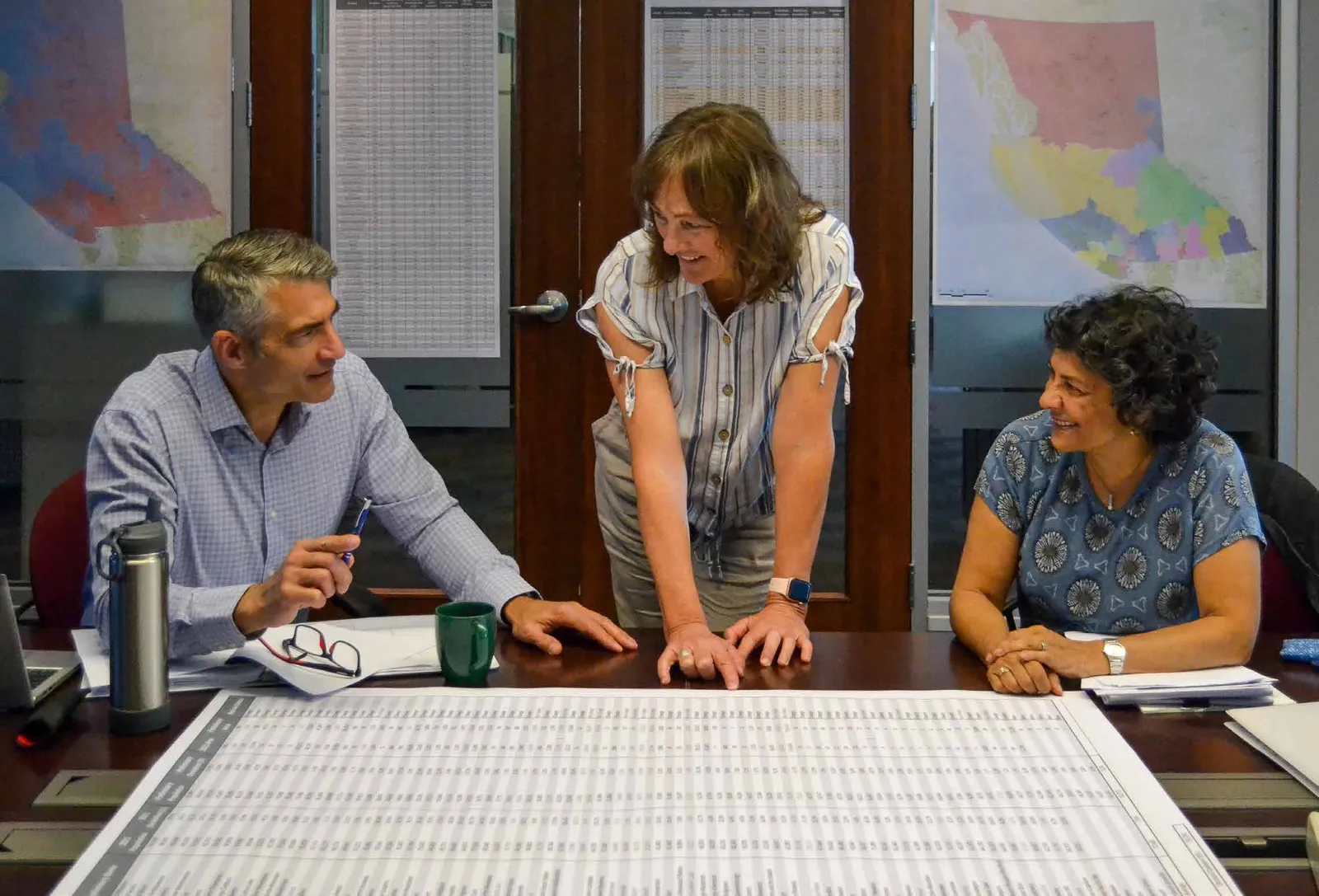
PRELIMINARY REPORT 2022 | 29 IMAGE 4: COMMISSIONER DELIB- ERATIONS, VICTORIA, B.C. CREDIT: BC ELECTORAL BOUNDARIES COM- MISSION. DATE: JUNE 24, 2022. Core Principles Section 9 of the Act establishes “repre- sentation by population” and “effective representation” as our fundamental guid- ing principles when making proposals for electoral districts. The Supreme Court of Canada has interpreted these principles in light of the right to vote in section 3 of the Canadian Charter of Rights and Freedoms. (c) that the commission may exceed the 25% deviation principle if it considers it necessary to provide for effective representation. (3) For the purposes of subsection (2)(c), in considering whether it is necessary to exceed the 25% deviation principle to provide for effective representation, the commission may take into account one or both of the following: (a) any special geographic consider- ations, including a manageable geo- graphic size for electoral districts; (b) any special demographic consid- erations, including communities of interest. Page 98 of 308
Page 99
30 | PRELIMINARY REPORT 2022 Both principles have everything to do with the right to vote and nothing to do with the results of a vote. Our recommendations for electoral boundaries must be based on the considerations set out in the Act. We must not consider the impact of our proposals on particular parties or representatives. Representation by Population Section 9 requires that “the principle of representation by population be achieved.” Representation by population, or representative democracy, refers to the type of democracy where the people elect representatives who make the laws and policies that govern everyone. There are many types of representative democracies. In British Columbia, as in all other Canadian jurisdictions, the electorate is divided into subsets called electoral districts, or ridings. The people living in each riding vote for the person they want to represent them. In order to be democratic, the number of people in each electoral district must be roughly the same. Representation by population in our democracy is therefore the right to a relatively equal voice in electing the representatives that govern us. Where a person lives, what they do for a living or how much they contribute to the economic well-being of the community does not make a difference to the weight of their vote. The principle of representation by population must be balanced with the equally important principle of effective representation. Effective Representation The principle of “effective representation,” which is also found in section 9 of the Act, complements representation by population by recognizing that differences between groups of people in different parts of the province may affect their ability to communicate with and seek assistance from their elected representatives. In Canada, elected representatives have two equally important roles. In their legislative role, they decide who forms government (usually the party with the most representatives) and what laws get passed. In their ombudsperson role, they and their staff assist constituents in dealing with government bodies. In 1991, the Supreme Court of Canada found that the purpose of the right to vote in section 3 of the Canadian Charter of Rights and Freedoms is not to guarantee absolute equality of voting power. That would require each riding to have the same number of people. Instead, the constitutional right to vote guarantees the right to effective representation by population. The Court explained that this right includes consideration of factors such as geography and community interests. It ensures that constituents in different electoral districts have relatively equal access to their representatives, both as legislators and as ombudspersons.2 In particular, the Supreme Court recognized that transportation and communications challenges in rural ridings may justify somewhat lower populations than in urban ridings.3 Factors in the Act Section 9 of the Act specifies three broad and overlapping considerations that we must apply when proposing new electoral boundaries. They are: Page 99 of 308
Page 100
PRELIMINARY REPORT 2022 | 31 • Geographic considerations, which in- clude the accessibility, size or physical configuration of any part of British Columbia; • Demographic considerations, which include communities of interest and the sparsity, density or rate of growth of the population of any part of British Columbia; and • The availability and means of commu- nication and transportation between various parts of British Columbia.
Our understanding of these terms stems from their relationship to representation by population and effective representa- tion, how these factors affect electoral boundaries in B.C. historically and pres- ently, and the ways people spoke of these factors in our initial consultations. Geographic Considerations “Accessibility” refers to how easy or hard it is for constituents to access their MLA and staff, particularly when seeking help with a particular problem. It includes access by internet, by phone and in person. It is important for MLAs to be present in communities throughout their electoral district. We know that some concerns are better addressed in face-to-face meetings. We also appreciate that, although internet and wireless communications are improving, there are significant parts of the province where these services are not reliable. “Size” refers to the physical area covered by an electoral district. The large geo- graphical size of some electoral districts, together with communication and trans- portation barriers, affects accessibility. “Physical configuration” refers to the unique geographical characteristics of an electoral district. It includes waterways, mountain ranges and other geographical features that affect accessibility. Demographic Considerations “Communities of interest” can have a wide range of meanings. In the context of electoral boundaries, it is about groups whose similar interests—whether cultural, social, economic or regional—relate to electoral representation. Trying to ensure that such groups are not divided by electoral boundaries can provide more- effective representation. We heard a great deal about the different interests of urban and rural constituents and about the shared interests of residents within a municipality. We also heard about the shared interests of smaller communities connected by a transportation corridor and about unique neighbourhoods within urban settings. “Sparsity and density” refer to the concentration of population within an electoral district or across several ridings. Both present challenges for drawing electoral boundaries. Population sparsity is a challenge in the northern part of the province because it leads to geographically large electoral districts and problems with accessibility. Population density is a problem in the Lower Mainland because it leads to electoral districts with more constituents and problems of voter inequality compared to more sparsely populated ridings. Larger populations in a district can also impede effective access to a person’s MLA. “Rate of growth” refers to how quickly the population of an area is expected to Page 100 of 308
Page 101
32 | PRELIMINARY REPORT 2022 the need for constituents and their MLA to have in-person meetings. Weather, environmental crises (such as floods and fires) and inadequate infrastructure can be significant barriers to transportation in some parts of the province. New Electoral Districts Section 3(2) of the Act permits us to propose up to six new electoral districts, increasing the number of MLAs to 93 from 87. As section 3 does not state any different factors to guide proposals for the creation of new electoral districts, we use the principles in section 9 as a guide, together with the more specific principles set out below. Notes 2. REFERENCE RE PROV. ELECTORAL BOUNDARIES (SASK), [1991] 2 SCR 158 AT PARAS 49-55. 3. REFERENCE RE PROV. ELECTORAL BOUNDARIES (SASK), [1991] 2 SCR 158. AT PARA 78. grow or shrink over time. It is an important consideration because the Act says that electoral boundaries accepted by the government will be used over the next two general elections, or about eight years. Many people we heard from referred to anticipated population growth as a reason for changing existing electoral boundaries or adding a new electoral district. Communication and Transportation Considerations In this context, “communication” generally refers to internet and cellular coverage. This is a real problem in many parts of the province, especially in mountainous areas and in more northern communities. Many urban residents are not aware of how fragile or non-existent these connections are, despite the efforts made during the pandemic to improve connectivity. “Transportation” refers to all ways of getting from one place to another. By far, the most common way of moving within electoral districts is driving. However, ferries and other forms of water transport, public transit, and even air travel are vital for people living in some areas of B.C. The availability and cost of transportation, as well as the time it takes, are important when considering Page 101 of 308
Page 102
PRELIMINARY REPORT 2022 | 33 Page 102 of 308
Page 103
34 | PRELIMINARY REPORT 2022 The Commission heard more than 200 presentations at its initial public meetings across the province. IMAGE 5: PUBLIC MEETING IN VIC- TORIA, B.C. CREDIT: BC ELECTOR- AL BOUNDARIES COMMISSION. MARCH 21, 2022. Page 103 of 308
Page 104
PRELIMINARY REPORT 2022 | 35 Our Guiding Principles How the core concepts and key terms from the Act shape our process for redistricting. Interpreting the Act Section 9 of the Act requires us to achieve representation by population that provides effective representation for British Columbians. It says we must determine the “electoral quotient,” which is the average number of British Columbians per electoral district. It tells us that we may propose electoral boundaries for ridings whose population fall within the usual deviation range of up to 25% more or less than the electoral quotient. The Act says that our proposals for revised electoral boundaries within the usual deviation range must be based on geographic factors, demographic factors and means of communication and transportation. The Act also permits us to propose boundaries for electoral districts with populations outside of the usual deviation range where “necessary to provide for effective representation.” We understand that this is a stringent test. The Act is different from its predecessor. The previous law mandated a minimum number of seats for three specific regions of the province: the North, Cariboo- Thompson and Columbia-Kootenay, which together comprised 17 electoral districts. Ten of these ridings had populations that were lower than 25% below the electoral quotient. No ridings outside these regions had populations as low. The 2015 Commission did not have the power to reduce the number of ridings in these regions or adjust their boundaries, regardless of their population. In 2021, the legislature repealed these provisions. We heard from many residents, particularly from these three regions, that they wanted us to take the same approach and preserve these 17 electoral districts as the previous law had required. We cannot do that because we must comply with the Act as it exists now. Our Act requires us to look at the boundaries of every electoral district in the province. For a riding whose population falls outside the usual deviation range, we must consider whether it is possible, in light of the statutory factors, to revise Page 104 of 308
Page 105
36 | PRELIMINARY REPORT 2022 its electoral boundaries to bring it within the usual deviation range. If it is not, we must decide whether special geographic or demographic considerations make the unusual deviation truly necessary. Specific Principles Based on our understanding of the Act, we developed additional specific principles to guide our deliberations. We did not prioritize them but used them as touchstones in our discussions. They are: • Only make changes where they are needed. We consider continuity important. While it is possible to approach electoral boundaries with a blank slate, this would cause a lot of disruption and would not respect the historical traditions of communities within the same electoral district.
• Allow for future population growth. The Act is forward looking and the recommendations we make, if accepted, will apply for the next two general elections.
• Balance populations in the same area. The Act does not divide British Co- lumbia into formal regions. However, British Columbians commonly identify themselves as living in particular areas, such as the North, or the Interior. We recognize this reality by trying to reduce population disparities within each area.
• Use existing boundaries. There are an astonishing number of boundaries in the province quite apart from federal and provincial electoral districts. They include municipalities, First Nations territories, regional districts and school districts. We used existing boundaries as much as possible to reduce confusion.
• Use geographical boundaries. Existing boundaries are often drawn along natural boundaries, such as waterways, mountains and major highways. People tend to think of them as natural divid- ers, and we wanted to reflect that in our boundary drawing.
• Avoid splitting Indigenous commu- nities. Although the Declaration on the Rights of Indigenous Peoples Act and the UN Declaration on the Rights of Indigenous Peoples (UNDRIP) are directed at governments and not in- dependent commissions such as ours, we adopt this principle because it is consistent with the objectives of our Act.
• Consider the ombudsperson role of an MLA. This principle reminds us that an MLA’s ombudsperson role is as important as their legislative role. We recognize that being an effective ombudsperson may be harder in more sparsely populated ridings with fewer services.
• Reduce the number of electoral dis- tricts falling outside the 25% deviation range. We believe this principle fol- lows from the core concept of repre- sentation by population and the Act’s definition of the usual deviation range. By increasing the number of ridings within that range, we reduce the need for exceptions.
Page 105 of 308
Page 106
PRELIMINARY REPORT 2022 | 37 • Change names of ridings only where necessary and prefer inclusive names. Traditionally, names of provincial ridings have referred to larger com- munities or distinct geographical areas. We wanted to continue that approach with names that reflect the breadth of the riding. We also wanted to keep names relatively short and to try to ensure that, in alphabetic lists of ridings, those in the same geographical area would be listed together. Page 106 of 308
Page 107
38 | PRELIMINARY REPORT 2022 The Commission travelled more than 10,000 km by car, ferry and plane in its preliminary input phase—a lesson in B.C.'s vast geographic area. IMAGE 6: PUBLIC MEETING IN REVELSTOKE, B.C. CREDIT: BC ELECTORAL BOUNDARIES COM- MISSION. APRIL 7, 2022. Page 107 of 308
Page 108
PRELIMINARY REPORT 2022 | 39 Our Process to Date We were appointed as Commissioners on October 21, 2021. Our first virtual meeting was a week later, on October 28, and our first in-person meeting was on November 4. None of us knew each other previously. At the outset, we agreed that we wanted to operate by consensus. We would talk through any issues until we all felt comfortable with how to proceed. We agreed that our first steps should be to better understand the importance of electoral boundaries and redrawing them. We invited experts to talk with us about electoral boundary law, the experience of prior electoral boundary commissions, demographics, population statistics and mapping. We also determined what staff we needed to hire. Our staff joined us be- tween December 2021 and February 2022. In our initial meetings, we decided that we wanted to be as accessible and transparent as possible. We wanted to visit as many communities in all areas of the province as we could, especially areas outside the Lower Mainland and Victoria. Recognizing the limitations posed by travel times and distances, as well as by the COVID-19 pandemic, we decided to hold virtual meetings in addition to in- person meetings. Our website went live on February 22, 2022. As part of our efforts to increase awareness, we began a media campaign asking for feedback on the area, boundaries and names of the current provincial electoral districts. We directly contacted First Nations organizations, local governments, MLAs and others that we thought might be interested in our work. We advertized in newspapers, on radio and television, as well as online. Recognizing the challenge in asking the public to comment on a topic as abstract as provincial electoral boundaries, we de- scribed our Commission and our mandate in our outreach materials and at public meetings. We chatted with people infor- mally and answered questions after our in-person and virtual public meetings. Our website has a survey tool that prompts people with questions about their elec- toral district in relation to the factors in the Act. In addition to public meetings and our website, we accepted submissions by email or post, and over the phone. The initial public consultation phase ended on May 31, 2022. We heard from people at 50 public meetings in 43 communities, and we received over 1,000 submissions. Page 108 of 308
Page 109
40 | PRELIMINARY REPORT 2022 We learned a great deal from this con- sultation, both about British Columbians’ views on electoral boundaries in general and in their particular districts, and about the process of public outreach campaigns. What we heard about electoral bound- aries has significantly influenced our rec- ommendations. What we learned about public outreach will influence our final round of public consultation. We spent two weeks deliberating in June 2022, and the months of June, July and August writing this initial report. Page 109 of 308
Page 110
PRELIMINARY REPORT 2022 | 41 Page 110 of 308
Page 111
42 | PRELIMINARY REPORT 2022 Recommendations 05 — Page 111 of 308
Page 112
PRELIMINARY REPORT 2022 | 43 Introduction This chapter contains our proposals for electoral boundary adjustments. For ease of reading, we have divided the province into 11 geographical areas organized in the order that we discussed them during our deliberations. Each area contains overviews and descriptions of our proposed boundaries for the electoral districts in that area, together with maps of each area and district. We have listed electoral districts within each area or sub-area alphabetically. We propose two changes with province-wide effects. First, we consider that six additional electoral districts are necessary to provide British Columbians with effective representation. Second, we propose three technical mapping changes to improve electoral riding maps. These technical mapping changes do not affect populated areas. In our view, six additional ridings are a necessary response to the province’s significant population growth since the 2015 Commission and the projected population growth trends in densely populated urban areas. We propose to locate these new electoral districts in Langford, Kelowna, Langley, Burnaby, Surrey and Vancouver. With 93 electoral districts, the electoral quotient is 53,773, and the usual deviation range is between 40,330 and 67,216 people in each electoral district. Many people told us that they believe new electoral districts are needed in areas where the population of existing ridings Page 112 of 308
Page 113
44 | PRELIMINARY REPORT 2022 Legend ! Community Railway Road River, Creek Waterbody Greenspace Park First Nations First Nations Land Claim Settlement Administrative Boundary Municipality Electoral District Boundary Coincidental Electoral District/Admin Boundary is significantly more than 25% over the electoral quotient. Some said that it is unfair that a vote in the densest urban ridings is currently worth one-fourth of a vote in the province’s least populous ridings. We received several detailed proposals about where new districts should be situated. Some residents of more sparsely populated ridings said that creating new districts in densely populated communities was an effective way to reduce the population disparity between urban and rural areas without reducing the number of rural ridings. Our initial review of the populations of existing electoral districts also pointed to the need for new ridings. Using 2021 population figures and the 87 existing electoral districts, six electoral districts are over the maximum of 25% more than the electoral quotient. Four of them are 30% over the electoral quotient and one is more than 40% over. Many of these ridings are next to one another and the problem is compounded by the fact that these areas are projected to continue to grow faster than the average population growth rate. Adding six new electoral districts as we propose not only alleviates the problem of over-populated ridings but is also an effective way to address ridings whose populations are less than the minimum usual deviation of 25% below the electoral quotient. The new ridings lower the bottom of the usual deviation range from the current minimum of 43,111 people in a riding to 40,330. That means fewer boundary adjustments are needed to bring more sparsely populated ridings within the usual deviation range. As a result, the weight of a vote in the province’s least populated riding will no longer be four times more than the weight of a vote in the province’s most densely populated riding. The difference will be about three to one. We believe our proposal strongly supports the twin principles of representation by population and effective representation for all British Columbians, as the Act requires. Page 113 of 308
Page 114
PRELIMINARY REPORT 2022 | 45 The three technical mapping changes we propose affect how electoral maps are drawn in unpopulated areas. First, we adjust riding boundaries on the Pacific coast to coincide with existing regional district boundaries, which follow the coastline at a 5 km distance out to sea. Presently, coastal boundaries are drawn at a much greater distance, unnecessarily incorporating more unpopulated ocean area into these ridings. Second, we adjust existing electoral district boundaries in unpopulated areas to coincide with nearby municipal or administrative boundaries. Third, we orient electoral district boundaries that continue into inland waterways to angles of zero, 90, 180 or 270 degrees. The proposed electoral district maps in this report incorporate these changes. Page 114 of 308
Page 115
46 | PRELIMINARY REPORT 2022 Page 115 of 308
Page 116
PRELIMINARY REPORT 2022 | 47 Vancouver Island Current Electoral Districts (14) Proposed Electoral Districts (15) Courtenay-Comox Courtenay-Comox Cowichan Valley Cowichan Valley Esquimalt-Metchosin Esquimalt-Colwood Langford-Juan de Fuca Juan de Fuca-Malahat Mid Island-Pacific Rim Langford-Highlands Nanaimo Mid Island-Pacific Rim Nanaimo-North Cowichan Nanaimo-Gabriola Island North Island Nanaimo-Ladysmith Oak Bay-Gordon Head Nanaimo-Oceanside Parksville-Qualicum North Island Saanich North and the Islands Oak Bay-Gordon Head Saanich South Saanich North and the Islands Victoria-Beacon Hill Saanich South Victoria-Swan Lake Victoria-Beacon Hill
Victoria-Swan Lake TABLE 1: VANCOUVER ISLAND ELECTORAL DISTRICTS NOTE: THIS CHAPTER USES PROPOSED ELECTORAL DISTRICT NAMES Page 116 of 308
Page 117
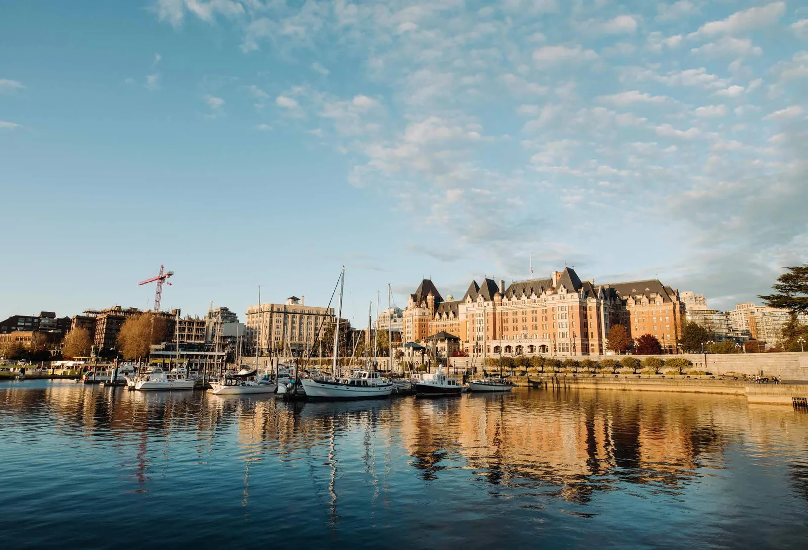
48 | PRELIMINARY REPORT 2022 IMAGE 7: VICTORIA CAUSEWAY MARINA, VICTORIA, B.C. CREDIT: ARMON ARANI. MAY 11, 2020 fast-growing Greater Victoria area, to move the Victoria West neighbourhood out of the Victoria-Beacon Hill district, and to recognize the strong community links between Cumberland, Courtenay and Comox. We propose creating a new electoral district in the Langford area, called Langford-Highlands, to address the rapid population growth in Greater Victoria, with consequent changes to neighbouring ridings. We recommend boundary changes Presently, the Vancouver Island area is made up of 14 electoral districts. They encompass all of Vancouver Island, adjacent islands and the area defined by the boundaries of the Regional District of Mount Waddington, which includes parts of the mainland. The Vancouver Island area is growing quickly but unevenly. It includes dense urban centres, large fast-growing suburban neighbourhoods and smaller slower growing rural communities. In parts of this area, geographic features such as waterways shape connections between communities. Many people living on the Island believe that the current electoral boundaries continue to serve their communities well. However, there is pressure for change in some communities. These include calls to create an additional riding in the Page 117 of 308
Page 118
PRELIMINARY REPORT 2022 | 49 in a number of other electoral districts to accommodate existing and projected population growth. As a result of these changes, we are proposing name changes to five electoral districts. We believe that these changes better reflect the communities that comprise these ridings. The population distribution, and anticipated growth in the Comox Valley do not support a proposal to move Cumberland into the same electoral district as Courtenay and Comox at this time. Doing so would result in a Mid Island- Pacific Rim riding with a population far less than that of the neighbouring Courtenay- Comox electoral district. Greater Victoria The Greater Victoria area is situated on the southern tip of Vancouver Island, running up to Port Renfrew on the west coast and including the Southern Gulf Islands to the north and east. Our key proposals include adding a new electoral district centred on Langford; moving the Victoria West neighbourhood out of the Victoria- TABLE 2: VANCOUVER ISLAND POPULATION, DEVIATION AND AREA SOURCE: 2021 STATISTICS CANADA CENSUS COUNT Electoral District Population Deviation (%) Area (sq km) Courtenay-Comox 60,354 12.2 1,587 Cowichan Valley 54,199 0.8 1,916 Esquimalt-Colwood 58,343 8.5 53 Juan de Fuca-Malahat 44,931 -16.4 3,116 Langford-Highlands 49,114 -8.7 86 Mid Island-Pacific Rim 58,783 9.3 11,830 Nanaimo-Gabriola Island 58,924 9.6 780 Nanaimo-Ladysmith 54,385 1.1 1,783 Nanaimo-Oceanside 60,069 11.7 899 North Island 58,940 9.6 39,933 Oak Bay-Gordon Head 56,466 5.0 302 Saanich North and the Islands 57,346 6.6 1,514 Saanich South 59,226 10.1 96 Victoria-Beacon Hill 54,375 1.1 83 Victoria-Swan Lake 54,780 1.9 18 Total/Average 840,235 0.4 63,996 Page 118 of 308
Page 119
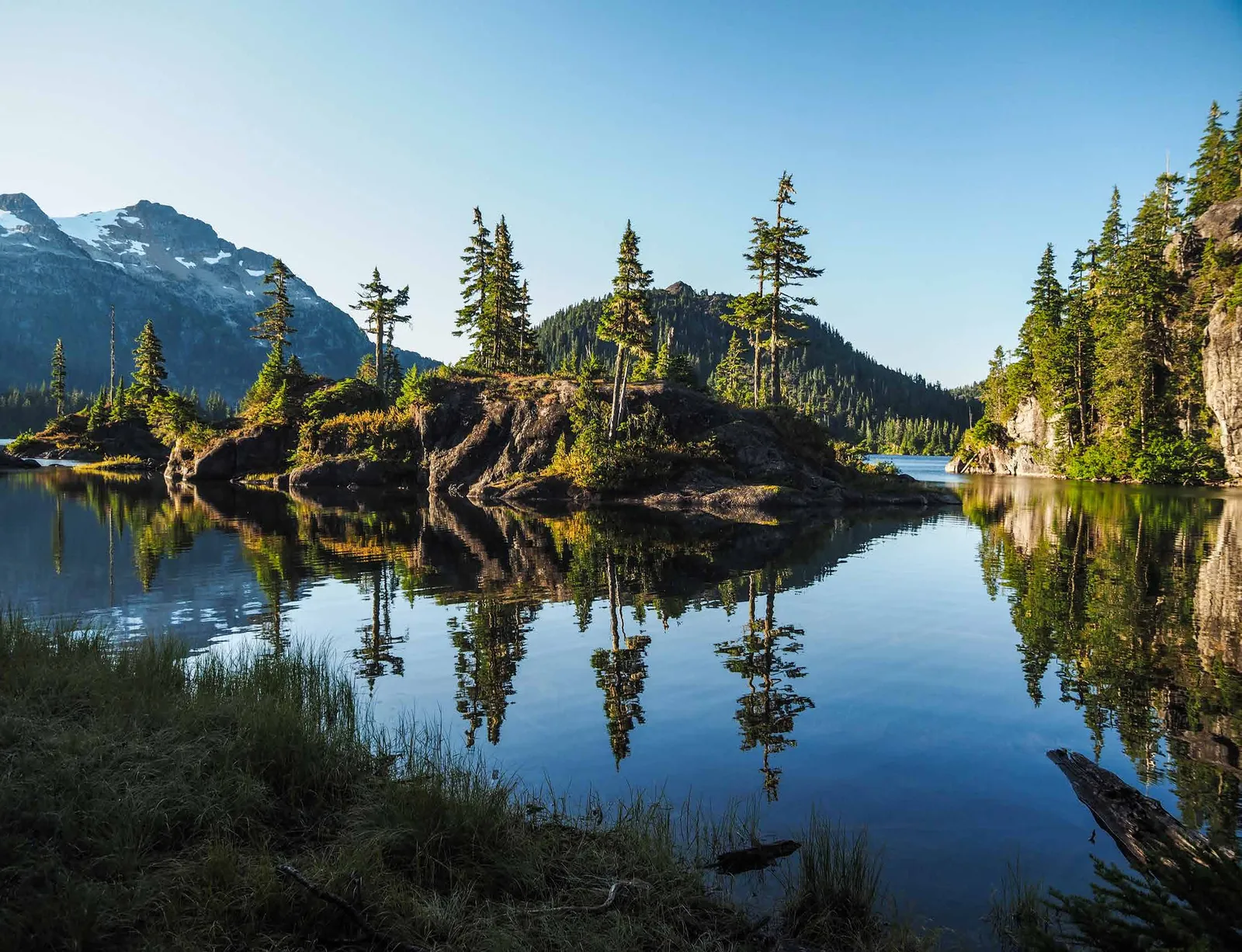
50 | PRELIMINARY REPORT 2022 IMAGE 8: FORBIDDEN PLATEAU, STRATHCONA PROVINCIAL PARK, B.C. CREDIT: LESLY DERKSEN MAY 5, 2019 Juan de Fuca-Malahat Our proposal for this riding unites the communities along the Strait of Juan de Fuca—Metchosin, Sooke and Port Renfrew—with those north of the Malahat Pass—Shawnigan Lake, Mill Bay and Cobble Hill. We believe combining several smaller communities and rural areas in one electoral district is preferable to the alternative of moving part of the Juan de Fuca region into the Cowichan Valley riding. Beacon Hill riding and into Esquimalt- Colwood; and moving Brentwood Bay from Saanich North and the Islands into Saanich South. Esquimalt-Colwood Esquimalt-Colwood includes the fast- growing municipalities of Colwood, View Royal, and Esquimalt. We heard that the Victoria West neighbourhood is more closely connected with communities west of the Gorge Waterway than with the City of Victoria. Their shared interests include transit corridors such as the E&N Trail and the Island Highway. We therefore propose adding Victoria West to this riding. Page 119 of 308
Page 120
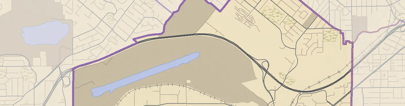
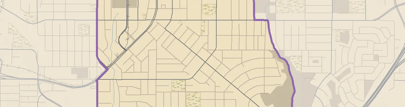
PRELIMINARY REPORT 2022 | 51 Langford-Highlands The population of the City of Langford has grown by 31.8% over the past five years and is projected to continue growing rapidly. To address this, we propose a new electoral district whose boundaries follow the municipal boundaries of the City of Langford and the District of Highlands. Oak Bay-Gordon Head This riding includes the municipality of Oak Bay, the Saanich neighbourhoods of Gordon Head and Cadboro Bay, the Gonzales neighbourhood of Victoria and the University of Victoria. It has room for growth within its current boundaries and we propose no changes. Saanich North and the Islands This electoral district includes much of Central Saanich, as well as North Saanich, Sidney and the Southern Gulf Islands. Moving the community of Brentwood Bay from this riding into Saanich South, as we propose, creates room for the anticipated population growth in this riding. Saanich South This riding includes the Saanich neigh- bourhoods of Royal Oak, Cordova Bay, Prospect Lake and Brentwood Bay. We propose moving Brentwood Bay into this electoral district to address the popula- tion disparity between it and the adjacent riding of Saanich North and the Islands. Victoria-Beacon Hill Victoria-Beacon Hill contains the City of Victoria’s urban core. It includes the downtown area, and the James Bay, Fairfield, Rockland, Harris Green, North Park and Fernwood neighbourhoods. Our proposal to move the Victoria West neighbourhood out of this riding creates room for anticipated growth. Victoria-Swan Lake Victoria-Swan Lake encompasses the neighbourhoods north of downtown Victoria, including Tillicum, Burnside, Oak- lands and Lake Hill. Its existing boundaries work well, and we propose no changes. Greater Nanaimo In addition to the City of Nanaimo, the three electoral districts in Greater Nanaimo run from Ladysmith in the south to Qualicum Beach in the north. Some residents suggested that the City of Nanaimo should have its own riding. Doing so would create a riding with a population exceeding the maximum of the usual deviation range, compromising effective representation by population. Instead, we propose adjusting the boundaries of the three existing Nanaimo ridings to better balance their populations. Nanaimo-Gabriola Island This electoral district consists of Nanai- mo’s downtown core, adjacent neigh- bourhoods, and the Snuneymuxw First Nation communities to the south of the city centre. We included Gabriola Island in this riding because its access to Vancouver Island is through downtown Nanaimo. Nanaimo-Ladysmith Nanaimo-Ladysmith includes Ladysmith, Cassidy, Cedar and Yellow Point, as well as the fast-growing suburban part of north Page 120 of 308
Page 121
52 | PRELIMINARY REPORT 2022 Nanaimo between Departure Bay Road in the south and Brickyard, Rutherford and Mostar roads in the north. We are not proposing an exclusively North Nanaimo riding because we wanted to balance its population with the adjacent Nanaimo- Oceanside electoral district. Nanaimo-Oceanside This riding includes the Oceanside communities of Parksville, Qualicum, French Creek, Nanoose Bay and Lantzville. It also includes the northern neighbourhoods of Nanaimo to the west of Brickyard, Rutherford and Mostar roads. Other than the riding name, we are not proposing changes to this district. Other Vancouver Island Ridings Courtenay-Comox This electoral district includes Courtenay, Comox, Little River, Merville and Black Creek. For the reasons explained in the Vancouver Island area overview, we propose no changes to this electoral district’s boundaries at this time. Cowichan Valley This riding consists of Cowichan Valley communities including Duncan, Lake Cowichan and Cowichan Bay. We propose boundary adjustments to include Chemainus in the north and Cherry Point in the south. These changes better balance the population of this riding with its neighbours. Mid Island-Pacific Rim Mid Island-Pacific Rim spans the middle of Vancouver Island, encompassing communities on both coasts. These include Ucluelet, Tofino, Port Alberni, Qualicum Bay, Cumberland, and Denman and Hornby Islands. For the reasons explained in the Vancouver Island area overview, we propose no changes to this electoral district’s boundaries at this time. North Island This electoral district encompasses the northern portion of Vancouver Island, adjacent islands and the area defined by the boundaries of the Regional District of Mount Waddington, which extends onto the mainland. It includes the communities of Campbell River, Sayward, Port McNeill, Port Hardy and Alert Bay. Although its population is within the usual deviation range, it is less than its neighbours. We consider that its comparatively large geographical area and uneven population distribution continue to support its present boundaries, and we propose no changes to this riding. Page 121 of 308
Page 122
PRELIMINARY REPORT 2022 | 53 Proposals | Vancouver Island Vancouver Island 15 12 14 11 9 10 13 15 Washington SEE INSET 5 Qualicum Beach Port Alice Zeballos Port McNeill Sayward Port Alberni Tofino Campbell River Gold River Tahsis Lake Cowichan Sidney Cumberland Alert Bay Ladysmith Port Hardy Nanaimo Duncan North Cowichan Ucluelet Courtenay Parksville Comox ¯ 1:2,500,000 0 50 100 25 (km) ¯ Vancouver Island 5 6 8 4 2 3 1 7 Saanich Victoria Esquimalt Colwood Highlands Langford Metchosin Central Saanich Oak Bay ¯
- Esquimalt-Colwood
- Juan de Fuca-Malahat
- Langford-Highlands
- Oak Bay-Gordon Head
- Saanich North and the Islands
- Saanich South
- Victoria-Beacon Hill
- Victoria-Swan Lake
- Nanaimo-Gabriola Island
- Nanaimo-Ladysmith
- Nanaimo-Oceanside
- Courtenay-Comox
- Cowichan Valley
- Mid Island-Pacific Rim
- North Island Electoral Districts Page 122 of 308
Page 123
54 | PRELIMINARY REPORT 2022 Proposals | Vancouver Island Esquimalt-Colwood E& N R ail Trail Esquimalt-Colwood Electoral District Juan de Fuca-Malahat Electoral District Saanich South Electoral District Victoria- Beacon Hill Electoral District Victoria-Swan Lake Electoral District Langford-Highlands Electoral District 1 17 1 1 1 17 Bay St Jacklin Rd Soo ke Rd Gol dstre am A v e Islan d H wy Ad m ira l s R d Colv ille Rd E s q u im al t R d Lampson St Crai g flo wer R d Tran s-C anada Hwy Bur nsi d e Rd W B u rns i de R d W Adm iral s R d Tra n s-Canada Hwy Vet era n s M e m or ial P ky H e l mck e n R d Lat ori a R d Wis har t R d Me tc h os in R d Lago o n Rd Mil lstr e am Rd D u k e Rd E Duke Rd W W ilk ins on R d Ro y al O a k Dr Mann Ave We s t S aanic h Rd McKenzie Ave Gorge Rd E Gorg e R d W Obed Ave Qu ad ra St Dallas Rd Isl an d H w y Go r ge Wa t erw ay Portage Inlet Esquimalt Harbour Esquimalt Lagoon Vict oria Harbour Strait of Juan de Fuca Francis/King Regional Park Thetis Lake Regional Park New Songhees 1A Saanich Victoria Esquimalt Colwood Highlands Langford View Royal Metchosin Victoria Capital Regional District Belmont Park Victoria West Strawberry Vale Sevenoaks Royal Oak James Bay Lake Hill Marigold Braemar Heights Albert Head Colquitz Tillicum Burnside 1:60,000 0 1 2 0.5 (km) Page 123 of 308
Page 124
PRELIMINARY REPORT 2022 | 55 Proposals | Vancouver Island Juan de Fuca-Malahat 14 17 1 14 1 17 1 Colwood Highlands Langford Metchosin Sooke Saanich Central Saanich North Saanich Mid Island-Pacific Rim Electoral District Cowichan Valley Electoral District Esquimalt- Colwood Electoral District Juan de Fuca-Malahat Electoral District SEE INSET A Saanich South Electoral District Langford- Highlands Electoral District Saanich North and the Islands Electoral District Victoria-Beacon Hill Electoral District Pacific Rim National Park Sooke Hills Wilderness Regional Park Juan de Fuca Provincial Park East Sooke Park W e st Coa s t Rd W e st C o ast R d O t t er Poi n t Rd Ea s t S o o ke Rd Renfre w Rd We s t S haw n ig a n L a ke Rd Shawnig an L a k e Rd Sooke R d Capital Regional District Cowichan Valley Regional District Cowichan Valley Regional District Capital Regional District CVRD -EA E CVRD - EA B CVRD - EA B CVRD - EA F Sa n Juan River Loss Creek Jord an R iver Ko ksi l ah R iver Ha rri s Cr eek M u ir C r e e k Gordon R iver Shirley East Sooke Port Renfrew Jordan River Malahat Mill Bay Shawnigan Lake Deerholme Washington Washington Washington Washington Sooke Lake Strait of Juan de Fuca Saan ich I nlet Cobble Hill Arbutus Ridge Cowichan Station Cowichan Bay Fairbridge Cherry Point Juan de Fuca- Malahat Electoral District INSET A Cowichan Valley Electoral District Saanich North and the Islands Electoral District 1 Aros Rd Koksilah Rd Mo un tai n Rd W il m o t Rd Te le gr a ph Rd Fis h er R d C h er ry P oin t R d Cob ble H ill R d Ki n g b ur n e Dr R i v e rs id e R d K o k s ila h R iver Capital Regional District Cowichan Valley Regional District CVRD - EA B CVRD - EA E 0 8 16 4 (km) 1:370,000 Page 124 of 308
Page 125
56 | PRELIMINARY REPORT 2022 Proposals | Vancouver Island Langford-Highlands Goldstream Luxton Braemar Heights Happy Valley Malahat Prospect Lake Belmont Park S o u t h e r n V a nc ouve r I s l a n d R R Southern Van couv er Is l a n d RR Southern Va nc ou v e r Islan d RR Langford-Highlands Electoral District Esquimalt-Colwood Electoral District Juan de Fuca-Malahat Electoral District Saanich South Electoral District Juan de Fuca-Malahat Electoral District 1 1 1 1 Jacklin Rd Interurban Rd Wallace Dr L a t or i a R d H a ppy V al ley Rd So o ke Rd Hu m pb ack Rd G o l d s tream Ave Vete rans M e m o ria l P k y Tre a no r A v e M ill s tre am R d Trans-Ca n ada Hwy M i l l stre am L a k e R d Ro ss
Du rranc e Rd W i llis P o int Rd Oldfield Rd West S aan i ch R d B u r n sid e R d W Golds tream A ve So oke Rd Isla n d H wy Veter ans M e mo rial Pky Wi shar t R d Metchosin Rd La go o n R d Langford Lake Saanich Inlet Prospect Lake Esquimalt Harbour Strait of Juan de Fuca Finlayson Arm Francis/King Regional Park Goldstream Provincial Park Mount Wells Regional Park Thetis Lake Regional Park Sooke Hills Wilderness Regional Park Mount Work Regional Park Gowlland Tod Provincial Park Sooke Hills Wilderness Regional Park Thetis Lake Regional Park Saanich Esquimalt Colwood Highlands Langford View Royal Metchosin Central Saanich Capital Regional District Cowichan Valley Regional District 1:77,000 0 1.5 3 0.75 (km) Page 125 of 308
Page 126
PRELIMINARY REPORT 2022 | 57 Proposals | Vancouver Island Oak Bay-Gordon Head Discovery Island 3 Chatham Islands 4 Griffin Island Great Chain Island Trial Islands Saanich Victoria Oak Bay Saanich Oak Bay-Gordon Head Electoral District Saanich North and the Islands Electoral District Victoria-Swan Lake Electoral District Saanich South Electoral District Victoria-Beacon Hill Electoral District Mount Douglas Park Uplands Park Discovery Island Marine Provincial Park Ross Bay Cemetery Arbutus Rd Oak Bay Ave Fort St Moss St McNeill Ave Ash Rd Cedar Hill Rd Tyndall Ave Pandora Ave Beach Dr Hillside Ave Majestic Dr Beach Dr Sinclair Rd Torquay Dr Lansdowne Rd Shelbourne St Foul Bay Rd Beach Dr Cedar Hill Rd Tudor Ave Feltham Rd San Juan Ave Kenmore Rd Gordon Head Rd Transit Rd Cor dova Ba y Rd D a llas Rd Fa i r f ie ld R d Rich a rds o n S t R ic h mond Ave Richmond Rd Bay St Newton St H e n der so n Rd C a db o ro B ay Rd North Dairy Rd Ced ar H i ll Cross Rd M c K e n z i e A ve McK enz i e A ve G r and v ie w Dr Ar but u s Rd C a d b o r o B ay R d B e a c h D r Cook St Cook St Blen kin sop Rd Strait of Juan de Fuca Cadboro Bay Oak Bay Ross Bay Haro Strait Cadboro Bay Gordon Head Gonzales Fairfield Fernwood University of Victoria Oaklands Rockland Electoral District Extents 1:53,000 0 1 2 0.5 (km) Page 126 of 308
Page 127
58 | PRELIMINARY REPORT 2022 Proposals | Vancouver Island Saanich North and the Islands 17 1 1 17 Saltspring Island Galiano Island Saturna Island Pender Island Valdes Island Mayne Island Sidney Island Prevost Island Moresby Island Portland Island James Island Saanich Highlands Delta North Cowichan Juan de Fuca- Malahat Electoral District Langford- Highlands Electoral District Saanich North and the Islands Electoral District Saanich South Electoral District Delta South Electoral District Nanaimo-Ladysmith Electoral District Oak Bay-Gordon Head Electoral District SEE INSET A Cowichan Valley Electoral District Mount Maxwell Provincial Park Ruckle Provincial Park Gulf Islands National Park Reserve Porlier Pass Rd Po rli er P a s s R d Su n s e t Dr N o r t h E nd R d M an se ll R d Fulfor d
G a n g es Rd Bea ve r P o int R d East Point Rd Capital Regional District Cowichan Valley Regional District Cowichan Valley Regional District Capital Regional District Capital Regional District Montague Harbour Sturdies Bay Vesuvius Ganges Long Harbour Fulford Harbour Bedwell Harbour Cowichan Bay Cobble Hill Mill Bay Otter Bay Washington Washington Washington Washington Strait of Georgia Saanich Inlet Haro Strait Boundary Pass Saanich South Electoral District Saanich North and the Islands Electoral District Capital Regional District North Saanich INSET A 17 17 Coal Island Piers Island James Island Saanich Sidney Central Saanich McTavish Rd Wain Rd Mills Rd L a n ds End Rd West S a a n ic h Rd M t N e wton Cr o s s R d P at ricia Bay H wy We s t Sa a nich Rd Saanich Inlet Haro Strait Cole Bay 3 South Saanich 1 East Saanich 2 Keating Deep Cove Brentwood Bay 1:265,000 0 5 10 2.5 (km) Page 127 of 308
Page 128
PRELIMINARY REPORT 2022 | 59 Proposals | Vancouver Island Saanich South Saanich South Electoral District South Saanich 1 17 1 17 17 1 1 Saanich Highlands Langford Saanich Central Saanich Victoria Esquimalt View Royal Colwood Saanich Juan de Fuca- Malahat Electoral District Esquimalt-Colwood Electoral District Langford-Highlands Electoral District Oak Bay-Gordon Head Electoral District Saanich North and the Islands Electoral District Victoria-Swan Lake Electoral District Gowlland Tod Thetis Lake Regional Park Francis/King Regional Park Mount Work Bear Hill Regional Park Elk/Beaver Lake Regional Park Mount Douglas Park Regional Park Provincial Park Interurban Rd Oldfield Rd Ros s-D urra nce Rd Bu r n s i de R d W Ro ya l O ak D r C ed a r H i ll Rd E m il y C a r r D r Wi l kinso n R d Mann Ave Q ua d r a S t H e l m c k e n R d C ar ey Rd Glanford Ave Ad mi r a l s R d McKenzie Ave Till icu m R d C ed a r Hill X Rd Trans-Cana d a Hw y I n te r u rb a n R d W ill i s Point Rd C la r em o n t A ve C or d o v a B a y R d Patric ia B a y Hwy Old I s l a n d H w y Bl en kinsop Rd Ash Rd S helbou r n e S t M c K e n z ie A v e James Island Patricia Bay Hwy Bu rns i d e R d W C o r d ov a Ba y Rd Ravine Way Carey Rd Keating Cross Rd West S a ani ch Rd Wes t Saa nic h Rd Mt N ew ton C ro ss Rd Stellys Cross Rd Central Saanich Rd B e n ve n ut o Av e Wal l ace Dr Wa lla c e D r Wall a ce Dr Tr e a nor Av e Mi l l st re a m Rd Cra igfl ower Rd Capital Regional District Cowichan Valley Regional District Esquimalt Harbour Strait of Georgia Elk Lake Beaver Lake Prospect Lake Maltby Lake Durrance Lake Saanich Inlet Portage Inlet Swan Lake Royal Oak Marigold Brentwood Bay Beaver Lake Colquitz Cordova Bay Prospect Lake Lake Hill Keating Saanichton Tillicum Belmont Park 1:77,000 0 1 2 0.5 (km) Page 128 of 308
Page 129
60 | PRELIMINARY REPORT 2022 Proposals | Vancouver Island Victoria-Beacon Hill Victoria-Beacon Hill Electoral District Esquimalt-Colwood Electoral District Juan deFuca-Malahat Electoral District Oak Bay- Gordon Head Electoral District Victoria-Swan Lake Electoral District 1 17 Vancouver St Catherine St Haultain St Niagara St Richmond Rd Cook St Kingston St Bay St Fisgard St Erie St Fernwood Rd Menzies St Moss St Balmoral Rd Fairfield Rd Begbie St Pandora Ave Quadra St Oswego St Johnson St Douglas St Belleville St Southgate St Yates St Ri ch m on d A ve Superior St Richardson St Chandler Ave Bay St Fair fi e l d R d Richmond Ave D a llas Rd Dall as R d Dallas Rd Bla nsh ard St Dou gla s S t Government St Cook St She lbou r n e S t Pand ora A v e Johnson St Yates St Fort St Moss St Government St R o c kla nd A ve Oak Bay Ave Fort St Fort St Cook St St Charles St St C harl e s S t E s q u i m alt Rd Bay St Ross Bay Victoria Harbour Gor ge W ate r w a y Strait of Juan de Fuca Beacon Hill Park Ross Bay Cemetery Clover Point Park Victoria Esquimalt Victoria Victoria Victoria James Bay Fairfield Fernwood Rockland North Park Vic West Electoral District Extents 0 0.5 1 0.25 (km) 1:21,000 Page 129 of 308
Page 130
PRELIMINARY REPORT 2022 | 61 Proposals | Vancouver Island Victoria-Swan Lake 1 17 Saanich Victoria Esquimalt View Royal Victoria Saanich Saanich Saanich Esquimalt-Colwood Electoral District Oak Bay-Gordon Head Electoral District Saanich South Electoral District Victoria-Beacon Hill Electoral District Victoria-Swan Lake Electoral District Cuthbert Holmes Park Topaz Park Playfair Park Braefoot Park Tillicum Park Mount Tolmie Park Hampton Park Summit Park Swan Lake Park Burnside Rd E Trans-Canada Hwy Burnside Rd W Hillside Ave Quadra St Bay St Sa an i ch R d Patricia Bay Hwy Tillicum Rd Richmond Rd Finlayson St Cook St Gorge Rd W Cedar Hill Cross Rd Gorge Rd E Cedar Hill Rd Shelbourne St Cedar Hill Rd Cloverdale Ave Shelbourne St Douglas St Admirals Rd McKenzie Ave McKenzie Ave Blenkinsop Rd Tillicum Rd Harriet Rd Int er u rb an Rd Bay St Tolmie Ave Trans-Canada Hwy Blan sh a r d St Hillside Ave Lansdowne Rd Ceda r Hill Cro s s R d Ca r ey Rd Patricia Bay Hwy Newton St North Dairy Rd Ravine Way M c K e n zie Ave Cook St Quadra St Douglas St Blansh ard St Craigflower Rd Interurban Rd Quadra St Blenki n sop R d C e dar H ill Rd Richmond Rd Fernwood Rd Haultain St Begbie St Government St Lampson St Esq u ima lt Rd Victoria Harbour Gorge Waterway Portage Inlet Lake Hill Tillicum Oaklands Burnside Strawberry Vale Sevenoaks Marigold Colquitz Fernwood North Park Vic West 0 0.5 1 0.25 (km) 1:33,500 Page 130 of 308
Page 131
62 | PRELIMINARY REPORT 2022 Proposals | Vancouver Island Nanaimo-Gabriola Island Cinnabar Valley East Wellington Chase River Cedar South Wellington Cassidy Wellington Nanaimo-Gabriola Island Electoral District SEE INSET A Nanaimo-Ladysmith Electoral District Nanaimo-Oceanside Electoral District Nanaimo-Ladysmith Electoral District Nanaimo-Ladysmith Electoral District 19A 1 19 19 19 1 19 1 Fifth St Baker St Bruce Ave Second St Sixth St Third St Tiesu Rd Barnes Rd Cedar Rd Peterso n R d Nort h R d North Rd S o u t h R d Sout h Rd F e r ne R d Ba r r e t t R d Berr y P o in t R d Duk e Po in t Hwy Islan d H w y S N a n a i mo Pky Jingle Po t R d God frey Rd W hi t e R a p ids R d N a n a i m o Rive r Rd Spr ust o n Rd Ad s he ad Rd H a sl a m Rd Cedar Rd Hallberg Rd Yellow Point Rd Ced a r R d Yel l o w P o in t R d Holden C o r so Rd U pl an d s Dr Hamm ond Bay R d Ro c k Ci t y Rd Los t L a ke Rd Icaru s D r D o u m o nt R d Bi g g s R d N a n aim o Pk y Ji n gl e P o t R d Q u en ne ll R d Strait of Georgia Nanaimo River Mount Benson Regional Park Lyackson 3 Nanaimo River 2 Nanaimo River 3 Nanaimo River 4 Nanaimo Nanaimo Newcastle Island Gabriola Island Valdes Island De Courcy Island Mudge Island Regional District of Nanaimo Cowichan Valley Regional District Regional District of Nanaimo Regional District of Nanaimo Departure Bay Northfield Nanaimo- Gabriola Island Electoral District Inset A Nanaimo-Ladysmith Electoral District 19A 19 19 19A Latimer Rd Townsite Rd Glenayr Dr Meredith Rd Bay St Estevan Rd Rosstown Rd Labieux Rd Labieux Rd Nor t h f iel d R d Bow e n R d Bo we n Rd Nor well Dr D e p artu re B a y Rd Du f ferin C r e s W a dd ington Rd Ea st W e l li n g ton Rd Nanaimo Nanaimo Regional District of Nanaimo Electoral District Extents 0 2 4 1 (km) 1:125,000 Page 131 of 308
Page 132
PRELIMINARY REPORT 2022 | 63 Proposals | Vancouver Island Nanaimo-Ladysmith 4A 1 19 19 19 4 19A 4 1 19 Saltspring Island Galiano Island Gabriola Island Valdes Island Thetis Island Lasqueti Island City of Richmond Ladysmith Lantzville North Cowichan Qualicum Beach Parksville Mid Island-Pacific Rim Electoral District Cowichan Valley Electoral District Nanaimo-Gabriola Island Electoral District Nanaimo-Ladysmith Electoral District Nanaimo-Oceanside Electoral District Vancouver-Point Grey Electoral District SEE INSET A Mid Island-Pacific Rim Electoral District Saanich North and the Islands Electoral District Richmond-Bridgeport Electoral District SEE INSET B Alberni-Clayoquot Regional District Capital Regional District Regional District of Nanaimo Cowichan Valley Regional District Cowichan Valley Regional District Regional District of Nanaimo RDN - EA E RDN - EA C RD N - E A E RD N - E A C C V R D
EA H C VR D
E A G Nanai m o Ri v er E ng li shman Ri ve r C a m er o n River Saltair Chemainus Cassidy Coombs Errington Nanoose Bay Youbou Caycuse Hilliers Dolphin Beach Cowichan Lake Cameron Lake Fourth Lake Nanaimo Lakes Jump Lake Strait of Georgia Nanaimo-Ladysmith Electoral District INSET B Nanaimo- Gabriola Island Electoral District 1 19 1 19 Akenhead Rd Woobank Rd Tiesu Rd Barnes Rd Cedar Rd Ce d a r Rd Go d fre y Rd Exte n sio n R d H o l de n C or so R d Cedar Rd Ye llo w P oi n t Rd Nanaimo River 3 Nanaimo River 4 Nanaimo River 2 Nanaimo Mudge Island Regional District of Nanaimo Cinnabar Valley Chase River Cedar South Wellington Extension Nanaimo-Ladysmith Electoral District INSET A Nanaimo-Gabriola Island Electoral District Nanaimo-Oceanside Electoral District 19 19A 19 19A 19 Dover Rd Comox Rd Icarus Dr Stewart Ave Bowen Rd L o st L a k e Rd Hammond Bay Rd Brickyard Rd R u t h e rf o r d R d Most a r R d N o r w ell Dr De part u re Ba y R d East We ll i n g t o n R d Upla nds Dr Labieux Rd Jing le P ot R d Bo w e n R d Town site Rd N a na imo Pky Nanaimo Nanaimo Nanaimo Newcastle Island Regional District of Nanaimo Regional District of Nanaimo Northfield East Wellington Departure Bay Wellington 0 6 12 3 (km) 1:435,000 Page 132 of 308
Page 133
64 | PRELIMINARY REPORT 2022 Proposals | Vancouver Island Nanaimo-Oceanside Nanoose 19 4 19A 19 4A 19A Texada Island Lasqueti Island Jedediah Island Parksville Qualicum Beach Lantzville Nanaimo Mid Island-Pacific Rim Electoral District Nanaimo-Gabriola Island Electoral District Nanaimo-Ladysmith Electoral District Nanaimo-Oceanside Electoral District Powell River-Sunshine Coast Electoral District SEE INSET A Grafton Ave Doumont Rd Inlan d Is l and H wy Albe rn i H w y Isla nd Hwy Do l ph i n D r Fair w i n ds D r Cor ca n R d NW Bay L o g g i ng Rd Na na i mo P k y Isl a nd Hw y Isl a n d H w y Biggs Rd Sunshine Coast Regional District qathet Regional District Regional District of Nanaimo Comox Valley Regional District Regional District of Nanaimo Regional District of Nanaimo RDN - EA E RDN - EA G Eng lish ma n Riv er Li t tl e Q u a li cu m R. French Creek Nanoose Bay False Bay Dashwood Errington Coombs Hillers Whiskey Creek Dolphin Beach Strait of Georgia 19 19A 19 Nanaimo Nanaimo Nanaimo- Ladysmith Electoral District Nanaimo-Oceanside Electoral District INSET A Hammond Bay Rd Aulds Rd Do u m o nt Rd Brickyard Rd Lewis Rd S u n s et Rd McGirr Rd B i gg s R d Icar u s Dr N a n a imo Pky Island Hwy Mostar R d Ru t h e r f o r d R d Rutherford Rd Wellington Brannen Lake Long Lake 0 5 10 2.5 (km) 1:235,000 Page 133 of 308
Page 134
PRELIMINARY REPORT 2022 | 65 Proposals | Vancouver Island Courtenay-Comox 19 19A 19 19 19A 19A Denman Island Hornby Island Campbell River Cumberland Courtenay Comox Campbell River Mid Island-Pacific Rim Electoral District Courtenay-Comox Electoral District North Island Electoral District Powell River-Sunshine Coast Electoral District North Island Electoral District SEE INSET A Strathcona Provincial Park Mount Geoffery Escarpment ProvincialPark Helliwell ProvincialPark Fillongley ProvincialPark Strathcona Provincial Park Island Hwy S Buckley Bay Rd McLeod Rd Royston Rd Strathcona Pky Isl a n d Hw y Inland Islan d H wy Strathcona Regional District qathet Regional District Alberni-Clayoquot Regional District Comox Valley Regional District Strathcona Regional District Comox Valley Regional District CMXRD - EA C CMXRD - EA A Pu n t l edg e River Oyst e r Riv er Oyste r Rive r Tsolum River Black Creek Merville Royston Mount Washington Saratoga Beach Oyster River Williams Beach Little River Grantham Balmoral Beach Lazo Buttle Lake Upper Quinsam Lake Comox Lake Strait of Georgia 19 19A Cumberland Courtenay Mid Island-Pacific Rim Electoral District Courtenay-Comox Electoral District INSET A Co mo x Va lley Pky Island Hwy Fraser Rd Lockwell Rd Cu m be rland R d Arden Rd Como x L o ggi n g Rd Comox Valley Region District Royston 0 5 10 2.5 (km) 1:275,000 Page 134 of 308
Page 135
66 | PRELIMINARY REPORT 2022 Proposals | Vancouver Island Cowichan Valley Honeymoon Bay Caycuse Youbou Maple Bay Paldi Deerholme Somenos Westholme Mesachie Lake Sahtlam Crofton Chemainus Saltair Port Renfrew Malahat Galiano Island Vesuvius Cobble Hill Mill Bay Shawnigan Lake Arbutus Ridge Cowichan Valley Electoral District Juan de Fuca-Malahat Electoral District Mid Island- Pacific Rim Electoral District Nanaimo-Ladysmith Electoral District Saanich North and the Islands Electoral District Juan de Fuca-Malahat Electoral District SEE INSET A 1 18 14 Lakes Rd Heald Rd Frayne Rd Herd Rd Youbou Rd Renfrew Rd Cowichan Lake Rd Gor do n R iver Main li n e F S R S h a w M a i n F S R R i v e rb o t t o m Rd W C o w ic ha n River San Juan River Ko ks il ah Ri ve r Gordon Bay Provincial Park Cowichan 1 Penelakut Island 7 Chemainus 13 Highlands Lake Cowichan Ladysmith Duncan North Cowichan Thetis Island Saltspring Island Capital Regional District Regional District of Nanaimo Cowichan Valley Regional District CVRD - EA E CVRD - EA F CVRD - EA G CVRD - EA H Cowichan Station Cowichan Bay Fairbridge Cherry Point Cowichan Valley Electoral District INSET A Juan de Fuca-Malahat Electoral District Saan ich N orth an d the Island s Electoral D istrict 1 1 Aros Rd Hillbank Rd Koksilah Rd Tel egr a p h Rd La k e s ide Rd C h err y P o in t R d W il m o t R d F i s c he r R d Cowichan 1 Capital Regional District Cowichan Valley Regional District CVRD - EA C CVRD - EA D CVRD - EA E CVRD - EA B 0 5 10 2.5 (km) 1:300,000 Page 135 of 308
Page 136
PRELIMINARY REPORT 2022 | 67 Proposals | Vancouver Island Mid Island-Pacific Rim Maa-nulth First Nations Maa-nulth First Nations Maa-nulth First Nations 19 4 19A 19 Texada Island Nootka Island Flores Island Lasqueti Island Denman Island Hornby Island Meares Island Qualicum Beach Port Alberni Tofino Gold River Cumberland Ucluelet Courtenay Parksville Comox Mid Island-Pacific Rim Electoral District Courtenay-Comox Electoral District Juan de Fuca- Malahat Electoral District Nanaimo-Ladysmith Electoral District North Island Electoral District Nanaimo-Oceanside Electoral District Powell River-Sunshine Coast Electoral District Cowichan Valley Electoral District SEE INSET A SEE INSET B Strathcona Provincial Park Hesquiat Peninsula Provincial Park Pacific Rim National Park Carmanah Walbran Provincial Park Strathcona Provincial Park Pacific Ri m Hwy Pa ci f ic Ri m H w y CMXRD - EA A Youbou Rd South Shore Rd Gordon River Mainline FSR Shaw Main FSR NW Bay Logging Rd Strathcona Regional District qathet Regional District Alberni-Clayoquot Regional District Capital Regional District Regional District of Nanaimo Comox Valley Regional District Cowichan Valley Regional District Alberni-Clayoquot Regional District Comox Valley Regional District Regional District of Nanaimo RDN - EA F Bedwell River Klanaw a Ri ver Fr a n k lin River Shaw Ck Bamfield Port Renfrew Caycuse Royston Union Bay Fanny Bay Bowser Youbou Washington Washington Buttle Lake Kennedy Lake Comox Lake Elsie Lake Hucuktlis Lake Cowichan Lake Great Central Lake Sproat Lake Nitinat Lake Pacific Ocean Horne Lake 19 19A Courtenay Cumberland Mid Island-Pacific Rim Electoral District Courtenay-Comox Electoral District INSET B Cu m b erlan d R d Co m o x V al l ey P ky Fraser Rd Arden Rd Lockwell Rd Islan d H w y Minto Rd Comox Valley Regional District 4A 4 19A 19A 19 Qualicum Beach Parksville Mid Island-Pacific Rim Electoral District Nanaimo-Oceanside Electoral District INSET A Little Qualicum Falls Provincial Park Isl a n d Hwy Grafton Ave Baylis Rd Co rc a n Rd Inla nd I slan d H w y Alber ni Hw y Isl an d H wy NW Bay Logging Rd M em ori a l A v e Regional District of Nanaimo RDN - EA H Litt le Q u ali cu m Ri v e r F r e n c h C r e e k E n g l i sh ma n Ri ver Errington Coombs Whiskey Creek Hillers Strait of Georgia 0 10 20 5 (km) 1:875,000 Page 136 of 308
Page 137
68 | PRELIMINARY REPORT 2022 Proposals | Vancouver Island North Island Cariboo-North Thompson Electoral District Hope Island 1 Maa-nulth First Nations 19 19 28 30 19 20 Spider Island Athabaskan Island Manley Island Kidney Island Brodeur Island Nelles Island Gosling Island Goose Island Robert Island Jones Island Ronald Island Duck Island Swan Island Currie Islet Blenheim Island Guy Island Snipe Island Beech Islet Typhoon Island Spitfire Island Triquet Island Latta Island Gull Island Triangle Island Quadra Island West Thurlow Island Sonora Island Cortes Island West Cracroft Island Hardwicke Island Read Island Nootka Island Port Alice Zeballos Port McNeill Sayward Campbell River Gold River Tahsis Cumberland Alert Bay Port Hardy Courtenay Comox Powell River Mid Island-Pacific Rim Electoral District Courtenay-Comox Electoral District North Coast Electoral District North Island Electoral District Powell River-Sunshine Coast Electoral District SEE INSET A North Coast Electoral District Schoen Lake Provincial Park Strathcona Provincial Park Tahsish-Kwois Provincial Park Brooks Peninsula Provincial Park Woss Lake Provincial Park Cape Scott Provincial Park Tweedsmuir (South) Provincial Park Ho l be rg Rd Island H w y Strathcona Regional District Central Coast Regional District qathet Regional District Regional District of Mount Waddington Cariboo Regional District Alberni-Clayoquot Regional District Comox Valley Regional District Strathcona Regional District Regional District of Mount Waddington Strathcona Regional District Ho mat h ko Ri ver B u r ma n R . Klin aklin i River M a c h m ell R i ver Yuquot Nuchatlitz Atluck Woss Heriot Bay Minstrel Island Thompson Sound Kingcome Inlet Hopetown Sointula Mahatta River Winter Harbour Holberg Quatsino Coal Harbour Nimpkish Telegraph Cove Kyuquot Buttle Lake Comox Lake Pacific Ocean Bute Inlet Knight Inlet Sey m ou r Inl e t Rivers Inlet Queen Charlotte Strait Hope Island 1 Maa-nulth First Nations 19 19A Campbell River Courtenay-Comox Electoral District North Island Electoral District INSET A Ju b ile e Pk y Hamm Rd M ac A ul a y R d Inland Island H wy Yor k R d Island H w y Strathcona Regional District Comox Valley Regional District Oy s ter R i v e r Saratoga Beach Oyster River Strait of Georgia O y s t e r River 0 30 60 15 (km) 1:1,600,000 Page 137 of 308
Page 138
PRELIMINARY REPORT 2022 | 69 The North Current Electoral Districts (6) Proposed Electoral Districts (6) Nechako Lakes Bulkley Valley-Stikine North Coast Nechako Lakes Peace River North North Coast Peace River South Peace River North Skeena Peace River South Stikine Skeena TABLE 3: THE NORTH ELECTORAL DISTRICTS NOTE: THIS CHAPTER USES PROPOSED ELECTORAL DISTRICT NAMES Page 138 of 308
Page 139
70 | PRELIMINARY REPORT 2022 IMAGE 9: BRIDGE NEAR KITIMAT, B.C. CREDIT: BEN DE ENGELSEN. AUGUST 6, 2020 where necessary to provide for effective representation. We heard from many residents of this area about the tremendous obstacles constit- uents and MLAs face in trying to access each other effectively. Most expressed great concern that reducing the number of electoral districts in this area would undermine effective representation. Some advocated for increasing the number of ridings in this area because they felt they need a greater voice in the legislature. This area of the province is divided into six electoral districts: Bulkley Valley-Stikine, Nechako Lakes, North Coast, Peace River North, Peace River South and Skeena. They include the largest geographical ridings in the province. Their terrain is challenging, with complex coastal waterways, river systems and mountains. Along with weather, inadequate communications and transportation infrastructure combine to make it difficult for constituents and their elected representatives to interact. The populations of five of these six ridings (all except Peace River North) fall below the lower limit of 25% less than the electoral quotient. The former legislation prohibited the 2015 Commission from reducing the number of ridings in this area. Our Act permits us to create electoral districts with populations less than 25% of the electoral quotient Page 139 of 308
Page 140
PRELIMINARY REPORT 2022 | 71 Electoral District Population Deviation (%) Area (sq km) Bulkley Valley-Stikine 20,552 -61.8 196,484 Nechako Lakes 25,293 -53.0 73,815 North Coast 21,980 -59.1 120,665 Peace River North 40,375 -24.9 175,795 Peace River South 25,635 -52.3 30,362 Skeena 30,148 -43.9 31,610 Total/Average 163,983 -49.2 628,731 They told us that rural ridings do not have a sufficient say in government. We appreciate the depth and sincerity of these concerns; however, we believe the principles of representation by population and effective representation in the Act do not permit us to increase population disparities between ridings. Rather, we must apply the legislative factors and justify the boundaries of any riding whose population falls outside the usual deviation range as truly necessary. As our mandate requires, we first asked ourselves whether it was possible to reduce the number of electoral districts in this area and bring each district’s population within the usual deviation range without compromising effective representation. We considered the location of communities, geographical features, transportation corridors and communications. Having done so, we concluded that any changes to the existing boundaries of these six electoral districts would deprive their residents of effective representation. Therefore, we propose no changes to their existing boundaries. We explain why we consider it necessary for effective representation that each riding falling below the usual deviation range maintain its current boundaries in the summary for those electoral districts below. Bulkley Valley-Stikine This is the largest electoral district in British Columbia at 196,484 sq. km, and it is the most sparsely populated at 61.8% below the electoral quotient. Most people reside in the Bulkley Valley, located in the southern part of the riding. For this reason, we are proposing to change the name of this riding from Stikine to Bulkley Valley-Stikine. This district includes the communities of Hazelton, Smithers and Telkwa, along Highway 16. The riding extends to the TABLE 4: THE NORTH POPULATION, DEVIATION AND AREA SOURCE: 2021 STATISTICS CANADA CENSUS COUNT Page 140 of 308
Page 141
72 | PRELIMINARY REPORT 2022 Canada-U.S. border in the west and north to the Yukon border, and it includes the communities of the Tahltan Nation, Dease Lake, Telegraph Creek and Atlin. The remote communities in the north of this riding are separated by very long stretches of road that are subject to harsh weather conditions much of the year. Alternative transportation, such as air travel, is limited and expensive. Internet and cellular connectivity are poor. We considered moving other communities along Highway 16, such as Houston, into this riding; however, that would have reduced the population of the Nechako Lakes riding without meaningfully increasing the population of Bulkley Valley-Stikine. We also explored combining Bulkley Valley- Stikine with Skeena. This would have further concentrated the population in the south, making it less practically feasible for the remainder of the population and their MLA to interact. We therefore propose no changes to this riding's existing boundaries. Nechako Lakes Most of the population of this electoral district resides along Highway 16 in the communities of Houston, Burns Lake, Fraser Lake and Vanderhoof. The riding includes Fort Babine and Fort St. James to the north and Tweedsmuir Provincial Park to the south. Its population is 53% below the electoral quotient. As we experienced first-hand during our travel in Nechako Lakes, much of this electoral district lacks reliable cellular and internet connections. We considered eliminating this riding by moving the western half into the Bulkley Valley-Stikine electoral district and the eastern half into Prince George-Mackenzie. However, that would have significantly exacerbated the isolation of this sparsely populated district, compromising effective representation. We propose to leave this district’s electoral boundaries as they are. North Coast This riding encompasses Haida Gwaii, the North Coast and the Central Coast. Other than the urban centre of Prince Rupert, its sparse population is spread across numerous towns, villages and islands. Many communities are accessible only by water or air, subject to favourable weather and available transport. The district covers 120,665 sq. km, and its population is 59.1% below the electoral quotient. We considered combining North Coast with Skeena, but that would have compounded the accessibility challenges caused by this area’s vast geography. We also considered moving the Bella Coola valley into the Cariboo-North Thompson riding, since they share a transportation corridor along Highway 20, but decided against this because it would make the population of the North Coast even smaller. We propose no consequential changes to its existing boundaries.4 Peace River North This riding consists of communities north of the Peace River, including Hudson’s Hope, Fort St. John, the Northern Rockies Regional Municipality and Fort Nelson. It is the second largest riding in British Columbia at 175,795 sq. km. Travel within the district is difficult because of its size, limited transportation options and severe winter climate. The population Page 141 of 308
Page 142
PRELIMINARY REPORT 2022 | 73 of Peace River North is within the usual deviation range. As we believe the existing boundaries are appropriate, we propose no consequential changes.5 Peace River South This electoral district covers an area south of the Peace River, including Dawson Creek, Chetwynd and Tumbler Ridge. Its population is 52.3% below the electoral quotient. Geographically, it is smaller than most other northern ridings, but it is adjacent to the large riding of Peace River North, and it is separated from the rest of the province by the Rocky Mountains. We considered combining the two Peace River ridings, but that would have exacerbated already significant transportation and connectivity problems. We also looked at moving some of the communities just west of the Rocky Mountains into Peace River South; however, an electoral district that spans the Rocky Mountains makes little sense given the lack of reliable transportation routes. Importantly, South Peace communities have different interests than those of communities west of the Rockies. We concluded that the geographical size and communities of interest in this riding make its current boundaries necessary. We propose no changes to them. Skeena Skeena includes Terrace, Kitimat and the Nisga'a Nation. At 31,610 sq. km, it is smaller than its neighbouring electoral districts of North Coast, Bulkley Valley-Stikine and Nechako Lakes. Its population puts it 43.9% below the electoral quotient. This is a mountainous riding with climate challenges that make communication and transportation difficult. Its communities are connected by Highways 16, 37 and 113, which are subject to adverse weather conditions for much of the year. Since Skeena is smaller than other northern ridings and many communities are only connected by highways, we considered combining it with one or more of its neighbours. However, given their very large sizes, doing so would significantly compound existing obstacles to effective representation. It would also disrupt long-standing communities of interest in Skeena, compromising the effectiveness of their representation. We believe the existing boundaries are necessary and propose no changes. Notes 4. THE ONLY BOUNDARY CHANGES TO THIS ELECTORAL DISTRICT IMPACT THE BOUNDARIES THAT PASS THROUGH WATER (OCEAN, RIVERS AND LAKES). SEE PAGE 45 FOR AN EXPLANATION OF TECHNICAL MAPPING CHANGES. 5. THE ONLY BOUNDARY CHANGES TO THIS ELECTORAL DISTRICT IMPACT THE BOUNDARIES THAT PASS THROUGH WATER (RIVERS AND LAKES). SEE PAGE 45 FOR AN EXPLANATION OF TECHNICAL MAPPING CHANGES. Page 142 of 308
Page 143
74 | PRELIMINARY REPORT 2022 Proposals | The North The North 1 4 5 2 6 3 Yukon Alberta Northwest Territories Stewart Fraser Lake Terrace Fort St. John Telkwa Houston Vanderhoof Port Clements Hudson's Hope Masset Northern Rockies Taylor Pouce Coupe Tumbler Ridge Hazelton New Hazelton Daajing Giids Granisle Kitimat Chetwynd Dawson Creek Smithers Port Edward Prince Rupert Burns Lake Fort St. James ¯ 1:6,000,000 0 130 260 65 (km)
- Bulkley Valley-Stikine
- Nechako Lakes
- North Coast
- Peace River North
- Peace River South
- Skeena Electoral Districts ¯ The North Alaska Page 143 of 308
Page 144
PRELIMINARY REPORT 2022 | 75 Proposals | The North Bulkley Valley-Stikine Yukon Yukon Bulkley Valley-Stikine Electoral District 37 16 37A 16 37 97 97 2 37 113 37 Stewart Telkwa Northern Rockies Regional Municipality New Hazelton Granisle Smithers Atlin Hazelton Terrace Nechako Lakes Electoral District North Coast Electoral District Peace River North Electoral District Skeena Electoral District Dune Za Keyih Provincial Park Atlin Provincial Park Tatshenshini-Alsek Provincial Park Northern Rocky Mountains Provincial Park Liard River Corridor Provincial Park Omineca Provincial Park Finlay-Russel Provincial Park Sustut Provincial Park Tatlatui Provincial Park Stikine River Provincial Park Mount Edziza Provincial Park Spatsizi Plateau Wilderness Provincial Park Alaska Hwy A l a sk a H wy RDBN -EA A Chapman FSR Nilkitkwa FSR Stikine Region Peace River Regional District North Coast Regional District Regional District of Kitimat-Stikine Stikine Region Regional District of Bulkley-Nechako Regional District of Kitimat-Stikine R D K S
EA B Stiki ne Ri ver Skeena R iver Bear Lake Dease Lake Iskut Lower Post Fort Ware Gingolx Fort Babine Kuldo Lax Kw'alaams Telegraph Creek Middle River Tachie Alaska Alaska Atlin Lake Nisga'a Nation 0 50 100 25 (km) 1:3,650,000 Page 144 of 308
Page 145
76 | PRELIMINARY REPORT 2022 Proposals | The North Nechako Lakes Nechako Lakes Electoral District 16 35 27 16 20 16 37 16 Mackenzie Burns Lake Fraser Lake Telkwa Houston Vanderhoof New Hazelton Granisle Fort St. James Smithers Prince George-Cariboo Electoral District North Coast Electoral District Peace River North Electoral District Prince George-Mackenzie Electoral District Skeena Electoral District Bulkley Valley-Stikine Electoral District Bulkley Valley-Stikine Electoral District Cariboo-North Thompson Electoral District Entiako Provincial Park Tweedsmuir (North) Provincial Park Tweedsmuir (South) Provincial Park Heather - Dina Lakes Provincial Park Carp Lake Provincial Park Sutherland River Provincial Park Finger-Tatuk Provincial Park Morice Lake Provincial Park Kluskoil Lake Provincial Park Nation Lakes Provincial Park Omineca Provincial Park Swan Lake Kispiox River Provincial Park Tazdli Wyiez Bin/Burnie-Shea Provincial Park Seven Sisters Provincial Park Babine Mountains Provincial Park Babine River Corridor Addition Provincial Park Mount Blanchet Provincial Park Mudzenchoot Provincial Park Rubyrock Lake Provincial Park Nadina Mountain Provincial Park Nanika-Kidprice Provincial Park Atna River Provincial Park Uncha Mountain Red Hills Provincial Park C ha pm a n FS R Nilkitkwa FSR Babine Lake Rd RDBN - EA G Ca nad ia n N atio n a l R R Can adia n N ati onal RR Stikine Region Central Coast Regional District Peace River Regional District Cariboo Regional District Regional District of Fraser-Fort George Regional District of Kitimat-Stikine Regional District of Bulkley-Nechako Regional District of Kitimat-Stikine Regional District of Bulkley-Nechako Regional District of Bulkley-Nechako Na t io n Ri v er Omin e c a Riv e r N e c h a k o R iver C h i l a k o R i v e r B ab in e R i ve r S k ee na Ri v e r Sk e e n a R iv e r Hazelton Nazko Takysie Lake Endako Topley Fort Babine Bulkley House Old Hogem Manson Creek Bear Lake Williston Lake Germansen Lake Kitlope Lake Stuart Lake Carrier Lake Francois Lake Eutsuk Lake Tezzeron Lake Trembleur Lake Pinchi Lake Babine Lake Cluculz Lake Fulton Lake Naltesby Lake Moose Lake Oppy Lake Natalkuz Lake Takla Lake Ootsa Lake Whitesail Lake Tahtsa Lake Tchentlo Lake Chuchi Lake 1:1,900,000 0 40 80 20 (km) Page 145 of 308
Page 146
PRELIMINARY REPORT 2022 | 77 Proposals | The North North Coast Cariboo-North Thompson Electoral District 16 16 37 16 20 16 Princess Royal Island Porcher Island Graham Island Moresby Island Aristazabal Island Pitt Island Banks Island King Island Haida Gwaii Terrace Telkwa Houston Port Clements Masset Daajing Giids Kitimat Smithers Port Edward Prince Rupert Burns Lake Prince George-Cariboo Electoral District Nechako Lakes Electoral District North Coast Electoral District North Island Electoral District Skeena Electoral District Bulkley Valley-Stikine Electoral District Naikoon Provincial Park Entiako Provincial Park Foch - Gilttoyees Provincial Park Tweedsmuir (South) Provincial Park Morice Lake Provincial Park Khutzeymateen Provincial Park Gitnadoiks River Provincial Park Atna River Provincial Park Tweedsmuir (North) Provincial Park Gwaii Haanas National Park Ye l lo w h ea d H w y Kallu m L ak e R d Central Coast Regional District Regional District of Mount Waddington North Coast Regional District Cariboo Regional District Regional District of Kitimat-Stikine Regional District of Bulkley-Nechako Regional District of Kitimat-Stikine M a ch m ell Ri v er Sandspit Skidegate Old Massett Bella Coola Stuie Hagensborg Hartley Bay Klemtu Bella Bella Kingcome Inlet Alaska Alaska Owikeno Lake Hecate Strait Queen Charlotte Sound Rivers Inlet Eutsuk Lake Lax Kw'alaams 1 Nisga'a Nation 0 30 60 15 (km) 1:2,500,000 Page 146 of 308
Page 147
78 | PRELIMINARY REPORT 2022 Proposals | The North Peace River North Alberta Alberta Yukon Yukon Northwest Territories Northwest Territories Peace River North Electoral District 37 37 37A 97 77 29 97 29 52 2 97 97 Hudson's Hope Northern Rockies Regional Municipality Chetwynd Fort Nelson Dawson Creek Nechako Lakes Electoral District Peace River South Electoral District Bulkley Valley-Stikine Electoral District SEE INSET A Prince George- Mackenzie Electoral District Redfern-Keily Provincial Park Northern Rocky Mountains Provincial Park Graham - Laurier Provincial Park Muncho Lake Provincial Park Maxhamish Lake Provincial Park Liard River Corridor Provincial Park Muscovite Lakes Provincial Park Omineca Provincial Park Ed Bird - Estella Lakes Provincial Park Chase Provincial Park Kwadacha Wilderness Provincial Park Sustut Provincial Park Tatlatui Provincial Park Finlay - Russel Provincial Park Klua Lakes Provincial Protected Area Swan Lake Kispiox River Provincial Park Spatsizi Plateau Wilderness Provincial Park Dune Za Keyih Provincial Park Thinahtea South Provincial Protected Area C ass i a r H w y A l a s k a H w y Li a rd H w y Alask a H w y Stikine Region Peace River Regional District Regional District of Fraser-Fort George Regional District of Kitimat-Stikine Regional District of Bulkley-Nechako Stikine Region Peace River Regional District Peace River Regional District B a b in e Ri ve r P e ace Rive r L ia rd R i ve r Sk ee n a R i v e r Peace R iv er Bear Lake Fort Ware Upper Halfway Wonowon Buick Osborne Cecil Lake Two Rivers Pink Mountain Kahntah Prophet River Steamboat Summit Lake Muncho Lake Fireside Williston Lake Etthithun Lake Kotcho Lake Tutizzi Lake Thutade Lake Takla Lake Will isto n L ake 97 97 Fort St. John Taylor Peace River North Electoral District Peace River South Electoral District INSET A 271 Rd Rd 265 Airport Rd Baldonnel Rd Rd 259 116 St Rd 255 Rose Prairie Rd Cecil L a k e R d Alaska Hw y 100 Ave C a n a dian N a t i o nal RR Peace River Regional District P in e R i v e r Be at t o n R iv e r P e a c e Ri v er Peac e Riv er 0 50 100 25 (km) 1:2,800,000 Page 147 of 308
Page 148
PRELIMINARY REPORT 2022 | 79 Proposals | The North Peace River South Alberta Alberta Peace River South Electoral District 52 52 29 97 97 29 97 49 2 97 29 16 16 97 39 Mackenzie Fort St. John Prince George Hudson's Hope Taylor Pouce Coupe Tumbler Ridge Chetwynd Dawson Creek Chetwynd Peace River North Electoral District Prince George-Mackenzie Electoral District Prince George-Valemount Electoral District Nechako Lakes Electoral District Prince George-Cariboo Electoral District Kakwa Provincial Park Monkman Provincial Park Wapiti Lake Provincial Park Arctic Pacific Lakes Provincial Park Bearhole Lake Provincial Park Gwillim Lake Provincial Park Pine Le Moray Provincial Park Heather - Dina Lakes Provincial Park Carp Lake Provincial Park Bocock Peak Provincial Park Klin-Se-Za Provincial Park Butler Ridge Provincial Park Ye l lo w h e ad Hw y Joh n H ar t H wy Jo hn H ar t H wy H e r i t a ge H w y H e r itage H w y Canadian National RR C a na dia n Nat iona l R R Peace River Regional District Regional District of Fraser-Fort George Peace River Regional District Regional District of Fraser-Fort George Peace River Regional District Regional District of Bulkley-Nechako Fraser Riv er M urr a y R i v er Sa k un k a R iv e r Pi ne River Clearw ate r Creek Pe a ce River K isk at ina w R i v er Charlie Lake N a rr a w a y Riv er He rric k Cre ek P a r sn i p R iver Re d De er C r eek K i s k a t i n a w R iv er C a r b o n C r ee k P e ac e R i ver Mo b erly R i ve r P ine R i ve r N abe sch e Ri v e r H al fw a y Ri ve r Tupper Rolla Dome Creek McLeod Lake Pine Valley Williston Lake Williston Lake East Moberly Lake 169 West Moberly Lake 168A Kerry Lake East 9 Weedon Carp 6 1:1,310,000 0 25 50 12.5 (km) Page 148 of 308
Page 149
80 | PRELIMINARY REPORT 2022 Proposals | The North Skeena Skeena Electoral District 16 16 37 37 113 Pitt Island McCauley Island Banks Island Princess Royal Island Hawkesbury Island Gribbell Island Gil Island Roy Island Porcher Island Stewart Terrace Hazelton New Hazelton Kitimat Prince Rupert Smithers Telkwa Port Edward Nechako Lakes Electoral District North Coast Electoral District Bulkley Valley-Stikine Electoral District North Coast Electoral District Nechako Lakes Electoral District Foch - Gilttoyees Provincial Park Tweedsmuir Provincial Park Morice Lake Provincial Park Swan Lake Kispiox River Provincial Park Tazdli Wyiez Bin/Burnie-Shea Provincial Park Seven Sisters Provincial Park Khutzeymateen Provincial Park Gitnadoiks River Provincial Park Nanika-Kidprice Provincial Park Atna River Provincial Park Huchsduwachsdu Nuyem Jees / Kitlope Heritage Conservany Nisga'a Memorial Lava Bed Provincial Park RDKS - EA C EA A Yel l ow he a d Hwy North Coast Regional District Regional District of Kitimat-Stikine Regional District of Bulkley-Nechako Regional District of Kitimat-Stikine Central Coast Regional District Regional District of Kitimat-Stikine Regional District of Bulkley-Nechako Gitwinksihlkw Gitlaaxt'aamiks Lakelse Lake Hartley Bay Kemano Beach Cranberry Junction Kuldo Lax Kwalaams Metlakatla Kitkatla Kitamaat Village Gingolx Laxgalts'ap Kispiox Alaska Alaska Hecate Strait Portland Inlet Sk e en a R i v e r Nas s R i v e r Zym o etz R i ver Nisga'a Nation 1:1,400,000 0 25 50 12.5 (km) Page 149 of 308
Page 150
PRELIMINARY REPORT 2022 | 81 Prince George and the Cariboo Current Electoral Districts (4) Proposed Electoral Districts (4) Cariboo-Chilcotin Cariboo-North Thompson Cariboo North Prince George-Cariboo Prince George-Mackenzie Prince George-Mackenzie Prince George-Valemount Prince George-Valemount TABLE 5: PRINCE GEORGE AND THE CARIBOO ELECTORAL DISTRICTS NOTE: THIS CHAPTER USES PROPOSED ELECTORAL DISTRICT NAMES Page 150 of 308
Page 151
82 | PRELIMINARY REPORT 2022 IMAGE 10: NECHAKO RIVER, PRINCE GEORGE, B.C. CREDIT: HARSH SINGH. NOVEMBER 13, 2021 to keep four ridings and propose boundary adjustments that bring the population of each electoral district within the usual deviation range. We also considered adding the Bella Coola valley to Cariboo- North Thompson but decided against that because it would have further reduced the small population of the North Coast electoral district. Residents in this area consistently emphasized the challenge of ensuring effective representation for people living in rural and remote areas. They highlighted The Prince George and the Cariboo area is made up of four electoral districts situated in the centre of the province. Prince George is the most populous city in this area with 76,708 residents. Other communities include Quesnel, Williams Lake and 100 Mile House. This part of the province is mostly rural, with many people living in remote locations. The population is relatively sparse and it is growing slower than the provincial average. The two current Cariboo ridings, Cariboo-Chilcotin and Cariboo North, fall significantly below the usual deviation range at -40.9% and -49.6% respectively. The population of the two existing Prince George ridings are within the usual deviation range. We considered combining the two Cariboo electoral districts into one riding; however, we concluded that the better alternative for effective representation is Page 151 of 308
Page 152
PRELIMINARY REPORT 2022 | 83 Electoral District Population Deviation (%) Area (sq km) Cariboo-North Thompson 41,267 -23.3 51,239 Prince George-Cariboo 42,080 -21.7 41,851 Prince George-Mackenzie 41,224 -23.3 20,500 Prince George-Valemount 43,014 -20.0 39,679 Total/Average 167,585 -22.1 153,269 the inadequacy of existing transportation and connectivity infrastructure. Many told us that we should maintain the existing electoral district boundaries. Some said that ensuring adequate representation in growing urban areas should not come at the expense of the residents of this area. Transportation is a particular challenge here. The arterial Highways 16, 97 and 20 connect the communities throughout the Cariboo and Chilcotin. They run over a high plateau that is subject to harsh weather conditions year round. Many remote communities depend on these roads and have no alternative routes. This area has among the worst connectivity in the province. Although improving, cellular and internet access remains poor outside of major communities. Combining the Cariboo ridings would exacerbate these transportation and connectivity problems. Our proposal distributes the population concentrated in Prince George over three ridings, bringing all of this area’s ridings within the usual deviation range. We have kept downtown Prince George in one riding and have not disrupted existing connections between communities in the Robson Valley, the Chilcotin Plateau and the South Cariboo. We propose two electoral district name changes to reflect the communities within these ridings. Cariboo-North Thompson This electoral district consists of the southern part of the Cariboo and the Chilcotin Plateau, as well as part of the North Thompson. We propose including Williams Lake, Lac la Hache, 100 Mile House, Clearwater, Barrière and Anahim Lake into this riding. Prince George-Cariboo The southern neighbourhoods of Prince George and the communities of the northern Cariboo and Chilcotin regions make up this electoral district. It includes Prince George south from the College Heights neighbourhood and the communities of Quesnel, Likely, Stoner, Hixon and Wells. TABLE 6: PRINCE GEORGE AND THE CARIBOO POPULATION, DEVIATION AND AREA SOURCE: 2021 STATISTICS CANADA CENSUS COUNT Page 152 of 308
Page 153
84 | PRELIMINARY REPORT 2022 Prince George-Mackenzie This riding consists of the northwestern neighbourhoods of Prince George and the areas to the north and west of the city. It includes the Cranbrook Hill and Heritage neighbourhoods of Prince George and extends beyond the city to include the Lheidli T'enneh First Nation communities, Salmon Valley, Summit Lake, Bear Lake, MacLeod Lake and Mackenzie. Prince George-Valemount This electoral district runs from the urban centre of Prince George east to the Alberta border. It includes downtown Prince George, the neighbourhoods of South Fort George and Charella Garden, and the northern part of College Heights. To the east, it covers the Robson Valley and the northernmost part of the North Thompson River Valley, including Valemount, McBride, Tête Jaune Cache and Blue River, along Highways 5 and 16. Page 153 of 308
Page 154
PRELIMINARY REPORT 2022 | 85 Proposals | Prince George and the Cariboo Prince George and the Cariboo Alberta Alberta 1 2 3 4 Mackenzie Prince George Barriere Clearwater 100 Mile House Valemount McBride Quesnel Wells Williams Lake ¯ 1:3,250,000 0 70 140 35 (km) ¯ Prince George and the Cariboo Electoral Districts
- Cariboo-North Thompson
- Prince George-Cariboo
- Prince George-Mackenzie
- Prince George-Valemount Page 154 of 308
Page 155
86 | PRELIMINARY REPORT 2022 Proposals | Prince George and the Cariboo Cariboo-North Thompson Nimpo Lake Alexis Creek Anahim Lake Chezacut Gang Ranch Bridge Lake Lac la Hache Little Fort Canim Lake Kleena Kleene Chilanko Forks 141 Mile House Alkali Lake Eagle Creek Louis Creek Yunesit'in Tl'etinqox Tl'esqox Xeni Tsideldel Tete Jaune Cache Summit Lake Dunster Shelley Dome Creek Horsefly Sinclair Mills Aleza Lake Likely Blue River Australian Avola Baldy Hughes Woodpecker Castle Rock Red Rock Willow River Upper Fraser McLure Stoner McGregor Hixon Bouchie Lake Buckhorn Foreman Strathnaver Nazko Barkerville Salmon Valley Otway Seymour Arm Shady Valley Dunkley Pineview Soda Creek Rich Bar Lamming Mills Vanway Kelly Lake Big Bar Creek 70 Mile House Cariboo-North Thompson Electoral District SEE INSET B SEE INSET A Prince George-Cariboo Electoral District Fraser-Nicola Electoral District Kamloops- North Shuswap Electoral District North Coast Electoral District North Island Electoral District Powell River- Sunshine Coast Electoral District Prince George-Valemount Electoral District 24 5 97 20 26 97 Davis Rd Eddy Rd Likely Rd Slim Creek Little River Entiako River Raft River Azure River Deadman River Chedakuz Creek Goat River Hor sefly River Yalakom River Mu rtle River Hag gen Cree k Chilcot in Rive r Mc Gr ego r R ive r C h il k o R iv er Bona parte River Nazko River Ba ez ae ko Ri ver Dean River T a se k o R iv er Fraser River Mc Gre gor Riv er C h il a k o R iv er Willow R iver Bow ron Rive r Chilc otin R I v er A d ams R iv e r Ba rr i er e R iv e r Q u esn el R iver Kli nakl i n i R ive r Ho mathko R i ve r Chilko Lake Fra se r R i v e r Mount Robson Provincial Park Cariboo Mountains Provincial Park Entiako ProvincialPark Ts'il?os Provincial Park Itcha Ilgachuz Provincial Park Wells Gray Provincial Park Big Creek Provincial Park Chase Barriere Sicamous Clearwater Clinton 100 Mile House Valemount Mcbride Kamloops Quesnel Wells Williams Lake Columbia Shuswap Regional District Peace River Regional District Central Coast Regional District qathet Regional District Thompson-Nicola Regional District Cariboo Regional District Squamish-Lillooet Regional District Regional District of Mount Waddington CRD - EA I CRD - EA K He igh t o f Land CRD - EA F CRD - EA H Height of Land TNRD - EA B TNRD EA O TNRD - EA J TNRD - EA O TNRD - EA P Alberta Alberta Cariboo-North Thompson Electoral District INSET B Prince George- Valemount Electoral District 5 Blowhole Creek Mad R iver Clearwater River Raft Rive r Nor th Thom p so n River Dunn Peak Provincial Park Clearwater Thompson-Nicola Regional District TNRD - EA A TNRD - EA B Birch Island Vavenby Blackpool C a n a d i a n N a t i o n al R R Cariboo-North Thompson Electoral District INSET A Prince George-Cariboo Electoral District 20 97 Likely Rd Horsefly Rd Pi g e o n R d Williams Lake 1 Williams Lake Cariboo Regional District CRD EA K CRD - EA G CRD - EA F 1513 Likely Rd 1452 Likely Rd BC Hydro Right of Way DL 9044 Sec 24 TP 40 Sec 13 TP 40 E1/2 Sec 17 TP 40 Moffat L a ke FS R Sec 1 TP 40 Williams Lake CRD - EA F 150 Mile House St Joseph Mission South Lakeside Dog Creek Pine Valley Commodore Heights 0 30 60 15 (km) 1:2,050,000 Page 155 of 308
Page 156
PRELIMINARY REPORT 2022 | 87 Proposals | Prince George and the Cariboo Prince George-Cariboo 16 97 97 26 16 McBride Quesnel Wells Williams Lake Prince George Prince George-Cariboo Electoral District Cariboo- North Thompson Electoral District Nechako Lakes Electoral District North Coast Electoral District Prince George-Valemount Electoral District SEE INSET A Fraser-Nicola Electoral District SEE INSET B INSET C Cariboo Mountains Provincial Park Entiako Provincial Park Tweedsmuir (North) Provincial Park Bowron Lake Provincial Park Tweedsmuir (South) Provincial Park Nazko Lake Provincial Park Finger-Tatuk Provincial Park Kluskoil Lake Provincial Park Itcha Ilgachuz Provincial Park White Pelican Provincial Park Wells Gray Provincial Park N a z k o R d H orse fl y R d Li k e ly Rd CRD - EA F CRD - EA F CRD - EA I Upper Mud River Rd Thompson-Nicola Regional District Central Coast Regional District Cariboo Regional District Regional District of Fraser-Fort George Bulkley-Nechako Regional District Cariboo Regional District CRD - EA K Chilcotin River B ae z aeko R i v er H o r se f l y R iv er B e ef T r a il C r C lisba k o R iver S h a g C r ee k Fr as e r R iver F r a s e r Riv er D ea n R i v er Horsefly Alexis Creek Nazko Dome Creek 100 Mile House Likely Takysie Lake Marguerite Soda Creek Bella Coola Anahim Lake Stoner Hixon Tsacha Lake Moose Lake Tatelkuz Lake Sigutlat Lake Ahbau Lake Batnuni Lake Stony Lake Cariboo Lake Crooked Lake Isaac Lake Quesnel Lake Tzenzaicut Lake Eagle Lake Horsefly Lake College Heights Charella Garden Prince George-Cariboo Electoral District Prince George- Valemount Electoral District INSET B Hwy 16 W 4410 Cowart Rd Doman o B l v d Bernard Rd St Anne Ave St Gerald Pl Southridge Ave S O s p o i ka B lv d C owa rt R d Simon F r a s e r Ave Tre n t D r Fras er R iver Prince George 97 97 97 Williams Lake Williams Lake Cariboo-North Thompson Electoral District Prince George-Cariboo Electoral District INSET A F o x M o u nt a i n Rd H orse fl y
Li ke ly R d DL 8885 P i geo n R d E1/2 Sec 17 TP 40 CRD - EA D H o r se f l y R d CRD - EA F M o ff a t Lak e FS R BC Hydro Right of Way Sec 1 TP 40 Sec 24 TP 40 Sec 13 TP 40 CRD - EA F C a ri bo o H w y 1513 Likely Rd DL 9044 1452 Likely Rd L i k e ly Rd Cariboo Regional District Cariboo Regional District B o r l a n d C r e e k Spokin Lake Dugan Lake Dewar Lake 150 Mile House McIntosh Lakes Miner Lake Williams Lake 1 0 30 60 15 (km) 1:1,900,000 Damms Rd Buckhorn Lake Rd 97 Scott Rd INSET C Prince George Page 156 of 308
Page 157
88 | PRELIMINARY REPORT 2022 Proposals | Prince George and the Cariboo Prince George-Mackenzie Prince George-Mackenzie Electoral District 97 39 16 97 16 16 97 97 97 Mackenzie Prince George Vanderhoof Tumbler Ridge Nechako Lakes Electoral District Peace River North Electoral District Peace River South Electoral District Prince George-Cariboo Electoral District SEE INSET A SEE INSET B Peace River South Electoral District Prince George- Valemount Electoral District Purden Lake ProvincialPark Sugarbowl - Grizzly Den ProvincialPark Sukunka Falls ProvincialPark Monkman Provincial Park Gwillim Lake ProvincialPark Pine Le Moray Provincial Park Heather - Dina Lakes Provincial Park Pine River Breaks ProvincialPark Moberly Lake ProvincialPark Stuart River Provincial Park Carp Lake Provincial Park Hwy 97 S Upper Fraser Rd Upper Fraser Rd Upper Fraser Rd Lone Prairie Rd Upper Mud River Rd Canadian National RR Canadian National RR Ca na di an Na ti on al RR CNR CNR CNR Peace River Regional District Regional District of Fraser-Fort George Regional District of Bulkley-Nechako Regional District of Bulkley-Nechako Regional District of Fraser-Fort George Regional District of Fraser-Fort George RDFFG - EA G RDF FG
EA G PID: 015-378-985 Peace River Regional District Regional District of Fraser-Fort George Herrick Creek North Burnt River Burnt River B u r n t R i v e r Par s nip Ri ve r Fra ser River Bear Lake Summit Lake McLeod Lake Beaverley Salmon Valley Reid Lake Nukko Lake Stoner Red Rock Willow River Williston Lake Great Beaver Lake Gwillim Lake Purden Lake Mcleod Lake 5 Prince George-Mackenzie Electoral District 16 97 97 16 Prince George Prince George Prince George-Valemount Electoral District INSET A Prince George-Cariboo Electoral District 5th Ave Ty ne r B lv d Univer sit y W a y S Os pi ka B lv d 15th Ave Regional District of Fraser-Fort George PID: 013-805-088 3311 Tyner Blvd N e ch ak o R iv er F r a s er Riv er North Nechako Charella Garden Island Cache College Heights South Fort George Prince George-Valemount Electoral District 97 16 Prince George Prince George-Mackenzie Electoral District INSET B Shelley Rd N No r th w o o d Pul p R d O l d S um m i t L ak e R d PG Pulpmi ll Rd Regional District of Fraser-Fort George Fr a s er R i v e r Fr a se r Riv er Nech a ko R ive r Shady Valley Shelley Island Cache Foreman Fort George (Shelley) 2 1:1,150,000 0 20 40 10 (km) Page 157 of 308
Page 158
PRELIMINARY REPORT 2022 | 89 Proposals | Prince George and the Cariboo Prince George-Valemount Tete Jaune Cache Dunster Dome Creek Sinclair Mills Aleza Lake Blue River Avola Willow River Upper Fraser Cedarside Lamming Mills Ferndale Summit Lake Horsefly 108 Mile Ranch 150 Mile House Alexandria Likely Kersley Australian Glendale Castle Rock Mica Creek Bear Lake Forest Grove Gang Ranch Lac la Hache Little Fort Buffalo Creek Canim Lake Darfield Riske Creek Springhouse Stoner Hixon Lone Butte ?Esdilagh Strathnaver Sugarcane St Joseph Mission Salmon Valley 141 Mile House Soda Creek Rich Bar McLeese Lake Marguerite Dog Creek Alkali Lake Eagle Creek 70 Mile House South Lakeside Gateway Esler Commodore Heights 93 Mile Lust Subdivision Chilcotin Forest Tl'esqox Pine Valley Cana dian Nati onal RR Prince George-Valemount Electoral District Cariboo-North Thompson Electoral District Prince George-Cariboo Electoral District Fraser-Nicola Electoral District Peace River South Electoral District Prince George-Mackenzie Electoral District Columbia River- Revelstoke Electoral District Prince George-Cariboo Electoral District Cariboo-North Thompson Electoral District SEE INSET A SEE INSET B 24 5 97 16 26 16 16 97 5 5 24 23 Ra f t Ri v er Fr as e r Ri ver Blowhole Creek Mount Robson Provincial Park Cariboo Mountains Provincial Park Bowron Lake Provincial Park Kakwa Provincial Park Monkman Provincial Park Wells Gray Provincial Park Clearwater Tumbler Ridge 100 Mile House Valemount Mcbride Quesnel Wells Williams Lake Columbia Shuswap Regional District Thompson-Nicola Regional District Peace River Regional District Thompson-Nicola Regional District Cariboo Regional District Regional District of Fraser-Fort George Cariboo Regional District Regional District of Fraser-Fort George Regional District of Fraser-Fort George Cariboo Regional District TNRD - EA A TNRD - EA B TNRD - EA O RDFF G - EA F RDFFG - EA F RDFF - EA F Alberta Alberta Prince George- Valemount Electoral District Prince George-Cariboo Electoral District Prince George-Mackenzie Electoral District INSET A 97 16 97 97 Upland St 17th Ave 10th Ave Victoria St 5th Ave 15th Ave Carney St Ferry Ave Pacific St Ty ner Blvd University Way Southridge Ave St Anne Ave St Gerald Pl Bernard Rd D o m a n o B lvd Tre nt Dr Simon Fraser Ave Cowart Rd S Ospika B lvd 22nd Ave Mass e y D r Yello wh ea d Hwy 20th Ave S T ab or B lvd Winnipeg St 3311 Tyner Blvd Nechako River Frase r Ri v er Prince George PID: 013-805-088 North Nechako Charella Garden Island Cache South Fort George College Heights CNR Prince George-Valemount Electoral District Prince George-Cariboo Electoral District INSET B 97 97 Old Cariboo Hwy Damms Rd Damms Rd Buckhorn Lake Rd Scott Rd FSR Cale Cr ee k Fr a s er River Prince George Regional District of Fraser-Fort George Buckhorn Pineview 1:1,750,000 0 30 60 15 (km) Page 158 of 308
Page 159
90 | PRELIMINARY REPORT 2022 Page 159 of 308
Page 160
PRELIMINARY REPORT 2022 | 91 The Kootenays Current Electoral Districts (4) Proposed Electoral Districts (4) Columbia River-Revelstoke Columbia River-Revelstoke Kootenay East Kootenay Central Kootenay West Kootenay East Nelson-Creston Kootenay West TABLE 7: THE KOOTENAYS ELECTORAL DISTRICTS NOTE: THIS CHAPTER USES PROPOSED ELECTORAL DISTRICT NAMES Page 160 of 308
Page 161
92 | PRELIMINARY REPORT 2022 IMAGE 11: DOWNTOWN NELSON, B.C. CREDIT: PROVINCE OF BRITISH COLUMBIA. APRIL 29, 2007 Following our mandate, we first considered whether it made sense to propose reducing the number of ridings to three from four. It quickly became clear that fewer ridings would create even greater barriers to effective representation by making it harder for constituents and their MLAs to interact. In addition to the challenging transportation routes, some of which require ferry travel, the area faces severe seasonal weather. Internet and cellular connectivity is limited outside of The Kootenays’ four electoral districts lie in the southeast corner of the province. This area is dominated by mountain ranges and large bodies of water creating challenges for transportation. The population of the Kootenays is growing more slowly than the provincial average, and the populations of both Columbia River-Revelstoke and Nelson-Creston currently fall more than 25% below the electoral quotient. Many people expressed concern that we might propose reducing the number of electoral districts in this area. Residents pointed to travel and communication bar- riers that currently impede effective rep- resentation. Some stressed the different identities of the East and West Kootenays, and others suggested changes to recog- nize links between specific communities. Page 161 of 308
Page 162
PRELIMINARY REPORT 2022 | 93 Electoral District Population Deviation (%) Area (sq km) Columbia River-Revelstoke 40,703 -24.3 38,780 Kootenay Central 42,993 -20.0 16,853 Kootenay East 41,314 -23.2 12,134 Kootenay West 41,727 -22.4 9,031 Total/Average 166,737 -22.5 76,798 the larger centres and we heard that these networks often do not extend to rural homes. We explored removing Revelstoke and Golden from the Columbia River-Revel- stoke riding and adding them to Salmon Arm-Shuswap in the Interior area. How- ever, Revelstoke and Golden are only connected directly to the Shuswap area by Highway 1, which traverses the Mona- shee and Selkirk Mountains. This highway is subject to severe weather conditions including frequent winter closures. Com- mercial air travel into these communities is unavailable. We rejected dividing the population of the Nelson-Creston riding between the three other Kootenays elec- toral districts for the same reasons. We concluded that effective representa- tion for this area of the province requires four electoral districts. Our proposed electoral boundary adjustments reduce the differences between the populations of each of this area’s ridings, and bring the population of all four districts within the usual deviation range. Columbia River-Revelstoke This electoral district stretches along the Columbia Valley. It includes Kimberley, Radium Hot Springs, Golden and Mica Creek. The northern part of this riding contains the communities along Highway 1 from Revelstoke in the west to Field in the east. To better balance the population between the Kootenays ridings, we propose extending the southern boundary of Columbia River-Revelstoke to take in the western outskirts of Cranbrook. Kootenay Central The communities around Kootenay and Slocan Lakes make up most of the pop- ulation of this electoral district. These in- clude Nelson, Kaslo, Creston, Nakusp, New Denver, Silverton and Salmo. We propose changing the name of this electoral district from Nelson-Creston to Kootenay Central to reflect its many communities. Kootenay East Kootenay East consists of communities along Highway 3, including Cranbrook, TABLE 8: THE KOOTENAYS POPULATION, DEVIATION AND AREA SOURCE: 2021 STATISTICS CANADA CENSUS COUNT Page 162 of 308
Page 163
94 | PRELIMINARY REPORT 2022 Sparwood, Fernie and Jaffray, running north past Elkford. We do not propose changes to this riding’s southern, eastern or western boundaries. We propose an adjustment north and west of Cranbrook to move some of the population currently in Kootenay East into Columbia River- Revelstoke. The core of the City of Cranbrook remains in the Kootenay East riding. Kootenay West This riding includes Castlegar, Rossland, Trail, Christina Lake and the communities along the Slocan River delta up to the Village of Slocan. We propose moving the Christina Lake area into this riding, and moving the communities of Nakusp, New Denver and Silverton into Kootenay Central. Page 163 of 308
Page 164
PRELIMINARY REPORT 2022 | 95 Proposals | The Kootenays The Kootenays 3 4 2 1 Alberta Washington Idaho Montana Rossland Trail New Denver Canal Flats Radium Hot Springs Slocan Kaslo Salmo Nakusp Nelson Cranbrook Sparwood Golden Revelstoke Fruitvale Kimberley Elkford Fernie Invermere Creston Castlegar ¯ 1:2,000,000 0 40 80 20 (km)
- Columbia River-Revelstoke
- Kootenay Central
- Kootenay East
- Kootenay West Electoral Districts ¯ The Kootenays Page 164 of 308
Page 165
96 | PRELIMINARY REPORT 2022 Proposals | The Kootenays Columbia River-Revelstoke Alberta Alberta Columbia River-Revelstoke Electoral District Columbia Lake 3 23 1 23 31 1 95 93 93 95 Kootenay East Electoral District Kootenay West Electoral District Kootenay Central Electoral District Prince George-Valemount Electoral District Salmon Arm-Shuswap Electoral District Vernon-Monashee Electoral District SEE INSET A Kamloops- North Shuswap Electoral District Glacier National Park Yoho National Park Hamber Provincial Park Kootenay National Park Valhalla Provincial Park Kokanee Glacier Provincial Park Mount Robson Provincial Park Monashee Provincial Park St. Mary's Alpine Provincial Park Elk Lakes Provincial Park Mount Assiniboine Provincial Park Height Of The Rockies Provincial Park Purcell Wilderness Conservancy Provincial Park Bugaboo Provincial Park Cummins Lakes Provincial Park Mount Revelstoke National Park West Arm Provincial Park Regional District of East Kootenay Thompson- Nicola Regional District Columbia Shuswap Regional District Regional District of Kootenay Boundary Regional District of North Okanagan Regional District of Central Kootenay Regional District of Fraser-Fort George Regional District of East Kootenay Columbia Shuswap Regional District CSRD - EA B RDEK - EA E RDEK - EA F De w a r C k P a ll is e r R H or sethie f C re e k Col um bi a R iv er S F o st h a l l C k Lumby Nakusp Kaslo Nelson Cranbrook Kimberley Fernie Sparwood Elkford Wasa Fairmont Hot Springs Canal Flats Windermere Invermere Radium Hot Springs Edgewater Brisco Spillimacheen Nicholson Golden Blaeberry Mica Creek Field Revelstoke Shelter Bay Revelstoke Lake Hunakwa Lake Kinbasket Lake Upper Arrow Lake Trout Lake Upper Arrow Lake Slocan Lake Sugar Lake Duncan Lake Kootenay Lake Columbia Lake INSET A H ei gh t o f La n d Hidden Valley Rd 21st St S Columbia-River Revelstoke Electoral District Kootenay East Electoral District Fassifern FSR St Marys 1 95A 3 Cranbrook W y cl iff e R d Mi s s i o n
W y cl iff e R d St Ma ry s R i ver Wycliffe 1:1,600,000 0 30 60 15 (km) Page 165 of 308
Page 166
PRELIMINARY REPORT 2022 | 97 Proposals | The Kootenays Kootenay Central 31A 31 3A 3A 3 6 3 3A 21 95 95 3 6 6 Rossland Trail New Denver Kaslo Salmo Nelson Fruitvale Kimberley Creston Castlegar Cranbrook Nakusp Invermere Canal Flats Revelstoke Columbia River-Revelstoke Electoral District Kootenay East Electoral District Columbia River-Revelstoke Electoral District SEE INSET A Kootenay West Electoral District Kootenay Central Electoral District Kootenay National Park Kokanee Glacier Provincial Park Goat Range Provincial Park Kianuko Provincial Park St. Mary's Provincial Park Mount Assiniboine Provincial Park Purcell Wilderness Conservancy Provincial Park Bugaboo Provincial Park West Arm Provincial Park Valhalla Provincial Park Cro w sne st H wy Regional District of East Kootenay Columbia Shuswap Regional District Regional District of Kootenay Boundary Regional District of Central Kootenay Central Kootenay Regional District Columbia Shuswap Regional District Regional District of East Kootenay Central Kootenay Regional District Regional District of Central Kootenay Regional District of Central Kootenay RDCK - EA J RDCK - EA G RDCK EA "E" RDCK EA "I" RDCK - EA H RDCK - EA F RDCK
- EA K RDCK
- EA H Dunc n Ri ver How ser C reek We s tfa ll R iv e r Sil verton C r ee k Willow Point Lister Wynndel Sirdar Boswell Passmore Crawford Bay Ainsworth Hot Springs Cooper Creek Moyie Yahk Trout Lake Fauquier Ymir Washington Washington Idaho Idaho Montana Montana Columbia Lake Slocan Lake Trout Lake Kootenay Lake Kootenay Lake Duncan Lake Upper Arrow Lake 6 6 3A 3A Nelson INSET A Kootenay West Electoral District Kootenay Central Electoral District Central Kootenay Regional District RDCK
- EA E RDCK
- EA H RD CK - EA I RDCK - EA E Ko o te n ay Ri v e r Sloc a n R . Crescent Valley 1:1,000,000 0 20 40 10 (km) Page 166 of 308
Page 167
98 | PRELIMINARY REPORT 2022 Proposals | The Kootenays Kootenay East Alberta Alberta Tobacco Plains 2 3 3 93 3 95 95 3 3 43 3A Cranbrook Sparwood Kimberley Elkford Fernie Creston Akamina-Kishinena Provincial Park Gilnockie Provincial Park Kianuko Provincial Park St. Mary's Alpine Provincial Park Elk Lakes Provincial Park Columbia Lake ProvincialPark Top Of The World Provincial Park Height of the Rockies Provincial Park Purcell Wilderness Conservancy ProvincialPark James Chabot ProvincialPark Windemere Lake ProvincialPark Columbia River-Revelstoke Electoral District Kootenay East Electoral District Kootenay Central Electoral District Columbia River-Revelstoke Electoral District SEE INSET A Wills Rd Toby Creek Rd Cr o w s n e st Hwy Canadian Pacific RR Ca na dia n Pa cif ic RR Ca na di an Pa cif ic RR Dutch Creek Findlay Creek To by Cr eek Moyie River Regional District of East Kootenay Regional District of Central Kootenay East Kootenay Regional District Regional District of East Kootenay RDEK - EA C RDEK - EA A Hosmer Moyie Wardner Elko Boswell Wynndel Yahk Koocanusa, Lake Windermere Lake Kootenay Lake M Montana Montana Idaho Idaho S t . M ary Riv er Ko ote na y Ri ver W il d H ors e R ive r Regional District of East Kootenay He i g h t o f L a n d H e i g ht o f L an d RDEK
- EA C W yc liffe Rd 21st St Hidden Valley Rd F a s s if e rn FS R Columbia River- Revelstoke Electoral District Cranbrook Kimberley 95A 93 3 95 3 93 Kootenay 1 Kootenay East Electoral District INSET A Rockyview Mayook Wycliffe Marysville 0 20 40 10 (km) 1:975,000 Page 167 of 308
Page 168
PRELIMINARY REPORT 2022 | 99 Proposals | The Kootenays Kootenay West Kootenay West Electoral District SEE INSET A Boundary-Similkameen Electoral District Kootenay Central Electoral District Columbia River- Revelstoke Electoral District Vernon-Monashee Electoral District Kootenay Central Electoral District 6 22A 3A 3A 3 31A 3B 3 22 31 6 6 Granb y Riv e r Sa l m o R iv er Shuswap River Lardeau River Upper Arrow Lake Lower Arrow Lake Sout h F o sth al l C r e e k Slo ca n Riv er Silverto n C reek Slocan Lake Christina Lake Valhalla Provincial Park Kokanee Glacier Provincial Park Hamling Lakes ProvincialPark Goat Range ProvincialPark Granby Provincial Park West Arm Provincial Park Gladstone Provincial Park Montrose Rossland Warfield Trail New Denver Silverton Slocan Kaslo Salmo Nakusp Nelson Grand Forks Greenwood Fruitvale Castlegar Regional District of Central Kootenay Regional District of Kootenay Boundary Regional District of North Okanagan RDCK - EA G RDCK - EA J RDCK
- EA E RDCK
- EA I RDCK - EA H RDCK - EA F Regional District of Central Kootenay RDCK
- EA H RDCK
- EA K Regional District of Kootenay Boundary RDKB -EA D RDKB -EA C Washington Washington Idaho Idaho Lemon Creek Edgewood Burton Krestova Fauquier Vallican Brouse Gibson Creek Christina Lake Paterson Shutty Bench Meadow Creek Cherryville Ainsworth Hot Springs Balfour Willow Point Boundary-Similkameen Electoral District INSET A Kootenay West Electoral District 3 Carson Rd Gr a n b y R d Kenmore Rd Siminoff Rd Sno wba ll Cr e ek K e t t le Cr e e k Gr a nb y R iv e r Grand Forks Regional District of Kootenay Boundary 1:700,000 0 10 20 5 (km) Page 168 of 308
Page 169
100 | PRELIMINARY REPORT 2022 Page 169 of 308
Page 170
PRELIMINARY REPORT 2022 | 101 The Interior Current Electoral Districts (10) Proposed Electoral Districts (11) Boundary-Similkameen Boundary-Similkameen Fraser-Nicola Fraser-Nicola Kamloops-North Thompson Kamloops Centre Kamloops-South Thompson Kamloops-North Shuwap Kelowna-Lake Country Kelowna Centre Kelowna-Mission Kelowna-Lake Country Kelowna West Kelowna-Mission Penticton Penticton-Summerland Shuswap Salmon Arm-Shuswap Vernon-Monashee Vernon-Monashee West Kelowna-Peachland TABLE 9: THE INTERIOR ELECTORAL DISTRICTS NOTE: THIS CHAPTER USES PROPOSED ELECTORAL DISTRICT NAMES Page 170 of 308
Page 171
102 | PRELIMINARY REPORT 2022 IMAGE 12: OKANAGAN LAKE, KELOWNA, B.C. CREDIT: KOLBY MILTON. JANUARY 23, 2021 Kamloops is also growing quickly. We reflect its urbanization by adjusting existing boundaries to divide the city centre and adjacent neighbourhoods from more sparsely populated neighbourhoods and rural areas. We propose moving some of the rural communities north and west of Kamloops into the electoral districts of Fraser Nicola and Cariboo-North Thompson. This brings the populations of these ridings within the usual deviation range while accommodating projected population growth in Kamloops. The Interior area presently consists of 10 electoral districts in south-central B.C., including the Okanagan, Nicola, Shuswap, Thompson and Boundary regions. The population of this area is unevenly distributed. It includes the growing urban centres of Kelowna, Kamloops, Vernon and Penticton, but also contains sparsely populated areas with little projected growth, particularly in the Boundary- Similkameen and Fraser-Nicola ridings. The three current Kelowna ridings (Kelowna-Mission, Kelowna West and Kelowna-Lake Country) are growing at nearly twice the provincial average. In addition, the populations of Kelowna West and Kelowna-Lake County are above the usual deviation range. We address this by proposing a new electoral district for this area. Page 171 of 308
Page 172
PRELIMINARY REPORT 2022 | 103 In contrast, Boundary-Similkameen is a rural riding with no major urban centre. We considered whether there was a way to increase the population of this riding without significantly adding to its already large geographic size. However, the terrain to the north, east and west made it impractical to adjust its boundaries with adjacent Okanagan ridings. Therefore, the only boundary change we propose is to move Christina Lake into Kootenay West. This change better balances the population of Boundary-Similkameen with its eastern neighbours. The population of the electoral district of Fraser-Nicola is currently 41% below the electoral quotient, and it is not projected to grow significantly over the next few years. To address this, we propose expanding its boundaries to include the district of Kent and Harrison Hot Springs. These neighbouring communities are located north of the Fraser River and are connected to the rest of Fraser-Nicola by Highway 7. This change increases the riding’s population without significantly expanding its geographical area and keeps related communities together. As a result of the boundary adjustments in this area, our proposals also include name changes for five electoral districts. We believe these changes better reflect the communities within these districts TABLE 10: THE INTERIOR POPULATION, DEVIATION AND AREA SOURCE: 2021 STATISTICS CANADA CENSUS COUNT Electoral District Population Deviation (%) Area (sq km) Boundary-Similkameen 45,867 -14.7 14,956 Fraser-Nicola 44,338 -17.5 36,781 Kamloops Centre 60,681 12.8 114 Kamloops-North Shuswap 56,642 5.3 6,805 Kelowna Centre 57,457 6.9 56 Kelowna-Lake Country 59,325 10.3 2,253 Kelowna-Mission 59,723 11.1 521 Penticton-Summerland 55,396 3.0 1,599 Salmon Arm-Shuswap 58,919 9.6 5,864 Vernon-Monashee 59,819 11.2 3,896 West Kelowna-Peachland 55,664 3.5 1,435 Total/Average 613,831 3.8 74,280 Page 172 of 308
Page 173
104 | PRELIMINARY REPORT 2022 Greater Kelowna Currently, the City of Kelowna is divided into three ridings. The electoral district of Kelowna West includes part of downtown Kelowna, as well as the City of West Kelowna. Residents of downtown Kelowna told us they found it confusing and inappropriate for them to vote in Kelowna West. We propose to address this by drawing the boundary of Kelowna West down the centre of Okanagan Lake, removing downtown Kelowna. We believe that the population density and projected growth of downtown Kelowna justify creating a new electoral district for this area, which we propose to locate in downtown Kelowna. Some people told us that Big White should become part of a Kelowna riding because of its proximity and shared economic interests with the City of Kelowna. We acknowledge these connections but are not proposing this change. As part of the Kootenay Boundary Regional District, Big White has administrative ties to its current electoral district. We did not hear that Big White is experiencing barriers to effective representation, and we note that its access to its MLA is facilitated by the riding’s relatively low population. We also heard requests that Rutland, which is currently divided by the electoral boundary that runs along Highway 33, be united in a single riding. While we appreciate the shared community interests of Rutland residents, its population is too large to include in one riding without requiring disruptive changes to surrounding electoral districts. We are therefore not recommending such a change at this time. Kelowna Centre This electoral district comprises Kelowna’s urban core. It includes the downtown area north of Cadder Avenue, and the neighbourhoods of Benvoulin and Glenmore. In light of its rapidly increasing population, our recommended boundaries leave room for growth. Kelowna-Lake Country We propose adding more of the area outside of downtown Kelowna to this riding, including the neighbourhoods of Poplar Point, Winfield and Rutland north of Highway 33. We also propose extending the boundary north into the Vernon area to include Ellison, Oyama, Beachcomber Bay, Okanagan Landing and East Bella Vista Highlands. Kelowna-Mission Kelowna-Mission includes the communities of East Kelowna, Mission Creek and Okanagan Mission. It also contains the portion of Rutland south of Highway 33. We propose moving the area north of K.L.O. Road, east of Gordon Drive and west of Mission Creek into the Kelowna Centre riding to balance populations between these electoral districts. West Kelowna-Peachland We propose removing downtown Kelowna from this electoral district and redrawing its boundaries to include only communities on the west side of Okanagan Lake, including the District of Peachland. We heard that Peachland has strong ties with West Kelowna, and the two communities are connected by Highway 97. This will create an electoral Page 173 of 308
Page 174
PRELIMINARY REPORT 2022 | 105 district that is within the usual deviation range with room for growth. Other Interior Area Ridings Boundary-Similkameen This riding stretches from the Canada- U.S. border to the southern Okanagan. It includes many communities along Highway 3 and 3A, such as Princeton, Keremeos, Oliver, Midway, Osoyoos and Grand Forks. In order to balance the population between this riding and its eastern neighbours, we propose removing Christina Lake from this riding and adding it to Kootenay West. Fraser-Nicola Fraser-Nicola runs from E.C. Manning Provincial Park in the south through the Fraser Canyon to the Thompson and Nicola regions in the north. It contains Hope, Lytton, Clinton, Merritt, Lillooet and Cache Creek. To bring its population within the allowable deviation range, we propose expanding its boundaries to include the District of Kent and Harrison Hot Springs. Kamloops Centre This electoral district includes Kamloops's urban core and surrounding neighbour- hoods of Aberdeen, Dufferin, Thompson Rivers University, North Kamloops and Brocklehurst. Currently, it straddles the Thompson River. We propose adjusting its boundaries so that the rural areas east and west of the urban centre fall within the Fraser-Nicola and Kamloops-North Shuswap ridings. That way, the neighbour- hoods around the downtown core remain connected and the populations between adjacent electoral districts are better balanced, accommodating projected pop- ulation growth. Kamloops-North Shuswap This riding comprises suburban parts of Kamloops and rural areas extending into the Shuswap, North and South Thompson regions. It includes the suburban neighbourhoods of Westsyde and Raleigh, and the rural communities of Prichard and Chase. The proposed changes expand this riding into the North Shuswap area and move neighbourhoods close to downtown Kamloops into the Kamloops Centre electoral district. Penticton-Summerland This riding is located at the southern end of Okanagan Lake and includes Naramata, Summerland and Penticton. We agree with those who told us that it is important that the three Penticton Indian Band reserves remain together in one riding. Our proposal to move Peachland from this riding into West Kelowna-Peachland does not affect the Penticton Indian Band’s reserve lands. Salmon Arm-Shuswap We propose reducing the size of this electoral district so that its population is similar to those of other Interior area ridings. Our proposal keeps Enderby, Armstrong, Salmon Arm and Sicamous in this district, moving a portion of North Shuswap Lake and Seymour Arm to Kamloops-North Shuswap. Page 174 of 308
Page 175
106 | PRELIMINARY REPORT 2022 Vernon-Monashee This riding encompasses the core of Vernon and Coldstream. It also extends south and east to include Lumby and Cherryville. The population of the riding is currently near the top of the usual deviation range and growing quickly. We therefore considered how to reduce its population. We considered that the close ties between the communities along Highway 6, Vernon and Coldstream support keeping them in the same electoral district. We propose moving Beachcomber Bay, Okanagan Landing and East Bella Vista Highlands into Kelowna-Lake Country. This reduces the population of Vernon- Monashee, bringing it in line with that of Kelowna-Lake Country. Page 175 of 308
Page 176
PRELIMINARY REPORT 2022 | 107 Proposals | The Interior The Interior 4 5 6 2 3 8 9 1 11 10 7 Penticton Sun Peaks Kent Lumby Lillooet Midway Sicamous Clinton Ashcroft Cache Creek Enderby Coldstream Lytton Chase Armstrong Kamloops Hope Lake Country Grand Forks Greenwood Summerland Logan Lake Keremeos Kelowna Salmon Arm Peachland Merritt Vernon West Kelowna Princeton Spallumcheen Oliver Osoyoos Washington Washington ¯ 1:2,200,000 0 40 80 20 (km) ¯ Interior
- Kelowna Centre
- Kelowna-Lake Country
- Kelowna-Mission
- Boundary-Similkameen
- Fraser-Nicola
- Kamloops Centre
- Kamloops-North Shuswap
- Penticton-Summerland
- Salmon Arm-Shuswap
- Vernon-Monashee
- West Kelowna-Peachland Electoral Districts Page 176 of 308
Page 177
108 | PRELIMINARY REPORT 2022 Proposals | The Interior Kelowna Centre Benvoulin McKinley Landing East Kelowna Traders Cove Rutland Canadian National RR Canadian National RR Kelowna Centre Electoral District Kelowna-Lake Country Electoral District Kelowna-Mission Electoral District West Kelowna-Peachland Electoral District 97 97 33 33 97 97 97 Water St Ziprick Rd McCurdy Rd Richter St Spall Rd Ethel St Ellis St Cadder Ave Rutland Rd N Bernard Ave Weddell Pl McKinley Rd Rifle Rd C l i f t o n R d Glenmore Dr Benvoulin Rd McCulloch Rd KLO Rd Byrns Rd 1650 Glenmore Rd 1602 Bennet Rd 1460 Glenmore Rd Glenmore Rd N Sc e n i c R d V a ll e y R d N S e x s mi t h Rd Sexsmith Rd A c a d em y W a y Ara b R d John H i n dl e D r KLO Rd Burtch Rd Burtch Rd Guisachan Rd Spr i ng f ield Rd Harvey Ave Clement Ave Clifton Rd Gle nmor e Rd N Hollywood Rd S H o l l y w oo d Rd N Mc C ur d y Rd E Rut l an d R d S Sprin gfi e l d Rd Old Vernon Rd Harvey Ave Graham St Go r do n D r Gordon Dr Sno w sell St N Glen more Rd L o nghil l R d D il w o rth Dr Mai l R d Pandosy St Lakesh or e R d Casors o R d Hi gh R d Va lle y R d Westsi d e R d Westsi d e R d K L O Rd Okanagan Lake Okanagan Lake Okanagan Lake Mi ssi o n Cr e ek Missi on C ree k Bear Creek Provincial Park Stephens Coyote Ridge Regional Park Kelowna West Kelowna Kelowna Kelowna Regional District of Central Okanagan Regional District of Central Okanagan PID: 011-490-683 PID: 024-626-295 PID: 011-646- 454 1:58,000 0 1 2 0.5 (km) Page 177 of 308
Page 178
PRELIMINARY REPORT 2022 | 109 Proposals | The Interior Kelowna-Lake Country Kelowna-Lake Country Electoral District SEE INSET A SEE INSET B Boundary- Similkameen Electoral District Fraser-Nicola Electoral District Kelowna-Mission Electoral District Penticton- Summerland Electoral District Salmon Arm-Shuswap Electoral District Vernon-Monashee Electoral District West Kelowna- Peachland Electoral District 97C 97 6 33 97 33 Reece Rd Dehart Rd Frost Rd Beach Ave Hwy 97 S KLO Rd Lakeshore Rd Big W h i te R d Rendell Creek Shus wap River Kettle River M is s ion C r ee k Kalamalka Lake Okanagan Lake Wood Lake Okanagan Mountain ProvincialPark Graystokes Provincial Park Big White Mountain Provincial Park Kalamalk Lake Provincial Park Lumby Coldstream Lake Country Summerland Kelowna Peachland Vernon West Kelowna Regional District of Kootenay Boundary Regional District of North Okanagan Regional District of Central Okanagan Thompson-Nicola Regional District Regional District of Okanagan-Similkameen RDNO - EA E RDNO - EA D Oyama Pixie Beach Cedar Grove Ellison Carrs Rutland Winfield Woodsdale Big White Canadian National RR Kelowna-Lake Country Electoral District Kelowna Centre Electoral District INSET B 97 97 Cross Rd Mail Rd Glenmore Rd N PID: 011-490-683 PID: 024-626-295 1460 Glenmore Rd Joh n H i n d l e Dr Aca d e m y W a y Ara b R d Sex s m i t h Rd S c e n i c R d V a l l ey R d N Sn ows ell St Gle nm o re Rd Sexsmith Rd Robert Lake Kelowna Kelowna-Lake Country Electoral District Salmon Arm-Shuswap Electoral District Vernon-Monashee Electoral District INSET A 97 41 St Fulton 32 Ave 42 St 30 Ave 32 St 48 Ave 43 Ave 25 Ave Com mon age Rd Be ll a V i s t a R d Okanagan Landing Rd O k a nag a n Av e 39 A ve 3107 Agnew Rd 3101 Agnew Rd Allenby Way Bench Row Rd PID: 010-994-294 PID: 027-373-291 PID: 013-537-504 PID: 013-537-539 6400 Okanagan Ave Mission Rd 27 St 701 Commonage Rd Ve r non Cr ee k T a s s i e C ree k Kalamalka Lake Provincial Park Okanagan 1 Coldstream Vernon Regional District of North Okanagan 0 6.5 13 3.25 (km) 1:400,000 Page 178 of 308
Page 179
110 | PRELIMINARY REPORT 2022 Proposals | The Interior Kelowna-Mission Tsinstikeptum 9 Tsinstikeptum 10 Medicine Hill 12 Medicine Hill 11 33 97 33 97 33 Kelowna Peachland West Kelowna Boundary-Similkameen Electoral District Electoral District Kelowna-Mission Electoral District Penticton-Summerland Electoral District West Kelowna-Peachland Electoral District SEE INSET A Boundary-Similkameen Electoral District Kelowna-Lake Country Electoral District SEE INSET B Okanagan Mountain Provincial Park Myra-Bellevue Provincial Park Myra-Bellevue Provincial Park Browne Lake Provincial Park Lake s h o re Rd Kootenay Boundary Regional District Regional District of Central Okanagan Regional District of Okanagan-Similkameen Kootenay Boundary Regional District Regional District of Central Okanagan M issi o n C re ek Hyd r a uli c Cr e ek Be lgo Cr eek D a v es C r e ek M is s ion C r Okanagan Lake Hydraulic Lake Haynes Lake Idabel Lake Greyback Lake East Kelowna Benvoulin Canadian National RR Kelowna-Mission Electoral District INSET B Kelowna-Lake Country Electoral District Kelowna Centre Electoral District 33 97 Dilworth Dr Ziprick Rd McCulloch Rd Harvey Ave Springfield Rd Cooper Rd Hwy 97 N Be n vo ul i n R d Gestmar Rd D u ns muir Dr Hall R d K LO R d Irma Rd Neid Rd Be wl ay Rd Woods Rd W il d w o o d R d OReilly Lane Mayer Rd D al l R d Pooley Rd B a r o n R d East Kelowna Rd Dunster Rd Missio n Cree k Kelowna Kelowna-Mission Electoral District Kelowna Centre Electoral District INSET A Pandosy St Richter St Spall Rd Burtch Rd Ethel St Lakeshore Rd Gordon Dr Benvoulin Rd KLO Rd Byrns Rd Springifeld Rd Guisac ha n Rd Guisachan Pl B u r t ch R d Gordon Dr KLO Rd Munson Rd Kelowna 0 4 8 2 (km) 1:190,000 Page 179 of 308
Page 180
PRELIMINARY REPORT 2022 | 111 Proposals | The Interior West Kelowna-Peachland Mis sion Creek Okanagan Lake Peac hla nd C re ek Tre pa n ie r C r eek N ico la Riv e r W hitem an Cr eek Sho rts C r eek La m b l y C reek Powe rs Cre e k Regional District of Central Okanagan Regional District of North Okanagan Thompson-Nicola Regional District Regional District of Okanagan-Similkameen Westside Rd Okanagan Mountain Provincial Park Fintry Provincial Park Trepanier Provincial Park Myra-Bellevue Provincial Park Boundary- Similkameen Electoral District Fraser-Nicola Electoral District Kelowna- Lake Country Electoral District Kelowna-Mission Electoral District Penticton- Summerland Electoral District Salmon Arm-Shuswap Electoral District Kelowna Centre Electoral District Lake Country Summerland Kelowna Peachland Vernon West Kelowna 97C 97 97 Okanagan 1 Tsinstikeptum 10 Tsinstikeptum 9 West Kelowna-Peachland Electoral District Penticton-Summerland Electoral District Trepanier Westbank Glenrosa Gellatly Lakeview Heights Traders Cove Killiney Beach Okanagan Centre Pixie Beach McKinley Landing Cedar Grove Carrs Okanagan Mission Winfield 1:260,000 0 5.5 11 2.75 (km) Page 180 of 308
Page 181
112 | PRELIMINARY REPORT 2022 Proposals | The Interior Boundary-Similkameen Boundary-Similkameen Electoral District INSET A Osoyoos 1 Range 13 Chopaka 7 & 8 Chuchuwayha 2 Ashnola 10 Keremeos Forks 12 & 12A Penticton 1 3 3 3 33 5 33 5A Penticton Midway Grand Forks Greenwood Osoyoos Princeton Summerland Keremeos Peachland West Kelowna Oliver Kelowna Lake Country Vernon Coldstream Spallumcheen Lumby Merritt Fraser-Nicola Electoral District Kelowna-Mission Electoral District Kootenay West Electoral District Penticton-Summerland Electoral District West Kelowna-Peachland Electoral District Vernon-Monashee Electoral District Kelowna-Lake Country Electoral District Fraser-Nicola Electoral District Salmon Arm-Shuswap Electoral District Okanagan Mountain Provincial Park Myra-Bellevue Provincial Park Granby Provincial Park E.C. Manning Provincial Park Gladstone Provincial Park Conkle Lake Provincial Park Cascade Provincial Recreation Area C r o w sne st H w y G r e e n M o u n t a i n R d Apex Mountain Rd Pr inc eto n K a m l o o p s Hw y Pr in c eto n S u m mer l a n d Rd Okanagan Falls FSR Beaverdell Rd Thompson-Nicola Regional District Regional District of Central Kootenay North Okanagan Regional District Fraser Valley Regional District Regional District of Central Okanagan Central Kootena Regional Distric Regional District of Okanagan-Similkameen Regional District of Kootenay Boundary Regional District of Okanagan- Similkameen RDOS
- EA G RDOS
- EA H RDKB
- EA B RDKB
- EA C S i m ilk ameen Ri v er P as a yte n R i ver Si mil k a m een R i v er E ll i s C r ee k W e s t K ett l e Ri v e r K e tt le R iv e r B ur rel l Cr ee k R e n dell C r e ek O t ter Cr e e k Tul a m e en Riv e r Gra nby Ri v e r Tulameen Hedley Fairview Bridesville Christina Lake Beaverdell Osprey Lake Washington Washington Lower Arrow Lake Osoyoos Lake Christina Lake Skaha Lake Okanagan Lake Boundary-Similkameen Electoral District INSET A Kootenay West Electoral District 3 G r a n b y R d Carson Rd Kenmore Rd Siminoff Rd Sno wba l l Cr e ek K e t t le Cr e e k Gr a nb y R iv e r Grand Forks Regional District of Kootenay Boundary 0 20 40 10 (km) 1:960,000 Page 181 of 308
Page 182
PRELIMINARY REPORT 2022 | 113 Proposals | The Interior Fraser-Nicola 1 99 20 97 99 12 1 97C 1 8 97C 5 5A 3 1 5 3 Whistler Lillooet Barriere Clinton Ashcroft Lytton Kamloops Hope Princeton Logan Lake Pemberton Merritt 100 Mile House Cache Creek Boundary-Similkameen Electoral District Cariboo-North Thompson Electoral District Chilliwack- Cultus Lake Electoral District Kamloops-North Shuswap Electoral District Salmon Arm-Shuswap Penticton- Summerland Electoral District West Vancouver-Sea to Sky Electoral District West Vancouver- Sea to Sky Electoral District West Kelowna-Peachland Electoral District SEE INSET A SEE INSET B Fraser-Nicola Electoral District Chilliwack North Electoral District Stein Valley Nlaka'pamux Heritage Provincial Park E.C. Manning Provincial Park Big Creek Provincial Park Marble Range Provincial Park Ts'il?os Provincial Park South Chilcotin Mountains Provincial Park C a r pe nte r Lak e Rd TNRD - EA M Ca n a d i an Nat iona l RR Thompson-Nicola Regional District Squamish-Lillooet Regional District Fraser Valley Regional District Cariboo Regional District Regional District of Central Okanagan Regional District of Okanagan-Similkameen Squamish-Lillooet Regional District Thompson-Nicola Regional District Thompson-Nicola Regional District TNRD - EA O TNRD - EA J TNRD - EA E FVRD - EA B FVRD - EA A SLRD - EA B SLRD - EAA FVRD - EA B F r a s e r River Dog Creek Sunshine Valley Tulameen Boston Bar Yale Big Bar Creek Gold Bridge Pemberton Meadows Washington Washington Lillooet Lake Downton Lake Taseko Lakes Harrison Lake Skeetchestn 0 Canoe Creek 2 Douglas Lake 3 Fraser-Nicola Electoral District INSET A Kamloops- North Shuswap Electoral District Kamloops Centre Electoral District 5 5A 5 1 Th o m p so n R i v er Lac Du Bois Grasslands Provincial Park Kamloops 1 Kamloops Thompson-Nicola Regional District TNRD - EA L TNRD - EA J Agassiz Laidlaw Harrison Mills Popkum Fraser-Nicola Electoral District Chilliwack North Electoral District Chilliwack- Cultus Lake Electoral District INSET B 9 7 1 Har riso n R iver Harrison Lake Seabird Island Kent Harrison Hot Springs Chilliwack Kent Fraser Valley Regional District FVRD - EA B FVRD - EA B FVRD - EA D FVRD - EA C 1:1,600,000 0 30 60 15 (km) Page 182 of 308
Page 183
114 | PRELIMINARY REPORT 2022 Proposals | The Interior Kamloops Centre Knutsford North Kamloops Aberdeen Brocklehurst Tranquille Dufferin Powers Addition Batchelor Hills Sahali Canadian National RR Can adi an Pac ifi c R R Canadian Nation RR Kamloops Centre Electoral District Fraser-Nicola Electoral District Kamloops- North Shuswap Electoral District 5A 97 1 5 1 5A 8th St 10th St 11th Ave 6th Ave Singh St Royal Ave 12th St Southill St Columbia St Schubert Dr Inks Lake Rd Fraser St Holt St Poplar St Mt Paul Way Parkcrest Ave Yellowhead Hwy Ord Rd Kootenay Way Ro se Hil l R d Paul Lake Rd Sum m it Dr Aberde en Dr Gl enea gl e s D r Trans -Canada Hwy Hil lsi d e Dr Su m m i t D r Wests y de R d Tr anqu ill e Rd Comazzetto Rd Lo n g Lak e R d H i lls i d e D r Tra n q u i l le R d So ut h T h o m p so n R iv er North Thompson River Thompson River Lac Du Bois Grasslands Provincial Park Tranquile Provincial Park Kamloops 1 Kamloops Kamloops Thompson-Nicola Regional District Thompson-Nicola Regional District 0 1.5 3 0.75 (km) 1:75,000 Page 183 of 308
Page 184
PRELIMINARY REPORT 2022 | 115 Proposals | The Interior Kamloops-North Shuswap Adams Lake Monte Creek Monte Lake Black Pines Pritchard Vinsulla McLure Scotch Creek Brigade Lake Celista Magna Bay Bestwick Seymour Arm Pinantan Lake Squilax Rayleigh St. Ives Westsyde Sunnybrae Grindrod Craigellachie Birch Island Mara Ashton Creek Balmoral Falkland Creighton Valley Vavenby Little Fort Darfield Eagle Bay Broadview Annis Kingfisher Stump Lake Canoe Grandview Bench Lavington Hupel Six Mile Point Trinity Valley Blackpool Louis Creek Ranchero South Canoe Kamloops-North Shuswap Electoral District Cariboo-North Thompson Electoral District Fraser-Nicola Electoral District Kelowna-Lake Country Electoral District Prince George- Valemount Electoral District Salmon Arm-Shuswap Electoral District Vernon-Monashee Electoral District West Kelowna- Peachland Electoral District Columbia River- Revelstoke Electoral District Fraser Nicola Electoral District SEE INSET A SEE INSET B Salmon Arm-Shuswap Electoral District 97A 5 97B 24 5A 6 1 1 97 25 Ave Cliff Ave Cools Rd Black Rd Carlin Rd Hwy 97A 30 St SE Hwy 5 Bx Rd Hwy 24 Canyon Rd Hullcar Rd Cha se- Fal kla nd Rd Adams River B e s s e t t e C r e e k North Thompson River Shuswap River Perry River Shus wap Rive r Raft River Bar riere River Seymour River Adams River Ea gle Ri ver North Tho mpson Riv er S h u s w a p R i v e r Seymour Arm Anstey Arm Shuwsap Lake Dunn Peak ProvincialPark Bonaparte Provincial Park Kamloops 1 Sun Peaks Lumby Barriere Sicamous Clearwater Enderby Coldstream Chase Armstrong Kamloops Lake Country Salmon Arm Spallumcheen Columbia Shuswap Regional District Thompson-nicola Regional District Regional District of North Okanagan Regional District of Central Okanagan Thompson-Nicola Regional District TNRD - EA P TNRD - EA P TNRD - EA O TNRD - EA O TNRD - EA J TNRD - EA M TNRD - EA L TNRD - EA L Batchelor Hills North Kamloops Brocklehurst Tranquille Powers Addition Canadian Na tional RR Canadian Pacific RR Canadian N a tion RR Kamloops-North Shuswap Electoral District Fraser-Nicola Electoral District Kamloops Centre Electoral District 5 Ord R d W ests y d e R d Kootenay Way Thompson River N. Thompson River Lac Du Bois Grasslands Provincial Park Tranquile Provincial Park Kamloops 1 Kamloops Thompson-Nicola Regional District Sahali Knutsford Kamloops-North Shuswap Electoral District Kamloops Centre Electoral District 5A 5 1 97 Aberdeen Dr Summit Dr Hwy 5A Sum mit Dr Ro b s o n Dr G lene a g l e s D r Comazzetto Rd Rose H i l l R d Kamloops 1 Kamloops Thompson-Nicola Regional District TNRD - EA J TNRD - EA L 1:750,000 0 10 20 5 (km) Page 184 of 308
Page 185
116 | PRELIMINARY REPORT 2022 Proposals | The Interior Penticton-Summerland West Bench Naramata Crescent Beach Prairie Valley Poplar Grove Trout Creek Garnet Valley Kaleden Penticton-Summerland Electoral District Boundary- Similkameen Electoral District Kelowna-Mission Electoral District West Kelowna- Peachland Electoral District Boundary-Similkameen Electoral District 3A 97 Pr i n c eton
Su m m e r l an d R d A p e x M oun tain Rd G re e n Mo u n t a i n Rd E a s t s i d e Rd N N a r a ma t a R d Beverdell Rd Sh u tt le worth Cre ek Rd Trout Cr e ek Skaha Lake El l is Creek Pe nt ic t o n Creek Sh i ngl e Cre e k Okanagan Lake C h u t e C r e e k Dr a k e C r ee k Nara m a t a C r eek Okanagan Mountain ProvincialPark Myra-Bellevue ProvincialPark Brent Mountain ProvincialPark Eneas Lake Provincial Park Drake Lake Provincial Park Trans-C a n ada T rai l Penticton 1 Penticton Summerland Kelowna Peachland Regional District of Kootenay Boundary Regional District of Central Okanagan Regional District of Okanagan-Similkameen Okanagan-Similkameen Regional District RDOS
- EA G RDOS
- EA F Regional District of Central Okanagan Regional District of Okanagan-Similkameen RDOS
- EA G RDOS
- EA I 0 3.5 7 1.75 (km) 1:250,000 Page 185 of 308
Page 186
PRELIMINARY REPORT 2022 | 117 Proposals | The Interior Salmon Arm-Shuswap Sunnybrae Silver Creek Sorrento Grindrod Malakwa Craigellachie Mara Blind Bay Ashton Creek Falkland Eagle Bay Kingfisher Hupel Tappen Six Mile Point Solsqua Creighton Valley Westwold Scotch Creek Cherryville Anglemont Celista Magna Bay Seymour Arm Shuswap Squilax Trinity Valley Turtle Valley St. Ives Lee Creek Killiney Beach CPR CPR Salmon Arm-Shuswap Electoral District Cariboo-North Thompson Electoral District Fraser-Nicola Electoral District Kamloops-North Shuswap Electoral District Kelowna-Lake Country Electoral District West Kelowna-Peachland Electoral District Columbia River-Revelstoke Electoral District Vernon-Monashee Electoral District SEE INSET A 97A 97B 97 23 6 1 1 97A 1 1 97 6 Shuswap Lake Sugar Lake Mabel Lake Okanagan Lake Revelstoke Lake Salmon Arm Shuswap Arm Monashee Provincial Park Mount Griffin Provincial Park Silver Star Provincial Park Okanagan 1 Lumby Sicamous Enderby Coldstream Chase Armstrong Lake Country Salmon Arm Revelstoke Vernon Spallumcheen Columbia Shuswap Regional District Regional District of North Okanagan Regional District of Central Okanagan Thompson-Nicola Regional District Regional District of North Okanagan Regional District of North Okanagan Thompson-Nicola Regional District Columbia Shuswap Regional District Columbia Shuswap Regional District CSRD - EA E CSRD - EA E RDNO - EA F RDNO - EA F Salmon Arm-Shuswap Electoral District 97 97 97A Vernon Vernon Vernon-Monashee Electoral District INSET A Pleasant Val ley R d Old K a m lo o p s R d Sil v er S t ar Rd We st side R d CNR Regional District of North Okanagan Spallumcheen Swan Lake Goose Lake Okanagan Lake Okanagan 1 Swan Lake 4 1:580,000 0 10 20 5 (km) Page 186 of 308
Page 187
118 | PRELIMINARY REPORT 2022 Proposals | The Interior Vernon-Monashee Vernon-Monashee Electoral District Okanagan 1 6 6 97 97A 97 6 Main Island Turtle Island Lumby City of Enderby Coldstream Armstrong Lake Country Kelowna City of Salmon Arm Vernon Spallumcheen Lake Country Boundary-Similkameen Electoral District Columbia River-Revelstoke Electoral District Kelowna-Lake Country Electoral District Kootenay West Electoral District Salmon Arm-Shuswap Electoral District Kelowna-Mission Electoral District SEE INSET A Kelowna-Lake Country Electoral District SEE INSET B Silver Star Provincial Park Monashee Provincial Park Upper Violet Creek Provincial Park Granby Provincial Park Greenbush Lake Provincial Protected Area 10 Ave SW Black Rd turning lane 20 St SE 15 St Salmon River Rd Hwy 97A 20 Ave NE 80 St SW Auto Rd Enderby Grindrod Rd Deep Creek Rd Cre i gh t o n V all ey Rd S i l ver St ar R d E n d erby M ab el L ak e Rd Canadian Pacific RR Canadian Pacific RR Can adia n Paci fic RR C a n a d i a n P a ci fi c R R Ca na dia n Pac ific RR Canadian Pacific RR C an ad ia n Pa ci fi c R R Columbia-shuswap Regional District Kootenay Boundary Regional District Regional District of North Okanagan Central Okanagan Regional District Regional District of Central Kootenay Regional District of North Okanagan RDNO - EA E RDNO - EA E R D NO
- E A C RDNO - EA D RDNO - EA E Regional District of Central Okanagan Regional District of North Okanagan Columbia Shuswap Regional District Regional District of Central Okanagan Regional District of North Okanagan Columbia Shuswap Regional District Columbia Shuswap Regional District Shu sw a p Ri v er C h er r y C r e e k Okana g an Lake W e st K ettle R i ver Mi ssio n C reek Pea rso n Cr eek Kett le Riv er Ve rn o n C r ee k Trinity Valley Creighton Valley Kingfisher Cherryville Mabel Lake Wood Lake Sugar Lake Peters Lake Specs Lakes O k an a gan Lak e Okanagan Landing Beachcomber Bay Tassie Creek Okanagan Lake Kalamalka Lake Regional District of North Okanagan PID: 010-994-394 PID: 027-373-291 PID: 012-642-134 PID: 013-537-504 PID: 013-537-539 32 Ave 15 St 27 St 32 St 43 Ave 25 Ave 39 Ave Mis sio n R d Commonage Rd 3107 Agnew Rd 41 St 3101 Agnew Rd Oka n agan A v e Bella V ist a R d Po t ter y R d O k a nag an H ills Blv d 6400 Okanagan Ave Bench Row Rd K i d s t on Rd 699 Commonage Rd Kalamalka Lake Provincial Park Kelowna-Lake Country Electoral District Salmon Arm-Shuswap Electoral District INSET A Coldstream Vernon Vernon 6 97 97 Okanagan 1 Vernon-Monashee Electoral District Regional District of North Okanagan Regional District of North Okanagan RDNO
- EA D Canadian National RR Kalamalka Rd Buchanan Rd Coldstream Cr e ek Rd Ki d s t on Rd Kalamalka Lake Provincial Park Kelowna-Lake Country Electoral District INSET B Coldstream Vernon 97 6 Vernon-Monashee Electoral District Kalamalka Lake 1:520,000 0 10 20 5 (km) Page 187 of 308
Page 188
PRELIMINARY REPORT 2022 | 119 Fraser Valley-Langley-Maple Ridge Current Electoral Districts (9) Proposed Electoral Districts (10) Abbotsford-Mission Abbotsford-Mission Abbotsford South Abbotsford South Abbotsford West Abbotsford West Chilliwack Chilliwack-Cultus Lake Chilliwack-Kent Chilliwack North Langley Langley-Aldergrove Langley East Langley-Murrayville Maple Ridge-Mission Langley-Willoughby Maple Ridge-Pitt Meadows Maple Ridge East Maple Ridge-Pitt Meadows TABLE 11: FRASER VALLEY-LANGLEY-MAPLE RIDGE ELECTORAL DISTRICTS NOTE: THIS CHAPTER USES PROPOSED ELECTORAL DISTRICT NAMES Page 188 of 308
Page 189
120 | PRELIMINARY REPORT 2022 IMAGE 13: ABBOTSFORD, B.C. CREDIT: PROVINCE OF BRITISH CO- LUMBIA. AUGUST 8, 2008 East, currently exceed the usual deviation range. At 35% over the electoral quotient, Langley East is one of the most populous ridings in the province. The consistent theme in the submissions we received from this area was population growth and the consequent need for more representation, particularly around Langley. Some people highlighted specific concerns, such as the division of some communities into more than one riding, or that a particular community was a better fit in a neighbouring district. At present, the Fraser Valley-Langley- Maple Ridge area is made up of nine electoral districts. They include the municipalities of Chilliwack, Abbotsford, Mission, Aldergrove, Langley, Maple Ridge and Pitt Meadows. The area includes fast- growing urban centres and suburbs along with large tracts of agricultural land. The natural boundary created by the Fraser River has an impact on transportation, accessibility and the identities of communities located along its banks. Langley, Maple Ridge and Abbotsford are expanding rapidly. New transportation corridors that will better integrate this area with the rest of the Lower Mainland are under construction. This has attracted many people to these communities, a trend that is projected to continue. Three of the ridings in this area, Maple Ridge- Mission, Abbotsford South, and Langley Page 189 of 308
Page 190
PRELIMINARY REPORT 2022 | 121 We propose adding a new riding in the Langley area. We see this as necessary to accommodate the current population and projected growth. Our proposed boundary changes recognize the suburban and rural composition of Langley and keep the downtown core of Langley intact. Our proposal also reflects the connection between the eastern part of Langley and Aldergrove by combining them into a Langley-Aldergrove riding. The adjustments we propose to the other ridings in the Fraser Valley-Langley-Maple Ridge area are aimed at reducing population differences between neighbouring ridings to create as much room as possible for future population growth. We considered creating a separate riding for Mission but, at 41,519 people, it would be much less populated than neighbouring ridings. That is why we propose moving more of the core of Mission into Abbotsford-Mission and maintaining downtown Chilliwack in a single riding. We also propose name changes for five of the electoral districts in this area to reflect their proposed composition. Abbotsford-Mission This riding straddles the Fraser River. It contains the core of Mission and the northeast part of Abbotsford. As the pop- ulation of this electoral district is relatively high, we looked at a number of ways to better balance it with its neighbours. We propose boundary adjustments to include more of the centre of Mission and less of Abbotsford, removing part of the riding south of a line bounded by Highway 11, Old Yale Road, and Marshall Road. TABLE 12: FRASER VALLEY-LANGLEY-MAPLE RIDGE POPULATION, DEVIATION AND AREA SOURCE: 2021 STATISTICS CANADA CENSUS COUNT Electoral District Population Deviation (%) Area (sq km) Abbotsford-Mission 61,807 14.9 89 Abbotsford South 60,614 12.7 174 Abbotsford West 59,529 10.7 90 Chilliwack-Cultus Lake 55,495 3.2 1,174 Chilliwack North 55,608 3.4 2,459 Langley-Aldergrove 58,672 9.1 287 Langley-Murrayville 54,753 1.8 56 Langley-Willoughby 55,560 3.3 30 Maple Ridge East 57,775 7.4 369 Maple Ridge-Pitt Meadows 58,752 9.3 1,996 Total/Average 578,565 7.6 6,724 Page 190 of 308
Page 191
122 | PRELIMINARY REPORT 2022 Abbotsford South This riding contains Abbotsford city centre and the Aberdeen, Poplar and Kilgard neighbourhoods. We propose to reduce its population to bring it in line with other area ridings by moving the area west of Bradner Road and south of the Trans- Canada Highway into Langley-Aldergrove. Abbotsford West Abbotsford West includes the northwest part of Abbotsford and the communities of Clayburn, Matsqui, Riverside, Gifford and Mount Lehman. We propose to move the areas west of Bradner Road and north of the Trans-Canada Highway into Langley-Aldergrove to better balance its population with neighbouring ridings. Chilliwack-Cultus Lake This riding includes part of the current Chilliwack-Kent electoral district south of the Fraser River, uniting it with other South Fraser communities of Sardis, Rosedale, Bridal Falls, Popkum and Cultus Lake. We propose moving Harrison Hot Springs and the District of Kent into Fraser-Nicola to better balance the population of both ridings. Chilliwack North This riding is centred on downtown Chilliwack and includes Greendale, Yarrow and Sumas Mountain, as well as Deroche, Dewdney and the areas north of the Fraser River around Harrison Lake that were previously in the riding of Chilliwack-Kent. Adding communities north of the Fraser River to this riding brings its population in line with neighbouring electoral districts. Langley-Aldergrove Langley-Aldergrove is based on the existing electoral district of Langley East. It includes most of the Township of Langley, as well as Fort Langley and Forest Knolls. We propose extending its eastern boundary to include Aldergrove. The communities in this riding are connected by the Fraser Highway and Highway 1. Langley-Murrayville Langley-Murrayville contains much of the existing electoral district of Langley, which includes the core of downtown Langley and the rural areas south to the Canada- U.S. border. We propose adding the neighbouring community of Murrayville to this riding to ensure its population is comparable to the new electoral district of Langley-Willoughby located on the northern boundary of this riding. Langley-Willoughby We propose combining parts of the existing electoral districts of Langley and Langley East to create this new riding extending north from the City of Langley to the Fraser River. It includes the Willowbrook and Willoughby neighbourhoods as well as the western part of Walnut Grove. The proposed boundaries anticipate continued rapid population growth in light of planned new rapid-transportation corridors. Maple Ridge East Maple Ridge East is situated on the north bank of the Fraser River and comprises much of the current electoral district of Maple Ridge-Mission. We propose boundary adjustments to shift the core Page 191 of 308
Page 192
PRELIMINARY REPORT 2022 | 123 of Mission into the adjacent riding of Abbotsford-Mission. Maple Ridge East extends west from the rural area outside of downtown Mission to 224th Street in Maple Ridge. It includes the communities of Stave Falls, Silverhill, Ruskin, Whonnock, Websters Corners and Albion. Maple Ridge-Pitt Meadows This riding is bounded by the Fraser River to the south and the Pitt River to the west. It contains Pitt Meadows and part of Maple Ridge west of 224th Street, including the neighbourhoods of Hammond and Haney. It also covers the northwest portion of the Fraser Valley Regional District and the communities of William’s Landing and Alvin. To better balance the populations of the Maple Ridge ridings and to accommodate projected population growth, we propose moving the neighbourhood of Yennadon into Maple Ridge East. Page 192 of 308
Page 193
124 | PRELIMINARY REPORT 2022 Proposals | Fraser Valley-Langley-Maple Ridge Fraser Valley-Langley-Maple Ridge 1 2 3 5 4 7 6 9 10 8 Maple Ridge Mission Abbotsford Pitt Meadows Langley Chilliwack Washington Washington ¯ 1:650,000 0 10 20 5 (km)
- Abbotsford-Mission
- Abbotsford South
- Abbotsford West
- Chilliwack-Cultus Lake
- Chilliwack North
- Langley-Aldergrove
- Langley-Murrayville
- Langley-Willoughby
- Maple Ridge East
- Maple Ridge-Pitt Meadows Electoral Districts ¯ Fraser Valley- Langley- Maple Ridge Page 193 of 308
Page 194
PRELIMINARY REPORT 2022 | 125 Proposals | Fraser Valley-Langley-Maple Ridge Abbotsford-Mission Hatzic Ridgedale West Heights Clayburn Matsqui Kilgard Dewdney Clearbrook Straiton Gifford Southern RR Canadian National RR Canadian Pacific RR Abbotsford-Mission Electoral District Abbotsford South Electoral District Abbotsford West Electoral District Chilliwack North Electoral District Maple Ridge East Electoral District Abbotsford South Electoral District 7 1 11 11 Hyde St Hurd St Ash St Haida Dr Ware St Grand St Cade Barr St 7th Ave Cedar St Wren St McMillan Rd 1st Ave Townline Rd Cherry Ave Lougheed Hwy Horne St Clay St 14th Ave Wright St Seldon Rd Dewdney Trunk Rd MacLure Rd Clayburn Rd Sylvester Rd Ferndale Ave Gladwin Rd Sumas Mountain Rd Page Rd Harris Rd Stave Lake St K e y ston e A v e Stave L a k e St T y l er S t Downes Rd Clearbrook Rd Su m a s W a y Ol d Yal e R d McCallum Rd Sumas Mountain R d W h at com Rd M a r s h a l l R d M c K e e R d Mc Ke e R d Hazelwood Ave O l d Cl a y b u r n R d Kirkpatrick Ave De w d ney Trunk Rd Low er S umas M o u n tain Rd Si l ve rd al e C r e ek Silver da l e C r e e k Fraser River Sumas Mountain Regional Park Three Islands 3 Upper Sumas 6 Matsqui Main 2 Pekw'xe:yles Sahhacum 1 Mission Abbotsford Hatzic Island Matsqui Island Fraser Valley Regional District 1:70,000 0 1.5 3 0.75 (km) Page 194 of 308
Page 195
126 | PRELIMINARY REPORT 2022 Proposals | Fraser Valley-Langley-Maple Ridge Abbotsford South Matsqui Bradner Hatzic Dewdney Ridgedale Mount Lehman Clayburn Straiton Gifford Canadian Pacific RR Canadian National RR Southern RR Abbotsford South Electoral District Abbotsford-Mission Electoral District Abbotsford West Electoral District Chilliwack North Electoral District Chilliwack- Cultus Lake Electoral District Langley-Aldergrove Electoral District SEE INSET A 7 1 1 11 Sumas Ri v er Fishtrap C ree k Washington Washington Vedder Canal Fraser Valley Regional District Fraser Valley Regional District Grand St Hyde St Ware St Bevan Ave 7th Ave Cedar St Cherry Ave Marshall Rd Simpson Rd Horne St 14th Ave Yale Rd Stave Lake St McCallum Rd MacLure Rd Gladwin Rd Mt Lehman Rd Vye Rd Sumas Way N Railway Ave Ferndale Ave Huntingdon Rd Clearbrook Rd Fraser Hwy Downes Rd Bradner Rd Bradner Rd M c Kee Rd Lo w e r S um as M o u n tai n R d Sum as M o u ntain Rd Townline Rd South Fraser Way Whatcom Rd Essendene Ave O l d Y a le Rd M a rs h a ll R d Trans-Canada Hwy Sumas Mountain RegionalPark Bert Brink ProvincialPark Abbotsford Chilliwack Upper Sumas 6 Huntingdon Kilgard Arnold Barrowtown North Poplar South Poplar Aberdeen Abbotsford South Electoral District Abbotsford West Electoral District INSET A 1 Hillcrest Ave Clearbrook Rd Old Yale Rd Peardonville Rd MacLure Rd Townline Rd South Fraser Way Dehavilland Dr Old Yale Rd Fir Ave Peardonville Rd Mitchell St Center St Mason St Janzen St Beaver St Windsor St Centennial St Victoria St Wheel Ave Countess St Westerly St Parkview St Pineview Ave Grant St Langdon St Lynden St Bakerview St Hill-Tout St Springhill St Enns Brook East Fishtrap Creek Fishtrap Creek Park Abbotsford 0 1.5 3 0.75 (km) 1:115,000 Page 195 of 308
Page 196
PRELIMINARY REPORT 2022 | 127 Proposals | Fraser Valley-Langley-Maple Ridge Abbotsford West Matsqui Clearbrook Mount Lehman Gifford Bradner West Heights Aberdeen Southern RR Canadian Pacific RR Canadian N ational RR Canadian National RR Abbotsford West Electoral District Abbotsford-Mission Electoral District Abbotsford South Electoral District Maple Ridge East Electoral District Langley-Aldergrove Electoral District Abbotsofrd-Mission Electoral District 7 1 11 Hyde St Hurd St Haida Dr Emerson St Bevan Ave Ware St Grand St 7th Ave Cedar St 1st Ave Cherry Ave Marshall Rd Lougheed Hwy Peardonville Rd Clay St 14th Ave Stave Lake St Seldon Rd MacLure Rd Page Rd Clayburn Rd Ferndale Ave Harris Rd Fraser Hwy Bradner Rd Downes Rd Mt Lehman Rd Gladwin Rd Townline Rd Cl ear b r o o k R d Old Ya l e R d Su m a s W a y Georg e Ferguson Way South F raser Way Ol d Yale Rd McCallum Rd Downes Rd A sh R d Mt Lehman Rd M a cL u re Rd Tretheway St Bradner Rd Essendene Ave Dehavilland Dr Sil v erdale Cr e e k Fraser River Fishtrap Creek Fishtrap Creek Park Glen Valley Regional Park Abbotsofrd xhibition Park Three Islands 3 Matsqui Main 2 Sahhacum 1 Mission Abbotsford Matsqui Island 1:66,000 0 1 2 0.5 (km) Page 196 of 308
Page 197
128 | PRELIMINARY REPORT 2022 Proposals | Fraser Valley-Langley-Maple Ridge Chilliwack-Cultus Lake Fraser Valley Regional District FVRD - EA D FVRD - EA B FVRD - EA D FVRD - EA B FVRD - EA B FVRD - EA D Fraser Valley Regional District Washington Washington Lindell Beach Cultus Lake Rosedale Slesse Park Bridal Falls Popkum Deroche Agassiz Harrison Mills Yarrow Laidlaw Silver Creek Co q ui h al la Ri ve r Si lv er h o p e C re e k Sil ve rh op e C ree k Harrison River Vedder Canal Chi l li w ac k R ive r Cultus Lake Chilliwack Lake Sle sse C reek Fraser R iv er Harrison Lake Hwy 3 Lou ghe ed H w y Chilliwack Lake Provincial Park Liumchen Provincial Park Abbotsford South Electoral District Chilliwack North Electoral District Fraser-Nicola Electoral District Fraser Nicola Electoral District Fraser-Nicola Regional District Kent Abbotsford Harrison Hot Springs Hope Chilliwack Echo Island 9 5 1 7 3 Seabird Island Chehalis 5 Chawathil 4 Chilliwack-Cultus Lake Electoral District SEE INSET A Ved der R iver Vedder Crossing Promontory Fraser Valley Regional District Canadian National RR Young Rd Evans Rd Prest Rd Carey Rd Jesperson Rd C a m p R i v e r Rd Yal e Rd Reaves Rd Ve dd er R d Lickman Rd Southern RR South Sumas Rd Trans-Canad a Hwy Veder Mountain Rd Giesbrecht Rd Spruce Dr Chilliwack North Electoral District Fraser-Nicola Electoral District Chilliwack 7 Chilliwack-Cultus Lake Electoral District SEE INSET A 0 5 10 2.5 (km) 1:275,000 Page 197 of 308
Page 198
PRELIMINARY REPORT 2022 | 129 Proposals | Fraser Valley-Langley-Maple Ridge Chilliwack North Deroche Durieu Harrison Mills Dewdney Miracle Valley Huntingdon Lindell Beach Arnold Ridgedale South Poplar Stave Falls Steelhead Clayburn Southern RR Chilliwack North Electoral District SEE INSET A Abbotsford- Mission Electoral District Abbotsford South Electoral District Abbotsford West Electoral District Chilliwack- Cultus Lake Electoral District Fraser-Nicola Electoral District Langley- Aldergrove Electoral District Maple Ridge East Electoral District Maple Ridge-Pitt Meadows Electoral District West Vancouver-Sea to Sky Electoral District Chilliwack-Cultus Lake Electoral District 9 7 1 S y l ves t e r Rd Dale Rd S u m a s M ou nt a i n R d Stave River Harriso n River B ig S il v er C re e k Chill iwac k Riv er Stave Lake Fr as er R ive r Harrison Lake Chehalis Lake Golden Ears Provincial Park Liumchen Provincial Park Maple Ridge Mission Kent Abbotsford Harrison Hot Springs Hope Langley TWP Fraser Valley Regional District FVRD - EA C FVRD EA B FVRD EA B FVRD EA C FVRD - EA C FVRD - EA F Fraser Valley Regional District Chehalis 5 Squawkum Creek 3 Upper Sumas 6 Cultus Lake Ryder Lake Vedder Crossing Promontory Southern RR Camp River Rd Chilliwack North Electoral District INSET A Chilliwack- Cultus Lake Electoral District 7 1 Yale Rd Lickman Rd Young Rd V e d d er Rd Vedder Rd South Sumas Rd Spruce Dr Yale Rd Reaves Rd Carey Rd Jesperson Rd Evans Rd Pres t R d Giesbrecht Rd Vedder Mountain Rd Chilliwa c k R iver Soowahlie 14 Skway 5 Chilliwack 1:375,000 0 7.5 15 3.75 (km) Page 198 of 308
Page 199
130 | PRELIMINARY REPORT 2022 Proposals | Fraser Valley-Langley-Maple Ridge Langley-Aldergrove Milner Walnut Grove Bradner Aldergrove Forest Knolls Fort Langley Port Hammond Fern Ridge Brookswood Murrayville Ruskin Silver Valley Haney Silverhill Mount Lehman Websters Corners Aberdeen So uth ern RR Langley-Aldergrove Electoral District Abbotsford South Electoral District Abbotsford West Electoral District Langley-Murrayville Electoral District Maple Ridge East Electoral District Maple Ridge- Pitt Meadows Electoral District Surrey East Electoral District Surrey South Electoral District Langley-Willoughby Electoral District SEE INSET A Maple Ridge East Electoral District 1 7 268 St 56th Ave Keystone Ave 256 St 48 Ave Mt Lehman Rd Lougheed Hwy 96 Ave 208 St Wilson St 240 St 200 St 40 Ave 248 St 64 Ave Hwy 10 88 Ave 100 Ave King Rd 0 Ave 24 Ave 16 Ave 232 St 216 St Huntingdon Rd 56 Ave Downes Rd Bradner Rd Fraser Hwy 72 Ave Dewdney Trunk Rd 224 St 272 St 264 St 248 St 272 St Fraser Hwy 264 St 235 St 224 St 224 St Glover Rd 216 St 216 St Frase r Riv e r Aldergrove Lake Regional Park Campbell Valley Regional Park Mcmillan Island 6 Maple Ridge Mission Abbotsford Pitt Meadows Township of Langley Surrey Langley City Barnston Island Washington Washington Langley-Aldergrove Electoral District Langley-Willoughby Electoral District 1 88 Ave 208 St W a ln u t Gr ov e Dr 212 St 9 3 Av e 93 Ave 210 St 90 A ve 89 Ave Wa l n ut Gr ove D r 87 Ave 86A Cres 93A Ave 86A Ave 91A Ave 90A Ave 207B St 213 St 92 Ave 8 7 B A v e 212 S t 85 Ave M u ndy Cr ee k Yo rk son Cr eek Yorkson Creek York son Cr eek Munday Creek Township of Langley 1:135,000 0 2.5 5 1.25 (km) Page 199 of 308
Page 200
PRELIMINARY REPORT 2022 | 131 Proposals | Fraser Valley-Langley-Maple Ridge Langley-Murrayville Fern Ridge Brookswood Murrayville Milner Hazelmere Cloverdale Langley-Murrayville Electoral District Langley-Aldergrove Electoral District Surrey East Electoral District Surrey South Electoral District Langley-Willoughby Electoral District 0 Ave 51B Ave 203 St 62 Ave 182 St 68 Ave 188 St 50 Ave 180 St 53 Ave 60 Ave 36 Ave Willowbrook Dr 52 Ave Glover Rd 28 Ave Langley Bypass Mufford Cres 205 St 208 St 32 Ave 4 Ave 204 St 200 St 48 Ave Co leb ro o k Rd 192 St Fraser Hwy 8 Ave 24 Ave 40 Ave 64 Ave 184 St 0 Ave 232 St 216 St 56 A ve Old Yale Rd 224 St 56 Ave 200 St 48 Ave Grade Cres 196 St 184 St 192 St 64 Ave 40 Ave 16 Ave 16 Ave 208 St 216 St 196 St 196 St 216 St 56 Ave 56 Ave Fraser Hwy Glover Rd D u nca n W ay 224 St 40 Ave Old Yale Bypass M ur r ay C reek Campbell Valley Regional Park Township of Langley Surrey Langley City Washington Washington 1:60,000 0 1 2 0.5 (km) Page 200 of 308
Page 201
132 | PRELIMINARY REPORT 2022 Proposals | Fraser Valley-Langley-Maple Ridge Langley-Willoughby Willowbrook Willoughby Milner Walnut Grove Port Kells Canadian Pacific RR Southern RR Canadian National RR Langley-Willoughby Electoral District Langley-Murrayville Electoral District Langley-Aldergrove Electoral District Maple Ridge- Pitt Meadows Electoral District Surrey East Electoral District Surrey-Guildford Electoral District 1 1 94 Ave 62 Ave 68 Ave 199A St 194 St Willowbrook Dr Langley Bypass 192 St 92 Ave 224 St Mufford Cres Harvie Rd 72 Ave 98A Ave 188 St 80 Ave 96 Ave 208 St 88 Ave 184 St 216 St 64 Ave 76 Ave 96 Ave 88 Ave G o l de n Ears W ay 80 Ave 201 St 200 St 72 Ave 9 2 A Ave 88 Ave 2 0 2 St Springbrook Rd 64 Ave 216 St Fraser Hwy 80 Ave 88 Ave 184 St 188 St 192 St 196 St 196 St 200 St Willowbrook Conn 208 St 2 0 4 S t Gl o v er R d Glover Rd 64 Ave 192 St Glover Rd 72 Ave Trans-Canada Hwy 96 Ave 92 Ave 208 St 93 A ve 212 St Wa ln u t G r o ve Dr 85 Ave Trans-Canada Hwy Univ ersity Dr Fraser River Munday Creek Derby Reach Regional Park Katzie 2 Barnston Island 3 Katzie 1 Maple Ridge Pitt Meadows Township of Langley Surrey Langley City Township of Langley Barnston Island Metro Vancouver Regional District 1:45,000 0 1 2 0.5 (km) Page 201 of 308
Page 202
PRELIMINARY REPORT 2022 | 133 Proposals | Fraser Valley-Langley-Maple Ridge Maple Ridge East Three Islands 3 Matsqui Main 2 Langley 5 Whonnock 1 Langley 2 Langley 4 Langley 3 7 11 7 McMillan I. Crescent I. Matsqui I. Maple Ridge Mission Abbotsford Pitt Meadows Township of Langley Maple Ridge Mission Abbotsford West Electoral District Langley-Aldergrove Electoral District Maple Ridge East Electoral District Maple Ridge-Pitt Meadows Electoral District Chilliwack North Electoral District Abbotsford-Mission Electoral District Golden Ears Provincial Park Rolley Lake Provincial Park Derby Reach Regional Park Kanaka Creek Regional Park Blaney Bog Regional Park Reserve Dewdney Trunk Rd Cherry Ave 102 Ave 240 St 232 St 272 St Cedar St Clay St Keystone Ave 132 Ave Ferndale Ave 100 Ave Bradner Rd Wil son St 224 St Loug hee d Hwy De w d n e y Tr un k R d Trans-Canada Hwy Page Rd Lougheed Hwy 256 St Stav e L a k e S t Aber n et h y W a y 128 St Southern RR Fraser Valley Regional District Fraser Valley Regional District Stave R i ver G ol d C r e e k Nort h Alou e tt e R i ve r K a n aka Creek Sil v e r da l e C r eek Alouette Lake Stave Lake Pitt Lake Whonnock Lake Cannell Lake Devils Lake Sayres Lake Morgan Lake Florence Lake Pine Lake Hayward Lake Silvermere Lake Stave Lake Fra ser R iv er Loon Lake Katherine Lake Al o u e tt e Rive r Alouett e River Ruskin Albion Whonnock Silverhill Stave Falls Steelhead Websters Corners Yennadon Matsqui Silver Valley Bradner Hatzic Mount Lehman 1:140,000 0 2 4 1 (km) Page 202 of 308
Page 203
134 | PRELIMINARY REPORT 2022 Proposals | Fraser Valley-Langley-Maple Ridge Maple Ridge-Pitt Meadows 7 1 1 Maple Ridge Mission Belcarra Anmore Port Moody North Vancouver Coquitlam Maple Ridge Chilliwack North Electoral District Coquitlam-Burke Mountain Electoral District Maple Ridge East Electoral District Maple Ridge-Pitt Meadows Electoral District North Vancouver-Seymour Electoral District West Vancouver-Sea to Sky Electoral District Chilliwack North Electoral District SEE INSET A West Vancouver-Sea to Sky Electoral District Mount Seymour Provincial Park Pinecone Burke Provincial Park Golden Ears Provincial Park Indian Arm Provincial Park Garibaldi Provincial Park Lower Seymour Regional Conservancy Area Garibaldi Provincial Park Pinecone Burke Provincial Park Golden Ears Provincial Park Metro Vancouver Regional District Squamish-Lillooet Regional District Fraser Valley Regional District Fraser Valley Regional District Squamish-Lillooet Regional District Fraser Valley Regional District Metro Vancouver Regional District FVRD
- EA F FVRD
- EA F Wi n s low Cr e e k Tin gle Cr ee k Fraser River A l o ue t te Riv e r Gold Creek Sta ve Ri ve r C o rb ol d C r eek Stave River Pitt R iver Pi tt Ri v er Alvin Williams Landing Harrison Lake Coquitlam Lake Alouette Lake Stave Lake Pitt Lake Hayward Lake Fraser River Stave Lake Maple Ridge East Electoral District INSET A Katzie 1 7 7 Maple Ridge Pitt Meadows Langley Port Coquitlam Coquitlam Surrey L l E t Coquitlam-Burke Mountain Electoral District Maple Ridge-Pitt Meadows Electoral District Port Coquitlam Electoral District Surrey-Guildford Electoral District Harris Rd 224 St Neaves Rd Canadian Pacific RR Lougheed Hwy Mc N e i l R d 232 St 132 Ave Pitt R iver Fra s er R iver A l o u e tte R i v er 1:375,000 0 6 12 3 (km) Page 203 of 308
Page 204
PRELIMINARY REPORT 2022 | 135 Burnaby-New Westminster-Tri-Cities Current Electoral Districts (9) Proposed Electoral Districts (10) Burnaby-Deer Lake Burnaby Centre Burnaby-Edmonds Burnaby East Burnaby-Lougheed Burnaby-New Westminster Burnaby North Burnaby North Coquitlam-Burke Mountain Burnaby South Coquitlam-Maillardville Coquitlam-Burke Mountain New Westminster Coquitlam-Mundy Park Port Coquitlam New Westminster-Maillardville Port Moody-Coquitlam Port Coquitlam Port Moody-Westwood Plateau TABLE 13: BURNABY-NEW WESTMINSTER-TRI-CITIES ELECTORAL DISTRICTS NOTE: THIS CHAPTER USES PROPOSED ELECTORAL DISTRICT NAMES Page 204 of 308
Page 205
136 | PRELIMINARY REPORT 2022 IMAGE 14: BURNABY, B.C. CREDIT: ROSHAN RAJ AUGUST 5, 2021 is strong connectivity and a high level of socio-economic interdependence. We propose adding an electoral district to the area and making consequential boundary adjustments. With these adjustments, our proposals also include name changes to six ridings. We consider it more important to ensure room for growth in all ridings in this area by keeping populations balanced than to adhere to existing municipal boundaries where they would create districts with This area currently consists of nine electoral districts between the Fraser and Pitt Rivers, Burrard Inlet and the City of Vancouver. It includes Burnaby, Coquitlam, Port Coquitlam, Port Moody and New Westminster (except Queensborough). Proposing adjustments to electoral boundaries in this area is challenging because of its rapid rate of population growth and the fact that two ridings are close to the top of the usual deviation range. In addition to this, New Westminster’s population is too large for a single riding but too small for two electoral districts. Based on what we heard, we understand that neighbourhood cores in this area have distinct identities but their boundaries are relatively fluid. The area has many transportation corridors including well established public transit networks. There Page 205 of 308
Page 206
PRELIMINARY REPORT 2022 | 137 very different numbers of residents. In part, this is because young voters told us that they feel their votes are less valuable because of overpopulation in these electoral districts. Although some people told us that the area needs two new electoral districts, we believe that our proposal for one additional riding is sufficient to bring all electoral districts in the area within the usual deviation range with room for growth. People expressed different opinions about whether the New Westminster neighbourhood of Queensborough, which was moved into Richmond-Delta in the last electoral boundary adjustment, should remain in a Richmond riding or return to New Westminster. We propose keeping it in a Richmond riding because moving it would neither improve effective representation nor better balance electoral district populations. Burnaby Centre We propose a Burnaby Centre riding situated on the west side of the city. The district follows Boundary Road in the west; a line bounded by Highway 1, Douglas Road, the Lougheed Highway and Sperling Avenue in the north; Imperial Street in the east; and Kingsway in the south. It includes Cascade Heights, Garden Village, Deer Lake and Buckingham Heights, uniting some of the fastest growing Burnaby neighbourhoods in one electoral district, with room for its projected rapid growth. TABLE 14: BURNABY-NEW WESTMINSTER-TRI-CITIES POPULATION, DEVIATION AND AREA SOURCE: 2021 STATISTICS CANADA CENSUS COUNT Electoral District Population Deviation (%) Area (sq km) Burnaby Centre 53,458 -0.6 18 Burnaby East 55,643 3.5 36 Burnaby-New Westminster 50,379 -6.3 8 Burnaby North 53,351 -0.8 17 Burnaby South 54,039 0.5 21 Coquitlam-Burke Mountain 56,394 4.9 598 Coquitlam-Mundy Park 60,068 11.7 33 New Westminster-Maillardville 59,403 10.5 14 Port Coquitlam 61,483 14.3 34 Port Moody-Westwood Plateau 59,697 11.0 102 Total/Average 563,915 4.8 881 Page 206 of 308
Page 207
138 | PRELIMINARY REPORT 2022 Burnaby East Situated in the northeast corner of Burna- by, bounded by Kensington Avenue, North Road and the Burrard Inlet, we propose boundary adjustments to this electoral district to remove the neighbourhood of Eastburn and to add the part of New Westminster bounded by McBride Boule- vard, E 8th Avenue and Cumberland Street to form its southern boundary. Burnaby-New Westminster We propose that this riding include the Kelvin, Eastburn and Glenbrooke neighbourhoods of New Westminster and the adjacent Middlegate and Edmonds neighbourhoods of Burnaby. The proposed boundaries of this riding are Imperial Street in the north, Griffiths Drive in the west, Sixth Avenue in the south and the line of McBride Boulevard and Newcombe Street in the east. Burnaby North This electoral district on the northwest side of Burnaby contains the neighbourhoods of Burnaby Heights, Capitol Hill, Willingdon Heights and Brentwood Park. We propose balancing its population with neighbouring districts by moving the portion of the current riding south of Highway 1, Douglas Road and the Lougheed Highway into Burnaby Centre. Burnaby South This riding sits between the Fraser River in the south and Kingsway in the north. It includes the Metrotown, Suncrest and South Slope neighbourhoods of Burnaby and New Westminster’s Connaught Heights. Adding the area around Metrotown south of Kingsway, as we propose, keeps this rapidly growing Skytrain corridor in one riding. Coquitlam-Burke Mountain Coquitlam-Burke Mountain includes the Eagle Ridge, River Springs and Sun Valley neighbourhoods. Given that its population is near the top of the usual deviation range, we propose moving Westwood Plateau out of this riding and into the adjacent riding of Port Moody-Westwood Plateau. This ensures that Coquitlam-Burke Mountain has room for growth. Coquitlam-Mundy Park This electoral district includes the Harbour Chines, Cariboo, Austin Heights, Fraser Mills, Ranch Park and Mayfair neighbourhoods. It follows North Road in the west and the Fraser River to the south, and it extends as far north as the Canadian Pacific Railway line. We propose moving Maillardville into the neighbouring riding of New Westminster-Maillardville. We also propose adjusting the eastern boundary of Coquitlam-Mundy Park to include both kʷikʷəƛ̓əm (Kwikwetlem) First Nation reserves in this riding. New Westminster-Maillardville The population of the current electoral district of New Westminster is large and growing quickly. To address this, we propose moving some of its more residential areas into adjacent electoral districts in Burnaby. The riding boundaries we propose encompass downtown New Westminster south of Sixth Avenue, and the neighbourhoods of Queen’s Park, Sapperton and Brunette Creek. We have also added the historically Francophone Page 207 of 308
Page 208
PRELIMINARY REPORT 2022 | 139 community of Maillardville. This riding now extends as far north and east as Austin Avenue and Schoolhouse Street. Port Coquitlam This electoral district is expected to continue growing at a moderate rate. This riding follows the municipal boundaries of the City of Port Coquitlam. The only change we propose is to move the kʷikʷəƛ̓əm (Kwikwetlem) First Nation reserve (Coquitlam 2) into neighbouring Coquitlam-Mundy Park so that both Kwikwetlem reserves are in the same electoral district. Port Moody-Westwood Plateau We propose that this electoral district include the communities of Port Moody, Belcarra and Anmore, as well as the Coquitlam neighbourhood of Westwood Plateau and part of Burquitlam. This riding will extend as far south as Smith Avenue and north to Indian Arm Provincial Park. This proposal makes its population comparable to its neighbours. Page 208 of 308
Page 209
140 | PRELIMINARY REPORT 2022 Proposals | Burnaby-New Westminster-Tri-Cities Burnaby-New Westminster-Tri-Cities 1 3 2 4 6 7 8 9 10 5 Burnaby Belcarra New Westminster Anmore Port Moody Langley Port Coquitlam Coquitlam Surrey ¯ 1:225,000 0 5 10 2.5 (km)
- Burnaby Centre
- Burnaby East
- Burnaby-New Westminster
- Burnaby North
- Burnaby South
- Coquitlam-Burke Mountain
- Coquitlam-Mundy Park
- New Westminster-Maillardville
- Port Coquitlam
- Port Moody-Westwood Plateau Electoral Districts ¯ Burnaby- New Westminster- Tri-Cities Page 209 of 308
Page 210
PRELIMINARY REPORT 2022 | 141 Proposals | Burnaby-New Westminster-Tri-Cities Burnaby Centre Cascade Heights Buckingham Heights Garden Village Metrotown South Slope Middlegate Expo/Millennium Line Canadian National RR Millen nium Line Burnaby Centre Electoral District Burnaby-New Westminster Electoral District Burnaby East Electoral District Burnaby North Electoral District Vancouver- Fraserview Electoral District Vancouver- Hastings Electoral District Vancouver- Trout Lake Electoral District Burnaby South Electoral District 1 E 45th Ave E 29th Ave Beresford St Bryant St McKay Ave Carleton Ave Irving St 6th St Dufferin Ave Joyce St Buxton St Elwell St Duthie Ave Bond St Holdom Ave Smith Ave Burke St Griffiths Dr E 22nd Ave Cliff Ave Dawson St Patterson Ave Madison Ave Nelson Ave Sperling Ave Phillips Ave E 49th Ave Lake City Way Grange St 14th Ave Burris St Arden Ave Kincaid St Moscrop St Gilpin St Government Rd Gilley Ave Broadway Kingsway Sussex Ave Edmonds St Imperial St Walker Ave Gilmore Ave 4th St Trans-Canada Hwy Wayburne Dr Willingdo n Ave Canada Way Spruce St Royal Oak Ave Gilmore Way St ill Cr e ek Dr Still Creek Ave Henning Dr Winston St Dee r La ke Pky Lougheed Hwy Norland Ave Grandview Hwy Bar ker Cr es Boundary Rd Imperial St R e i g at e R d L ak e f i eld D r Buckingham Av e Ca nada Way Sperling Ave Kensington Ave Sp r inge r A ve D o u g l as Rd Doug la s Rd Wayb u r ne Dr Victory St Kensington A ve Sprott St Royal Oak Ave Boundary Rd Canada Way M o r le y D r Mayfield St Imperial St Oa k land St Kingsway Patterson Ave Willingdon Ave Ca na da Way Trans-Canada Hway Sa n de rs o n W a y Sperling Ave Nursery St Deer Lake Forest Glen Park Burnaby Lake Regional Park Robert Burnaby Park Deer Lake Park Central Park Charles Rummel Park Vancouver Burnaby 0 0.5 1 0.25 (km) 1:30,000 Page 210 of 308
Page 211
142 | PRELIMINARY REPORT 2022 Proposals | Burnaby-New Westminster-Tri-Cities Burnaby East Burnaby Lake Deer Lake Burrard Inlet Fraser River Br u n e tte R i v er Canadian National RR Burlington North Santa Fe RR Canadian Pacific RR Eighth Ave Austin Rd 4th St North Rd Halifax St Imperial St Duthie Ave Clarke Rd Holmes St Canada Way Hastings St North Rd Sperling Ave Lougheed Hwy Curtis St Cameron St Winston St 16th Ave Underhill Ave Br oa dw ay 10th Ave Inlet Dr Eastlake Dr Un ivers ity Dr W Gaglardi Way Un iv e r s ity D r E Como Lake Ave Foster Ave Ca r ib o o R d Trans-Canada Hwy La k e fi eld D r Lakefield Dr Nursery St Ke n si n gt on Ave Deer Lake Ave Burnab y Moun ta in P ky Barnett Hwy M cB ri d e B lvd Broadway Broadway Kensington Ave Colby St E Columbia St Craig St 10th Ave 19th Ave 2nd St Newcombe St Government Rd Phillips Ave Kensington Ave Cumberland St Sperling Ave Wedgewood St E Eigth Ave Belcarra Regional Park Burnaby Lake Regional Park Robert Burnaby Park Deer Lake Park Barnet Beach Park Charles Rummel Park Squint Lake Park Stoney Creek Park Burnaby Mountain Park Burnaby Centre Electoral District Burnaby-New Westminster Electoral District Burnaby East Electoral District New Westminster-Maillardville Electoral District North Vancouver-Seymour Electoral District Port Moody-Westwood Plateau Electoral District Burnaby North Electoral District Coquitlam- Mundy Park Electoral District Burnaby New Westminster Port Moody District of North Vancouver Port Moody Coquitlam 1 1 7 7 7 7A 7A 7A 1A 1A Westridge Sullivan Heights Eastburn Brunette Creek Buckingham Heights Burquitlam Sapperton Glenbrooke North Cariboo Edmonds 1:40,000 0 1 2 0.5 (km) Page 211 of 308
Page 212
PRELIMINARY REPORT 2022 | 143 Proposals | Burnaby-New Westminster-Tri-Cities Burnaby-New Westminster Kelvin Eastburn Glenbrooke North Middlegate West End Edmonds Buckingham Heights Queens Park Connaught Heights Sout hern RR Third Ave Twentieth St Griffiths Ave Tenth St Marine Way Elwell St Salisbury Ave Imperial St 18th Ave E Eighth Ave Canada Way Eighth St Chilliwack St Cumberland St Queens Ave Second St Burris St Eighth Ave Royal Ave Armstrong Ave Columbia St Kingsway E Tenth Ave Sperling Ave Sixth Ave 16th Ave 14th Ave Tenth Ave Eighth Ave Edmonds St Walker Ave Sixth St 4th St Gri ffi th s D r Stewardson Way McBride Blvd Southridge Dr Mayfield St Morley Dr Imperial St 6th St Edmonds St 14th Ave Wedg e w o od St 19th Ave 2nd St Newcobe St Sixth Ave Sixth Ave Sixteenth Ave Tenth Ave 4th St Kingsway Twelfth St Queens Park Robert Burnaby Park Moody Park Mercer Park Edmonds Park Burnaby Centre Electoral District Burnaby East Electoral District New Westminster-Maillardville Electoral District Burnaby South Electoral District Burnaby New Westminster Poplar Island Burnaby-New Westminster Electoral District 0 0.3 0.6 0.15 (km) 1:20,000 Page 212 of 308
Page 213
144 | PRELIMINARY REPORT 2022 Proposals | Burnaby-New Westminster-Tri-Cities Burnaby North Burnaby Heights Capitol Hill Willingdon Heights Brentwood Park Cascade Heights Canadian National RR Burlington North Santa Fe RR Canadian Pacific RR Millennium Line Burnaby North Electoral District Burnaby Centre Electoral District Burnaby East Electoral District North Vancouver-Seymour Electoral District Vancouver-Hastings Electoral District Vancouver-Trout Lake Electoral District 1 1 1 Beta Ave Holdom Ave Dundas St Fell Ave E Hastings St Adanac St Eton St 1st Ave Dawson St Oxford St N Gamma Ave Edinburgh St Pender St Albert St Madison Ave Sperling Ave Broadway Halifax St Delta Ave Hastings St Holdom Ave Brentlawn Dr Curtis St Parker St Gilmore Ave G or in g St Canada Way Kensi ngton Ave Pe nz an ce Dr Spr ott St Still Creek Ave Henning Dr Loug heed Hwy Norland Ave N Boundary Rd Boundary Rd Still Creek Dr Gi lm or e D i v ers Spri nger A v e Douglas R d Westminster Ave Halifax St Springer Ave Kensington Ave Scenic Hwy Delta Ave Springer Ave Warwick Ave Ca p itol D r Empire Dr Willingdon Ave Gilmore Ave Boundary Ave William St Parker St Madison Ave Doug l as Rd Graveley St Willingdon Ave Lougheed Hwy Kensington Ave Trans-Canada Hwy Sti ll Cre ek Still Creek Still Creek Confederation Municipal Park Vancouver Burnaby District of North Vancouver 1:25,000 0 0.5 1 0.25 (km) Page 213 of 308
Page 214
PRELIMINARY REPORT 2022 | 145 PRELIMINARY REPORT 2022 | 145 Proposals | Burnaby-New Westminster-Tri-Cities Burnaby South Metrotown Suncrest Connaught Heights South Slope Killarney Kelvin Buckingham Heights Queensborough Garden Village Middlegate West End Edmonds Canadian National RR Canadian Pa cific RR Canadian National RR Expo/Millennium Line Burnaby South Electoral District Burnaby Centre Electoral District Burnaby-New Westminster Electoral District Delta North Electoral District New Westminster- Maillardville Electoral District Richmond-Queensborough Electoral District Vancouver-Fraserview Electoral District Vancouver-Trout Lake Electoral District 91A 91A Fraser River Fraser River Robert Burnaby Park Deer Lake Park Central Park Burnaby Fraser Foreshore Park Everett Crowley Park North East Bog Forest Park Vancouver Burnaby New Westminster Richmond New Westminster New Westminster Burnaby Gifford St 4th St Elwell St Tyne St Bryant St Dover St Victory St Central Blvd Sussex Ave Clinton St Tenth Ave Burris St Grange St Rumble St Boyd St Patterson Ave Oakland St Kingsway Edmonds St Boundary Rd Imperial St Walker Ave Glenlyon Pky Byrne Rd North Fraser Way Marine Way Marine Way Marine Dr Mari ne Dr Nel so n A v e Patterson Ave Boundary Rd E 45th Ave E 54th Ave E 49th Ave SE M arin e Dr M a r ine Way River Rd Kingsway Royal Oak Ave Willingdon Ave MacPherson Ave Gilley Ave Rumble St Nelson Ave Twelfth St Imperial St Canada Way Imperial St Irving St Kingsway Ewen Ave Gi l le y A ve Royal Oak Ave Sussex Ave Rumble St Sixth Ave Eighth Ave Twentieth St Twentieth St Boundary Rd Duncan St River Rd Grif fit h s D r So u thrid ge Dr 0 0.5 1 0.25 (km) 1:33,000 Page 214 of 308
Page 215
146 | PRELIMINARY REPORT 2022 Proposals | Burnaby-New Westminster-Tri-Cities Coquitlam-Burke Mountain Pitt Lake 4 Maple Ridge Belcarra Pitt Meadows Anmore Port Moody North Vancouver Coquitlam Coquitlam-Burke Mountain Electoral District Maple Ridge-Pitt Meadows Electoral District North Vancouver-Seymour Electoral District Port Moody- Westwood Plateau Electoral District West Vancouver-Sea to Sky Electoral District Maple Ridge-Pitt Meadows Electoral District SEE INSET A Mount Seymour Provincial Park Pinecone Burke Provincial Park Indian Arm Provincial Park Golden Ears Provincial Park Pinecone Burke Provincial Park Belcarra Regional Park Indian Arm Provincial Park Widgeon Marsh Regional Park Pitt-Addington Marsh Wildlife Management Area Pinecone Burke Provincial Park Q u a r r y R d Pi pe l in e Rd Metro Vancouver Regional District Squamish-Lillooet Regional District Fraser Valley Regional District Metro Vancouver Regional District Fraser Valley Regional District De Be c k C r e ek Coq uit lam Ri v er W id geon C re e k G r a n d Cr e ek Or Cre ek Bl a k en y Cr e ek Pitt Riv er Ind ia n Rive r Hixo n Creek Pitt River Osprey Cre ek Vickers Cr eek M a m qu am Rive r Buntzen Bay Granite Falls Williams Landing Westwood Plateau Sun Valley River Springs Coquitlam Lake Pitt Lake Widgeon Lake Indian Arm Bu r ra rd Inl et Buntzen Lake 7A 7 Port Moody Coquitlam Coquitlam-Burke Mountain Electoral District Coquitlam-Mundy Park Electoral District Town Centre Park Barnet Hwy Lougheed Hwy Lin co ln Ave oral Dr Johnson St Pine tree W a y Guildford Way Da v id A ve Ro b s o n Dr Johnso n S t Lands downe Dr Dav i d Ave Eagle Ridge Port Coquitlam Electoral District Port Moody-Westwood Plateau Electoral District Harbour Village Lafarge Lake Westwood St Canadian Pacifi c R ail w ay Pipeline Rd 1:195,000 0 2 4 1 (km) Page 215 of 308
Page 216
PRELIMINARY REPORT 2022 | 147 Proposals | Burnaby-New Westminster-Tri-Cities Coquitlam-Mundy Park Coquitlam 2 Coquitlam 1 7 7A 7A 1 1 7B Tree Island Douglas Island New Westminster Port Moody Port Coquitlam Coquitlam Surrey Coquitlam Burnaby Coquitlam Coquitlam-Burke Mountain Electoral District Coquitlam-Mundy Park Electoral District New Westminster-Maillardville Electoral District Port Coquitlam Electoral District Port Moody-Westwood Plateau Electoral District Surrey-Guildford Electoral District Surrey City Centre Electoral District Burnaby East Electoral District Surrey North Electoral District Pinnacle Creek Ravine Park Booth Creek Park Colony Farm Regional Park Reeve St Park Hume Park Mundy Park Colony Farm Regional Park North Rd Dewdney Trunk Rd Foster Ave Austin Ave Braid St Schoolhouse St Gatensbury St Linton St Brunette Ave Alderson Ave Blue Mountain St United Blvd Robinson St E Columbia St St Johns St Como Lake Ave Ma rine r W ay Hwy 7 Foster Ave Clarke Rd Hwy 7 Como Lake Ave North Rd Lougheed Hwy Riverview Cres Austin Ave Gatensbury St Rochester Ave Westwood St Pit t R i ver Rd Ma ry H ill Byp ass Trans-Canada Hwy M a ri ne r Way Kingsway Ave M a ri n e r W ay Smith Ave Austin Ave Blue Mountain St Mundy St Laurentain Cres Schoolhouse St Lougheed Hwy Trans-Canada Hwy King Edward St Schoolhouse St T h e r m a l D r Canadian National RR Canadian Pacific RR Canadian Pacific RR Canadian Pacific RR Fraser River Como Lake Coqu itla m R i v e r Coqu itlam River Chineside Laurentian Belaire Fraser Mills Mayfair Burquitlam Ranch Park Cassin Austin Heights Harbour Chines Harbour Village Dartmoor Cariboo Brunette Creek Maillardville Sapperton Mary Hill 0 0.5 1 0.25 (km) 1:35,000 Page 216 of 308
Page 217
148 | PRELIMINARY REPORT 2022 Proposals | Burnaby-New Westminster-Tri-Cities New Westminster-Maillardville Brunette Creek Maillardville Queens Park Sapperton Kelvin Eastburn Fraser Mills Buckingham Heights Bridgeview Surrey Centre Sullivan Heights Austin Heights Glenbrooke North Middlegate West End Cariboo New Westminster- Maillardville Electoral District Burnaby Centre Electoral District Burnaby-New Westminster Electoral District Burnaby East Electoral District Coquitlam-Mundy Park Electoral District Delta North Electoral District Richmond- Queensborough Electoral District Surrey City Centre Electoral District Surrey North Electoral District Burnaby South Electoral District 1 7 1A 1 First St Elliot St E Sixth Ave Marmont St Queens Ave Tenth St Columbia St 132 St Quayside Imperial St Sixth St Elwell St Eighth St E Columbia St Holmes St Kingsway 105A Ave Tenth Ave Twelfth St Cumberland St Schoolhouse St Second St Alderson Ave Royal Ave Carnarvon St Agnes St Braid St E Eighth Ave Armstrong Ave E Tenth Ave 110 Ave North Rd Boyd St 128 St 108 Ave 14th Ave Whalley Blvd Richmond St Eighth Ave Canada Way Edmonds St Rochester Ave 112 Ave 4th St 104 Ave 10th Ave 16th Ave Old Yale Rd Canfor A ve McBride Blvd United Blvd Austin Ave Lougheed Hwy Scott Rd King George Blvd 6th Ave 6th Ave 3rd Ave Burnette Ave Blue Mountain S t Austin Ave Schoolhouse St Twentieth St King Edward St S Fraser Perimeter Rd Fraser River Queens Park Burnaby Lake Regional Park Robert Burnaby Park Bolivar Park Burnaby New Westminster Coquitlam Surrey Poplar Island 0 0.7 1.4 0.35 (km) 1:35,000 Page 217 of 308
Page 218
PRELIMINARY REPORT 2022 | 149 Proposals | Burnaby-New Westminster-Tri-Cities Port Coquitlam Coquitlam 2 Coquitlam 1 7 7 7A 7 1 7B Tree Island Douglas Island Barnston Island Pitt Meadows Port Coquitlam Coquitlam Surrey Coquitlam Coquitlam-Burke Mountain Electoral District Maple Ridge-Pitt Meadows Electoral District Port Coquitlam Electoral District Surrey-Guildford Electoral District Coquitlam-Mundy Park Electoral District Lincoln Park Pitt River Regional Greenway Colony Farm Regional Park Reeve St Park Town Centre Park Surrey Bend Regional Park Minnekhada Regional Park Coquitlam River Park Barnet Hwy Apel Dr Westwood St Cedar Dr Glen Dr Chilko Dr Victoria Dr Cedar Dr Oxford St Coast Meridian Rd Broadway St Dewdney Trunk Rd Pipeline Rd McLean Ave Prairie Ave Ford Rd Lougheed Hwy Shaughnessy St Kennedy Rd Old Dewdney Trunk Rd Woolridge Rd Kingsway Ave Ford Rd Pit t R i v e r R d Ma r y H i ll B ypass Cita del Dr Pi t t R i v er Rd Coast Meridian Overpass Mary H i ll B y pas s Wellington St Fremont St Lincoln Ave Mary H ill Rd Ea ste r n Dr W es ter n D r S ha ugh nes s y S t Lougheed Hwy Johnson St Pine t re e Wa y David Ave Mason Ave Victoria Dr Lougheed Hwy So uth Fraser Pe rim eter Rd Coast Meridian Rd Linc oln Ave Canadian Pacific RR Canadian Pacific RR Canadian National RR Metro Vancouver Regional District De Bovi l l e S lough Coq uitl a m R iv er Alou ette R iver Pitt River Fraser River C o q u i tla m River Lafarge Lake Oxford Heights Meadowbrook Mary Hill Birchland Manor Lincoln Park Ranch Park Sun Valley Harbour Village River Springs 1:45,000 0 1 2 0.5 (km) Page 218 of 308
Page 219
150 | PRELIMINARY REPORT 2022 Proposals | Burnaby-New Westminster-Tri-Cities Port Moody-Westwood Plateau Woodhaven Pleasantside Coombe Barnet Westwood Plateau Chineside Eagle Ridge Laurentian Belaire Oxford Heights Burquitlam Sullivan Heights Ranch Park Cassin Harbour Village River Springs Cove Cliff Dollarton Cariboo Deep Cove Canadian Pacific RR Port Moody-Westwood Plateau Electoral District Burnaby East Electoral District Coquitlam- Burke Mountain Electoral District Coquitlam- Mundy Park Electoral District New Westminster- Maillardville Electoral District North Vancouver- Seymour Electoral District Port Coquitlam Electoral District 7 7B 1 Clarke St Henry Robinson Pipeline Rd St Johns St Linton St East Rd Glen Dr Foster Ave Clarke Rd Mariner Way North Rd Lougheed Hwy Austin Ave Bedw e l l Bay Rd Sunn y s i d e Rd Como Lake Ave Smith Ave Blue Mountain St Glenc o e Dr Glenayr e Dr Da vid Av e R o b s o n D r P a r kw a y B lvd Pipe l ine Rd Jo h ns o n S t I o c o R d B a r n e t H w y M u r r ay St Plate au Blvd Indian Arm Buntzen Lake Coquitlam Lake Mount Seymour Provincial Park Pinecone Burke Provincial Park Colony Farm Regional Park Indian Arm Provincial Park Belcarra Regional Park Lower Seymour Regional Park Coquitlam 2 Burnaby Belcarra Anmore Port Moody North Vancouver Port Coquitlam Coquitlam Metro Vancouver Regional District 1:75,000 0 1 2 0.5 (km) Page 219 of 308
Page 220
PRELIMINARY REPORT 2022 | 151 Surrey Current Electoral Districts (9) Proposed Electoral Districts (10) Surrey-Cloverdale Surrey Central Surrey-Green Timbers Surrey City Centre Surrey-Guildford Surrey East Surrey-Fleetwood Surrey-Fleetwood Surrey-Newton Surrey-Guildford Surrey-Panorama Surrey-Newton Surrey South Surrey North Surrey-Whalley Surrey-Panorama Surrey-White Rock Surrey South Surrey-White Rock TABLE 15: SURREY ELECTORAL DISTRICTS NOTE: THIS CHAPTER USES PROPOSED ELECTORAL DISTRICT NAMES Page 220 of 308
Page 221
152 | PRELIMINARY REPORT 2022 IMAGE 15: SKYTRAIN STATION, SURREY, B.C. CREDIT: PROVINCE OF BRITISH COLUMBIA. SEPTEMBER 6, 2008 They told us that the value of a vote in Surrey is significantly less than the value of a vote in the province’s most sparsely populated ridings. Some people said that this is especially troubling because Surrey’s population is more racialized than the populations of other parts of the province. We agree that it is imperative to ensure that the populations of all Surrey ridings both fall within the usual deviation range and have room for the population growth that is projected to occur before The Surrey area currently consists of nine ridings located between the Fraser River and the Canada-U.S. border. It covers the Cities of Surrey and White Rock. The riding is geographically diverse, containing a dense metropolitan core, several other urban areas, rapidly expanding suburbs and large tracts of agricultural land. It is also one of the most culturally diverse parts of the province and its population is growing very quickly. At present, two ridings, Surrey-Panorama and Surrey South, are significantly higher than the usual deviation range, at 36% and 45% respectively, calling the principle of representation by population into question. Surrey area residents expressed great concern about inequality of voting power. Page 221 of 308
Page 222
PRELIMINARY REPORT 2022 | 153 the next electoral boundary commission review. To that end, we propose adding a new electoral district in the centre of Surrey, with consequent changes to the boundaries of eight neighbouring ridings. We also propose four name changes that reflect the communities within those ridings. We have tried to avoid dividing neighbourhoods wherever possible without compromising our goal of having ridings with similar population size and room for growth. Surrey Central The boundaries we propose for this electrical district, situated in the middle of Surrey, encompass the neighbourhoods east of Newton town centre, south of Fleetwood and up to Cloverdale town centre. Moving these areas from the existing ridings of Surrey-Newton, Surrey- Panorama and Surrey-Cloverdale electoral districts brings together less densely populated neighbourhoods, agricultural land and recreation spaces in one riding. Surrey City Centre We propose to situate this riding in Surrey’s core, a dense and rapidly growing urban area. It contains a large part of the current Surrey-Whalley electoral district from 132nd Street east to the Surrey-Guildford and Surrey-Fleetwood borders, including the Bridgeview neighbourhood, Green Timbers Urban Forest Park and Bear Creek Park. It also includes the neighbourhoods south of Surrey Memorial Hospital to 88th Avenue. TABLE 16: SURREY POPULATION, DEVIATION AND AREA SOURCE: 2021 STATISTICS CANADA CENSUS COUNT Electoral District Population Deviation (%) Area (sq km) Surrey Central 58,521 8.8 32 Surrey City Centre 57,965 7.8 17 Surrey East 60,573 12.6 34 Surrey-Fleetwood 60,152 11.9 14 Surrey-Guildford 60,783 13.0 46 Surrey-Newton 58,232 8.3 13 Surrey North 59,482 10.6 27 Surrey-Panorama 58,235 8.3 13 Surrey South 56,867 5.8 123 Surrey-White Rock 59,586 10.8 68 Total/Average 590,396 9.8 387 Page 222 of 308
Page 223
154 | PRELIMINARY REPORT 2022 Surrey East This electoral district includes the eastern parts of Cloverdale and Fleetwood. We propose adjusting its boundaries to include more of the Cloverdale area currently in Surrey South. We propose this name change to more accurately describe the riding. Surrey-Fleetwood This riding contains the town centre of Fleetwood and adjacent neighbourhoods such as Johnson Heights. We propose reducing its population by adjusting its southern and eastern boundaries. We consider it important to keep the core of Fleetwood within one riding while better balancing its population with adjacent districts. Surrey-Guildford Surrey-Guildford contains the town centre of Guildford, Port Mann, Fraser Heights, Tynehead, Annidale and Port Kells. While most of the current district boundaries remain unchanged, we propose moving the southern boundary down to 88th Avenue at Highway 15, including more of southern Port Kells. Our proposal keeps these neighbourhoods along the south bank of the Fraser River in the same riding. Surrey-Newton Our proposed electoral district of Surrey- Newton includes parts of the current Surrey-Green Timbers and Surrey-Newton ridings, including Newton town centre, Strawberry Hill and the areas around King George Boulevard north of 64th Avenue. The proposed boundaries reflect the need to accommodate projected growth. Surrey North This proposed riding is based on the cur- rent electoral districts of Surrey-Whalley and Surrey-Green Timbers. Located in the northwest corner of Surrey, it extends from Surrey’s industrial core at 80th Av- enue up to the south arm of the Fraser River, including the northern part of New- ton and the western part of Whalley. Its primary eastern boundary is 132nd Street. Our proposal moves Surrey’s downtown areas to the new Surrey City Centre riding and adds more of the Newton area south of Whalley into this riding. This keeps sim- ilar neighbourhoods together. Surrey-Panorama This riding, straddling the King George Highway north of Highway 10, is significantly over-populated. We propose moving the neighbourhoods south of Highway 10, including Colebrook, into Surrey South. Doing so brings Surrey- Panorama’s population within the usual deviation range. Surrey South The Surrey South riding is currently the most over-populated riding in the province. We propose adjusting its boundaries to include Mud Bay, Colebrook, Crescent, Grandview, Hazelmere and Douglas, and to move the neighbourhoods east of Cloverdale town centre into Surrey- Cloverdale. This reduces Surrey South’s population and makes it comparable to other Surrey ridings. Page 223 of 308
Page 224
PRELIMINARY REPORT 2022 | 155 Surrey-White Rock This electoral district includes the City of White Rock and adjacent Surrey neighbourhoods of Ocean Park and Crescent Beach. We did not hear concerns about its current boundaries, and its current population and projected population growth keep it within the usual deviation range. As a result, we propose no changes to this district. Page 224 of 308
Page 225
156 | PRELIMINARY REPORT 2022 Proposals | Surrey Surrey 3 4 2 5 6 8 9 7 10 1 White Rock Surrey Washington Washington ¯ 1:150,000 0 3 6 1.5 (km)
- Surrey Central
- Surrey City Centre
- Surrey East
- Surrey-Fleetwood
- Surrey-Guildford
- Surrey-Newton
- Surrey North
- Surrey-Panorama
- Surrey South
- Surrey-White Rock Electoral Districts ¯ Surrey Page 225 of 308
Page 226
PRELIMINARY REPORT 2022 | 157 Proposals | Surrey Surrey Central Sullivan Canadian Pacific RR/Canadian National RR Southern RR Southern RR Southern RR Surrey Central Electoral District Surrey East Electoral District Surrey-Fleetwood Electoral District Surrey-Newton Electoral District Surrey-Panorama Electoral District Surrey South Electoral District Surrey North Electoral District SEE INSET A 182 St 74 Ave 177B St 142 St 70 Ave 160 St 82A Ave 156 St 148 St 180 St 176A St Old McLellan Rd 84 Ave 82 Ave 138 St 144 St 68 Ave 60 Ave 72 Ave 58 A ve 64 Ave 152 St K i n g G e o r g e B l v d 80 Ave 176 St Harvie Rd Colebrook Rd 56 Ave 164 St Fraser Hwy 168 St 8 0 A v e 152 St 140 St 76 Ave 140 St 84 Ave 80 Ave 84 Ave Fraser Hwy 64 Ave 180 St 156 St 172 St 168 St 175 St 56 Ave 64 Ave BC Hydro ROW 60 Ave 144 St S e r p e n tin e R ive r M a hoo d C reek Hylan d Creek Fleetwood Park Mound Farm Park Colebrook Park Surrey Surrey Surrey Surrey Surrey Central Electoral District Surrey-Newton Electoral District INSET A 76 Ave 144 St 144 St 76A Ave 143C St 75B Ave 75A Ave 76 Ave 143B St 77 Ave 142 St Goodrich Pl 144 St 77A Ave 77 Ave 142 St 143 St 142 St 143 St John Tompson Park John Tompson Park Surrey 0 0.5 1 0.25 (km) 1:38,000 Page 226 of 308
Page 227
158 | PRELIMINARY REPORT 2022 Proposals | Surrey Surrey City Centre Surrey City Centre Electoral District 1 17 17 Port Coquitlam Coquitlam Surrey Surrey-Guildford Electoral District Surrey North Electoral District Surrey-Fleetwood Electoral District Coquitlam-Mundy Park Electoral District Bear Creek Park Green Timbers Urban Forest Park Invergarry Park Royal Kwantlen Park Bolivar Park Hawthorne Park 100 Ave 134 St 88 Ave Pr i n c e Char les Blvd 128 St 138 St 144 St 148 St 140 St King George Blvd 132 St 92 Ave Fraser Hwy 96 Ave 148 St 100 Ave 100 Ave 88 Ave 140 St 88 Ave 92 Ave 92 Ave 96 Ave 96 Ave 99 Ave 100 Ave Old Yale Rd 104 Ave 104 Ave 104 Ave 132 St 104 Ave 150 St 152 St 152 St 128 St 98 Ave 102 Ave Old Yale Rd 10 8 Ave 108 Ave University Dr 108 Ave 108 Ave 110 Ave 140 St King George Blvd 13 2 St King George Blvd Grosvenor Rd Ha nsen Rd 112 Ave Bri dg e v ie w Dr King Rd McBride Dr 130 St 141 St 140B St 115 Ave 132 St 106 Ave 142A St BC Hydro ROW Surrey Rd 148 St Wa llac e D r Whalley Blvd South Fraser P erimete r Rd Trans-Canada Hwy 128 St S u r re y R d Canadian National RR Canadian National RR Canadia n Nationa l RR B o n Accor d Cre ek Fraser River Bridgeview Surrey Centre Port Mann Johnson Heights Fleetwood Guildford Whalley 1:29,000 0 0.5 1 0.25 (km) Page 227 of 308
Page 228
PRELIMINARY REPORT 2022 | 159 Proposals | Surrey Surrey East Anniedale Port Kells Southern RR Southern RR CNR/CPR CNR/CPR Surrey East Electoral District Langley-Murrayville Electoral District Surrey-Fleetwood Electoral District Surrey-Guildford Electoral District Surrey South Electoral District Surrey Central Electoral District Langley-Willoughby Electoral District 1 1 182 St 94 Ave 177B St 82 Ave 84 Ave 164 St 50 Ave 180 St 92A Ave 60 Ave Old McLellan Rd 194 St 160 St 52 Ave 192 St Langley Bypass 48 Ave 92 Ave 72 Ave 96 Ave 64 Ave 188 St C o l e b r o o k R d 80 Ave 184 St 168 St 88 Ave Fraser Hwy Harvie Rd 176 St 76 Ave 56 Ave 56 Ave 184 St 188 St 192 St 180 St 60 Ave 64 Ave 64 Ave Fraser Hwy 184 St 188 St 192 St 176 St 175 St 172 St 60 Ave 56 Ave Fraser Hwy 8 0 A v e 164 St 80 Ave 168 St 92 Ave 80 Ave 176 St Go lde n E ars W a y 88 Ave 88 Ave 96 Ave 92 Ave Trans-Canada Hwy Harvie Rd 162 St 196 St 196 St 196 St 176 St Serpentine River Se r p enti ne R i ver Tynehead Regional Park Mound Farm Park Bothwell Park Clayton Park High Knoll Park Township of Langley Surrey Langley City Surrey Surrey 1:42,000 0 0.8 1.6 0.4 (km) Page 228 of 308
Page 229
160 | PRELIMINARY REPORT 2022 Proposals | Surrey Surrey-Fleetwood Surrey Surrey Central Electoral District Surrey-Fleetwood Electoral District Surrey City Centre Electoral District Surrey East Electoral District Surrey Newton Electoral District Surrey-Guildford Electoral District Surrey North Electoral District Tynehead Regional Park Lionel Courchene Park British Manor Park Fleetwood Park Maple Green Park Barry Mather Park Green Timbers Urban Forest Park Enver Creek Park Maple Park Price Creek Park Hemlock Park Bear Creek Park Brookside Park 146 St 100 Ave 92 Ave 92 Ave 160 St 84 Ave 96 Ave 88 Ave 80 Ave 152 St 84 Ave 96 Ave 156 St 88 Ave 148 St 144 St 156 St 140 St 148 St Fraser Hwy 160 St Fraser Hwy 162 St 80 Ave 82 Ave 140 St 160 St 140 St 96 Ave 92 Ave BC Hydro ROW 144 St 152 St 80 Ave 164 St 82 Ave 164 St 96 Ave 98 Ave 148 St 84 Ave 88 Ave 152 St 156 St 162 St 100 Ave 100 Ave 92 Ave Fraser Hwy M a ho od C re ek Mah o o d C r ee k Johnson Heights Fleetwood 0 0.5 1 0.25 (km) 1:25,000 Page 229 of 308
Page 230
PRELIMINARY REPORT 2022 | 161 Proposals | Surrey Surrey-Guildford Surrey-Guildford Electoral District Barnston Island 3 Katzie 1 1 1 17 15 17 7 7 1 1 17 7B Barnston Island Douglas Island Maple Ridge Township of Langley Port Coquitlam Coquitlam Pitt Meadows Surrey Surrey Surrey East Electoral District Maple Ridge-Pitt Meadows Electoral District Langley-Willoughby Electoral District Surrey City Centre Electoral District Surrey-Fleetwood Electoral District Port Coquitlam Electoral District Coquitlam-Mundy Park Electoral District Surrey Bend Regional Park Tynehead Regional Park 192 St 112 Ave 104 Ave 108 Ave 96 Ave 156 St 148 St 152 St S. Fraser Per im et er Rd 96 Ave 160 St 168 St 176 St Golden Ears Way 100 Ave 140 St 104 Ave 100 Ave Golden Ears Way 106 Ave 142A St 108 Ave Su rr e y R d Fraser Hwy 92 Ave 96 Ave Trans-Canada Hwy 88 Ave 88 Ave Lougheed Hwy 140B St BC Hydro ROW 184 St 141 St 84 Ave 82 Ave 92 Ave 168 St 194 St 94 Ave 154 St 150 St 98 Ave 88 Ave Harvie R d 104 Ave Hammond Rd Airport Way Fra s er Way Bonson Rd Harris Rd 84 Ave 88 Ave 152 St 140 St 156 St 160 St 92 Ave 92 Ave 84 Ave 188 St 192 St Wooldridge Rd Ford Rd 176 St 96 Ave Citadel Dr Shaughnessy St 160 St 154 St 200 St 199A St 201 St 92A Ave 164 St Grosvenor Rd Canadian National RR Metro Vancouver Regional District B o n A ccor d C r eek Fraser River Pitt River Fraser River Port Mann Tynehead Fraser Heights Port Kells Guildford Anniedale Johnson Heights Mary Hill Fleetwood Essondale Mayfair 0 1 2 0.5 (km) 1:53,000 Page 230 of 308
Page 231
162 | PRELIMINARY REPORT 2022 Proposals | Surrey Surrey-Newton Surrey-Newton Electoral District Surrey Delta Surrey Surrey North Electoral District Surrey Central Electoral District Delta North Electoral District Surrey-Fleetwood Electoral District Surrey-Panorama Electoral District Delta South Electoral District Tamanawis Park John Tompson Park Newton Athletic Park Unwin Park Strawberry Hill Park Cougar Creek Park Kabaddi Park John Tompson Park 72 Ave 68 Ave 64 Ave 66 Ave 76 Ave 70 Ave King George Blvd 75A Ave 80 Ave 140 St 74 Ave Hyland Rd 75 Ave 120 St 122 St 124 St 144 St 132 St 134 St 138 St 128 St 130 St 80 Ave 68 Ave 138 S t 68 Ave King George Blvd 132 St 128 St 124 St 72 Ave 120 St 64 Ave 144 St 1 4 0 S t 64 Ave 68 Ave 80 Ave Comb e r W a y 72 Ave 124 St 128 St 132 St 140 St 142 St 82 Ave 142 St 76 Ave 142 St 77 Ave 120 St 144 St 64 Ave Southern RR Southern RR Southern RR Maho o d C re e k Hy l and Creek Strawberry Hill Newton 0 0.5 1 0.25 (km) 1:22,000 Page 231 of 308
Page 232
PRELIMINARY REPORT 2022 | 163 Proposals | Surrey Surrey North Surrey North Electoral District 17 17 17 Annacis Island New Westminster Delta Surrey Surrey Coquitlam New Westminster-Maillardville Electoral District Surrey City Centre Electoral District Delta North Electoral District Burnaby- New Westminster Electoral District Coquitlam-Mundy Park Electoral District Surrey-Newton Electoral District Surrey-Fleetwood Electoral District Royal Kwantlen Park Bear Creek Park 108 Ave 128 St 96 Ave 120 St 124 St 100 Ave 104 Ave 108 Ave 132 St 102 Ave 134 St 112 Ave Grosvenor Rd 140 St 100 Ave King George Blvd 140 St South Fraser Perimeter Rd Scott Rd 116 St 9 6 Av e 92 Ave 92 Ave 88 Ave 84 Ave 84 Ave Nordel Way 92A Ave Brooke Rd River Rd 120 St King George Blvd 82 Ave 84 Ave 88 Ave 128 St 132 St 122 St 92 Ave Pr i nc e Charles Blvd 104 Ave University Dr 1 3 2 S t King G eor ge B lv d 116 Ave 130 St Brid ge v ie w Dr Ol d Y a le R d Fr a ser Hwy Whalley Blvd McBride Blvd Second St 110 Ave Old Yal e Rd Sixth St Eighth St Queens Ave Royal Ave Carnarvon St Tenth Ave Cu m be r lan d St 126 St 99 Ave 123A St 128 St 128 St Sixth Ave 96 Ave 122 St 101A Ave 132 St 115 Ave Canadian National RR Southern RR Canadian National RR Southern RR Fraser River Fraser River Fraser River Whalley North Delta Bridgeview Surrey Centre Queens Park Glenbrooke North 80 Ave 80 Ave 80 Ave 140 St 1:37,000 0 0.6 1.2 0.3 (km) Page 232 of 308
Page 233
164 | PRELIMINARY REPORT 2022 Proposals | Surrey Surrey-Panorama Surrey-Panorama Electoral District 10 10 99 99 10 91 Surrey Delta Surrey Surrey Surrey Central Electoral District Surrey-Newton Electoral District Surrey South Electoral District Delta North Electoral District Delta South Electoral District Tamanawis Park Newton Athletic Park Unwin Park Colebrook Park Sullivan Park 70 Ave 68 Ave 140 St 132 St 125A St 124 St 134 St 68 Ave 56 Ave 128 St 148 St 120 St 144 St 152 St 138 St 152 St 64 Ave 56 Ave Kin g Ge or g e Blvd 64 Ave 72 Ave 60 Ave 64 Ave 152 St 156 St 130 St 76 Ave 72 Ave 68 Ave 120 St 72 Ave B ou nd ary D r E B o u ndary D r S 66 Ave 132 St 144 St 148 St 152 St 124 St 120 St 58 Ave 58 Ave 56 Ave 60 Ave 60 Ave 120 St 124 St 75 Ave 76 Ave 7 5 A Av e 132 St 74 Ave 68 Ave 76 Ave 136 St 56 Ave Colebrook Rd King Ge o rge Blvd 128 St CNR/CPR CNR/CPR Southern RR Southern RR Burlington North Santa Fe RR S e rpenti n e Ri ver Se rpe n t ine Riv er Mud Bay Sullivan Panorama Ridge Strawberry Hill Newton 0 0.5 1 0.25 (km) 1:34,000 Page 233 of 308
Page 234
PRELIMINARY REPORT 2022 | 165 Proposals | Surrey Surrey South Panorama Ridge Grandview Elgin Crescent Douglas Hazelmere South Surrey Ocean Park Brookswood Sullivan Sunshine Hills Crescent Beach Southern RR CNR/CPR CNR/CPR B u rl in g t o n No rth Santa F e RR Burlin gton North S anta Fe R R Southern RR Surrey South Electoral District Delta South Electoral District Langley-Murrayville Electoral District Surrey East Electoral District Surrey-Panorama Electoral District Surrey-White Rock Electoral District Surrey Central Electoral District 10 99 91 99 99 182 St 130 St 10 Ave Oxford St Best St 177B St 14 Ave 124 St 188 St Johnston Rd Stayte Rd 156 St 2 Ave 50 Ave 180 St 175 St 128 St 164 St 160 St 154 St 144 St 148 St 140 St 18 Ave 132 St 60 Ave 36 Ave 4 Ave 120 St 28 Ave 48 Ave 26 Ave Marine Dr 24 Ave 200 St 32 Ave King George Blvd 192 St 20 Ave 0 Ave 152 St 8 Ave 40 Ave 184 St 16 Ave 56 Ave 176 St 168 St 200 St 58 Ave Colebrook Rd 60 Ave 132 St 136 St 128 St 196 St 196 St 168 St 16 Ave 8 Ave 24 Ave 24 Ave 40 Ave 152 St 148 St 60 Ave 60 Ave 200 St 192 St 32 Ave 28 Ave 28 Ave Cres c ent R d Kin g Ge org e B lv d 20 Ave 136 St 164 St 144 St 16 Ave King George Blvd 168 St 176 St 184 St 192 St 32 Ave 40 Ave 32 Ave New McLell an Rd 0 Ave 28 A v e 184 St 172 St Pacific Ave Colebrook Rd Mud Bay Boundary Bay Ser p en tin e Ri v er Nico me k l R iv er Serpentine Provincial Park Colebrook Park Sunnyside Acres Urban Forest Park Mound Farm Park Semiahmoo Delta Township of Langley White Rock Surrey Langley City 12873 Crescent Rd Washington Washington 0 1 2 0.5 (km) 1:72,000 Page 234 of 308
Page 235
166 | PRELIMINARY REPORT 2022 Proposals | Surrey Surrey-White Rock Surrey-White Rock Electoral District Semiahmoo 99 99 99 White Rock Surrey Surrey Surrey South Electoral District Delta South Electoral District Surrey South Electoral District Dogwood Park Sunnyside Acres Urban Forest Park Centennial Park Sunnyside MunicipalPark Crescent Park Blackie Spit Regional Trail Fergus Watershed Park Johnston Rd 24 Ave Marine Dr 16 Ave 128 St 136 St 144 St Marine Dr Stayte Rd King George Blvd 148 St 24 Ave 152 St 140 St 132 St 1 168 St King George Blvd 12873 Crescent Rd 28 Ave 32 Ave 20 Ave 16 Ave 16 Ave North Bluff Rd 124 St O c ean Park R d 128 St 154 St 156 St 20 Ave 20 Ave 14 Ave Buena Vista Ave Pacific Ave 10 Ave 164 St Best St M art in D r 18 Ave 17 Ave 130 St 18 Ave 160 St 24 Ave 28 Ave Sullivan St Cre sce nt R d Cre s cen t R d 164 St 20 Ave Oxford St 144 St 152 St 168 St 136 St Marine Dr Burli ngto n No rth S anta Fe RR Burli n gton North Santa Fe RR Nic o me kl R iver Washington Washington Mud Bay Strait of Georgia Ocean Park Crescent Beach Elgin Crescent Electoral District Extents 0 1 2 0.5 (km) 1:44,000 Page 235 of 308
Page 236
PRELIMINARY REPORT 2022 | 167 Richmond-Delta Current Electoral Districts (6) Proposed Electoral Districts (6) Delta North Delta North Delta South Delta South Richmond North Centre Richmond-Bridgeport Richmond-Queensborough Richmond Centre Richmond South Centre Richmond-Queensborough Richmond-Steveston Richmond-Steveston TABLE 17: RICHMOND-DELTA ELECTORAL DISTRICTS NOTE: THIS CHAPTER USES PROPOSED ELECTORAL DISTRICT NAMES Page 236 of 308
Page 237
168 | PRELIMINARY REPORT 2022 IMAGE 16: FARM IN DELTA, B.C. CREDIT: PROVINCE OF BRITISH COLUMBIA. AUGUST 5, 2008 We did not hear Queensborough residents express concern about the effectiveness of their representation. Therefore, we do not propose any change for Queensborough, but do propose relatively minor adjustments to the boundaries of all six Richmond-Delta ridings to better balance their populations. With these adjustments, our proposals also include name changes for two ridings. Delta North Delta North contains the northeast part of the City of Delta. It includes the Richmond-Delta’s six electoral districts lie at the mouth of the Fraser River. They include the Cities of Richmond and Delta, and the Queensborough neighbourhood of the City of New Westminster. Some told us that projected population growth means a new riding is needed in this area. However, many were satisfied with the current electoral boundaries. We heard a division of opinion over whether Queensborough should or should not be moved back into a New Westminster riding. Queensborough was moved from New Westminster into Richmond after the 2015 Commission’s final report in order to improve population parity between neighbouring ridings. We heard that Queensborough has ties to both New Westminster and Richmond. Page 237 of 308
Page 238
PRELIMINARY REPORT 2022 | 169 densely populated neighbourhoods of North Delta and Townsend. We propose moving the area south of 64th Avenue out of this riding and into Delta South. This will distribute the populations of these two ridings more evenly and create room for anticipated population growth in Delta North. Delta South Delta South includes Ladner, Tsawwassen, Parkdale Gardens, Boundary Bay and agricultural lands. Moving the area south of 64th Avenue into this riding keeps the area around Watershed Memorial Park in one electoral district. Richmond-Bridgeport This electoral district covers the northwest part of Richmond, including Vancouver International Airport and the neighbourhoods of Thompson and Burkeville. We propose moving Bridgeport into this riding and moving the neighbourhoods east of No. 2 Road and south of the Westminster Highway into Richmond Centre. This adjustment keeps similar neighbourhoods in the same riding. Richmond Centre We propose boundary adjustments to this riding that reflect its shared urban interests. It contains Richmond’s downtown core, Brighouse and Broadmoor, and it extends to the dense urban area along No. 3 Road south of the Westminster Highway. Our proposal moves the residential area south of Blundell Road and west of Gilbert Road into the adjacent Richmond- Steveston district, uniting these suburban communities. Richmond-Queensborough This riding encompasses Queensborough on Lulu Island and the Richmond neigh- bourhood of Southarm. We propose mov- ing the Bridgeport neighbourhood out of this riding and into Richmond-Bridgeport. TABLE 18: PROPOSED RICHMOND-DELTA ELECTORAL DISTRICT POPULATIONS SOURCE: 2021 STATISTICS CANADA CENSUS COUNT Electoral District Population Deviation (%) Area (sq km) Delta North 58,813 9.4 28 Delta South 51,908 -3.5 461 Richmond-Bridgeport 56,106 4.3 446 Richmond Centre 54,284 1.0 7 Richmond-Queensborough 55,895 3.9 91 Richmond-Steveston 54,671 1.7 31 Total/Average 331,677 2.8 1,064 Page 238 of 308
Page 239
170 | PRELIMINARY REPORT 2022 Richmond-Steveston This electoral district includes southwest Richmond, Steveston and Seafair. We propose moving the area south of Blundell Road and east of Gilbert Road from Richmond Centre into this riding. Page 239 of 308
Page 240
PRELIMINARY REPORT 2022 | 171 Proposals | Richmond-Delta Richmond-Delta 1 2 3 5 4 6 Belcarra Port Moody Richmond Delta North Cowichan North Vancouver Coquitlam Washington Washington ¯ 1:260,000 0 4 8 2 (km)
- Delta North
- Delta South
- Richmond-Bridgeport
- Richmond Centre
- Richmond-Queensborough
- Richmond-Steveston Electoral Districts ¯ Richmond-Delta Page 240 of 308
Page 241
172 | PRELIMINARY REPORT 2022 Proposals | Richmond-Delta Delta North Delta North Electoral District 91A 91 17 91 10 91 17 Annacis Island Lion Island Don Island Burnaby New Westminster Richmond Delta Surrey Delta Surrey Burnaby South Electoral District Delta South Electoral District New Westminster-Maillardville Electoral District Richmond-Queensborough Electoral District Surrey North Electoral District Surrey South Electoral District Surrey Newton Electoral District Surrey Panorama Electoral District Burns Bog Regional Park Cougar Canyon Park North Delta Park Burns Bog Regional Park Watershed Park 96 Ave Kittson Pky 120 St River Rd River Rd 64 Ave 80 Ave 92 Ave 64 Ave 84 Ave 72 Ave 116 St Ladner Trunk Rd Derwent Way 75A Ave 112 St 116 St 96 Ave 120 St Cliveden Ave Nordel Way Westminster Hwy 120 St Canadian National RR Southern RR Burl ingt on N orth San ta F e R R Sou t h Fraser Perime ter Rd Fraser River North Delta Townsend Strawberry Hill Sunshine Hills Connaught Heights Queensborough 1:50,000 0 1 2 0.5 (km) Page 241 of 308
Page 242
PRELIMINARY REPORT 2022 | 173 Proposals | Richmond-Delta Delta South Tsawwassen Lands Musqueam 4 17 10 99 17A 10 99 17 91 17 91 Annacis I. Tilbury I. Kirkland I. Barber I. Gunn I. Steveston I. Westham Island Delta Surrey Richmond Delta Richmond-Queensborough Electoral District Richmond-Steveston Electoral District Surrey South Electoral District Surrey-White Rock Electoral District Delta North Electoral District Delta South Electoral District Surrey-Panorama Electoral District Surrey-Newton Electoral District Richmond-Bridgeport Electoral District Richmond Centre Electoral District Burns Bog Conservancy Area Deas Island Regional Park 120 St 56 St 62B St 72 Ave 1 Ave Ladner Trunk Rd River Rd Nordel Way Steveston Hwy No 3 Rd Deltaport Way Ar th u r Dr Bo u n d a ry B a y R d River Rd South Fras e r Per im e ter R d Ladner Trunk Rd 64 Ave River Rd Fraser Delta Thruway Canadian National RR Canadian National RR Washington Washington Boundary Bay Fraser River Strait of Georgia Port Guichon Parkdale Gardens Ladner Sunshine Hills Tsawwassen Beach Beach Grove Boundary Bay Broadmoor Southarm Seafair Steveston Townsend Electoral District Extents 0 2 4 1 (km) 1:100,000 Page 242 of 308
Page 243
174 | PRELIMINARY REPORT 2022 Proposals | Richmond-Delta Richmond-Bridgeport Richmond-Bridgeport Electoral District Musqueam 2 Sea Island 3 99 91 Sea Island Swishwash Island Mitchell Island Iona Island Richmond Richmond Vancouver Vancouver International Airport Richmond- Queensborough Electoral District Vancouver-Langara Electoral District Vancouver-Quilchena Electoral District Richmond Centre Electoral District Richmond-Steveston Electoral District Vancouver- Point Grey Electoral District Vancouver-Little Mountain Electoral District Iona Beach Regional Park Iona Beach Regional Park McDonald Beach Park Minoru Park Richmond Nature Park Blundell Rd No 1 Rd A Garden City Rd No 4 Rd No 2 Rd No 3 Rd No 3 Rd Cambie Rd Bridgeport Rd Railway Ave Gilbert Rd Alderbridge Way Westminster Hwy Granville Ave N o 2 R d Shell Rd No 4 Rd Grant McCona chie Way Oak St No 4 Rd Lansdowne Rd B a r n a r d Dr River Rd Seaf a i r D r Francis Rd Blundell Rd Granville Ave Westminster Hwy W 41st Ave SW Marine Dr Dunbar St Blenheim St W 49th Ave MacDonald St West Blvd Granville St Oak St Cambie St W 57th Ave W 64th Ave W 70th Ave E 57th Ave E 49th Ave Main St SE Marine Dr Rus s Bak er W a y Az ur e R d Park Dr Ri v er Dr Shell Rd CNR Can a dia n P a ci fic RR Canada Line Strait of Georgia Fraser River Burkeville Thompson Bridgeport Kerrisdale Oakridge Broadmoor Marpole Seafair Brighouse Langara Electoral District Extents 0 1 2 0.5 (km) 1:52,500 Page 243 of 308
Page 244
PRELIMINARY REPORT 2022 | 175 Proposals | Richmond-Delta Richmond Centre Richmond Centre Electoral District Richmond Richmond-Bridgeport Electoral District Richmond-Queensborough Electoral District Richmond-Steveston Electoral District Blundell Park Palmer Park Minoru Park Granville Ave Minoru Blvd Westminster Hwy No 4 Rd Blundell Rd Francis Rd No 3 R d Gilbert Rd Garden City Rd No 2 Rd Azure Rd Gilbert Rd No 3 Rd Garden City Rd No 4 Rd Granville Ave Blundell Rd Francis Rd No 2 Rd Westminster Hwy Westminster Hwy Francis Rd No 4 Rd Granville Ave Blundell Rd No 2 Rd No 3 Rd Broadmoor Brighouse 0 0.25 0.5 0.125 (km) 1:15,000 Page 244 of 308
Page 245
176 | PRELIMINARY REPORT 2022 Proposals | Richmond-Delta Richmond-Queensborough Southarm Queensborough Parkdale Gardens Ladner North Delta Broadmoor Brighouse Connaught Heights Bridgeport Canadian Pacific RR Canadian National RR Canadian National RR Canadian National RR Canadian National RR Burlin gton Nort h S ant a Fe R R Richmond-Queensborough Electoral District Burnaby-New Westminster Electoral District Delta North Electoral District Delta South Electoral District New Westminster- Maillardville Electoral District Richmond-Bridgeport Electoral District Richmond Centre Electoral District Richmond-Steveston Electoral District Surrey North Electoral District Vancouver-Fraserview Electoral District Vancouver-Langara Electoral District Burnaby South Electoral District 99 91 91A 17A 17 17 99 99 91 99 91 80 Ave Dunlop Rd Lyon Rd 64 St 57 St Francis Rd Central Ave Ryan Rd 45 Ave 112 St Williams Rd Jacombs Rd 84 Ave Gilbert Rd 72 Ave Steveston Hwy Bridgeport Rd Kittson Pky No 5 Rd Blundell Rd Granville Ave Finn Rd No 3 Rd Westminster Hwy 62B St Marine Way No 6 Rd No 4 Rd No 7 Rd Cambie Rd Sidaway Rd Westminster Hwy Alderbridge Way Shell Rd River Dr Oak St No 3 Rd Knight St No 5 Rd Bo yd S t River Rd Ladner Trunk Rd 92A Ave River Rd Ladner Trunk Rd SFPR W 70th Ave Southrid g e Dr M a ri n e D r River Rd River Rd Fraser River Fra ser River Burns Bog Regional Park Vancouver Burnaby New Westminster Richmond Delta Surrey New Westminster Annacis Island Tilbury Island Mitchell Island Kirkland Island Barber Island Gunn Island 0 1 2 0.5 (km) 1:75,000 Page 245 of 308
Page 246
PRELIMINARY REPORT 2022 | 177 Proposals | Richmond-Delta Richmond-Steveston Richmond-Steveston Electoral District Steveston Island Richmond Delta Richmond Delta South Electoral District Richmond-Bridgeport Electoral District Richmond- Queensborough Electoral District Richmond Centre Electoral District Blundell Park Hugh Boyd Park Minoru Park Steveston Community Park Blundell Rd No 1 Rd Blundell Rd Steveston Hwy No 2 Rd Williams Rd Francis Rd No 1 Rd No 2 Rd Railway Ave Finn Rd No 3 Rd Williams Rd Francis Rd Railway Ave Gilbert Rd Moncton St Steveston Hwy No 3 Rd Granville Ave Westminster Hwy Garden City Rd No 3 Rd M i no ru Blvd Barnard Dr Se af a ir Dr Ryan Rd Azure Rd Strait of Georgia Fraser River Seafair Steveston Broadmoor Brighouse Thompson 1:41,000 0 1 2 0.5 (km) Page 246 of 308
Page 247
178 | PRELIMINARY REPORT 2022 Page 247 of 308
Page 248
PRELIMINARY REPORT 2022 | 179 Vancouver Current Electoral Districts (11) Proposed Electoral Districts (12) Vancouver-Fairview Vancouver-Fraserview Vancouver-False Creek Vancouver-Hastings Vancouver-Fraserview Vancouver-Kensington Vancouver-Hastings Vancouver-Langara Vancouver-Kensington Vancouver-Little Mountain Vancouver-Kingsway Vancouver-Point Grey Vancouver-Langara Vancouver-Quilchena Vancouver-Mount Pleasant Vancouver-South Granville Vancouver-Point Grey Vancouver-Strathcona Vancouver-Quilchena Vancouver-Trout Lake Vancouver-West End Vancouver-West End Vancouver-Yaletown TABLE 19: VANCOUVER ELECTORAL DISTRICTS NOTE: THIS CHAPTER USES PROPOSED ELECTORAL DISTRICT NAMES Page 248 of 308
Page 249
180 | PRELIMINARY REPORT 2022 IMAGE 17: VANCOUVER, BC CREDIT: ELECTIONS BC. AUGUST 4, 2019 For example, a number of people told us that southern False Creek has little in common with downtown Vancouver, and we propose moving it out of that riding. We propose name changes for five Vancouver electoral districts to more accurately reflect the communities within them. Vancouver-Fraserview This electoral district runs between Burnaby and the Fraser River, taking in The Vancouver area presently consists of 11 electoral districts covering the City of Vancouver and the University of British Columbia Endowment Lands. It is composed of urban neighbourhoods of varying density, most of which have grown significantly over the last eight years. Some electoral districts are currently close to or over the usual deviation range and the population of the area continues to grow. We therefore propose creating a new riding in this area with adjustments to nine neighbouring electoral districts. We heard from residents of a number of Vancouver communities about their distinct identities, and we have tried to draw boundaries to respect the borders of those neighbourhoods as much as possible, consistent with ensuring that the populations of these ridings are balanced. Page 249 of 308
Page 250
PRELIMINARY REPORT 2022 | 181 the Victoria-Fraserview, Killarney and Champlain Heights neighbourhoods. We propose moving part of the Sunset neighbourhood south of 53rd Avenue and west of Inverness Street and Khalsa Diwan Road from this electoral district into Vancouver-Langara, which better balances the populations of both ridings. Vancouver-Hastings This electoral district sits between Com- mercial Drive to the west and Boundary Road to the east. It includes Hastings-Sun- rise and Still Creek, and the eastern part of Grandview-Woodlands. We are not proposing any changes to its boundaries. Vancouver-Kensington This electoral district lies south of Kingsway and includes the southern half of Kensington-Cedar Cottage. It extends west to include Mountain View Cemetery. To better balance the population with its neighbours, we propose moving the area north of 41st Avenue and west of Prince Edward Street, and the area north of King Edward Avenue and west of Fraser Street, into Vancouver-Little Mountain. Vancouver-Langara Vancouver-Langara runs from the Fraser River north to Oakridge. It includes Langara, Marpole, and the western part of TABLE 20: VANCOUVER POPULATION, DEVIATION AND AREA SOURCE: 2021 STATISTICS CANADA CENSUS COUNT Electoral District Population Deviation (%) Area (sq km) Vancouver-Fraserview 58,686 9.1 12 Vancouver-Hastings 58,095 8.0 14 Vancouver-Kensington 56,840 5.7 8 Vancouver-Langara 57,806 7.5 12 Vancouver-Little Mountain 56,766 5.6 11 Vancouver-Point Grey 58,183 8.2 42 Vancouver-Quilchena 55,531 3.3 23 Vancouver-South Granville 56,134 4.4 7 Vancouver-Strathcona 54,588 1.5 12 Vancouver-Trout Lake 56,922 5.9 8 Vancouver-West End 57,332 6.6 14 Vancouver-Yaletown 55,307 2.9 3 Total/Average 682,190 5.7 166 Page 250 of 308
Page 251
182 | PRELIMINARY REPORT 2022 the Sunset neighbourhood. We propose moving the area around Queen Elizabeth Park into Vancouver-Little Mountain, and the area west of Granville Street into Vancouver-Quilchena. We propose adding part of the Sunset neighbourhood south of 53rd Avenue into this riding. These adjustments reduce the district’s population and make it more comparable to adjacent ridings. Vancouver-Little Mountain Vancouver-Little Mountain is centred on Queen Elizabeth Park. We propose adding to it the neighbourhoods of South Cambie, Riley Park, the eastern part of Shaughnessy, Mount Pleasant west of Kingsway and Olympic Village. We propose that its southern boundary follows 41st Avenue east to Cambie Street and then along 44th Avenue. We propose that Oak Ridge, Fairview and Marpole move into Vancouver-Langara. Vancouver-Point Grey Vancouver-Point Grey lies in the westernmost part of Vancouver. It includes the UBC Endowment Lands, Point Grey, the western part of Kitsilano and part of Dunbar to the west of Wallace Street. We propose moving the part of Kitsilano east of Balsam Street into Vancouver-South Granville to make Vancouver-Point Grey slightly smaller, so its population is similar to other electoral districts in the west side of Vancouver. Vancouver-Quilchena This riding includes the xʷməθkʷəy̓əm (Musqueam) First Nation reserve, Arbutus Ridge, Kerrisdale, Southlands and most of Dunbar. We propose adding the part of Kerrisdale west of Granville Street into this riding, and moving part of the current Dunbar-Southlands riding west of Wallace Street into Vancouver-Point Grey. Vancouver-South Granville This riding lies south of the Granville Street bridge. It includes South Granville and Fairview. We propose moving its western boundary to include the part of Kitsilano running east of Balsam Street. This balances the population of this riding with its neighbours. Vancouver-Strathcona This riding includes Strathcona, China- town, and parts of Grandview-Woodland, Kensington-Cedar Cottage and Mount Pleasant. We propose moving Gastown into Vancouver-Yaletown, and Mount Pleasant south of Kingsway into Vancou- ver-Little Mountain to ensure the popula- tion of Vancouver-Strathcona stays in line with its neighbouring ridings. Vancouver-Trout Lake This East Vancouver riding includes Trout Lake, Renfrew Heights and part of Renfrew-Collingwood south of the Grandview Highway. We propose moving the area south of Kingsway and west of Rupert Street into Vancouver-Kensington to better balance the populations of these ridings. Vancouver-West End This downtown riding runs west from Burrard Street, encompassing the West End and Coal Harbour. We are not proposing any changes to its boundaries. Page 251 of 308
Page 252
PRELIMINARY REPORT 2022 | 183 Vancouver-Yaletown This downtown riding includes Yaletown, Gastown and downtown Vancouver east of Burrard Street. The current population of this riding, presently called Vancou- ver-False Creek, is more than 25% over the electoral quotient. To address this, we propose moving the south side of False Creek out of this riding and dividing it between Vancouver-Little Mountain and Vancouver-South Granville. We agree with those who told us that southern False Creek has stronger ties to Fairview and Mount Pleasant than to downtown, and that the waterway forms a natural bound- ary. We also propose moving Gastown from Vancouver-Strathcona into this the Vancouver-Yaletown riding because it is closely tied to downtown and Yaletown. Page 252 of 308
Page 253
184 | PRELIMINARY REPORT 2022 Proposals | Vancouver Vancouver 5 12 1 2 3 10 4 9 6 7 11 8 Vancouver Richmond ¯ 1:95,000 0 2 4 1 (km) ¯ Vancouver
- Vancouver-Fraserview
- Vancouver-Hastings
- Vancouver-Kensington
- Vancouver-Langara
- Vancouver-Little Mountain
- Vancouver-Point Grey
- Vancouver-Quilchena
- Vancouver-South Granville
- Vancouver-Strathcona
- Vancouver-Trout Lake
- Vancouver-West End
- Vancouver-Yaletown Electoral Districts Page 253 of 308
Page 254
PRELIMINARY REPORT 2022 | 185 Proposals | Vancouver Vancouver-Fraserview Mitchell Island Vancouver Richmond Burnaby Vancouver Burnaby Centre Electoral District Richmond-Queensborough Electoral District Vancouver-Kensington Electoral District Vancouver-Trout Lake Electoral District Vancouver-Langara Electoral District Vancouver-Fraserview Electoral District Burnaby South Electoral District Captain Cook Park Nanaimo Park Bobolink Park Gordon Park Everett Crowley Park Central Park Ross Park Killarney Park Kingsway E 41st Ave Earles St SE Marine Dr Boundary Rd E 57th Ave E 45th Ave E 54th Ave Victoria Dr Knight St Fraser St Tyne St E 4 9 th A ve E 49th Ave Fraser St Knight St Victoria Dr Kerr St Marine Dr Boundary Rd Imperial St E 49 th Av e E 45th Ave E 41st Ave Rupert St Nanaimo St Kerr St Clarendon St El l iot t St Joyce St Victoria Dr Argyle St SE Marine Dr Knight St Knight St No 6 Rd No 7 Rd River Rd River Rd E 53rd Ave Inverness St Ross St Crompton St Bl a k e S t Ch a m pla in C res Mar ine W a y E 54th Ave M a t h e so n Cr es Elliott St Canadian Pacific RR Canadian National RR Fraser River Killarney Victoria- Fraserview Sunset 0 0.5 1 0.25 (km) 1:23,000 Page 254 of 308
Page 255
186 | PRELIMINARY REPORT 2022 Proposals | Vancouver Vancouver-Hastings 1 1 7 Vancouver Burnaby City of North Vancouver District Municipality of North Vancouver North Vancouver-Lonsdale Electoral District Vancouver-Hastings Electoral District Vancouver-Trout Lake Electoral District Vancouver-Strathcona Electoral District Burnaby North Electoral District Burnaby Centre Electoral District North Vancouver-Seymour Electoral District Adanac Park Exhibition Park Rupert Park New Brighton Park Grandview Hwy E Broadway N Renfrew St E 1st Ave Lougheed H wy E Hastings St Rupert St Adanac St McGill St Victoria Dr Commercial Dr N Nanaimo St Venables St Dundas St E 12th Ave Boundary Rd Co m mis s ion e r St Boundary Rd Renfrew St Gr and v ie w H wy S Nanaimo St Commercial Divers N Commercial Dr Powell St Boundary Rd Trans-Canada Hwy E 1st Ave Commercial Dr E Hastings St E 1st Ave E Hastings St E Broadway Victoria Dr Victoria Dr Nanaimo St Renfrew St N Victoria Dr Canadian Pacific RR Millennium Line Millennium Line Burrard Inlet Grandview- Woodlands Hastings- Sunrise 1:21,000 0 0.5 1 0.25 (km) Page 255 of 308
Page 256
PRELIMINARY REPORT 2022 | 187 Proposals | Vancouver Vancouver-Kensington Vancouver Vancouver Vancouver-Kensington Electoral District Vancouver-Trout Lake Electoral District Vancouver-Langara Electoral District Vancouver-Strathcona Electoral District Vancouver-Fraserview Electoral District Vancouver-Little Mountain Electoral District Memorial South Park John Hendry Park Mountain View Cemetery Kingsway Knight St E King Edward Ave E 49th Ave E 33rd Ave E 49th Ave E 16th Ave Fraser St Victoria Dr Main St E 41st Ave Main St Knight St Nanaimo St Victoria Dr E 41st Ave E 33rd Ave Fraser St Rupert St E 41st Ave Kingsway Prince Edward St Fraser St E 33rd Ave Kingsway Kerr St E 45th Ave E 45th Ave E 41st Ave E 29th Ave Earles St Earles St E 22nd Ave Noo t ka St Renfrew St Knight St Nan ai m o St Elliott St Main St Trout Lake Kensington-Cedar Cottage Riley Park 0 0.5 1 0.25 (km) 1:21,000 Page 256 of 308
Page 257
188 | PRELIMINARY REPORT 2022 Proposals | Vancouver Vancouver-Langara Oakridge Marpole Sunset Langara Canadian Pacific RR Canada Line Canadian Pacific RR Vancouver-Langara Electoral District Richmond-Bridgeport Electoral District Richmond-Queensborough Electoral District Vancouver-Little Mountain Electoral District Vancouver-Fraserview Electoral District Vancouver-Kensington Electoral District Vancouver-Quilchena Electoral District Park Dr West Blvd Angus Dr Hudson St E 41st Ave Fraser St W 64th Ave Main St W 70th Ave E 49th Ave W 49th Ave No 4 Rd E 57th Ave W 75th Ave SW Marine Dr Cambie St W 41st Ave W 57th Ave Oak St Main St Fraser St W 44th Ave E 53rd Ave Inverness St E 57th Ave Ross St Crompton St SE Marine Dr Granville St Granville St Granville St Oak St SE Mar i ne Dr Cambie St Fraser St Knight St Knight St Knight St Granville St Cambie St E 49th Ave E 41st Ave Fraser River Memorial South Park Oak Park Winona Park Montgomery Park Tisdall Park Sunset Park Vancouver Richmond Vancouver Vancouver Mitchell Island 0 0.4 0.8 0.2 (km) 1:23,000 Page 257 of 308
Page 258
PRELIMINARY REPORT 2022 | 189 Proposals | Vancouver Vancouver-Little Mountain Vancouver-Little Mountain Electoral District Vancouver Vancouver Vandusen Botanical Garden Hillcrest Park Douglas Park Queen Elizabeth Park W King Edward Ave E 12th Ave Fir St E Broadway E 2nd Ave W 6th Ave Hemlock St W2ndAve E 16th Ave W 33rd Ave E 33rd Ave Midlothian Ave E 6th Ave Main St Oak St Granville St Cambie St W 33rd Ave E King Edward Ave Main St Granville St W 6th Ave Cambie St Oak St Marpole Ave Granville St W 41st Ave W 41st Ave Cambie St Main St E 41st Ave W King Edward Ave W 15th Ave W 16th Ave Wolfe Ave W 16th Ave W 12th Ave W Broadway W 6th Ave W 12th Ave W Broadway Cambie St W 7th Ave E 7th Ave Main St Terminal Ave E Broadway Fraser St Kingsway Prince Edward St W 16th Ave Oak St Great Northern Way E 5th Ave Fraser St E 12th Ave Fraser St W 44th Ave E 44th Ave W 4 th Ave Granville St Pacific Blvd Quebe c St Prince Edward St Canada Line False Creek Brokers Bay South Cambie Shaughnessy Riley Park Olympic Village Oakridge Mount Pleasant Fairview South Granville Vancouver-Yaletown Electoral District Vancouver-Kensington Electoral District Vancouver-Langara Electoral District Vancouver-Strathcona Electoral District Vancouver-Quilchena Electoral District Vancouver-South Granville Electoral District 1:21,500 0 0.5 1 0.25 (km) Page 258 of 308
Page 259
190 | PRELIMINARY REPORT 2022 Proposals | Vancouver Vancouver-Point Grey Musqueam 2 Vancouver Richmond Vancouver University of British Columbia and Endowment Lands Vancouver Richmond-Bridgeport Electoral District Vancouver- South Granville Electoral District Vancouver-Point Grey Electoral District Vancouver-Quilchena Electoral District Vancouver-West End Electoral District West Vancouver-Sea to Sky Electoral District Pacific Spirit Regional Park Pacific Spirit Regional Park Jericho Beach Park East Mall Dunbar St Alma St Arbutus St West Mall Blenheim St W Broadway W 4th Ave W 16th Ave Point Grey Rd W 16th Ave W 10th Ave W 33rd Ave W 4th Ave Thunderbird Blvd SW Marine Dr University Blvd MacDonald St N W M ar ine Dr Cha n cell or B lvd N W M arine Dr Westbrook Mall Point Grey Rd Balsam St Cornwall Ave Balsam St W 10th Ave Vine St West Blvd W 49th Ave Blenheim St MacDonald St MacKenzie St Larch St W 41st Ave W King Edward Ave Highbury St Wallace St W Kin g Edward Ave W 12t h Av e Metro Vancouver Regional District English Bay Strait of Georgia Fraser River Kitsilano University Hill West Point Grey Kerrisdale Dunbar- Southlands Arbutus Ridge 0 1 2 0.5 (km) 1:52,000 Page 259 of 308
Page 260
PRELIMINARY REPORT 2022 | 191 Proposals | Vancouver Vancouver-Quilcehna Musqueam 2 Vancouver Richmond Vancouver University of British Columbia and Endowment Lands Vancouver Richmond-Bridgeport Electoral District Vancouver-Langara Electoral District Vancouver-Point Grey Electoral District Vancouver-Quilchena Electoral District Vancouver-Little Mountain Electoral District Vancouver-South Granville Electoral District Musqueam Park Pacific Spirit Regional Park Iona Beach Regional Park McDonald Beach Park Quilchena Park Trafalgar Park VanDusen Botanical Garden Iona Beach Regional Park Granville St W 41st Ave W 57th Ave Dunbar St Larch St West Blvd W 41st Ave W 49th Ave W 33rd Ave W King Edward Ave MacKenzie St W 33rd Ave Arbutus St SW Marine Dr SW Marine Dr P uge t D r W 16th Ave MacDonal d S t W 16th Ave Granville St Wallace St Granville St MacDonald St Oak St Park Dr W 16t h A ve SW Marine Dr W 70th Ave Oak St Blenheim St Dunbar St W 64th Ave W 6 4th A ve Blenheim St W 75th Ave W K in g Edward Ave Highbury St SW Marine Dr Metro Vancouver Regional District Fraser River Strait of Georgia Kerrisdale Dunbar- Southlands Arbutus Ridge Marpole Shaughnessy 0 0.5 1 0.25 (km) 1:36,000 Page 260 of 308
Page 261
192 | PRELIMINARY REPORT 2022 Proposals | Vancouver Vancouver-South Granville Fairview South Granville Yaletown Canada Line Vancouver-South Granville Electoral District Vancouver- Little Mountain Electoral District Vancouver-Yaletown Electoral District Vancouver-Point Grey Electoral District Vancouver-Quilchena Electoral District Vancouver-West End Electoral District Nelson St Thurlow St Chestnut St Robson St Hemlock St Arbutus St Oak St McNicoll Ave Fir St Cypress St Mainland St Hornby St Cornwall Ave W 2 n d A v e Beatty St W 6th Ave Richards St Hamilton St W 12th Ave W Broadway Granville St Pacific St Davie St Beach Ave W 16th Ave Pacific Blvd Wolfe Ave Cambie St Burrard St W Broadway W 4th Ave Cambie St W 12th Ave W 16th Ave Marpole Ave W 15th Ave Wolfe Ave Granville St Cambie St W 16th Ave Oak St Arbutus St Burrard St Burrard St Fir St Granville St Granville St Ex po B lv d W 4th A ve W 12th Ave W Broadway Balsam St Point Grey Rd W 10th Ave Balsam St Trafalgar St False Creek English Bay Connaught Park Vanier Park Hadden Park Kitsilano Beach Park Granville Park Kitsilano 6 Vancouver Vancouver Vancouver 0 0.2 0.4 0.1 (km) 1:17,000 Page 261 of 308
Page 262
PRELIMINARY REPORT 2022 | 193 Proposals | Vancouver Vancouver-Strathcona Vancouver City of North Vancouver Vancouver Vancouver North Vancouver-Lonsdale Electoral District Vancouver-Little Mountain Electoral District Vancouver-Yaletown Electoral District Vancouver-Hastings Electoral District Vancouver-Kensington Electoral District Vancouver-Strathcona Electoral District Vancouver-West End Electoral District Vancouver-Trout Lake Electoral District Vancouver-South Granville Electoral District Strathcona Park Clark Park John Hendry Park Main St E King Edward Ave Fraser St Clark Dr Commercial Dr Commercial Dr Main St Knight St Venables St E 1st Ave Prior St Terminal Ave E 16th Ave Powell St Kingsway Quebec St E 2nd Ave E Hastings St E 12th Ave Grandview Hwy N Union St Keefer Pl Ke e fe r S t Taylor St E Broadway Victoria Dr Victoria Diversion Dundas St Fraser St W 16th Ave Cambie St Commercial Divers N Kingsway Main St E Hastings St W Hastings St Co mm erc i al D r W Pender St Abbott St W 12th Ave W 2nd Ave E 12th Ave W King Edward Ave Clark Dr Great Northern Way W 6th Ave W Broadway W 7th Ave E 29th Ave Nanaimo St E 22nd Ave E Broadway E 1st Ave E Hastings St Victoria Dr Victoria Dr N Victoria Dr McGill St Alexander St Waterfront Rd Main St Carrall St Nanaimo St E B roa dw ay Powell St Richards St Dunsmuir St W Pender St Water St M i ll e nni u m L ine Canada Line Trout Lake Burrard Inlet False Creek Kensington-Cedar Cottage Mount Pleasant Strathcona Chinatown Grandview- Woodlands South Cambie Olympic Village 1:27,000 0 0.5 1 0.25 (km) Page 262 of 308
Page 263
194 | PRELIMINARY REPORT 2022 Proposals | Vancouver Vancouver-Trout Lake 1 Vancouver Burnaby Vancouver Burnaby North Electoral District Vancouver-Fraserview Electoral District Vancouver-Hastings Electoral District Vancouver-Kensington Electoral District Vancouver-Trout Lake Electoral District Burnaby Centre Electoral District Vancouver-Strathcona Electoral District Burnaby South Electoral District Central Park Slocan Park Falaise Park John Hendry Park Beaconsfield Park E 22nd Ave Joyce St E 45th Ave E 29th Ave Bo undary Rd E 41st Ave Renfrew St E 33rd Ave E 12th Ave Nanaimo St Victoria Dr Earles St Rupert St Rupert St E 45th Ave Boundary Rd Grandview Hwy C a n a d a Way E 41st Ave Moscrop St Burke St Kingsway Commercial Dr E 22nd Ave Victoria Divers Gra ndvie w H wy S Rupert St Knight St Smithe Ave Kincaid St Victoria Dr Clarke Dr Rupert St E 29th Ave Kingsway Nan a im o S t Earles St N o ot ka St E 45th Ave Victoria Dr C l ar endon St E 41st Ave Knight St Kingsway Tyne St Wellington Ave Boundary Rd E 33rd Ave Canadian National RR Expo/Millennium Line Expo/Millennium Line Trout Lake Renfrew- Collingwood Cascade Heights Kensington-Cedar Cottage 0 0.5 1 0.25 (km) 1:20,000 Page 263 of 308
Page 264
PRELIMINARY REPORT 2022 | 195 Proposals | Vancouver Vancouver-West End Vancouver Vancouver Vancouver Vancouver-False Creek Electoral District Vancouver-West End Electoral District Vancouver-Yaletown Electoral District Vancouver-South Granville Electoral District Stanley Park Vanier Park Nelson Park G Pacific St Beach Ave Nelson St Beatty St Thurlow St Burrard St W Pender St Haro St Davie St Dunsmuir St W Georgia St Denman St Lagoon Dr Melville St Robson St Park Lane Mainland St Stanley Park Cau s eway Burrard St W Georgia St Canada Pl Granville St Howe St St a nl e y Pa r k D r Stanley Park Dr Pipeline Rd Comox St Alberni St Nelson St Barclay St Haro St Robson St Pendrell St Burnaby St Jervis St Bidwell St Cardero St Broughton St Bute St Chilco St W Cordova St Smithe St Hornby St W Wat erfront Rd Richards St Pacific Blvd Seymour St Homer St Cambie St Canadian Pacific R Canada Line Lost Lagoon English Bay Coal Harbour Burrard Inlet False Creek West End Electoral District Extents 1:15,000 0 0.25 0.5 0.125 (km) Page 264 of 308
Page 265
196 | PRELIMINARY REPORT 2022 Proposals | Vancouver Vancouver-Yaletown Yaletown Gastown West End Chinatown Olympic Village Canadian Pacific RR Canada Line Vancouver-Yaletown Electoral District Vancouver-Little Mountain Electoral District Vancouver-Strathcona Electoral District Vancouver-West End Electoral District Vancouver-South Granville Electoral District Columbia St Thurlow St Smithe St Nelson St E 2nd Ave Granville St Mainland St Seymour St Beatty St Homer St Hornby St Richards St Hamilton St Water St Howe St E Pender St E Hastings St E Cordova St Powell St W Cordova St W 2nd Ave Q ue be c St Robson St Pacific St Davie St W Georgia St Beach Ave Main St Burrard St W Pender St Pacific Blvd Cambie St Hornby St Pacific St Davie St Robson St W Georgia St Seymour St Richards St Homer St Howe St Pacific Blvd W Pender St Quebec St Carrall St Car r all St Te rmi nal A ve W G eor gia St W Hastings St Cambie St Expo Blvd Dunsmuir St Expo Blvd W Has tings St W Pender St W C o rdova St Main St E W a terfront R d Alex and er S t Waterfront Rd Canada Pl Burrard St Abbott St Taylor St Keefer Pl Union St Thurlow St Burrard St Granville St Burrard Inlet False Creek False Creek Vancouver Vancouver Vancouver 0 0.25 0.5 0.125 (km) 1:12,500 Page 265 of 308
Page 266
PRELIMINARY REPORT 2022 | 197 North Shore-Sea to Sky-Sunshine Coast Current Electoral Districts (6) Proposed Electoral Districts (6) North Vancouver-Lonsdale North Vancouver-Lonsdale North Vancouver-Seymour North Vancouver-Seymour Powell River-Sunshine Coast Powell River-Sunshine Coast West Vancouver-Capilano West Vancouver-Capilano West Vancouver-Sea to Sky West Vancouver-Sea to Sky TABLE 21: NORTH SHORE-SEA TO SKY-SUNSHINE COAST ELECTORAL DISTRICTS NOTE: THIS CHAPTER USES PROPOSED ELECTORAL DISTRICT NAMES Page 266 of 308
Page 267
198 | PRELIMINARY REPORT 2022 IMAGE 18: STAWAMUS CHIEF MOUNTAIN SQUAMISH, B.C. CRED- IT: TOM WHEATLEY. JUNE 8, 2022 North Vancouver-Lonsdale North Vancouver-Lonsdale includes North Vancouver’s urban core, Lower Lonsdale and Norgate. Moving North Lonsdale and the area east of Lynn Creek out of this riding, as we propose, reduces its population to allow room for growth. North Vancouver-Seymour This riding includes the communities of Lynn Valley, Dollarton, Deep Cove and the Tsleil-Waututh First Nation. We propose The North Shore-Sea to Sky-Sunshine Coast area is made up of five electoral districts. They include the north shore of Burrard Inlet, the Highway 99 corridor and the Sunshine Coast. The area’s population is concentrated in the Cities of North Vancouver and West Vancouver, and travel outside them is challenging because of mountain roads and dependence on ferries. Some people told us that the Sea to Sky corridor should have its own riding, distinct from West Vancouver. We understand that the Sea to Sky corridor has an identity and interests distinct from West Vancouver; however, it is not growing at a rate that supports the addition of an electoral district at this time. Our proposals adjust the boundaries of four of these five electoral districts to distribute the population more evenly, allowing for projected population growth. Page 267 of 308
Page 268
PRELIMINARY REPORT 2022 | 199 Electoral District Population Deviation (%) Area (sq km) North Vancouver-Lonsdale 61,964 15.2% 22 North Vancouver-Seymour 61,854 15.0% 391 Powell River-Sunshine Coast 53,217 -1.0% 21,093 West Vancouver-Capilano 62,564 16.3% 81 West Vancouver-Sea to Sky 62,166 15.6% 11,707 Total/Average 301,765 12.2% 33,294 moving North Lonsdale and the area east of Lynn Creek into this electoral district to bring its population in line with other area ridings. Powell River-Sunshine Coast This riding consists of the Sunshine Coast and adjacent islands, stretching north to the boundary with the Regional District of Mount Waddington. It includes the communities of Gibsons, Roberts Creek, Sechelt and Powell River. We did not hear any concerns about its current boundaries and its population falls within the usual deviation range. We do not propose any changes to this district. West Vancouver-Capilano This electoral district consists of West Vancouver’s city centre, Pemberton Heights, Ambleside, Park Royal, Dunderave and Sandy Cove. We propose extending its boundaries to include the neighbourhoods south of the Upper Levels Highway in order to better balance riding populations. West Vancouver-Sea to Sky West Vancouver-Sea to Sky contains the residential neighbourhoods of West Vancouver, as well as Bowen Island, Squamish, Whistler and Pemberton. It presents a challenge because it has a large and fast-growing population, but it is not yet big enough to warrant two distinct ridings. We did not want to move Bowen Island out of this riding and into Powell River-Sunshine Coast because Bowen Island’s ferry connection is to Horseshoe Bay. Instead, we propose reducing the population of this riding by adjusting its border with West Vancouver-Capilano. We propose that the boundary run north along Cypress Creek and then follow the Upper Levels Highway east before continuing north along Rodgers Creek. TABLE 22: NORTH SHORE-SEA TO SKY-SUNSHINE COAST POPULATION, DEVIATION AND AREA SOURCE: 2021 STATISTICS CANADA CENSUS COUNT Page 268 of 308
Page 269
200 | PRELIMINARY REPORT 2022 Proposals | North Shore-Sea to Sky-Sunshine Coast North Shore-Sea to Sky-Sunshine Coast 2 3 5 Bowen Island Maple Ridge Mission Kent Squamish Whistler Abbotsford Pitt Meadows Tofino Lions Bay Gibsons Sechelt Harrison Hot Springs Pemberton Chilliwack Coquitlam Powell River Ucluelet ¯ 1:1,500,000 0 30 60 15 (km) ¯ North Shore- Sea to Sky- Sunshine Coast
- North Vancouver-Lonsdale
- North Vancouver-Seymour
- Powell River-Sunshine Coast
- West Vancouver-Capilano
- West Vancouver-Sea to Sky Electoral Districts 1 2 4 5 West Vancouver North Vancouver ¯ SEE INSET Page 269 of 308
Page 270
PRELIMINARY REPORT 2022 | 201 Proposals | North Shore-Sea to Sky-Sunshine Coast North Vancouver-Lonsdale Keith-Lynn Lower Lonsdale Norgate Cedardale Sentinel Hill West End Park Royal North Lonsdale Pemberton Heights Canadian National RR North Vancouver-Lonsdale Electoral District North Vancouver-Seymour Electoral District Vancouver- Yaletown Electoral District Vancouver-Hastings Electoral District Vancouver- Strathcona Electoral District Vancouver-West End Electoral District West Vancouver- Capilano Electoral District 1 99 1 Jones Ave 11th St Fell Ave Lynn Valley Rd E 13th St W 13th St Kings Ave E 29th St Cotton Rd W 23rd St W Queens Rd W 3rd St W Keith Rd E Keith Rd Marine Dr E 25th St W 16th St Lions Gate E 3rd St Sta nley Park Caus eway Marine Dr Grand Blvd E E Keith Rd E 3rd St Trans-Canada Hwy M o u nti n H w y Lonsdale Ave Westvie w Dr Larso n Rd Taylor Way W 29th St Capilano River Mahon Park Stanley Park Princess Park Hastings Park Heywood Park Greenwood Park Mission 1 Capilano 5 Vancouver West Vancouver City of North Vancouver District of North Vancouver Metro Vancouver Regional District 0 0.7 1.4 0.35 (km) 1:35,000 Page 270 of 308
Page 271
202 | PRELIMINARY REPORT 2022 Proposals | North Shore-Sea to Sky-Sunshine Coast North Vancouver-Seymour Burrard Inlet 3 Seymour Creek 2 Inlailawatash 4A 99 1 1 Croker Island Vancouver Burnaby Belcarra Anmore Port Moody West Vancouver City of North Vancouver District of North Vancouver District of North Vancouver Coquitlam-Burke Mountain Electoral District North Vancouver-Lonsdale Electoral District North Vancouver-Seymour Electoral District Port Moody-Westwood Plateau Electoral District West Vancouver-Capilano Electoral District West Vancouver-Sea to Sky Electoral District Vancouver- Hastings Electoral District Burnaby North Electoral District Burnaby East Electoral District Mount Seymour Provincial Park Indian Arm Provincial Park Lynn Headwaters Regional Park Capilano Watershed Regional Park Indian Arm Provincial Park Belcarra Regional Park Lynn Canyon Regional Park Capilano River Regional Park Deep Cove Rd E 29th St Lonsdale Ave Mountain Hwy W Rockland Rd W 29th St Tr a n s
Can a d a H w y Mt Seymour Pky Dolla rto n Hwy Berkley Rd Marine Dr Montroyal Blvd Lynn Vall e y Rd Canadian N ati o n a l R R Metro Vancouver Regional District Squamish-Lillooet Regional District Metro Vancouver Regional District Metro Vancouver Regional District C a p i la no R iv er Si s ters Cr ee k East cap C r ee k Sey m o ur Ri v er Se y mo u r R iv er Ind i a n R i v er Hixon Creek Gra nd Cre e k Lynn Creek M o sq uit o C r e e k Capilan o River Ind ia n Rive r Wigwam Inn Bergs Burrard Inlet Indian Arm Sasamat Lake Buntzen Lake Capilano Lake Seymour Lake Palisade Lake Burwell Lake Indian Arm 1:125,000 0 2 4 1 (km) Page 271 of 308
Page 272
PRELIMINARY REPORT 2022 | 203 Proposals | North Shore-Sea to Sky-Sunshine Coast Powell River-Sunshine Coast North Island Electoral District Powell River-Sunshine Coast Electoral District Hamalco 1 Orford Bay 4 Klahoose 1 Sechelt Lands 15 Tla'amin Nation 19 19 19A 4 101 101 1 1 28 Gambier Island Goat I. Nelson Island Texada Island East Redonda Island West Redonda Island Hardwicke Island West Thurlow I. East Thurlow I. Sonora I. West Cracroft Island Gilford Island Lasqueti Island Cortes I. Read I. Hernando I. Bowen Island Port Alberni Sayward Campbell River Gold River Gibsons Sechelt Powell River Courtenay Parksville Comox Nanaimo Cumberland Mid Island-Pacific Rim Electoral District Cariboo-North Thompson Electoral District Courtenay-Comox Electoral District Fraser-Nicola Electoral District Nanaimo-Gabriola Electoral District North Island Electoral District Nanaimo-Oceanside Electoral District West Vancouver-Sea to Sky Electoral District Nanaimo-Ladysmith Electoral District Richmond- Bridgeport Electoral District Big Creek Provincial Park Strathcona Provincial Park Bishop River Provincial Park Spipiyus Provincial Park Tetrahedron Provincial Park Clendinning Provincial Park Callaghan Lake Provincial Park Tantalus Provincial Park Inland Lake Provincial Park Ts'il?os Provincial Park Upper Lillooet Provincial Park Desolation Sound Provincial Park Sunshine Coast Regional District qathet Regional District Regional District of Mount Waddington Squamish-Lillooet Regional District Cariboo Regional District Alberni-Clayoquot Regional District Regional District of Nanaimo Comox Valley Regional District Strathcona Regional District Strathcona Regional District S o u t h ga te R iv er H o m a th ko R i v er Ki n g c o m e R i v er F r a n klin Ri v e r T o b a R i ve r El a h o R iv e r S qu a m is h R i ver S t a f fo r d R iv e r Lund Lang Bay Saltery Bay Gillies Bay Madeira Park Halfmoon Bay Port Mellon Refuge Cove Stuart Island Port Neville Kingcome Inlet McCalls Landing Chilko Lake Powell Lake Taseko Lakes Toba Inlet Kn ight I n le t Bute Inlet Jervis Inlet Strait of G eorg ia Mal as p i na S t rait Johnstone Strait 1:1,225,000 0 25 50 12.5 (km) Page 272 of 308
Page 273
204 | PRELIMINARY REPORT 2022 Proposals | North Shore-Sea to Sky-Sunshine Coast West Vancouver-Capilano Capilano 5 1 1 99 1 West Vancouver City of North Vancouver District of North Vancouver North Vancouver-Lonsdale Electoral District North Vancouver-Seymour Electoral District West Vancouver-Capilano Electoral District West Vancouver-Sea to Sky Electoral District V W t E d West Vancouver-Sea to Sky Electoral District Cypress Provincial Park Capilano Watershed Regional Park Ballantree Park Cypress Provincial Park Capilano River Regional Park Lynn Headwaters Regional Park William Griffin Park W Keith Rd Marine Dr 15th St Cypress Bowl Rd 21st St Highland Blvd Lonsdale Ave 11th St Delbrook Ave Lonsdale Ave Montroyal Blvd Queens Ave Marine Dr Stevens Dr W Queens Rd W 3rd St W Keith Rd Mathers Ave Taylor Way Southborough Dr Cro s s C r ee k R d E y r em on t D r Hi g h l a n d D r Na n c y G ree ne W ay Ca pil an o Rd E 29th St MacKay Rd W 23rd St W 29th St W Rockland Rd M on tr oy al B l v d Cypre s s B o w l R d Lions Gate Bridge Canadian National RR Metro Vancouver Regional District Metro Vancouver Regional District Cro w n C re ek M o s q u it o Cre ek M a c ka y Creek Ma rr C reek M c Do n ald Cree k La w s o n C reek B r oth e r s C re e k Ca p ila n o Riv er Nickey C re ek F el l o w es Creek Rod gers Cr eek Strait of Georgia Capilano Lake British Properties Capilano Highlands Delbrook Sentinel Hill Westmount Park Royal Sandy Cove Dundarave Altamont Ambleside Canyon Heights Hollyburn Pemberton Heights Glenmore Cleveland Park Forest Hills Cedardale Keith-Lynn North Lonsdale Norgate 0 1 2 0.5 (km) 1:57,000 Page 273 of 308
Page 274
PRELIMINARY REPORT 2022 | 205 Proposals | North Shore-Sea to Sky-Sunshine Coast West Vancouver-Sea to Sky Douglas 8 Cheakamus 11 Mount Currie 6 Skookumchuck 4 99 12 99 99 12 101 99 1 Bowen Island Gambier Island Squamish Whistler Gibsons Sechelt Pemberton Lions Bay Chilliwack North Electoral District Coquitlam- Burke Mountain Electoral District Fraser-Nicola Electoral District Maple Ridge- Pitt Meadows Electoral District West Vancouver-Sea to Sky Electoral District SEE INSET A Powell River-Sunshine Coast Electoral District Powell River- Sunshine Coast Electoral District Richmond- Bridgeport Electoral District Nanaimo-Gabriola Island Electoral District Tetrahedron Provincial Park Clendinning Provincial Park Callaghan Lake Provincial Park Tantalus Provincial Park Stein Valley Nlaka'pamux Heritage Provincial Park Duffey Lake Provincial Park Garibaldi Provincial Park Birkenhead Lake Provincial Park Upper Lillooet Provincial Park Sea-to-Sky Hwy Ca n a d ia n N a tional RR Pe m be r to n P ort a ge R d Thompson-Nicola Regional District Strathcona Regional District Sunshine Coast Regional District qathet Regional District Squamish-Lillooet Regional District Fraser Valley Regional District Metro Vancouver Regional District Squamish-Lillooet Regional District Sunshine Coast Regional District Squamish-Lillooet Regional District Fraser Valley Regional District Fraser Valley Regional District SLRD - EA C SLRD
- EA C SLRD - EA C FV R D
E A C FVR D - EA C SLRD - E A C T zo o ni e R ive r C a p ila n o R. Elaho River Li l lo oet Rive r Lil lo o e t Rive r Gold Bridge Egmont D'Arcy Port Mellon Halfmoon Bay Seton Portage Pavilion Britannia Beach Oliver's Landing Lillooet Lake Downton Lake Anderson Lake Stave Lake Strait of Georgia Jervis Inlet Harrison Lake Westmount Sandy Cove Altamont West Vancouver-Sea to Sky Electoral District INSET A West Vancouver-Capilano Electoral District 1 99 27th St Tran s-Can ada H w y Cypres s Bow l Rd Cyp ress B o w l Rd Mari ne Dr Burrard Inlet Rodge rs Cr eek C y p res s C ree k District of West Vancouver District of West Vancouver Metro Vancouver Regional District 1:950,000 0 20 40 10 (km) Page 274 of 308
Page 275
206 | PRELIMINARY REPORT 2022 Next Steps 06 — Page 275 of 308
Page 276
PRELIMINARY REPORT 2022 | 207 Next Steps Versions of the executive summary in Simplified Chinese, Traditional Chinese, Tagalog, French, German, Korean, Farsi, Punjabi and Spanish will also be available there. We encourage all British Columbians to review our proposals and tell us what they think. There are a number of ways people can share their views with us. You may want to attend one of our in-person hearings. From October 17 to October 20, 2022, we will be in Prince George, Kamloops, Kelowna and Nelson. From October 31 to November 4, 2022, we will be in Victoria, Nanaimo, New Westminster, Surrey, Abbotsford and Coquitlam. We are holding virtual public hearings on October 21, 2022, and November 8, 2022. Dates and locations are listed below but please check our website for the most up-to-date hearing schedule. If you would like to make a presentation at a public hearing, please email or call us to register. You can also register upon arriving at the hearing on a first come, first served basis. Presenters will have up to five minutes to speak, after which the Commissioners may ask questions. We appreciate receiving a written copy of each presentation. THE DEADLINE FOR FINAL PUBLIC INPUT ON THE COMMISSION'S PROPOSALS IS NOVEMBER 22, 2022. We submit this preliminary report to the Speaker of the Legislative Assembly on October 3, 2022. It becomes public at that time. You can access the full report on our website. Page 276 of 308
Page 277
208 | PRELIMINARY REPORT 2022 You can also share your thoughts with us by: • Completing our website survey at bcebc.ca, • Emailing us at info@bcebc.ca, • Calling us toll-free at 1-800-661-8683, or • Mailing your input to 100-1112 Fort St, Victoria BC, V8V 3K8. We need to receive your input by 11:59 p.m. on Tuesday, November 22, 2022. As required by the Electoral Boundaries Commission Act, we will hold hearings for MLAs after the public input period. They will occur on November 23, 2022. After November 23, we will prepare our final report and recommendations for submission to the Legislative Assembly on April 3, 2023. Page 277 of 308
Page 278
PRELIMINARY REPORT 2022 | 209 Location Day Date Prince George Monday 17-Oct Kamloops Tuesday 18-Oct Kelowna Wednesday 19-Oct Nelson Thursday 20-Oct Virtual Meeting (All Regions) Friday 21-Oct Victoria Monday 31-Oct Nanaimo Tuesday 01-Nov New Westminster Wednesday 02-Nov Langley Wednesday 02-Nov Surrey Thursday 03-Nov Coquitlam Friday 04-Nov Vancouver Friday 04-Nov Virtual Meeting (All Regions) Tuesday 08-Nov Final Public Meetings October - November 2022 Page 278 of 308
Page 279
210 | PRELIMINARY REPORT 2022 Appendices 07 — Page 279 of 308
Page 280
PRELIMINARY REPORT 2022 | 211 Electoral District Population Deviation (%) Area (sq km) Abbotsford-Mission 61,807 14.9 89 Abbotsford South 60,614 12.7 174 Abbotsford West 59,529 10.7 90 Boundary-Similkameen 45,867 -14.7 14,956 Bulkley Valley-Stikine 20,552 -61.8 196,484 Burnaby Centre 53,458 -0.6 18 Burnaby East 55,643 3.5 36 Burnaby-New Westminster 50,379 -6.3 8 Burnaby North 53,351 -0.8 17 Burnaby South 54,039 0.5 21 Cariboo-North Thompson 41,267 -23.3 51,239 Chilliwack-Cultus Lake 55,495 3.2 1,174 Chilliwack North 55,608 3.4 2,459 Columbia River-Revelstoke 40,703 -24.3 38,780 Coquitlam-Burke Mountain 56,394 4.9 598 Coquitlam-Mundy Park 60,068 11.7 33 Courtenay-Comox 60,354 12.2 1,587 Cowichan Valley 54,199 0.8 1,916 Delta North 58,813 9.4 28 Delta South 51,908 -3.5 461 Esquimalt-Colwood 58,343 8.5 53 Fraser-Nicola 44,338 -17.5 36,781 Juan de Fuca-Malahat 44,931 -16.4 3,116 Kamloops Centre 60,681 12.8 114 Kamloops-North Shuswap 56,642 5.3 6,805 Kelowna Centre 57,457 6.9 56 Appendix A: Population Estimates, 93 Proposed Electoral Districts Statistics Canada 2021 Census Count Page 280 of 308
Page 281
212 | PRELIMINARY REPORT 2022 Appendix A: Population Estimates, 93 Proposed Electoral Districts, Continued Statistics Canada 2021 Census Count Electoral District Population Deviation (%) Area (sq km) Kelowna-Lake Country 59,325 10.3 2,253 Kelowna-Mission 59,723 11.1 521 Kootenay Central 42,993 -20.0 16,853 Kootenay East 41,314 -23.2 12,134 Kootenay West 41,727 -22.4 9,031 Langford-Highlands 49,114 -8.7 86 Langley-Aldergrove 58,672 9.1 287 Langley-Murrayville 54,753 1.8 56 Langley-Willoughby 55,560 3.3 30 Maple Ridge East 57,775 7.4 369 Maple Ridge-Pitt Meadows 58,752 9.3 1,996 Mid Island-Pacific Rim 58,783 9.3 11,830 Nanaimo-Gabriola Island 58,924 9.6 780 Nanaimo-Ladysmith 54,385 1.1 1,783 Nanaimo-Oceanside 60,069 11.7 899 Nechako Lakes 25,293 -53.0 73,815 New Westminster-Maillardville 59,403 10.5 14 North Coast 21,980 -59.1 120,665 North Island 58,940 9.6 39,933 North Vancouver-Lonsdale 61,964 15.2 22 North Vancouver-Seymour 61,854 15.0 391 Oak Bay-Gordon Head 56,466 5.0 302 Peace River North 40,375 -24.9 175,795 Peace River South 25,635 -52.3 30,362 Penticton-Summerland 55,396 3.0 1,599 Port Coquitlam 61,483 14.3 34 Page 281 of 308
Page 282
PRELIMINARY REPORT 2022 | 213 Electoral District Population Deviation (%) Area (sq km) Port Moody-Westwood Plateau 59,697 11.0 102 Powell River-Sunshine Coast 53,217 -1.0 21,093 Prince George-Cariboo 42,080 -21.7 41,851 Prince George-Mackenzie 41,224 -23.3 20,500 Prince George-Valemount 43,014 -20.0 39,679 Richmond-Bridgeport 56,106 4.3 446 Richmond Centre 54,284 1.0 7 Richmond-Queensborough 55,895 3.9 91 Richmond-Steveston 54,671 1.7 31 Saanich North and the Islands 57,346 6.6 1,514 Saanich South 59,226 10.1 96 Salmon Arm-Shuswap 58,919 9.6 5,864 Skeena 30,148 -43.9 31,610 Surrey Central 58,521 8.8 32 Surrey City Centre 57,965 7.8 17 Surrey East 60,573 12.6 34 Surrey-Fleetwood 60,152 11.9 14 Surrey-Guildford 60,783 13.0 46 Surrey-Newton 58,232 8.3 13 Surrey North 59,482 10.6 27 Surrey-Panorama 58,235 8.3 13 Surrey South 56,867 5.8 123 Surrey-White Rock 59,586 10.8 68 Vancouver-Fraserview 58,686 9.1 12 Vancouver-Hastings 58,095 8.0 14 Vancouver-Kensington 56,840 5.7 8 Page 282 of 308
Page 283
214 | PRELIMINARY REPORT 2022 Appendix A: Population Estimates, 93 Proposed Electoral Districts, Continued Statistics Canada 2021 Census Count Electoral District Population Deviation (%) Area (sq km) Vancouver-Langara 57,806 7.5 12 Vancouver-Little Mountain 56,766 5.6 11 Vancouver-Point Grey 58,183 8.2 42 Vancouver-Quilchena 55,531 3.3 23 Vancouver-South Granville 56,134 4.4 7 Vancouver-Strathcona 54,588 1.5 12 Vancouver-Trout Lake 56,922 5.9 8 Vancouver-West End 57,332 6.6 14 Vancouver-Yaletown 55,307 2.9 3 Vernon-Monashee 59,819 11.2 3,896 Victoria-Beacon Hill 54,375 1.1 83 Victoria-Swan Lake 54,780 1.9 18 West Kelowna-Peachland 55,664 3.5 1,435 West Vancouver-Capilano 62,564 16.3 81 West Vancouver-Sea to Sky 62,166 15.6 11,707 Page 283 of 308
Page 284
PRELIMINARY REPORT 2022 | 215 Appendix B: Population Estimates, 87 Current Electoral Districts, Statistics Canada 2021 Census Count Electoral District Population Deviation (%) Area (sq km) Abbotsford-Mission 67,139 16.8 660 Abbotsford South 68,055 18.4 243 Abbotsford West 65,094 13.2 135 Boundary-Similkameen 48,104 -16.3 15,614 Burnaby-Deer Lake 61,613 7.2 14 Burnaby-Edmonds 63,733 10.9 22 Burnaby-Lougheed 58,820 2.3 37 Burnaby North 64,950 13.0 23 Cariboo-Chilcotin 33,987 -40.9 44,512 Cariboo North 28,944 -49.6 38,579 Chilliwack 52,231 -9.1 135 Chilliwack-Kent 62,792 9.2 3,168 Columbia River-Revelstoke 37,614 -34.6 37,704 Coquitlam-Burke Mountain 70,504 22.7 620 Coquitlam-Maillardville 55,876 -2.8 30 Courtenay-Comox 60,354 5.0 1,584 Cowichan Valley 63,177 9.9 1,685 Delta North 60,774 5.7 32 Delta South 49,947 -13.1 464 Esquimalt-Metchosin 55,272 -3.8 378 Fraser-Nicola 33,986 -40.9 34,830 Kamloops-North Thompson 59,565 3.6 21,641 Kamloops-South Thompson 63,592 10.6 2,437 Kelowna-Lake Country 75,047 30.6 1,165 Kelowna-Mission 67,994 18.3 528 Kelowna West 73,035 27.1 1,142 Page 284 of 308
Page 285
216 | PRELIMINARY REPORT 2022 Appendix B: Population Estimates, 87 Current Electoral Districts, Continued Statistics Canada 2021 Census Count Electoral District Population Deviation (%) Area (sq km) Kootenay East 44,403 -22.8 13,210 Kootenay West 43,723 -23.9 12,009 Langford-Juan de Fuca 69,620 21.1 2,447 Langley 64,874 12.9 59 Langley East 77,530 34.9 186 Maple Ridge-Mission 68,042 18.4 393 Maple Ridge-Pitt Meadows 61,813 7.5 1,980 Mid Island-Pacific Rim 58,783 2.3 14,099 Nanaimo 64,581 12.4 458 Nanaimo-North Cowichan 58,880 2.4 2,700 Nechako Lakes 25,293 -56.0 73,795 Nelson-Creston 38,744 -32.6 13,212 New Westminster 67,942 18.2 14 North Coast 21,980 -61.8 143,864 North Island 58,940 2.5 45,034 North Vancouver-Lonsdale 66,709 16.1 25 North Vancouver-Seymour 57,100 -0.7 388 Oak Bay-Gordon Head 56,466 -1.8 330 Parksville-Qualicum 60,069 4.5 978 Peace River North 40,375 -29.8 175,813 Peace River South 25,635 -55.4 30,364 Penticton 61,482 7.0 1,908 Port Coquitlam 61,483 7.0 35 Port Moody-Coquitlam 58,994 2.6 85 Powell River-Sunshine Coast 53,217 -7.4 21,007 Prince George-Mackenzie 46,920 -18.4% 20,511 Page 285 of 308
Page 286
PRELIMINARY REPORT 2022 | 217 Electoral District Population Deviation (%) Area (sq km) Prince George-Valemount 50,059 -12.9 31,467 Richmond-Queensborough 58,369 1.5 440 Richmond-Steveston 52,152 -9.3 92 Richmond North Centre 60,191 4.7 7 Richmond South Centre 50,208 -12.7 30 Saanich North and the Islands 62,565 8.8 1,519 Saanich South 54,007 -6.0 91 Shuswap 62,087 8.0 8,610 Skeena 30,148 -47.6 31,610 Stikine 20,552 -64.2 196,484 Surrey-Cloverdale 67,444 17.3 55 Surrey-Fleetwood 59,428 3.4 17 Surrey-Green Timbers 56,443 -1.8 18 Surrey-Guildford 60,663 5.5 42 Surrey-Newton 56,327 -2.0 12 Surrey-Panorama 77,899 35.5 24 Surrey-Whalley 69,489 20.9 27 Surrey-White Rock 59,586 3.7 68 Surrey South 83,167 44.7 125 Vancouver-Fairview 61,496 7.0 9 Vancouver-False Creek 71,880 25.0 6 Vancouver-Fraserview 65,070 13.2 13 Vancouver-Hastings 58,095 1.1 14 Vancouver-Kensington 60,287 4.9 9 Vancouver-Kingsway 61,870 7.6 9 Vancouver-Langara 64,192 11.7 15 Page 286 of 308
Page 287
218 | PRELIMINARY REPORT 2022 Appendix B: Population Estimates, 87 Current Electoral Districts, Continued Statistics Canada 2021 Census Count Electoral District Population Deviation (%) Area (sq km) Vancouver-Mount Pleasant 61,610 7.2 13 Vancouver-Point Grey 64,491 12.2 42 Vancouver-Quilchena 55,867 -2.8 23 Vancouver-West End 57,332 -0.3 14 Vernon-Monashee 69,857 21.5 5,035 Victoria-Beacon Hill 62,741 9.2 90 Victoria-Swan Lake 54,780 -4.7 18 West Vancouver-Capilano 58,919 2.5 80 West Vancouver-Sea to Sky 65,811 14.5 11,709 Page 287 of 308
Page 288
PRELIMINARY REPORT 2022 | 219 Appendix C: Executive Summary, Datasets Descriptions of Datasets Referenced by the Commission 2021 Census of Population - Statistics Canada This dataset describes the population of British Columbia and its distribution across the province as of May 9, 2021. We used this population data—the most- recent and reliable that was available to us—to determine the total population of the province (5,000,879), and the populations of our proposed electoral districts. WWW.STATCAN.GC.CA/EN/CENSUS/CENSUS-ENGAGEMENT/ABOUT/2021-CENSUS BC Route Planner - DataBC This dataset identifies the average length of time and distance it takes to travel to locations within British Columbia. We used this data to determine how far a constituent within an electoral district would travel to reach their MLA office or satellite office. WWW2.GOV.BC.CA/GOV/CONTENT/DATA/GEOGRAPHIC-DATA-SERVICES/ LOCATION-SERVICES/ROUTE-PLANNER BC Network Connectivity - Ministry of Citizens’ Services, Connected Communities Branch This dataset describes the level of cellular telephone and internet network connectivity in British Columbia. CATALOGUE.DATA.GOV.BC.CA/DATASET/BC-NETWORK-CONNECTIVITY Population Growth Projection - BC Stats This dataset forecasts future population growth in British Columbia. These projections are based on historical population data from the BC Stats PEOPLE (Population Extrapolation for Organisational Planning with Less Error) model and the preliminary counts from the 2021 Census of Canada. This model has been modernised in 2022 with an expanded methodology to account for new data availability and understanding of population impacts and trends. WWW2.GOV.BC.CA/GOV/CONTENT/DATA/STATISTICS/PEOPLE-POPULATION- COMMUNITY/POPULATION/POPULATION-PROJECTIONS Page 288 of 308
Page 289
220 | PRELIMINARY REPORT 2022 Remoteness Index - Statistics Canada Statistics Canada measures the level of remoteness of a community with a remoteness index. This index measures the size of the community and distance to service centres in a travel radius that permits daily accessibility. WWW150.STATCAN.GC.CA/N1/PUB/18-001-X/18-001-X2017002-ENG.HTM Appendix C: Executive Summary, Datasets, Continued Descriptions of Datasets Referenced by the Commission Page 289 of 308
Page 290
PRELIMINARY REPORT 2022 | 221 Location Day Date Vancouver Monday 07-Mar East Vancouver Monday 07-Mar Richmond Tuesday 08-Mar Delta Tuesday 08-Mar Surrey Wednesday 09-Mar Surrey Wednesday 09-Mar Langley Wednesday 09-Mar Abbotsford Thursday 10-Mar Chilliwack Thursday 10-Mar Hope Thursday 10-Mar Burnaby Friday 11-Mar Coquitlam Friday 11-Mar Virtual Meeting: Lower Mainland Tuesday 15-Mar Victoria Monday 21-Mar Langford Monday 21-Mar Nanaimo Tuesday 22-Mar Port Alberni Wednesday 23-Mar Courtenay Thursday 24-Mar Campbell River Thursday 24-Mar Port McNeill Friday 25-Mar Virtual Meeting: Vancouver Island Tuesday 29-Mar Nelson Monday 04-Apr Trail Monday 04-Apr Radium Hot Springs Tuesday 05-Apr Cranbrook Tuesday 05-Apr Penticton Wednesday 06-Apr Appendix D: Schedule, Initial Public Meetings March - May 2022 Page 290 of 308
Page 291
222 | PRELIMINARY REPORT 2022 Location Day Date Kelowna (West) Wednesday 06-Apr Kelowna Wednesday 06-Apr Salmon Arm Thursday 07-Apr Revelstoke Thursday 07-Apr Kamloops Friday 08-Apr Virtual Meeting (South Central & South Eastern) Monday 11-Apr Masset Tuesday 26-Apr Prince Rupert Wednesday 27-Apr Terrace Wednesday 27-Apr Smithers Thursday 28-Apr Quesnel Friday 29-Apr Williams Lake Friday 29-Apr Virtual Meeting (North & Interior) Tuesday 03-May Prince George Monday 09-May Vanderhoof Monday 09-May Dawson Creek Monday 09-May Dawson Creek Tuesday 10-May Fort Nelson Tuesday 10-May Dease Lake Tuesday 10-May Powell River Wednesday 11-May Sechelt Wednesday 11-May West Vancouver Thursday 12-May Squamish Thursday 12-May Virtual Public Meeting (All Regions) Friday 13-May Appendix D: Schedule, Initial Public Meetings, Continued March - May 2022 Page 291 of 308
Page 292
PRELIMINARY REPORT 2022 | 223 Location Day Date Prince George Monday 17-Oct Kamloops Tuesday 18-Oct Kelowna Wednesday 19-Oct Nelson Thursday 20-Oct Virtual Meeting (All Regions) Friday 21-Oct Victoria Monday 31-Oct Nanaimo Tuesday 01-Nov New Westminster Wednesday 02-Nov Langley Wednesday 02-Nov Surrey Thursday 03-Nov Coquitlam Friday 04-Nov Vancouver Friday 04-Nov Virtual Meeting (All Regions) Tuesday 08-Nov Appendix E: Schedule, Final Public Meetings October - November 2022 Page 292 of 308
Page 293
PRELIMINARY REPORT TO THE LEGISLATIVE ASSEMBLY OF BRITISH COLUMBIA 100-1112 FORT STREET VICTORIA, B.C. V8V 3K8 WWW.BCEBC.CA 1-800-661-8683 Page 293 of 308