DocumentsStaff ReportOct 5, 2020Pages 85–97
Staff Report - Development Variance Permit (628 Kestrel Ridge) - Rear Yard Setback Reduction
Staff report recommending that Council give notice to consider issuing a Development Variance Permit to reduce the rear yard setback from 6.0 m to 3.0 m for 628 Kestrel Ridge, subject to site-specific conditions and engineering recommendations.
Key facts
- Address: 628 Kestrel Ridge
- Variance requested: rear yard setback 6.0 m -> 3.0 m
- Conditions: development per Appendix A plans, deck to be constructed per Strathcona Consulting report (June 2020)
- Recommendation: provide notice that Council will consider issuing DVP
Staff Report - Development Variance Permit (628 Kestrel Ridge) - Rear Yard Setback Reduction
Date: September 14, 2020
Department: Planning
Application No.: DVP20-0005
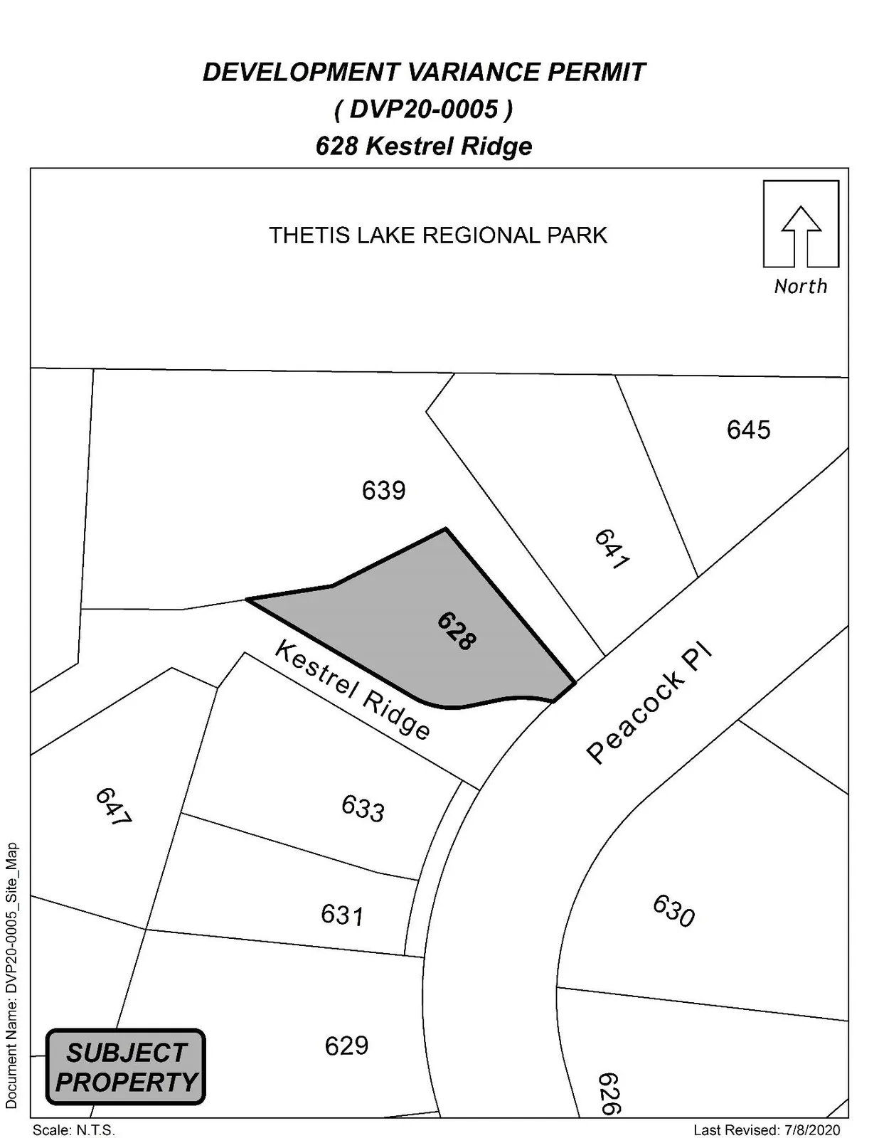
Subject: Application for Development Variance Permit to reduce the rear yard setback from the required 6.0 m to 3.0 m for the property located at 628 Kestrel Ridge.
PURPOSE
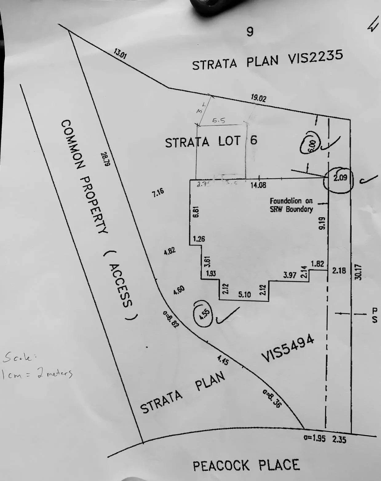
Chris McFarland has applied for a development variance permit to reduce the rear yard setback from the required 6.0 m to 3.0 m in order to facilitate the construction of a deck attached to an existing single-family dwelling.
BACKGROUND
PREVIOUS APPLICATIONS
In 2003, an Interface Fire Hazard Development Permit was issued for the construction of six single-family dwellings on the parent parcel of the subject property—formerly 637 Peacock Place—now 628, 640, 647 651, 655 and 659 Kestrel Ridge.
Table 1: Site Data
| Item | Details |
|---|---|
| Applicant | Chris McFarland |
| Owner | Same as above |
| Civic Address | 628 Kestel Ridge |
| Legal Description | STRATA LOT 6, SECTION 2, RANGE 2, WEST HIGHLAND DISTRICT, STRATA PLAN VIS5494, TOGETHER WITH AN INTEREST IN THE COMMON PROPERTY IN PROPORTION TO THE UNIT ENTITLEMENT OF THE STRATA LOT AS SHOWN ON FORM V |
| PID | 025-880-331 |
| Size of Property | 654 m2 (0.161 Acres) |
| DP Areas | Interface Fire Hazard |
| Zoning Designation | One-and Two Family Residential (R2) |
| OCP Designation | Neighbourhood |
SITE AND SURROUNDING AREA
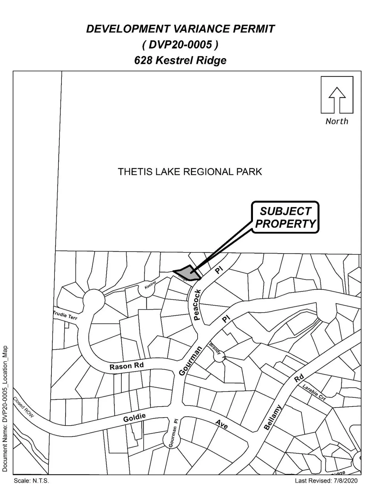
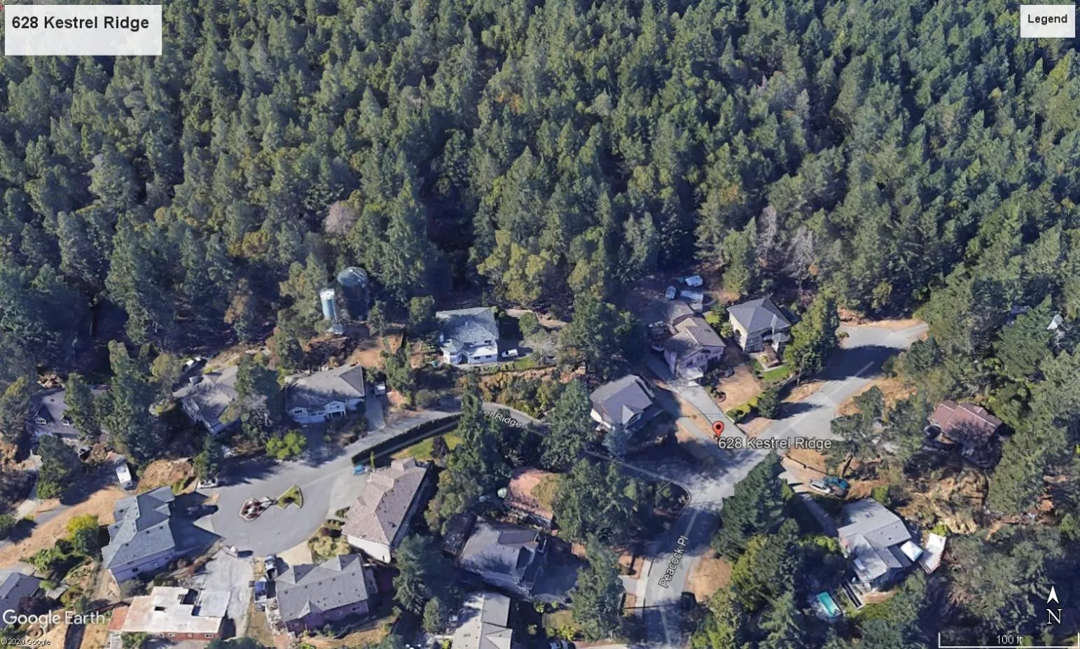
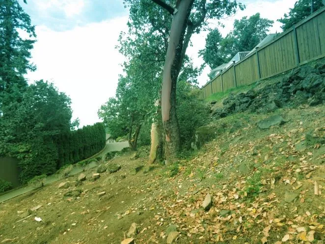
The 654 m2 property is currently occupied by a single-family dwelling within a bare land strata consisting of six lots ranging in size from 587 m2 to 914 m2. Access to the site is by means of common property access. The topography of the site rises up approximately 6 m from the front property line to the rear property line. The area between the existing dwelling and the north property line is virtually clear of vegetation. Thetis Lake Regional Park is located approximately 25 m north of the subject property.
Table 2: Surrounding Land Uses
| Direction | Zoning | Use |
|---|---|---|
| North | One-and Two Family Residential (R2) | Single Family Dwelling |
| East | One-and Two Family Residential (R2) | Single Family Dwelling |
| South | One-and Two Family Residential (R2) | Single Family Dwelling |
| West | One-and Two Family Residential (R2) | Single Family Dwelling |
COMMENTS
DEVELOPMENT PROPOSAL
The applicant is proposing to construct a 351.5 ft2 (32.5 m2) deck attached to the rear of the 160 m2 (1,712 aq. ft.) dwelling. The resulting lot coverage is below the maximum allowable lot coverage of 35%, as stipulated in the R2 Zone.
As a requirement of the Wildfire Interface Fire Hazard Guidelines, the applicant has submitted an interface fire hazard report from a professional forester, providing measures to mitigate the risk of wildfire and to verify the proposal can be safely implemented. According to the fire hazard report (Strathcona Consulting, 2020), the deck is required to be constructed of fire-rated non-combustible materials such as fiber cement board and metal screening.
Table 3: Proposal Data
| Permitted by R2 (Current Zoning) | Proposed by DVP Application |
|---|---|
| Rear Yard Setback | 6.0 m |
| 3.0 m |
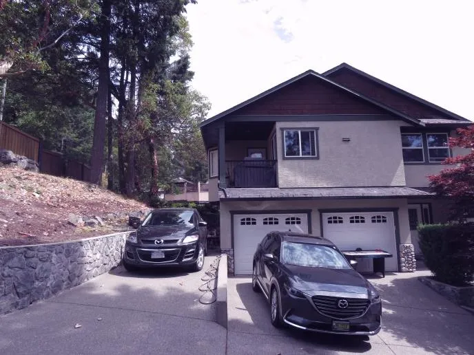
Photos / Location
OPTIONS
Option 1
That the Planning, Zoning and Affordable Housing Committee recommend that Council:
- That Council direct staff to provide notice that Council will consider issuing a Development Variance Permit:
a) That Section 6.21.06(1)(a) of Zoning Bylaw No. 300 be varied from the required 6.0 m to 3.0 m;
Subject to the following terms and conditions:
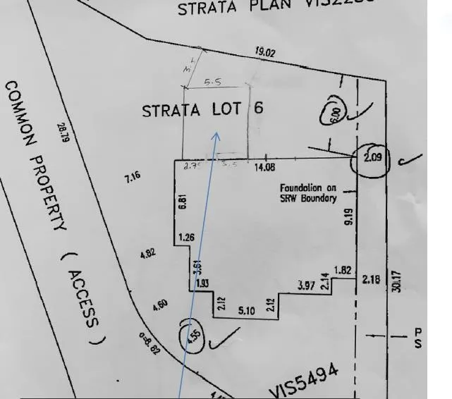
i) That the site is developed in accordance with the plan attached to this report as Appendix A;
ii) That the applicant constructs the deck in accordance with the recommendations of the report provided by Strathcona Consulting, dated June 2020 attached to this report as Appendix D;
OR Option 2
- Reject this application for development variance permit.
SUBMITTED BY / CONCURRENCE
Submitted by:
Dave Sametz, Land Development Planner
Concurrence:
Matthew Baldwin, MCIP, RPP, Director of Planning
Marie Watagon, Manager of Legislative Services
Chris Aubrey, Fire Chief
Lorne Fletcher, Manager of Community Safety and Municipal Enforcement
Cory Manton, Manager of Parks and Recreation
Michelle Mahovlich, P.Eng, P.Geo, Director of Engineering
Leah Stohmann, MCIP, RPP, Deputy Director of Planning
Michael Dillabaugh, CPA, CA, Director of Finance
Braden Hutchins, Director of Corporate Services
Darren Kiedyk, Chief Administrative Officer
:ds
APPENDICES
Appendix A
Appendix B
Appendix C
Strathcona Forestry Consulting — Letter and Wildfire Assessment
Margaret Symon, RPF PCP
Strathcona Forestry Consulting
PO Box 387 Stn. Mn.
Duncan BC V9L 3X5
strathcona.fc@shaw.ca
250 715-6983 (c/text)
July 18, 2020
To:
Mr. David Sametz
City of Langford
Planning Department
2nd Floor – 877 Goldstream Avenue
Victoria BC V9B 2X8
cc: Mr. Chris McFarland — cdnmcfarland@gmail.com
Property: 628 Kestrel Ridge
Re: DP for Wildfire - Amendment: 628 Kestrel Ridge
Introduction
On behalf of Mr. Chris McFarland, property owner, 628 Kestrel Ridge, this letter is a request for an amendment to the Development Permit for Wildfire. The subject property is designated in a Development Permit Area for Wildfire, where a 6 m rear setback is specified. Mr. McFarland is planning to construct a deck which would reduce the rear setback. The property is located near (not at) the boundary with Thetis Lake Regional Park.
Description of Proposal
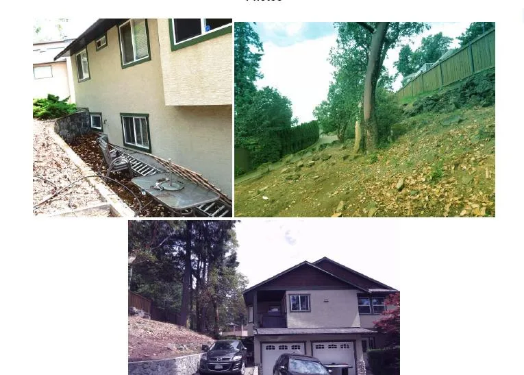
The property owner requests approval to construct a deck extending upslope from the west side of the home, and, which, due to topographical constraints, would result in a 3 metre setback. (see site plan, photos, pgs. 3 to 5).
Site Visit
The site visit took place on July 14, 2020. Mr. McFarland was present.
Assessment Comments
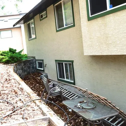
Mr. McFarland is planning to have a 18.5 ft. x 19 ft. deck constructed on the upper side of his home in order to extend the usable portion of his property. At present, the land uphill of the house has a sloping gradient impractical for lawn or garden space. The upslope of his property adjoins a neighbouring property to the west, and is bordered by a wooden fence, which is virtually clear of vegetation. In preparation for the renovation, Mr. McFarland has reduced fuel loading by removing coniferous shrubs (mainly spreading junipers) and pruned several mature Douglas-fir and arbutus trees upslope of the residence. Landscape rock, a concrete pathway, and bare soil occupy the area where the proposed deck would be built. Mr. McFarland has removed stored materials next to the home (beneath the location of the proposed deck), and plans to minimize storage of materials under the deck once it is built. The home exterior features a fire resistant roof (rated asphalt shingles) and siding (stucco). Infrastructure planning utilizes piped water for firefighting. The nearest fire hydrant is located across from the front of the house.
Recommendations
As discussed with Mr. McFarland, actions taken to date to reduce the fire hazard are commendable, and should be continued to include:
- Prune the lower branches of the arbutus tree located upper back yard
- Continue to remove the row of juniper shrubs along the perimeter
- Select fire rated composite decking material for the deck, and sheath the underside of the deck with non-combustible sheathing, such as fibre cement board or metal screening.
- Deck maintenance is important to maintain fire-resistance
- Ensure combustible debris and vegetation are kept clear on, around, and beneath the deck
Compliance with the above recommendations is essential to reducing vulnerability to ignition during a wildfire.
Disclaimer
The subject property lies within the service area of Langford Fire Rescue, a composite career / volunteer department. Response times can vary between the day and evening hours dependent on staffing levels and job responsibilities. A response study is currently being undertaken by Langford Fire Rescue.
Summary
In accordance with the City of Langford’s Wildfire Development Permit guidelines, a DP amendment is requested to permit construction of a deck at the home located on 628 Kestrel Ridge that would result in a 3 m setback upslope. Providing the property owner continues to comply with FireSmart strategies to minimize the risk of wildfire at the home and property, the proposed construction will be safe for its intended use.
Yours sincerely,
Margaret Symon
Margaret Symon RPF PCP
Photos (Strathcona Forestry Consulting)
The proposed deck would extend upslope to a 3 m setback from the neighbouring property line. Mr. McFarland has reduced fuel loading in the area.
Limitations
This report provides an assessment of WUI hazard and risk. Evaluation is based on professional judgment. The investigation involved a field observation. Recommended treatment pertains only to the particular site as disclosed at the time of inspection. The report was prepared considering site-specific circumstances and conditions. It is intended only for use by the client for the purpose for which it was commissioned and for use by local government regulating the activities to which it pertains.