DocumentsAppendixMay 7, 2018Pages 12–16
Freedom Mobile - Aerial Photo, Photo-simulation and Site Plans (Appendices)
Image appendices for the Freedom Mobile proposal including aerial photo, before/after photo-simulation, site plan, compound layout and tower profile.
Key facts
- Aerial photo indicating proposed location on site
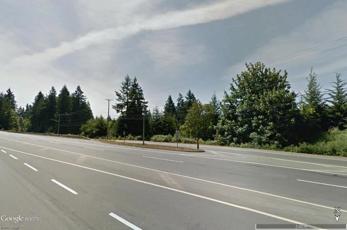
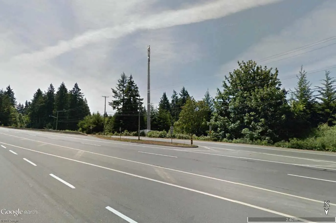
- Photo-simulation showing conceptual visual impact from Trans Canada Hwy
- Site plan, compound layout and tower profile provided as technical appendices
- Last revised/site map date shown: 3/19/2018 (on site map image)
Freedom Mobile - Aerial Photo, Photo-simulation and Site Plans (Appendices)
Aerial Photo
Proposed
Location
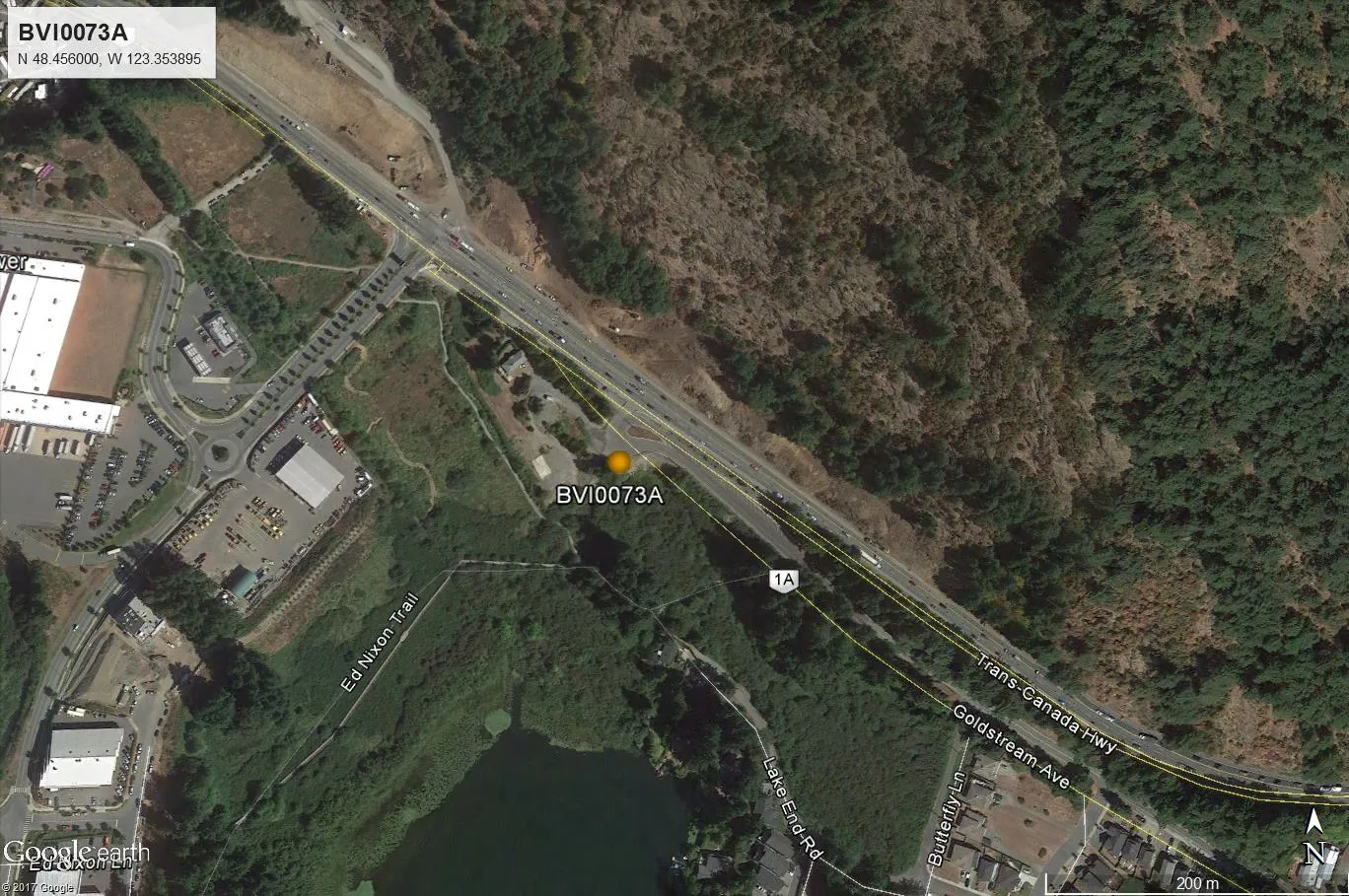
Photo Simulation
BEFORE
AFTER
Artist’s rendering of proposed facility, looking south from Trans Canada Hwy.
Note: Photo-simulation is for conceptual purposes only.
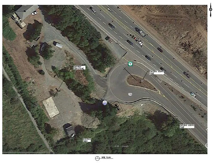
Site Plan
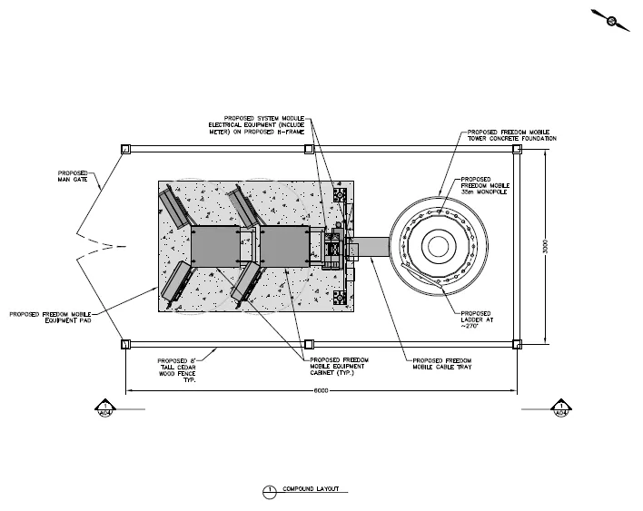
Compound Layout
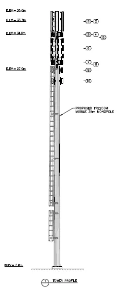
Tower Profile
Page 12–16
Document Images
(1)
Extracted from: 20180507-Agenda-Package-Redacted(211 pages total)