DocumentsDelegationJul 15, 2024Pages 3–13
775 Latoria Road - Response to Questions / Proposed Townhomes (Presentation)
Presentation/response materials by the applicant (R. Sansom) for the 775 Latoria Road rezoning/development proposal addressing questions on creek protection, tree protection, rock face safety, permeable pavement, park interface and site access.
Key facts
- Civic address: 775 Latoria Road
- Includes proposed townhome views, elevations and design slides
- Trail connection proposed to avoid riparian area; riparian plantings and erosion control measures described
- 8.5 metre strip proposed between townhomes and adjacent park (buffer to be maintained by strata)
- Recommendation for impermeable stamped concrete/asphalt for patios/driveways with Oil Grit Separator treatment and a s.219 covenant for maintenance
775 Latoria Road - Response to Questions / Proposed Townhomes (Presentation)

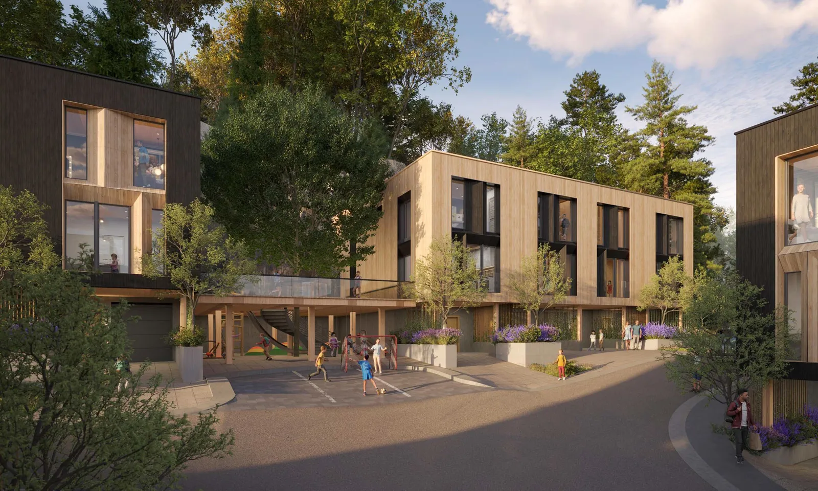
Proposed Townhomes – View from Latoria


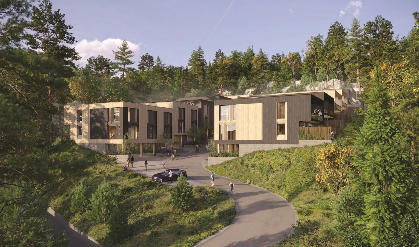
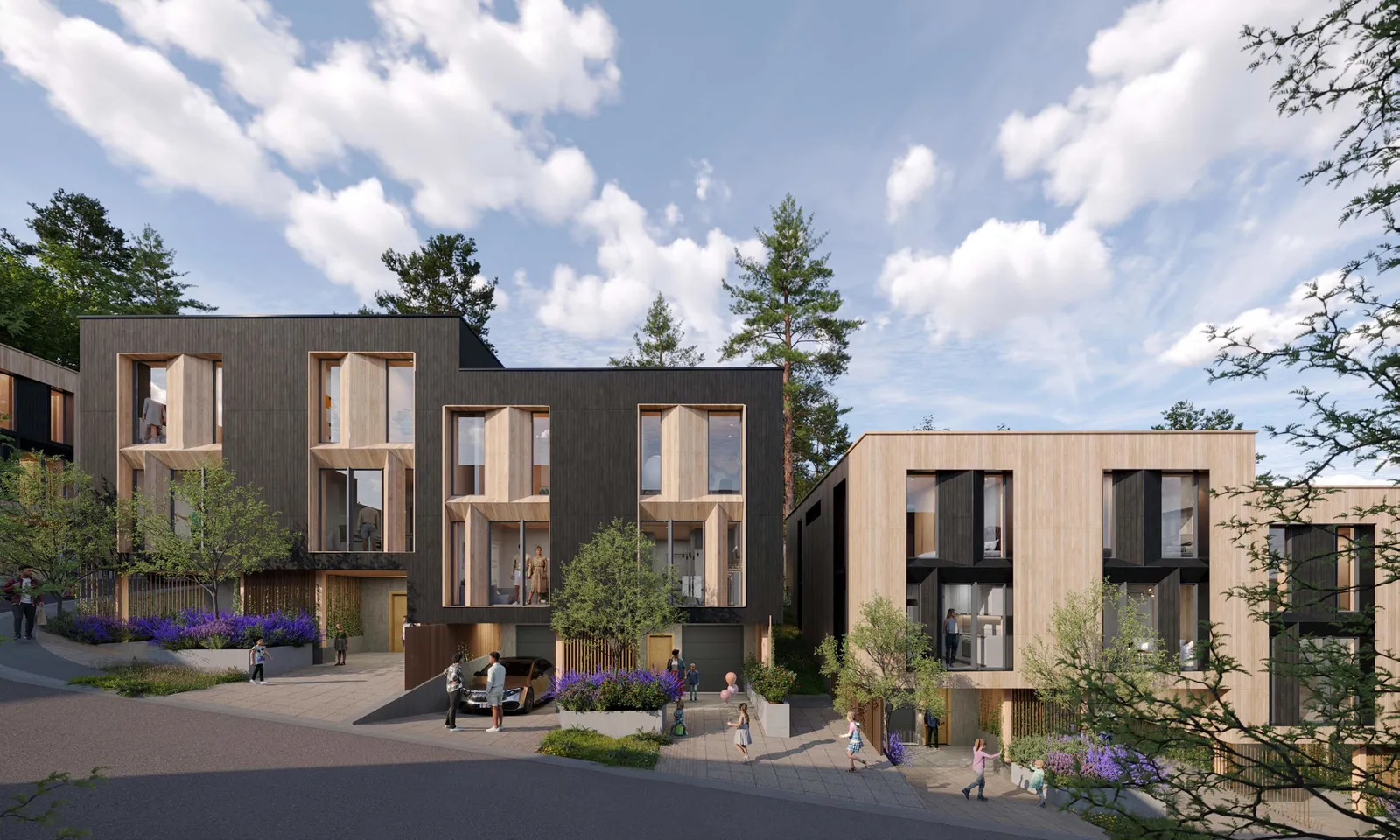
Proposed Townhomes - Elevations
Response to Questions
Summary table (Issues, Details, Action)
| Issue | Details | Action |
|---|---|---|
| Pritchard Creek | Concerns regarding enclosing creek for sidewalk to the east. | A trail connection is proposed from the townhomes that avoids the riparian area yet provides safe passage to the pedestrian crossing at Autumn Lane. (See slide). The trail is fully outside the 10m SPEA. The riparian area as shown will be planted as prescribed by the project biologist. Erosion and sediment control will be provided while the plantings become established. This includes erosion control blanket for the slopes above the road/drainage ditch. Invasive species will be removed. The arborist recommends that any hazardous trees within the riparian area be modified to wildlife stumps while leaving root systems intact The arborist will follow ANSI A300 standards for tree care operations and best management practices with a view to retaining viable trees Further details will be provided as a condition of Development Permit approvals. |
| Green Buffer | What will this look like? Who will maintain? | An 8.5 meter buffer between the townhomes and Park Dedication provided at the request of the City. The buffer area will be owned and maintained by the townhouse strata in accordance with the requirements of the wildfire report. Trees will be modified, and area cleaned up in accordance with the Wildfire interface recommendations. Existing forest floor will remain. Project arborist will ensure that all viable trees will be protected. Some trees will need to be assessed on site during site preparations to see the extent of root systems. Project biologist to recommend replanting as required. The Park area will be reviewed by both the Director of Parks and arborist to ensure that it is transferred to the City in a safe condition. (See slide) |
| Rock face behind townhomes | Concerns regarding the look and safety | Rock face will be completed under the supervision of the geotechnical engineer of record. Any safety measures (fencing, mesh, anchors or catchment areas) will be provided and as approved by the Director of Engineering per Bylaw 1000. |
| Biologist report | Perceived conflicting info | An updated report can be provided to the City with as part of the Development Permit process. |
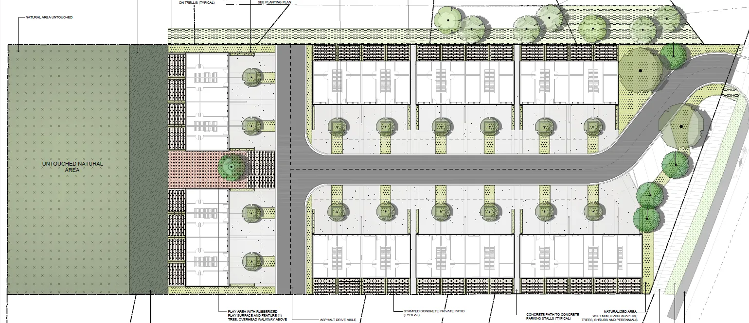
| Patio pavers, parking spaces | Should these be pavers or concrete? | The design team did a review of the proposed paving plan. It was determined that storm water can be better managed and treated on site with impermeable materials like stamped concrete or stamped asphalt. They researched permeable materials and did not feel that long-term maintenance would be guaranteed. Hydrocarbons if any can be contained and treated appropriately if directed to the Oil Grit separators or other treatment in accordance with the storm water management plan. This will apply to private patios, driveways, parking spaces and other hard surfaced areas. See slide |
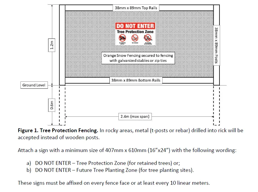
| Tree protection | Tree removal, condition of remaining trees, protection plan for remaining trees | Tree protection will be in accordance with ANSI Standards and BMP’s. Combination of fencing, stem and root armouring if required as detailed in the arborist report. See slide |
| Tree replacement | Native plantings? | Tree species are provided in the Landscape plans. Those that are not specifically native species have been selected for compatibility with native species, as well as the growing conditions post development. |
| Dust mitigation | Construction management program | In accordance with bylaw 1000 and the upcoming “Good Neighbour” policies. |
| Access | Suggested access through strata to the east | No recommended by Langford (we checked). There are no rights of way in place to allow access. |
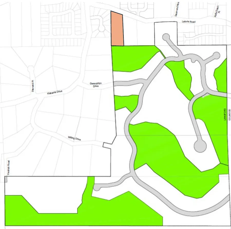
| Connectivity to Olympic View | See attached | At this time there is no access, or trails proposed from this development to OV parks. See slide |
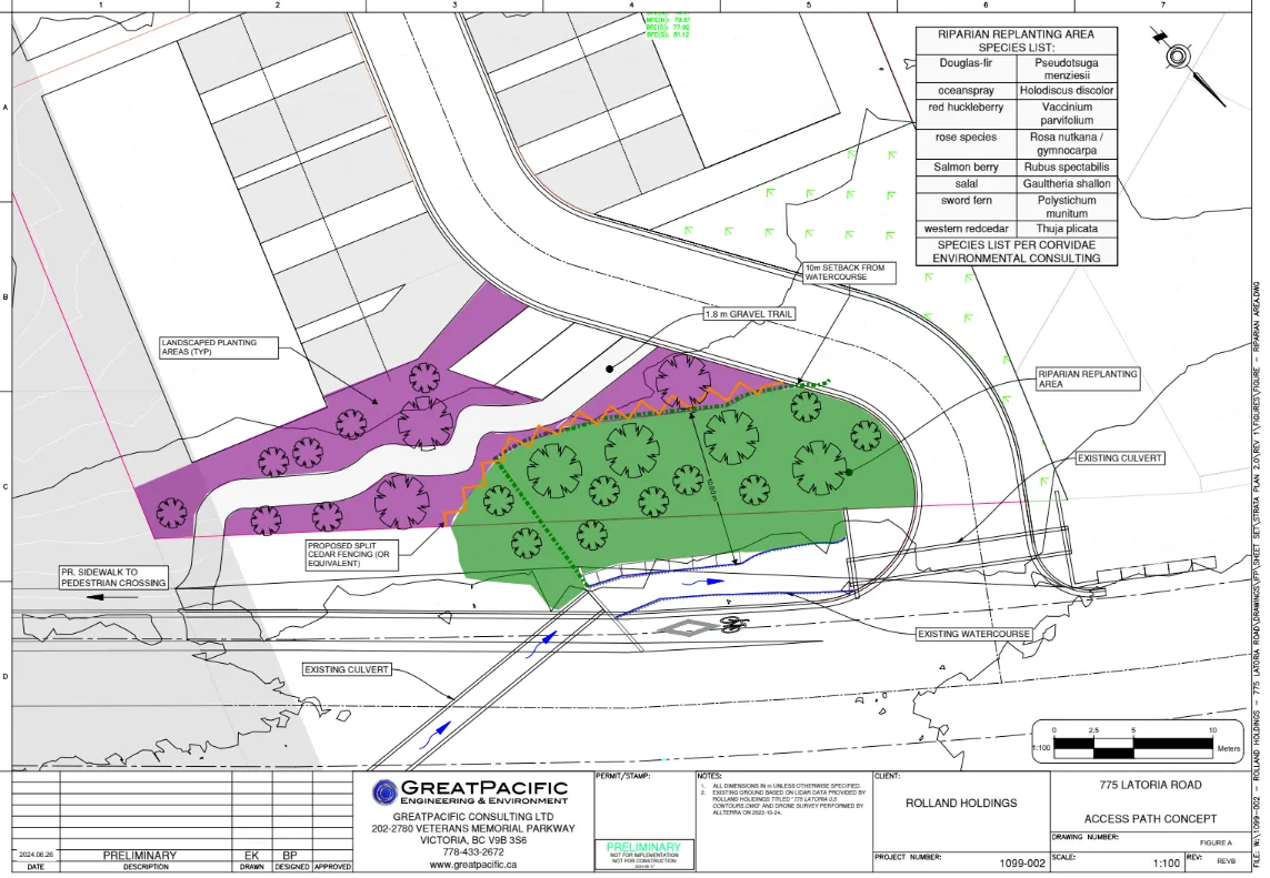
Safe Pedestrian Access and Creek Protection
- Pritchard Creek Tributary – Channel to be left open
- Riparian Plantings
- On-site gravel path to sidewalk
- Landscaping and trees
- Split Rail Fence
- Autumn Lane Crossing
- Riparian Enhancement Area
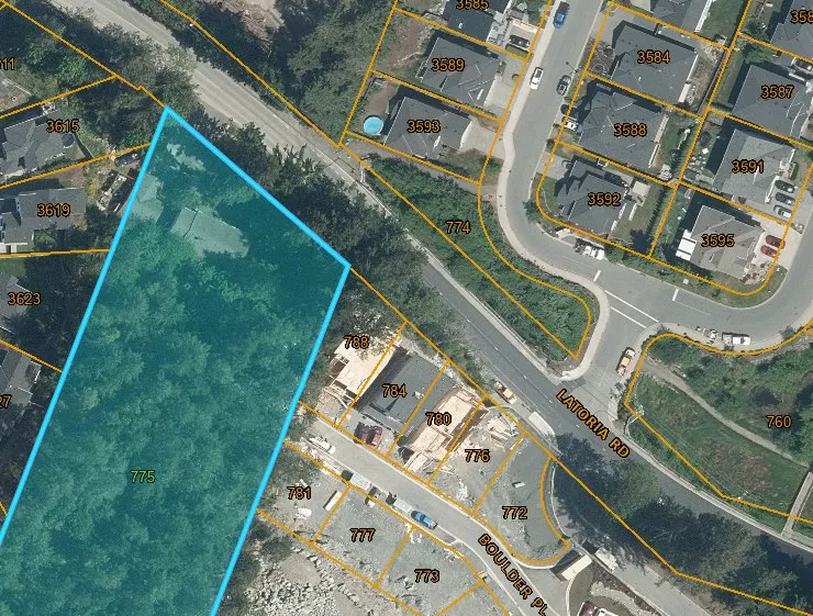
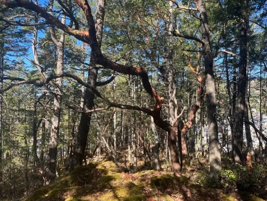
Managed Greenspace
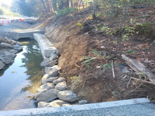
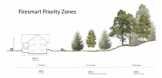
Managed Greenspace Interface
8.5 metre strip between Townhomes and Park
- Provides a buffer between residential use and Langford’s Park.
- To be maintained by Townhouse Strata.
- Hazardous trees to be removed, stumps and forest floor to remain. Trees to remain will be protected during construction. Arborist to supervise.
- Wildland interface maintenance to be performed.
- Geotechnical safety zone will allow any remedial measures to be installed. Geotech will certify.
- Area will be replanted with the appropriate native species as directed by project Biologist
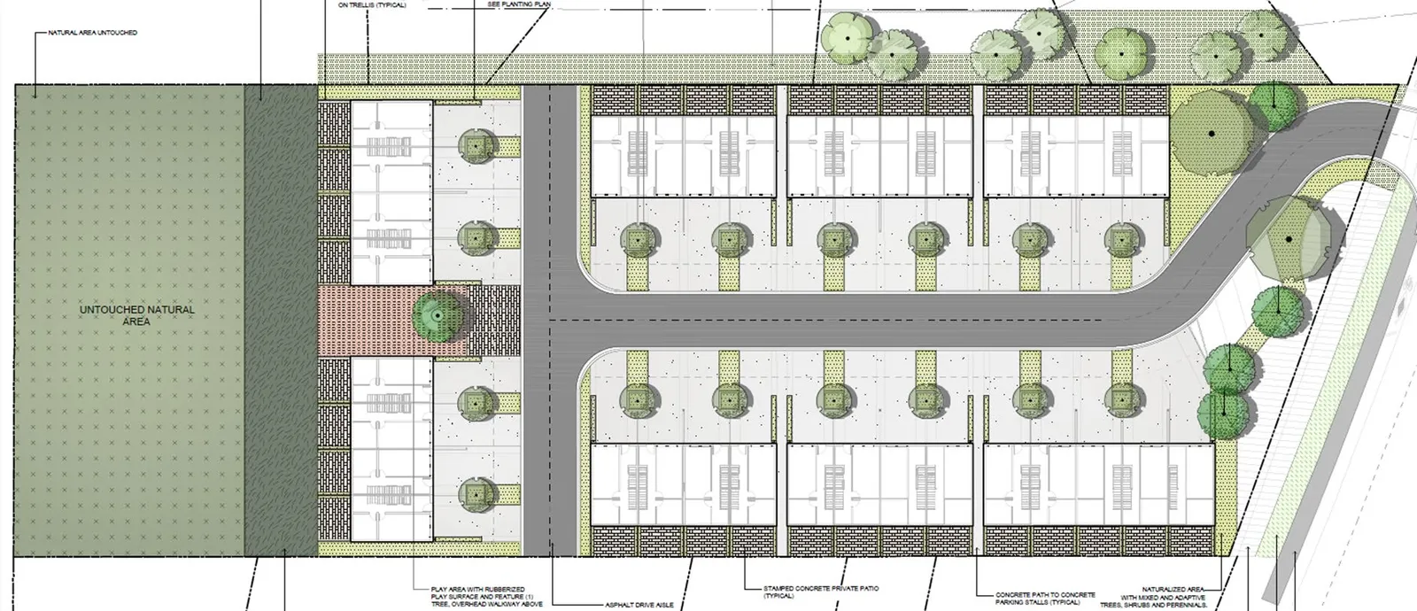
Tree Protection
Tree protection will be in accordance with ANSI Standards and BMP’s. Combination of fencing, stem and root armouring if required as detailed in the arborist report.
Project Arborist will identify tree protection zones for trees to remain and ensure that they are protected throughout construction.
Permeable Pavement?
After thorough discussions with the project Civil Engineer, it was determined that patios, driveways and parking spaces should be impermeable stamped concrete or asphalt in order to properly capture and treat stormwaters on site. Stormwaters will be treated by “Oil Grit Separators” and maintained by the strata. A section 219 covenant on title will ensure on going maintenance.
Contiguous Parkland
- Olympic View Parkland
- 775 Latoria Park