DocumentsAppendixMay 16, 2022Page 7
BYLAW NO. 2063 — Schedule A (Map)
Schedule A map showing the parcels subject to Bylaw No. 2063 shaded on the plan.
Key facts
- Schedule A: plan map for 2869, 2875, 2885 Leigh Road and 1080 Dunford Avenue
- Referenced as attachment to Bylaw No. 2063
Schedule A
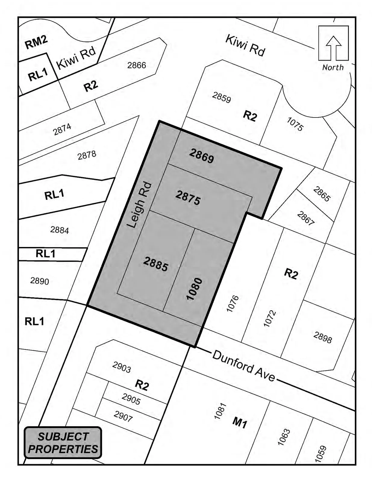
Transcription of visible text from the map
- Kiwi Rd
- North (with arrow)
- Leigh Rd
- Dunford Ave
- SUBJECT PROPERTIES (callout)
- Zoning labels:
- RM2
- RL1
- R2
- M1
- Lot / parcel numbers visible on the map:
- 2866
- 2869
- 2874
- 2875
- 2878
- 2859
- 1075
- 2865
- 2867
- 2884
- 2890
- 2885
- 1080
- 1076
- 1072
- 2898
- 2903
- 2905
- 2907
- 1081
- 1063
- 1059
Note
- The shaded subject properties shown on the map are 2869, 2875, 2885, and 1080.
Page 7
Extracted from: Agenda Package(236 pages total)