DocumentsAppendixMar 2, 2020Page 20
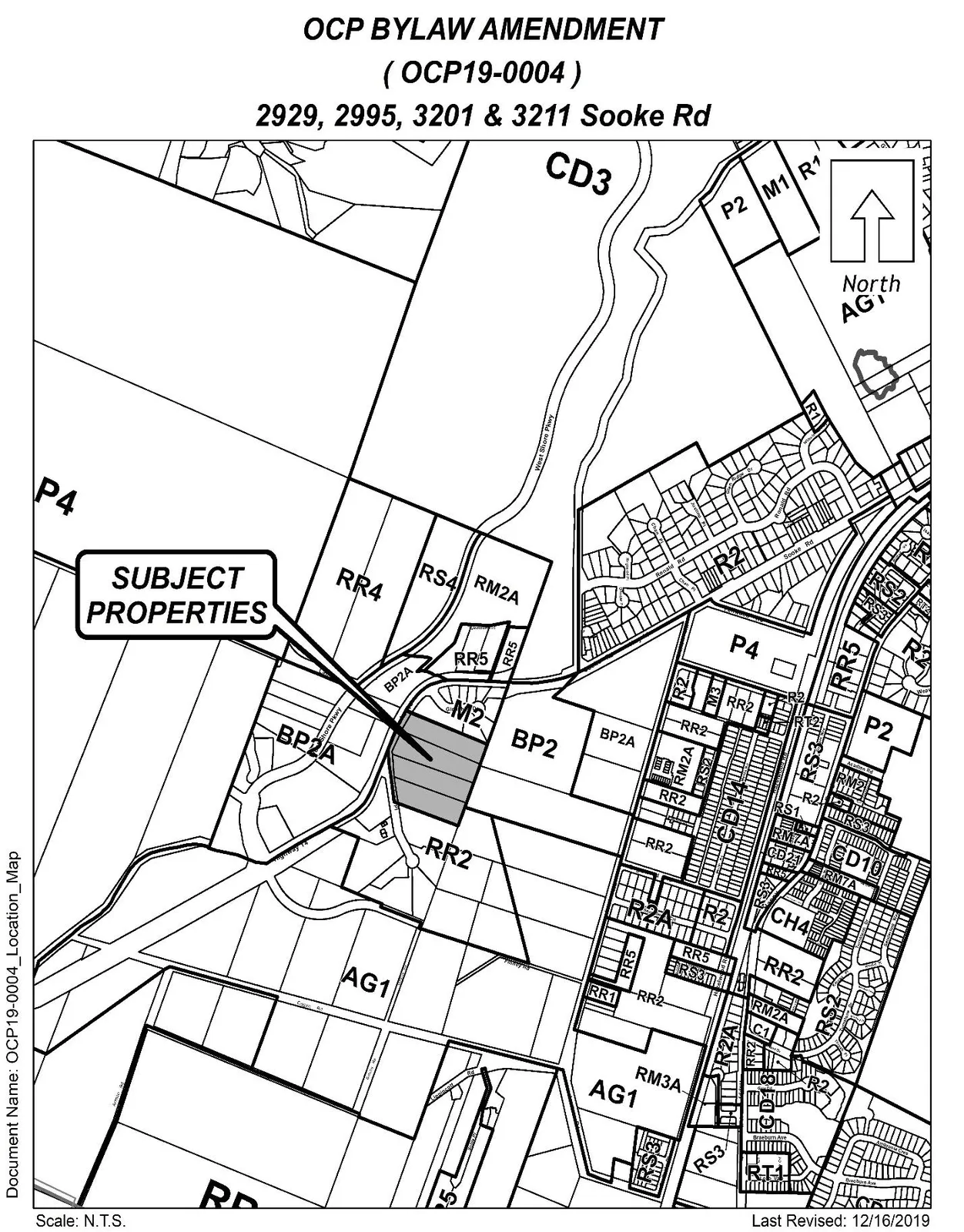
Appendix B – OCP19-0004: Location Map
Location map showing the context of the four subject properties within the surrounding area.
Key facts
- Appendix to Staff Report OCP19-0004
- Visual: location map
Appendix B
LOCATION MAP
OCP BYLAW AMENDMENT
(OCP19-0004)
2929, 2995, 3201 & 3211 Sooke Rd
Document Name: OCP19-0004_LocationMap
Scale: N.T.S.
Last Revised: 12/16/2019
Notes visible on map:
- SUBJECT PROPERTIES (callout)
- North (with directional arrow)
- Land use designations visible: CD3, P4, BP2, M2, RR2, RR4, RR5, RS4, RM2A, AG1, P2, CH4, RT1, RM3A, BP2A, RR3, BP2 (shaded area)
- Addresses listed in title: 2929, 2995, 3201 & 3211 Sooke Rd
[End of page content]
Page 20
Extracted from: 20200302-Agenda-Package(278 pages total)