DocumentsStaff ReportFeb 3, 2020Pages 428–444
Application to Rezone 2716 and 2720 Strathmore (to RM7A Medium-Density Apartment A)
Staff report for an application to rezone 2716 and 2720 Strathmore from R2 (One- and Two-Family Residential) to RM7A (Medium-Density Apartment A) to permit a six-storey residential building of approximately 32 dwelling units.
Key facts
- Addresses: 2716 and 2720 Strathmore
- Proposed zoning: R2 -> RM7A
- Proposed building: six storeys, ~32 dwelling units
- Pages: 428-444
Application to Rezone 2716 and 2720 Strathmore (to RM7A Medium-Density Apartment A)
Date: January 27, 2020
Department: Planning
Application No.: Z19-0026
Subject: Application to Rezone 2716 and 2720 Strathmore from the R2, One- and Two-Family Residential Zone to the RM7A, Medium-Density Apartment A, Zone to Allow for the development of a six (6) storey residential building made up of approximately 32 dwelling units.
PURPOSE
Nicholas Frappell, with Keycorp Planning Incorporated has applied on behalf of Rick Genovese and Robert Klein of 1199599 BC Ltd. to rezone 2716 and 2720 Strathmore Road from the R2, One and Two Family Residential, Zone to the RM7A, Medium-Density Apartment A, Zone in order to allow the development of a six (6) storey residential building comprised of approximately 32 units within the City of Langford’s designated City Centre policy area.
BACKGROUND
Previous Applications
There have been no records of previous development applications for the subject properties.
Site Data
Table 1: Site Data
| Item | Details |
|---|---|
| Applicant | Nicholas Frappell, Keycorp Planning Incorporated |
| Owner | Rick Genovese and Robert Klein, 1199599 BC Ltd. |
| Civic Address | 2716 and 2720 Strathmore Road |
| Legal Description | LOT 5, SECTION 5, ESQUIMALT DISTRICT, PLAN 16167 (2716 Strathmore Road) & LOT 6, SECTION 5, ESQUIMALT DISTRICT, PLAN 16167 (2720 Strathmore Road) |
| Size of Property | 1381 m2 |
| DP Areas | City Centre DP Area, Multi-Family Residential DP Area |
| Zoning Designation | R2, One and Two Family Residential, Zone |
| OCP Designation | City Centre |
SITE AND SURROUNDING AREA
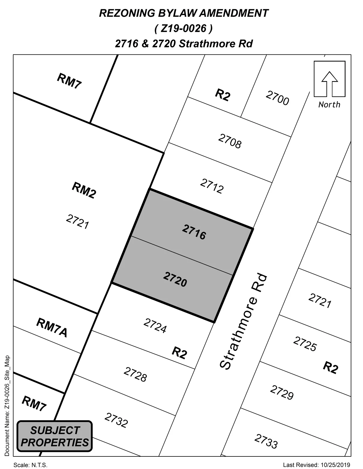
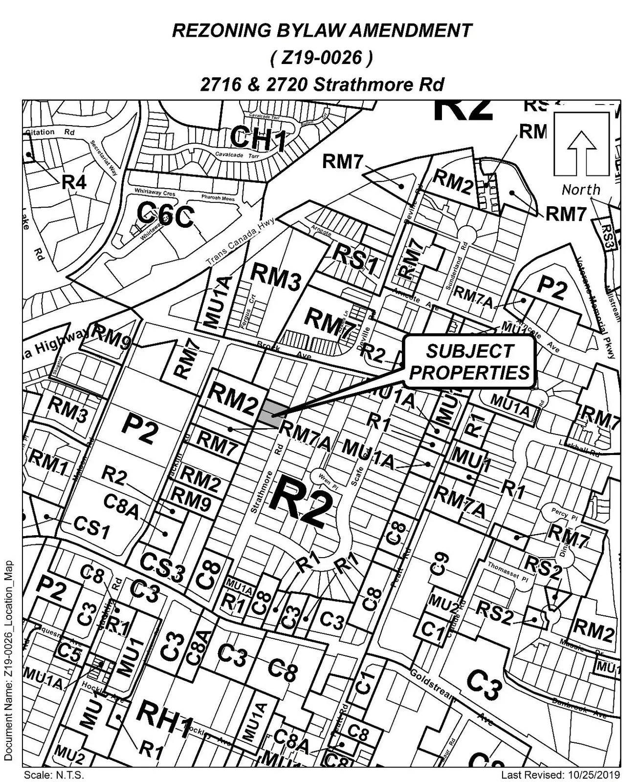
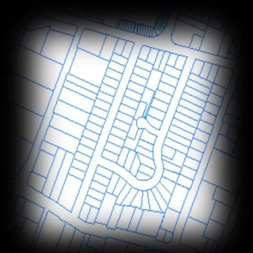
Both properties are located at the north end of Strathmore Road, a connector road providing direct access to the downtown via Goldstream Avenue, as well as close access to the highway via Brock Avenue and Peatt Road to Veterans Memorial Parkway.
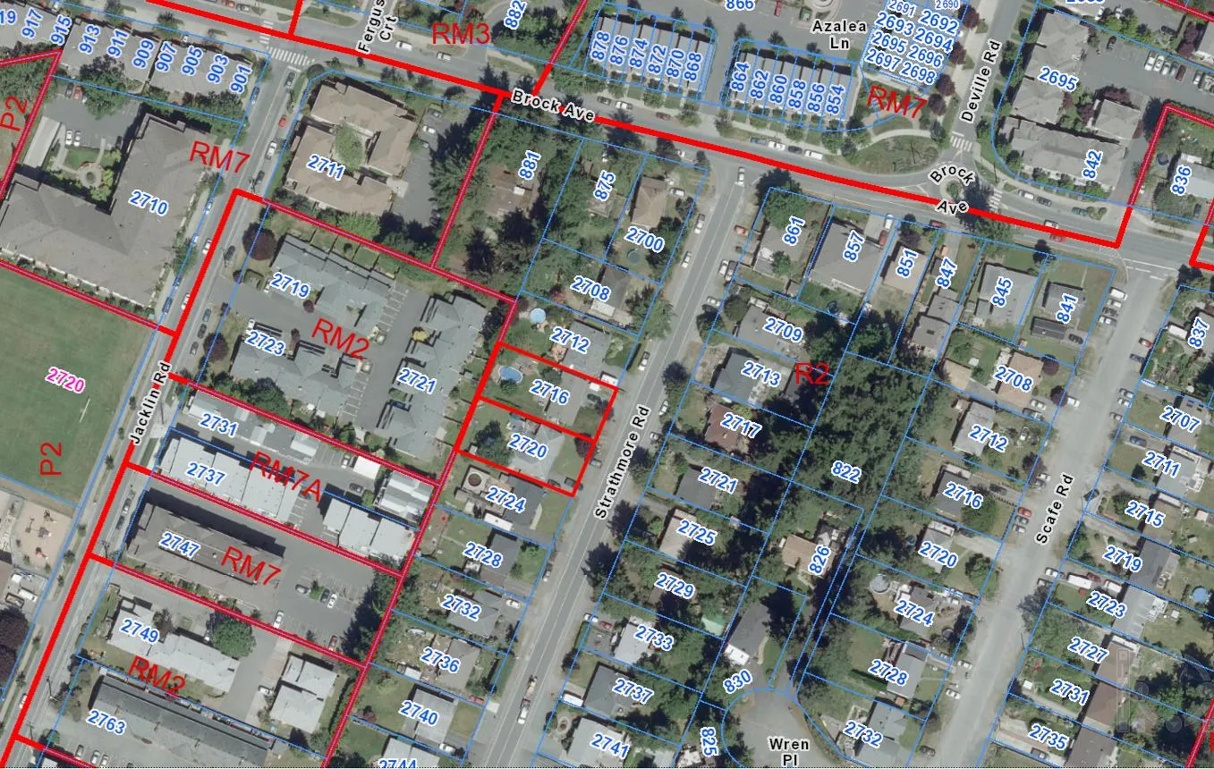
Combined, the subject properties have a frontage of approximately 36 m, a depth of 38 m and are approximately 1400 m2, or 15,000 ft2, in area. The homes on the properties are typical of the area, that being single storey split level family homes with ample yard space setback approximately 6 m from the road. The rear yards of both properties are nominally landscaped with ornamental trees and sod.
Due to its proximity to the City Centre and the connection to Trans-Canada Highway, Strathmore Road has seen moderate redevelopment to accommodate higher density residential and commercial buildings. A mixed-use building, comprised of one floor of ground floor commercial uses and 5 storeys of residential above, was constructed on the corner of Strathmore Road and Goldstream Avenue in 2005. At the opposite corner of Strathmore Road and Goldstream Avenue, a four-storey residential building was constructed in 2017. The remainder of Strathmore Road hasn’t experienced redevelopment on the same scale as those properties on the corner of Goldstream Avenue and Strathmore Road and have remained single and split-level family dwellings.
Being in the designated City Centre of Langford’s OCP, the immediate area will continue to see redevelopment into higher density developments, both commercial and residential. The area as a whole has seen mid to high density redevelopment with several townhouse complexes as well as higher density, 4 and 6 storey multi-residential developments.
Surrounding Land Uses
Table 2: Surrounding Land Uses
| Address | Zoning | Use |
|---|---|---|
| West: 2719, 2723 and 2721 Jacklin Road | RM2, Attached Housing, Zone | Townhouses |
| East: 2717, 2721, 2725 Strathmore Road | R2, One and Two Family Residential, Zone | One Family Dwelling |
| South: 2724 Strathmore Road | R2 | One Family Dwelling |
| North: 2712 Strathmore Road | R2 | One Family Dwelling |
COMMENTS
OFFICIAL COMMUNITY PLAN
The subject property is within the City Centre designation of Langford’s OCP, Map 2 of Bylaw No. 1200. The proposed multi-family residential building would result in an increase in density that is appropriate given its proximity to the City Centre, an area where growth should be concentrated to take advantage of nearby established services and access to major transportation corridors.
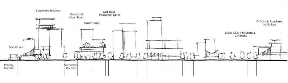
City Centre
- A major regional growth centre that supports a wide range of high-density housing, including affordable and rental housing
- A major employment area for institutional, office, commercial, light industrial uses
- Major civic uses and public buildings are key landmarks
- A major place of community gathering and celebration
- A wide range of public squares, parks and open spaces are integrated throughout
- The City’s major entertainment and/or cultural precinct
- Inter-city and/or inter-regional transit hub connect residents
ZONING, BYLAW NO.300
The developer has requested to amend their current zone of R2, One- and Two-Family Dwelling, to the MU1A, Mixed Use Residential Commercial, Zone to accommodate a multi-family residential development. Despite the developer’s intention to zone the property to MU1A, Staff would like Council to consider that the Mixed-Use zones, MU1, MU1A and MU2, be applied exclusively to developments proposing a mix of residential and commercial uses. Historically the MU1A Zone has been requested by developers due to its generous setbacks, FAR and allowable lot coverage modifiers that can accommodate high density proposals regardless of whether they contain a mix of commercial and residential uses indicative of the zone’s name and purpose statement. Therefore, staff feels that future developments, including the subject proposal, should be zoned to the RM7A, Medium Density Apartment A, Zone, where the use being proposed is strictly residential.
Council should be aware that Staff are preparing a new zone that will be applied to properties exclusively within the downtown core so the application of the RM7A zone and the Mixed-Use Zones will only be used for proposals outside of the City Centre. Despite its City Centre location, the subject proposal should proceed with a zoning amendment to the RM7A zone in order to give Staff time to properly prepare the new City Centre Zone regulations.
DESIGN GUIDELINES, APPENDIX J: GENERAL DESIGN GUIDELINES FOR LANGFORD CITY CENTRE
5.1 Apartment Buildings
Intent: To have apartment buildings contribute to the housing density and visual appearance of the City Centre.
Guidelines:
a) Large apartment buildings shall have a ground level that engages the pedestrian environment, animates the street and provides individuality from adjacent buildings;
b) Large façades are expected to be broken up by using a variety of materials and architectural features;
c) Balconies and patios should be a feature of every unit;
i. Balcony and patio screening shall be an opaque glass; and
ii. Area must be a functional area, not solely an architectural feature.
d) Visual characteristics of adjacent buildings should be incorporated into new development; and
e) Adjacent developments should promote sense of community through incorporating adjoining green or open space.
N2 Strathmore
The Strathmore neighbourhood is located towards the middle of the City Centre. The borders consist of main connector roads going north/south and east/west.
This neighbourhood is a very suitable location for medium and high-density residential development due to the variety of existing building types. Development along Peatt Road and Goldstream Avenue, including the southern end of Jacklin Rd. shall contain commercial and heavily pedestrian oriented ground floors.
A development emphasis should be on creating an animated street level for the public.
DEVELOPMENT PERMIT AREAS
The subject property is not within any areas identified as having significant environmentally sensitive or high-risk hazard attributes, and therefore will not require any professional review of these aspects to accompany a subsequent development permit.
The proposal will require a development permit to review the form and character of the proposed building for spatial layout and aesthetics that conform to the Design Guidelines for Langford’s Downtown (Appendix J of the Zoning Bylaw No. 300). The development permit will also review the building as a multi-family residential development, a use that requires a review for form and character as well.
PEDESTRIAN, CYCLING AND MOTORIST NETWORK
As mentioned, the location of the subject properties benefits from access to the highway and to existing services and establishments, thus concentrating the density in this location is appropriate and encouraged.
Strathmore Road is connected to Veteran’s Memorial Parkway, a major roadway, via Goldstream Avenue at its south end and Brock Avenue at its north end. Veteran’s Memorial Parkway connects north Langford to South Langford and Sooke Road. Veterans Memorial Parkway also provides a connection to Trans Canada Highway One.
With its proximity to these major streets, Strathmore Road is within walking distance to the services and businesses along Goldstream Avenue. Bus routes along Goldstream Avenue provide service to riders to Victoria as well as to other West Shore Communities, including the District of Sooke.
Bike lanes have been installed along the east side of Strathmore, including within the subject properties’ frontage. This provides cyclists with a connection along Brock Avenue as well as Goldstream Avenue to other connected roads where cycling infrastructure exists to provide connections within Langford and beyond. The developer will be required to install sidewalks along the shared frontage with Strathmore Road as part of their required frontage improvements. Sidewalks will be built in accordance with Bylaw No.1000 standards for this area within the Langford City Centre.
INFRASTRUCTURE
Frontage improvements shall be the responsibility of the developer and installed in accordance with Bylaw No. 1000. Frontage improvements will include road edge parking, 3 m drive lanes, sidewalks, boulevard landscaping, and possibly street lighting. If required to contain these improvements, road dedication will be required along the Strathmore Road frontage. To determine if this is necessary, the developer will be required to submit a frontage drawing to the satisfaction of the Director of Engineering prior to Public Hearing.
Sewer and water mains exist on Strathmore Road fronting this site. Any improvements or modifications needed to the sewer mains within the municipal road right-of-way will be constructed by West Shore Environmental Services at the developer’s expense. The developer will be required to provide a Fire Underwriters Survey (FUS) Report to verify that sufficient water pressure is available to serve the development. Any upgrades to the water system noted in the FUS report would need to be completed at the developers’ expense prior to the issuance of a building permit. The developer will be responsible for all connections and upgrades to services and sanitary systems needed to accommodate the proposed development, a provision that Council may wish to include within a Section 219 Covenant registered with the property.
As there is no on-site infrastructure to direct stormwater away from the property, the developer will be responsible to provide a stormwater management plan on how drainage to and from the site will be managed and stormwater captured and contained. A technical stormwater management memo, approved by the Director of Engineering, will be required prior to the scheduling of a Public Hearing for the Bylaw associated with the rezoning of the property. A formal stormwater management plan, also approved by the Director of Engineering, will be required prior to the issuance of a building permit to develop the site. This provision should be included within a Section 219 covenant registered on the property.
The subject property is in an area deemed to be of a low fire risk in accordance with Map 19: Interface Fire Hazard Areas, of Langford’s OCP, Bylaw No. 1200. In order to ensure the control of an urban fire in this location, the fire department has requested that the developer install a fire hydrant, if required in accordance with Bylaw No.1000.
DEVELOPMENT PROPOSAL
The developer is proposing to consolidate the properties in order to construct a 32-unit 6 storey multi-family residential building comprised of one underground floor, a surface parking lot, four (4) storeys of residential units and a roof top patio as the sixth storey. Access to the surface parking will be off of Strathmore Road and will meet the minimum requirements for the 32 units, with 32 resident parking stalls and 8 visitor stalls provided. The allocation of resident parking stalls must align with the regulations in the Zoning Bylaw that require one parking stall per unit. To prevent parking spaces being offered separate from a unit for additional compensation, Council may be supportive of the inclusion of a condition within a Section 219 covenant, registered with the property, to secure that each unit be allocated a parking stall and that no parking stalls, including those for visitors, will be offered for compensation separately from that of the residential units.

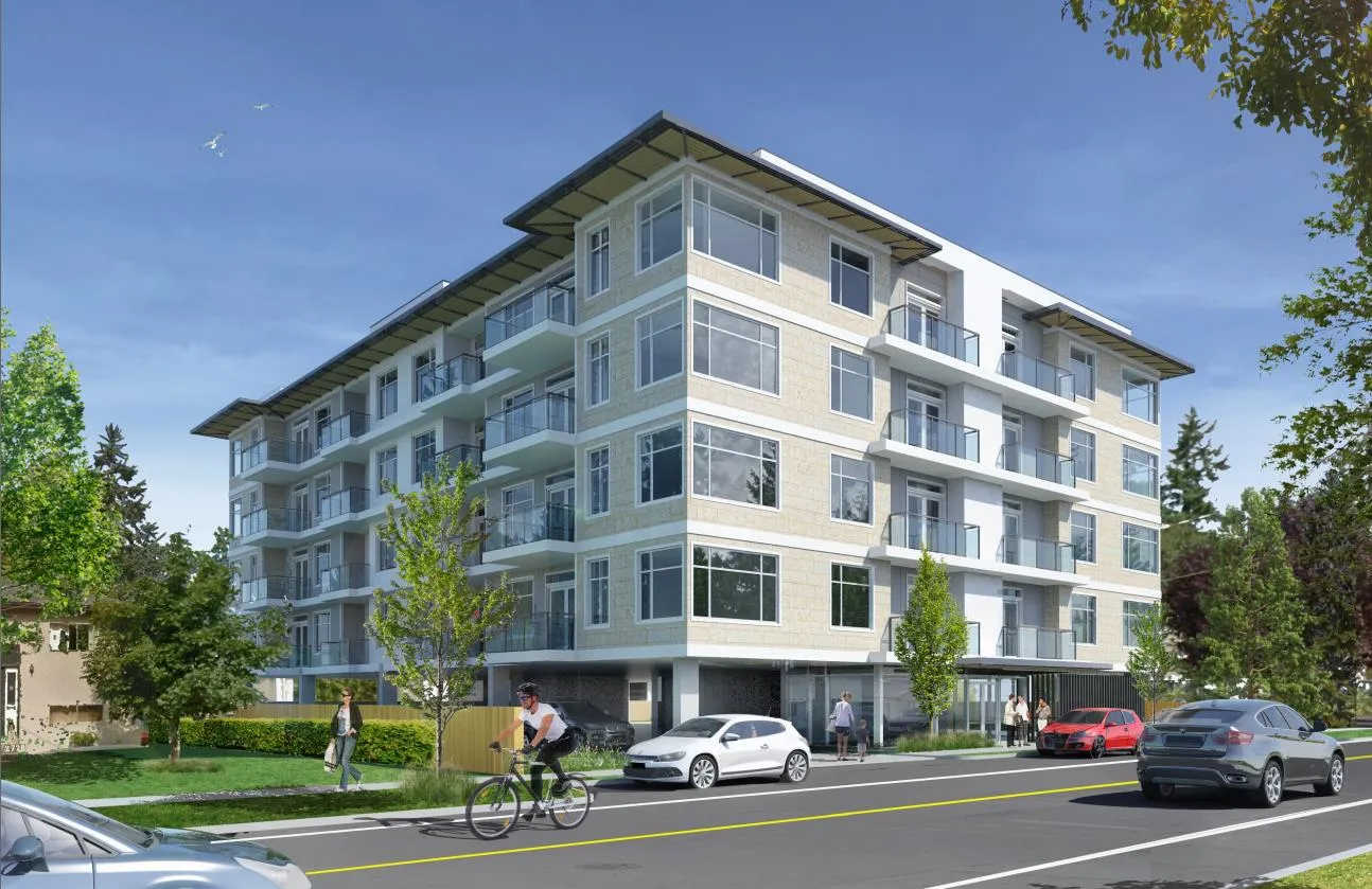
The design of the building design will significantly comply with the Design Guidelines for the City Centre, and specifically, for an apartment use within the Strathmore (N2) designated policy area. The emphasis of these guidelines is to articulate the at-grade level of the building to enhance the pedestrian experience of the downtown. This has been done through the use of ample fenestration for the lobby face, that will break up the building façade and invite interaction between pedestrians and the interior of the building. As well, the building is proposed to include surface parking, so screening will be used to mask the view of the parking lot and will articulate the building façade along the street side of the building.
The building’s façade will incorporate elements to enhance the visual appeal of the neighbourhood. Elements such as large windows that bridge two facades at the corner of the building, exaggerated roof over hangs and glass balconies that will complement the amount of glass used throughout the design on the building.
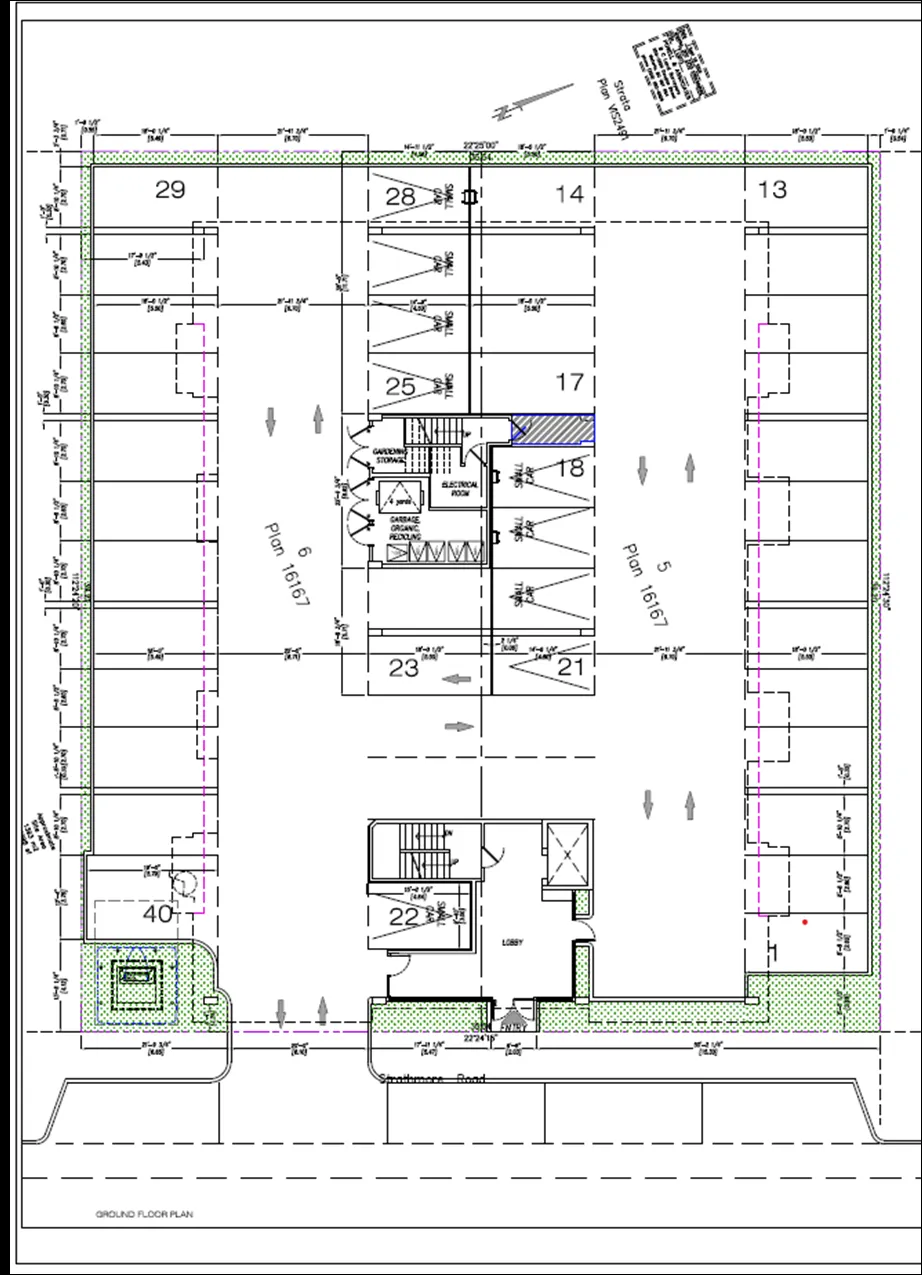
A variance to reduce the required building setback distance from the front property from 7.5 m to 0.48 m is being requested in order to accommodate building articulation including roof overhang and lobby. Furthermore, a variance to reduce the required building setback distance to the rear property line from 7.5 m to 3 m is being requested to accommodate living space on the second floor of the building. The developer does not need variances to either side setbacks, however the parking lot extends to both lot lines, only leaving about 0.50 m of space left for landscaping along the building’s side perimeter. This does not comply with the Landscaping regulations of the RM7A Zone or with the General Regulations (Section 3.21) in the Zoning Bylaw, that require a 1 m landscaping strip along each side setback.
Reduced setbacks will allow the developer to achieve the density that the Langford OCP encourages in the City Centre, however, other aspects of the development such as landscaping and meaningful articulation may be sacrificed by doing so. If Council is supportive of reducing the required building setbacks they may wish to authorize the Director of Planning to grant these variances through the subsequent form and character development permit for an apartment building developed in the City Centre.
Council should note that acquiring additional properties, as part of a land assembly, may allow for increased density that does not sacrifice design or landscaping. The provision for greater setbacks provided by acquiring more land to develop will also avoid potential encroachments onto City property because of the reduced setbacks. Council may wish to note that staff is working on developing City Centre zoning regulations that will include minimum property sizes for properties wishing to redevelop. Larger minimum lot sizes will ensure higher density proposals still uphold key elements of the downtown design guidelines such as façade articulation and landscaping.
The applicant has requested an increase to the allowable lot coverage within the RM7A zone from 50% to 65%, as well as an increased Floor Area Ratio (FAR) from the maximum 1.25 to 3. Typically, this would require a text amendment to the zone, however, Schedule AI of Zoning Bylaw No. 300 allows properties within the RM7A zone to realize a FAR maximum of 3. if Council is supportive of allowing the increased density, a text amendment to the Schedule AI map will be required to include the subject properties. Similarly, Schedule AE allows properties within its subject shaded area to have their lot coverage increased to 85%, the properties are already within the shaded area shown in Schedule and therefore, will not require any amendments to accommodate this requested additional density. The developer will have to comply with Zoning regulations for increasing the allowable density on a property that includes contributions to Council’s Affordable Housing Reserve Fund and General Amenity Reserve Fund in accordance with Council’s Policies.
Council should note that, as previously mentioned, the developer’s initial request was to have the property rezoned to MU1A, a zone that has a much higher FAR maximum at 4.0 and a lot coverage allowance of 90%. Setbacks for the MU1A zone are also more generous, but still require 2 m building setback to the front property line and 7.5 m required setback to the rear property line. Interior side property lines in the MU1A zone do not require building setbacks but may be governed by building code regulations.
Proposal Data
Table 3: Proposal Data
| Item | Allowed in R2, One and Two Family Residential (Current Zoning) | Allowed in RM7A, Medium Density Apartment (Proposed Zoning) | Proposed Development |
|---|---|---|---|
| Density (FAR and/or min. lot size) | Minimum Lot Size; 550 m2 FAR: 1.0 to a maximum of 1.25 |
FAR: | FAR: 2.65* |
| Height | 9 m | 6 storeys | 6 storeys |
| Site Coverage | 35%, on lots less than 550 m2, 50% on lots 550 m2 or greater | 35%, 50% when density bonusing provisions are met | Lot Coverage: 64%* |
| Front Yard Setback | 6 m (20 ft) | 7.5 m (25 ft) | 0.48 m* |
| Interior Side Yard Setback | 1.5 m (5 ft) | 3 m (10 ft) | 4.95 m (south side p/l) 4.95 m (north side p/l) |
| Exterior Side Yard Setback | NA | ||
| Rear Yard Setback | 6 m (20 ft) | 7.5 m (25 ft) | 3.1 m* |
| Parking Requirement | 2 stalls per dwelling, an additional stall for a secondary suite (if applicable) | 1.25 stalls per dwelling, | 1.25 stalls per dwelling (32 units = 40 stalls) |
*Variance or text amendment to the Zone required
FINANCIAL CONTRIBUTIONS
Rezoning the subject properties to permit higher density of development will increase the assessed value of lands and eventually will increase municipal revenue due to the number of units created. As the developer is responsible to complete all frontage improvements, servicing connections and upgrades necessary to service the site, the direct capital costs to the City associated with this development will be negligible. A summary of Amenity Contributions and Development Cost Charges that the developer will be expected to pay, is outlined in Tables 4 and 5 below.
COUNCIL’S AFFORDABLE HOUSING, AND GENERAL AMENITY CONTRIBUTION POLICY
Table 4 – Amenity Contributions per Council Policy
| Amenity Item | Per unit contribution | Total @ 32 units | Possible Reduction (per unit) |
|---|---|---|---|
| Affordable Housing Policy | $750* | $24,000 | (50% reduction for any units on the 5th and 6th storey) |
| General Amenity Reserve Fund | $2850* | $91,200 | (50% reduction for any units on the 5th and 6th storey) |
| TOTAL Amenity Contributions1 | $3600* | $115,200 |
- The applicant will be charged for new units created at the time of building permit issuance, and is entitled to a 50% or 75% reduction depending on the use and height for units above the 4th storey.
DEVELOPMENT COST CHARGES
Table 5 – Development Cost Charges
| Development Cost Charge | Per unit | Total @32 units |
|---|---|---|
| Roads | $3,188 | $102,016 |
| Park Improvement | $1,890 | $60,480 |
| Park Acquisition | $1,100 | $35,200 |
| Incremental Storage Improvement Fees | $331.65 | $10,612.80 |
| Integrated Survey Area | NA | NA |
| Subtotal (DCCs paid to City of Langford) | $6,509.65 | $208,308.8 |
| CRD Water | $1,493.63 | $47,796.16 |
| School Site Acquisition | $488 | $15,616 |
| TOTAL (estimate) DCCs | $8,491.28 | $271,720 |
OPTIONS
Option 1
That the Planning, Zoning and Affordable Housing Committee recommend that Council:
- Direct Staff to prepare a bylaw to rezone the properties at 2716 and 2720 Strathmore Road from the R2, One and Two Family Residential, Zone to the RM7A, Medium – Density Apartment A, Zone and to add the subject properties to Schedule A1, of Zoning Bylaw No.300. subject to the following terms and conditions:
a. That the applicant provides, as a bonus for increased density, the following contributions, per unit, prior to the issuance of a building permit to develop the property:
i. $750 per unit towards the General Amenity Reserve Fund;
ii. $2850 per unit towards the Affordable Housing Fund;
iii. And subject to a 50% reduction to the total amount of contribution fees for units on the 5th and 6th storey, in accordance with the Affordable Housing and Amenity Contribution Policy.
b. That the applicant provides, prior to Public Hearing, the following:
i. A technical memo from an engineer that verifies storm water can be adequately managed on-site for the proposed developments, to the satisfaction of the Director of Engineering; ii. A Traffic Impact Assessment (TIA) briefing prepared by a professional engineer, and approved by the Director of Engineering; iii. A frontage drawing to the satisfaction of the Director of Engineering to confirm whether road dedication is required to complete all required frontage improvements, including boulevard landscaping, sidewalks, road edge parking and street lighting (if applicable);
c. That the applicant registers, prior to Bylaw Adoption, if necessary, the road frontage to accommodate required frontage improvements to the satisfaction of the Director of Engineering;
d. That the applicant provides, prior to Bylaw Adoption, a Section 219 covenant, registered in priority of all other charges on title, that agrees to the following:
i. That the developer agrees to install, or bond for, all required frontage improvements to Bylaw No. 1000 standards, including the installation of road edge parking, sidewalks, boulevard landscaping and possibly streetlights, to the satisfaction of the Director of Engineering, prior to issuance of a building permit;
ii. That the developer will connect and be responsible for any upgrades and/or installation of services and utilities required to support the proposed development;
iii. That all storm water management plan(s) be provided prior to issuance of a building permit and implemented, as per Bylaw 1000, all to the satisfaction of the Director of Engineering;
iv. That a construction parking and traffic management plan, prepared to the satisfaction of the Director of Engineering, be provided prior to the issuance of a building permit;
v. That the required parking stalls for this development are allocated for each residential unit and visitors, as required by Zoning Bylaw No. 300, and that parking is not offered separately from individual residential and visitor units for compensation;
vi. That the developer submits the Fire Underwriters Survey (FUS) calculations prior to the issuance of a development permit to develop the property, and acknowledges that these calculations may determine different setbacks than what is prescribed in the zone or from what has been granted through variances;
vii. That the developer agrees to install any infrastructure, including fire hydrants, required to fight an urban fire, as prescribed in Bylaw No. 1000.
- That Council authorize the Director of Planning to authorize the following variances within a Development Permit that addresses the form and character of the development:
a. A variance to reduce the required building setback to a rear property line from 7.5m to 3m;
b. A variance to reduce the required building setback from a front lot line from 7.5m to 0.48m subject to the following:
i. That the applicant registers a Section 219 Covenant on the property acknowledging that they will not require an encroachment agreement onto City property as a result of receiving a variance from the required building setback to the front property line;
OR
Option 2
- Take no action at this time with respect to rezoning the property at 2716 and 2720 Strathmore Road;
Submitted by
Lauren Morhart, MCIP, RPP, Planner 2
Concurrence:
Matthew Baldwin, MCIP, RPP, Director of Planning
Adriana Proton, Manager of Legislative Services
Cory Manton, Manager of Parks and Recreation
Michelle Mahovlich, P.Eng, P.Geo, Director of Engineering
Leah Stohmann, MCIP, RPP, Deputy Director of Planning
Michael Dillabaugh, CPA, CA, Director of Finance
Braden Hutchins, Director of Corporate Services
Darren Kiedyk, Chief Administrative Officer
:lhm
Appendix A
Appendix B