DocumentsBylawMay 1, 2017Pages 48–69
BYLAW NO. 1674 - Langford Official Community Plan Amendment (duplicate copy / maps)
Duplicate/expanded copy of the Official Community Plan amendment bylaw for Centre Mountain, including additional map schedules and image-dominant pages.
Key facts
- Title repeated: Langford Official Community Plan Bylaw, Amendment No. 22 (Centre Mountain Properties), 2017
- Contains Schedules A–S (maps) and image-based mapping pages
- Includes same 'Read a First Time' and public hearing placeholders as earlier copy
CITY OF LANGFORD
BYLAW NO. 1674
A BYLAW TO AMEND BYLAW NO. 1200,
“LANGFORD OFFICIAL COMMUNITY PLAN BYLAW, 2008"
The Council of the City of Langford, in open meeting assembled, hereby enacts as follows:
A.
Langford Official Community Plan Bylaw No. 1200, 2008 is amended as follows:
By adding to the BUSINESS OR LIGHT INDUSTRIAL designation and the HILLSIDE OR SHORELINE designation the property as shown shaded Plan No. 1 attached to and forming part of this Bylaw;
By replacing “Map 1: Planning Area” with a new Map 1 as shown in Schedule A attached to and forming part of this Bylaw;
By replacing “Map 2: City of Langford – Growth Management & Land Use Strategy” with a new Map 2 as shown in Schedule B attached to and forming part of this Bylaw;
By replacing “Map 3: Sensitive Ecosystems & Habitat Areas” with a new Map 3 as shown in Schedule C attached to and forming part of this Bylaw;
By replacing “Map 4: Natural Features” with a new Map 4 as shown in Schedule D attached to and forming part of this Bylaw;
By replacing “Map 5: Natural Setting, Parks & Open Spaces Inventory” with a new Map 5 as shown in Schedule E attached to and forming part of this Bylaw;
By replacing “Map 6: Natural Setting, Parks & Open Spaces Integration Strategy” with a new Map 6 as shown in Schedule F attached to and forming part of this Bylaw;
By replacing “Map 7: Institutional Uses & Institutions Inventory” with a new Map 7 as shown in Schedule G attached to and forming part of this Bylaw;
By replacing “Map 8: Regional Transportation System Context” with a new Map 8 as shown in Schedule H attached to and forming part of this Bylaw;
By replacing “Map 9: Multi-Modal Transportation Strategy” with a new Map 9 as shown in Schedule I attached to and forming part of this Bylaw;
By replacing “Map 10: Agricultural Land Reserve (ALR) Inventory” with a new Map 10 as shown in Schedule J attached to and forming part of this Bylaw;
By replacing “Map 11: Water Infrastructure Inventory” with a new Map 11 as shown in Schedule K attached to and forming part of this Bylaw;
By replacing “Map 12: Sanitary Sewer Inventory” with a new Map 12 as shown in Schedule L attached to and forming part of this Bylaw;
By replacing “Map 13: Riparian Zones” with a new Map 13 as shown in Schedule M attached to and forming part of this Bylaw;
By replacing “Map 14: Sensitive Ecosystems” with a new Map 14 as shown in Schedule N attached to and forming part of this Bylaw;
By replacing “Map 15: Areas with Potential Habitat & Biodiversitty Values” with a new Map 15 as shown in Schedule O attached to and forming part of this Bylaw;
By replacing “Map 16: 200 Year Floodplain” with a new Map 16 as shown in Schedule P attached to and forming part of this Bylaw;
By replacing “Map 17: Steep Slopes” with a new Map 17 as shown in Schedule Q attached to and forming part of this Bylaw;
By replacing “Map 18: Drainage Concerns” with a new Map 18 as shown in Schedule R attached to and forming part of this Bylaw;
By replacing “Map 19: Interface Fire Hazard Areas” with a new Map 19 as shown in Schedule S attached to and forming part of this Bylaw;
B.
This Bylaw may be cited for all purposes as “Langford Official Community Plan Bylaw, Amendment No. 22, (Centre Mountain Properties), 2017".
READ A FIRST TIME this day of , 2017.
PUBLIC HEARING held this day of , 2017.
READ A SECOND TIME this day of , 2017.
READ A THIRD TIME this day of , 2017.
ADOPTED this day of , 2017.
MAYOR
(Certified Correct)
CORPORATE OFFICER
Schedules and Attached Plans / Maps
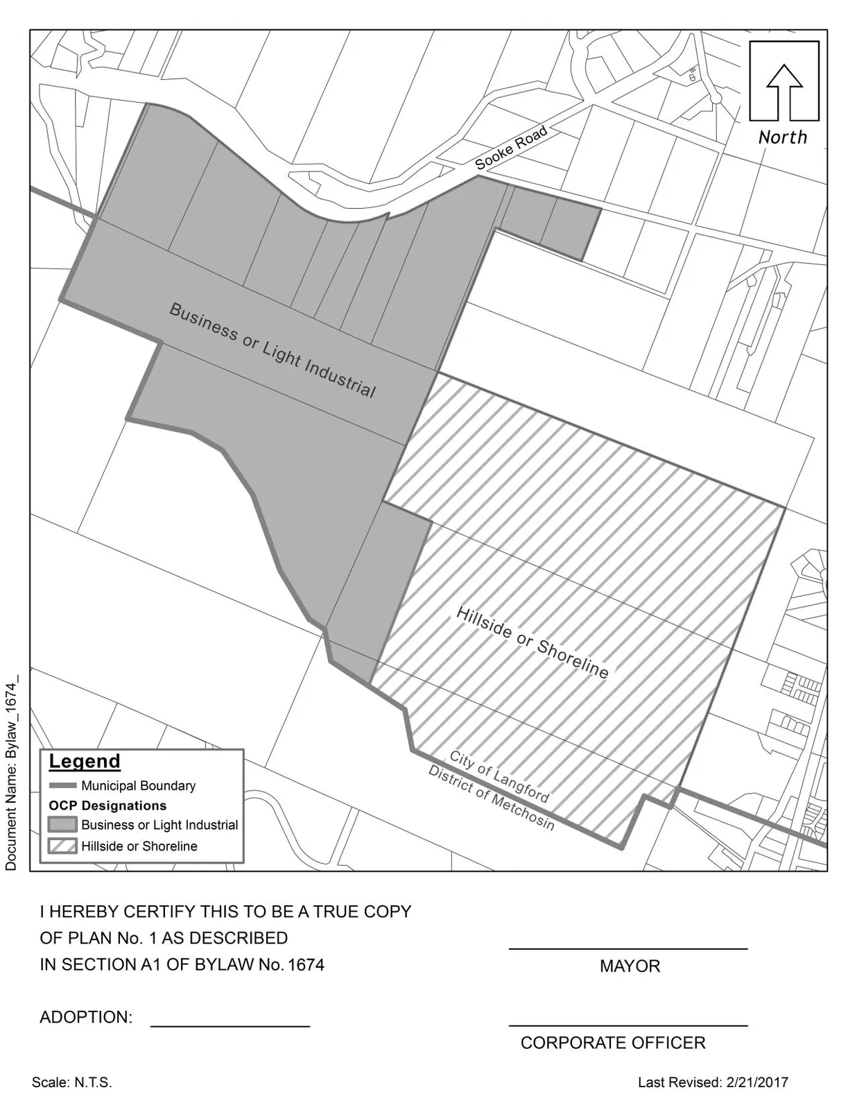
Plan No. 1 — property shown shaded, attached to and forming part of this Bylaw 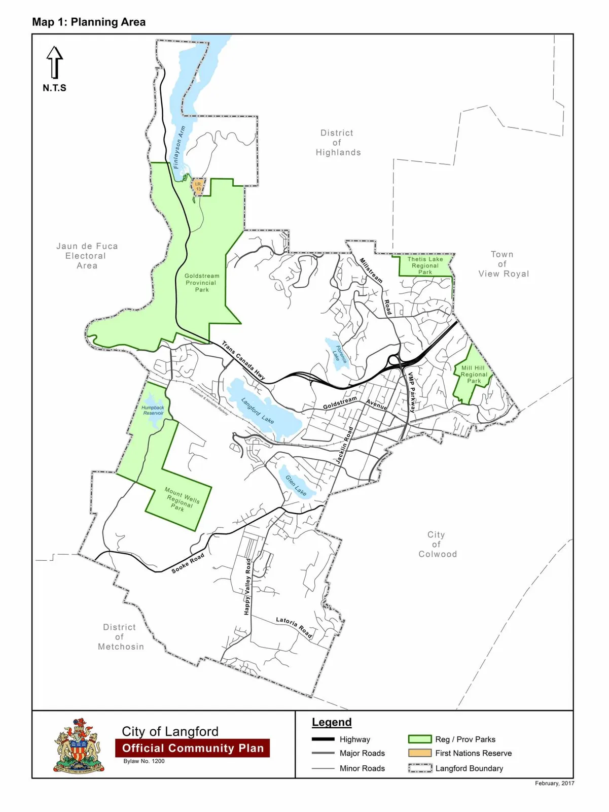
Schedule A — Map 1: Planning Area 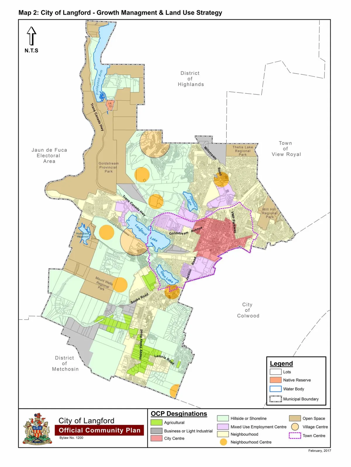
Schedule B — Map 2: City of Langford – Growth Management & Land Use Strategy 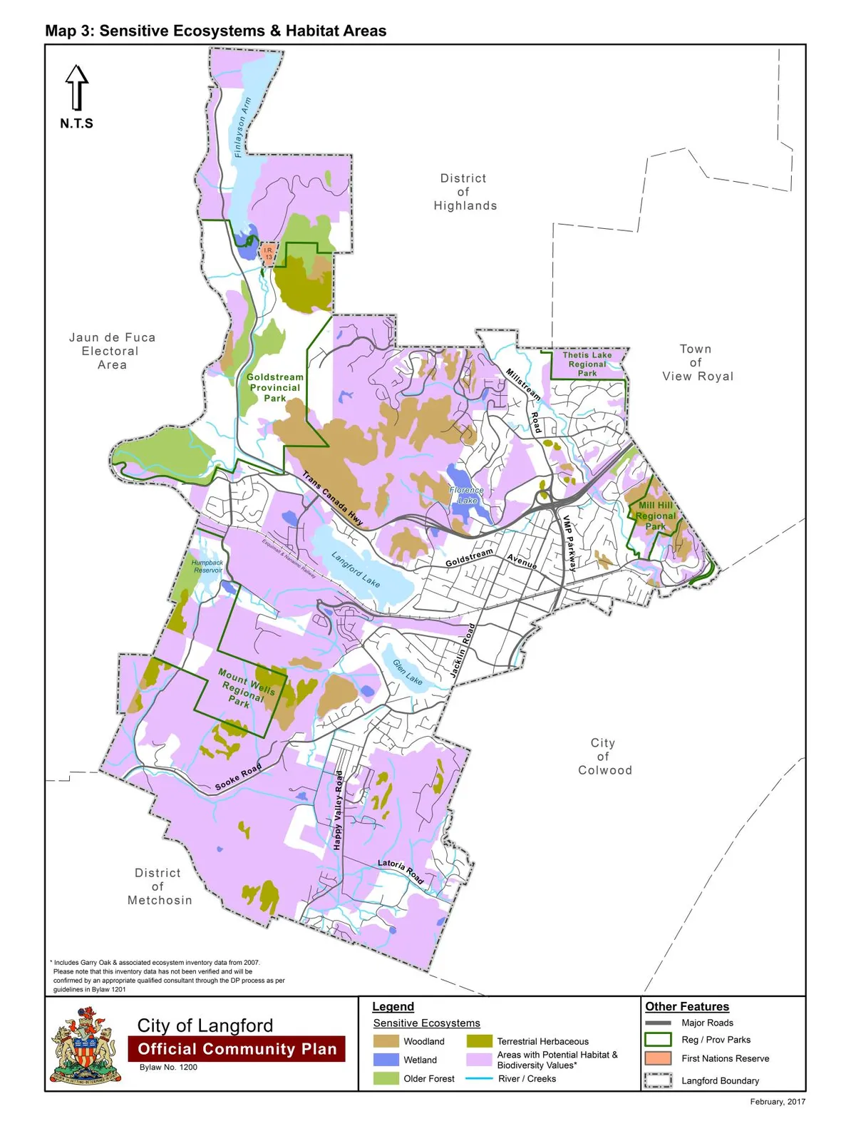
Schedule C — Map 3: Sensitive Ecosystems & Habitat Areas 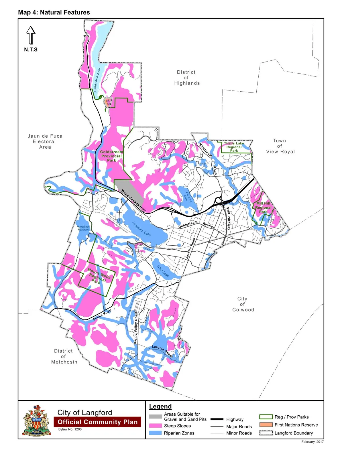
Schedule D — Map 4: Natural Features 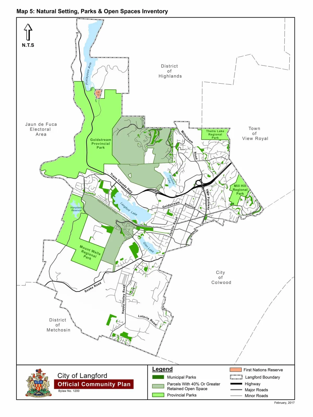
Schedule E — Map 5: Natural Setting, Parks & Open Spaces Inventory 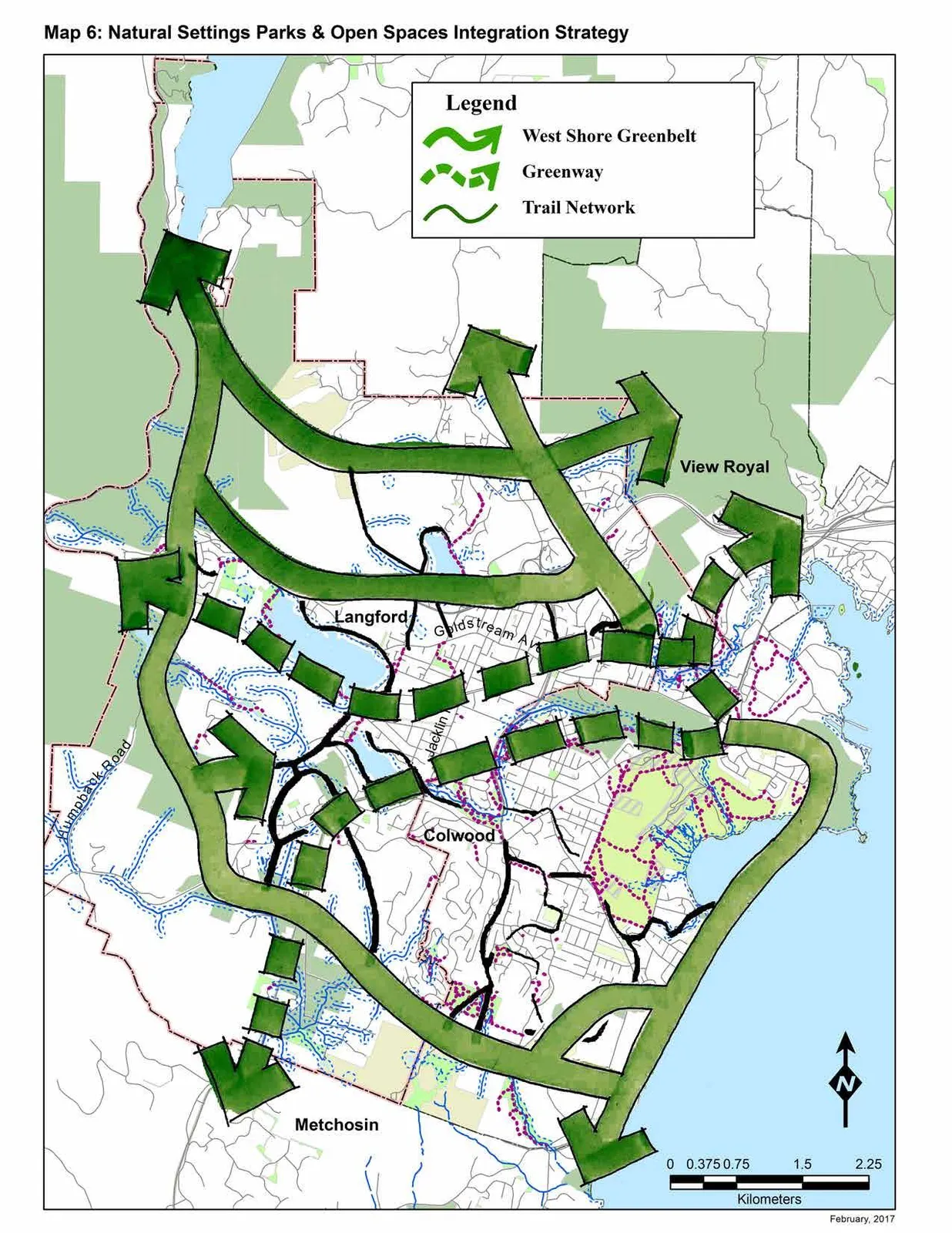
Schedule F — Map 6: Natural Setting, Parks & Open Spaces Integration Strategy 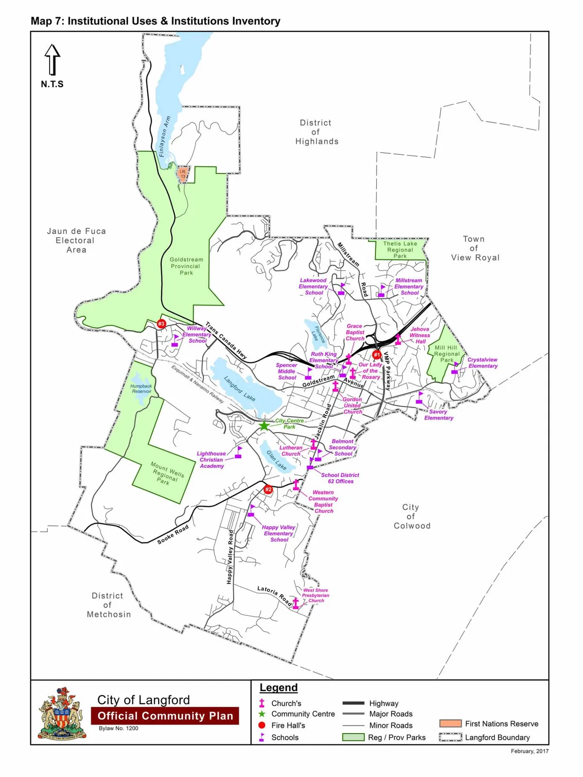
Schedule G — Map 7: Institutional Uses & Institutions Inventory 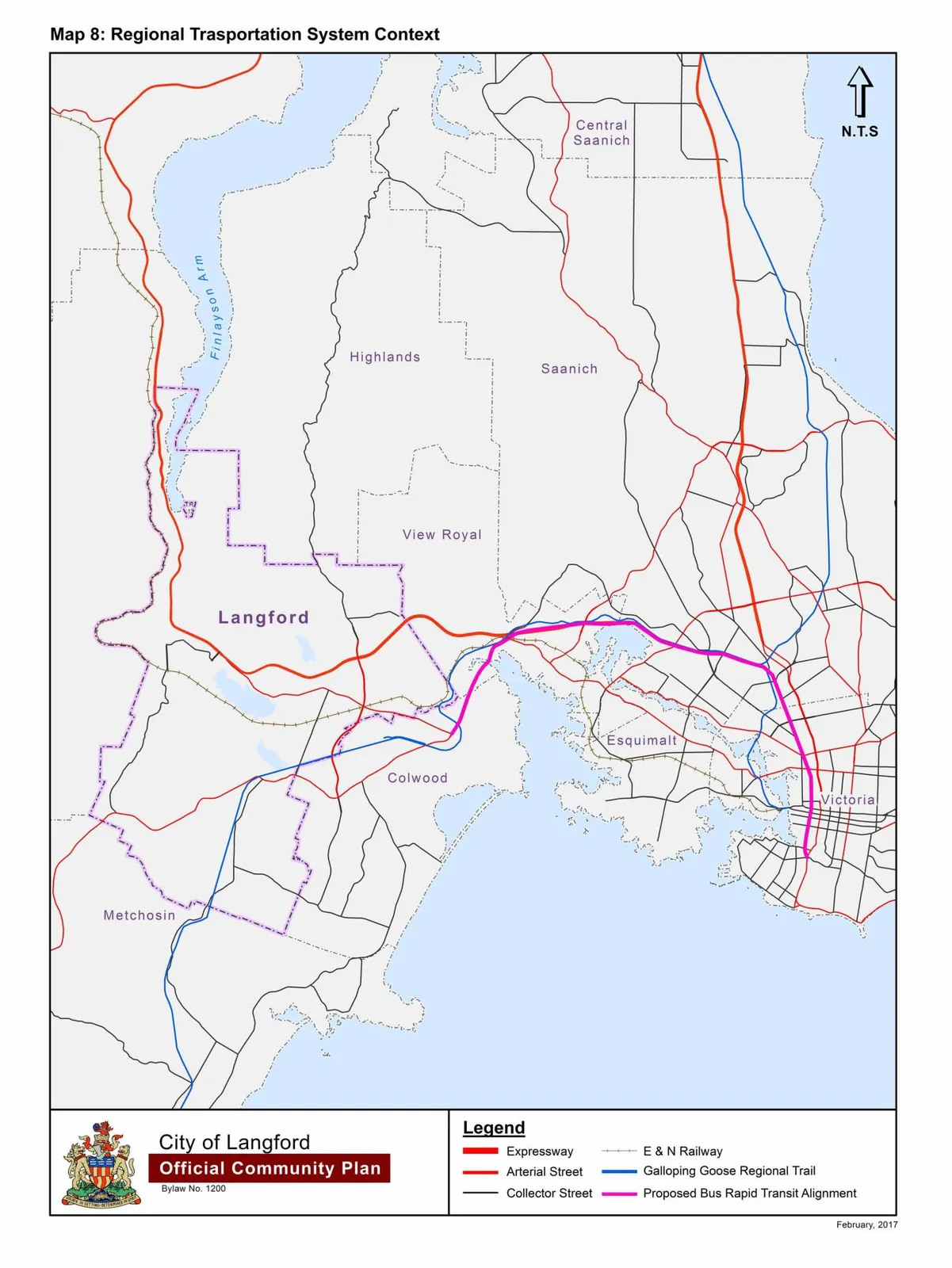
Schedule H — Map 8: Regional Transportation System Context 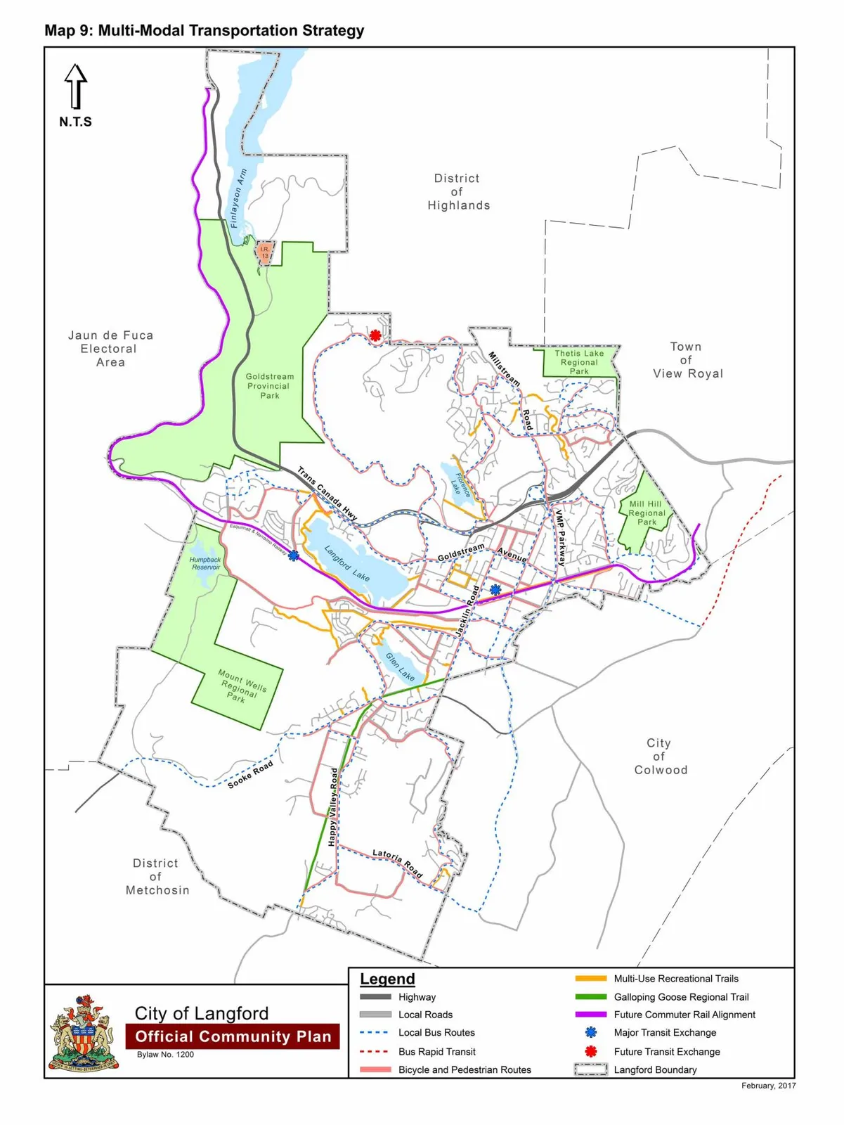
Schedule I — Map 9: Multi-Modal Transportation Strategy 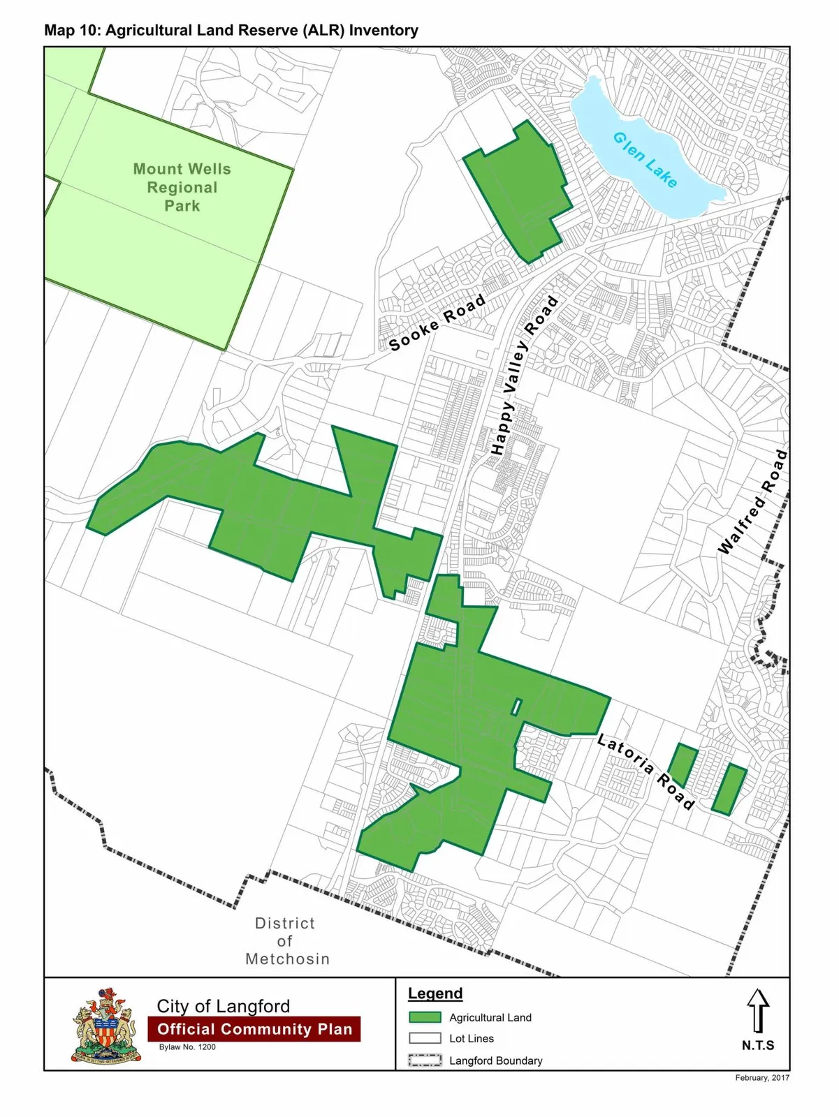
Schedule J — Map 10: Agricultural Land Reserve (ALR) Inventory 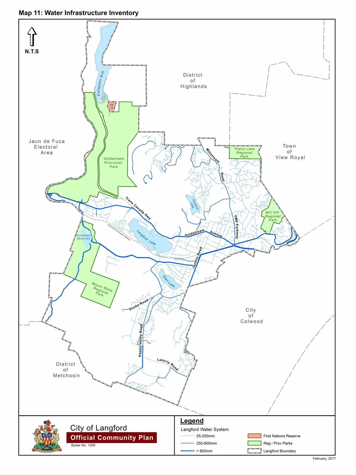
Schedule K — Map 11: Water Infrastructure Inventory 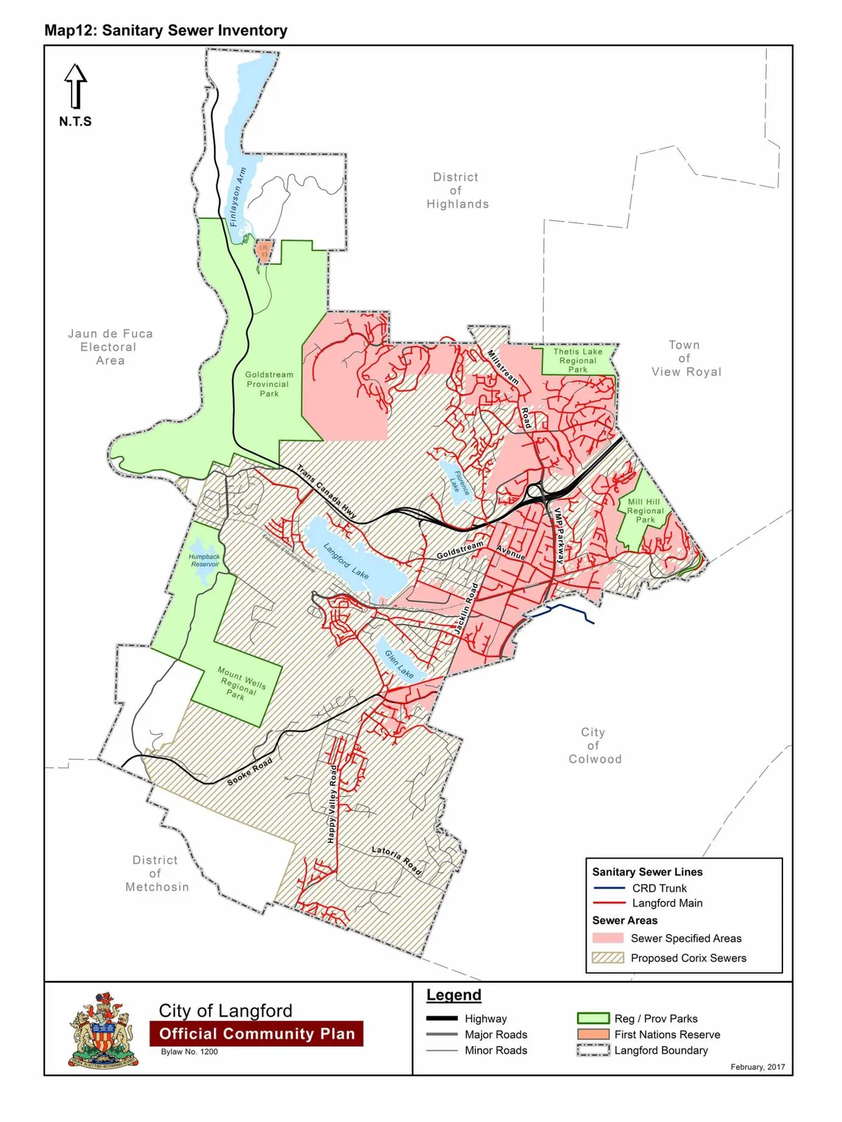
Schedule L — Map 12: Sanitary Sewer Inventory 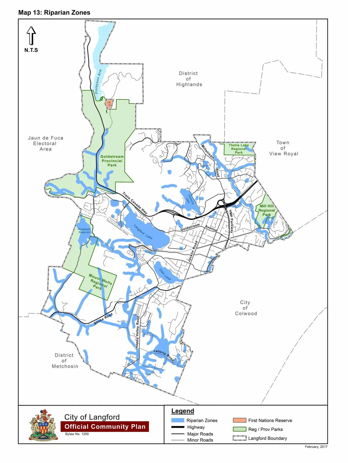
Schedule M — Map 13: Riparian Zones 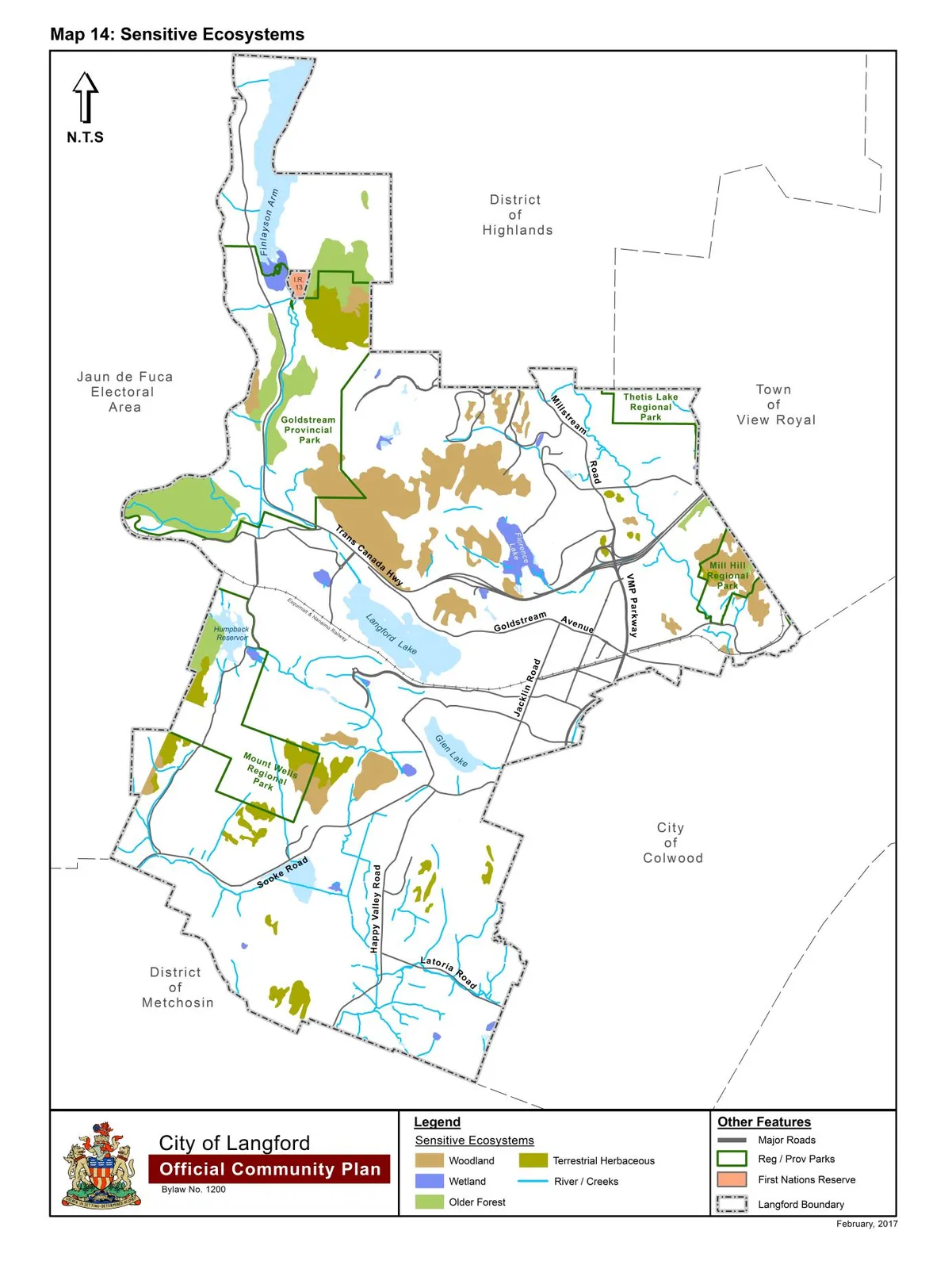
Schedule N — Map 14: Sensitive Ecosystems 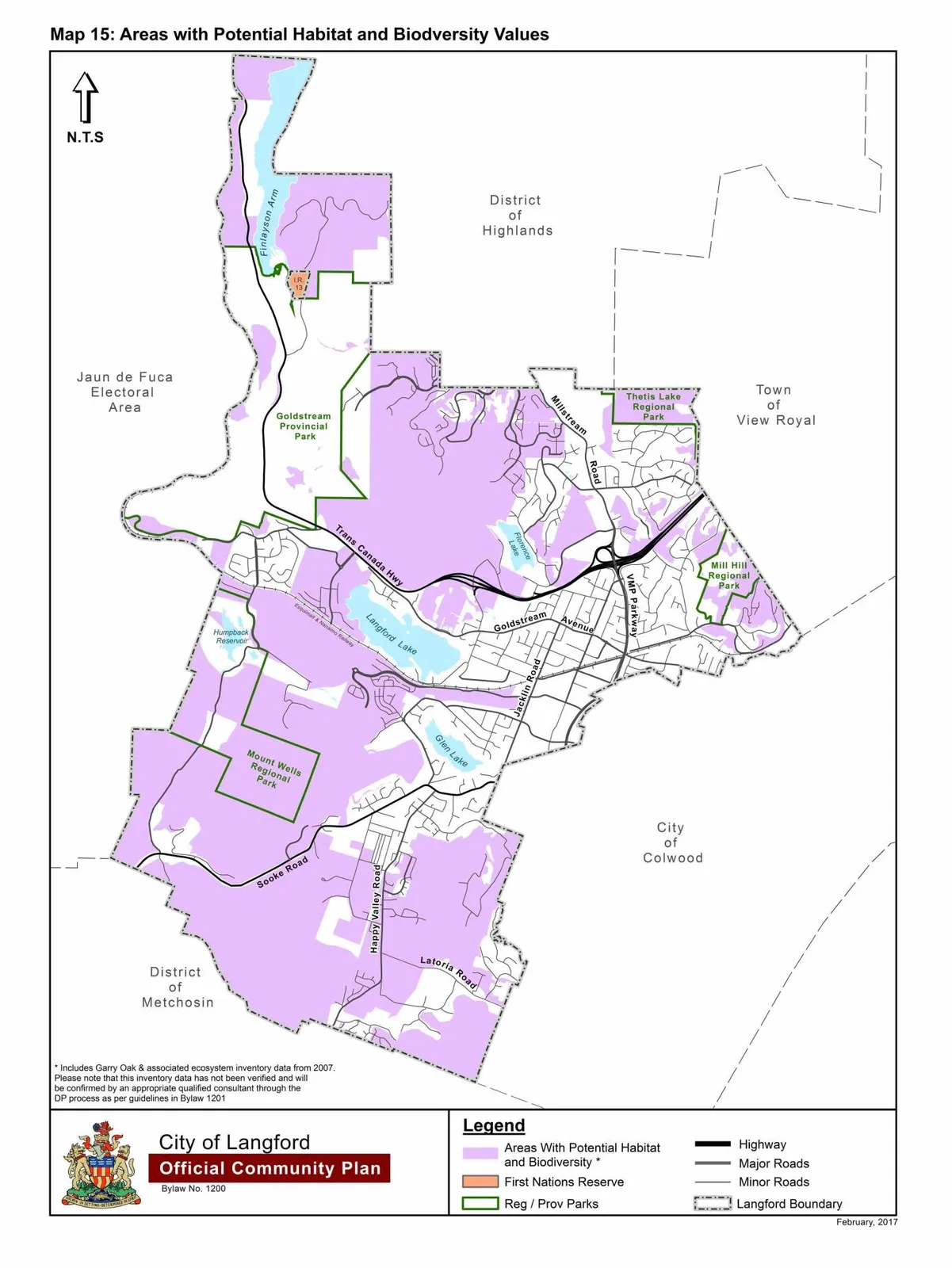
Schedule O — Map 15: Areas with Potential Habitat & Biodiversitty Values 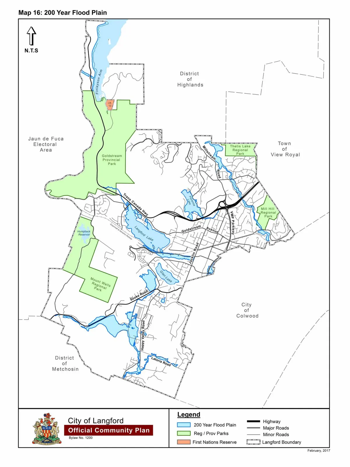
Schedule P — Map 16: 200 Year Floodplain 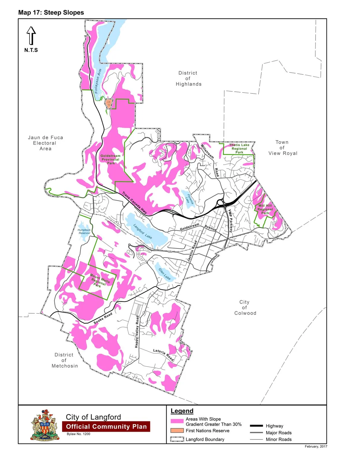
Schedule Q — Map 17: Steep Slopes 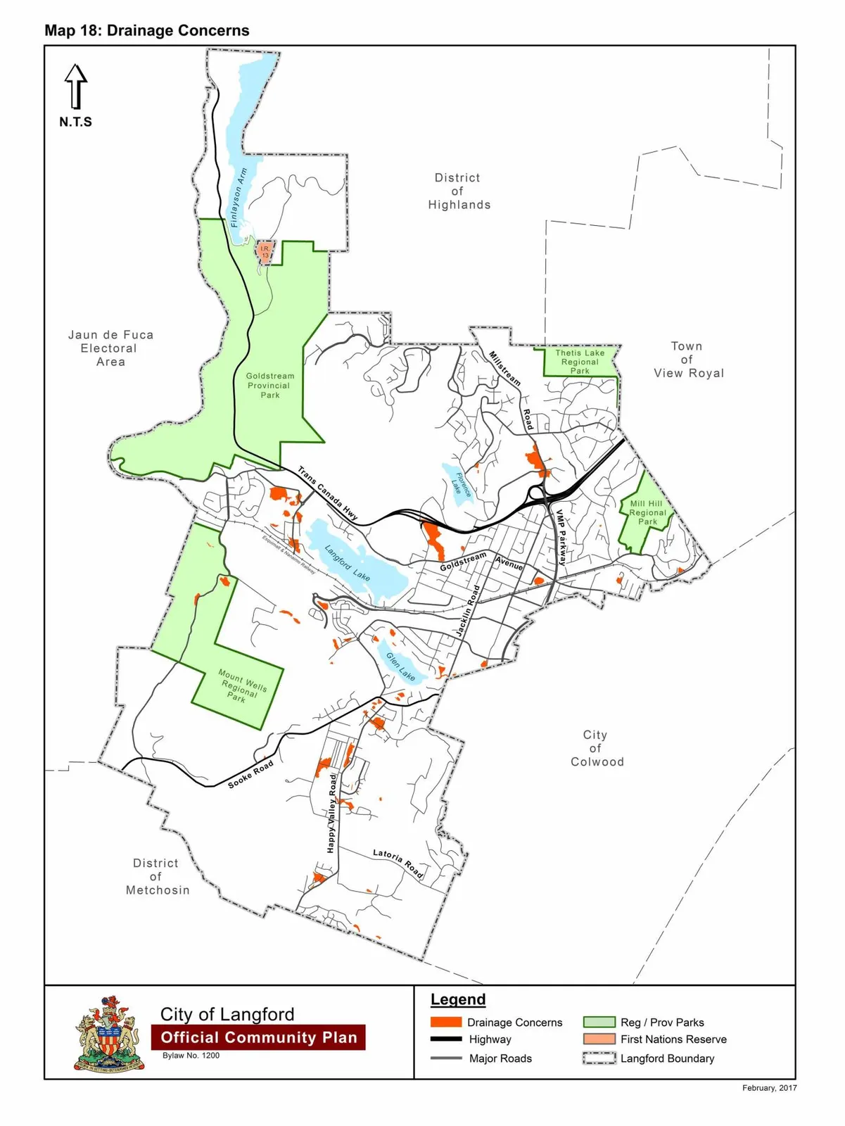
Schedule R — Map 18: Drainage Concerns 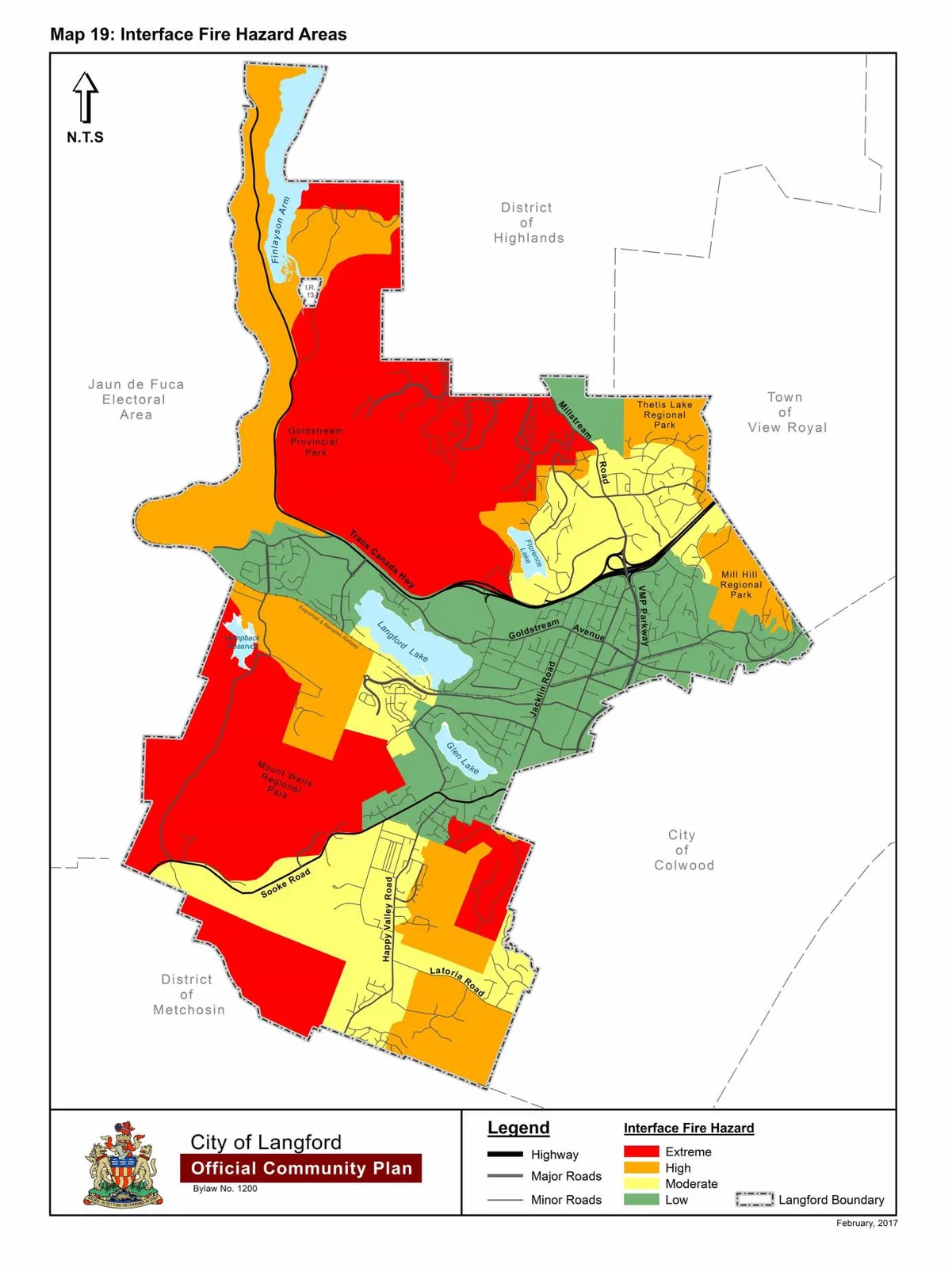
Schedule S — Map 19: Interface Fire Hazard Areas