DocumentsAppendixMay 1, 2017Page 47
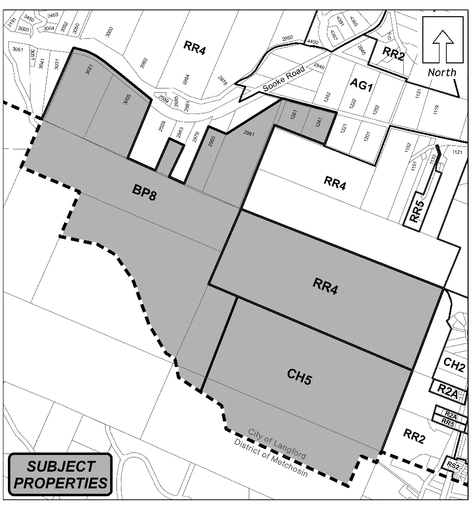
Appendix A – Location and Proposed Zoning (Centre Mountain maps)
Map appendix showing the location and proposed zoning layout for the Centre Mountain properties (image-based map).
Key facts
- Appendix: Location and Proposed Zoning map for Centre Mountain
- Format: image/map (graphical representation)
- Connects to Staff Report Z17-0005 and Bylaws 1674 & 1675
Appendix “A”
Location and Proposed Zoning
Page 47
Extracted from: 20170501-Agenda-package(168 pages total)