DocumentsBylawMay 1, 2017Pages 4–25
BYLAW NO. 1674 - Langford Official Community Plan Bylaw, Amendment No. 22 (Centre Mountain Properties), 2017
Official Community Plan amendment bylaw to incorporate lands known as 'Centre Mountain' into the City of Langford OCP and to update/replace multiple OCP maps (Maps 1–19/Schedules A–S) to reflect the new lands.
Key facts
- Title: Langford Official Community Plan Bylaw, Amendment No. 22 (Centre Mountain Properties), 2017
- Amends multiple OCP maps including Map 1 (Planning Area) and Maps 2–19 (Schedules A–S)
- Read a first time: 3rd day of April, 2017 (as stated in bylaw text)
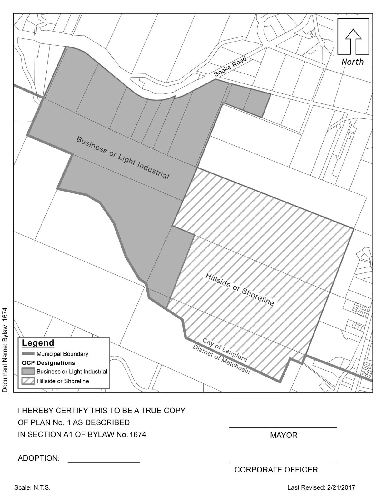
- Purpose: Add lands to BUSINESS OR LIGHT INDUSTRIAL and HILLSIDE OR SHORELINE designations
BYLAW NO. 1674 - Langford Official Community Plan Bylaw, Amendment No. 22 (Centre Mountain Properties), 2017
A BYLAW TO AMEND BYLAW NO. 1200, “LANGFORD OFFICIAL COMMUNITY PLAN BYLAW, 2008"
The Council of the City of Langford, in open meeting assembled, hereby enacts as follows:
A.
Langford Official Community Plan Bylaw No. 1200, 2008 is amended as follows:
By adding to the BUSINESS OR LIGHT INDUSTRIAL designation and the HILLSIDE OR SHORELINE designation the property as shown shaded Plan No. 1 attached to and forming part of this Bylaw;
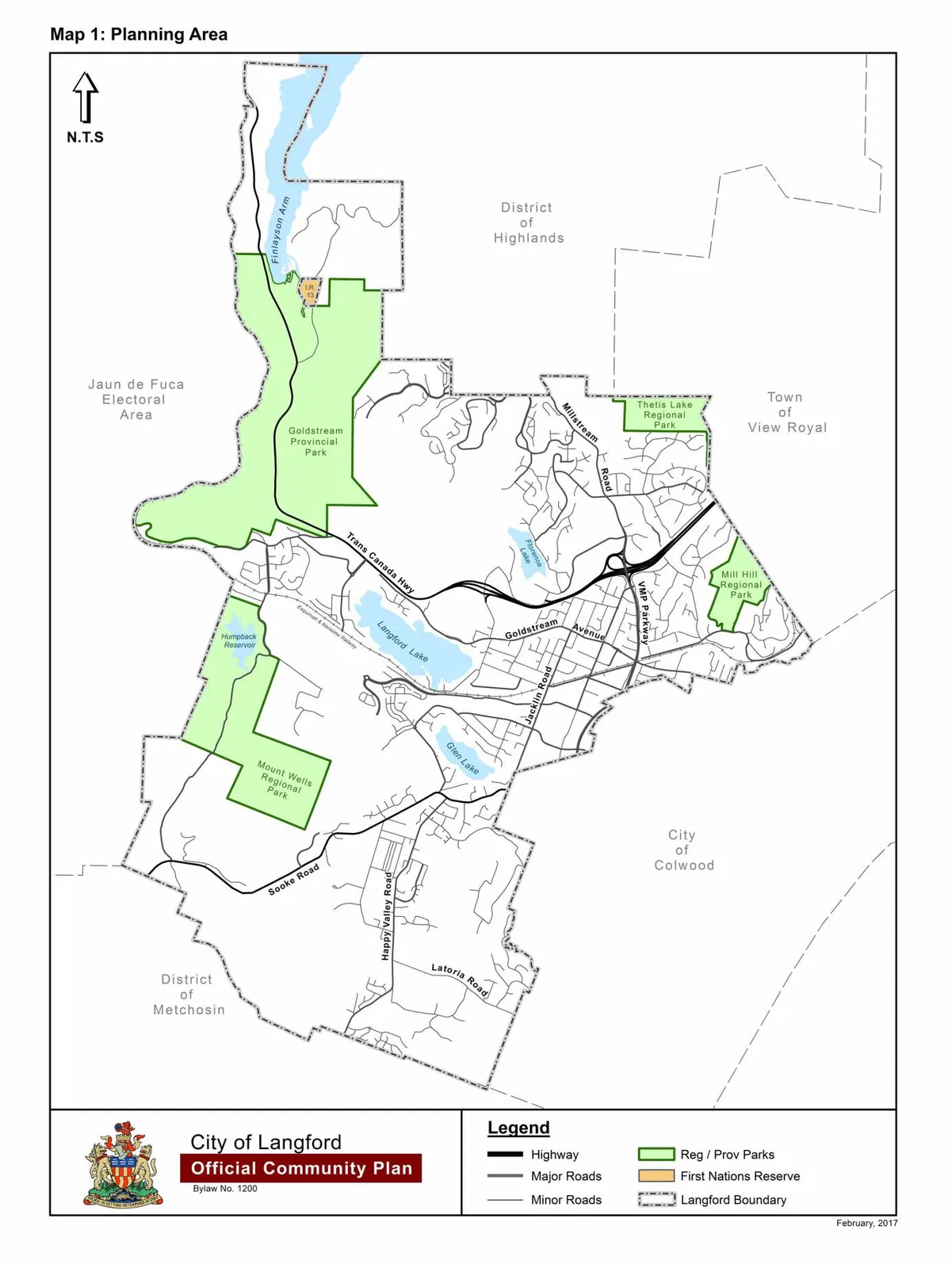
By replacing “Map 1: Planning Area” with a new Map 1 as shown in Schedule A attached to and forming part of this Bylaw;
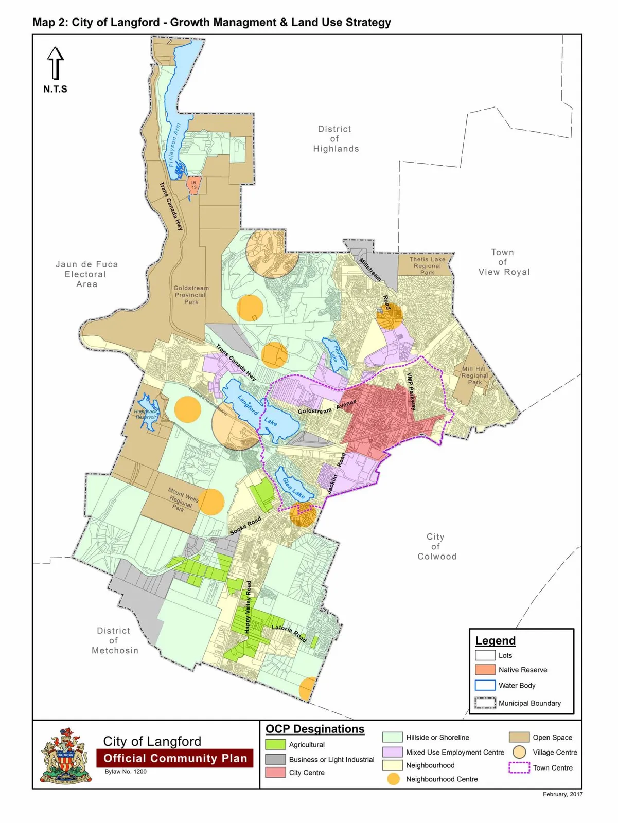
By replacing “Map 2: City of Langford – Growth Management & Land Use Strategy” with a new Map 2 as shown in Schedule B attached to and forming part of this Bylaw;
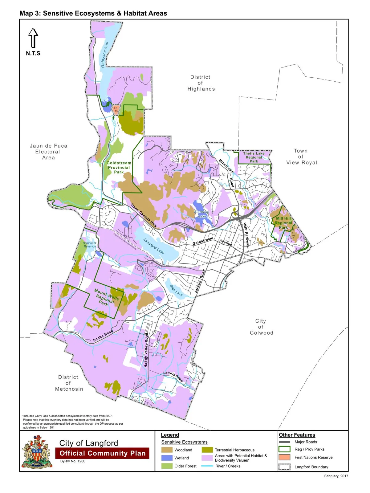
By replacing “Map 3: Sensitive Ecosystems & Habitat Areas” with a new Map 3 as shown in Schedule C attached to and forming part of this Bylaw;
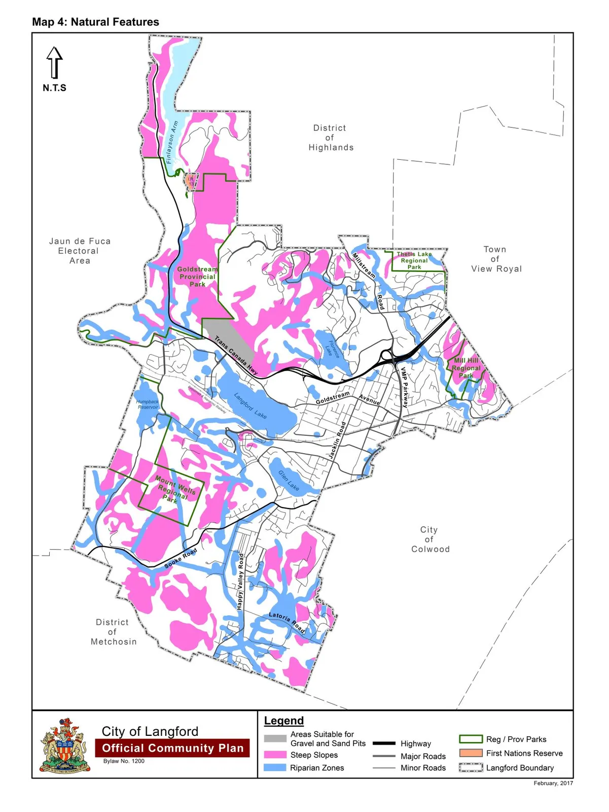
By replacing “Map 4: Natural Features” with a new Map 4 as shown in Schedule D attached to and forming part of this Bylaw;
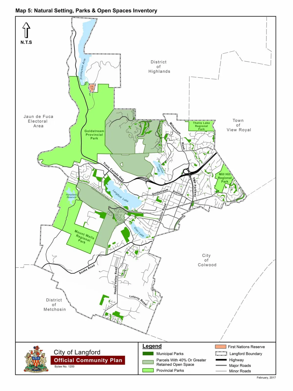
By replacing “Map 5: Natural Setting, Parks & Open Spaces Inventory” with a new Map 5 as shown in Schedule E attached to and forming part of this Bylaw;
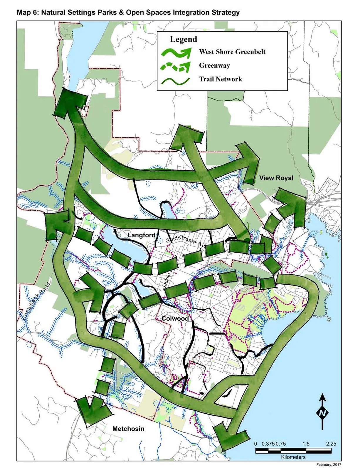
By replacing “Map 6: Natural Setting, Parks & Open Spaces Integration Strategy” with a new Map 6 as shown in Schedule F attached to and forming part of this Bylaw;
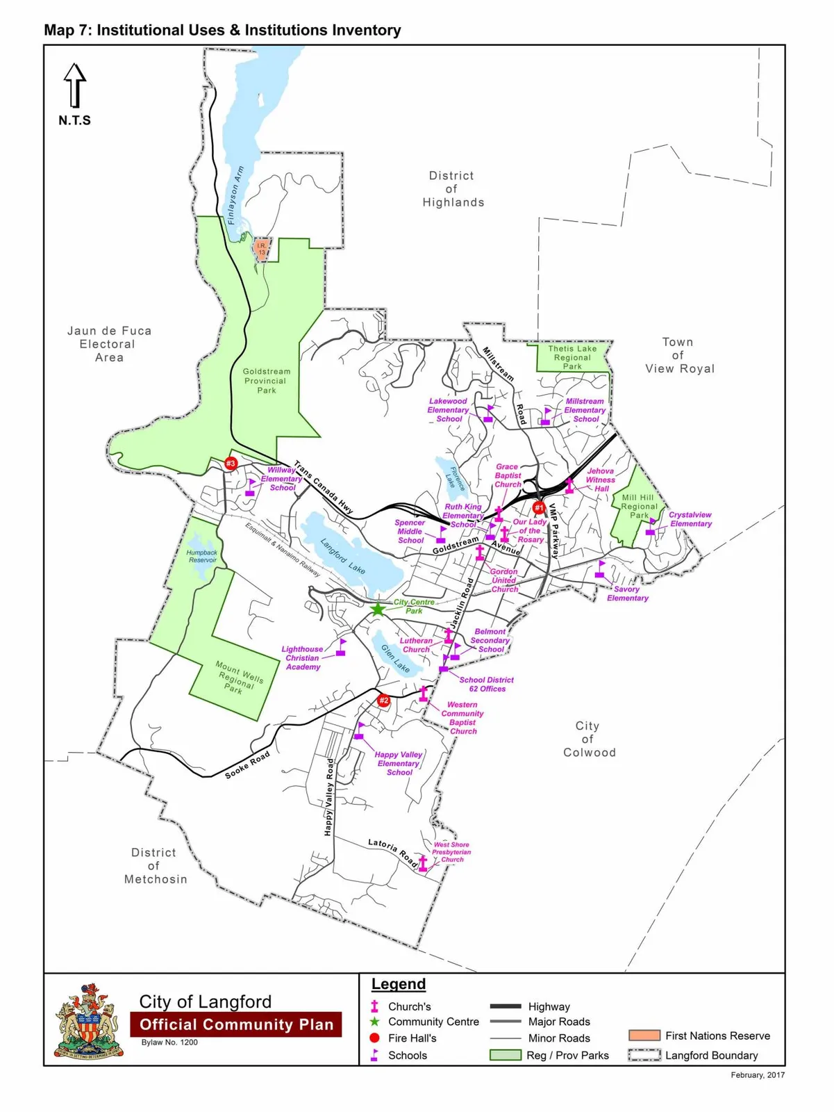
By replacing “Map 7: Institutional Uses & Institutions Inventory” with a new Map 7 as shown in Schedule G attached to and forming part of this Bylaw;
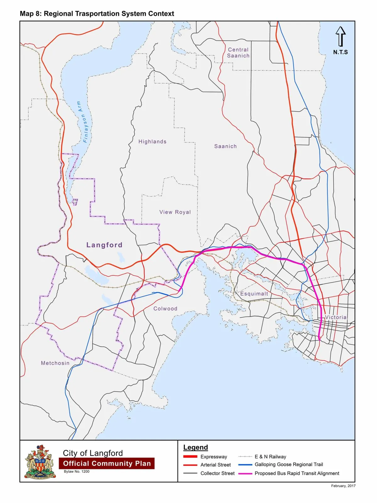
By replacing “Map 8: Regional Transportation System Context” with a new Map 8 as shown in Schedule H attached to and forming part of this Bylaw;
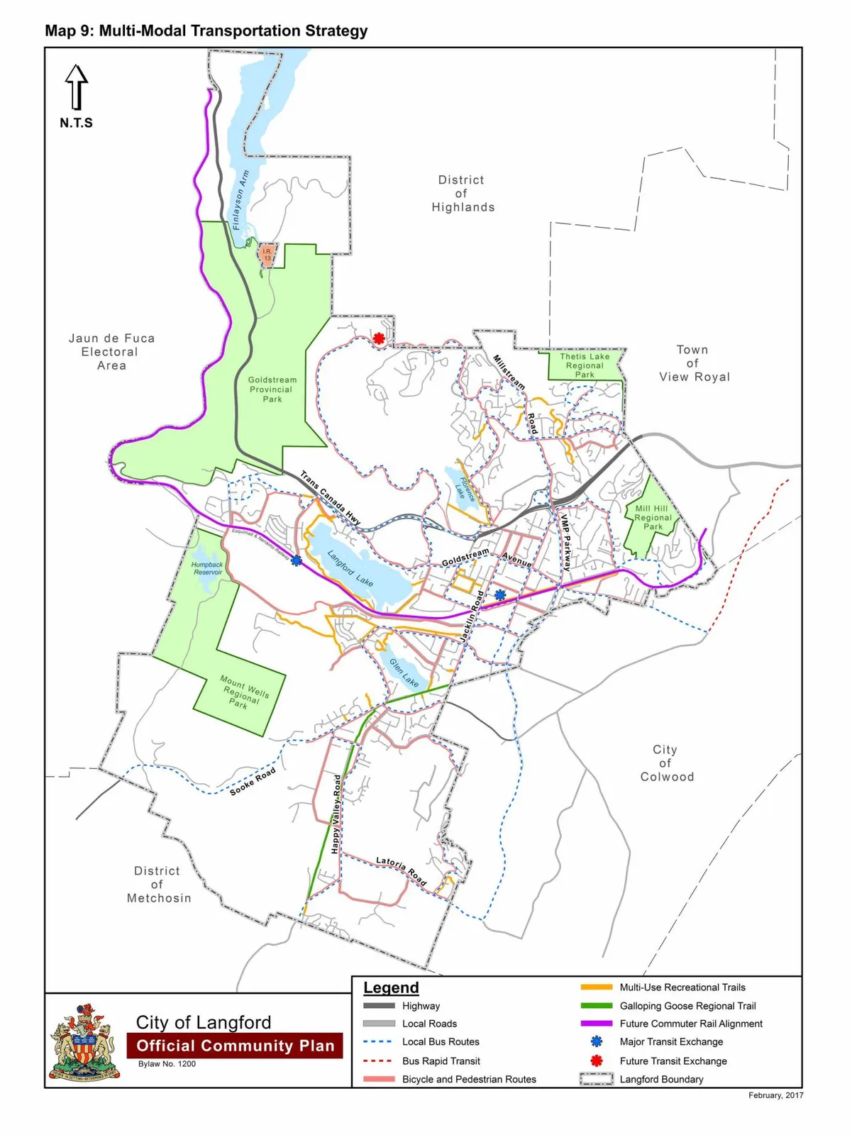
By replacing “Map 9: Multi-Modal Transportation Strategy” with a new Map 9 as shown in Schedule I attached to and forming part of this Bylaw;
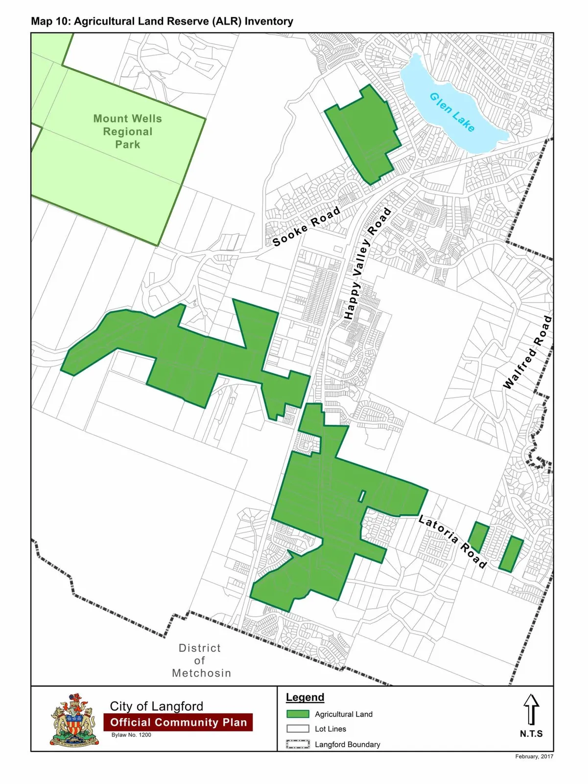
By replacing “Map 10: Agricultural Land Reserve (ALR) Inventory” with a new Map 10 as shown in Schedule J attached to and forming part of this Bylaw;
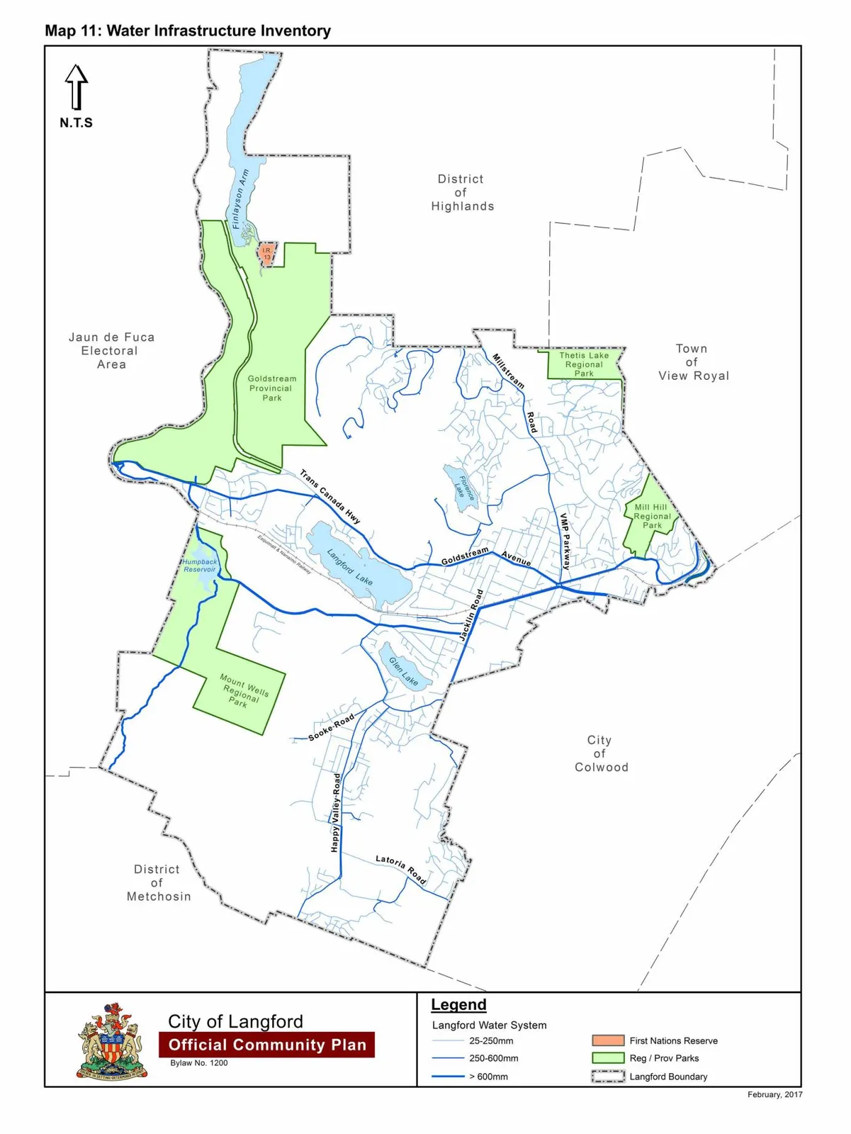
By replacing “Map 11: Water Infrastructure Inventory” with a new Map 11 as shown in Schedule K attached to and forming part of this Bylaw;
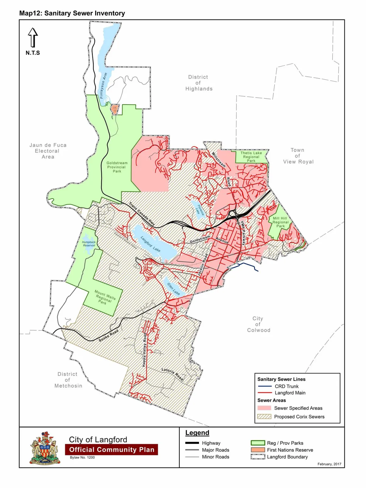
By replacing “Map 12: Sanitary Sewer Inventory” with a new Map 12 as shown in Schedule L attached to and forming part of this Bylaw;
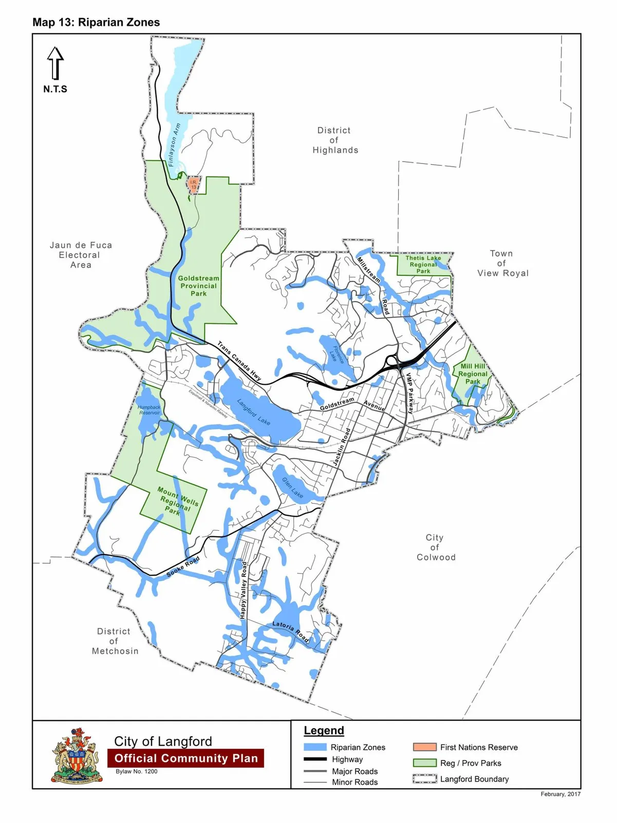
By replacing “Map 13: Riparian Zones” with a new Map 13 as shown in Schedule M attached to and forming part of this Bylaw;
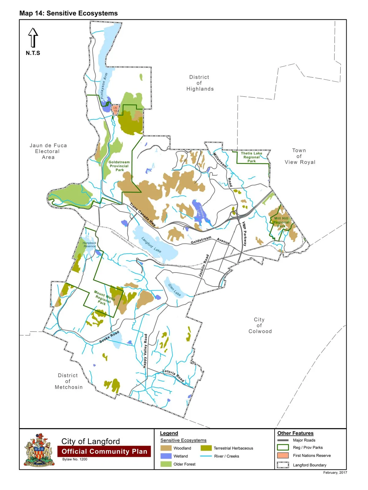
By replacing “Map 14: Sensitive Ecosystems” with a new Map 14 as shown in Schedule N attached to and forming part of this Bylaw;
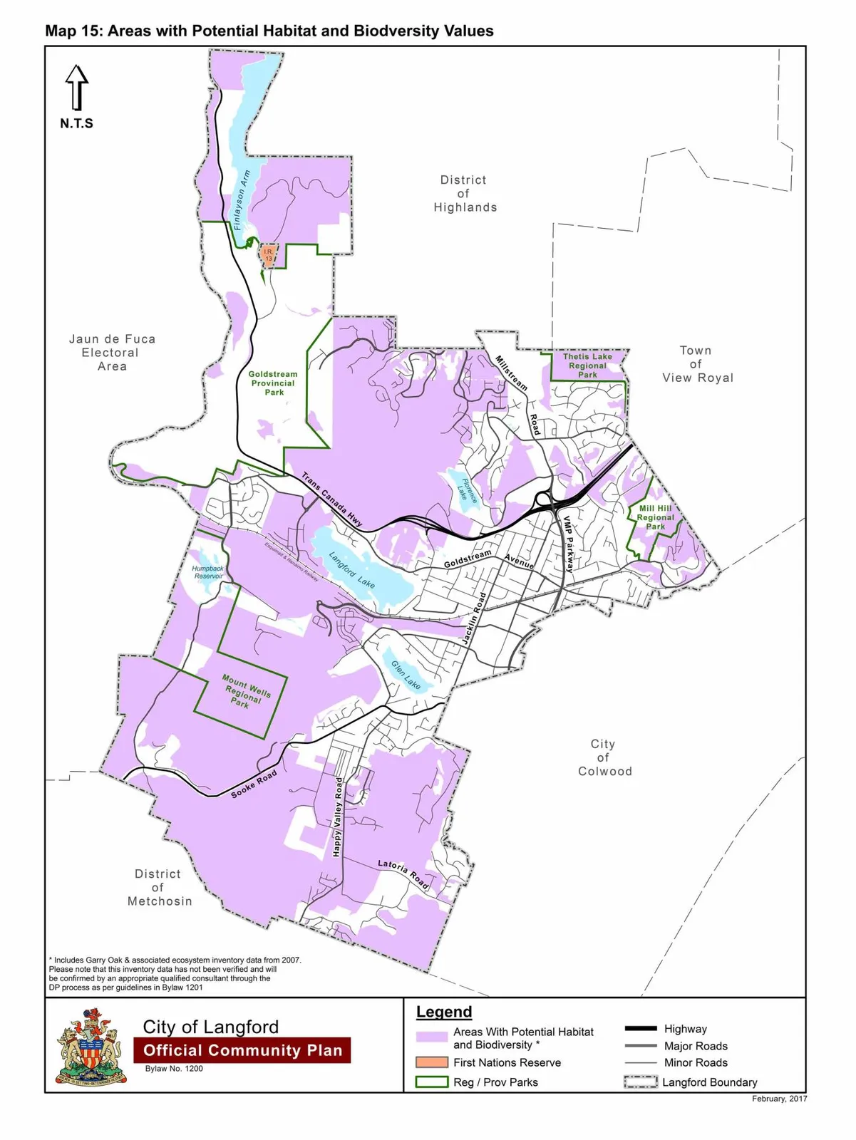
By replacing “Map 15: Areas with Potential Habitat & Biodiversitty Values” with a new Map 15 as shown in Schedule O attached to and forming part of this Bylaw;
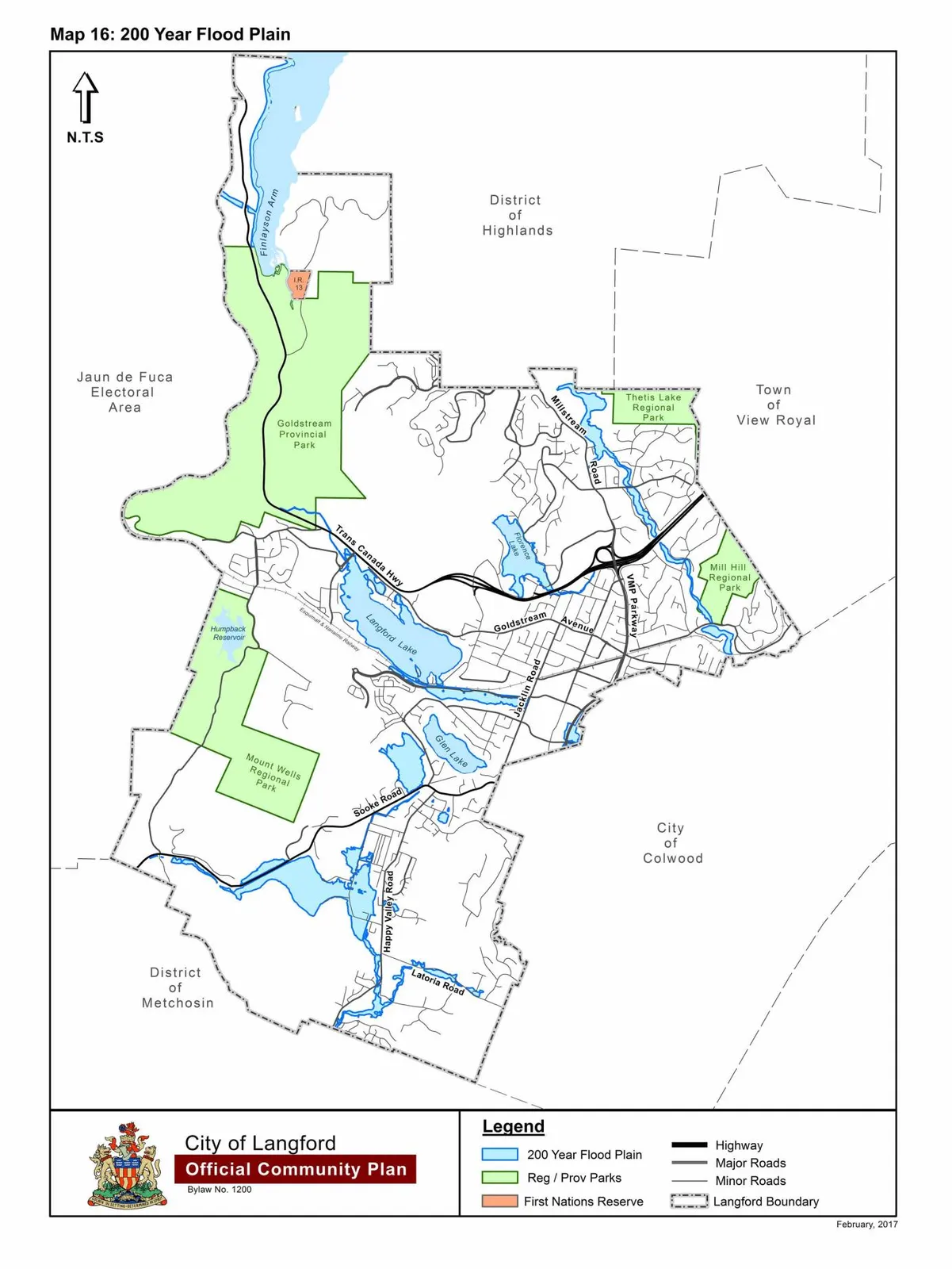
By replacing “Map 16: 200 Year Floodplain” with a new Map 16 as shown in Schedule P attached to and forming part of this Bylaw;
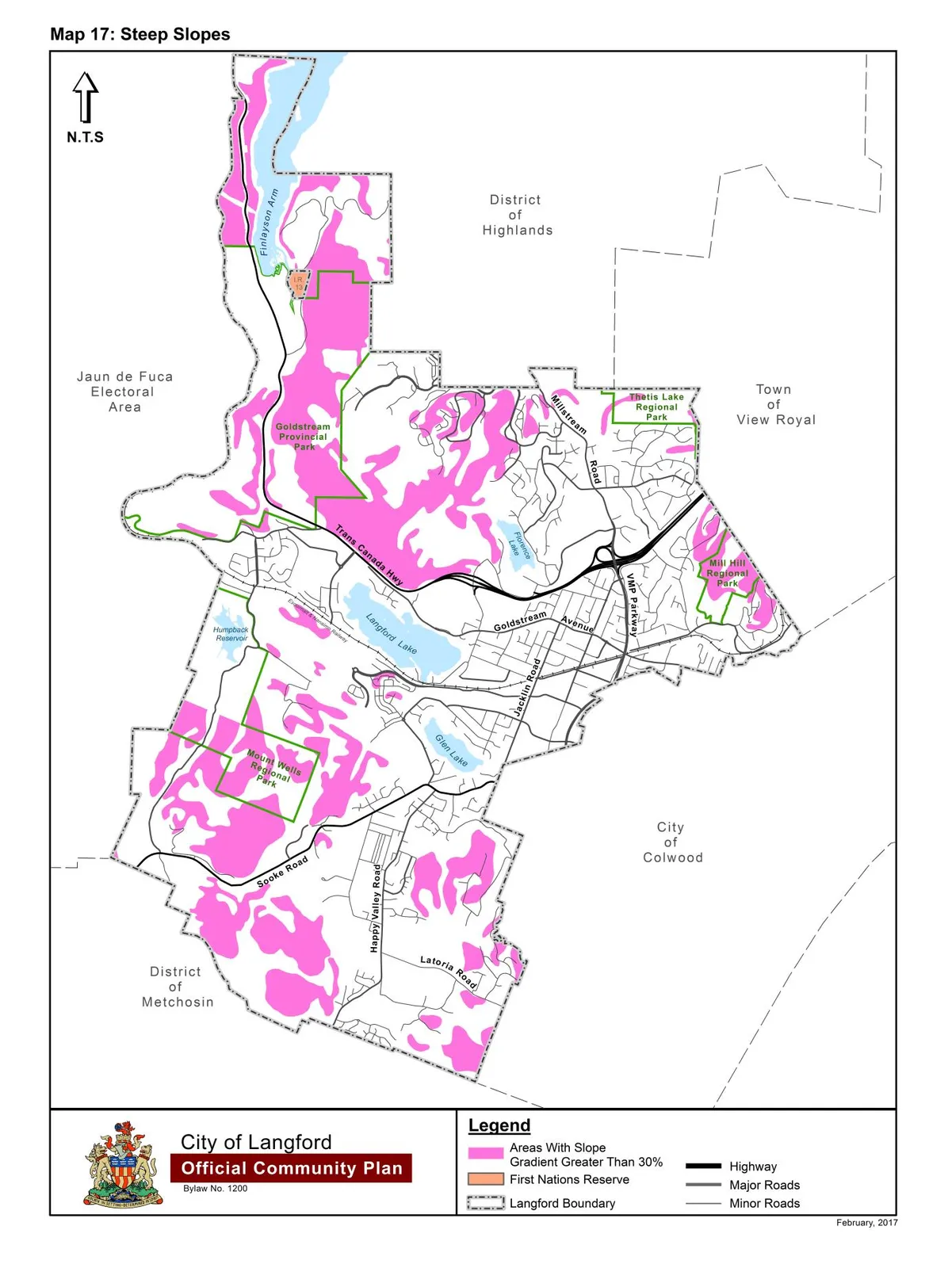
By replacing “Map 17: Steep Slopes” with a new Map 17 as shown in Schedule Q attached to and forming part of this Bylaw;
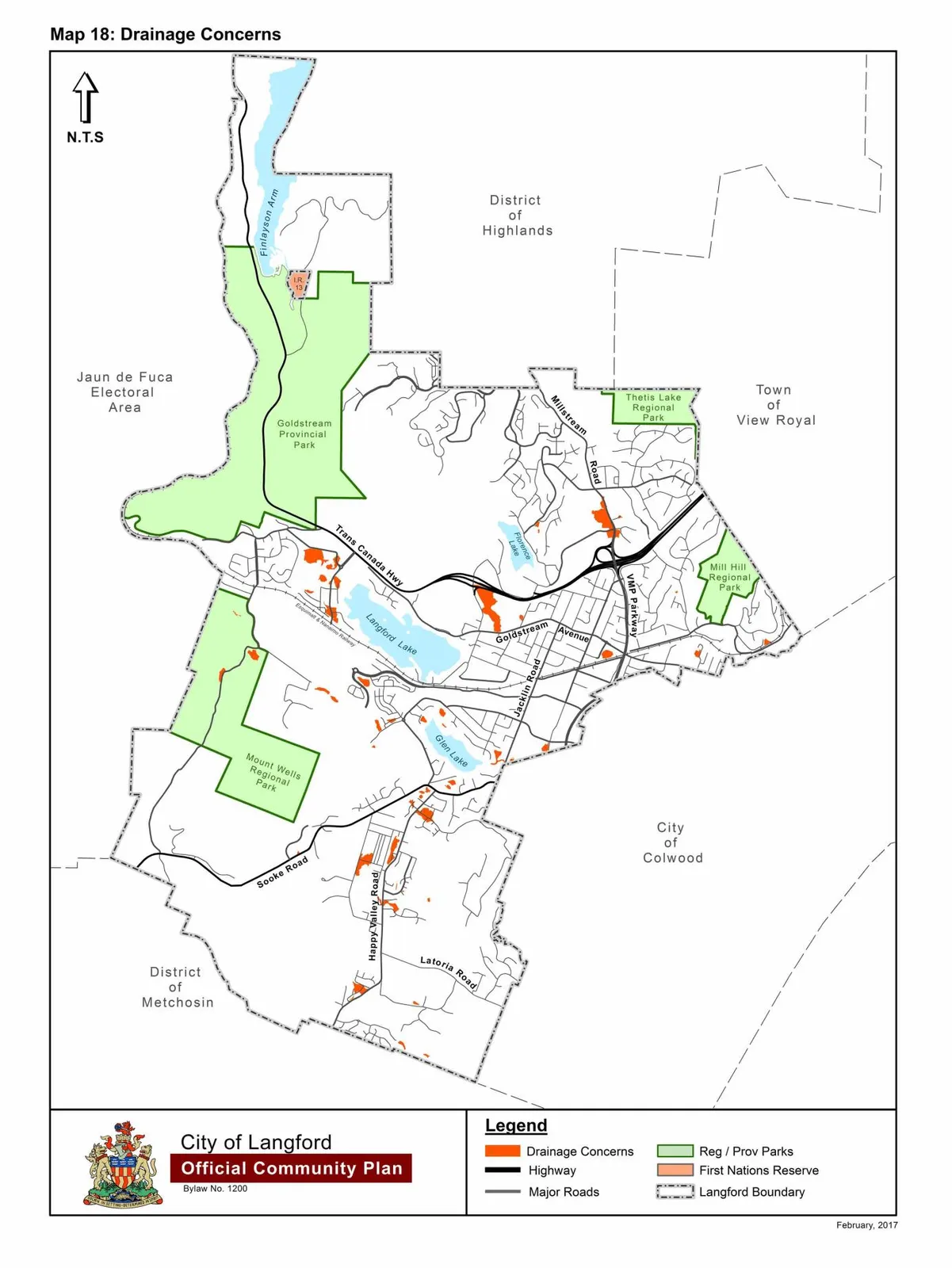
By replacing “Map 18: Drainage Concerns” with a new Map 18 as shown in Schedule R attached to and forming part of this Bylaw;
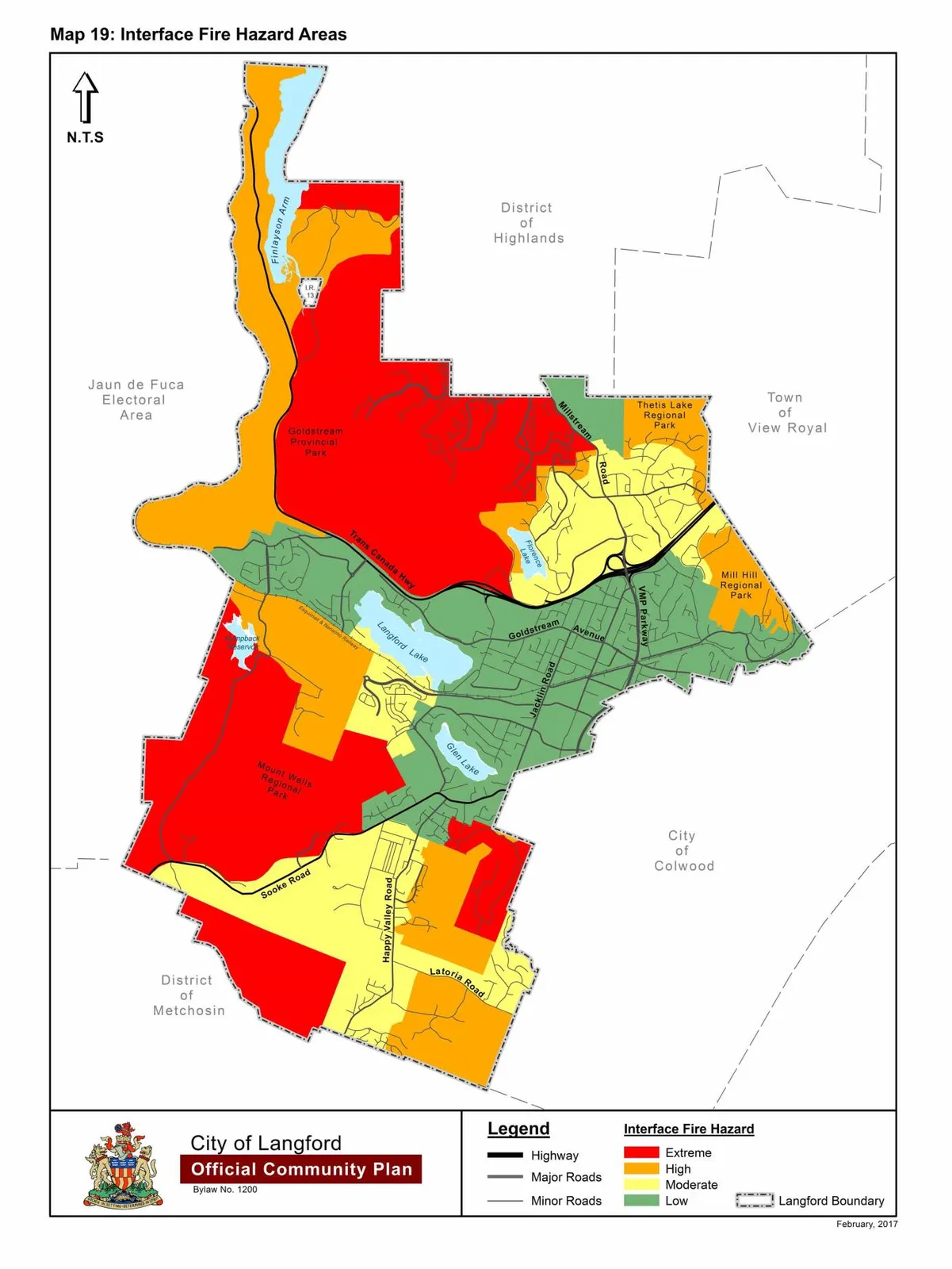
By replacing “Map 19: Interface Fire Hazard Areas” with a new Map 19 as shown in Schedule S attached to and forming part of this Bylaw;
B.
This Bylaw may be cited for all purposes as “Langford Official Community Plan Bylaw, Amendment No. 22, (Centre Mountain Properties), 2017".
READ A FIRST TIME this 3rd day of April, 2017.
PUBLIC HEARING held this day of , 2017.
READ A SECOND TIME this day of , 2017.
READ A THIRD TIME this day of , 2017.
ADOPTED this day of , 2017.
MAYOR
(Certified Correct)
CORPORATE OFFICER
Attached Plan and Maps