This site is in beta — data may be incomplete and features are still being added.

DocumentsAppendixFeb 6, 2017Page 21

Schedule A (to Boundary Adjustment Agreement)

Schedule A map/graphic for the Boundary Adjustment Agreement showing Section 92 (labeled 'Non Designated Use') and the proposed boundary change.

Key facts

  • Label: SCHEDULE A
  • Depicts Section 92 Metchosin Land District and boundary adjustment (map/graphic, scanned)
  • Noted label: 'Non Designated Use'

SCHEDULE A
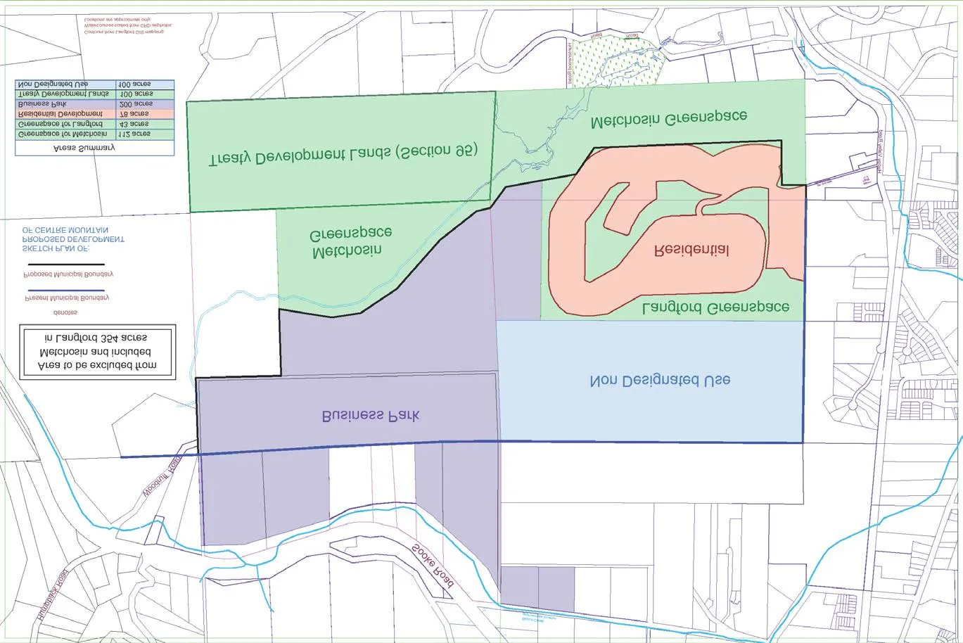
Map titled "Schedule A" showing the proposed municipal boundary adjustment (map of Centre Mountain area). The map includes colored areas labeled Business Park, Non Designated Use, Langford Greenspace, Metchosin Greenspace, Residential, and Treaty Development Lands (Section 95). Legend and an "Areas Summary" table appear on the map indicating acreage for each area.
Page 21
Extracted from: Report-Agenda-Item-9f-Tax-Agreement-re-Boundary-Extension(21 pages total)